
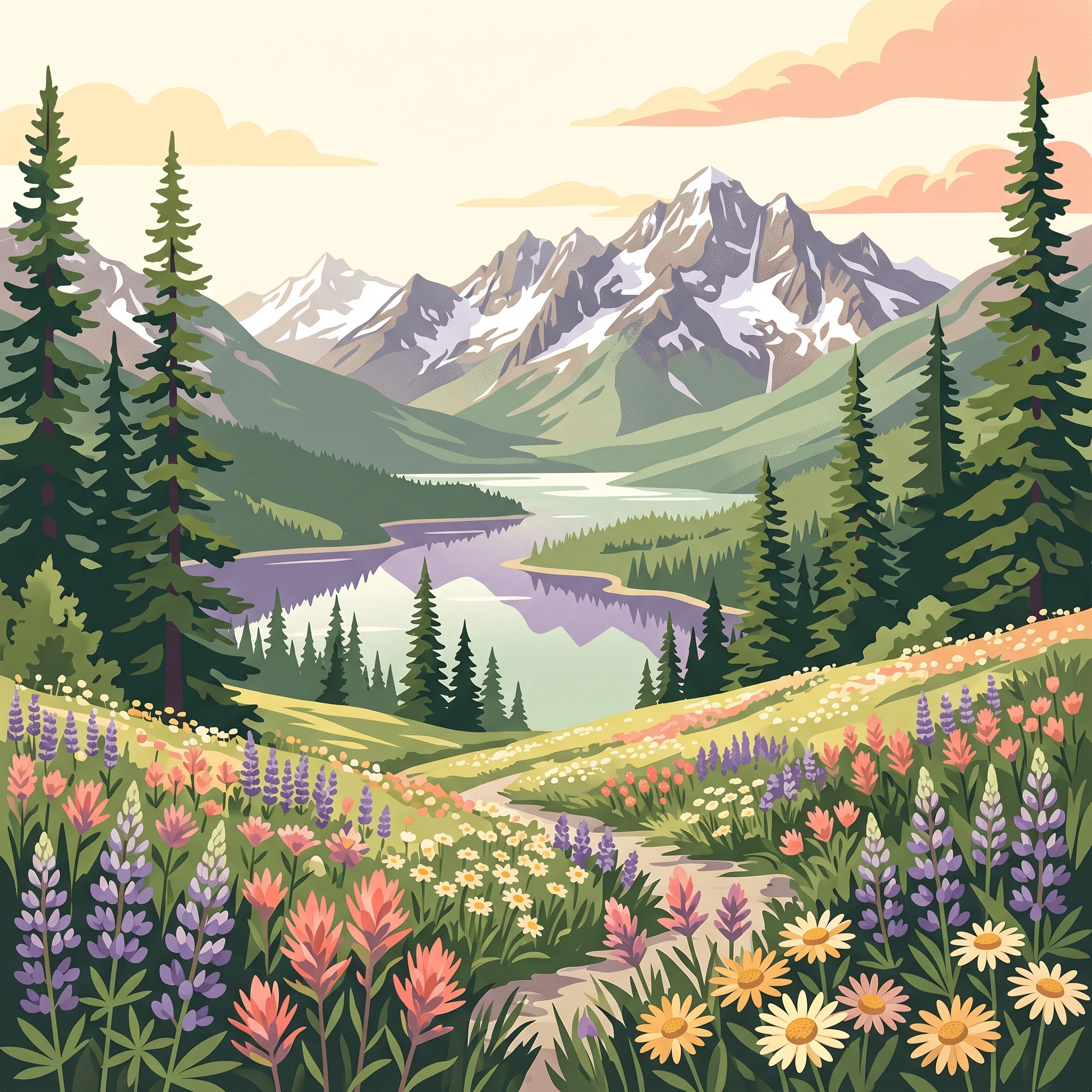
Trip Timing
When is the best time to visit E. C. Manning Provincial Park?
Deciding on the best time to visit E. C. Manning Provincial Park requires navigating the distinct divide between its mountain-based summer hiking and snow-reliant winter recreation. Because the park spans a significant elevational range across the Hozameen Range, conditions vary substantially between the sheltered river valleys and the subalpine meadows that define much of the landscape. For many visitors, the priority is accessing these high-elevation zones when they are free of snow, which effectively constrains the primary hiking window to a short period in mid-to-late summer. In contrast, those seeking to engage with the park's winter infrastructure find that the deepest, most reliable snow conditions occur during the colder, darker months of the calendar year.
The Influence of Elevation and Geography
The park's climate is shaped by its position along the transition from temperate coastal rainforest to the drier interior of British Columbia. This geographic placement means that visitors often experience rapid shifts in weather even within a single day. At the higher elevations where many of the park's signature trails are located, temperatures remain significantly cooler than in the surrounding lowlands. Data suggests that mean temperatures at higher altitudes often stay near or below freezing during much of the winter, while summer peak temperatures are generally mild, rarely reaching levels of extreme heat. This moderate summer climate is a major draw for outdoor enthusiasts but also means that cold-weather gear is a necessity even during the height of the summer season.
Seasonal Trade-offs in Mountain Conditions
Visitors should view the park's timing through the lens of specific seasonal trade-offs. The summer months offer the benefit of long daylight hours and stable, dry weather, which provides the best opportunity for exploring the vast networks of trails and alpine meadows. These months are characterized by peak wildflower blooms and manageable trail conditions. However, this accessibility comes with the reality that these same high-altitude areas are inaccessible or dangerous for the average hiker during the winter months when snowpack covers the terrain. The shift from late autumn into winter brings a dramatic increase in precipitation and a rapid decline in daylight hours, which fundamentally changes the character of the park from a hiking destination to a hub for winter sports.
Ultimately, there is no single month that satisfies every visitor objective. The timing of your visit should be dictated by whether your goal is to traverse the high-elevation ridges or to utilize the groomed terrain and resort facilities. Aligning your travel plans with the seasonal rhythm of the Hozameen Range ensures that you are prepared for the specific weather patterns and accessibility levels you will encounter on the ground.
Visitor Timeline
Seasonal Visiting Patterns and Best Months for E. C. Manning Provincial Park
Peak Summer for Alpine Meadows and High-Elevation Hiking
The most reliable period for accessing the park's higher elevations, including the subalpine meadows that define the Skyline Trail, spans from mid-July through August. During these weeks, average daily maximum temperatures reach their peak, often exceeding 25 degrees Celsius at higher elevations. This timing provides the best conditions for hikers looking to avoid snow-covered trails, which can persist at these altitudes well into early summer. The trade-off for this prime weather is that these months represent the park's busiest period, with limited solitude on popular routes and significantly warmer days compared to the rest of the year.
Transition Seasons for Variable Conditions
Visitors planning travel for late spring, specifically June, or the early autumn months of September and October, should anticipate volatile weather patterns. June offers long daylight hours, but hikers may still encounter lingering snow patches and muddy terrain, particularly on shaded north-facing slopes. By contrast, September often brings a return to cooler nights and shorter days, though it remains a viable window for those who prefer moderate temperatures over the intense heat of mid-summer. These shoulder months are ideal for those who are flexible with their itinerary and prepared for rapid changes in temperature, as the mean monthly temperatures drop significantly once the summer warmth dissipates.
Winter Recreation and Snow-Dependent Activities
For those focused on the park's winter sports and snow-covered landscapes, the period from December through March provides the most consistent environment. During these months, temperatures frequently remain below freezing, with average daily minimums often dipping toward minus 20 degrees Celsius. This climate sustains the snow base required for skiing and other winter recreational activities. Travelers visiting during this window should prioritize preparation for extreme cold and short daylight hours, which drop to approximately eight hours in December. The primary compromise for choosing this period is the exclusion of high-altitude trails, which become inaccessible or dangerous due to snow depth and avalanche risk, alongside the necessity for winter-ready vehicles to navigate the corridor.
Comparison of Visiting Windows
- Mid-July to August: Ideal for high-altitude hiking and floral displays; warmest temperatures; highest probability of snow-free trails.
- June and September: Best for moderate temperatures and potential for lower visitor traffic; requires flexibility regarding mud, potential snow, and cooling weather.
- December to March: Best for winter sports and snow recreation; requires preparation for sub-zero temperatures and limited daylight; high-elevation trails are largely inaccessible.
Annual Climate Analysis
E. C. Manning Provincial Park Weather and Climate by Month
Understanding the Annual Climate Rhythm
E. C. Manning Provincial Park experiences a dramatic climate transition throughout the year, driven largely by its position straddling the Cascade Mountains. This elevation-dependent environment results in distinct shifts in temperature, daylight, and precipitation that directly influence how the park environment presents itself from month to month. Readers should note that these figures represent long-term climate normals (1991-2020) at a specific high-elevation sample site, providing a baseline for environmental patterns rather than a live weather forecast. Because the park covers vast terrain ranging from valley bottoms to exposed ridges, localized conditions can vary significantly from these average measurements.
The Transition from Winter Depths to Spring Thaw
Winter in the park is defined by sustained cold and high humidity, with the deepest monthly averages occurring in December and January. Mean temperatures during these core winter months hover between -7°C and -8°C, while daily minimums frequently descend into the low -20°C range. This period is also characterized by the shortest daylight windows of the year, with December offering roughly 8 hours of sun, which limits the time available for outdoor recreation. By March, the grip of the deepest cold begins to ease, though average nighttime temperatures remain well below freezing at -17°C. The transition into spring is a slow process where the gradual increase in daylight, reaching nearly 12 hours by the end of March, begins to drive the slow reduction of snow cover at lower elevations.
The Peak Summer Window and Alpine Conditions
As the park moves into May and June, the climate changes rapidly. Daylight hours peak in June, reaching nearly 16 hours, which allows for extended periods of activity in the high-country meadows. While spring temperatures remain cool, with June averages around 8.5°C, the daytime maximums show a sharp upward trend. July and August represent the warmest period, with mean temperatures peaking at approximately 12.5°C and average daily highs reaching up to 26°C. During these two months, humidity levels reach their annual low, and precipitation is at its most manageable, making these the most predictable months for dry, clear weather. Travelers should be aware that even in the height of summer, high-elevation nights remain cool, often dipping near the freezing mark, which serves as a reminder of the subalpine setting.
Autumn Cooling and the Return of Moisture
September marks a crisp shift in the park climate as temperatures begin to retreat, with average highs falling to roughly 23°C and nights dropping back into the negative values. By October, the influence of the approaching winter becomes more pronounced, characterized by a notable increase in precipitation and shorter daylight hours. This month serves as a pivotal bridge between the temperate summer and the wet, cold conditions that define the winter season. Precipitation patterns, which are most suppressed during the dry summer window, become more consistent as humidity levels rise toward the 90 percent threshold by November. The rapid decline in both temperature and daylight during November acts as a final transition before the park settles back into its winter cycle, where the cycle of cold and snow resumes until the following spring thaw.
Seasonal dynamics
Annual Weather Patterns and Seasonal Transitions in E. C. Manning Park
The High-Elevation Alpine Window
For travellers interested in the park's subalpine meadows and high-elevation trails, the window of stability is focused entirely between July and August. This period represents the only reliable time when snowmelt has fully receded from the upper ridges of the Hozameen Range, revealing the blooming wildflowers that define the park's summer identity. While June can provide glimpses of warmer temperatures, the ground remains saturated and high-elevation routes often retain significant snow patches that limit access. By August, the environmental rhythm shifts toward a drier, more stable state, though this is also when the risk of extreme temperatures and parched conditions can fluctuate. This window is distinct for its combination of long daylight hours, reaching over 15 hours in July, and the retreat of the heavy precipitation that characterizes much of the rest of the year.
The Transitional Shoulders of Spring and Autumn
The periods flanking the summer peak are defined by rapid instability rather than gradual shifts. May acts as a volatile transition from winter to summer. While average temperatures rise, the lingering snowpack means that the high country remains essentially winter-like, creating a sharp disconnect between the warming base of the park and the still-frozen summits. Visitors should not view May or early June as early summer, but rather as a period of thaw where mud and slush dominate the lower trails and technical navigation is required for any higher-altitude movement.
Conversely, September represents the autumn transition. This month is defined by a rapid contraction of daylight and a sharp decline in overnight temperatures. While the days can remain quite pleasant, the shift toward the cooler, rainier conditions of October is definitive. The risk of early-season snowfall at higher elevations increases significantly after the second week of September, effectively closing the high-country hiking window. This period is less about seasonal decline and more about a sudden return to the park's inherent cold-climate nature.
The Extended Winter Recreation Phase
From November through March, the park functions within a winter-dominant framework. This phase is characterized by sustained low temperatures, high relative humidity, and significant precipitation that arrives largely in the form of snow at higher elevations. The winter period is not a monolith, however. December and January exhibit the shortest daylight hours of the year, often dipping to around eight hours, which creates a very limited window for daytime activities. February and March begin to show a slight recovery in solar energy and temperature, yet the snowpack remains at its deepest. This phase is defined by the solidification of the park's recreation infrastructure, specifically the ski areas and snow-based trail networks that rely on this predictable winter climate. Unlike the summer peak, which is subject to the quick variability of mountain weather, the winter phase offers a more consistent, albeit cold, environment that persists until the cycle resets during the spring thaw.
Seasonal Experiences
What Visiting E. C. Manning Provincial Park Is Like Throughout the Year
Timing the Transition to High-Elevation Hiking
The most defining characteristic of the park experience is the rigid, climate-dependent nature of its high-elevation trail network. The Skyline Trail and other routes winding through the Hozameen Range are only reliably accessible for hiking from late July through August. Before July, persistent snowpack often blankets the higher subalpine meadows, creating hazardous conditions for those unprepared for snow travel. By visiting during the peak summer months, travelers ensure the best opportunity to experience the subalpine wildflower meadows that characterize this portion of the Cascade Mountains. The lower humidity levels observed in August, compared to the spring and early summer, typically provide the most comfortable environment for sustained physical activity in exposed alpine terrain.
Water-Based Recreation and Shoreline Access
Lightning Lake serves as the primary hub for water-based activities, including canoeing and stand-up paddling. Because the lake is situated at a lower elevation than the surrounding peaks, the water becomes accessible earlier in the season than the high-country trails. The peak months for water activities are July and August, when daytime temperatures are most conducive to time spent on the water. While June offers longer daylight hours, visitors should remain aware that water temperatures remain cold due to snowmelt. By late August and early September, the air temperature is often cooler, which some visitors prefer for paddling, though daylight begins to shorten noticeably during this period.
Winter Sports and Backcountry Reliability
From December through March, the park experience shifts entirely from terrestrial hiking to winter recreation. The resort area, including the Gibson Pass Ski Area, becomes the focus for downhill and cross-country skiing, as well as snowshoeing. The reliability of this season is tied to the consistent winter precipitation patterns and the colder temperatures required to maintain snow quality. Unlike the short summer hiking season, winter activities rely on established resort infrastructure. Backcountry enthusiasts seeking solitude in the snow-covered forests and meadows find the most stable snow conditions during the core winter months, when cold mean temperatures, which often sit well below zero, minimize the risk of rapid melt-freeze cycles that can destabilize terrain. The shorter daylight hours during this window necessitate careful planning for any backcountry excursions, emphasizing the need for headlamps and adherence to marked routes.
Shoulder Season Realities for Trail Exploration
The months of May, June, and September represent a transitional phase where the park experience is highly variable. In May and early June, the park is in a deep thaw, which often results in muddy trail conditions and lingering snow at higher elevations. Conversely, September begins to introduce early frost, particularly at night, as mean temperatures drop. While these shoulder months can offer a quieter visitor experience for those focused on lower-elevation forested trails, they are generally not suitable for visitors whose primary goal is accessing the high-altitude meadow systems or the northern terminus of the Pacific Crest Trail. Access to these specific destinations is fundamentally dictated by the melting of winter snowpack in spring and the return of early winter conditions in autumn.
Visitor Priorities
Timing Your Visit to E. C. Manning Provincial Park Based on Specific Activities
Prioritizing Clear Skies and Dry Walking Conditions
If your primary goal is to avoid precipitation, the statistical evidence points clearly toward the mid-summer period. August records the lowest daily precipitation average at approximately 1.23 mm per day, closely followed by July at 1.36 mm per day. These two months represent the most reliable window for outdoor pursuits where rainfall would interfere with your enjoyment, such as hiking the long-distance alpine routes. The trade-off for this dry stability is the high-elevation temperature, which, while comfortable, can reach daily maximums of 26 degrees Celsius. Hikers should be prepared for intense sun exposure, as these periods offer the highest daylight counts of the year, frequently exceeding 14 to 15 hours, meaning little shade is available on exposed ridgelines.
Targeting Cooler Temperatures for Mid-Altitude Exploration
For travellers who prefer cooler, more temperate weather for physical exertion, the shoulder months of June and September offer a distinct alternative to the peak summer heat. In June, you can expect mean temperatures around 8.5 degrees Celsius, while September provides similar conditions with a mean of 8.5 degrees Celsius. These months are often better suited for lower-elevation walks and valley-floor exploration where the summer maximums might otherwise be stifling. The significant trade-off here is the higher probability of rain, with September recording nearly double the precipitation of August. Additionally, high-country trails in early June are frequently subject to lingering snowpack from the previous winter, which can limit access to the highest peaks regardless of the comfortable valley temperatures.
Seeking Maximum Daylight for Extended Wilderness Trips
Those looking to maximize their time in the field should target the period between late June and mid-July. June records the longest daylight hours at 15.92 hours, followed closely by July at 15.53 hours. This extra light provides a significant buffer for long-distance hikers and those setting up basecamp in the backcountry. The primary compromise during this window is that early-summer melting can lead to wetter trail conditions and potentially muddier paths, particularly in subalpine zones. You will also encounter colder overnight lows as compared to late August, necessitating a more robust sleeping system even when daytime conditions feel pleasant.
Aligning Preferences for Snow-Based Winter Recreation
Visitors prioritising winter sports such as cross-country skiing, tubing, or snowshoeing must focus on the core winter months of December through March. During this period, the park experiences the coldest mean temperatures, typically ranging from -7.78 degrees Celsius in December to -4.76 degrees Celsius in March. These months offer the necessary climate conditions for consistent snow cover. The trade-off is the significant reduction in daylight hours, which bottom out at 8.07 hours in December. Visitors must manage their daily activity schedules strictly around this limited natural light, ensuring that backcountry excursions are completed well before the rapid onset of early winter evenings.
Access and Logistics
Seasonal Access and Operational Considerations for Planning a Trip to E. C. Manning Provincial Park
Navigating Access via the Highway 3 Corridor
The primary logistical foundation for visiting the park is the Crowsnest Highway, known locally as Highway 3. This major artery serves as the essential access point, connecting the park to Hope in the west and Princeton in the east. Travelers coming from the Vancouver region typically follow this route, which provides the most consistent path into the Cascades regardless of the season. Because this is a major provincial route, it is generally maintained for year-round vehicle traffic, but drivers should always consult provincial road safety and transport authorities for real-time conditions before departing. Winter travel along this mountain pass requires particular attention, as heavy snowfall or icy conditions can influence passability and require specific winter tire mandates or equipment beyond what is necessary for lower-elevation driving.
Seasonal Transit and Regional Connectivity
Public transit options are limited and subject to change based on the scheduling of commercial operators. While some specialized regional bus services have historically included stops within the park, these arrangements are not permanent fixtures of the park infrastructure. If you are planning to travel without a personal vehicle, it is critical to verify the current availability of commercial bus services, their specific stopping points, and their frequency. Relying on historical schedules or legacy travel guides can lead to significant planning errors. Always confirm your transport strategy directly with the service providers for current booking requirements and active routes.
Park Entry and High-Country Accessibility
Access to the park's internal network, including its vast array of hiking trails and subalpine meadows, is heavily dictated by the natural cycle of snow accumulation and melt. While the park itself remains open, specific trailheads and high-elevation routes often become inaccessible during the winter and late-spring months. Travelers should not assume that because the park is technically open for winter recreation, all mountain routes or campgrounds are available. Many campgrounds and backcountry areas operate on a seasonal basis, with facilities often closing during periods of low visitation or high snow depth. Information regarding the operational status of the Lightning Lake area, visitor centres, and specific trail openings must be verified through official park management sources.
Considerations for Trail-Based Entry
For those accessing the park by foot, particularly via the Pacific Crest Trail, planning requires adherence to international and regional regulations. The northern terminus of this trail lies within the park boundaries. Entry requirements, especially for those crossing international borders or utilizing specific long-distance trail segments, can shift significantly based on administrative policy. Do not rely on outdated trail guides for permit requirements or legal access status. Always consult the official website of the trail governing body and relevant border authorities to ensure you have the necessary documentation and clearance before attempting to access the park via the trail network.
Safety and Preparation
Weather, Safety, and Seasonal Preparation in E. C. Manning Provincial Park
Managing Mountain Weather and Temperature Variability
Preparation for E. C. Manning Provincial Park requires recognizing the dramatic contrast between the park's low-valley areas and its high-elevation subalpine terrain. Climate normals for the park indicate that mean temperatures can hover near freezing for much of the year, with deep winter lows that drop well into the negative twenties. Even in peak summer, high-country overnight temperatures can approach the freezing point, necessitating a flexible approach to clothing regardless of the season. Visitors should expect rapid weather shifts, particularly as clouds move across the Hozameen Range, which can bring sudden temperature drops, increased humidity, and reduced visibility. Always check current weather forecasts and official park alerts before setting out, as these will provide the most accurate picture of expected conditions compared to annual averages.
Seasonal Safety Considerations and Terrain Awareness
Seasonal safety is closely tied to the snow cycle. During the long winter months, from approximately December through March, the combination of sub-zero temperatures and snow accumulation creates an environment where winter driving precautions are essential. If you are traveling via Highway 3 during this time, be prepared for hazardous road conditions, including patches of black ice and heavy snow that may occur before plowing operations are completed. Carrying tire chains and maintaining an emergency kit in your vehicle is a prudent step for those navigating the mountain passes.
In the summer, safety focus shifts to the backcountry environment. The park is home to a diverse wildlife population, and bear awareness is a fundamental requirement for hikers. Utilizing proper food storage practices, such as bear-resistant canisters or designated bear caches in wilderness campgrounds, is necessary to minimize human-wildlife encounters. Hikers should also remain conscious of daylight hours, which vary significantly from the long, expansive days of June and July to the short, light-restricted afternoons of late autumn and winter. Planning your return times to account for shorter days is a critical habit for those exploring the extensive trail networks.
Preparing for Elevation and Exposure
The park's subalpine meadows and rugged peaks expose visitors to higher levels of ultraviolet radiation and wind, regardless of the time of year. Because high-elevation trails are often exposed, preparation should focus on layers that manage both cold, biting winds and warm, intense sun. Because the climate in the southern Cascades can transition quickly from temperate conditions to harsh mountain weather, relying on modular clothing rather than a single heavy outer layer allows for better adjustment to changing temperatures. Before any visit, consult official trail condition reports to understand if current snowpack or washout issues might influence your route choice, as climate averages cannot predict the presence of lingering ice or blocked trails.
Final Planning
How to Choose the Ideal Time to Visit E. C. Manning Provincial Park
Balancing Your Priorities and Seasonal Conditions
Finalizing your travel dates to E. C. Manning Provincial Park requires a clear assessment of your primary recreation goals against the realities of a mountain environment. Because the park features such distinct seasonal shifts between the high-country hiking window and the winter snow period, your decision effectively hinges on whether your visit is driven by alpine trail access or winter sports terrain. Travellers prioritizing wildflower displays and subalpine exploration should focus their planning on the peak of summer. During July and August, the receding snowpack finally opens the high-elevation trail network, providing the most reliable conditions for reaching mountain summits and meadow corridors. These months offer the warmest daily temperatures and the most stable, albeit brief, weather patterns.
Conversely, those seeking winter recreation must align their travel with the consistent snow cycle that typically characterizes the period from December through March. During these months, the park functions as a hub for skiing and snow-based exploration. Selecting this window is not merely a choice of timing but a commitment to winter mountain travel, which necessitates specific preparation for cold temperatures, reduced daylight, and the potential for challenging road conditions on Highway 3. If your goals fall between these two seasonal poles, expect high variability. The shoulder months of late spring and early autumn often present a mix of lingering snow at higher elevations and unpredictable precipitation at lower levels, which can significantly alter the accessibility of backcountry routes.
Refining Your Travel Framework
Choosing when to visit is ultimately an exercise in matching your activity requirements to the park’s ecological timeline. If your objective is extended wilderness trekking, the window of late summer provides the best support for your goals. If you are interested in a destination for accessible winter sports or quiet snow-covered landscapes, the peak winter months offer the most reliable infrastructure. To ensure your expectations remain aligned with reality, consider the following decision factors:
Prioritize July and August if you are chasing wildflower blooms, high-country hiking, and lake-based recreation, while accepting that these months are the most popular times for the park.
Prioritize December through March if you are focused on skiing or winter photography, while acknowledging that many high-elevation trails are either closed or require specialized backcountry navigation skills due to heavy snow.
Prioritize the shoulder seasons of June and September if you prefer lower-traffic periods, while remaining flexible with your itinerary to accommodate rapidly changing weather and potential trail closures.
Always remember that the monthly climate normals described throughout this guide represent long-term averages rather than accurate weather forecasts for your specific dates. Mountain environments are inherently dynamic, and conditions can shift rapidly regardless of historical patterns. Before you depart, verify all current road status updates, park facility alerts, and weather forecasts through official government channels to ensure your travel plans are safe and viable.