Mori Atlas logo
National park'Eua National Park

Explore the mapped boundaries and unique natural terrain of this key protected area in Tonga.

'Eua National Park: Tonga's Protected Landscape and National Park Geography

As a designated national park within the Kingdom of Tonga, 'Eua National Park provides a distinct entry into protected landscape discovery. This page offers an atlas-driven view of the park's geographic setting, helping users understand its placement within Tonga's island nation geography and the specific mapped boundaries that define its protected area status. Delve into the unique natural terrain that characterizes this significant conservation landscape.

Tropical rainforestPacific islandsEndemic speciesCoastal cliffsForest conservationCaves and chasms

'Eua National Park

National park

Park overview

Structured park overview, official facts, and landscape profile for ʻEua National Park

ʻEua National Park park facts, protected area profile, and essential visitor context

Review the core facts for ʻEua National Park, including designation, size, terrain, visitor scale, habitats, and operating context in one park-focused overview.

About ʻEua National Park

ʻEua National Park represents Tonga's premier protected area and the nation's only national forest park, established to safeguard the exceptional ecological value of ʻEua Island's rainforest. The park occupies a narrow but significant coastal strip along the island's eastern edge, where tropical rainforest descends in a relatively confined band approximately 800 meters wide from the interior highlands to the ocean cliffs. This positioning creates a unique ecosystem where species have evolved in isolation, producing remarkable levels of endemism across both flora and fauna. The western boundary of the park is defined by spectacular sheer cliffs that drop directly into the Pacific Ocean, featuring numerous caves and deep chasms that add geological significance to the protected landscape. The park's establishment in 1992 marked a watershed moment for environmental conservation in Tonga, providing formal protection to ecosystems that had previously lacked institutional safeguards. The Ministry of Environment and Climate Change, through its Forestry Division, maintains management authority over the park, working to balance conservation objectives with sustainable use considerations appropriate to the park's classification. The rainforests within the park constitute the dominant habitat type, supporting a complex structure of canopy layers that shelter diverse species assemblages.

Quick facts and research context for ʻEua National Park

ʻEua National Park occupies the eastern coastline of ʻEua Island in the Kingdom of Tonga, a Pacific island nation in the South Pacific region. The park was established in 1992 and remains Tonga's only national forest park. Its protected zone encompasses tropical rainforest habitat spanning approximately 800 meters in elevation from the cliff base upward. The area is managed by the Ministry of Environment and Climate Change through its Forestry Division. The park's dramatic western boundary features sheer ocean cliffs with numerous caves and chasms.

Park context

Deeper park guide and search-rich context for ʻEua National Park

ʻEua National Park history, landscape, wildlife, and travel context

Explore ʻEua National Park through its history, landscape character, ecosystems, wildlife, conservation priorities, cultural context, and seasonal travel timing in a structured park guide built for atlas discovery and search intent.

Why ʻEua National Park stands out

ʻEua National Park is most notably recognized as the conservation anchor for Tonga's forest biodiversity, protecting one of the Pacific region's last remaining tracts of primary tropical rainforest on a raised limestone island. The park harbors exceptional endemic flora, including the rare and endangered Podocarpus pallidus conifer with approximately 1,000 remaining individuals, alongside numerous endemic tree and plant species found nowhere else on Earth. The park's fauna includes the endangered Eua forest gecko and the striking red shining-parrot, making it a significant site for Pacific island biodiversity conservation.

ʻEua National Park history and protected-area timeline

ʻEua National Park was established in 1992, representing Tonga's first and only national forest park designation. The park's creation was driven by growing recognition of the ecological significance of ʻEua Island's rainforest and the need to protect endemic species from habitat degradation and loss. Prior to formal protection, the forest areas faced pressures from agricultural expansion and resource extraction. The designation of national park status in 1992 placed the area under the governance of the Ministry of Environment and Climate Change's Forestry Division, establishing a management framework for conservation. The park received international recognition through its IUCN Category II designation, aligning it with global standards for national park protection. Management planning efforts, including a draft management plan developed in collaboration with New Zealand researchers in the mid-1990s, have guided conservation approaches for the protected area.

ʻEua National Park landscape and geographic character

The physical landscape of ʻEua National Park is defined by its dramatic topographical setting on the eastern coast of ʻEua Island. The park occupies a band of terrain approximately 800 meters wide that traverses from the island's interior elevated grounds downward to the western coastline. The most striking geological feature is the line of sheer cliffs that border the park's western edge, where limestone formations drop steeply to meet the Pacific Ocean. These cliffs are punctuated by numerous caves and chasms that penetrate the rock face, creating a complex coastal morphology. The interior of the park features tropical rainforest covering rolling terrain that transitions from the cliff base upward into the more developed forest zones. The combination of coastal cliffs, forested slopes, and the maritime interface creates a visually distinctive landscape within the Pacific island context.

ʻEua National Park ecosystems, habitats, and plant life

The ecological character of ʻEua National Park centers on its tropical rainforest ecosystem, which represents one of the most significant forest habitats in Tonga. The park's rainforests support multiple canopy layers and maintain high humidity levels appropriate to the tropical setting. These forests constitute critical habitat for numerous endemic species that have evolved in isolation on ʻEua Island. The vegetation includes a range of tree species, some of which such as Podocarpus pallidus represent ancient lineages with restricted global distributions. The park's biodiversity extends beyond trees to include diverse plant groups, with botanical research documenting numerous endemic species across multiple plant families. The combination of forest habitat, cliff ecosystems, and coastal interfaces creates a mosaic of microhabitats that support ecological complexity.

ʻEua National Park wildlife and species highlights

ʻEua National Park provides essential habitat for several notable endemic animal species. The park harbors the endangered Eua forest gecko, a rare reptile species confined to ʻEua Island and recognized for its conservation significance. Birdlife within the park includes the red shining-parrot, known locally as the koki, which represents one of the most visually striking avian residents of Tonga's forests. The white-rumped swiftlet occupies the park's cave systems, utilizing the cliff formations for nesting sites. The white-tailed tropicbird also frequents the coastal cliff areas, adding to the park's avian diversity. This collection of endemic species, combined with the presence of rare and endangered classifications, positions ʻEua National Park as a critical conservation site for Pacific island fauna.

ʻEua National Park conservation status and protection priorities

The conservation significance of ʻEua National Park extends beyond Tonga to represent broader Pacific biodiversity priorities. As the nation's only national forest park and the sole IUCN Category II protected area in Tonga, the park serves as the primary benchmark for forest conservation in the country. The protection of approximately 1,000 Podocarpus pallidus individuals represents a global conservation priority for this endangered conifer species. Similarly, the Eua forest gecko's endangered status underscores the park's role in preventing species extinctions. The endemic flora list, which includes multiple species with highly restricted distributions, highlights the irreplaceable nature of this protected area. The park's establishment formalized protections for forest ecosystems that had previously lacked formal conservation status, creating institutional frameworks for ongoing habitat preservation.

ʻEua National Park cultural meaning and human context

ʻEua Island and its national park exist within the cultural context of the Kingdom of Tonga, one of the oldest monarchies in the Pacific. The local Tongan communities maintain connections to the island's landscapes and natural resources. The red shining-parrot, known locally as koki, appears in local cultural contexts and contributes to the island's natural heritage identity. While the park itself does not contain extensive documented archaeological or historical sites, the broader ʻEua Island has significance within Tonga's regional identity. The park's management involves coordination between government authorities and local communities, reflecting the traditional land stewardship approaches present in Tongan society.

Top sights and standout views in ʻEua National Park

ʻEua National Park stands as Tonga's premier protected area, distinguished by its status as the nation's sole national forest park. The park protects exceptional biodiversity including the rare Podocarpus pallidus conifer, the endangered Eua forest gecko, and the distinctive red shining-parrot. Its dramatic landscape of coastal cliffs, caves, and tropical rainforest creates a visually compelling conservation area within the Pacific islands. The park's narrow but significant 800-meter rainforest band represents one of the last intact primary forest tracts in Tonga. Endemic species across both flora and fauna make this protected area globally significant for biodiversity conservation.

Best time to visit ʻEua National Park

The park can be visited throughout the year given Tonga's tropical climate, though the optimal period generally falls during the dry season from May to October when rainfall is reduced and visitor conditions are more comfortable. The wet season from November to April brings higher humidity and more frequent rainfall, which maintains the rainforest's lush character but may create less favorable conditions for exploration. Temperature remains warm throughout the year in the tropical Pacific setting. Visitors interested in birdwatching may find different species active during different seasons, with the red shining-parrot and other avian residents observable year-round.
Monthly climate preview

Long term temperature and precipitation records across twelve months

Eua National Park Climate Normals and Annual Weather Patterns

Representative point measurements for Eua National Park document a consistent annual rhythm of mean temperatures and daily precipitation rates from NASA climatology data. Examining the complete monthly climate normals reveals detailed variations in temperature ranges and precipitation amounts across the year.
Annual mean24 °C
22 °C27 °C
Jan26°
Feb27°
Mar27°
Apr26°
May24°
Jun23°
Jul22°
Aug22°
Sep22°
Oct23°
Nov24°
Dec25°
Warmest month
February

26.7 °C

Coolest month
August

22.1 °C

Wettest month
February

6.2 mm/day

Driest month
July

2.4 mm/day

Park location guide

Geography guide, regional context, and park location map for ʻEua National Park

ʻEua National Park park geography, regions, and map view in Tonga

Understand where ʻEua National Park sits in Tonga through a broader geographic reading of the surrounding landscape, nearby location context, and its mapped position within the national park landscape.

How ʻEua National Park fits into Tonga

Tonga is a sovereign island nation in Polynesia, Oceania, comprising 171 islands (45 inhabited) spread across 700,000 km² of the southern Pacific Ocean. The country operates as a semi-constitutional monarchy under King Tupou VI, with its capital and largest city at Nuku'alofa on Tongatapu island. Tonga has a population of approximately 100,000, predominantly of Tongan ethnic heritage, and maintains official languages of Tongan and English. The nation has a unique history as one of the few Pacific islands never colonized, transitioning from British protected state status (1900-1970) to full independence and constitutional reform in 2010.

Wider geography shaping ʻEua National Park in Tonga

Tonga is an archipelago of 171 islands (45 inhabited) located in the southern Pacific Ocean, about 1,800 km from New Zealand's North Island. The country stretches approximately 800 km north-south across 700,000 km² of ocean but covers only about 750 km² of land. It is bordered by Fiji and Wallis and Futuna to the northwest, Samoa to the northeast, New Caledonia and Vanuatu to the west, Niue to the east, and Kermadec Islands to the southwest. The main island Tongatapu hosts about 70% of the population.

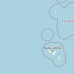
Map view of ʻEua National Park

Use this park location map to pinpoint ʻEua National Park in Tonga, understand its exact geographic position, and read its mapped placement within the surrounding landscape more clearly.

Pigeon | © OpenStreetMap contributors
Park atlas

Trace the regional spread of protected landscapes, comparing 'Eua's unique rainforests with adjacent island conservation sites.

Explore More Pacific Island Protected Areas Near 'Eua National Park

After exploring 'Eua National Park's unique tropical rainforest and dramatic coastal cliffs in Tonga, browse other protected areas across the broader Pacific Islands region. This geographic discovery enables comparison of diverse conservation landscapes and highlights regional variations in ecological protection strategies.
National parkSamoa
About 880 km away#1 closest

Northeast

O Le Pupu-Puʿe National Park: Explore Samoa's Protected National Park Geography and Boundaries

Mapped terrain and protected landscape context for this Samoan national park.

Understand O Le Pupu-Puʿe National Park as a significant protected area within Samoa's archipelago. This detail entry provides essential geographic context, mapping its boundaries and situating it within the nation's protected lands. Explore the park's role as a national park and its contribution to the mapped natural landscape of Samoa.

Area
50.2 km²
Established
1978
IUCN
II
Relief
Mixed relief
National parkUpolu
About 892 km away#2 closest

North

Lake Lanoto'o National Park: Discover Its Protected Landscape and Geographic Setting on Upolu

Explore park boundaries and regional natural terrain.

Lake Lanoto'o National Park represents a crucial protected area on the island of Upolu, Samoa. This page provides detailed geographic information, focusing on the park's mapped boundaries and its contribution to the natural landscape of the region. Understand its role as a national park and its position within the broader atlas of protected lands, offering insight into the island's unique geography.

Area
4.7 km²
Established
2003
IUCN
II
Relief
Highland
Marine protected areaAmerican Samoa
About 893 km away#3 closest

Northeast

National Marine Sanctuary of American Samoa: Mapped Marine Protected Area Geography

Discover protected marine landscapes across American Samoa's region.

Investigate the National Marine Sanctuary of American Samoa, a protected marine area with distinct geographic relevance. This detailed view focuses on its mapped boundaries and its role as a protected landscape within the broader atlas of American Samoa. Understand the unique environmental context and protected-area significance that shapes this marine sanctuary.

Area
35,170 km²
Established
1986
Climate
Tropical
Access
Easy access
National parkUnited States of America
About 904 km away#4 closest

Northeast

National Park of American Samoa: A Mapped Protected Landscape within the USA

Discover its island geography and protected area context.

National Park of American Samoa stands as a significant protected natural area, offering unique insights into island geography and conservation landscapes. Explore its detailed mapped boundaries and understand its placement within the broader atlas of United States of America protected lands. This entity provides a focal point for understanding distinct geographic features and the territorial spread of protected natural resources.

Area
33.414 km²
Established
1988
IUCN
V
Visitors
12.1K annual
Marine protected areaAmerican Samoa
About 912 km away#5 closest

Northeast

Rose Atoll Marine National Monument: Protected Marine Area in American Samoa

Explore mapped boundaries and regional geographic context.

Rose Atoll Marine National Monument is designated as a marine protected area within the geographic scope of American Samoa. This page offers detailed insights into its protected status, mapped terrain, and the surrounding natural landscapes. It serves as a resource for understanding the park's specific boundaries and its role as a conservation area, providing a foundation for geographic discovery.

Relief
Lowland
Scope
Marine
Water
Water-dominated
Nature reserveNew Zealand
About 924 km away#6 closest

South

Kermadec Islands Nature Reserve: Mapping the Volcanic Terrain and Subtropical Ecosystems

A remote New Zealand volcanic arc and marine protected area.

The Kermadec Islands comprise an isolated chain of volcanic landforms stretching along a submarine ridge in the South Pacific. This nature reserve protects unique subtropical moist forests, diverse seabird colonies, and complex hydrothermal vent communities, serving as a critical area for ongoing ecological restoration and marine science.

Area
33.6 km²
Established
1937
Relief
Mountain
Climate
Subtropical
Wildlife reserveAmerican Samoa
About 1,043 km away#7 closest

Northeast

Rose Atoll National Wildlife Refuge: Southernmost U.S. Wildlife Reserve & Mapped Coral Ecosystem

Discover unique protected landscape geography in American Samoa.

Rose Atoll National Wildlife Refuge is a remote U.S. wildlife reserve situated in American Samoa, distinguished by its unique atoll structure and the southernmost geographical coordinates within the United States. This protected area is renowned for its exceptional marine biodiversity, including extensive coral reef ecosystems, a significant seabird nesting colony, and vital sea turtle habitats. Exploring this refuge offers a window into distinct regional geography, mapped marine protected areas, and the ecological significance of isolated Pacific atolls.

Area
158.09 km²
Established
1973
IUCN
Ia
Relief
Lowland
Marine protected areaNorfolk Island
About 1,714 km away#8 closest

Southwest

Norfolk Marine Park: A Comprehensive Look at Australia's Offshore Protected Ocean Reserve

Marine geography, deep sea features, and ocean convergence zones

Norfolk Marine Park represents a vast expanse of offshore territory defined by varied seafloor bathymetry including ridges, plateaus, and troughs. As a key component of the Temperate East Marine Parks Network, the reserve protects the Tasman Front, where dynamic water masses interact to drive biological productivity across the South Pacific. Its geographic isolation and structural diversity make it a pivotal research site for understanding regional marine ecosystems and deep-water fauna connectivity.

Area
188,444 km²
Established
2018
IUCN
IV
Climate
Subtropical

Common questions about visiting, size, designation, and location context for ʻEua National Park

ʻEua National Park FAQs for park facts, access, geography, and protected area context

Find quick answers about ʻEua National Park, including protected-area facts, park geography, trail and visitor context, and how the park fits into its surrounding country and regional landscape.
MoriAtlas Explorer

Continue Your Protected Areas Search Across the Global Atlas

Deepen your exploration by continuing the structured search for national parks and protected areas worldwide. Utilize the comprehensive filtering capabilities to compare different conservation landscapes and refine your understanding of global park geography. Discover more about the distribution and characteristics of protected natural areas.

Global natural geography