
Visit Planning
When is the best time to visit Fitzgerald River National Park?
Determining the best time to visit Fitzgerald River National Park requires balancing the peak wildflower season against the specific requirements for whale watching and hiking. Because the park acts as a significant biodiversity hotspot along the southwestern coast of Western Australia, its environment changes markedly between the cool, wetter months and the hot, dry summer. For most visitors, the ideal window falls between September and November. During this period, the arrival of spring brings milder temperatures, and the heathlands are transformed by endemic wildflower displays that are unique to this UNESCO Biosphere Reserve.
Seasonal Trade-offs in the Biosphere
Visitors planning their trip must weigh competing priorities. If the primary goal is to observe southern right whales, which frequent the coastal waters near Point Ann to calve, the winter months offer the highest probability of sightings. However, this preference involves accepting cooler temperatures, increased wind speeds, and higher precipitation levels compared to the rest of the year. Conversely, those visiting primarily for hiking the rugged terrain of the Barren Range or exploring remote coastal tracks will find the autumn and spring months more comfortable for physical exertion. During the height of summer, temperatures can become extreme, which often limits the feasibility of strenuous treks and makes mid-day coastal exploration less pleasant.
Environmental Factors Influencing Timing
Temperature, wind, and rainfall patterns dictate the rhythms of the park. Winters are characterized by lower average temperatures, frequently dipping into the single digits at night, which contrasts sharply with the hot, dry conditions observed from December through March. Rainfall is concentrated in the cooler months, which supports the park's lush spring botanical growth but can impact the accessibility of certain unsealed roads and remote tracks. Wind is a constant presence in this coastal environment, influencing everything from sea conditions for whale watching to the perceived chill factor for hikers on exposed ridges.
Ultimately, there is no single month that perfectly serves all interests. The decision to visit depends on whether a traveller prioritizes the temperate climate and floral biodiversity of spring, the whale migration activity of the cooler winter months, or the long, bright days of summer that favor extended coastal stays. By understanding these seasonal dynamics, visitors can better align their expectations with the realities of the park's Mediterranean-influenced climate. Because conditions can shift, always verify current park alerts and weather forecasts before finalizing travel dates.
Seasonal Outlook
Best months to visit Fitzgerald River National Park by activity
Spring wildflowers: The peak botanical window
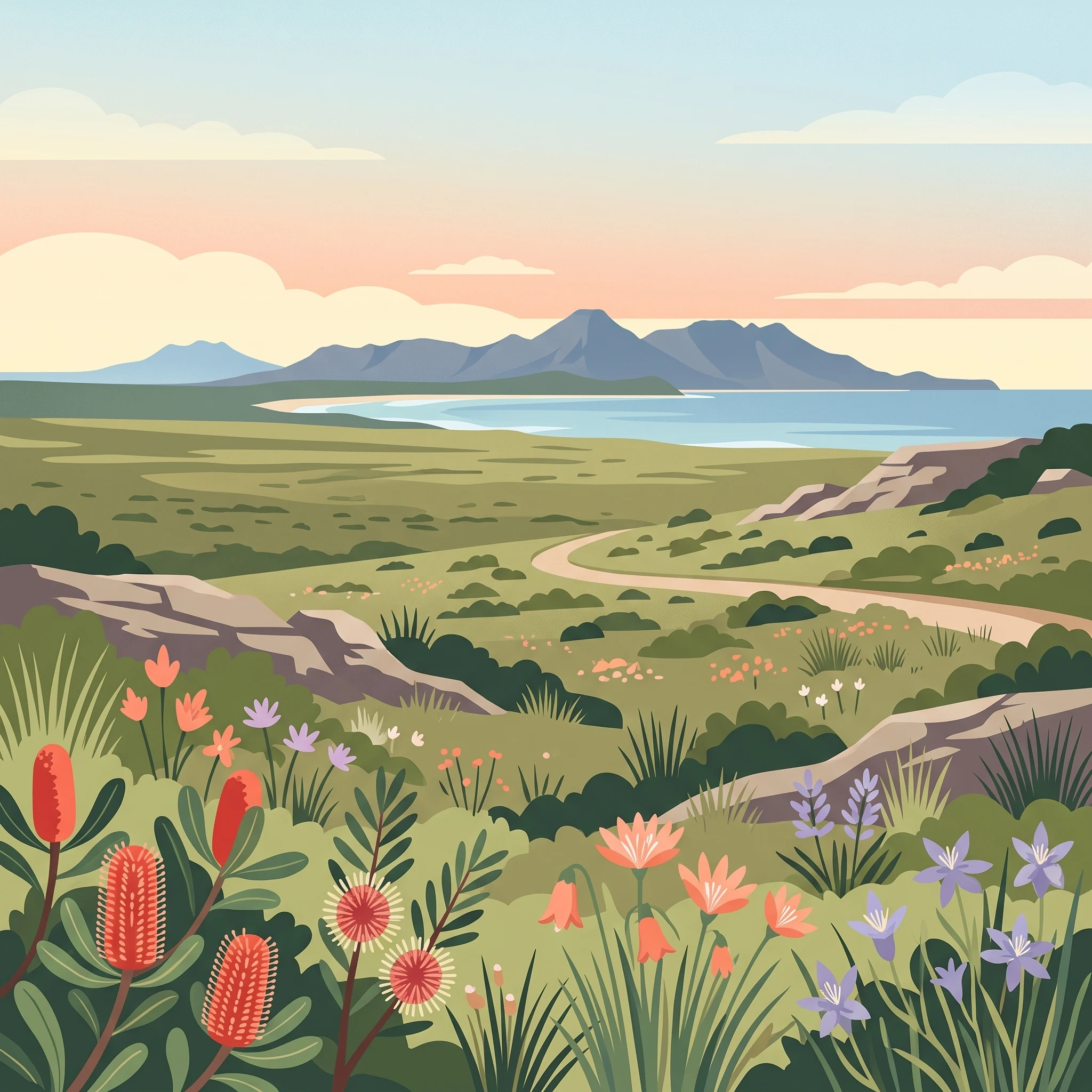
The most rewarding period for visitors primarily interested in the park's botanical diversity is between September and November. During these months, the heathlands transition into a complex mosaic of color as endemic species like the royal hakea, Qualup bell, and various featherflowers reach their bloom. Spring offers a moderate climate with mean temperatures rising from roughly 13°C in September to 17°C by November, creating comfortable conditions for long days of hiking across the Barren Range. While rainfall decreases compared to the winter months, visitors should still anticipate variable weather, as the transition into the warmer months can occasionally bring unpredictable shifts in wind and temperature.
Winter whale watching: Coastal observation periods
For travellers prioritizing the observation of southern right whales, the winter months from June through August serve as the primary window. Point Ann is recognized as a critical calving habitat during this season. While whale activity is a significant draw, this period represents the park's coolest and dampest phase, with mean temperatures often dipping to near 11°C in July and average maximums hovering around 21°C. Rainfall totals are statistically higher during these months, and wind speeds remain consistent. Visitors choosing this window should prioritize gear that can handle potential exposure to coastal rain and cool breezes, recognizing that the tradeoff for wildlife sightings is less reliable hiking weather.
Summer and shoulder season transitions
Those looking to avoid the peak crowds of the primary wildflower or whale watching windows might consider the late summer months of December through February or the autumn shoulder period of April and May. Summer days provide long daylight hours, sometimes exceeding 14 hours in December, yet daytime maximums can frequently exceed 37°C. These high temperatures make mid-day physical activity, such as strenuous hiking, significantly more demanding. Conversely, the transition months of April and May offer cooling temperatures as the park enters the pre-winter phase, often providing a quieter environment with moderate conditions before the onset of the wettest winter weeks.
Ultimately, the choice hinges on whether your priority is the botanical display of the spring or the migratory wildlife of the winter. Spring provides a more temperate climate suited to exploration of the diverse terrain, while winter requires a focus on coastal vantage points and patience with potentially harsher weather conditions.
Annual Climate Analysis
Monthly Temperature, Rainfall and Climate Normals in Fitzgerald River National Park
Understanding the Annual Climate Rhythm
The climate of Fitzgerald River National Park is defined by a Mediterranean pattern where temperature and rainfall operate in distinct cycles. Based on climate normals recorded from 1991 to 2020, the park experiences significant variations in heat, moisture, and daylight throughout the year. Visitors should view these figures as a long-term baseline for the region rather than as a live forecast, as daily conditions across such a large and rugged coastal area can deviate substantially from these averages.
Heat and Temperature Trends
The park sees its highest temperature readings during the peak of summer. January and February are the warmest months, with average maximums often exceeding 38 degrees Celsius. These periods feature high daylight availability, regularly reaching over 13 hours, which provides ample time for exploration. However, the daytime heat is a critical factor for hikers, particularly when traversing inland terrain or exposed coastal ridges like the Barren Range. Conversely, the coldest period occurs between June and August. During July, the mean temperature drops to its annual low of approximately 11 degrees Celsius, with average minimums dipping below 4 degrees Celsius. While these temperatures are mild compared to alpine regions, the combination of cooler air and frequent coastal breezes can lead to a much colder sensation, requiring appropriate gear for early mornings and late afternoons.
Precipitation and Humidity Cycles
Rainfall in the park follows a trend where the cooler months generally receive more precipitation than the warmer months. August stands out as the wettest period based on long-term data, with average precipitation levels of 1.88 millimetres per day. This moisture, combined with relatively high humidity levels that hover around 77 to 78 percent during the winter months, contributes to the park's lush growth and the vitality of its unique heathlands. In contrast, the summer months are notably drier, with January and December seeing average rainfall around 0.84 millimetres per day. These drier periods see lower humidity levels, often dipping near 61 percent, which can increase fire danger and demand greater awareness of water carrying requirements for any extended excursions.
The Influence of Coastal Winds and Daylight
Wind is a consistent feature of the Fitzgerald River coastline throughout the year. Data shows mean wind speeds remain relatively steady, typically fluctuating between 5 and 6 metres per second. While these figures represent long-term averages, they reflect the exposed nature of the park's cliffs and open heathlands, where the lack of dense forest canopy can make wind feel more impactful. Daylight hours reach their peak in December at over 14 hours, providing the most generous window for activities, whereas June offers the shortest days at just under 10 hours. This fluctuation in daylight, paired with the seasonal shift in wind and rainfall, creates a highly variable environment where the same trail can feel dramatically different depending on whether it is visited during the peak of the winter whale-watching window or the heat of the summer season.
Seasonal climate patterns
Understanding local seasonal transitions and weather phases in Fitzgerald River National Park
The Coastal Mediterranean Rhythm
Fitzgerald River National Park operates on a seasonal rhythm dictated by its Mediterranean climate, which is characterized by dry, warm summers and cooler, wetter winter months. Unlike regions that experience four distinct seasons, the park undergoes a transition between two primary phases: a period of relative cooling and moisture that supports the park's immense floral biodiversity, and a period of increasing warmth and dryness that dominates the later months of the year. Understanding this duality is essential for planning, as the shift between these phases significantly changes how visitors experience the rugged mountain ranges and extensive heathlands.
The Cool and Moist Winter Phase
From June through August, the park experiences its most significant cooling and peak precipitation. Average daily temperatures during this period reach their annual lows, with mean temperatures often hovering between 10 and 12 degrees Celsius. While this is not a period of extreme cold, the increased rainfall and higher humidity levels (often peaking near 78 percent in July) create a distinct environment. This phase is defined by its atmospheric consistency and is the time when the coastline becomes critical for wildlife, specifically southern right whales. Visitors should expect more frequent coastal winds during these months, which can influence the experience on exposed cliffs and open trails. This is not a time of continuous rain, but rather a period where the landscape is more susceptible to water-saturated trails and damp conditions, necessitating proper gear for outdoor activities.
The Spring Flowering Transition
September acts as the vital bridge between the cooler winter phase and the warming trends of late spring. As the moisture from the winter months persists but temperatures begin to climb toward the mid-teens and twenties, the park enters its most vibrant state. This transition period is defined by the rapid growth and flowering of the park's endemic species. By October, the influence of the warmer, drier months begins to take hold, resulting in more comfortable hiking conditions as rainfall totals drop significantly compared to the winter peak. This phase is arguably the most distinct because it offers a rare overlap: the residual moisture from the previous months sustains the landscape, while the lengthening daylight hours and climbing temperatures encourage the prolific botanical displays that the park is known for.
The Warm and Dry Summer Stretch
From December through February, the park shifts into its most pronounced dry phase. Temperatures rise significantly, with average daily maximums consistently reaching into the high 30s. Humidity levels drop to their annual lows, often falling below 62 percent, and the intensity of the sun is high, with daylight hours stretching toward 14 hours per day. During this period, the vegetation in the heathlands dries out, and the landscape takes on a sun-bleached appearance. This stretch is characterized by very stable, dry weather, making it the most reliable time for clear visibility from the peaks of the Barren Range, although the heat requires careful planning for any extended hiking or physical activity. Visitors during this window should anticipate firm, dry ground conditions, which differ significantly from the softer, more verdant tracks experienced earlier in the year.
Seasonal Experiences
What Visiting Fitzgerald River National Park is Like Throughout the Year
Hiking the Barren Range Under Seasonal Conditions
Exploring the peaks of the Barren Range, including West Mount Barren and East Mount Barren, depends heavily on the interplay between ambient temperature and wind exposure. During the summer months, particularly December and January, maximum temperatures often climb toward 38°C or 39°C. Combined with high evaporation rates and constant coastal winds, these conditions turn exposed hiking trails into significant physical challenges. Visitors intending to scale these ridges should note that the terrain lacks substantial shade, making the cooler, shorter days of late autumn and early spring,typically April through May or September through October,more favorable for active exploration. By choosing these months, hikers benefit from milder temperatures while still enjoying sufficient daylight to navigate the trails safely without the physiological stress of peak summer heat.
Observing Southern Right Whale Migration
Point Ann serves as the primary vantage point for observing southern right whales that arrive in the protected bay to calve. The behavior of these marine mammals is inherently tied to the austral winter, with sightings most frequent from June through October. While winter is defined by higher precipitation levels,peaking at approximately 1.8 mm per day in August,and cooler mean temperatures around 11°C, the trade-off is the unique opportunity to witness whale activity. Visitors should prepare for variable coastal weather during these months, as the increased rainfall and lower humidity comfort levels compared to summer can shift quickly. Observation platforms offer a relatively stable environment, but the cold wind speeds, which remain consistent throughout the year, necessitate windproof layers for anyone planning an extended stay at the coast.
Seasonal Botanical Cycles
The park's reputation as a biodiversity hotspot is most evident during the spring flowering season, roughly from September through November. The rise in temperatures from the winter lows allows for a surge in botanical activity, showcasing species such as the royal hakea and various featherflowers. This period provides a distinct experience compared to the rest of the year, as the heathlands transition into a period of visible growth. While many visitors associate the park with the wildflowers of spring, those interested in the historical context of the region, such as the Quaalup Homestead, find the cooler, drier months of late autumn equally rewarding for walking through the historic grounds without the intensity of summer sun or the peak spring crowds. Access to these inland areas remains relatively consistent, though travellers should always check current conditions before departing, as specific paths or remote tracks may require maintenance depending on recent weather events.
Travel Planning Priorities
Optimizing Your Fitzgerald River National Park Visit for Specific Interests
Balancing Walking and Temperature
For travellers focused on hiking the rugged terrain of the Barren Range, the primary concern is managing the intense heat of the peak summer months. Maximum temperatures frequently exceed 37 degrees Celsius from December through March. During these months, the heat radiating from the exposed heathlands and rocky ridges can make strenuous activity dangerous. The most supportive period for hiking is instead the shoulder transition of late spring, specifically October and November, or the cool weeks of late winter in August. These months provide significantly more manageable daytime temperatures, typically peaking between 20 and 25 degrees Celsius. The main compromise for choosing these cooler months is the increased probability of rain and higher wind speeds, which can affect visibility and trail comfort on exposed ridges like West Mount Barren.
Targeting Whale Watching Opportunities
Visitors prioritizing coastal wildlife, specifically the southern right whales that frequent the waters near Point Ann, should align their travel with the winter migration period. While peak whale activity is documented between June and October, this window coincides with the coolest and wettest months of the year. July and August feature the highest average daily precipitation rates, often exceeding 1.8 mm per day, and the lowest mean temperatures. Travellers must accept that the best chance for viewing whales requires a willingness to navigate cooler, damp conditions and potentially unpredictable coastal winds, which hover around 6 m/s throughout this period. The trade-off is clear: to prioritize wildlife density, one must sacrifice the warmer, sunnier days of late spring.
Seeking Dry Conditions and Longer Daylight
For those whose priority is maximizing outdoor time with the lowest risk of rain and the longest available daylight, the summer months are the clear choice. December and January offer the most reliable weather for dry-land activities, characterized by precipitation averages below 0.9 mm per day and approximately 14 hours of potential daylight. These months are ideal for visitors who wish to explore the park's coastal edges or use the boat ramp at Point Ann when conditions are calmest. However, the trade-off is the extreme heat during the middle of the day. To manage this, travellers must plan their excursions for the early morning or late afternoon to avoid the high-sun peaks. Readers should verify the current status of specific remote tracks or internal access routes, as the park authorities may implement seasonal restrictions based on fire risk or track maintenance that are not reflected in climate normals.
Visitor Access
Seasonal access and trip planning requirements for Fitzgerald River National Park
Navigating to and within the park
Fitzgerald River National Park is accessible primarily via the South Coast Highway, which connects major regional centers like Albany and Esperance. While this route provides the main artery for transit to the region, the final approach to the park involves secondary roads that branch off from the highway. Visitors should plan for several hours of driving when traveling from either of these major Western Australian coastal hubs, as the scale of the landscape means distances between significant points of interest can be substantial.
Once inside the park, road conditions are varied. Much of the primary network consists of graded gravel surfaces that are generally accessible to standard vehicles under normal conditions. However, the reliance on unsealed roads means that the quality of your transit experience is highly dependent on recent weather. While gravel roads are typically well-maintained for general access, rainfall can quickly alter surface stability, potentially making certain stretches difficult to navigate without specialized equipment.
Seasonal impacts on road accessibility
Your ability to reach specific, more remote corners of the park often fluctuates with the seasons. During the wetter months, which historically see higher precipitation totals between June and August, some secondary tracks are subject to temporary closures if they become flooded or too saturated for safe passage. Because these conditions are reactive, there is no permanent seasonal calendar for road closures. Instead, access is managed based on real-time environmental impact.
If your itinerary relies on reaching remote areas via 4WD-only tracks, you must verify the current status of these routes through the official park authority website or local visitor centers before your departure. These tracks are most prone to closures following intense weather events, which can occur outside of the primary winter rainfall window. Never assume that a road remains open based on the time of year alone. Check for active alerts, road condition reports, and any notices regarding temporary maintenance or flood-related closures.
Planning for remote landscape logistics
Given the park's size, which spans nearly 3,000 square kilometres, effective trip planning requires accounting for the distances between trailheads and coastal viewing spots like Point Ann. Because mobile service and fuel stations are not available within the park boundaries, all necessary supplies and fuel must be secured in nearby towns like Bremer Bay or Hopetoun. Your transit plan should include a buffer for changing road conditions, especially if you are visiting during a period of transition between the dry summer and the wetter winter months. Always consult the official state parks agency for the most current information on park alerts, entry requirements, and any temporary facility restrictions before you commit to your travel dates.
Safety and Preparation
Weather, Safety, and Seasonal Preparation at Fitzgerald River National Park
Preparing for Coastal Weather and Variable Conditions
Visitors to Fitzgerald River National Park should plan for a Mediterranean climate defined by pronounced seasonal swings in temperature and precipitation. While long-term climate normals highlight distinct trends, such as the warmer, drier conditions of the summer months (December to February) and the cooler, wetter, and breezier nature of winter (June to August), these figures do not represent day-to-day forecasts. Because the park encompasses a diverse range of terrain, including coastal cliffs and inland heathlands, weather conditions can shift rapidly. It is essential to monitor current Bureau of Meteorology forecasts and park-specific alerts issued by the Department of Biodiversity, Conservation and Attractions before leaving for your trip. This ensures your itinerary remains flexible if high winds or sudden changes in local weather patterns occur.
Seasonal Clothing and Gear Considerations
Preparation for your visit should account for the intensity of the environment rather than a fixed uniform. During the spring months of September to November, temperatures are generally moderate, making this period ideal for longer hikes in the Barren Range. However, even in warmer months, the coastal environment is subject to persistent wind, which can make air temperatures feel cooler, particularly in the mornings and evenings. Layering is a practical approach for navigating the park throughout the year, allowing you to adapt to the fluctuations between active hiking periods and quieter observations of wildflowers or marine life. Ensure that your clothing provides sufficient coverage for the sun during the long daylight hours of summer, and consider wind-resistant outer layers for coastal visits during the winter whale-watching season.
Safety in a Natural Environment
Safety planning for this park involves awareness of the local landscape and the risks associated with remote coastal areas. Past experiences in the region indicate that bushfire risk is a significant consideration, particularly during the dry summer and early autumn periods. Visitors must remain vigilant, carry necessary communication equipment, and stay informed about fire conditions and total fire bans that may be in effect. When exploring the park's network of tracks and coastal trails, ensure you have a clear understanding of your route and an alternative escape plan. If you are travelling during the quieter winter months, prioritize stability and warmth while keeping in mind that gravel tracks can become difficult to traverse following heavy rainfall. Always verify the status of trails, campgrounds, and access roads with official park authorities, as site conditions can change based on recent weather events.
Trip decision guide
Selecting your ideal timeframe to visit Fitzgerald River National Park
Balancing your primary travel objectives
Finalizing your travel dates to Fitzgerald River National Park requires weighing your specific interest in wildlife against the preference for particular weather conditions. The most significant trade-off remains the choice between the peak whale watching window of mid-winter and the vibrant botanical displays of the spring transition. If your primary goal is to spot southern right whales, you must accept cooler temperatures, shorter daylight hours, and the higher likelihood of precipitation that defines the June to August period. Conversely, those visiting primarily for the wildflowers will find the mild, sunnier days of September and October significantly more comfortable for extended exploration of the heathlands and coastal trails.
Assessing personal comfort and climate trade-offs
Your tolerance for temperature fluctuations should be a guiding factor in your final decision. The summer months from December through February offer the longest daylight hours and consistent warmth, yet the potential for high maximum temperatures and dry conditions can make strenuous activities like hiking the Barren Range taxing. For travelers who find intense summer heat prohibitive, the shoulder months of April, May, or November offer a middle ground, providing milder conditions that are often ideal for hiking and photography. These periods effectively bridge the extremes of the winter rainfall and summer heat, though you must prepare for the variability that characterizes a coastal Mediterranean climate.
Prioritizing access and current conditions
Regardless of which time of year aligns with your personal priorities, remember that the environment in this region is dynamic. While the seasonal patterns provide a reliable baseline for planning, they are not forecasts. Access to remote areas, particularly those requiring the use of four-wheel-drive tracks, can change rapidly due to rainfall or other environmental factors. Before finalizing your itinerary, verify current road status, fire danger ratings, and park alerts through official Western Australia government resources. Relying on these verified, up-to-date sources ensures that your chosen timeframe remains safe and practical, allowing you to focus on the unique ecological experience that defines this national park.