
Mori Atlas logo
Protected areaFlat Tops Wilderness

Explore the unique volcanic topography, glaciated valleys, and alpine lake networks of this expansive protected landscape.

Flat Tops Wilderness: A Geographic Analysis of Colorado's High Mountain Basalt Plateau

(Flat Tops Wilderness Area)

Flat Tops Wilderness represents a distinctive protected landscape within the Rocky Mountains of Colorado, spanning over 235,000 acres of national forest land across Garfield, Rio Blanco, and Eagle counties. The area is defined by a massive volcanic basalt plateau that rises between 11,000 and 12,000 feet, providing a stark contrast to the surrounding jagged mountain terrain. This atlas entry examines the physical geography of the region, including the Devils Causeway knife-edge ridge, the complex basin of over 110 glacial lakes, and the diverse forest mosaic of spruce, fir, and aspen ecosystems.

alpine tundrabasalt plateauhigh lakesmoose habitatenglemann sprucesubalpine fir
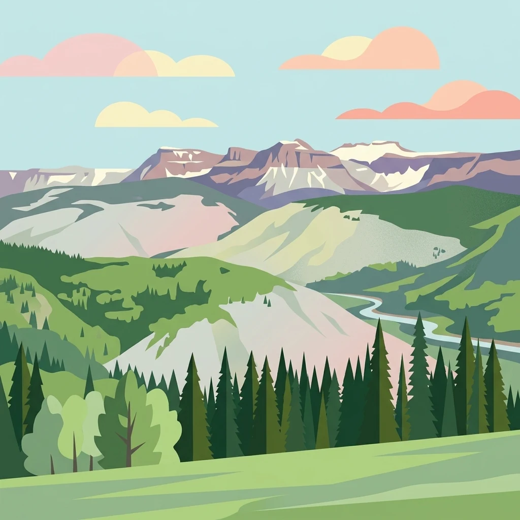
A flat-style digital illustration of a mountainous landscape with a forest in the foreground, rolling green hills in the midground, and snow-capped, flat-topped mountain peaks in the background under a blue sky with soft, stylized clouds.

Flat Tops Wilderness

Protected area

Park overview

Structured park overview, official facts, and landscape profile for Flat Tops Wilderness

Flat Tops Wilderness park facts, protected area profile, and essential visitor context

Review the core facts for Flat Tops Wilderness, including designation, size, terrain, visitor scale, habitats, and operating context in one park-focused overview.

About Flat Tops Wilderness

Flat Tops Wilderness is a large, federally protected wilderness area in the northwestern Rocky Mountains of Colorado, recognized for its unusual geology and its extraordinary concentration of high lakes and ponds. The wilderness was once part of the broader Routt and White River national forests and today remains embedded within both the Routt and White River national forests, managed as a single contiguous wild landscape by the United States Forest Service.

The defining identity of the area comes from a broad, basalt-capped plateau that is the northeastern portion of the larger White River Uplift. Horizontal basalt flows left over from Tertiary volcanic activity sit on top of the uplift, while Pleistocene glaciation later carved valleys on either side of the plateau. The result is a striking scene of nearly level, treeless tundra surfaces above 11,000 feet separating deeply cut glacial valleys below, an arrangement that is uncommon among Colorado's typically more sharply peaked mountain ranges.

Within this plateau setting, the wilderness is known for its abundant water features, with roughly 110 ponds and lakes scattered across the high country. Trappers Lake, on the northern side of the area, is the most famous and historically the most important, while many lesser-known lakes offer quieter backcountry experiences. The single highest point is the summit of Flat Top Mountain at 12,361 feet on the east side of the range, while the Devils Causeway, just a few feet wide where opposing glaciers nearly met, has become one of the most recognizable landmarks in the Colorado wilderness system.

Flat Tops is equally valued for the way its ecosystems stack vertically across the plateau and its bordering valleys. The lodgepole pine, Engelmann spruce, and subalpine fir forests that fill much of the middle elevations give way to aspen groves lower down and to open alpine tundra on the plateau tops, producing a layered habitat mosaic that supports a strong suite of mammals. Visitors approach the wilderness from the west for Trappers Lake and from the east by way of Yampa and Routt County Road 7, and the area is a destination for both day hiking, especially shorter traverses like the Devils Causeway, and extended backcountry travel.

Quick facts and research context for Flat Tops Wilderness

Flat Tops Wilderness lies in northwestern Colorado, spanning portions of Garfield, Rio Blanco, and Eagle counties and covering about 235,214 acres across the Routt and White River national forests. It is the third largest U.S. Wilderness Area in the state and has been managed as wilderness since January 1, 1975, following congressional designation under the leadership of Senator Floyd Haskell and signature by President Gerald Ford. The area sits at a high plateau elevation roughly between 11,000 and 12,000 feet, with Flat Top Mountain as its highest summit and the Devils Causeway as one of its most iconic geological features.

Protection and recognition

Documented terrestrial protection framework and historical designation records

Flat Tops Wilderness Protection Status and Official Designation History

Flat Tops Wilderness maintains a documented terrestrial protection status established through historical designation records from nineteen seventy-five. Official management scope details and administrative recognition metrics provide verified structural context for the protected area.

Protection details

Protection scope
Terrestrial
Designated year
1975
Transboundary protection
No
Park context

Deeper park guide and search-rich context for Flat Tops Wilderness

Flat Tops Wilderness history, landscape, wildlife, and travel context

Explore Flat Tops Wilderness through its history, landscape character, ecosystems, wildlife, conservation priorities, cultural context, and seasonal travel timing in a structured park guide built for atlas discovery and search intent.

Why Flat Tops Wilderness stands out

The wilderness is best known for its defining flat-topped volcanic plateau, its dense network of high lakes and ponds, and a distinctive mix of alpine tundra and conifer forest that is unusually broad for Colorado. More than 110 named and unnamed lakes, including the famous Trappers Lake, dot a landscape that supports one of the state's strongest moose populations together with elk, mule deer, black bear, and cougar. The Devils Causeway, a knife-edge ridge crossing once carved by opposing glaciers, has become the park's signature hiking experience and a visually dramatic symbol of this plateau. Combined with its large size and nearly ten decades of protection history, these features make Flat Tops Wilderness a defining example of Colorado's high-country wilderness character.
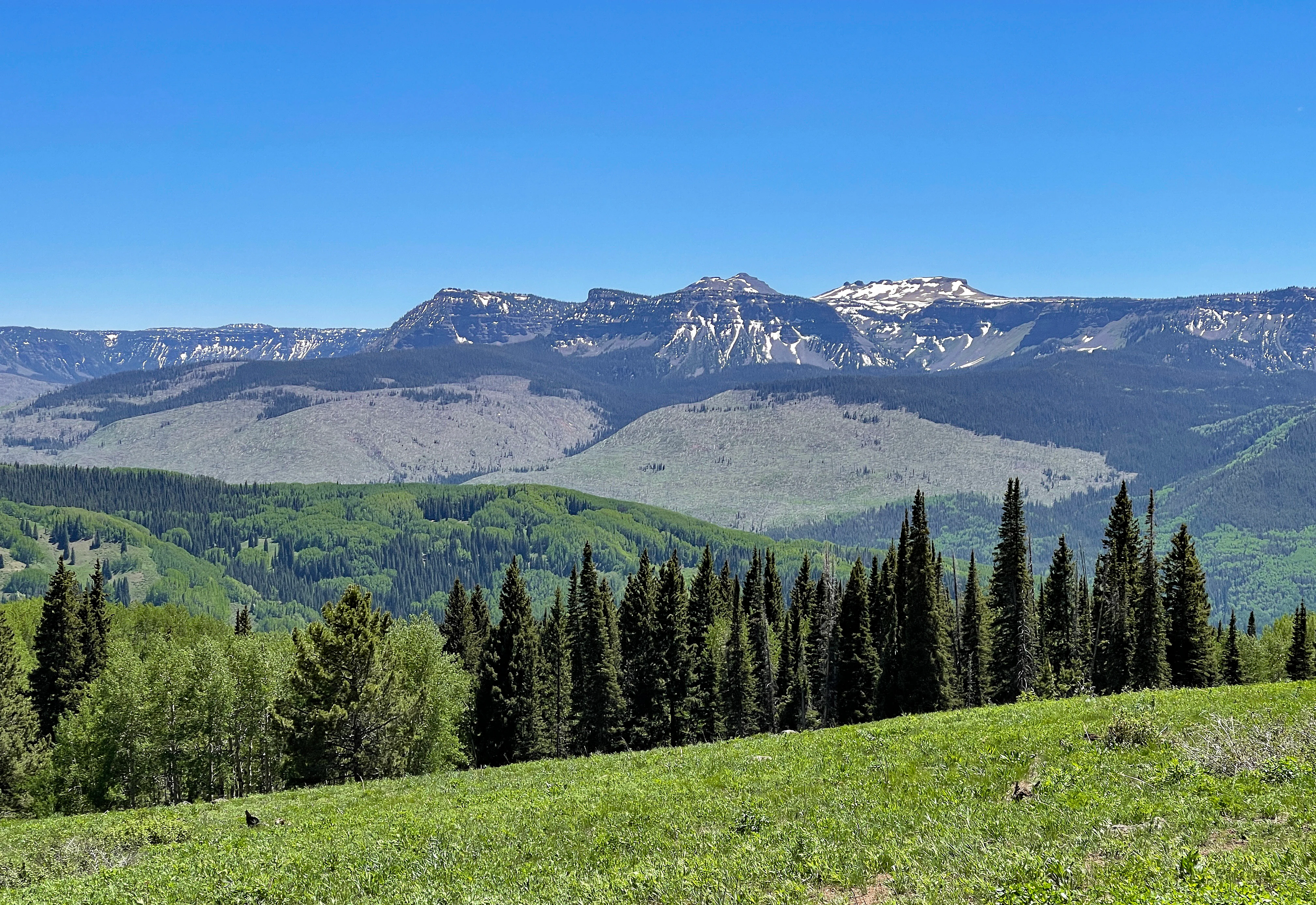
A wide, clear-day view of a mountainous landscape with distinctive flat, plateau-like peaks in the background, a band of coniferous forest in the midground, and a grassy meadow in the foreground.
Panoramic view of the flat-topped geological formations characteristic of the Flat Tops Wilderness as seen from Ripple Creek Overlook.

Flat Tops Wilderness history and protected-area timeline

Flat Tops Wilderness carries an unusually important place in the early history of the American wilderness movement. In the early twentieth century, U.S. Forest Service official Arthur Carhart visited Trappers Lake on the north side of the present-day wilderness and was so struck by the area that he began advocating formally for the preservation of American wilderness. That moment is often treated as a foundational episode in the development of wilderness protection in the United States.

The first formal protection came on March 4, 1932, when the Chief of the U.S. Forest Service designated 118,230 acres of the Routt and White River national forests as the Flat Tops Primitive Area, intended to safeguard the area's wild values under the Forest Service's primitive area classification. The area remained in that category until the passage of the Wilderness Act in 1964, which required the Secretary of Agriculture to evaluate primitive areas for inclusion in the new national wilderness system within a decade.

Following that mandate, the Forest Service evaluated the Flat Tops primitive area and its surroundings and in 1967 recommended 142,230 acres for wilderness designation. The recommendation was contested. Private and public interests proposed dam and water diversion projects on the South Fork of the White River, near the southwest boundary, to support development of oil shale resources to the west, and timber interests objected to wilderness outside the original primitive area's boundaries. Conservation groups, including the Colorado Open Space Coordination Council, the Sierra Club, The Wilderness Society, Defenders of Wildlife, and the National Audubon Society, organized to support a much larger area of around 230,000 acres.

The legislative outcome was a compromise but a substantial one. On June 5, 1975, the U.S. Senate passed a bill sponsored by Senator Floyd Haskell of Colorado to designate 235,230 acres as the Flat Tops Wilderness Area. The U.S. House of Representatives approved the measure by a vote of 369 to 1 on December 1, 1975, and President Gerald R. Ford signed it into law on December 12, 1975. The act took effect on January 1, 1975 in the area's official records, and the final boundaries included the contested lands along the South Fork of the White River, effectively blocking the proposed dam construction.

The wilderness has continued to face ecological pressures after designation. The most notable large disturbance came in August 2002, when two lightning-struck fires, the Big Fish Fire and the Lost Lake Fire, burned more than 22,500 acres together, roughly ten percent of the wilderness, leaving lasting ecological impacts on the plateau's forests and tundra margins. The non-native plant yellow toadflax has also affected portions of the area, prompting ongoing management attention.

The designation itself was a turning point: the wilderness grew from a Forest Service primitive area into a congressionally protected wilderness with a strong conservation constituency and substantial ecological diversity.

Flat Tops Wilderness landscape and geographic character

Flat Tops Wilderness is distinguished from most other Colorado mountain ranges by its plateau character. The towering mountains of Colorado are usually defined by jagged summit ridges, but Flat Tops takes its name from a broad horizontal basalt cap, the surface of the volcanic flows that once covered the area.

The plateau sits at a typical elevation between 11,000 and 12,000 feet and forms the northeastern portion of the White River Uplift. Its flat upper surface is dissected by glacial valleys carved by later Pleistocene ice, producing a mix of open, rolling tundra on top of the plateau and steep forested valleys below. The transition is dramatic, with the flat-topped mountains rising abruptly above much lower terrain around them.

The single highest feature is the summit of Flat Top Mountain at 12,361 feet on the east side of the range. Nearby, the Devils Causeway is the most visually striking feature: a narrow neck of remaining basalt between two glacial valleys that are otherwise separated, crossed by a trail just three or four feet wide at its narrowest, with hundreds of feet of vertical drop on either side. The causeway has become both a defining landmark of the area and one of the most demanding day hikes in Colorado wilderness.

Beneath the plateau, more than 110 named and unnamed lakes and ponds fill basins hollowed by ice and volcanic geology. Trappers Lake, on the northern side of the wilderness, is the most prominent example and remains a centerpiece landscape feature. Together, the basalt plateau, the glacial valleys, and the network of high lakes define the physical identity of the area and give it a distinctive look that does not occur elsewhere in the Colorado mountains.

Flat Tops Wilderness ecosystems, habitats, and plant life

The ecosystems of Flat Tops Wilderness are unusually varied because so much of its area sits on a single high plateau rather than on a typical mountain ridge. Across the area, vegetation shifts quickly with elevation and exposure.

The upper surface of the plateau is a relatively rare in-colorado example of true alpine tundra, treeless and exposed to high winds, harsh winters, and a short growing season. Margins of the plateau grade downward into dense conifer forest. The dominant tree species are Engelmann spruce, subalpine fir, and lodgepole pine, with aspen groves occupying the lower elevations on the flanks of the plateau and along the eastern approaches. This layering of alpine tundra, subalpine conifer forest, and aspen woodland on a single massif produces a habitat mosaic of unusual richness.

The abundance of standing water on the plateau also shapes the area's natural character. Lakes, ponds, wet meadows, and slow-moving streams support riparian vegetation and wetland-edge habitats even at high elevations, adding to the biological distinctness of the region. The combination of open tundra, conifer forest, aspen groves, and high lakes results in a habitat mix that stands out among Colorado's wilderness areas.

The wilderness faces ongoing ecological pressures. The non-native yellow toadflax has established itself in parts of the area, and the large 2002 Big Fish and Lost Lake fires burned roughly ten percent of the wilderness, leaving behind a patchwork of post-fire forest regeneration that continues to influence habitat structure today.

Flat Tops Wilderness wildlife and species highlights

The mix of habitats on and around the basalt plateau makes Flat Tops Wilderness one of the most important big-game strongholds in Colorado. The area's combination of open tundra for grazing, dense conifer cover for shelter, willow wetlands for browsing, and large quiet valleys for movement supports large and visible populations of the Rockies' signature mammals.

Moose are especially associated with the wilderness, and the area is widely recognized as one of the premier moose habitats in the state. Elk are abundant and form one of the most visible large mammal experiences in the backcountry, while mule deer, black bear, and cougar are also established residents. The combination of large predators and large herbivores in a single continuous wilderness gives the area an unusually complete Rocky Mountain mammal community.

The wetland-rich lakes and ponds across the plateau also support a strong bird presence, with breeding habitat for waterfowl and other species typical of high-elevation lakes and meadows. Together, the mammal and bird life contribute to the wilderness's identity as both a backcountry recreation destination and a sizeable functioning ecosystem.

Flat Tops Wilderness conservation status and protection priorities

The conservation story of Flat Tops Wilderness reaches well back into the early decades of the twentieth century. The area is closely tied to the origins of formal wilderness protection in the United States, and its protection history is unusually long and layered compared with many other wilderness areas in the Rockies.

Trappers Lake is widely cited as the place where Arthur Carhart, a U.S. Forest Service official, became convinced that some wild landscapes should be preserved in an undeveloped state, an experience that helped motivate the Forest Service's primitive area system. In 1932 the Chief of the U.S. Forest Service formally designated the Flat Tops Primitive Area, one of the earliest large primitive areas in the national forests. Congressional designation as the Flat Tops Wilderness Area in 1975 completed the transition to today's wilderness status and decisively blocked proposed dam construction on the South Fork of the White River.

The conservation value of the wilderness today rests on its sheer size, the rare plateau ecosystem it protects, and the continuity of habitat it provides for wide-ranging mammals and migratory birds. Together with adjoining national forest lands, the wilderness helps maintain habitat connectivity across northwestern Colorado. The area has not been free of environmental disturbance, as the 2002 Big Fish and Lost Lake fires burned roughly a tenth of the wilderness, and non-native plants such as yellow toadflax have required active management.

Flat Tops Wilderness cultural meaning and human context

Flat Tops Wilderness sits in a region of northwestern Colorado that has long been defined by ranching, hunting, and small mountain towns. The nearby town of Yampa is a gateway community on the east side of the wilderness, and the broader area carries the cultural imprint of working Colorado mountain landscapes, where family ranching operations, seasonal grazing, and backcountry hunting traditions remain part of regional identity.

The wilderness also carries a distinct cultural meaning in American environmental history. Its very protection narrative is woven into the early narrative of the U.S. Forest Service and the broader wilderness movement. From Arthur Carhart's early-twentieth-century advocacy at Trappers Lake through the activism of conservation groups during the 1960s and 1970s to the final wilderness legislation of 1975, the area has functioned as both a working landscape and a touchstone example in the story of American wilderness preservation.

Top sights and standout views in Flat Tops Wilderness

Flat Tops Wilderness's standout qualities include the flat-topped basalt plateau at 11,000 to 12,000 feet, an uncommon landscape profile in Colorado; the Devils Causeway, a famous knife-edge ridge crossing under the protection of the Wilderness Act; and Trappers Lake, the historically important lake at the heart of the area's protection story. More than 110 high-elevation lakes and ponds punctuate the plateau, while Engelmann spruce, subalpine fir, lodgepole pine, and aspen create a layered forest mosaic beneath the alpine tundra. The wilderness is also a stronghold for moose, elk, mule deer, black bear, and cougar across a continuous block of more than 235,000 acres of national forest land.

Best time to visit Flat Tops Wilderness

Summer is the dominant season for visiting Flat Tops Wilderness. Late June through early September typically provides the most accessible conditions, with snow-free trails, open tundra crossings, and active wildlife, while the high plateau retains some snow well into June. Autumn can be a quieter and visually striking time, with aspen groves turning color at lower elevations and crisp conditions for backcountry travel, although weather becomes more variable and nights grow cold.
Monthly climate preview

Long-term temperature and precipitation records measured at reference coordinates

Flat Tops Wilderness Climate Normals and Representative Elevation Temperatures

Representative point records outline the measured annual temperature rhythm and monthly precipitation averages for Flat Tops Wilderness across a thirty-year climatology period. Examining the complete twelve-month dataset clarifies the full range of long-term weather patterns and elevation-specific averages recorded at the coordinate.
Annual mean3 °C
-10 °C17 °C
Jan-10°
Feb-8°
Mar-3°
Apr
May
Jun13°
Jul17°
Aug16°
Sep11°
Oct
Nov-4°
Dec-9°
Warmest month
July

17.2 °C

Coolest month
January

-9.6 °C

Wettest month
April

2 mm/day

Driest month
June

0.9 mm/day

Park location guide

Geography guide, regional context, and park location map for Flat Tops Wilderness

Flat Tops Wilderness park geography, regions, and map view in United States of America

Understand where Flat Tops Wilderness sits in United States of America through a broader geographic reading of the surrounding landscape, nearby location context, and its mapped position within the national park landscape.

How Flat Tops Wilderness fits into United States of America

The United States of America is a federal presidential republic and one of the world's largest countries by area and population. It consists of 50 states across a vast territory spanning multiple time zones, with its capital in Washington, D.C. and largest city in New York City. The nation has a diverse economy, influential political system, and significant cultural and military presence globally.

Wider geography shaping Flat Tops Wilderness in United States of America

The United States occupies a vast territory in North America, bordered by Canada to the north and Mexico to the south. The 48 contiguous states stretch from the Atlantic to the Pacific Ocean, while Alaska occupies the northwestern region and Hawaii is an archipelago in the Pacific. The country encompasses diverse terrain including the Rocky Mountains, Appalachian Mountains, Great Plains, and extensive river systems.

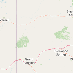
Map view of Flat Tops Wilderness

Use this park location map to pinpoint Flat Tops Wilderness in United States of America, understand its exact geographic position, and read its mapped placement within the surrounding landscape more clearly.

Pigeon | © OpenStreetMap contributors

Visual reference for high-elevation volcanic plateaus and glacial terrain

Flat Tops Wilderness Photos and Protected Landscape Scenery

Visual documentation captures the broad basalt plateaus, alpine tundra, and dense high-elevation lake networks defining the protected landscape. Examining these field photographs reveals the distinct geological character, dense conifer forests, and dramatic mountain environments spanning the wilderness.

A wide, clear-day view of a mountainous landscape with distinctive flat, plateau-like peaks in the background, a band of coniferous forest in the midground, and a grassy meadow in the foreground.

A high angle view looking along a rocky, narrow ridge line known as Devils Causeway with steep cliff faces dropping off on either side into grassy slopes and distant alpine plateaus.

Park atlas

Compare nearby national forests and protected landscapes in the Rocky Mountains

Parks Near Flat Tops Wilderness And Protected Areas Across The Surrounding Region

Browse protected areas and high-elevation mountain landscapes connected to the regional geography surrounding Flat Tops Wilderness. Extending your geographic search helps reveal broader ecological patterns and neighboring wildlands across the wider mountain range.
Wildlife reserveColorado
About 67 km away#1 closest

Southeast

Holy Cross Wilderness: Mapped Alpine Landscapes and Colorado Protected Areas

Glacial valleys and high-country geography in the Sawatch Range

Discover the geographic layout of the Holy Cross Wilderness, a vital protected area in central Colorado. This resource details the rugged Sawatch Range environment, from high alpine lake basins to the iconic northern couloirs of its namesake mountain, offering a clear view of the park boundaries and surrounding high-country terrain.

Area
496.94 km²
Established
1980
IUCN
Ib
Relief
Mountain
Wildlife reserveColorado
About 68 km away#2 closest

East

Eagles Nest Wilderness: Alpine Geography and Protected Landscape of the Colorado Gore Range

High-mountain protected area in the White River National Forest

Spanning the southern Gore Range, Eagles Nest Wilderness represents a core protected landscape in Colorado characterized by high-elevation peaks, glacial cirque lakes, and extensive backcountry trail networks. Its geography bridges the gap between deep coniferous forests and exposed alpine tundra, maintaining significant ecological and historical value within the mountainous terrain of Eagle and Summit Counties.

Area
546.79 km²
Established
1976
IUCN
Ib
Relief
Mountain
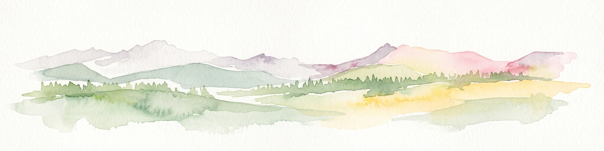
A soft watercolor illustration depicting a flat-topped mountain landscape with a line of trees and a foreground meadow.
Protected landscapeColorado
About 76 km away#3 closest

Southwest

Grand Mesa National Forest: A Comprehensive Atlas of Colorado High-Plateau Geography

Mapping the basalt-capped flat-top mountain terrain

Grand Mesa National Forest stands as a primary protected landscape within the Colorado Rockies, characterized by its signature basalt-capped plateau. This forest unit serves as a vital geographic landmark, offering unique insights into high-altitude mountain terrain, subalpine water systems, and historical forest conservation. Learn about the boundaries and physical landscape features that define this massive elevated tableland above the surrounding dry valleys.

Area
1,402.46 km²
Established
1892
Relief
Highland
Climate
Alpine
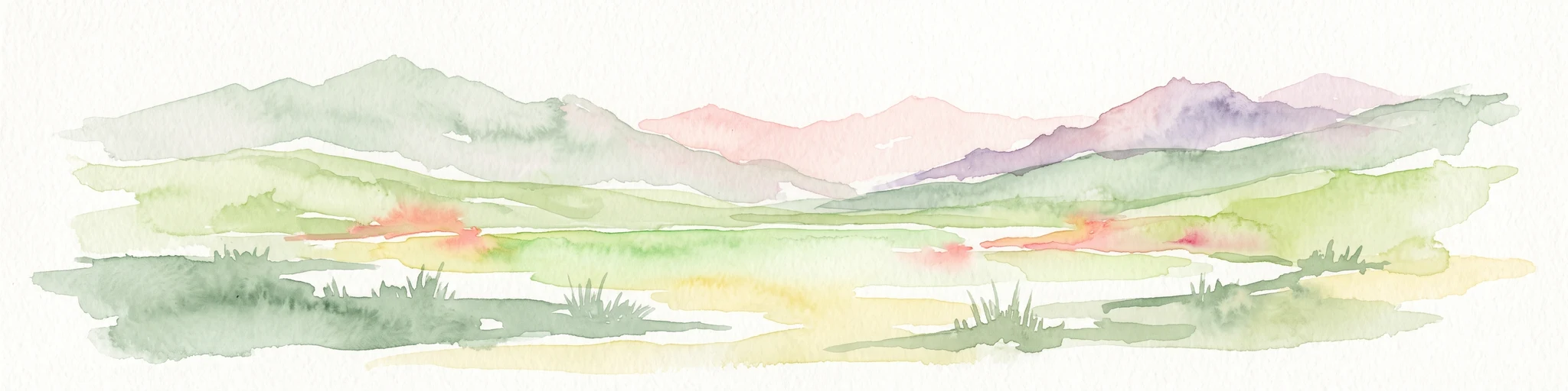
A watercolor illustration of a mountain range with soft, pastel-colored peaks in the background and a green treeline in the foreground.
Wildlife reserveColorado
About 81 km away#4 closest

Northeast

Mount Zirkel Wilderness: Protected Mountain Geography and Forested Landscape Overview

A study of high elevation terrain in the Colorado Rocky Mountains.

Mount Zirkel Wilderness stands as a primary protected area within the Colorado Rocky Mountains. The landscape is defined by the Encampment River headwaters, glaciated alpine basins, and the characteristic ribbon forests formed by extreme snowfall. This analysis explores the metamorphic bedrock and forest composition across the high ridges near the Continental Divide, providing a clear view of the park boundaries and regional environmental features.

Area
647.23 km²
Established
1980
IUCN
Ib
Relief
Mountain
Watercolor painting of a serene mountain landscape featuring rolling hills, coniferous trees, and a lake in the foreground, rendered in light pastel tones.
Protected landscapeColorado
About 97 km away#5 closest

Southeast

San Isabel National Forest: Geographic Overview and Protected Mountain Landscape Atlas

Central Colorado alpine terrain and designated wilderness areas

Spanning eleven counties in central Colorado, San Isabel National Forest serves as a cornerstone of the Southern Rocky Mountains. The forest landscape is dominated by the Sawatch and Sangre de Cristo ranges, offering a unique atlas of alpine tundra, dense coniferous forests, and high-altitude peaks that define the character of the region. This protected area provides a vital habitat and a vast, rugged environment characterized by volcanic formations like the Spanish Peaks and glacial geological features.

Area
4,533.42 km²
Established
1902
Relief
Mountain
Climate
Alpine
Protected areaColorado
About 97 km away#6 closest

South

Raggeds Wilderness: Geographic Profile and Protected Area Mapping for the Elk Mountains

High altitude wilderness terrain in west-central Colorado

Raggeds Wilderness encompasses over 65,000 acres of protected high-country terrain in the Elk Mountains. This atlas record provides a detailed look at the park, covering its dramatic vertical transitions from deep forest drainages to jagged peaks and its function as a major node in the regional wilderness network.

Area
264.64 km²
Established
1980
IUCN
Ib
Relief
Mountain
A soft watercolor painting of a mountain landscape with rolling green hills in the foreground and layered, pale purple peaks in the distance.
Wildlife reservePitkin County
About 100 km away#7 closest

Southeast

Hunter-Fryingpan Wilderness: Mapped Protected Geography in the Central Rocky Mountains

High-altitude wilderness area in Pitkin County, Colorado

Hunter-Fryingpan Wilderness encompasses approximately 82,000 acres of rugged terrain near the continental divide. This protected area acts as a headwaters sanctuary for the Fryingpan River and Hunter Creek, defined by its steep granite ridges, subalpine meadows, and clusters of pristine alpine lakes. Understanding its geography reveals the stark, glaciated character of the central Colorado Rockies.

Area
331.95 km²
Established
1978
IUCN
Ib
Relief
Mountain
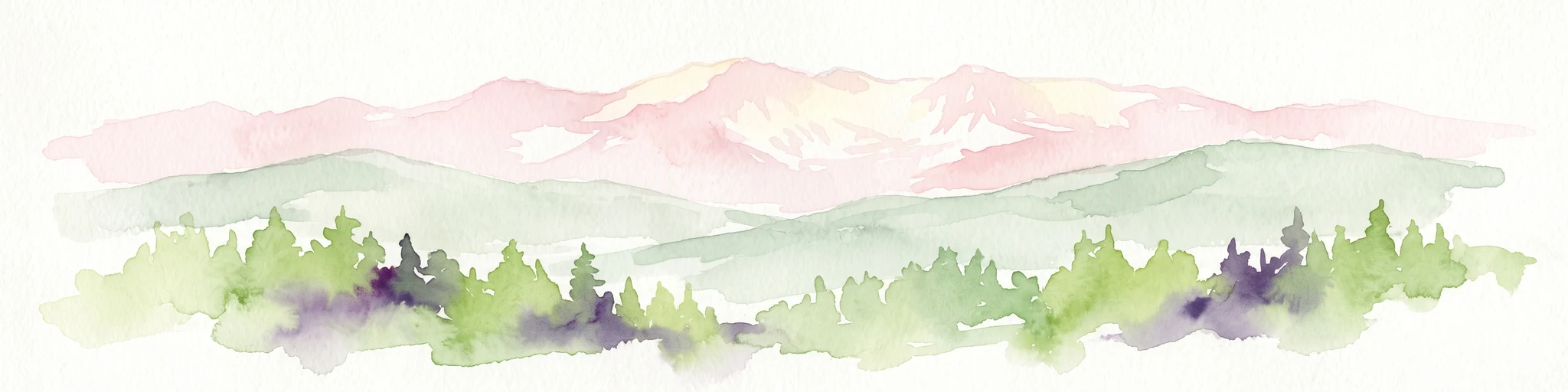
A horizontal watercolor painting showing layers of pale green and soft pink mountain ridges behind a foreground of simple green and purple evergreen tree shapes.
Wildlife reserveColorado
About 102 km away#8 closest

Southeast

Mount Massive Wilderness: A Protected Alpine Landscape in the Colorado Sawatch Range

High-altitude wilderness geography and Continental Divide terrain.

Mount Massive Wilderness represents a critical protected landscape in the central Colorado Rockies, encompassing glacially carved valleys, alpine tundra, and the second-highest peak in the state. This wilderness area provides a window into the rugged vertical relief and subalpine ecosystems that define the high-altitude geography surrounding Leadville, anchored by the iconic Sawatch Range and Continental Divide.

Area
123.6 km²
Established
1980
IUCN
Ib
Relief
Mountain

Common questions about visiting, size, designation, and location context for Flat Tops Wilderness

Flat Tops Wilderness FAQs for park facts, access, geography, and protected area context

Find quick answers about Flat Tops Wilderness, including protected-area facts, park geography, trail and visitor context, and how the park fits into its surrounding country and regional landscape.
MoriAtlas Explorer

Continue Your Protected Areas Search Across the Global Atlas

Deepen your exploration by continuing the structured search for national parks and protected areas worldwide. Utilize the comprehensive filtering capabilities to compare different conservation landscapes and refine your understanding of global park geography. Discover more about the distribution and characteristics of protected natural areas.

Global natural geography