Mori Atlas logo
Protected areaFort Pierre National Grassland

Tracing the boundaries and geographic character of this vast northern Great Plains prairie ecosystem

Fort Pierre National Grassland: Mapping the Protected Landscapes of Central South Dakota

Fort Pierre National Grassland represents a significant protected area within the northern Great Plains, encompassing extensive mixed-grass prairie across Lyman, Stanley, and Jones counties. This landscape, characterized by its open horizons and rolling terrain, offers a clear view into the region's historical geography. Beyond the vast grasslands, the area features small wetland pockets and subtle drainage patterns shaped by millennia of environmental change, preserving a vital stretch of native habitat near the Missouri River corridor.

national grasslandmixed-grass prairieGreat Plainsupland prairieprairie wetlandsseasonal wetlands

Fort Pierre National Grassland

Protected area

Park overview

Structured park overview, official facts, and landscape profile for Fort Pierre National Grassland

Fort Pierre National Grassland park facts, protected area profile, and essential visitor context

Review the core facts for Fort Pierre National Grassland, including designation, size, terrain, visitor scale, habitats, and operating context in one park-focused overview.

About Fort Pierre National Grassland

Fort Pierre National Grassland represents the modern effort to protect a representative portion of the northern Great Plains prairie system. It is situated in central South Dakota, immediately south of Pierre and Fort Pierre, two communities set along the Missouri River. The grassland's setting places it within a transitional belt of the Great Plains where the more arid short-grass prairies of the west gradually blend into the taller mixed-grass communities of the eastern Plains, producing a habitat mosaic that supports a rich variety of grasses, wildflowers, and prairie wildlife.

In ecological terms, the grassland is characterized by its dominant cover of native perennial grasses, including typical northern Plains species such as western wheatgrass, needlegrass, and big bluestem in favorable microsites. Interspersed through this grass matrix are low areas that collect seasonal moisture, forming ephemeral wetlands and shallow ponds that are important to migratory waterfowl, shorebirds, and the broader prairie food web. Small draws, rolling hills, and exposed badland-like ridges add topographic variety to what might otherwise appear to be a uniform sea of grass.

Beyond its ecological function, Fort Pierre National Grassland plays a strong cultural and historical role. The region around Fort Pierre was a focal point for fur trade-era interaction between European-American traders and the Lakota and other Plains peoples, and the surrounding countryside retains tangible connections to the nineteenth-century events that shaped the Great Plains. The grassland's preservation under the National Grassland system reflects a recognition that prairie ecosystems, despite their understated appearance, are among the most altered environments in North America and merit active conservation management.

The grassland is also notable for its continued use as a working landscape. Grazing by cattle, where compatible with conservation goals, has long been part of the management approach, illustrating how prairie reserves can integrate agricultural heritage with ecological preservation. The combination of open space, biological diversity, and historical depth makes Fort Pierre National Grassland an unusually well-rounded representation of contemporary Great Plains conservation.

Quick facts and research context for Fort Pierre National Grassland

Fort Pierre National Grassland is a National Grassland designation managed by the U.S. Forest Service, covering roughly 115,890 acres (around 46,900 hectares) of primarily mixed-grass prairie in central South Dakota. It lies south of Pierre and Fort Pierre and extends across parts of Lyman, Stanley, and Jones counties, the three counties that encompass nearly all of its land area.

Administration of the grassland is shared with other federal units from common offices in Chadron, Nebraska, while a local ranger district office is located in Pierre. The grassland is part of the broader National Grassland system, a category of federally managed prairie reserves created to protect representative Great Plains ecosystems that are no longer widespread across the American landscape.

Protection and recognition

Examine the documented conservation status and terrestrial area framework.

Fort Pierre National Grassland Protection Status and Management Scope

Terrestrial protection status for Fort Pierre National Grassland covers documented management mandates across the protected landscape. Verified conservation records establish the official framework and international recognition criteria without additional designations.

Protection details

Protection scope
Terrestrial
Transboundary protection
No
Park context

Deeper park guide and search-rich context for Fort Pierre National Grassland

Fort Pierre National Grassland history, landscape, wildlife, and travel context

Explore Fort Pierre National Grassland through its history, landscape character, ecosystems, wildlife, conservation priorities, cultural context, and seasonal travel timing in a structured park guide built for atlas discovery and search intent.

Why Fort Pierre National Grassland stands out

Fort Pierre National Grassland is best known for preserving an authentic stretch of mixed-grass prairie within the Great Plains. Unlike forested parks or mountain reserves, its identity is built around open horizons, native grass composition, and the subtle seasonal changes of the prairie, from spring green-up to late-summer golden hues. The grassland is particularly valued as a landscape-scale example of a habitat type that has been largely converted to agriculture elsewhere in the region. The area is also associated with the broader cultural and historical narrative of the northern Plains. Its proximity to Fort Pierre, a historic river-crossing and trade location associated with the early nineteenth-century fur trade, places the grassland within a region long tied to the history of the Lakota, Euro-American exploration, and westward expansion. The result is a protected area whose appeal rests as much on its sweeping prairie scenery and wildlife presence as on its connection to the wider story of the American Great Plains.
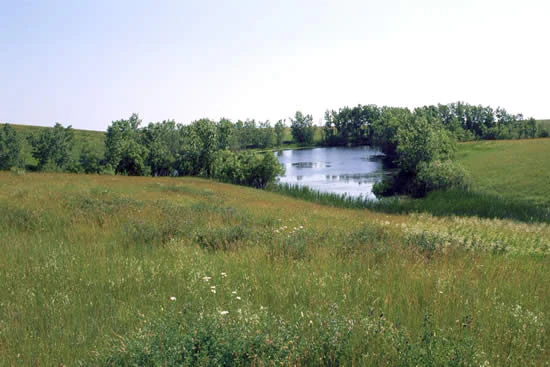
A small, calm pond surrounded by green grasses and a line of deciduous trees in an open prairie environment.
A tranquil pond nestled within the prairie landscape of Fort Pierre National Grassland.

Fort Pierre National Grassland history and protected-area timeline

Fort Pierre National Grassland, like the other units in the National Grassland system, owes its existence to a large-scale reorganization of federal lands during the twentieth century. Much of the acreage that became the grassland had previously been privately worked land that proved marginal for sustained cultivation. When these lands were acquired and placed under federal management, they were restored or allowed to revert toward native grassland cover, becoming part of a national network of prairie reserves designed to safeguard representative Great Plains ecosystems.

The region itself carries a much older human history. Fort Pierre, the river town just north of the grassland, traces back to a nineteenth-century fur trading post that served as an important meeting point between traders and the Lakota. Earlier still, the surrounding plains were home to Indigenous peoples whose presence long predates European-American exploration. The place names, including the grassland itself, echo this layered history and reinforce the cultural weight of the landscape.

In more recent decades, the grassland has continued to evolve as a managed conservation area. It is administered by the U.S. Forest Service alongside the Nebraska and Samuel R. McKelvie National Forests and the Buffalo Gap and Oglala National Grasslands, with shared offices in Chadron, Nebraska and a local ranger district presence in Pierre. This structure reflects the practical reality of administering scattered Great Plains reserves, and it has allowed Fort Pierre National Grassland to benefit from coordinated planning and shared expertise across a broader prairie network.

The area also gained public recognition through its appearance in the film Dances with Wolves, a production that drew attention to the visual power of the open prairie. Beyond the screen, however, the grassland's significance lies in the ongoing work of maintaining a functioning grassland ecosystem in a region where native prairie has otherwise been widely converted, making its history as much a story of ecological restoration as one of formal designation.

Fort Pierre National Grassland landscape and geographic character

The landscape of Fort Pierre National Grassland unfolds as expansive, gently rolling terrain under an enormous sky. The dominant impression is one of openness: long sightlines, broad sweeps of grass, and few vertical interruptions other than occasional ridges, eroded breaks, and low hills. This is classic Great Plains topography, shaped by glacial deposition, ancient river systems, and the persistent work of wind and water across millennia.

Throughout the grassland, the Missouri River valley just to the north exerts a subtle influence on the terrain. Some areas show the influence of past river activity in their drainage patterns, while small drainages and shallow depressions collect seasonal runoff, creating wetland pockets that punctuate the otherwise grass-dominated view. In drier portions, short-grass species become more prominent, while the slightly moister zones support a richer mixed-grass composition, giving the landscape an internal variety that is not always obvious at a glance.

Light plays a defining role in the character of the place. The wide horizon means that sunrise and sunset color the entire sky, and storm systems moving across the Plains can change the mood of the landscape quickly. The result is a setting that feels both ancient and continually renewed, with the same horizon that nineteenth-century travelers saw still largely intact today.

Fort Pierre National Grassland ecosystems, habitats, and plant life

Ecologically, Fort Pierre National Grassland belongs to the northern mixed-grass prairie biome, a transitional zone between the tall-grass prairies farther east and the short-grass plains to the west. Its habitats are built around native perennial grasses that form the structural backbone of the ecosystem. Western wheatgrass, green needlegrass, and various bluestem and grama species are among the typical components, often mixed with sedges and a diverse community of prairie wildflowers that bloom across the growing season.

A distinctive ecological feature of the grassland is its wetland network. Across the rolling terrain, low-lying areas collect water during wet periods and may dry down in summer, producing a patchwork of temporary and seasonal wetlands. These habitats are disproportionately important for the broader prairie ecosystem, supporting amphibians, aquatic invertebrates, and seasonal concentrations of waterfowl and shorebirds on migration.

Beyond the wetland margins, the upland prairie provides habitat for the small mammals, reptiles, and insects that sustain raptors and other predators. Native pollinators, including bees and butterflies, find refuge in the grassland's wildflower diversity, an ecological value that has gained increasing recognition as pollinator habitat has declined elsewhere. The interplay between upland prairie and seasonal wetlands gives the grassland a layered ecological character that is typical of well-conserved Great Plains landscapes.

Fort Pierre National Grassland wildlife and species highlights

Fort Pierre National Grassland supports a wildlife community characteristic of the northern Great Plains. Large grazers and browsers, including both native pronghorn and mule deer, are among the most visible mammals, while smaller species such as white-tailed deer, coyotes, badgers, and various ground squirrels inhabit the grasslands in less conspicuous but persistent numbers. Burrowing mammals, in particular, are important to the prairie ecosystem, and their abandoned burrows provide shelter for other species as well.

Birdlife is one of the grassland's richest features. The open habitat and surrounding wetlands support nesting grassland songbirds such as meadowlarks, sparrows, and longspurs, while raptors including hawks, falcons, and the occasional golden eagle hunt across the open terrain. Seasonal wetlands and the nearby Missouri River corridor attract waterfowl and shorebirds, especially during spring and fall migration, when the area can host concentrations of ducks, geese, and wading birds using the prairie wetlands as stopover habitat.

Reptiles and amphibians are also present in forms typical of Great Plains reserves, including various snake and lizard species that thrive in the warmer, drier portions of the landscape, and amphibians that depend on the seasonal wetlands for breeding. Together, these fauna make the grassland a meaningful refuge for species that depend on intact prairie and prairie-wetland mosaics, habitats that have been substantially reduced across the broader region.

Fort Pierre National Grassland conservation status and protection priorities

Fort Pierre National Grassland plays an important role in the conservation of the Great Plains prairie, one of the most altered ecosystems in North America. Across much of the region, native prairie has been converted to cropland or improved pasture, so any large, contiguous block of native grassland serves as a reservoir of biodiversity and ecological function. The grassland's protected status under the U.S. Forest Service ensures that the land is managed with long-term ecological objectives in mind rather than short-term production.

A central conservation value of the unit is its representation of the mixed-grass prairie type. By maintaining the native grass community, soil structure, and ecological processes such as fire and grazing, the grassland preserves a functioning example of how the northern Great Plains once worked across much larger areas. This makes it valuable not only for resident wildlife but also as a reference site for research and monitoring of prairie health.

The grassland also contributes to broader conservation networks in the region. Its wetlands and uplands form stepping-stone habitat across the Great Plains, and its management is coordinated with other national grasslands and national forests that together constitute a sizable federal conservation footprint in central and western South Dakota and adjacent states. In this sense, Fort Pierre National Grassland is both a local refuge and a component of a larger strategy to sustain prairie ecosystems in a working landscape.

Fort Pierre National Grassland cultural meaning and human context

The cultural setting of Fort Pierre National Grassland is inseparable from the deep human history of the Missouri River stretch of central South Dakota. Just to the north, Fort Pierre originated as a nineteenth-century fur trade post, a meeting point between Euro-American traders and the Lakota, and earlier occupants of the region who had used the Missouri River corridor for trade, travel, and settlement for generations before.

The grassland sits within a landscape that was part of Lakota, and broader Plains Indigenous, homelands, and the place retains a strong association with the era of westward expansion, frontier-era military presence, and the transformation of the Plains through settlement and agriculture. Today, the area around the grassland reflects a mix of contemporary ranching communities, the historic Pierre and Fort Pierre towns, and connections to regional tribal histories that remain an important part of the area's identity.

Through its preservation as a federally managed grassland, the landscape also reflects an evolving public understanding of how prairie landscapes themselves carry cultural meaning. The open, unbroken vistas of the grassland represent a setting that shaped both Indigenous life and the mythology of the American frontier, and the continued preservation of that visual and ecological openness has become part of the area's modern cultural significance.

Top sights and standout views in Fort Pierre National Grassland

The defining highlights of Fort Pierre National Grassland are tied to its openness, its ecological authenticity, and its place within the Great Plains story. Vast stretches of native mixed-grass prairie provide a contemporary example of a habitat type that has become rare, and the area's seasonal wetlands add layers of biological richness, especially during migratory seasons when waterfowl, shorebirds, and grassland songbirds make notable use of the landscape.

Equally striking is the grassland's scale of view. Wide horizons, dramatic prairie skies, and the interplay of light across the rolling terrain give visitors a sense of the spatial character that once defined the American interior. The grassland also offers cultural and historical resonance through its location near Fort Pierre, its connection to Plains Indigenous history, and its broader association with the imagery of the nineteenth-century American frontier.

For travelers, the grassland provides an accessible South Dakota experience that complements visits to more heavily marketed sites in the state, offering quiet prairie scenery, wildlife observation opportunities, and a sense of the Great Plains that is increasingly difficult to find elsewhere in the region.

Best time to visit Fort Pierre National Grassland

The character of Fort Pierre National Grassland shifts with the seasons in ways that reflect the broader patterns of the Great Plains. Spring brings fresh green growth across the prairie, intense wildflower color in favorable years, and the arrival of migratory birds using the seasonal wetlands. Cooler temperatures and generally open access make this a productive period for wildlife observation, particularly for viewing grassland songbirds and waterfowl on migration.

Summer warms the landscape into its classic golden tones, with grasses reaching their full height and the heat of the day encouraging wildlife activity in the cooler morning and evening hours. Summer storms can be dramatic over the open terrain, and wildflower displays vary with rainfall. By late summer and into autumn, the grasses take on amber and tawny colors, and cooler weather returns along with reduced insect pressure, producing comfortable conditions for extended exploration.

Winter brings its own austere beauty, with snow sweeping across the prairie and the open landscape highlighting the area's scale and silence. Visitor use in winter is more limited than in milder seasons, but the period can offer rewarding views for those prepared for cold-weather conditions. Across all seasons, the grassland rewards visitors who value quiet landscapes, big skies, and a sense of openness that is increasingly rare elsewhere in the country.
Monthly climate preview

Long-term representative averages tracking temperature and precipitation rhythm

Fort Pierre National Grassland Climate and Monthly Temperature Normals

Representative coordinates record measured monthly air temperatures ranging from negative sub-zero winter lows to warm summer maximums alongside varying precipitation rates. Analyzing complete monthly climate normals reveals full seasonal shifts across this South Dakota protected landscape.
Annual mean9 °C
-6 °C25 °C
Jan-6°
Feb-4°
Mar
Apr
May15°
Jun21°
Jul25°
Aug24°
Sep18°
Oct
Nov
Dec-4°
Warmest month
July

25.3 °C

Coolest month
January

-5.7 °C

Wettest month
June

3.2 mm/day

Driest month
January

0.4 mm/day

Park location guide

Geography guide, regional context, and park location map for Fort Pierre National Grassland

Fort Pierre National Grassland park geography, regions, and map view in United States of America

Understand where Fort Pierre National Grassland sits in United States of America through a broader geographic reading of the surrounding landscape, nearby location context, and its mapped position within the national park landscape.

How Fort Pierre National Grassland fits into United States of America

The United States of America is a federal presidential republic and one of the world's largest countries by area and population. It consists of 50 states across a vast territory spanning multiple time zones, with its capital in Washington, D.C. and largest city in New York City. The nation has a diverse economy, influential political system, and significant cultural and military presence globally.

Wider geography shaping Fort Pierre National Grassland in United States of America

The United States occupies a vast territory in North America, bordered by Canada to the north and Mexico to the south. The 48 contiguous states stretch from the Atlantic to the Pacific Ocean, while Alaska occupies the northwestern region and Hawaii is an archipelago in the Pacific. The country encompasses diverse terrain including the Rocky Mountains, Appalachian Mountains, Great Plains, and extensive river systems.

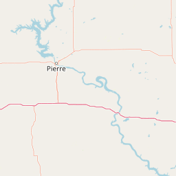
Map view of Fort Pierre National Grassland

Use this park location map to pinpoint Fort Pierre National Grassland in United States of America, understand its exact geographic position, and read its mapped placement within the surrounding landscape more clearly.

Pigeon | © OpenStreetMap contributors

Location context for Fort Pierre National Grassland

South Dakota
Recorded earthquake history

Examine Recorded Earthquake History Near Fort Pierre National Grassland

Explore documented seismic activity associated with the vicinity of Fort Pierre National Grassland. Access a historical database of recorded events, including magnitude and proximity, to gain insight into the seismic history of this Great Plains protected area.

Fort Pierre National Grassland Earthquake Records

Catalogued events

3 events

Strongest magnitude

Magnitude 3.7

Most recent event

May 30, 2024

This history includes earthquakes recorded inside the park or within 50 km of its borders

Explore protected-area photography capturing rolling terrain, native mixed-grass prairie, and wide horizons.

Fort Pierre National Grassland Photos and Scenery: Visualizing the Northern Great Plains Landscape

Visual records illustrate the expansive topography, native mixed-grass composition, and seasonal wetland habitats characteristic of Fort Pierre National Grassland. Examining these protected-area views helps researchers and visitors understand the distinctive open character and ecological scale of the northern Great Plains.

A small, calm pond surrounded by green grasses and a line of deciduous trees in an open prairie environment.

Park atlas

Compare adjacent Great Plains landscapes and regional conservation areas.

Parks Near Fort Pierre National Grassland and Surrounding Protected Areas

Browse other parks and protected areas near Fort Pierre National Grassland to examine related mixed-grass prairie ecosystems. Regional comparison provides deeper geographic context for the surrounding northern plains and open landscapes.
National parkSouth Dakota
118 km away#1 closest

West

Badlands National Park: South Dakota's Premier National Park for Atlas Exploration

Explore mapped terrain and protected landscape boundaries.

Badlands National Park stands as a key protected area within the geography of South Dakota, offering a distinct natural landscape for detailed atlas exploration. This National Park's unique terrain and mapped boundaries provide crucial context for understanding regional geography and conservation landscapes. Engage with structured information that highlights the park's geographic identity, making it an essential destination for those seeking to map and comprehend protected natural areas.

Area
982.4 km²
Established
1939
IUCN
II
Visitors
1M annual
National parkCherry County
139 km away#2 closest

South

Samuel R. McKelvie National Forest: Mapping Nebraska's Sandhills Protected Landscape

An atlas view of rolling dune grasslands and forest mosaics in Cherry County.

Located in the heart of Cherry County, Samuel R. McKelvie National Forest presents a distinct landscape where prairie grasses meet planted pine islands. This overview examines the forest's placement within the Sandhills region, highlighting its role as a protected grassland unit near the shores of Merritt Reservoir and the Snake River corridor.

Area
469.76 km²
Established
1971
Relief
Upland
Climate
Temperate
Protected landscapeSouth Dakota
176 km away#3 closest

Northwest

Grand River National Grassland: Protected Landscape and Regional Geography in South Dakota

Mapped prairie, riparian corridors, and badland terrain.

Grand River National Grassland represents a complex protected landscape in South Dakota. Managed by the U.S. Forest Service, this area features diverse landforms including sand dunes, claypan playas, and green ash draws. This record provides a structured geographic overview of the grassland mosaic, spanning Perkins, Corson, and Ziebach counties with significant cultural ties to local tribal lands.

Area
626.38 km²
Established
1960
Relief
Lowland
Climate
Temperate
Wildlife reserveNorth Dakota
202 km away#4 closest

Northwest

Cedar River National Grassland: A Protected Prairie Landscape in Southern North Dakota

Mixed-grass prairie geography and regional watershed context

Cedar River National Grassland preserves a representative mosaic of upland plains and rolling hills in southern North Dakota. As part of the wider Dakota Prairie Grasslands, this wildlife reserve provides insight into northern prairie topography and intermittent stream ecosystems that define the regional character of the Great Plains.

Area
27.18 km²
Relief
Lowland
Climate
Temperate
Scope
Terrestrial
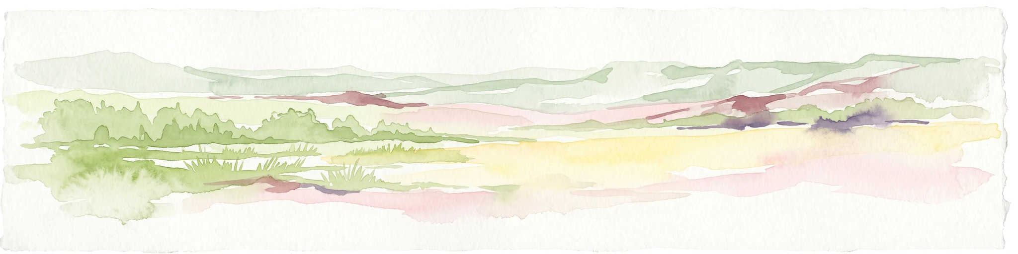
A pale, minimalist watercolor illustration of a wide, open grassy landscape with soft rolling hills in the background and light green vegetation in the foreground.
Protected landscapeSouth Dakota
About 204 km away#5 closest

West

Buffalo Gap National Grassland: Regional Geography and Protected Prairie Boundaries

Mapping the vast grasslands of southwestern South Dakota

Spanning across four counties in southwestern South Dakota, Buffalo Gap National Grassland serves as a premier example of a working Great Plains landscape. The region is defined by its immense scale, where undulating mixed-grass prairie transitions into striking, chalky badlands. This area is recognized for its vital conservation role, including successful species recovery programs, and stands as a foundational feature of the regional geological and ecological map.

Area
2,410.77 km²
Established
1960
Relief
Upland
Climate
Temperate
National parkCuster County
236 km away#6 closest

West

Wind Cave National Park: A National Park with Distinct Protected Landscape and Geographic Identity

Explore the mapped terrain and regional context of this US protected area.

Wind Cave National Park represents a key protected area within Custer County, offering users a deep dive into its unique geography and landscape characteristics. As a designated national park in the United States, its mapped boundaries provide crucial context for understanding its ecological and geological significance. This MoriAtlas entry facilitates detailed exploration, focusing on the protected land's identity and its role within the wider regional geography and natural landscape.

Area
136.97 km²
Established
1903
IUCN
II
Visitors
489.4K annual
A watercolor painting showing a rolling landscape with green hills, patches of coniferous forest, and a soft, hazy sky.
Protected landscapeNebraska
About 243 km away#7 closest

Southwest

Nebraska National Forest: Geographic Context and Protected Landscape Boundaries

Mapped terrain across Sandhills and Pine Ridge districts.

This protected landscape is defined by its unusual dual-district structure, encompassing both the historic tree-planting experiments in the central Sandhills and the rugged, native pine-covered canyons of the Pine Ridge. Discover how these distinct environmental zones create a unique ecological footprint within the broader Nebraska geography through detailed map-based insights.

Area
574.1 km²
Established
1908
Relief
Upland
Climate
Temperate
Watercolor painting of a wide, rolling grassy plain leading to distant low hills or badlands against a pale sky.
Protected landscapeNebraska
265 km away#8 closest

Southwest

Oglala National Grassland: Geological Terrain and Protected Landscape Map in Nebraska

Regional geography of prairie rangelands and eroded badlands

Situated in the northwest corner of Nebraska, Oglala National Grassland covers nearly 95,000 acres of shortgrass prairie and badlands. This protected landscape is defined by the unique exposure of Pierre Shale, creating a terrain characterized by deep gullies, banded sedimentary rock, and hoodoo formations that provide essential habitat and a deep record of natural history.

Area
382.5 km²
Relief
Upland
Climate
Arid
Access
Easy access

Common questions about visiting, size, designation, and location context for Fort Pierre National Grassland

Fort Pierre National Grassland FAQs for park facts, access, geography, and protected area context

Find quick answers about Fort Pierre National Grassland, including protected-area facts, park geography, trail and visitor context, and how the park fits into its surrounding country and regional landscape.
MoriAtlas Explorer

Continue Your Protected Areas Search Across the Global Atlas

Deepen your exploration by continuing the structured search for national parks and protected areas worldwide. Utilize the comprehensive filtering capabilities to compare different conservation landscapes and refine your understanding of global park geography. Discover more about the distribution and characteristics of protected natural areas.

Global natural geography