
Mori Atlas logo
Wildlife reserveGarden of the Gods Wilderness

A rugged sandstone plateau landscape featuring iconic rock hoodoos and panoramic forest overlooks

Garden of the Gods Wilderness: Exploring the Geologic Geography of Southern Illinois Protected Areas

Garden of the Gods Wilderness preserves an unglaciated sandstone plateau within the Shawnee National Forest of southern Illinois. This 3,318-acre roadless protected area stands out for its dramatic erosional hoodoos, including Anvil Rock and Camel Rock, which create a distinct geological character separate from the surrounding Midwestern plains. The wilderness provides a unique map of ridge lines, hollows, and bluff-top vistas such as Buzzards Point that offer broad views across the forested terrain of the region.

wilderness areasandstone plateauhoodoosrock formationsscenic overlookssecond growth forest
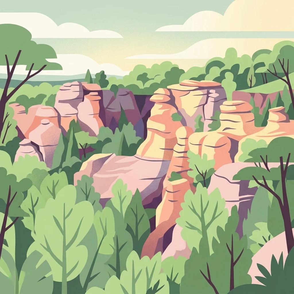
A flat-style digital illustration depicting a canyon with light-colored sandstone rock formations rising above a lush, green forest canopy.

Garden of the Gods Wilderness

Wildlife reserve

Park overview

Structured park overview, official facts, and landscape profile for Garden of the Gods Wilderness

Garden of the Gods Wilderness park facts, protected area profile, and essential visitor context

Review the core facts for Garden of the Gods Wilderness, including designation, size, terrain, visitor scale, habitats, and operating context in one park-focused overview.

About Garden of the Gods Wilderness

Garden of the Gods Wilderness occupies a distinctive corner of southern Illinois where ancient geology, forest history, and outdoor recreation converge. Encompassing 3,318 acres inside the much larger Shawnee National Forest, it spans portions of Hardin, Pope, Saline, and Gallatin counties and lies near the small town of Equality. Although Illinois is generally associated with farmland and glaciated plains, this wilderness preserves a comparatively rugged and visually dramatic landscape shaped by hundreds of millions of years of geological activity.

The defining character of the area comes from its position on an uplifted sandstone plateau. Because this plateau was not covered by the continental glaciers that flattened much of the rest of Illinois, the softer rock of the region has been exposed to prolonged weathering and erosion. The result is a network of steep slopes, rock outcrops, bluffs, and unusual erosional formations that contrast sharply with the gently rolling terrain most visitors would expect from the state. The sandstone features, especially the hoodoos, give the wilderness its iconic character and its strongly evocative name.

Beyond its geology, Garden of the Gods is also significant because it protects a roadless block of second-growth forest within the Shawnee National Forest. The land was once cleared for farming, but acquisitions during the 1930s allowed forest cover to return, and the area was later formally designated as wilderness. Today it is the most-visited wilderness in Illinois, served by the River to River Trail and a system of shorter hiking paths that lead to overlook vistas such as Buzzards Point. Its combination of scenic geology, accessible trail systems, and national-forest setting makes it a focal point of outdoor experience in southern Illinois.

Quick facts and research context for Garden of the Gods Wilderness

Garden of the Gods Wilderness is a designated Wilderness Area resting inside the Shawnee National Forest, the principal national forest of southern Illinois. It occupies roughly 3,318 acres across four counties (Hardin, Pope, Saline, and Gallatin), making it one of several small wilderness parcels carved out of the larger forest. The wilderness is defined geologically by an unglaciated uplifted sandstone plateau and is widely recognized for its hoodoo formations and overlooks such as Buzzards Point, Anvil Rock, Camel Rock, and Table Rock.

Protection and recognition

Examine the documented conservation scope and international recognition facts for this protected landscape.

Garden of the Gods Wilderness Protection Status and Territorial Designation

Garden of the Gods Wilderness maintains a defined terrestrial protection scope within its natural boundaries. Review official designation records and management frameworks to understand the conservation status of this protected area.

Protection details

Protection scope
Terrestrial
Transboundary protection
No
Park context

Deeper park guide and search-rich context for Garden of the Gods Wilderness

Garden of the Gods Wilderness history, landscape, wildlife, and travel context

Explore Garden of the Gods Wilderness through its history, landscape character, ecosystems, wildlife, conservation priorities, cultural context, and seasonal travel timing in a structured park guide built for atlas discovery and search intent.

Why Garden of the Gods Wilderness stands out

Garden of the Gods Wilderness is best known for its unusual concentration of sandstone hoodoos and rock formations, a striking landscape feature in a region of Illinois otherwise known for relatively gentle terrain. The wilderness sits on an unglaciated uplifted sandstone plateau, allowing weathering to sculpt tall, oddly shaped rock features that have attracted named formations such as Anvil Rock, Camel Rock, and Table Rock. Together, these dramatic erosional forms and the surrounding bluff-top overlooks give the area a visual identity that feels closer to the desert Southwest than to the typical Midwest.
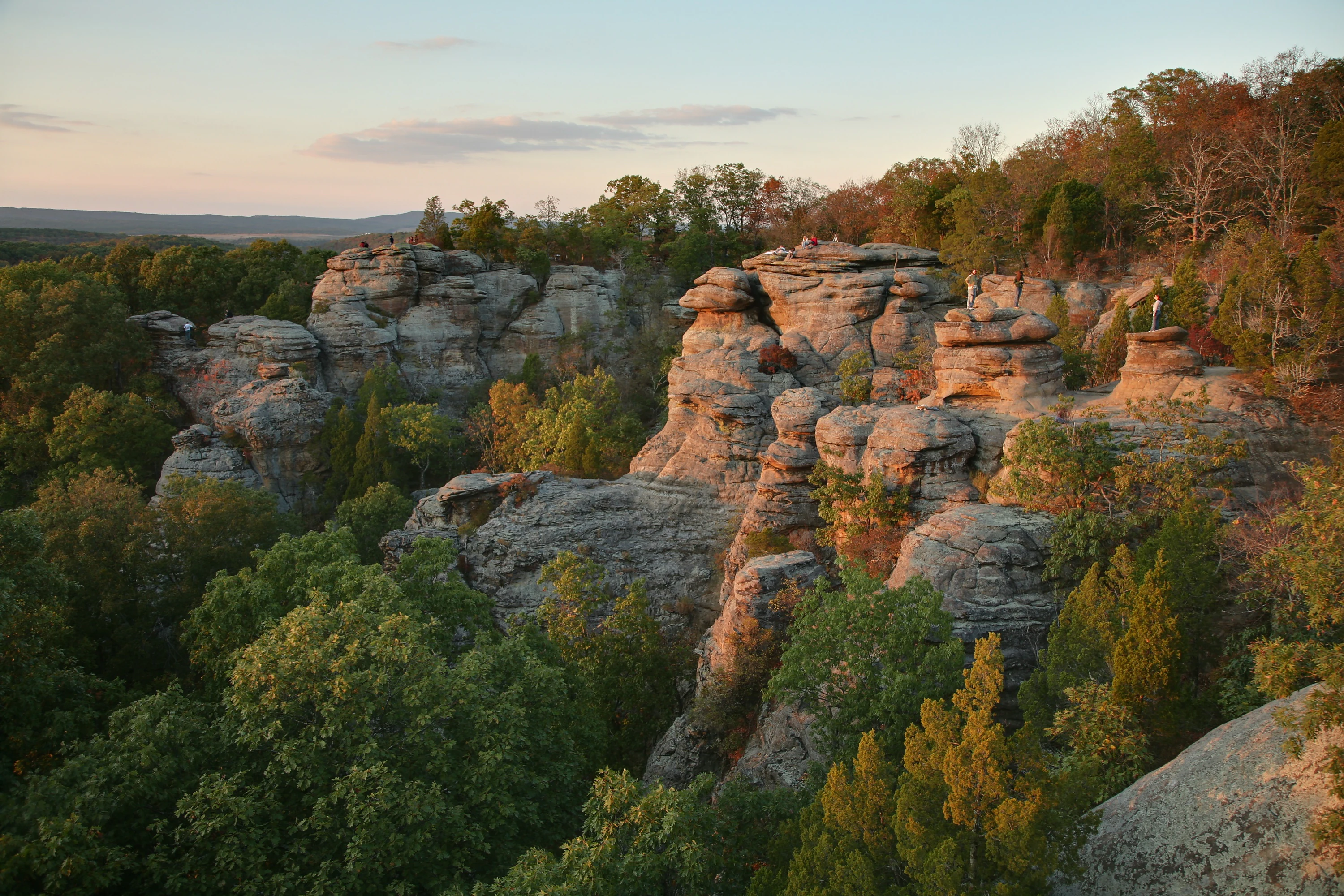
A wide angle landscape view of Garden of the Gods in Illinois at sunset, featuring large, weathered sandstone cliffs and rock outcrops surrounded by lush green and autumn-tinged deciduous trees.
Sunset light illuminating the sandstone rock formations at the Garden of the Gods Wilderness.

Garden of the Gods Wilderness history and protected-area timeline

The wilderness area's modern history is closely tied to the creation and evolution of the Shawnee National Forest, which was established in 1939. Prior to that period, portions of what is now the wilderness had been cleared for agricultural use, but land acquisitions during the 1930s allowed the landscape to transition back toward forested conditions. The forest that grew back is largely second growth, which is typical of the wilderness parcels within the national forest.

The wilderness itself was formally designated in 1990, when Congressman Glenn Poshard sponsored and Congress passed the Illinois Wilderness Act. This act set aside seven separate parcels of land within the Shawnee National Forest as relatively small wilderness areas, and Garden of the Gods was one of these designated parcels. A tongue of non-wilderness land was intentionally left to allow a paved road between Buzzards Point and a public-use area in southeastern Saline County, ensuring visitor access to the trails.

In 2016, the U.S. Mint recognized the area's geological importance by featuring a hoodoo from Garden of the Gods on quarters issued as part of the America the Beautiful Quarters series. An image of Camel Rock was struck for one of the 56 designs in that program, drawing attention to the wilderness as a nationally notable natural landmark within southern Illinois.

Garden of the Gods Wilderness landscape and geographic character

Garden of the Gods Wilderness has a landscape that stands out sharply from the broader Midwestern context in which it sits. The underlying geology is a thick gray sandstone bed laid down during the Carboniferous period, roughly 300 million years ago, and later uplifted into a plateau. Because ice sheets advancing from the north during the Illinoian glaciation never reached this part of Illinois, the sandstone was not planed off the way it was in much of the rest of the state, leaving behind steep, rocky terrain where gentler slopes would otherwise have formed.

Erosion over time has sculpted the plateau into a network of bluffs, ridges, hollows, and isolated rock formations. Hoodoos are a defining element of this sculpting process: tall, weathered sandstone spires and columns produced when softer layers wear away faster than the harder rock above. Several of these features have become locally famous under evocative names, including Anvil Rock, Camel Rock, and Table Rock, which serve as both landmarks and destinations for visitors.

A second defining element of the landscape is its collection of scenic overlooks, with Buzzards Point being the most prominent. From these bluff-top vantage points, the wilderness drops away into views across the surrounding Shawnee National Forest, giving visitors a panoramic sense of southern Illinois that would be impossible on the flatter terrain typical of the region.

Garden of the Gods Wilderness ecosystems, habitats, and plant life

The wilderness's natural character is anchored in its unglaciated sandstone plateau and the second-growth forest that covers much of it. Because the plateau escaped direct glaciation, the soils, microclimates, and erosional patterns here differ from those of most other Illinois forests, supporting ecological communities that respond to thin, rocky soils and steep slopes. The surrounding Shawnee National Forest context adds further ecological richness through its position at the southern edge of the state, where northern and southern floral influences come together.

Vegetation across the wilderness is largely second-growth forest that returned after farming ceased during the land acquisitions of the 1930s. The mix of forest cover and exposed sandstone creates a patchwork of habitats, from shaded hollows and sheltered slopes to sun-exposed rock surfaces and ridge tops. This variability is part of what gives the wilderness its distinct sense of place, with the rock formations standing as both ecological and visual focal points within an otherwise wooded setting.

Garden of the Gods Wilderness wildlife and species highlights

Because of the mixture of open rock, forested slopes, and bluff-top overlooks, the wilderness supports a range of wildlife typical of southern Illinois mixed hardwood forests. Buzzards Point and similar overlooks are particularly associated with raptors and scavenger birds that use the updrafts along the bluffs, and visitors often encounter these species while viewing the surrounding terrain. The forest itself hosts the broader woodland fauna of the Shawnee region, contributing to the wilderness's identity as a refuge for native Midwestern forest wildlife.

Garden of the Gods Wilderness conservation status and protection priorities

Garden of the Gods Wilderness holds a special conservation role as one of the small but important roadless parcels protected within the much larger Shawnee National Forest. Its unglaciated sandstone plateau preserves a geological and ecological setting that is uncommon in Illinois, and its wilderness designation keeps this setting free from roads and development, allowing forest recovery processes to continue on land that was once farmed. The wilderness designation, established through the 1990 Illinois Wilderness Act, formalizes this protection and ties the area to a broader network of nationally protected landscapes overseen by the U.S. Forest Service.

Garden of the Gods Wilderness cultural meaning and human context

Although Garden of the Gods Wilderness is primarily valued for its natural features, it also sits within a southern Illinois cultural landscape where outdoor recreation, scenic tourism, and small-community life are tightly intertwined. The nearest town of any size is Equality, and the wilderness serves as a major natural landmark for residents and visitors alike, supporting traditions like fall color viewing and family-oriented hiking in the Shawnee hills. The wilderness's appearance on the America the Beautiful Quarters in 2016 reflects its standing as a regionally and nationally recognized natural landmark within the cultural geography of southern Illinois.

Top sights and standout views in Garden of the Gods Wilderness

The wilderness's standout qualities include its concentration of named sandstone hoodoos such as Anvil Rock, Camel Rock, and Table Rock, which are uncommon features in Illinois. Its bluff-top overlooks, anchored by Buzzards Point, give visitors sweeping views across the Shawnee National Forest and make the area especially memorable during the fall color season. As the most-visited wilderness in Illinois, it also stands out for offering an unusually accessible, trail-rich experience within a formally protected roadless landscape.

Best time to visit Garden of the Gods Wilderness

Autumn is widely regarded as the standout season for visiting Garden of the Gods Wilderness, when cooler weather and changing leaf colors across the surrounding forest combine with clear overlooks to produce vivid views from locations like Buzzards Point. Spring and milder shoulder seasons also offer pleasant conditions for hiking the trail network, including the segment of the River to River Trail that runs through the area. Because the wilderness is accessible year round and weather conditions across southern Illinois can shift, visitors typically find that the rougher trails and exposed rock are most comfortable in drier, cooler periods rather than in the heat of high summer.

Monthly climate preview

Long-term monthly temperature averages and precipitation measurements for Illinois

Garden of the Gods Wilderness Climate Normals and Annual Weather Patterns

Representative coordinate records show measured monthly temperature variations spanning from sub-zero winter lows to warm summer peaks alongside steady year-round precipitation. Detailed twelve-month climate normals provide a complete breakdown of temperature ranges and precipitation rates for this protected area.
Annual mean14 °C
0 °C26 °C
Jan
Feb
Mar
Apr14°
May19°
Jun24°
Jul26°
Aug25°
Sep22°
Oct15°
Nov
Dec
Warmest month
July

25.7 °C

Coolest month
January

0.3 °C

Wettest month
April

4.2 mm/day

Driest month
August

2.5 mm/day

Park location guide

Geography guide, regional context, and park location map for Garden of the Gods Wilderness

Garden of the Gods Wilderness park geography, regions, and map view in United States of America

Understand where Garden of the Gods Wilderness sits in United States of America through a broader geographic reading of the surrounding landscape, nearby location context, and its mapped position within the national park landscape.

How Garden of the Gods Wilderness fits into United States of America

The United States of America is a federal presidential republic and one of the world's largest countries by area and population. It consists of 50 states across a vast territory spanning multiple time zones, with its capital in Washington, D.C. and largest city in New York City. The nation has a diverse economy, influential political system, and significant cultural and military presence globally.

Wider geography shaping Garden of the Gods Wilderness in United States of America

The United States occupies a vast territory in North America, bordered by Canada to the north and Mexico to the south. The 48 contiguous states stretch from the Atlantic to the Pacific Ocean, while Alaska occupies the northwestern region and Hawaii is an archipelago in the Pacific. The country encompasses diverse terrain including the Rocky Mountains, Appalachian Mountains, Great Plains, and extensive river systems.

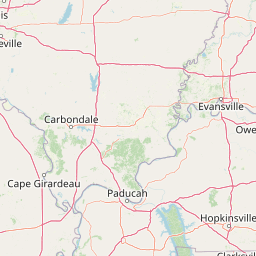
Map view of Garden of the Gods Wilderness

Use this park location map to pinpoint Garden of the Gods Wilderness in United States of America, understand its exact geographic position, and read its mapped placement within the surrounding landscape more clearly.

Pigeon | © OpenStreetMap contributors

Location context for Garden of the Gods Wilderness

Illinois
Recorded earthquake history

Review Recorded Earthquake History for Garden of the Gods Wilderness

Access a detailed catalogue of historical seismic events associated with the location of Garden of the Gods Wilderness. This archive, powered by MoriAtlas, organizes USGS records to help you trace regional seismic activity and proximity data for this unique sandstone landscape in southern Illinois.

Garden of the Gods Wilderness Earthquake History

Catalogued events

6 events

Strongest magnitude

Magnitude 3.8

Most recent event

Mar 1, 2006

This history includes earthquakes recorded inside the park or within 50 km of its borders

Visual exploration of sandstone hoodoos, bluffs, and protected terrain in southern Illinois.

Garden of the Gods Wilderness Photos, Scenery, and Sandstone Landscape Views

Visual documentation captures the weathered sandstone spires, dramatic bluffs, and expansive forest canopies defining the unglaciated plateau of Garden of the Gods Wilderness. Detailed photography reveals the unique geological character and rugged topography separating this protected natural area from the surrounding Midwestern terrain.

A wide angle landscape view of Garden of the Gods in Illinois at sunset, featuring large, weathered sandstone cliffs and rock outcrops surrounded by lush green and autumn-tinged deciduous trees.

A narrow, stone-paved trail runs between two large, weathered grey sandstone rock formations in a forest setting.

Park atlas

Compare regional park geography, rugged sandstone terrain, and connected natural areas

Explore Parks Near Garden of the Gods Wilderness and Surrounding Protected Landscapes

Visitors exploring Garden of the Gods Wilderness can browse nearby protected areas and regional forestlands with similar geological formations. Comparing adjacent terrain features helps place southern Illinois conservation lands within a broader geographic context.
Watercolor painting of a wide, rolling landscape featuring layered sandstone bluffs and green forested hills against a light background.
Protected landscapeIllinois
Park boundaries overlap#1 closest

Southwest

Shawnee National Forest: Exploring the Protected Landscapes of the Illinois Shawnee Hills

Mapped sandstone formations and glacial terrain in southern Illinois

Spanning nearly 289,000 hectares, Shawnee National Forest is the largest body of public land in Illinois. The area is defined by its dramatic sandstone bluffs, deep canyons, and seven designated wilderness areas that provide a rare rugged topography within the American Midwest. Explore the complex geography of this forest, from its glacial-sculpted river watersheds to its diverse hardwood habitats and historic reforestation sites.

Area
2,017.83 km²
Established
1933
Relief
Upland
Climate
Temperate
Wildlife reserveIllinois
7.1 km away#2 closest

Southwest

Lusk Creek Wilderness: An Atlas of Protected Sandstone Canyons and Forests in Southern Illinois

Mapping rugged wilderness terrain and forest ecological recovery.

Lusk Creek Wilderness serves as a key protected landscape in southern Illinois, featuring extensive sandstone canyon systems and dense hardwood woodland. This area offers a unique look at the geological and forested character of the Shawnee region, documented through its boundaries, elevation changes, and natural landmarks. Use this geographic entry to examine the rugged, roadless character of the state largest wilderness designation and its place within the wider regional drainage system.

Area
25.47 km²
Established
1990
IUCN
Ib
Relief
Upland
A watercolor painting showing a stylized landscape with rolling green hills, a band of trees, and a pale pink lake surface under a soft morning sky.
Protected landscapeUnited States of America
64 km away#3 closest

South

Land Between the Lakes National Recreation Area: Mapped Geography and Protected Landscapes

An inland peninsula preserved between two major river reservoirs.

Land Between the Lakes National Recreation Area occupies a distinct narrow land bridge between Kentucky Lake and Lake Barkley. This protected landscape contains a dense mix of forested ridges, stream valleys, and managed wildlife prairies. The area is integral to the lower Ohio River Valley geography, showcasing the results of long-term watershed management and large-scale ecological restoration within the United States.

Area
693.1 km²
Established
1963
Visitors
2M annual
Relief
Lowland
Watercolor painting of a soft, hazy forest landscape with rolling hills in the background and soft green trees in the foreground.
Protected landscapeIndiana
146 km away#4 closest

Northeast

Hoosier National Forest: Geographic Overview of Indiana Protected Wilderness and Woodlands

Mapping the karst terrain and forest corridors of southern Indiana.

Hoosier National Forest defines the landscape of southern Indiana with its rolling unglaciated hills and ridge systems. Discover the mapped geography of this protected area, including its rare prairie-like barrens, sandstone cliff formations, and the designated Charles C. Deam Wilderness. This overview focuses on the spatial extent and diverse topographic features that distinguish this forest from the surrounding Midwest plains.

Area
826.78 km²
Established
1961
Relief
Upland
Climate
Temperate
National parkMissouri
147 km away#5 closest

West

Mark Twain National Forest: Geography and Protected Area Atlas of Southern Missouri

Mapping the karst terrain and ancient ridges of the Ozark Highlands

Mark Twain National Forest represents a sprawling conservation area within the Missouri Ozark Highlands. Its geography is defined by volcanic mountain remnants, rocky glades, and significant river corridors like the Eleven Point National Scenic River. This record provides insight into the forest's complex mapped boundaries, seven designated wilderness areas, and the distinctive karst geology that characterizes this unique American landscape.

Area
6,037.3 km²
Established
1939
Relief
Upland
Climate
Temperate
Wildlife reserveMissouri
About 172 km away#6 closest

Southwest

Mingo Wilderness: Missouri Protected Wildlife Reserve and Wetland Geography

Primitive bottomland forest and swamp landscape

Mingo Wilderness encompasses 8,000 acres of protected bottomland hardwood forest and cypress-tupelo swamp in southeastern Missouri. As a federally designated wilderness area embedded within a national wildlife refuge, it provides a quiet, primitive habitat characterized by slow-moving creek corridors and varied seasonal wetlands.

Area
32 km²
Established
1976
IUCN
Ib
Relief
Lowland
Wildlife reserveMissouri
174 km away#7 closest

West

Rockpile Mountain Wilderness: Mapping the Rugged Ridge Landscapes of the Southeastern Ozarks

A federally protected wilderness within Missouri's Mark Twain National Forest

Explore the distinct geography of Rockpile Mountain Wilderness, where a steep granite ridge runs from Little Grass Mountain toward the national forest boundary. This protected area features unique cultural history in the form of an Indigenous stone cairn and showcases the eroded, rocky character of the eastern Ozark highlands. Use this resource to understand the boundary and terrain of this significant wilderness tract.

Area
17.15 km²
Established
1980
IUCN
Ib
Relief
Mountain
National parkKentucky
191 km away#8 closest

East

Mammoth Cave National Park: Kentucky's Premier National Park for Protected Landscape Exploration

Explore its mapped boundaries and regional geography.

Mammoth Cave National Park in Kentucky presents a profound opportunity for protected-area discovery, anchored by its status as a national park. This resource focuses on providing a factual atlas-style view of its landscape, emphasizing its geographic context within the region and the extent of its protected boundaries. Users can engage with detailed information designed for structured exploration, understanding the park not just as a location but as a key component of natural landscape data.

Area
210.46 km²
Established
1941
IUCN
II
Visitors
747K annual

Common questions about visiting, size, designation, and location context for Garden of the Gods Wilderness

Garden of the Gods Wilderness FAQs for park facts, access, geography, and protected area context

Find quick answers about Garden of the Gods Wilderness, including protected-area facts, park geography, trail and visitor context, and how the park fits into its surrounding country and regional landscape.
MoriAtlas Explorer

Continue Your Protected Areas Search Across the Global Atlas

Deepen your exploration by continuing the structured search for national parks and protected areas worldwide. Utilize the comprehensive filtering capabilities to compare different conservation landscapes and refine your understanding of global park geography. Discover more about the distribution and characteristics of protected natural areas.

Global natural geography