
Mori Atlas logo
Protected landscapeLand Between the Lakes National Recreation Area

Understanding the geography of a protected landscape bordered by the Cumberland and Tennessee rivers.

Land Between the Lakes National Recreation Area: A Mapped Analysis of This Inland Peninsula

Land Between the Lakes National Recreation Area serves as a major protected inland peninsula spanning western Kentucky and northwestern Tennessee. This significant landscape features a complex network of oak-hickory forests, restored prairie habitats, and extensive lake shorelines created by the impoundments of the Cumberland and Tennessee rivers. The geography remains defined by its unique inter-river position, providing a continuous, protected forested corridor that supports diverse ecological habitats and long-standing wildlife restoration efforts.

inland peninsulanational recreation areaoak-hickory forestnative prairieelk and bison prairielake-based recreation
A graphic illustration depicting a log cabin near a winding river in a mountain valley under a sunlit sky.

Land Between the Lakes National Recreation Area

Protected landscape

Park overview

Structured park overview, official facts, and landscape profile for Land Between the Lakes National Recreation Area

Land Between the Lakes National Recreation Area park facts, protected area profile, and essential visitor context

Review the core facts for Land Between the Lakes National Recreation Area, including designation, size, terrain, visitor scale, habitats, and operating context in one park-focused overview.

About Land Between the Lakes National Recreation Area

Land Between the Lakes National Recreation Area occupies a distinctive position in the American landscape. It is a broad peninsula of protected land that lies between two very large reservoirs, Kentucky Lake on the Tennessee River to the south and Lake Barkley on the Cumberland River to the north. Together, these lakes nearly encircle the recreation area, making it one of the largest inland peninsulas in the United States. With roughly 171,000 acres under federal management, the area preserves a significant corridor of forest, former prairie, wetlands, and shoreline habitat in a region where these landscapes have otherwise been heavily altered by agriculture and development.

The recreation area's identity is shaped as much by its history as by its geography. In the nineteenth century, communities such as Tharpe and Model in Tennessee and Golden Pond in Kentucky occupied the ridge between the two rivers. Communities like Birmingham, Kentucky were later inundated when the Tennessee Valley Authority completed Kentucky Lake in the 1940s, displacing hundreds of families through the exercise of eminent domain. When the U.S. Army Corps of Engineers finished Lake Barkley and a connecting canal in the 1960s, the same region was formally set aside as a national recreation area.

Land Between the Lakes offers an unusually broad blend of natural, cultural, and recreational resources. Its central programs include the Elk and Bison Prairie, the Homeplace 1850s living history farm, environmental education facilities at Golden Pond, and extensive hiking, mountain biking, and water-based recreation. Its management has transitioned from a New Deal era infrastructure authority to the United States Forest Service, reflecting a shift from hydroelectric and flood control priorities toward conservation education and outdoor recreation. Despite a short-lived designation as a UNESCO Biosphere Reserve between 1991 and 2017, the area's core identity has remained rooted in its lakeside forests, restored native prairies, and accessible public landscapes.

Quick facts and research context for Land Between the Lakes National Recreation Area

Land Between the Lakes National Recreation Area lies in Lyon and Trigg counties in Kentucky and Stewart County in Tennessee, with Murray, Kentucky as the nearest city. The recreation area sits on a low ridge that separates the Cumberland and Tennessee rivers, the two largest river systems in the central United States.

Designated in 1963 and developed with funding appropriated during the Johnson administration, the area was originally managed by the Tennessee Valley Authority following the construction of Kentucky Lake and Lake Barkley. In 1998, operation of the recreation area was transferred to the United States Forest Service, which continues to manage it today.

A 700-acre Elk and Bison Prairie, a living history farm called The Homeplace, an iron furnace memorial, and an environmental education center near the former site of Golden Pond are among its most recognizable features.

Protection and recognition

Documented terrestrial protection scope and international recognition records

Land Between the Lakes National Recreation Area Protection Status

Land Between the Lakes National Recreation Area maintains a documented terrestrial protection scope without external international recognition listings. Systematic conservation records detail the established management parameters and administrative classifications for the protected area.

Protection details

Protection scope
Terrestrial
Transboundary protection
No
Park context

Deeper park guide and search-rich context for Land Between the Lakes National Recreation Area

Land Between the Lakes National Recreation Area history, landscape, wildlife, and travel context

Explore Land Between the Lakes National Recreation Area through its history, landscape character, ecosystems, wildlife, conservation priorities, cultural context, and seasonal travel timing in a structured park guide built for atlas discovery and search intent.

Why Land Between the Lakes National Recreation Area stands out

Land Between the Lakes is best known for being one of the largest inland peninsulas in the United States, formed between two major impoundments of the Cumberland and Tennessee rivers. The area's defining identity comes from this unusual geographic setting, where a continuous stretch of protected forest and prairie lies almost entirely surrounded by water. It is equally recognized for its 700-acre Elk and Bison Prairie, a managed enclosure that reintroduced large grazing mammals to a landscape they had not occupied in significant numbers for more than a century. The prairie is maintained through prescribed burning and reseeding, reflecting the area's broader role in prairie and oak-hickory forest restoration in the lower Ohio River Valley.
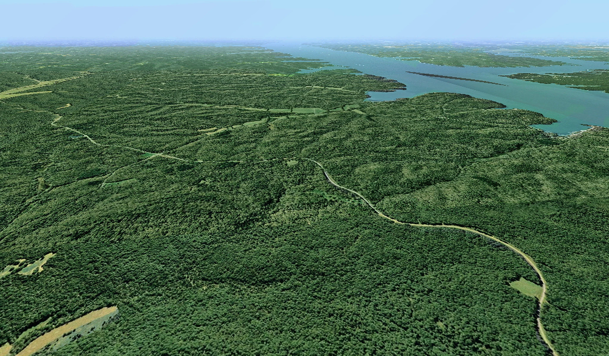
Aerial view looking over a dense green forest peninsula surrounded by water, with a winding road cutting through the trees.
An aerial view of the Woodlands Trace National Scenic Byway as it winds through the forested landscape of Land Between the Lakes National Recreation Area.

Land Between the Lakes National Recreation Area history and protected-area timeline

Land Between the Lakes has a layered history that begins with the Civil War era and extends through dam building, community displacement, and modern conservation management. During the American Civil War, Confederate forces built Fort Henry on the Tennessee River to defend the upper reaches of that waterway from Union gunboats. Once Fort Henry fell in early 1862 and Union forces occupied much of Tennessee, the surrounding area saw relatively little further military action.

The modern transformation of the region began during the Great Depression, when President Franklin D. Roosevelt established the Tennessee Valley Authority. The TVA built a series of dams along the Tennessee River for flood control and hydroelectric power, with the final downstream dam constructed near Gilbertsville, Kentucky. The resulting impoundment created Kentucky Lake and submerged low-lying land along the western side of the Between the Rivers area. Roughly 800 families were displaced, and entire towns, including Birmingham, Kentucky, disappeared beneath the new reservoir.

In the 1960s, the U.S. Army Corps of Engineers completed a dam on the Cumberland River, creating Lake Barkley. The two lakes were connected by a canal that did not require locks, reflecting an early ambition to shorten commercial shipping routes from the Cumberland Valley to Gulf of Mexico ports. President John F. Kennedy designated the intervening land as the Land Between the Lakes National Recreation Area in 1963, and the area was developed through funding appropriated during the Johnson administration. Unlike a national park, the recreation area was designed to permit regulated hunting alongside other uses.

The 1970s saw the addition of two signature attractions: the Homeplace, a working 1850s-style farm operated as a living museum, and what would become the Elk and Bison Prairie. The prairie enclosure was prepared through prescribed burning and reseeding to push back against encroaching oak and hickory forest; elk and bison were introduced in subsequent decades, and the prairie was formally inaugurated in 1996. In the 1990s, the Tennessee Valley Authority sought to withdraw from activities requiring direct taxpayer funding, and in 1998, Congress authorized the transfer of the recreation area to the U.S. Forest Service. In 1991, the area was designated a UNESCO Biosphere Reserve, though it was withdrawn from the program in June 2017. In December 2021, two tornadoes struck the north and south ends of the recreation area, damaging landscapes and portions of the trail system.

Land Between the Lakes National Recreation Area landscape and geographic character

Land Between the Lakes occupies a low, mostly forested ridge that separates the Tennessee and Cumberland rivers in western Kentucky and northwestern Tennessee. The two rivers run remarkably close together in this part of the lower Ohio River Valley, leaving a long and narrow strip of dry land between them. When Kentucky Lake and Lake Barkley were created, this strip became a true inland peninsula. Downstream, the mouths of the two rivers empty into the Ohio River only about four miles apart, emphasizing how tightly the rivers are bundled in this region.

The terrain is largely rolling rather than mountainous. Forested uplands dominated by oak and hickory transition into former prairie openings, wetland margins, and extensive lake shoreline. The northern end of the recreation area is anchored by the canal that links Lake Barkley to Kentucky Lake, while the southern reaches are defined by the broad curves of Kentucky Lake itself. Long ridges, hollows, and small stream valleys give the area an overall wooded character, broken occasionally by open vistas across the prairie enclosure and views across the surrounding reservoirs.

The two large reservoirs surrounding the peninsula create nearly 300 miles of sheltered shoreline used for boating, fishing, and waterfowl habitat. The Trace, a historic north-south road (formerly Tennessee State Route 49), still traces the route once used by bison and later by Native Americans and European-American settlers. This road, combined with internal lakes like Hematite and Honker, defines much of the recreation area's scenic and navigational character.
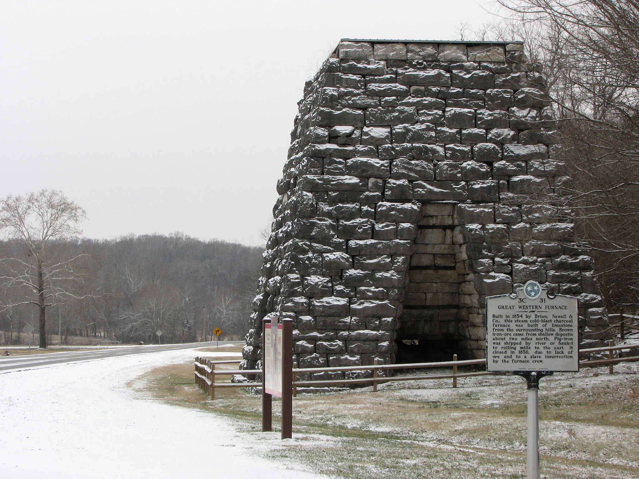
A stone iron furnace structure in winter, featuring a tapered block design with snow on its surfaces, set next to a roadside historical marker.
The historic Great Western Furnace, a stone relic from 1854, stands in the snow at Land Between the Lakes.

Land Between the Lakes National Recreation Area ecosystems, habitats, and plant life

The natural character of Land Between the Lakes is defined by the interaction between oak-hickory hardwood forest, recovered native prairie, and extensive freshwater lake and shoreline habitat. For more than a century before the creation of the recreation area, grazing pressures on the landscape had largely disappeared, allowing oak and hickory trees to crowd out remnant patches of native grassland. Restoration work, particularly within the Elk and Bison Prairie enclosure, has attempted to reverse this trend by reintroducing fire and large herbivores.

Beyond the prairie enclosure, the broader forest matrix supports a mix of hardwood species typical of the lower Ohio River Valley. Upland hardwood forest covers much of the peninsula, while bottomland forest, marshy edges, and lake-fringe wetland communities occupy low-lying areas near the two reservoirs. The interconnecting canal, the smaller inland lakes like Hematite and Honker, and the irregular coves of Kentucky Lake and Lake Barkley together create a wide range of aquatic and semi-aquatic habitats in a relatively compact area.

The result is a diverse transitional landscape where eastern deciduous forest meets recovering tallgrass prairie elements and large-lake freshwater systems. Although not technically a wilderness area, the recreation area's size and connectivity make it an unusually large block of relatively natural habitat in the region, supporting ecological processes that are uncommon in the surrounding agricultural matrix.
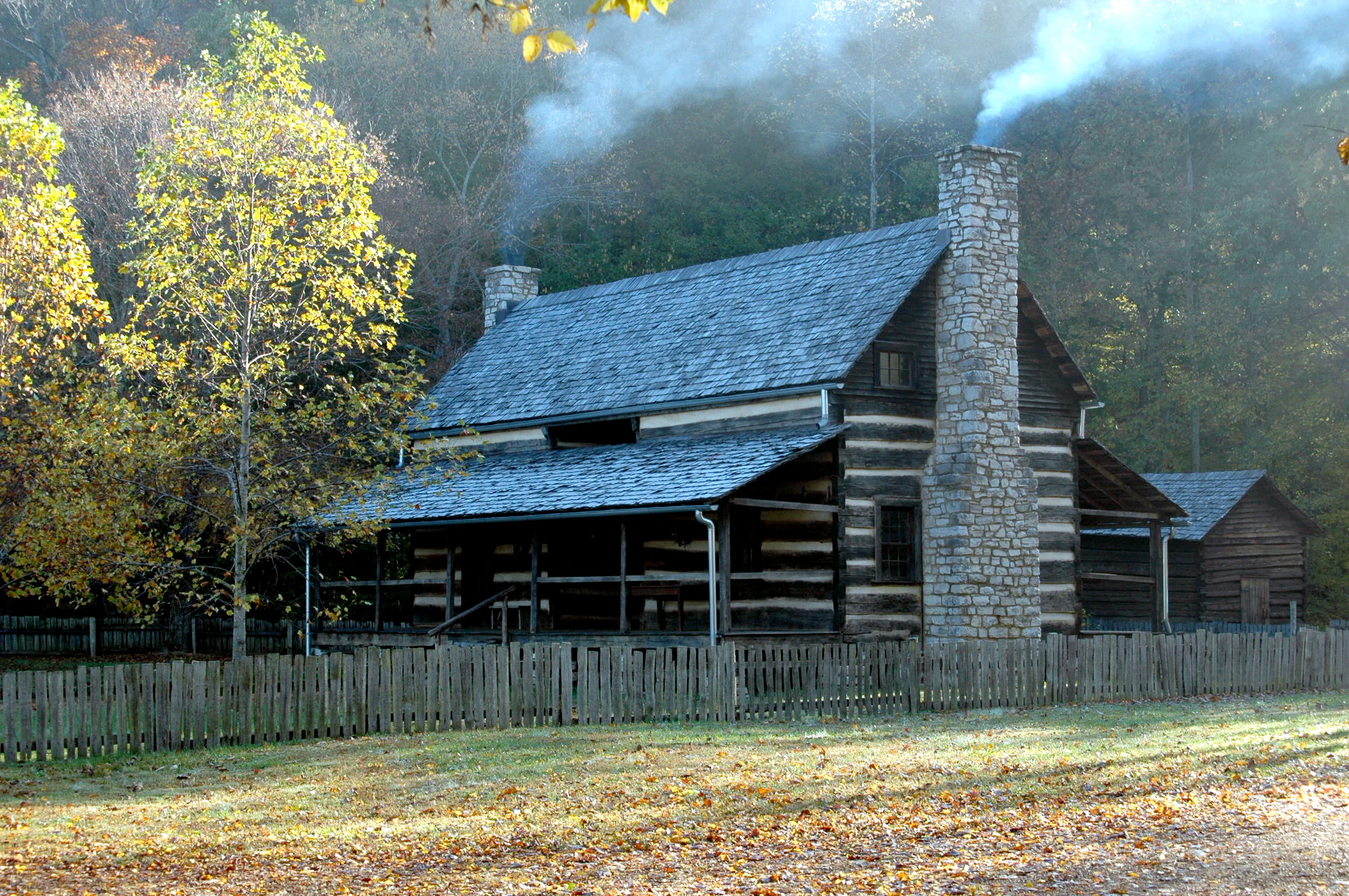
A rustic 19th-century double-pen log cabin with two stone chimneys and a wooden shingle roof, surrounded by autumn foliage and a picket fence, with smoke visible from the chimneys.
A historic double-pen log cabin at the Homeplace Living History Farm with smoke rising from stone chimneys.

Land Between the Lakes National Recreation Area wildlife and species highlights

Land Between the Lakes is most famous for the large mammals reintroduced to its restored prairie. American bison and elk, both historically native to this region, now roam the 700-acre Elk and Bison Prairie enclosure, which is maintained through prescribed burning, reseeding with native grasses, and the grazing pressure of the animals themselves. Visitors are able to observe these species from driving tours, accessing a landscape that more closely resembles what the lower Ohio River Valley would have looked like in the eighteenth century than the heavily farmed terrain that surrounds the recreation area today.

The two big reservoirs and their connecting canal support freshwater fish populations typical of the Cumberland and Tennessee river systems. Common species include bass, crappie, sauger, catfish, sunfish, and bluegill, making the area a significant warmwater fishery in the region. Wetland margins, inland ponds, and lake coves provide habitat for waterfowl and wading birds, while the surrounding oak-hickory forest supports typical upland bird communities and a wide variety of forest-edge and interior species. The combination of forest, open prairie, and extensive shoreline gives the recreation area unusual breadth of habitat for an inland peninsula.
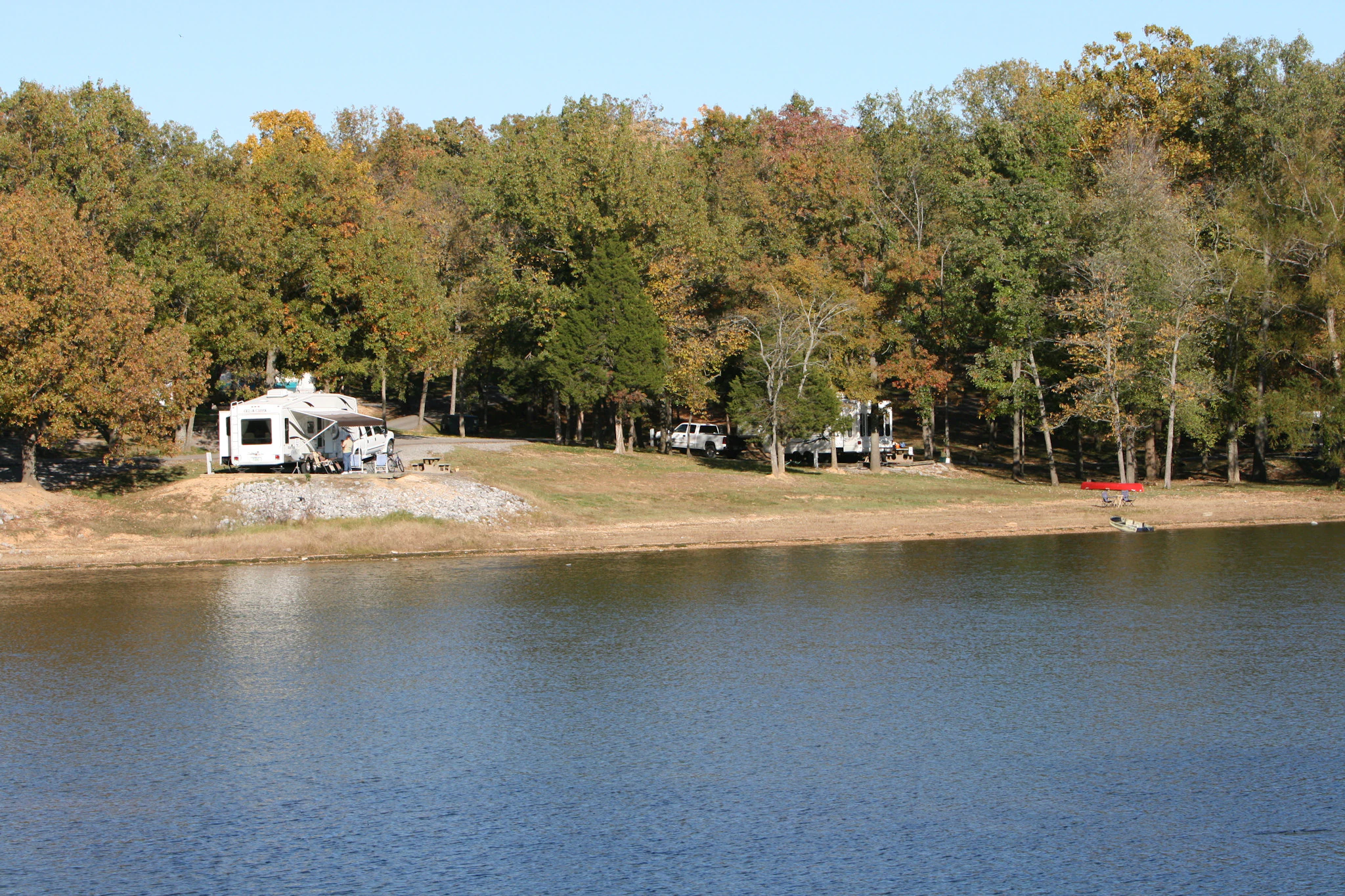
Several recreational vehicles parked in a wooded lakeside campground along a calm body of water during the autumn season.
Recreational vehicles parked at the shoreline of Kentucky Lake at Hillman Ferry Campground.

Land Between the Lakes National Recreation Area conservation status and protection priorities

Although Land Between the Lakes was not established with the strict preservation mandate of a national park, it has played an important role in landscape-scale conservation in the lower Ohio River Valley. The recreation area preserves more than 170,000 acres of largely contiguous forest, restored prairie, and lakeshore habitat inside a region otherwise dominated by agriculture and small communities. Its size and protected status allow ecological processes, including prescribed fire and managed grazing, to be applied across areas far larger than is typical for state or private conservation lands in the region.

The recreation area's prairie restoration work within the Elk and Bison Prairie has become one of its most visible conservation achievements. Through decades of prescribed burning and reseeding, managers have re-established native grassland plant communities that had been largely lost to forest succession, while demonstrating how large herbivores can be used as a tool in maintaining open prairie habitats. The introduction of bison from Elk Island National Park in Alberta and elk from other source populations has revived a native grazing dynamic that had been absent from the region for many generations.

Recognition of these conservation values has extended beyond the United States. In 1991, Land Between the Lakes was designated a UNESCO Biosphere Reserve, acknowledging its role as a demonstration site for the relationship between human land use and ecological systems. The recreation area was withdrawn from the program in June 2017, but it continues to function as an important conservation, education, and land-management laboratory within the national forest system.

Land Between the Lakes National Recreation Area cultural meaning and human context

Land Between the Lakes carries a layered human history that is unusually visible for a recreation area. The displacement of roughly 800 families during the creation of Kentucky Lake and Lake Barkley remains a defining part of the area's story. Communities such as Tharpe and Model in Tennessee and Birmingham and Golden Pond in Kentucky were either submerged or abandoned to make way for the reservoirs and the recreation area itself. Some former residents left reluctantly; others welcomed the opportunity to relocate from remote farmland to more accessible communities.

The Homeplace 1850s farm offers a sustained interpretation of mid-nineteenth-century rural life in the upper South, complete with period agricultural techniques and costumed interpreters. Nearby, the remains of the Great Western Iron Furnace, which was operated in the 1850s by enslaved African-American workers, anchor the community history associated with the former town of Model. At the former site of Golden Pond, the recreation area's headquarters coexists with a museum, a planetarium, and an environmental education area, bringing together local history, science education, and outdoor recreation in a single locus.

The Trace, the historic north-south road that now serves as the recreation area's spine, evokes even older layers of cultural use. The route follows paths once used by bison, then by Native American hunters, and later by European-American settlers, tying the area's modern recreation landscape to a much longer sequence of human movement across the lower Ohio River Valley.

Top sights and standout views in Land Between the Lakes National Recreation Area

Land Between the Lakes stands out for combining a large inland peninsula setting with a diverse mix of forest, restored prairie, and lake-based recreation. The 700-acre Elk and Bison Prairie and the Homeplace 1850s farm are its most recognizable cultural and ecological attractions, while the canal linking Kentucky Lake and Lake Barkley gives the area an unusually coherent water-based geography. Its 59-mile North/South Trail, 11-mile Central Hardwoods Scenic Trail, and broader network of campgrounds, boat ramps, and environmental education sites make it one of the most accessible large federal recreation landscapes in the southeastern United States.

Best time to visit Land Between the Lakes National Recreation Area

Land Between the Lakes offers different experiences depending on the season. Spring and fall tend to be especially rewarding for hiking, mountain biking, and wildlife observation across the peninsula, with milder temperatures and active bird and mammal presence. Summer is the most popular season for lake-based recreation, including boating, fishing, and swimming, though it brings higher visitor numbers and warmer, more humid conditions. Winter visits are quieter and can offer stark views across the surrounding reservoirs and open prairie, though some facilities and portions of the trail system may have reduced access following severe weather events, as has been the case after the December 2021 tornadoes.

Monthly climate preview

Long-term representative temperature and precipitation patterns across twelve months

Land Between the Lakes National Recreation Area Climate Normals and Weather by Month

Representative coordinates track recorded average monthly temperature extremes and daily precipitation rhythms across the protected terrain. Analyzing twelve-month climatological normals provides deeper insight into measured meteorological cycles.
Annual mean14 °C
1 °C26 °C
Jan
Feb
Mar
Apr14°
May20°
Jun24°
Jul26°
Aug26°
Sep22°
Oct15°
Nov
Dec
Warmest month
July

26.1 °C

Coolest month
January

1 °C

Wettest month
April

4.2 mm/day

Driest month
August

2.5 mm/day

Park location guide

Geography guide, regional context, and park location map for Land Between the Lakes National Recreation Area

Land Between the Lakes National Recreation Area park geography, regions, and map view in United States of America

Understand where Land Between the Lakes National Recreation Area sits in United States of America through a broader geographic reading of the surrounding landscape, nearby location context, and its mapped position within the national park landscape.

How Land Between the Lakes National Recreation Area fits into United States of America

The United States of America is a federal presidential republic and one of the world's largest countries by area and population. It consists of 50 states across a vast territory spanning multiple time zones, with its capital in Washington, D.C. and largest city in New York City. The nation has a diverse economy, influential political system, and significant cultural and military presence globally.

Wider geography shaping Land Between the Lakes National Recreation Area in United States of America

The United States occupies a vast territory in North America, bordered by Canada to the north and Mexico to the south. The 48 contiguous states stretch from the Atlantic to the Pacific Ocean, while Alaska occupies the northwestern region and Hawaii is an archipelago in the Pacific. The country encompasses diverse terrain including the Rocky Mountains, Appalachian Mountains, Great Plains, and extensive river systems.

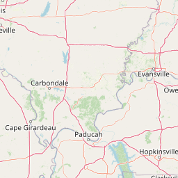
Map view of Land Between the Lakes National Recreation Area

Use this park location map to pinpoint Land Between the Lakes National Recreation Area in United States of America, understand its exact geographic position, and read its mapped placement within the surrounding landscape more clearly.

Pigeon | © OpenStreetMap contributors

Location context for Land Between the Lakes National Recreation Area

KentuckyTennessee
Recorded earthquake history

Explore Recorded Earthquake History near Land Between the Lakes National Recreation Area

Examine a catalogued collection of historical seismic events linked by location to the Land Between the Lakes National Recreation Area landscape. This MoriAtlas data source provides transparent access to recorded earthquake dates, magnitudes, and epicentre proximity for regional geographic study.

Land Between the Lakes Earthquake Records

Catalogued events

2 events

Strongest magnitude

Magnitude 3.8

Most recent event

Aug 26, 2003

This history includes earthquakes recorded inside the park or within 50 km of its borders

Visual reference guide to oak hickory forests, restored prairies, and inland lake shorelines

Land Between the Lakes National Recreation Area Photos and Scenic Landscapes

Visual documentation captures the diverse terrain and protected habitats across the expansive inland peninsula of Land Between the Lakes National Recreation Area. Detailed photography illustrates the rolling forested ridges, open prairie enclosures, and winding river shorelines that define the region.

Aerial view looking over a dense green forest peninsula surrounded by water, with a winding road cutting through the trees.

A bull elk with large antlers looking toward the camera, standing in a field of tall, dry grass in front of a forest of bare trees.

A stone iron furnace structure in winter, featuring a tapered block design with snow on its surfaces, set next to a roadside historical marker.

A rustic 19th-century double-pen log cabin with two stone chimneys and a wooden shingle roof, surrounded by autumn foliage and a picket fence, with smoke visible from the chimneys.

Several recreational vehicles parked in a wooded lakeside campground along a calm body of water during the autumn season.

Park atlas

Compare adjacent river valleys, forested ridges, and regional wildlife habitats.

Parks Near Land Between the Lakes National Recreation Area and Surrounding Protected Landscapes

Browse other protected areas near Land Between the Lakes National Recreation Area to examine regional forest cover, river valleys, and lake ecosystems. Comparing adjacent public lands reveals broader ecological patterns across the lower Ohio River Valley.
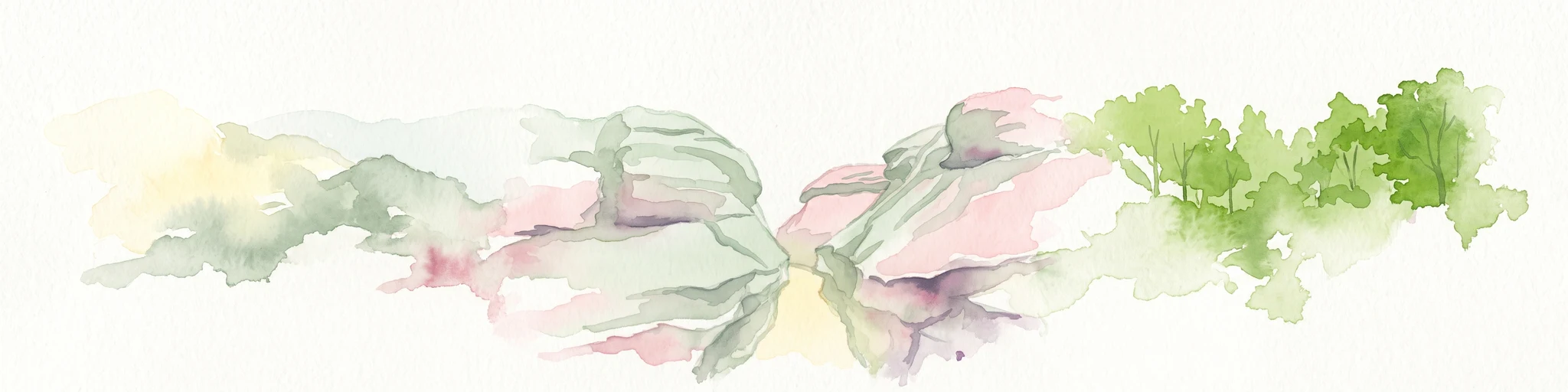
Watercolor painting of a wide, rolling landscape featuring layered sandstone bluffs and green forested hills against a light background.
Protected landscapeIllinois
28 km away#1 closest

Northwest

Shawnee National Forest: Exploring the Protected Landscapes of the Illinois Shawnee Hills

Mapped sandstone formations and glacial terrain in southern Illinois

Spanning nearly 289,000 hectares, Shawnee National Forest is the largest body of public land in Illinois. The area is defined by its dramatic sandstone bluffs, deep canyons, and seven designated wilderness areas that provide a rare rugged topography within the American Midwest. Explore the complex geography of this forest, from its glacial-sculpted river watersheds to its diverse hardwood habitats and historic reforestation sites.

Area
2,017.83 km²
Established
1933
Relief
Upland
Climate
Temperate
Wildlife reserveIllinois
61 km away#2 closest

Northwest

Lusk Creek Wilderness: An Atlas of Protected Sandstone Canyons and Forests in Southern Illinois

Mapping rugged wilderness terrain and forest ecological recovery.

Lusk Creek Wilderness serves as a key protected landscape in southern Illinois, featuring extensive sandstone canyon systems and dense hardwood woodland. This area offers a unique look at the geological and forested character of the Shawnee region, documented through its boundaries, elevation changes, and natural landmarks. Use this geographic entry to examine the rugged, roadless character of the state largest wilderness designation and its place within the wider regional drainage system.

Area
25.47 km²
Established
1990
IUCN
Ib
Relief
Upland
Watercolor painting of rock formations and surrounding green trees on a plain white background.
Wildlife reserveIllinois
64 km away#3 closest

North

Garden of the Gods Wilderness: A Protected Sandstone Plateau in Southern Illinois

Explore geologic boundaries, sandstone hoodoos, and forested wilderness terrain

Garden of the Gods Wilderness represents a critical protected area within the Shawnee National Forest, notable for its unglaciated sandstone geography. This 3,318-acre wilderness offers an intimate view of ancient carboniferous rock formations, including prominent hoodoos and clifftop overlooks that provide expansive sightlines across the southern Illinois landscape.

Area
13.43 km²
Established
1990
Relief
Upland
Climate
Temperate
Watercolor painting of a soft, hazy forest landscape with rolling hills in the background and soft green trees in the foreground.
Protected landscapeIndiana
154 km away#4 closest

Northeast

Hoosier National Forest: Geographic Overview of Indiana Protected Wilderness and Woodlands

Mapping the karst terrain and forest corridors of southern Indiana.

Hoosier National Forest defines the landscape of southern Indiana with its rolling unglaciated hills and ridge systems. Discover the mapped geography of this protected area, including its rare prairie-like barrens, sandstone cliff formations, and the designated Charles C. Deam Wilderness. This overview focuses on the spatial extent and diverse topographic features that distinguish this forest from the surrounding Midwest plains.

Area
826.78 km²
Established
1961
Relief
Upland
Climate
Temperate
National parkKentucky
158 km away#5 closest

East

Mammoth Cave National Park: Kentucky's Premier National Park for Protected Landscape Exploration

Explore its mapped boundaries and regional geography.

Mammoth Cave National Park in Kentucky presents a profound opportunity for protected-area discovery, anchored by its status as a national park. This resource focuses on providing a factual atlas-style view of its landscape, emphasizing its geographic context within the region and the extent of its protected boundaries. Users can engage with detailed information designed for structured exploration, understanding the park not just as a location but as a key component of natural landscape data.

Area
210.46 km²
Established
1941
IUCN
II
Visitors
747K annual
National parkMissouri
173 km away#6 closest

West

Mark Twain National Forest: Geography and Protected Area Atlas of Southern Missouri

Mapping the karst terrain and ancient ridges of the Ozark Highlands

Mark Twain National Forest represents a sprawling conservation area within the Missouri Ozark Highlands. Its geography is defined by volcanic mountain remnants, rocky glades, and significant river corridors like the Eleven Point National Scenic River. This record provides insight into the forest's complex mapped boundaries, seven designated wilderness areas, and the distinctive karst geology that characterizes this unique American landscape.

Area
6,037.3 km²
Established
1939
Relief
Upland
Climate
Temperate
Wildlife reserveMissouri
About 177 km away#7 closest

West

Mingo Wilderness: Missouri Protected Wildlife Reserve and Wetland Geography

Primitive bottomland forest and swamp landscape

Mingo Wilderness encompasses 8,000 acres of protected bottomland hardwood forest and cypress-tupelo swamp in southeastern Missouri. As a federally designated wilderness area embedded within a national wildlife refuge, it provides a quiet, primitive habitat characterized by slow-moving creek corridors and varied seasonal wetlands.

Area
32 km²
Established
1976
IUCN
Ib
Relief
Lowland
Watercolor painting of a green landscape featuring rolling hills, small clusters of trees, and a calm water feature in the foreground.
Protected landscapeMississippi
184 km away#8 closest

South

Holly Springs National Forest: Geographic Context and Protected Landscape Boundaries

Northern Mississippi forest topography and ecological restoration geography.

Holly Springs National Forest occupies the rolling hills of north central Mississippi, where federal land tracts form a complex mosaic with private holdings. This protected area features diverse forest types including loblolly and shortleaf pine uplands alongside bottomland hardwood swamps. It serves as an essential watershed region, hosting multiple reservoirs like Chewalla Lake and Puskus Lake while protecting the headwaters of the Wolf River.

Area
629.94 km²
Established
1936
Relief
Upland
Climate
Subtropical

Common questions about visiting, size, designation, and location context for Land Between the Lakes National Recreation Area

Land Between the Lakes National Recreation Area FAQs for park facts, access, geography, and protected area context

Find quick answers about Land Between the Lakes National Recreation Area, including protected-area facts, park geography, trail and visitor context, and how the park fits into its surrounding country and regional landscape.
MoriAtlas Explorer

Continue Your Protected Areas Search Across the Global Atlas

Deepen your exploration by continuing the structured search for national parks and protected areas worldwide. Utilize the comprehensive filtering capabilities to compare different conservation landscapes and refine your understanding of global park geography. Discover more about the distribution and characteristics of protected natural areas.

Global natural geography