
Mori Atlas logo
Protected landscapeGebiete nördlich des Neckars bei Mundelsheim, Hessigheim, Besigheim und Gemmrigheim: Käsberg, Felsengärten, Wurmberg, Gündelstein, Kelterschen und Umgebung

A diverse cultural landscape preserving historic vineyard terraces and rocky hillside habitats

Gebiete nördlich des Neckars bei Mundelsheim, Hessigheim, Besigheim und Gemmrigheim: Protected Landscape Mapping

Spanning 299 hectares, this protected landscape along the middle Neckar valley preserves a critical corridor of sloping terrain. The area encompasses the distinct formations of Käsberg, Felsengärten, Wurmberg, Gündelstein, and Kelterschen, where traditional viticulture meets natural rocky outcrops and orchard habitats. This site serves as a vital ecological network and regional recreation zone in Baden-Württemberg, showcasing the complex relationship between human-tilled stone-walled terraces and natural valley features.

protected landscapeterraced vineyardsNeckar valleycultural landscapevineyard terracesrocky hillside
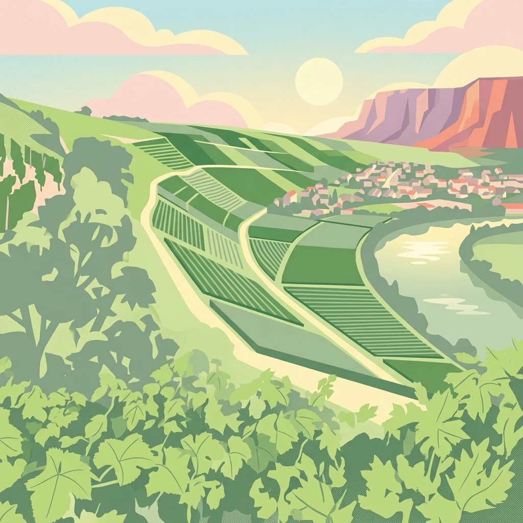
An illustration of terraced vineyards on hillsides overlooking a winding river and a small town, set against a sunset sky.

Gebiete nördlich des Neckars bei Mundelsheim, Hessigheim, Besigheim und Gemmrigheim: Käsberg, Felsengärten, Wurmberg, Gündelstein, Kelterschen und Umgebung

Protected landscape

Park overview

Structured park overview, official facts, and landscape profile for Neckar Valley Protected Landscape near Mundelsheim, Hessigheim, Besigheim and Gemmrigheim

Neckar Valley Protected Landscape near Mundelsheim, Hessigheim, Besigheim and Gemmrigheim park facts, protected area profile, and essential visitor context

Review the core facts for Neckar Valley Protected Landscape near Mundelsheim, Hessigheim, Besigheim and Gemmrigheim, including designation, size, terrain, visitor scale, habitats, and operating context in one park-focused overview.

About Neckar Valley Protected Landscape near Mundelsheim, Hessigheim, Besigheim and Gemmrigheim

The protected landscape of the Neckar valley north of Mundelsheim, Hessigheim, Besigheim, and Gemmrigheim represents a typical example of a German Landschaftsschutzgebiet, a category of protection aimed at preserving the character of a culturally shaped landscape rather than setting aside untouched wilderness. Its roughly 299 hectares are located on the slopes above the Neckar, where the river has carved a working valley flanked by vineyards, settlements, orchards, and rocky outcrops that together form a continuous landscape mosaic.

The ordinance that established the area emphasizes the diversity of this cultural landscape: historic terraced vineyards built on stone walls and steps, ecologically interconnected hillside habitats, traditional orchards, and the visual integrity of the valley as a whole. The protection framework recognizes both the active human landscape, through centuries of wine-growing, and the natural structures that give the valley its distinct visual character.

In regional terms, the protected area sits within the broader Neckar Basin natural region and forms part of a network of landscape protection areas surrounding the district of Ludwigsburg, one of Germany's most intensively used agricultural and wine-growing zones. Within that network, this site is notable for bringing together several named landscape elements, from Käsberg and the Felsengärten to Wurmberg, Gündelstein, and the Kelterschen, in a single protected perimeter.

The area also serves as a near-natural recreation space for the surrounding communities, forming a continuous zone for walking and local leisure between the four towns named in its title. The protection is therefore not only ecological, but also social and scenic, preserving the valley's role as a lived-in, working, and visible cultural landscape.

Quick facts and research context for Neckar Valley Protected Landscape near Mundelsheim, Hessigheim, Besigheim and Gemmrigheim

This protected landscape lies in the district of Ludwigsburg in Baden-Württemberg, in south-western Germany, and is administered by the lower nature conservation authority of the Landkreis Ludwigsburg. It was designated under the protected-area ordinance of 9 September 1988, with the official establishment recorded as 5 September 1988, and is registered under the identifier 1.18.059 with the World Database on Protected Areas.

The area lies within the natural region of the Neckar Basin and spans the slopes rising north of the river between Mundelsheim and Gemmrigheim. It is classified as a Protected Landscape / Seascape under IUCN Category V, a designation used for managed cultural landscapes whose scenic, ecological, and recreational values are protected together. The site is one of numerous protected landscapes within the district and is associated in particular with the upper Neckar valley's long wine-growing tradition.

Protection and recognition

Documented terrestrial protection scope, designation year, and official records

Protection Status and Designation History for Gebiete nördlich des Neckars bei Mundelsheim, Hessigheim, Besigheim und Gemmrigheim

Gebiete nördlich des Neckars bei Mundelsheim, Hessigheim, Besigheim und Gemmrigheim maintains a documented terrestrial protection status established in 1988. Review the official designation history, management scope, and conservation records associated with this protected landscape.

Protection details

Protection scope
Terrestrial
Designated year
1988
Transboundary protection
No
WDPA ID
321000
Park context

Deeper park guide and search-rich context for Neckar Valley Protected Landscape near Mundelsheim, Hessigheim, Besigheim and Gemmrigheim

Neckar Valley Protected Landscape near Mundelsheim, Hessigheim, Besigheim and Gemmrigheim history, landscape, wildlife, and travel context

Explore Neckar Valley Protected Landscape near Mundelsheim, Hessigheim, Besigheim and Gemmrigheim through its history, landscape character, ecosystems, wildlife, conservation priorities, cultural context, and seasonal travel timing in a structured park guide built for atlas discovery and search intent.

Why Neckar Valley Protected Landscape near Mundelsheim, Hessigheim, Besigheim and Gemmrigheim stands out

The protected area is best known for safeguarding a compact stretch of the middle Neckar valley where steep, historical terraced vineyards meet natural hillside features such as rock formations and dry habitat zones. The names incorporated in its official title, including Käsberg, Felsengärten, Wurmberg, Gündelstein, and Kelterschen, point to the combination of famous vineyard sites and characteristic rocky or hillside landscapes that define the area. What makes the site distinctive is the way traditional viticulture and natural conditions coexist on the same slopes. The protected landscape preserves not only the vineyards themselves, but also the stone walls, terraces, and steps that hold them in place, while maintaining the surrounding ecological networks that connect vineyards, orchards, and natural habitat on the valley flanks.
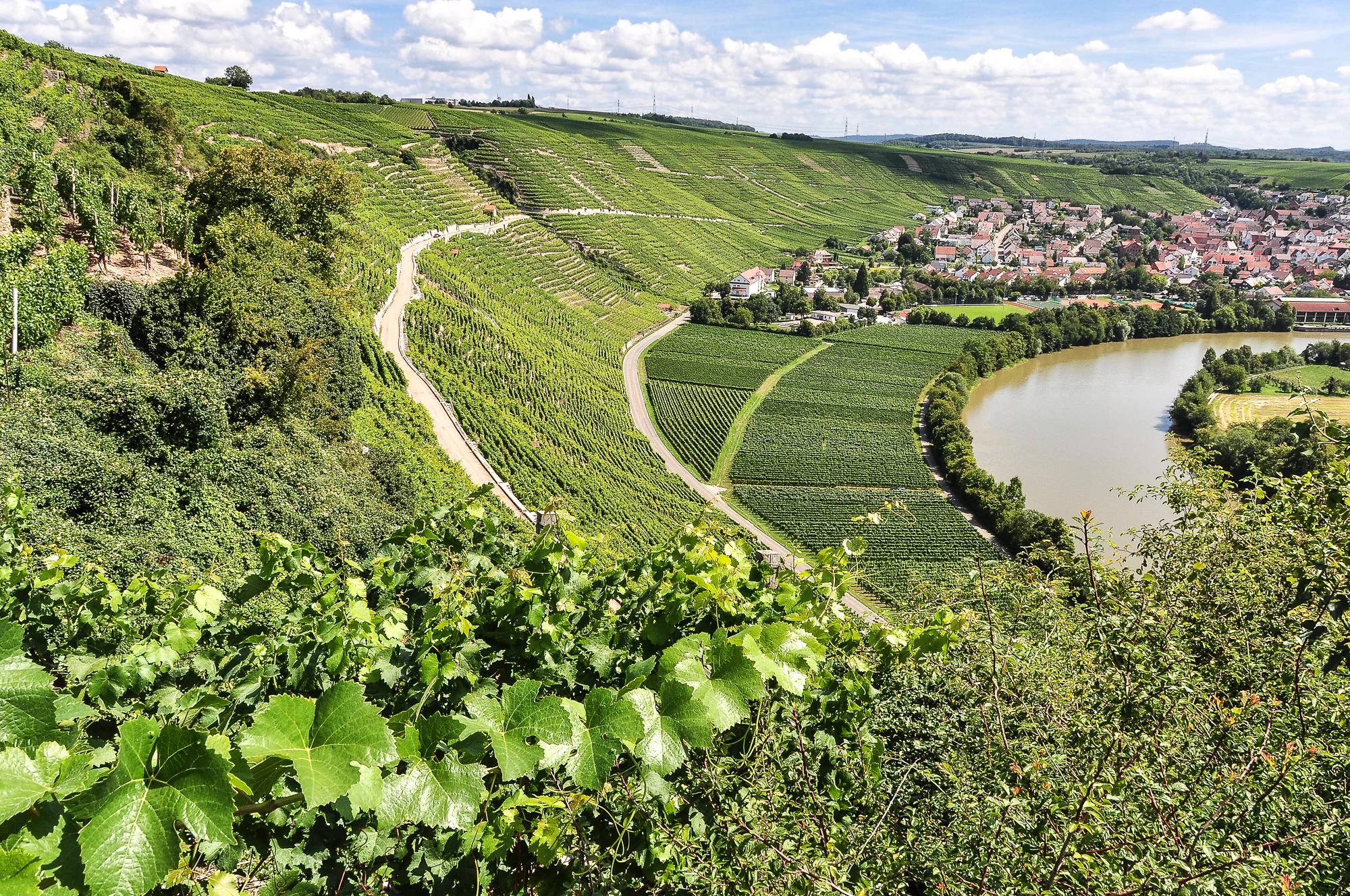
A high-angle scenic view of terraced vineyard slopes on a hillside, sloping down toward the curving Neckar river and a small town in the background under a blue sky with clouds.
A view of the terraced vineyards at Käsberg overlooking the Neckar river near Mundelsheim.

Neckar Valley Protected Landscape near Mundelsheim, Hessigheim, Besigheim and Gemmrigheim history and protected-area timeline

The protected landscape was formally established on 5 September 1988 under an ordinance of the Untere Naturschutzbehörde (lower nature conservation authority) at the Landratsamt Ludwigsburg, dated 9 September 1988. Its designation falls within the broader system of Landschaftsschutzgebiete used in German nature conservation to protect traditional cultural landscapes.

The cultural landscape it protects is, however, considerably older than the protected-area designation itself. The slopes of the middle Neckar valley between Mundelsheim and Gemmrigheim have been shaped by viticulture for centuries, with terraced vineyards, dry-stone walls, and stone steps forming part of the long-standing wine-growing heritage of the region. The protected-area ordinance explicitly singles out these elements as part of the area's protected character, linking the modern designation to an older, historically evolved land use.

Neckar Valley Protected Landscape near Mundelsheim, Hessigheim, Besigheim and Gemmrigheim landscape and geographic character

The protected area occupies a stretch of valley slope rising north of the Neckar river, between the town of Mundelsheim to the south and the village of Gemmrigheim to the north. The terrain belongs to the natural region of the Neckar Basin, where the river has shaped a valley defined by steep slopes, vineyard terraces, rocky hillside features, and inset small valleys. The slope forms the dominant physical feature of the area, with vineyards, rock formations, dry zones, and orchards arranged along its face.

Within this overall setting, several named landscape elements give the site a more specific identity. The Felsengärten refers to rocky hillside areas, while Käsberg, Wurmberg, Gündelstein, and Kelterschen identify further distinct features on the same continuous slope. Together, they create a varied topography that shifts from cultivated vineyard terraces to more exposed rocky and shrubby zones, all within a single protected landscape.

Neckar Valley Protected Landscape near Mundelsheim, Hessigheim, Besigheim and Gemmrigheim ecosystems, habitats, and plant life

The ecological value of the protected area arises from the close interconnection between cultivated land and natural habitats along the Neckar valley slopes. Vineyards and orchards are interspersed with rocky outcrops, dry grassland, scrub, and woodland patches, forming a mosaic that supports local flora and fauna and maintains ecological functions across land-use boundaries.

The protection ordinance places particular emphasis on the relationship between these elements, recognizing that the ecological value of the vineyards depends on the surrounding habitat network. The orchard stands within the area are explicitly highlighted as both visually and ecologically valuable components of the landscape, reinforcing the close link between traditional land use and biological diversity.

Neckar Valley Protected Landscape near Mundelsheim, Hessigheim, Besigheim and Gemmrigheim wildlife and species highlights

The source material does not provide detailed species-specific information about the fauna of this protected landscape. Its ecological significance is described in general terms, with the ordinance recognizing the area as habitat for native wild animal and plant species and emphasizing the importance of preserving habitat function for the broader natural balance of the valley. No specific species lists, birdlife details, or mammal records are documented in the supplied source.

Neckar Valley Protected Landscape near Mundelsheim, Hessigheim, Besigheim and Gemmrigheim conservation status and protection priorities

As a Landschaftsschutzgebiet under IUCN Category V, the area's conservation purpose is tied to preserving the character of a lived-in, culturally shaped landscape rather than setting aside a strictly natural reserve. The protection ordinance aims to maintain the diversity of the valley slopes, the historical terraced vineyards with their stone walls and steps, the ecological interlinkages between habitats, and the visual integrity of the Neckar valley in this stretch.

The ordinance also recognizes the area's role in maintaining habitat for native flora and fauna, protecting ecologically valuable orchard stands, and securing the area for local recreation. By combining ecological, cultural, scenic, and recreational objectives, the protection framework treats the landscape as an integrated system whose ecological value depends on the continuation of traditional land use alongside the conservation of natural features.

Neckar Valley Protected Landscape near Mundelsheim, Hessigheim, Besigheim and Gemmrigheim cultural meaning and human context

The protected landscape carries a strong cultural dimension rooted in the long wine-growing tradition of the middle Neckar valley. Terraced vineyards, dry-stone walls, and stone-stepped paths are not merely incidental features but central cultural elements, explicitly mentioned in the protection ordinance as deserving special preservation. The area thus represents an example of how centuries of viticulture have produced a distinctive working landscape that still defines local identity in the towns of Mundelsheim, Hessigheim, Besigheim, and Gemmrigheim.

Top sights and standout views in Neckar Valley Protected Landscape near Mundelsheim, Hessigheim, Besigheim and Gemmrigheim

Among the area's most notable features is the combination of historic terraced vineyards and rocky hillside landscapes, expressed in the named elements Käsberg, Felsengärten, Wurmberg, Gündelstein, and Kelterschen that give the protected landscape its official subtitle. The continuous, connected character of the area between the four towns is another highlight, allowing the protected zone to function as a unified ecological and recreational corridor along the northern Neckar slope.

The explicit protection of orchard stands as well as vineyards adds a further dimension, making the area a place where traditional mixed valley land use is preserved as a recognizable landscape pattern rather than reduced to a single use.

Best time to visit Neckar Valley Protected Landscape near Mundelsheim, Hessigheim, Besigheim and Gemmrigheim

The source material does not provide seasonal guidance, and this dimension is left null to avoid unsupported claims. As a working vineyard and valley landscape, the area would naturally reflect the rhythms of the wine-growing year, but specific seasonal recommendations cannot be supported from the supplied source.

Monthly climate preview

Compare long-term temperature and precipitation at a representative valley point

Monthly climate normals for the protected northern Neckar slopes

For the protected areas north of the Neckar near Mundelsheim, Hessigheim, Besigheim, and Gemmrigheim, a representative coordinate at about 353 metres records monthly temperature and precipitation normals for 1991–2020. The complete profile separates mean, minimum, and maximum temperatures from daily precipitation across all twelve months.
Annual mean9 °C
0 °C20 °C
Jan
Feb
Mar
Apr
May13°
Jun17°
Jul20°
Aug20°
Sep15°
Oct10°
Nov
Dec
Warmest month
July

19.6 °C

Coolest month
January

-0.2 °C

Wettest month
July

2.7 mm/day

Driest month
April

1.6 mm/day

Park location guide

Geography guide, regional context, and park location map for Neckar Valley Protected Landscape near Mundelsheim, Hessigheim, Besigheim and Gemmrigheim

Neckar Valley Protected Landscape near Mundelsheim, Hessigheim, Besigheim and Gemmrigheim park geography, regions, and map view in Germany

Understand where Neckar Valley Protected Landscape near Mundelsheim, Hessigheim, Besigheim and Gemmrigheim sits in Germany through a broader geographic reading of the surrounding landscape, nearby location context, and its mapped position within the national park landscape.

How Neckar Valley Protected Landscape near Mundelsheim, Hessigheim, Besigheim and Gemmrigheim fits into Germany

Germany is a federal republic in Western and Central Europe with a population of over 83 million across sixteen constituent states. It is Europe's largest economy by nominal GDP and a major global exporter and importer. The capital is Berlin, and the country borders Denmark, Poland, Czech Republic, Austria, Switzerland, France, Luxembourg, Belgium, and the Netherlands.

Wider geography shaping Neckar Valley Protected Landscape near Mundelsheim, Hessigheim, Besigheim and Gemmrigheim in Germany

Germany is located in Western and Central Europe, spanning 357,022 km². It borders Denmark to the north, Poland and the Czech Republic to the east, Austria and Switzerland to the south, and France, Luxembourg, Belgium, and the Netherlands to the west. The country has coastlines on the Baltic Sea and North Sea to the north, with the Alps located in the southern region.

Map view of Neckar Valley Protected Landscape near Mundelsheim, Hessigheim, Besigheim and Gemmrigheim

Use this park location map to pinpoint Neckar Valley Protected Landscape near Mundelsheim, Hessigheim, Besigheim and Gemmrigheim in Germany, understand its exact geographic position, and read its mapped placement within the surrounding landscape more clearly.

Pigeon | © OpenStreetMap contributors

Location context for Neckar Valley Protected Landscape near Mundelsheim, Hessigheim, Besigheim and Gemmrigheim

Baden-Württemberg

Rocky slopes, vineyard terraces, orchards, and valley structure in view

Northern Neckar protected-landscape images and visual context

Images of Gebiete nördlich des Neckars bei Mundelsheim, Hessigheim, Besigheim und Gemmrigheim reveal how named slopes and rocky outcrops fit along the middle Neckar valley. Visual references connect stone-walled vineyard terraces and orchard habitats with the protected corridor's natural terrain.

A high-angle scenic view of terraced vineyard slopes on a hillside, sloping down toward the curving Neckar river and a small town in the background under a blue sky with clouds.

Park atlas

Compare vineyard terraces, rocky valley edges, and regional conservation terrain

Continue from the northern Neckar slopes into other protected areas

After exploring the protected areas north of the Neckar near Mundelsheim, Hessigheim, Besigheim, and Gemmrigheim, compare other parks across the surrounding region. Related records place its rocky slopes, orchard habitats, and terraced valley corridor within a wider Baden-Württemberg conservation geography.
A horizontal watercolor painting of layered, soft green and yellow hills, stylized and minimalist.
Protected landscapeBaden-Wuerttemberg
About 7.4 km away#1 closest

Southeast

Neckartal zwischen Benningen und Großingersheim mit angrenzenden Gebieten Geography and Maps

A preserved Swabian river valley and vineyard landscape

This protected landscape in Baden-Wuerttemberg encompasses the scenic Neckar river bend. The area combines traditional vineyard terraces, riparian corridors, and gentle valley topography to maintain a functional cultural landscape within the Ludwigsburg district.

Area
4.1 km²
Established
1985
IUCN
V
Relief
Lowland
A soft watercolor painting showing a pale river curving through green hills and vegetation.
Protected landscapeBaden-Württemberg
About 15 km away#2 closest

Southeast

Neckartal zwischen den Neckarbrücken von Hochberg und Neckarweihingen Protected Landscape Overview

A detailed geographic look at the Neckar river valley and its surrounding terrain.

Analyze the protected landscape boundaries of the Neckar valley between Hochberg and Neckarweihingen. This area features a complex mosaic of renaturalized river floodplains, traditional terraced vineyards with stone walls, and wooded edge habitats in the Ludwigsburg district of Baden-Württemberg.

Area
3.803 km²
Established
1988
IUCN
V
Relief
Lowland
Protected landscapeBaden-Württemberg
About 17 km away#3 closest

Southwest

Wartbiegel - Katharinenlinde und Umgebung: Mapped Protected Landscape and Regional Geography

Traditional orchard mosaic in the Neckar basin, Germany

Discover the geographic structure of Wartbiegel - Katharinenlinde und Umgebung. This protected landscape preserves a unique relief of slopes and agricultural patterns in Baden-Württemberg. The area functions as a vital example of traditional land-use conservation, combining local ecological value with a textured rural landscape near Schwieberdingen.

Area
0.421 km²
Established
1987
IUCN
V
Relief
Upland
A watercolor painting of a gentle, rolling landscape with soft green hills, forests, and a light-filled sky.
Protected landscapeBaden-Württemberg
About 19 km away#4 closest

Southeast

Hartwald mit Umgebung Protected Landscape and Regional Geographic Map Context

Forested hill topography and traditional orchard landscapes in Baden-Württemberg.

The Hartwald mit Umgebung protected area provides a focal point for understanding regional geography in the Neckar basin. Defined by a forested summit rising above loess plains, the protected landscape preserves valuable stream corridors and ancient burial mounds. This site serves as a vital case study in geological relief inversion and the preservation of culturally shaped natural terrain near the Rems and Neckar river confluence.

Area
2.025 km²
Established
1968
IUCN
V
Protected landscapeBaden-Württemberg
About 20 km away#5 closest

Southeast

Unteres Remstal mit Randgebieten Protected Landscape and Regional Geographic Map

Mapping the cultural landscapes of Baden-Württemberg

Unteres Remstal mit Randgebieten represents a key protected landscape in Baden-Württemberg, encompassing the lower Rems river valley. This area preserves a rich mosaic of traditional orchard meadows, scrubby wastelands, and transitional slope reliefs that connect the valley floor to the rising Gäu plateau, forming a vital buffer for regional habitat connectivity.

Area
2.5 km²
Established
1987
IUCN
V
Relief
Lowland
Protected landscapeBaden-Württemberg
About 21 km away#6 closest

South

Zuckerberg-Muckensturm Protected Landscape: Geography and Cultural Viticulture Heritage

Exploring the Neckar valley slopes in Baden-Württemberg

Zuckerberg-Muckensturm represents a vital cultural landscape on the outskirts of Stuttgart, characterized by its historical vine-growing terraces and exposed Muschelkalk limestone cliffs. The area serves as a significant case for studying regional earth history and the interplay between urban-adjacent land use and natural geological monuments within the Neckar river valley.

Area
0.505 km²
Established
1987
IUCN
V
Protected areaBaden-Württemberg
About 22 km away#7 closest

South

Penal Substitution: Protected Area Mapping and Regional Geography in Baden-Württemberg

Cultural landscape and habitat mosaic overview

Penal Substitution represents a preserved cultural landscape in the German state of Baden-Württemberg, featuring a structured mix of orchard meadows, farmland, and riparian habitats. This area serves as a critical regional green link, where mapped boundaries reveal a complex interplay of agricultural history and active environmental conservation just outside the urban core.

Area
2.586 km²
Established
2004
Relief
Upland
Climate
Temperate
Protected landscapeBaden-Württemberg
About 24 km away#8 closest

Southwest

Weissach Protected Landscape: A Geographic Overview of the Heckengäu Mosaic in Germany

Orchard meadows, dry grasslands, and riparian corridors in Baden-Württemberg

Discover the unique geography of the Weissach protected landscape, a five hundred hectare mosaic of traditional orchards, hedges, and small-scale field systems in the Neckar Basin. This atlas entry details the connectivity of its sub-areas, from the Strudelbach valley to the dry grassland slopes, framing the area as a vital component of the broader regional conservation network.

Area
5.782 km²
Established
1994
IUCN
V
Relief
Upland

Common questions about visiting, size, designation, and location context for Neckar Valley Protected Landscape near Mundelsheim, Hessigheim, Besigheim and Gemmrigheim

Neckar Valley Protected Landscape near Mundelsheim, Hessigheim, Besigheim and Gemmrigheim FAQs for park facts, access, geography, and protected area context

Find quick answers about Neckar Valley Protected Landscape near Mundelsheim, Hessigheim, Besigheim and Gemmrigheim, including protected-area facts, park geography, trail and visitor context, and how the park fits into its surrounding country and regional landscape.
MoriAtlas Explorer

Continue Your Protected Areas Search Across the Global Atlas

Deepen your exploration by continuing the structured search for national parks and protected areas worldwide. Utilize the comprehensive filtering capabilities to compare different conservation landscapes and refine your understanding of global park geography. Discover more about the distribution and characteristics of protected natural areas.

Global natural geography