
Mori Atlas logo
Nearby park discovery

Geographic context and spatial distribution of nearby regional protected landscapes

Protected Areas and Natural Landscapes near Gengenbachtal und Dolinenlandschaft südlich Göbrichen

Explore the regional geography and distribution of protected areas surrounding Gengenbachtal und Dolinenlandschaft südlich Göbrichen. This overview maps the spatial relationships between this unique karst and valley landscape and adjacent protected sites in the Baden-Württemberg region of Germany.

A flat-style digital illustration depicting a valley with steep canyon walls, a waterfall, and a winding river surrounded by simplified trees and clouds.

A small protected landscape in the Enzkreis safeguarding an unspoiled wooded valley and a doline-rich meadow basin in the Kraichgau.

Gengenbachtal und Dolinenlandschaft südlich Göbrichen

Gengenbachtal und Dolinenlandschaft südlich Göbrichen is a protected landscape, known in German as a Landschaftsschutzgebiet, located in the Enzkreis district of Baden-Württemberg in southwestern Germany. It covers roughly 340 hectares distributed across two separate parcels in the municipal territories of six communities: Königsbach-Stein, Neulingen, Kämpfelbach, Ispringen, Eisingen and Kieselbronn. The protected area combines two very different natural assets: the wooded valley of the Gengenbach stream southeast of Königsbach-Stein, and a doline-studded meadow landscape in a closed basin south of Göbrichen in the Kraichgau natural region. The two part-areas of this Landscape Protection Area border the neighboring Eisinger Gäulandschaft, and significant portions also fall within the Natura 2000 FFH site Pfinzgau Ost. The site reflects the patchwork of small valley, karst, and meadow habitats typical of the transitional zone between the Black Forest and the Gäu plateau landscape of Baden. Designated by decree of the former Landratsamt Pforzheim on 31 July 1952 and now administered by the Enzkreis district office, the landscape protection area remains one of the older regional instruments for preserving the visual and ecological character of the Enzkreis countryside. Its purpose is twofold: the protection of an unspoiled meadow valley flanked by forested slopes, and the preservation of a closed sink-hole landscape surrounding the Neulinger Dolinen nature reserve.

Location
Germany
Park type
Protected landscape
Established
1952
Area
3.4 km²
Gengenbachtal und Dolinenlandschaft südlich Göbrichen Geography
Regional park map

See the ranked park cluster in its geographic setting

Nearby parks around Gengenbachtal und Dolinenlandschaft südlich Göbrichen

This regional map shows the same 20 nearby parks ranked below around Gengenbachtal und Dolinenlandschaft südlich Göbrichen. Select a ranked marker to highlight that park’s boundary where boundary data is available.
Reference park: Gengenbachtal und Dolinenlandschaft südlich GöbrichenRanked nearby park20 nearby parks shown
20 nearby parks

Ranked geographic proximity and surrounding regional landscape comparisons

Parks and Protected Areas Geographically Near Gengenbachtal und Dolinenlandschaft südlich Göbrichen

Geographic distance measurements structure this ranked collection of protected areas surrounding Gengenbachtal und Dolinenlandschaft südlich Göbrichen. Environmental characteristics and regional context provide clear comparison signals for adjacent terrain across the broader conservation landscape.
Protected landscapeBaden-Württemberg
About 8.1 km away#1 closest

Northwest

Wössinger Waldwiesen: A Protected Landscape in the Kraichgau Region of Baden-Württemberg

Mapped valley meadows and stream corridor geography

Wössinger Waldwiesen is a compact protected landscape located in the Baden-Württemberg region of Germany. The area provides a significant example of Kraichgau valley geography, blending orchard meadows with the headwaters of the Walzbach stream. This protected territory focuses on maintaining diverse meadow habitats and transitioning former conifer stands into structured, native broadleaf forest ecosystems.

Area
0.056 km²
Established
1988
IUCN
V
Relief
Upland
Protected landscapeBaden-Württemberg
About 11 km away#2 closest

Southwest

Grafenhausener Kirschengau: Protected Landscape and Regional Geography in Baden-Wurttemberg

Orchard meadows and Arnbach stream valley terrain.

Spanning 137 hectares near Birkenfeld, the Grafenhausener Kirschengau preserves a vital cultural and ecological mosaic in the Kraichgau uplands. This protected landscape combines calcareous grasslands, wooded slopes, and riparian gallery forest, offering a detailed glimpse into the region's traditional land-use history and geological heritage.

Area
1.366 km²
Established
1983
IUCN
V
Relief
Upland
A watercolor illustration of a soft, rolling landscape featuring distant hills, forested midground, and a central winding meadow or stream area with wildflowers in the foreground.
Protected landscapeBaden-Württemberg
About 13 km away#3 closest

Northwest

Pfinzgau Protected Landscape: Mapping the Cultural Terrain of the Kraichgau Region

A structured geographic overview of the Pfinz valley landscapes.

Pfinzgau preserves a mosaic of woodlands, meadows, and orchards in the Karlsruhe district of Baden-Württemberg. This protected landscape functions as a green corridor within the Kraichgau, featuring near-natural forests, ancient field hedges, and stream corridors that define the regional relief. Study the mapped boundaries and natural terrain of this significant conservation area as it navigates the transition between the Black Forest and the Odenwald.

Area
21.496 km²
Established
1991
IUCN
V
Relief
Upland
A watercolor painting showing a wide, panoramic view of a soft, rolling landscape with gentle hills, grassy fields, and small forested areas against a pale, warm sky.
Protected landscapeBaden-Württemberg
About 15 km away#4 closest

South

Neuhausen-Biet: A Protected Landscape at the Edge of the Northern Black Forest in Baden-Württemberg

Mapping the geographic transition between Gäu plateaus and the Würm valley

Neuhausen-Biet serves as an essential protected corridor connecting open agricultural plateaus with the rising, wood-cloaked ridges of the Black Forest fringe. This landscape is characterized by its dramatic transition in topography, featuring the Würm river valley and a complex mosaic of orchards, meadows, and forest blocks within the Enzkreis district. Understanding its boundaries provides insight into regional habitat connectivity.

Area
19.268 km²
Established
2004
IUCN
V
Relief
Upland
Nature reserveBaden-Württemberg
About 16 km away#5 closest

Southwest

Eyach oberhalb Neuenbürg Nature Reserve: Mapped Geography and Protected Area Context

A diverse habitat mosaic in the northern Black Forest highlands

The Eyach oberhalb Neuenbürg nature reserve protects an intricate valley system that cuts through the northern Black Forest. This site is defined by its rich variety of forest, grassland, and rocky habitats clustered across steep hillsides and plateau surfaces. The data highlights the essential land cover and topographical features that sustain this protected area within the Baden-Württemberg regional landscape, offering a precise look at its ecological configuration and physical boundaries.

Area
3.219 km²
Established
2019
Relief
Mountain
Climate
Temperate
Protected landscapeBaden-Württemberg
About 19 km away#6 closest

Southeast

Weissach Protected Landscape: A Geographic Overview of the Heckengäu Mosaic in Germany

Orchard meadows, dry grasslands, and riparian corridors in Baden-Württemberg

Discover the unique geography of the Weissach protected landscape, a five hundred hectare mosaic of traditional orchards, hedges, and small-scale field systems in the Neckar Basin. This atlas entry details the connectivity of its sub-areas, from the Strudelbach valley to the dry grassland slopes, framing the area as a vital component of the broader regional conservation network.

Area
5.782 km²
Established
1994
IUCN
V
Relief
Upland
Protected landscapeBaden-Württemberg
About 20 km away#7 closest

Northwest

Weingartener Wiesental Protected Landscape: Geography and Meadow Valley Overview

Historic irrigation heritage in the Baden-Württemberg region.

The Weingartener Wiesental provides a clear example of a managed meadow valley landscape, featuring an extensive network of historical irrigation ditches and a surviving aqueduct. Situated within the Hardtebenen natural region, this protected area serves as an ecological buffer and a window into the traditional land management practices characteristic of the Kinzig-Murg-Rinne river corridor.

Area
1.109 km²
Established
1991
IUCN
V
Relief
Lowland
A watercolor landscape illustration showing a gently winding water feature through low-lying marshy vegetation with distant rolling hills.
Protected landscapeBaden-Württemberg
About 20 km away#8 closest

Northwest

Füllbruch-Vokkenau Protected Landscape: Geographic Profile and Regional Map Context

Wetland mosaic and flood-retention geography in Baden-Württemberg

This protected landscape in Karlsruhe encompasses a distinct lowland floodplain forest, merging traditional orchard meadows with structured wet woodland terrain. The area is defined by its role in regional flood management for the Pfinz river, creating a unique intersection of protected natural habitat and active hydraulic infrastructure within the historical Kinzig-Murg lowland channel.

Area
4.313 km²
Established
1988
IUCN
V
Protected landscapeBaden-Württemberg
About 25 km away#9 closest

East

Wartbiegel - Katharinenlinde und Umgebung: Mapped Protected Landscape and Regional Geography

Traditional orchard mosaic in the Neckar basin, Germany

Discover the geographic structure of Wartbiegel - Katharinenlinde und Umgebung. This protected landscape preserves a unique relief of slopes and agricultural patterns in Baden-Württemberg. The area functions as a vital example of traditional land-use conservation, combining local ecological value with a textured rural landscape near Schwieberdingen.

Area
0.421 km²
Established
1987
IUCN
V
Relief
Upland
Protected landscapeBaden-Württemberg
About 25 km away#10 closest

West

Waldteil bei der Lochmühle Protected Landscape and Riparian Forest Map and Regional Context

A protected woodland remnant in the Baden-Württemberg forefield landscape.

Waldteil bei der Lochmühle represents a significant protected forest parcel within the Ortenau-Bühler Vorberge, known for its priority alder and ash floodplain habitat. The site demonstrates the importance of small stream-side forest corridors as ecological refuges amidst the agricultural matrix of northern Baden-Württemberg, while housing a protected individual elm tree as a natural monument.

Area
0.013 km²
Established
1962
IUCN
V
Protected landscapeBaden-Württemberg
About 26 km away#11 closest

Southwest

Staatswald südlich Bernbach: Protected Landscape and Forested Ridge Atlas

Regional geography of the northern Black Forest in Baden-Württemberg

Staatswald südlich Bernbach represents a key protected landscape area in the northern Black Forest. Known for its continuous woodland covering peaks like the Tannschachberg and the Pfahlwald, the area also preserves unique wetland biotopes and designated natural monuments. This atlas entry provides a detailed look at the geographic boundaries and ecological context of this protected ridge system within the Calw district.

Area
6.471 km²
Established
1953
IUCN
V
Relief
Mountain
Protected landscapeBaden-Württemberg
About 26 km away#12 closest

Southeast

Heckengäu-Weil der Stadt Protected Landscape: Mapping the Cultural Scenery of Baden-Württemberg

A regional mosaic of orchard meadows and river valleys

Heckengäu-Weil der Stadt defines a complex protected area composed of fourteen distinct sub-sections circling the town of Weil der Stadt. This geography preserves an intact cultural landscape of small-scale fields, hedgerows, and the Würm river floodplain, standing as a critical transition zone between the Gäu plateau and the rising foothills of the Black Forest.

Area
17.7 km²
Established
1986
IUCN
V
Relief
Upland
Protected landscapeBaden-Württemberg
About 29 km away#13 closest

North

Um die Großwiese Protected Landscape: Geography of the Northern Kraichgau Cultural Mosaic

Mapped protected area in the Landkreis Karlsruhe region.

Um die Großwiese is a designated landscape protection area in Bad Schönborn, characterizing the transitional foothill zone of the Kraichgau. The terrain comprises a high-value collection of sessile oak and hornbeam forests, traditional orchards, and riparian stream corridors. This detailed atlas entry provides context on the physical boundaries and landscape elements preserved within this German regional site.

Area
2.529 km²
Established
1990
IUCN
V
Relief
Upland
A soft watercolor illustration of a rolling meadow landscape featuring green grasses and pink flowers against a light background.
Protected landscapeBaden-Württemberg
About 30 km away#14 closest

Northwest

Hambrücker Wiesen Protected Landscape: A Geographical Atlas of Baden-Württemberg Terrain

Mapped meadows, wetland corridors, and regional landscape boundaries

Spanning 107 hectares in the Hardtebenen, Hambrücker Wiesen functions as a critical protected landscape in Baden-Württemberg. The area anchors a diverse geographic profile featuring lowland hay meadows, reed beds along the Wagbach, and open agricultural terrain. Discover how this site integrates into the broader network of protected zones within the Upper Rhine Plain while preserving its traditional rural character against development.

Area
1.066 km²
Established
1991
IUCN
V
Relief
Lowland
Protected landscapeBaden-Württemberg
About 30 km away#15 closest

South

Teinachtal mit Seitentälern: Protected River Valley Landscape in the Northern Black Forest

Geographic map overview of the Teinach river valley and tributary systems.

The Teinachtal mit Seitentälern protected area serves as a significant conservation zone in the Landkreis Calw. This landscape, integrated with the Naturpark Schwarzwald Mitte and Nord, preserves a richly structured network of stream corridors and forest slopes that connect diverse local habitats.

Area
12.606 km²
Established
2000
IUCN
V
Watercolor painting of a tranquil wetland landscape with soft green vegetation and a calm water body, reflecting the floodplain environment of the Rhine river.
Nature reserveLandkreis Germersheim
About 31 km away#16 closest

Northwest

Hördter Rheinaue Nature Reserve: Landscape and Geographic Context in Landkreis Germersheim

Examining the hydrology and floodplain forest of the German Rhine.

Hördter Rheinaue serves as a critical node in the Palatinate Rhine floodplains, preserving a vast mosaic of willow and poplar forests alongside stable hardwood stands. Analyze the mapped terrain shaped by centuries of river activity, including the meandering Michelsbach and associated oxbow systems that define this essential protected corridor in western Germany.

Area
8.18 km²
Established
1966
IUCN
IV
Relief
Lowland
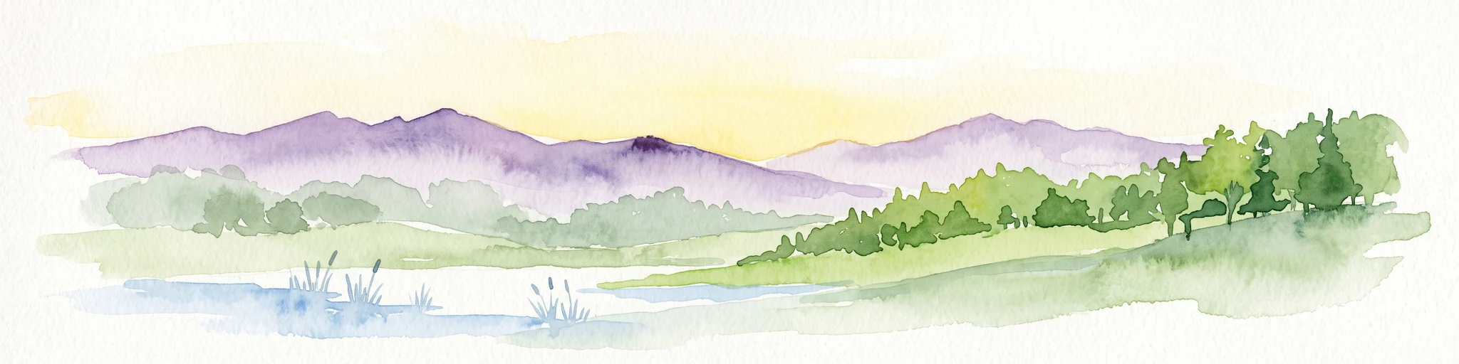
A watercolor painting showing a rolling landscape with purple hills, green vegetation, and light yellow fields.
Protected landscapeBaden-Württemberg
About 31 km away#17 closest

North

Obere Lußhardt Protected Landscape: Geography and Regional Woodland Mapping

A study of forest biotopes and meadow stream corridors

The Obere Lußhardt area stands as a central protected landscape on the Hardt plain, spanning municipalities within the Baden-Württemberg district. Through forest conservation and open grassland corridors like the Gemswiesen, the site provides a distinct look at the transition between Rhine lowland forest and local stream valley ecology.

Area
5.862 km²
Established
1973
IUCN
V
Relief
Lowland
A watercolor painting showing a soft, atmospheric landscape with a foreground of water and green grasses, a midground of trees, and purple mountains in the background under a pale yellow sky.
Nature reserveRhineland-Palatinate
About 31 km away#18 closest

West

Rheinniederung Neuburg-Wörth: A Protected Floodplain Landscape in Rhineland-Palatinate

An analysis of river meanders, oxbows, and floodplain forest geography

This nature reserve encompasses a 14.5 square kilometer corridor of the Upper Rhine, featuring a distinct topography of hardwood forests, wet meadows, and aquatic habitats. The site remains a focal point for understanding Rhine river dynamics and the conservation of rare floodplain ecosystems like the Wörther Altrhein.

Area
14.48 km²
Established
2004
Relief
Lowland
Climate
Temperate
Protected areaBaden-Württemberg
About 31 km away#19 closest

Southeast

Penal Substitution: Protected Area Mapping and Regional Geography in Baden-Württemberg

Cultural landscape and habitat mosaic overview

Penal Substitution represents a preserved cultural landscape in the German state of Baden-Württemberg, featuring a structured mix of orchard meadows, farmland, and riparian habitats. This area serves as a critical regional green link, where mapped boundaries reveal a complex interplay of agricultural history and active environmental conservation just outside the urban core.

Area
2.586 km²
Established
2004
Relief
Upland
Climate
Temperate
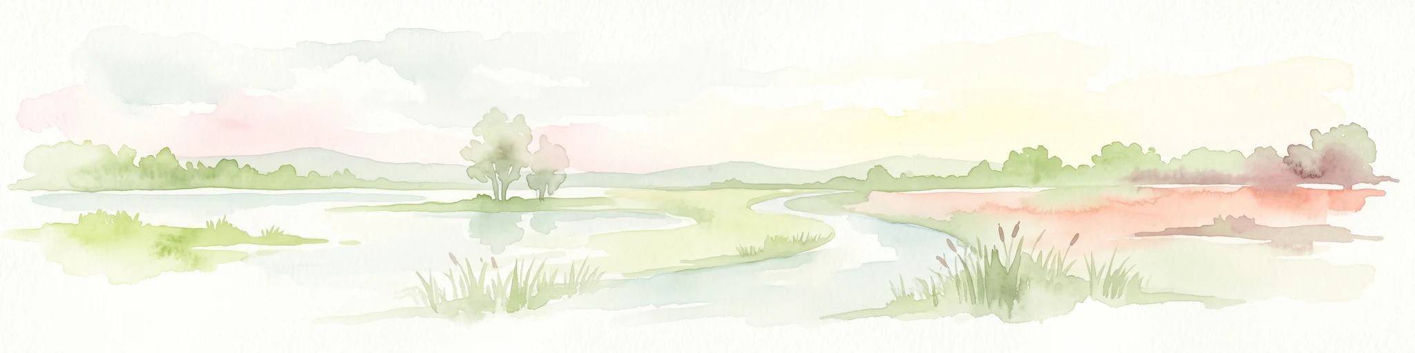
A soft, light watercolor painting of a wetland scene with a winding river branch, reeds, and low-lying greenery under a hazy sky.
Nature reserveRheinland-Pfalz
About 32 km away#20 closest

Northwest

Neupotzer Altrhein Nature Reserve: A Detailed Map and Geographic Overview

Protected floodplain landscape in the Rheinland-Pfalz region.

The Neupotzer Altrhein reserve stands as a prominent example of Rhine floodplain recovery, featuring a diverse topography of slow-moving water channels, marshes, and softwood alluvial forests. Located in the Rheinland-Pfalz district of Germersheim, this protected area offers significant insight into the historical and natural shifts of the Rhine corridor, serving as a key refuge within the European Natura 2000 network.

Area
2.375 km²
Established
2000
IUCN
IV
Relief
Lowland
Distance methodology

Geographic measurements, not driving distances

How nearby park distances are calculated

Distances use park boundaries whenever the available geometry allows it. When one or both boundaries are missing, the mapped park locations provide a clearly labelled estimate. Every value represents straight-line geographic separation and does not use roads or routing.

Boundary distance

Calculated between the nearest points of both park boundaries.

Location-to-boundary estimate

Estimated from one mapped park location to the nearest boundary of the other park.

Mapped-location estimate

Estimated between the mapped locations of both parks.

MoriAtlas Explorer

Explore the Landscape Profile of Gengenbachtal und Dolinenlandschaft südlich Göbrichen

Navigate the valley and karst terrain of this Baden-Württemberg protected landscape through our structured atlas mapping. Examine the physical boundaries of the Gengenbach valley and the sinkhole-heavy meadow basin to understand their role in the wider regional ecology of the Enzkreis.