Mori Atlas logo
National parkGhin-Doo-Ee National Park

Discover the mapped landscape and geographic boundaries of Ghin-Doo-Ee National Park.

Ghin-Doo-Ee National Park: New South Wales National Park Protected Area Atlas

Ghin-Doo-Ee National Park stands as a significant protected area within New South Wales, offering a unique lens for exploring Australia's natural geography. As a designated National Park, its mapped boundaries define a distinct landscape ready for atlas-style discovery. Understanding Ghin-Doo-Ee National Park involves examining its place within the regional geography of New South Wales, providing critical context for its protected land identity and natural terrain.

New South Wales national parksCoastal forestsProtected areas NSWWorimi heritageAustralian wildlife habitatsMid North Coast NSW

Ghin-Doo-Ee National Park

National park

Park overview

Structured park overview, official facts, and landscape profile for Ghin-Doo-Ee National Park

Ghin-Doo-Ee National Park park facts, protected area profile, and essential visitor context

Review the core facts for Ghin-Doo-Ee National Park, including designation, size, terrain, visitor scale, habitats, and operating context in one park-focused overview.

About Ghin-Doo-Ee National Park

Ghin-Doo-Ee National Park is located in the Great Lakes region of New South Wales, approximately 200 kilometers by road northeast of Sydney. The park occupies a coastal forest landscape characterized by gently rolling terrain, with the average elevation of the park at approximately 250 meters above sea level. The protected area connects to a broader network of conservation lands in the region and provides habitat for a range of native species typical of coastal New South Wales forests. The park was formally declared as a national park in 1999, adding to New South Wales's system of protected areas. Its establishment reflected ongoing efforts to preserve representative samples of the state's native vegetation communities and the biodiversity they support. The National Parks and Wildlife Service manages the park as part of its portfolio of protected areas in coastal New South Wales.

Quick facts and research context for Ghin-Doo-Ee National Park

Ghin-Doo-Ee National Park covers 47.94 square kilometers (approximately 18.5 square miles) in the Mid North Coast region of New South Wales. The park was officially established on 23 January 1999 and is administered by the National Parks and Wildlife Service NSW. It is classified as an IUCN Category II protected area, the designation for national parks. The nearest township is Bulahdelah, which serves as a local access point. The park sits at an average elevation of 250 meters within a landscape of coastal forest and woodland.

Protection and recognition

Verifying terrestrial management scope and historical conservation establishment dates

Official Protection Status and Geographic Designation of Ghin-Doo-Ee National Park

Establishment records for Ghin-Doo-Ee National Park detail the terrestrial protection status and conservation history initiated in 1999. Tracking regional governance frameworks and documented boundary scopes helps researchers analyze the geographic context of terrestrial landscapes.

Protection details

Protection scope
Terrestrial
Designated year
1999
Transboundary protection
No
Park context

Deeper park guide and search-rich context for Ghin-Doo-Ee National Park

Ghin-Doo-Ee National Park history, landscape, wildlife, and travel context

Explore Ghin-Doo-Ee National Park through its history, landscape character, ecosystems, wildlife, conservation priorities, cultural context, and seasonal travel timing in a structured park guide built for atlas discovery and search intent.

Why Ghin-Doo-Ee National Park stands out

Ghin-Doo-Ee National Park is best known for its namesake connection to the Australian brushturkey, a large ground-dwelling bird that inhabits the forested environments of eastern Australia. The park preserves coastal forest ecosystems in the Great Lakes area of New South Wales, providing protected habitat within a region that has seen significant land use change. Its location in the transition zone between the Sydney basin and the Hunter region offers access to a landscape of mixed sclerophyll forest typical of the NSW coast.

Ghin-Doo-Ee National Park history and protected-area timeline

Ghin-Doo-Ee National Park was established on 23 January 1999 through formal proclamation under the National Parks and Wildlife Act. The park's declaration represented the culmination of a process to protect coastal forest lands in the Bulahdelah area of New South Wales. The selection of the park's name reflects the cultural heritage of the Worimi people, whose traditional language area includes the Gadjang (or Gadhang) dialect. The name translates directly to the Australian brushturkey, a species commonly encountered in the forested environments of eastern Australia. This naming convention follows the practice of using Indigenous language names for protected areas in New South Wales, honoring the cultural significance of the landscape and its traditional owners.

Ghin-Doo-Ee National Park landscape and geographic character

The terrain within Ghin-Doo-Ee National Park consists of gently undulating hills characteristic of the coastal lowlands in the Mid North Coast region of New South Wales. The average elevation of approximately 250 meters places the park within the coastal plain and lower foothills zone. The landscape supports forests dominated by sclerophyll vegetation, with mixtures of open forest and woodland communities. The underlying geology and soils support plant communities adapted to the moist coastal environment of the region.

Ghin-Doo-Ee National Park ecosystems, habitats, and plant life

The park protects examples of coastal forest ecosystems typical of the Great Lakes region in northern New South Wales. The vegetation communities present include sclerophyll forest types adapted to the temperate coastal climate. These forests provide structural diversity and habitat resources for a variety of native species. The moist coastal environment supports plant growth throughout most of the year, with the forest composition reflecting the influence of both continental and maritime climatic factors.

Ghin-Doo-Ee National Park wildlife and species highlights

The Australian brushturkey, for which the park is named, inhabits the forested landscapes of the region and is likely present within the park boundaries. This large ground-dwelling bird is a characteristic species of eastern Australian forests and woodland, known for its distinctive behavior of building large mound nests from leaf litter. The forest environments within the park provide suitable habitat for a range of other native birds, mammals, and reptiles typical of coastal New South Wales.

Ghin-Doo-Ee National Park conservation status and protection priorities

Ghin-Doo-Ee National Park contributes to the conservation network in the Mid North Coast of New South Wales, protecting examples of coastal forest ecosystems that have been modified by rural and residential development in the surrounding landscape. As an IUCN Category II protected area, the park is managed primarily for ecosystem conservation and national-level protection of natural values. The establishment of the park in 1999 added to the state's protected area coverage and supports biodiversity conservation objectives in the Great Lakes region.

Ghin-Doo-Ee National Park cultural meaning and human context

The park's name originates from the Gadjang language, which is part of the broader Worimi language family of the Aboriginal people of the lower Hunter and Mid North Coast regions of New South Wales. The Worimi people are the traditional custodians of the land on which the park sits, and the use of their language for the park's name acknowledges this heritage. The word for the Australian brushturkey was selected as the park's name, reflecting both the presence of this species in the area and the practice of using Indigenous language to name protected places.

Top sights and standout views in Ghin-Doo-Ee National Park

Ghin-Doo-Ee National Park offers coastal forest exploration in the Great Lakes area of New South Wales, with protected bushland approximately 200 kilometers northeast of Sydney. The park provides access to natural environments in a region where development pressure has altered much of the original vegetation. Visitors can experience native forest ecosystems while supporting conservation of the area's biodiversity. The park's Indigenous heritage is reflected in its Worimi-derived name, connecting the protected landscape to the cultural history of the region.

Best time to visit Ghin-Doo-Ee National Park

The park can be visited throughout the year, with autumn and spring typically offering mild temperatures and comfortable conditions for forest walking. The coastal location means the area experiences a temperate climate with adequate rainfall throughout the year to maintain forest environments. Summer months can be warm and may bring higher visitor numbers, while winter generally sees cooler but still mild conditions suitable for day visits.
Monthly climate preview

Long-term representative temperature and precipitation patterns across the year

Ghin-Doo-Ee National Park Climate Normals and Annual Weather Rhythm

Historical averages for Ghin-Doo-Ee National Park record mean monthly temperatures from 11.75 degrees Celsius to 24.01 degrees Celsius alongside varying precipitation levels. Detailed monthly breakdowns provide complete baseline data for tracking long-term climatic trends at this protected location.
Annual mean18 °C
12 °C24 °C
Jan24°
Feb23°
Mar21°
Apr18°
May15°
Jun13°
Jul12°
Aug13°
Sep16°
Oct18°
Nov21°
Dec22°
Warmest month
January

24 °C

Coolest month
July

11.8 °C

Wettest month
February

4.4 mm/day

Driest month
August

1.6 mm/day

Park location guide

Geography guide, regional context, and park location map for Ghin-Doo-Ee National Park

Ghin-Doo-Ee National Park park geography, regions, and map view in Australia

Understand where Ghin-Doo-Ee National Park sits in Australia through a broader geographic reading of the surrounding landscape, nearby location context, and its mapped position within the national park landscape.

How Ghin-Doo-Ee National Park fits into Australia

Australia is a constitutional monarchy and federal parliamentary democracy comprising six states and ten territories. With a population of nearly 28 million, it is one of the world's most urbanised countries, with most people concentrated on the eastern seaboard. The country has a high Human Development Index and is known for its cultural diversity, ancient Aboriginal heritage, and unique wildlife.

Wider geography shaping Ghin-Doo-Ee National Park in Australia

Australia occupies the entire Australian continent, the island of Tasmania, and numerous smaller islands. It is the world's flattest and driest inhabited continent, featuring vast deserts in the interior (the Outback), tropical rainforests along the eastern coast, and a coastline bordering the Indian and Pacific Oceans.

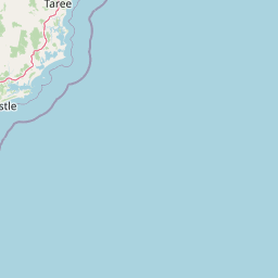
Map view of Ghin-Doo-Ee National Park

Use this park location map to pinpoint Ghin-Doo-Ee National Park in Australia, understand its exact geographic position, and read its mapped placement within the surrounding landscape more clearly.

Pigeon | © OpenStreetMap contributors

Location context for Ghin-Doo-Ee National Park

New South Wales
Recorded earthquake history

Review the Historical Earthquake Catalogue for Ghin-Doo-Ee National Park

Examine the recorded seismic history associated with the coastal landscapes of Ghin-Doo-Ee National Park. MoriAtlas provides a clear, data-focused look at past earthquake activity in the surrounding region through an accessible historical archive.

Ghin-Doo-Ee National Park Earthquake History

Catalogued events

1 event

Strongest magnitude

Magnitude 3.3

Most recent event

Mar 11, 2010

This history includes earthquakes recorded inside the park or within 50 km of its borders

Park atlas

Compare Regional Protected Landscapes and Coastal Forest Geography Near Ghin-Doo-Ee National Park

Discover Nearby Protected Areas: Expanding Beyond Ghin-Doo-Ee National Park in New South Wales

Explore other national parks and protected areas near Ghin-Doo-Ee National Park, tracing the regional spread of coastal forests and sclerophyll habitats in New South Wales. Broaden your understanding of Eastern Australia's conservation efforts by mapping adjacent protected landscapes and comparing their unique geographic features and biodiversity values.
National parkNew South Wales
0 km away#1 closest

Southeast

Myall Lakes National Park National Park: Mapped Boundaries and Protected Landscape Exploration

Discover its regional geography and natural terrain context.

Delve into the specific protected landscape and geographic features of Myall Lakes National Park. As a national park located in New South Wales, it provides critical atlas context for understanding protected areas and their distribution. Explore its mapped terrain and boundaries to gain a deeper appreciation for this significant natural area within Australia's geography.

Area
448 km²
Established
1972
IUCN
II
Relief
Lowland
Nature reserveNew South Wales
About 6.8 km away#2 closest

Northwest

The Glen Nature Reserve: Protected Forest Geography and Mapped Sanctuary in New South Wales

Conservation-focused landscape in the Hunter Region

Covering over 2,700 hectares, The Glen Nature Reserve protects a rich mosaic of sub-tropical sclerophyll forest and creek-lined gullies in the Hunter Region. The reserve provides essential habitat for threatened wildlife and represents a key node in the protected land network of eastern New South Wales, highlighting the intersection of forest types and local watershed topography.

Area
27.5 km²
Established
1999
IUCN
Ia
Relief
Upland
National parkNew South Wales
21 km away#3 closest

East

Wallingat National Park: Explore Protected Landscape and Regional Geography in New South Wales

Discover mapped park boundaries and terrain context.

Wallingat National Park in New South Wales is a protected landscape crucial for understanding Australia's natural geography. This canonical page detail provides essential information for atlas exploration, focusing on the park's protected status, mapped contours, and its place within the regional context. Discover the unique geographic features that distinguish this national park from others in the atlas.

Area
65.57 km²
Established
1999
IUCN
II
Relief
Lowland
Nature reserveNew South Wales
23 km away#4 closest

West

Black Bulga State Conservation Area: Forest Geography and Protected Area Overview

A vital ecological refuge in the Hunter Region of New South Wales

Black Bulga State Conservation Area encompasses a diverse bushland mosaic of Sydney blue gum, tallowwood, and subtropical rainforest patches. This reserve highlights the abrupt shifts in terrain and vegetation typical of the Barrington Tops foothills, providing a stable habitat for koalas and various marsupials within its protected boundaries.

Area
15.54 km²
Established
2003
IUCN
Ia
Relief
Upland
National parkNew South Wales
30 km away#5 closest

East

Booti Booti National Park: New South Wales National Park Protected Landscape Atlas

Mapped boundaries and regional geography for this Australian national park.

Delve into the specifics of Booti Booti National Park, a designated national park within New South Wales, Australia. This resource facilitates a detailed understanding of its protected area status, landscape characteristics, and precise geographic placement. Explore its mapped features and regional context to enrich your atlas-based discovery of Australia's protected lands.

Area
15.67 km²
Established
1992
IUCN
II
Relief
Highland
Nature reserveNew South Wales
About 31 km away#6 closest

East

Wallis Island Nature Reserve: Estuarine Protected Landscapes of the New South Wales Coast

Coastal heath, lagoon systems, and wetland habitat geography

Spanning over 580 hectares, Wallis Island Nature Reserve anchors the protective network around Wallis Lake. The site is defined by its characteristic wet heathland and swamp terrain, offering a clear geographic look at Australia's estuarine island environments and the layered history of coastal land management.

Area
5.84 km²
Established
1983
Relief
Lowland
Scope
Terrestrial
Watercolor illustration of a river flowing through hills with distant mountains and pink trees
National parkNew South Wales
32 km away#7 closest

West

Barrington Tops National Park: A Protected National Park in New South Wales

Explore ancient Gondwana rainforests and dramatic volcanic terrain.

Barrington Tops National Park represents a significant protected landscape in New South Wales, Australia, offering a deep dive into diverse ecosystems. Its unique altitudinal vegetation gradient supports the southernmost subtropical rainforests in Australia and showcases geological formations dating back millions of years. This park is crucial for understanding Australia's natural heritage, providing a rich context for landscape exploration and the study of ancient flora within a mapped geographic setting.

Area
765.12 km²
Established
1969
IUCN
Ib
Relief
Mountain
State or regional parkNew South Wales
33 km away#8 closest

Northwest

Copeland Tops State Conservation Area: Geography and Protected Land Overview in New South Wales

Mapping forest ecosystems and historic industrial relic landscapes.

Copeland Tops State Conservation Area provides a distinct look at the Hunter Region landscape, offering an unusual blend of dry rainforests with massive Moreton Bay figs and red cedar alongside expansive wet sclerophyll forests. The reserve functions as an essential habitat for koalas, wombats, and greater gliders, while the Mountain Maid gold mine remnants offer insight into the local nineteenth century history hidden within these sheltered valleys.

Area
22.01 km²
Established
2003
Relief
Upland
Scope
Terrestrial

Common questions about visiting, size, designation, and location context for Ghin-Doo-Ee National Park

Ghin-Doo-Ee National Park FAQs for park facts, access, geography, and protected area context

Find quick answers about Ghin-Doo-Ee National Park, including protected-area facts, park geography, trail and visitor context, and how the park fits into its surrounding country and regional landscape.
MoriAtlas Explorer

Continue Your Protected Areas Search Across the Global Atlas

Deepen your exploration by continuing the structured search for national parks and protected areas worldwide. Utilize the comprehensive filtering capabilities to compare different conservation landscapes and refine your understanding of global park geography. Discover more about the distribution and characteristics of protected natural areas.

Global natural geography