
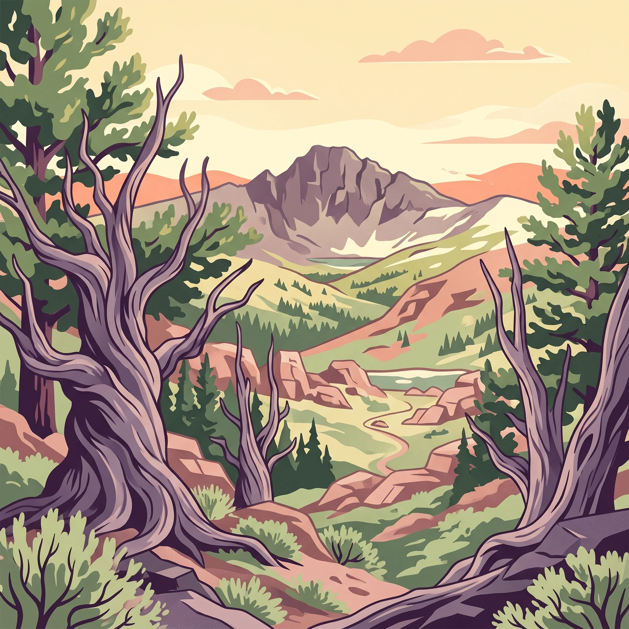
Trip Timing
When is the Best Time to Visit Great Basin National Park?
For most travelers, the best time to visit Great Basin National Park is during the window of early summer through early autumn, typically spanning June to September. This period provides the most consistent access to the park's higher elevations, where the combination of thinning snowpack and milder daytime temperatures allows for safer exploration of trailheads and alpine environments. During these months, the primary park roads remain clear of seasonal snow, ensuring that visitors can reach the subalpine forests and glacial terrain that define the upper reaches of the landscape.
Balancing Accessibility and High-Elevation Conditions
While summer months offer the highest degree of physical accessibility, the park’s immense vertical relief creates significant temperature gradients that influence when a visit is most practical. Great Basin National Park features a dramatic elevation range, stretching from the sagebrush-dominated desert valleys to the rugged crest of Wheeler Peak. Because of this, even when valley temperatures are warm, alpine areas can remain cold or covered in lingering snow well into June. Visitors planning trips early in the season must account for the reality that access to certain high-altitude trails may be restricted by remaining winter debris or late-season snowstorms, which can occur regardless of the calendar date.
The Impact of Elevation and Climate on Travel Planning
Travelers should consider the park's identity as a high-elevation desert when determining their preferred time for arrival. The thin, dry air contributes to sharp temperature fluctuations between day and night. While summer days are generally pleasant, nighttime temperatures at higher elevations often drop significantly, requiring careful preparation for varied conditions. By mid-autumn, the return of colder temperatures and the increased likelihood of early winter weather patterns begin to limit high-elevation access, effectively closing the most accessible window for summit-bound hikers and those looking to explore the bristlecone pine groves.
Trade-offs for Shoulder Season Visits
Choosing to visit outside of the primary summer window presents a distinct trade-off. Shoulder seasons, particularly during the transition months of late spring and early autumn, offer quieter experiences for those willing to endure more variable, and sometimes harsh, weather. While these periods avoid the peak visitor volumes found in mid-summer, they demand a higher level of flexibility. Travelers who prioritize solitude or specific photographic conditions should recognize that access to scenic drives and remote trailheads becomes less predictable as the year progresses toward winter. Ultimately, the timing of a trip to this park hinges on whether a visitor prioritizes the warmth and reach of mid-summer or the quieter, more challenging conditions found during the seasonal transitions.
Seasonal Planning
Best Months to Visit Great Basin National Park for Every Traveler
Peak Access for High Elevation Hiking and Exploration
For most travelers, the period from July through early September serves as the most reliable window for accessing the full breadth of the park. During these months, the high-elevation trailheads, including those leading to the bristlecone pine groves and the Wheeler Peak summit, are typically free of the winter snowpack that can persist well into June. This is the time when the climate provides the most consistent daytime warmth, with mean temperatures at mid-elevation exceeding 20 degrees Celsius. Visitors prioritizing alpine hikes and the complete experience of the scenic drive will find this window the most practical, though they must prepare for the trade-off of potentially intense afternoon thunderstorms and the park's highest density of fellow travelers.
The Value of the Shoulder Seasons
Late June and September represent the most effective compromise for those looking to avoid the height of summer heat while still maintaining access to primary attractions. Late June often captures the tail end of the spring bloom at lower elevations, even as some high-country trails remain dampened by retreating snow. Conversely, September provides a cooling trend that brings comfortable daytime conditions without the extreme temperature drops of late autumn. These months are often favored by travelers who value cooler air for strenuous activity and prefer a more subdued environment, provided they accept the inherent variability of the weather, which can transition rapidly from bright sunshine to cold, snowy conditions as elevation increases.
Navigating Cold-Weather and Off-Peak Periods
From November through April, the park shifts into a period of extreme cold and limited access at higher elevations. This time is best suited for visitors specifically seeking winter solitude or those with specialized equipment and experience in navigating cold, snowy environments. While the lower-elevation areas near the park entrance may remain accessible, the vast majority of the landscape is dominated by freezing temperatures, with mean values often dropping below 0 degrees Celsius. Travelers choosing to visit during these months trade accessibility and convenience for a quiet, starkly beautiful landscape. Anyone considering a visit during this time must rely on current local reports rather than seasonal averages, as winter weather patterns are highly unpredictable and service-related closures are common. Regardless of the month, the massive elevation gap between the valley floor and the peaks creates a micro-climate effect where travelers should always be prepared for conditions significantly harsher than what they experience in the town of Baker.
Annual Climate Analysis
Understanding Great Basin National Park Weather and Climate by Month
The Annual Climate Cycle and High Elevation Dynamics
Great Basin National Park experiences a climate defined primarily by its extreme vertical relief. With nearly 8,000 feet of elevation difference between the lowest reaches and the summit of Wheeler Peak, monthly climate normals recorded at a mid-elevation sample point offer a reliable baseline for general trends, yet they mask the localized extremes travelers encounter. The annual pattern is characterized by cold, snowy winters and mild, dry summers, with transitions that fluctuate significantly depending on the specific altitude of your intended destination.
Seasonal Temperature Transitions
Temperature patterns follow a distinct V-shaped curve throughout the year. Winter months from December through February are defined by mean temperatures dropping below freezing, frequently dipping into the negative double digits during overnight lows. As spring progresses, the shift is rapid, particularly between May and June. During May, mean temperatures hover near 11 degrees Celsius, but this marks a transitional phase where the park often experiences its most volatile weather. By July, the mean temperature peaks at over 22 degrees Celsius, creating the most accessible window for high-alpine exploration. Because of the thin atmosphere at these altitudes, the intensity of solar radiation is a constant factor throughout the year. Daytime highs can feel significantly warmer than the ambient air temperature would suggest, while evening temperatures consistently plummet regardless of the season, often requiring visitors to layer clothing even during the height of summer.
Patterns of Precipitation and Humidity
Low annual precipitation is a defining characteristic of the Great Basin region, though moisture patterns change in their impact throughout the year. Winter and early spring months, particularly February, see the most consistent precipitation in the form of snow, which creates the deep, persistent snowpack that typically blocks high-elevation roads and trails until late June. As summer arrives, precipitation levels reach their lowest monthly totals, creating the arid, low-humidity conditions typical of a high-elevation desert. However, this dryness should not be mistaken for total stability. Fierce afternoon thunderstorms are a documented phenomenon during the summer months, often arriving quickly and bringing localized lightning, which represents a critical safety concern for hikers on exposed ridges or summits. Humidity is lowest in July and August, often dropping below 33 percent, which enhances the perception of dryness and increases the importance of hydration.
Daylight and Wind as Influencing Factors
Daylight duration follows the expected northern hemispheric curve, peaking in June at nearly 15 hours. This abundance of light provides an extended window for exploration but also prolongs exposure to the sun. Wind speeds, while generally moderate, show a slight increase during the spring months of March and April, which can exacerbate the cooling effect of remaining snow or cold temperatures. It is vital for visitors to interpret these climate normals as long-term historical averages rather than daily forecasts. Localized weather within the park is notoriously fickle and can deviate sharply from regional averages. Whether you are planning for a summer excursion or a shoulder-season visit, always verify current conditions, as these long-term statistics cannot account for anomalous storm systems or late-season snow events that occur even in months with statistically mild averages.
Seasonal dynamics
Understanding Annual Weather Patterns and Seasonal Shifts at Great Basin National Park
Great Basin National Park does not adhere to a standard four-season calendar due to its extreme elevation gradient, which spans from the arid valley floor to the alpine tundra near Wheeler Peak. Instead, the park's annual rhythm is best understood through two primary phases: the high-elevation snow-affected season and the summer dry season. These periods are separated by distinct transition windows where valley-level comfort often masks high-altitude hazards.
The Prolonged Winter and Spring Thaw
From November through May, the park is largely defined by cold temperatures and persistent snowpack at elevations above 8,000 feet. While the valley floor near Baker may experience moderate daytime highs, the higher reaches of the park remain firmly in winter conditions. This period is characterized by the accumulation of snow that does not fully vacate the highest trailheads until well into June. Visitors during this time should expect the Wheeler Peak Scenic Drive to be closed beyond the lower sections, effectively cutting off access to the subalpine groves and alpine hiking areas. The transition from winter to spring is gradual and unpredictable, marked by freeze-thaw cycles that can make lower-elevation trails muddy while the peaks remain inaccessible to all but those equipped for technical winter travel.
The High-Elevation Summer Season
By late June, the park enters its most accessible phase, which typically persists through September. This period is defined by the melting of the final high-altitude snowbanks and the opening of the full length of the Wheeler Peak Scenic Drive. Temperatures during these months show a clear separation between the hot, arid valley floors and the temperate, subalpine climate found at higher elevations. While daytime temperatures in July and August can reach daily maximums exceeding 30 degrees Celsius in the lower reaches, the alpine regions remain significantly cooler, providing a vital retreat from the surrounding desert heat. This window is not, however, a guarantee of constant sunshine. High-elevation summer is frequently interrupted by rapid-onset afternoon thunderstorms, a standard feature of the region's climate that requires visitors to manage their time and exposure carefully.
Transition Windows and Seasonal Instability
October represents a critical transition month, as the park moves rapidly from the dry summer pattern to the early onset of winter. The sharp drop in mean temperatures between September and October is a defining feature of the local climate, often accompanied by the first significant snowfalls that signal the end of the high-country hiking season. Conversely, May serves as the spring equivalent, where the potential for lingering snow is high even as the days grow longer and warmer. Because these transitional months do not align with predictable seasonal changes, the park requires visitors to remain flexible. Conditions at the base of the mountains can be misleading, and individuals must monitor local reports, as weather at 2,000 meters can change from mild to severe within a few hours, irrespective of the calendar month.
Seasonal Experiences
What Visiting Great Basin National Park Is Like Throughout the Year
Accessing the High-Elevation Alpine Landscape
The park experience is defined by a vertical transition that dictates what travelers can actually reach. During the peak of summer, typically from July into early September, the Wheeler Peak Scenic Drive opens fully to vehicles, providing the primary access point for subalpine and alpine ecosystems. This is the only period when travelers can reliably reach trailheads for high-altitude landmarks like the ancient bristlecone pine groves or the lakes beneath Wheeler Peak without contending with seasonal snow closure. If your goal is to walk among these ancient trees, timing your visit to the mid-summer or early-autumn window is essential, as higher trails remain inaccessible under deep snowpack during the cooler, wetter months of the year.
Subterranean Experiences in Lehman Caves
Unlike the high-altitude trails, the Lehman Caves offer a subterranean environment that remains stable and protected from the surface extremes of the Great Basin climate. Tours of this limestone system provide a consistent experience throughout the year. Because the temperature inside the cave does not fluctuate with the monthly shifts seen at the surface, these tours serve as an excellent primary activity during periods when surface weather is unfavorable, such as the shoulder seasons of May or October, or during the coldest months of winter. Reservations are always required, and because this remains one of the most popular experiences in the park, the timing of your visit should be centered on booking capacity rather than seasonal weather patterns.
Stargazing and Dark Sky Conditions
Great Basin is recognized for its status as an International Dark Sky Park, an experience that relies heavily on clear, cloud-free nights. While stargazing is technically possible throughout the year, the summer and early autumn months offer the most reliable weather conditions for extended viewing sessions. The late September period is particularly notable for its dedicated astronomy festivals, which capitalize on the drier air and longer nights that start to develop as the summer heat dissipates. Travelers visiting in mid-winter will encounter the darkest and longest nights, but they must be prepared for extreme sub-zero temperatures at higher elevations. Those prioritizing the night sky experience should balance the appeal of winter darkness against the harsh cold, or choose the milder nights of late summer for a more comfortable, if slightly shorter, viewing window.
Visitor Priorities
Choosing the Best Time to Visit Great Basin National Park by Interest
Balancing Alpine Hiking Objectives and Weather Risks
For travelers prioritizing high-altitude hiking, such as reaching the bristlecone pine groves or attempting summit trails near Wheeler Peak, the most suitable window is generally mid-July through early September. During this period, the winter snowpack is typically at its lowest, and the risk of persistent ice on high-elevation trails is minimized. The trade-off for this access is the necessity of early-morning starts to avoid afternoon thunderstorms, which are a common feature of the summer climate at these altitudes. Because these high-elevation regions lack significant shelter, hikers must accept the reality that mountain weather can shift abruptly, even during the peak of summer, turning a pleasant hike into a cold or wind-exposed experience. Travelers should monitor local conditions frequently, as late-melting snow can delay the opening of high-elevation trailheads well into July in years with heavy winter precipitation.
Prioritizing Milder Temperatures and Low Humidity
Visitors who find mid-summer daytime highs of 34C too warm for strenuous activity may prefer the shoulder months of June or September. During these times, the daytime maximum temperatures remain significantly lower than the July and August peaks, while still providing enough daylight for outdoor exploration. June often features longer daylight hours compared to September, which can be advantageous for those who prefer leisurely exploration without rushing before dusk. However, the compromise in early June is the higher likelihood of encountering residual snow at elevations above 3,000 meters, which may limit access to certain trails. Conversely, September offers more stable, dry conditions but with noticeably shorter daylight, requiring a more disciplined approach to planning the duration of day-long hikes.
Optimizing for Dark Sky Stargazing
While the park is an excellent destination for stargazing throughout the year due to its elevation and isolation, the best conditions occur when atmospheric clarity aligns with warmer overnight temperatures. Late summer and early autumn represent the primary window for those who wish to stargaze without the extreme cold of the winter months, where nighttime temperatures can drop far below freezing. July through September offers a reliable, warmer experience for night-time activities. A specific consideration for this priority is the moon cycle, which provides a more significant impact on the quality of the night sky than the specific month chosen. For visitors specifically interested in astronomy, timing a visit to coincide with the annual late-September astronomy festival can provide additional educational context, though this also brings higher attendance levels compared to the quieter weeks of late August.
Reliability and Consistency in Lehman Caves
For travelers whose primary interest is visiting the subterranean environment of Lehman Caves, the specific time of year is less relevant than in surface-based activities. The internal cave environment remains consistent, providing a stable experience regardless of the heat, wind, or precipitation occurring on the surface. This makes the cave system an ideal priority for visitors traveling during the transitional shoulder seasons of May or October, when outdoor hiking conditions are unpredictable and subject to high diurnal temperature swings. The compromise for choosing these months specifically for cave visits is that surface-level amenities and scenic drives may be subject to limited access or seasonal closures, requiring visitors to focus their trip strictly on the subterranean tours and local lower-elevation viewpoints.
Access & Logistics
Seasonal Access and Operational Considerations for Great Basin National Park
Planning a trip requires awareness of how the park's isolated location and steep elevation gain create significant logistical variables. While seasonal weather patterns dictate the window for most outdoor activities, specific access to high-elevation roads and trails relies on current conditions that change annually. Travelers should identify which areas remain accessible during their intended window before finalizing any logistics, particularly for those targeting the Wheeler Peak area or backcountry regions.
Accessing the High Country
The Wheeler Peak Scenic Drive acts as the primary artery for reaching the park's subalpine ecosystems, including the ancient bristlecone pine groves and various trailhead access points. This road typically experiences closures due to snow and ice throughout the winter and shoulder seasons, with clearing efforts usually commencing once spring melt is sufficiently advanced. Because the timing of these openings fluctuates based on the severity of the previous winter and spring precipitation, visitors planning a trip for May, June, or October must verify current road status through official channels. Expecting consistent access to these high-altitude zones outside of the core summer period can lead to significant itinerary disruptions.
Visitor Facilities and Operational Logistics
Beyond road access, the park operates key infrastructure that influences planning. The visitor centers, including those in Baker and near Lehman Caves, provide orientation and trip planning support. While some facilities maintain consistent service levels, others may adjust hours or services based on the time of year. Specifically, tours of the limestone caverns are a central component of many visits and often operate on a structured, limited-capacity basis. Prospective visitors should confirm operating hours and booking protocols for any guided tours well in advance of their arrival, as these are managed by park staff and subject to change based on staffing or maintenance requirements.
Travel Planning and Regional Context
The remoteness of the park, situated in a sparse region of eastern Nevada near the Utah border, means that fuel, supplies, and lodging are limited in the immediate vicinity of the park entrance. Travelers should plan for self-sufficiency, particularly when arriving during the early or late shoulder seasons when local services in the town of Baker may operate on reduced schedules. Ensuring vehicle readiness for mountainous terrain is essential for navigating the ascent to the park, regardless of the time of year. Always check the official park website for the latest alerts regarding closures, permit requirements for specific backcountry activities, or temporary restrictions on park services before beginning your journey.
Safety and Preparation
Seasonal Weather Hazards and Preparedness in Great Basin National Park
Navigating High Elevation Exposure
The most critical aspect of physical preparation in this park is accounting for the extreme elevation range, which dictates both ambient temperature and oxygen levels. Because major features like the bristlecone pine groves and mountain peaks sit at high altitudes, visitors often experience significantly colder temperatures than those recorded at lower, more populated valley elevations. Even during the peak summer months of July and August, when daytime highs can be warm, the thin atmosphere provides little protection against solar radiation and allows temperatures to drop rapidly after sunset. Dressing in layers is essential throughout the year to manage these sharp diurnal swings. Regardless of your planned activity, carry additional clothing that can address sudden changes in wind chill and cooling temperatures as you gain altitude.
Preparing for Seasonal Weather Shifts
The transition between seasons in the park is marked by instability, particularly during the shoulder months of May and October. While long-term climate normals suggest a warming trend in late spring and a cooling trend in mid-autumn, these periods frequently see rapid shifts in mountain weather. Visitors should anticipate that conditions at the peaks may remain winter-like long after valley temperatures suggest otherwise. Packing for the park requires a flexible approach. Instead of relying on a static seasonal wardrobe, monitor official sources for current trail conditions and weather alerts. The high-altitude areas are prone to lightning and sudden storms during the monsoon-like patterns of mid-summer, making it necessary to remain weather-aware throughout any outdoor excursion.
Hydration and Environmental Considerations
Low relative humidity and high elevation create a dehydrating environment year-round, even when temperatures are moderate. The arid nature of the Basin and Range province, combined with the dry mountain air, often causes moisture to evaporate quickly from the skin. Visitors should plan for consistent fluid intake regardless of the season. Because the park features expansive, exposed areas with minimal natural shade, proactive sun protection is a standard requirement for all visitors exploring the high-country trails during the long daylight hours of June and July.
Assessing Conditions Before Travel
Because this is a mountainous environment, long-term climate averages are intended for broad planning rather than daily itinerary prediction. Seasonal hazards, such as water flow levels in canyon washes or the presence of snow and ice on high-elevation trails, depend entirely on the specific year's precipitation totals and temperature patterns. Before finalizing your packing list or travel dates, check the official park website for current conditions, road status, and active alerts. Relying on current operational updates is the only way to accurately prepare for the specific terrain and weather challenges you may face during your visit.
Final Decision Framework
Choosing Your Best Time to Visit Great Basin National Park
Determining the right time for your visit requires balancing the physical realities of high-altitude mountain environments against your personal priorities for solitude or accessibility. Because Great Basin National Park is defined by extreme elevation, your decision rests on whether you intend to explore the alpine terrain near the summit of Wheeler Peak or prefer the sheltered, year-round accessibility of the lower-elevation caves and sagebrush valleys. If your goal is to traverse high-altitude trails to see bristlecone pines or reach the mountain peaks, the window of stability is relatively narrow. Focusing your travel between mid-July and early September maximizes the likelihood that snow-free conditions will allow full access to high-elevation trailheads. During this peak summer period, you accept the trade-off of more frequent interactions with other visitors and the potential for late-afternoon monsoon thunderstorms which are typical of this region. Conversely, if your primary interest lies in photography, stargazing, or visiting the lower desert regions and cave systems, you may find greater value in the shoulder months of late June or September. These periods often provide a moderate compromise, offering cooler daytime temperatures and the chance to experience the park without the peak-season rush, though you must remain flexible as the higher trails can remain snow-covered well into early summer or see early closures in the fall. For those whose travel timing is fixed during the winter months, your experience will shift significantly toward low-elevation exploration and winter sports, requiring careful preparation for cold temperatures and limited access to the scenic mountain roads. Regardless of which season you choose, remember that the climate normals provided throughout this guide describe long-term patterns rather than specific weather forecasts. Mountain environments are notoriously dynamic, and current conditions can diverge sharply from historical averages. Always verify the status of roads, trail conditions, and facility operating hours through official park resources before you finalize your departure plans. By weighing these environmental constraints against your specific interests, you can build a visit that balances your tolerance for weather and crowds with the specific experiences you hope to enjoy in this diverse Basin and Range ecosystem.