Mori Atlas logo
Marine protected areaGreater Farallones National Marine Sanctuary

A comprehensive look at the oceanic terrain, coastal habitats, and protected marine environment off the California coast.

Greater Farallones National Marine Sanctuary: Mapped Boundaries and Protected Marine Geography

Greater Farallones National Marine Sanctuary spans over three thousand square miles of protected waters, tidal flats, and rocky intertidal zones along the central California coast. This expansive marine protected area encompasses essential habitats ranging from estuarine wetlands and kelp forests to the rugged Farallon Islands and the continental shelf. Its location within the highly productive California Current system defines a unique regional geography of nutrient rich waters and diverse marine ecosystems.

marine sanctuaryPacific coastCaliforniamarine wildlifeupwelling ecosystemseabirds

Greater Farallones National Marine Sanctuary

Marine protected area

Park overview

Structured park overview, official facts, and landscape profile for Greater Farallones National Marine Sanctuary

Greater Farallones National Marine Sanctuary park facts, protected area profile, and essential visitor context

Review the core facts for Greater Farallones National Marine Sanctuary, including designation, size, terrain, visitor scale, habitats, and operating context in one park-focused overview.

About Greater Farallones National Marine Sanctuary

Greater Farallones National Marine Sanctuary protects a sweeping corridor of ocean and coastal habitat along the northern and central California shoreline, stretching from north of San Francisco Bay outward toward the edge of the continental shelf. Although the sanctuary is an ocean-focused reserve, its boundaries reach from sandy beaches and estuarine wetlands along the mainland out to deep offshore waters, encompassing a remarkable variety of marine environments within a single managed region.

At the core of the sanctuary's identity is the California Current ecosystem, one of only four major eastern boundary current systems on Earth. Persistent winds along the western coast of North America drive deep, nutrient-rich waters upward toward the sunlit surface, fueling extraordinary phytoplankton blooms and the food chains they support. This cold, productive current is one of the main reasons that the West Coast of the Americas hosts some of the world's most abundant fisheries, vibrant kelp forests, and thriving populations of seabirds and marine mammals.

Greater Farallones is also notable for the breadth of its biological communities. The sanctuary serves as breeding or feeding habitat for a substantial number of protected species, including several species of whales, pinnipeds such as harbor seals and the threatened Steller sea lion, and one of the most significant white shark populations anywhere. Above and below the surface, its rocky reefs and intertidal zones shelter dense invertebrate communities, while its nearshore wetlands serve as nurseries for fish and shellfish. Beyond its ecological role, the sanctuary protects historically significant shipwrecks and other cultural resources, reinforcing its identity as a place where natural and human history intersect along a heavily used coastal corridor.

The sanctuary is closely linked to several other protected areas in the region. It shares a boundary with Monterey Bay National Marine Sanctuary to the south and Cordell Bank National Marine Sanctuary to the northwest, and it forms part of the broader Golden Gate Biosphere Reserve recognized by the United Nations. Together, these designations reflect a long-running recognition that the waters of central and northern California represent an outsized conservation priority for the entire Pacific coast.

Quick facts and research context for Greater Farallones National Marine Sanctuary

Greater Farallones National Marine Sanctuary is a federally designated marine protected area in the Gulf of the Farallones region off the coast of California, managed by NOAA's National Ocean Service. The sanctuary was originally designated as Gulf of the Farallones National Marine Sanctuary in 1981 and was significantly expanded and renamed in 2015. Its waters are part of the California Current ecosystem, a globally recognized eastern boundary current system known for exceptional marine productivity driven by seasonal upwelling. The sanctuary also includes the Farallon Islands and the surrounding National Wildlife Refuge, and contributes to the larger Golden Gate Biosphere Reserve.

Protection and recognition

Examine the documented marine protection scope and official designation records.

Greater Farallones National Marine Sanctuary Protection Status and Recognition

Greater Farallones National Marine Sanctuary maintains a documented marine protection scope within federal conservation boundaries. Official records organize the designated conservation status and management framework for this protected area.

Protection details

Protection scope
Marine
Transboundary protection
No
Park context

Deeper park guide and search-rich context for Greater Farallones National Marine Sanctuary

Greater Farallones National Marine Sanctuary history, landscape, wildlife, and travel context

Explore Greater Farallones National Marine Sanctuary through its history, landscape character, ecosystems, wildlife, conservation priorities, cultural context, and seasonal travel timing in a structured park guide built for atlas discovery and search intent.

Why Greater Farallones National Marine Sanctuary stands out

Greater Farallones is best known for the extraordinary productivity of its waters, which support an unusually dense concentration of marine life along a relatively short stretch of the California coast. The sanctuary is particularly recognized for its populations of great white sharks, blue and humpback whales, Pacific harbor seals, and over a quarter-million breeding seabirds, many of which are tied to the Farallon Islands and nearby coastal roosting and haul-out sites. Its location within the California Current upwelling system makes it one of the most biologically rich offshore environments on the West Coast of the United States.
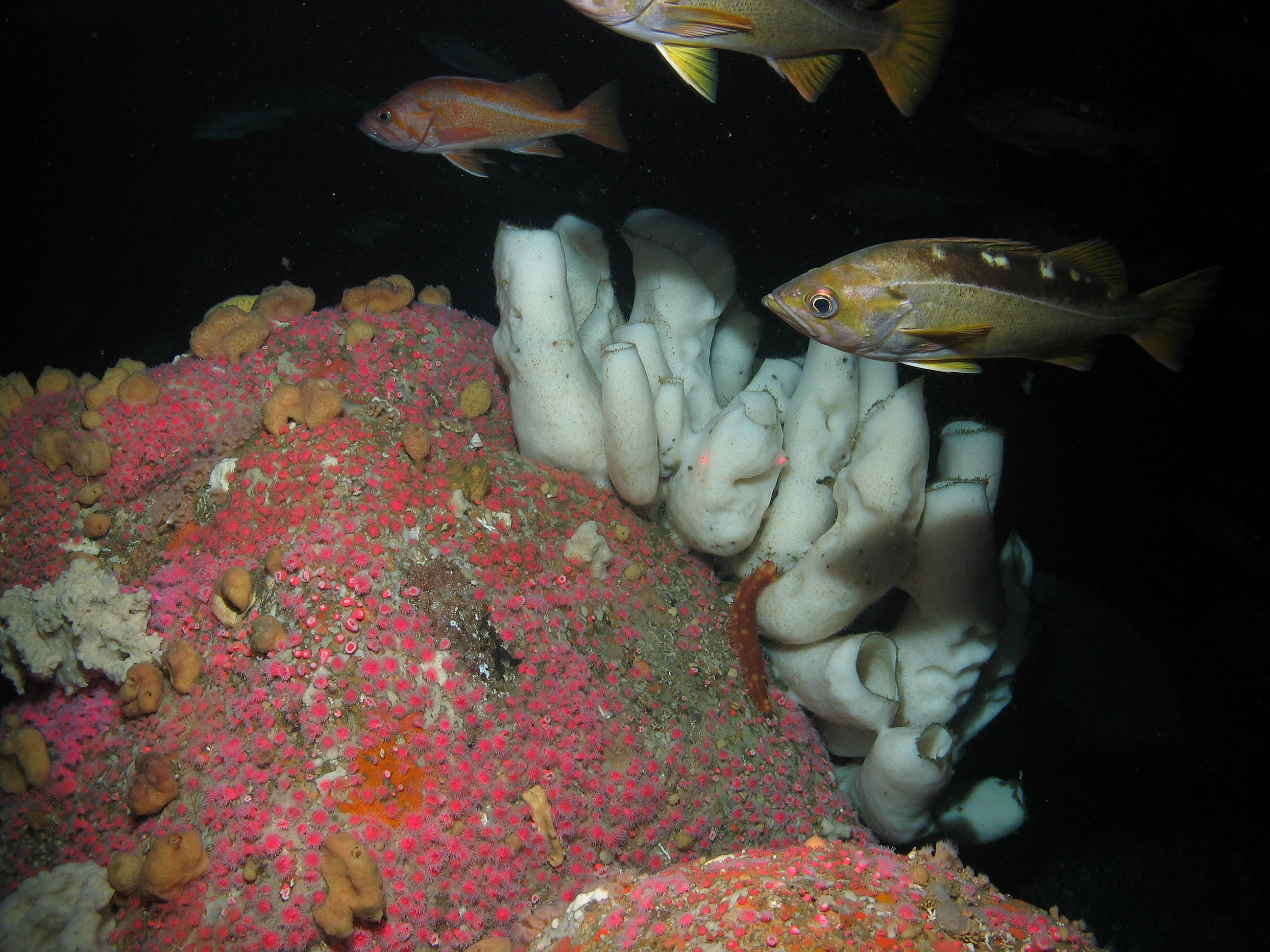
Underwater view showing yellowtail rockfish and large white boot sponges on a colorful seabed.
Yellowtail rockfish swimming over boot sponges at Rittenburg Bank.

Greater Farallones National Marine Sanctuary history and protected-area timeline

Greater Farallones National Marine Sanctuary originated in the early wave of marine conservation legislation that reshaped ocean policy in the United States during the 1970s. In 1972, Congress passed the National Marine Sanctuaries Act, authorizing the federal government to formally designate and protect marine areas of national significance. This law laid the legal foundation for a nationwide system of reserves designed to safeguard habitat, cultural resources, and opportunities for research and recreation.

On January 16, 1981, the area off the northern California coast was officially designated as Gulf of the Farallones National Marine Sanctuary, covering roughly 1,279 square miles of ocean and nearshore habitat north and west of San Francisco Bay. The original sanctuary protected a diverse mix of environments, from open ocean and rocky reefs to tidal flats and estuarine wetlands, and quickly became established as one of the more biologically productive units in the national system.

In 2015, the sanctuary was substantially expanded, growing to its current size of 3,295 square miles, and was renamed Greater Farallones National Marine Sanctuary. The expansion extended protection northward along the coast and outward into deeper offshore waters, integrating more of the California Current ecosystem into the managed area. The sanctuary also took on administrative responsibility for the northern portion of the neighboring Monterey Bay National Marine Sanctuary. Today, the sanctuary maintains an administrative office and public Visitor Center at Crissy Field in the Presidio of San Francisco, helping connect the public to one of the most ecologically significant stretches of ocean on the West Coast.

Greater Farallones National Marine Sanctuary landscape and geographic character

Although Greater Farallones is fundamentally an oceanic sanctuary, its "landscape" is best understood as a layered mosaic of marine environments. Close to shore, the sanctuary includes long stretches of sandy beach, estuarine wetlands where freshwater streams meet the sea, and tidal flats that retreat and advance with the tides. These shallow, sheltered areas contrast sharply with the exposed rocky intertidal zones, where waves, wind, and salt shape dense communities of mussels, algae, and resilient invertebrates.

Moving offshore, the seafloor transitions into subtidal reefs that continue the rocky habitat structure beneath the surface, supporting kelp forests and a rich diversity of fish and invertebrate life. Beyond the reefs, the sanctuary's open ocean habitat reaches across roughly 3,295 square miles, including deeper waters near the edge of the continental shelf. The Farallon Islands, a small, rugged archipelago within the sanctuary, rise dramatically from these surrounding waters, providing breeding and haul-out habitat for seabirds and pinnipeds and helping define the distinctive geography of the region.

Greater Farallones National Marine Sanctuary ecosystems, habitats, and plant life

Greater Farallones encompasses an unusually rich variety of marine and coastal habitats within a relatively compact latitudinal range. Estuarine wetlands along the mainland act as nurseries for fish and invertebrates, while tidal flats and rocky intertidal zones support dense populations of algae, mollusks, crustaceans, and other intertidal life. Subtidal reefs below the waterline extend these habitats into three dimensions, supporting kelp forests and the species that depend on them.

Farther offshore, the cold, nutrient-rich waters of the California Current ecosystem sustain a wealth of pelagic life. The upwelling of deep, nutrient-loaded water toward the surface fuels phytoplankton blooms, which in turn support everything from tiny zooplankton to sardines and anchovies, and ultimately the larger predators that attract seabirds, marine mammals, and sharks. The combination of sheltered coastal habitats, exposed reef systems, and open ocean makes the sanctuary a place where extraordinarily different ecological worlds coexist within a single protected region.

Greater Farallones National Marine Sanctuary wildlife and species highlights

The sanctuary's wildlife profile is one of the most varied in the U.S. National Marine Sanctuary system. At least twenty-five species within the sanctuary are listed as threatened or endangered, reflecting both the productivity of the waters and the pressures facing many coastal species. The sanctuary supports thirty-six marine mammal species, including blue whales, gray whales, humpback whales, Pacific white-sided dolphins, harbor seals, elephant seals, and one of the southernmost U.S. populations of the threatened Steller sea lion.

The sanctuary's offshore waters are particularly notable for sharks. Greater Farallones is recognized as a globally significant area for white sharks, which patrol the region in pursuit of seals and other prey. Along the shoreline and around the Farallon Islands, seabirds breed in extraordinary numbers, with more than a quarter-million individuals estimated to use the sanctuary's coastline and offshore rocks each year. Together, these populations illustrate the sanctuary's role as a critical refuge for some of the Pacific coast's most iconic marine species.

Greater Farallones National Marine Sanctuary conservation status and protection priorities

Greater Farallones plays an outsized role in Pacific coast marine conservation. As a federally designated National Marine Sanctuary, it provides long-term protection for habitats that would otherwise be vulnerable to pressures from industrial fishing, shipping, oil and gas development, coastal development, and other offshore activities. Its ecological significance is reinforced by its inclusion in the United Nations' Golden Gate Biosphere Reserve, connecting it to a network of internationally recognized conservation areas.

The 2015 expansion greatly increased the sanctuary's conservation footprint, extending protection across an additional expanse of northern California coastal and offshore waters. By linking with Monterey Bay National Marine Sanctuary and Cordell Bank National Marine Sanctuary, the reserve also functions as part of a continuous network of marine protected habitats along the West Coast. The sanctuary's combination of habitat diversity, high productivity, threatened species presence, and cultural resource protection makes it a cornerstone of marine conservation in the United States.

Greater Farallones National Marine Sanctuary cultural meaning and human context

The waters of Greater Farallones carry a long human history that continues to influence their management and identity. The sanctuary protects culturally and historically significant shipwrecks and other maritime heritage sites that reflect the area's longstanding importance as a shipping corridor into San Francisco Bay and along the California coast. Beyond its maritime archaeology, the sanctuary's coastal boundaries include estuarine wetlands, beaches, and rocky shores that have historically supported coastal communities, indigenous land use, and generations of fishing activity. Today, these cultural layers sit alongside the sanctuary's ecological mission, reminding visitors that the coast is not only a wild environment but also a long-inhabited landscape.

Top sights and standout views in Greater Farallones National Marine Sanctuary

Greater Farallones stands out for the sheer biological density of its waters, where upwelling fuels one of the richest food webs along the West Coast. Few places in the United States combine such a varied mix of habitats, from estuarine wetlands and kelp forests to deep offshore canyons, within a single protected boundary. The sanctuary's white shark population, large whale migration corridor, and seabird-dense islands give it a wildlife profile that rivals or exceeds better-known marine reserves elsewhere in the world. Its integration with neighboring sanctuaries and the broader Golden Gate Biosphere Reserve further strengthen its role as a flagship protected area on the Pacific coast.

Best time to visit Greater Farallones National Marine Sanctuary

Seasonal conditions strongly influence the experience of visiting the waters and shoreline of Greater Farallones. Spring and early summer often coincide with the most dramatic upwelling along the California coast, bringing cold, nutrient-rich water to the surface, which in turn tends to concentrate marine wildlife, including whales, seabirds, and sharks, near the coast. Late summer and fall can offer calmer sea conditions and active kelp forest ecosystems, though they also reflect the natural seasonal shift in productivity. Winter and early spring bring an important gray whale migration along the outer coast and often produce dramatic wave conditions along the sanctuary's beaches and rocky shores. Visitors drawn to marine wildlife observation generally find the late spring through early fall period most rewarding, while those interested in coastal scenery and quieter beaches may favor shoulder seasons whenever conditions permit.

Monthly climate preview

Long-term representative temperature and precipitation patterns across the coordinate profile

Greater Farallones National Marine Sanctuary Climate Normals and Weather by Month

Measured long-term averages for Greater Farallones National Marine Sanctuary reveal a steady annual rhythm in baseline temperature and daily precipitation rates. Examining the full twelve-month profile provides deeper analytical context on how monthly conditions shift across the sanctuary coordinate.
Annual mean13 °C
11 °C15 °C
Jan11°
Feb11°
Mar11°
Apr12°
May12°
Jun13°
Jul14°
Aug15°
Sep15°
Oct15°
Nov13°
Dec11°
Warmest month
September

15.5 °C

Coolest month
January

10.8 °C

Wettest month
December

4.6 mm/day

Driest month
July

0.1 mm/day

Park location guide

Geography guide, regional context, and park location map for Greater Farallones National Marine Sanctuary

Greater Farallones National Marine Sanctuary park geography, regions, and map view in United States of America

Understand where Greater Farallones National Marine Sanctuary sits in United States of America through a broader geographic reading of the surrounding landscape, nearby location context, and its mapped position within the national park landscape.

How Greater Farallones National Marine Sanctuary fits into United States of America

The United States of America is a federal presidential republic and one of the world's largest countries by area and population. It consists of 50 states across a vast territory spanning multiple time zones, with its capital in Washington, D.C. and largest city in New York City. The nation has a diverse economy, influential political system, and significant cultural and military presence globally.

Wider geography shaping Greater Farallones National Marine Sanctuary in United States of America

The United States occupies a vast territory in North America, bordered by Canada to the north and Mexico to the south. The 48 contiguous states stretch from the Atlantic to the Pacific Ocean, while Alaska occupies the northwestern region and Hawaii is an archipelago in the Pacific. The country encompasses diverse terrain including the Rocky Mountains, Appalachian Mountains, Great Plains, and extensive river systems.

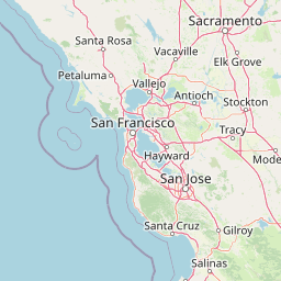
Map view of Greater Farallones National Marine Sanctuary

Use this park location map to pinpoint Greater Farallones National Marine Sanctuary in United States of America, understand its exact geographic position, and read its mapped placement within the surrounding landscape more clearly.

Pigeon | © OpenStreetMap contributors

Location context for Greater Farallones National Marine Sanctuary

California
Recorded earthquake history

Review Greater Farallones National Marine Sanctuary Seismic History

Examine the record of earthquakes associated with Greater Farallones National Marine Sanctuary to understand regional seismic history. This collection helps users track past activity near the sanctuary boundaries using reliable, structured geographic datasets.

Greater Farallones Earthquake History

Catalogued events

930 events

Strongest magnitude

Magnitude 6

Most recent event

Sep 3, 2026

This history includes earthquakes recorded inside the park or within 50 km of its borders

Visualizing marine habitats, rugged coastlines, and protected offshore environments

Greater Farallones National Marine Sanctuary Photos and Scenery

Visual records reveal the diverse coastal terrain, rocky intertidal zones, and open ocean habitats spanning Greater Farallones National Marine Sanctuary. Detailed photography provides a clear window into the protected marine ecosystems and rugged island geography of the Pacific coast.

Underwater view showing yellowtail rockfish and large white boot sponges on a colorful seabed.

A sunny coastal scene showing waves crashing over dark jagged rocks on a sandy beach, with distant hills visible along the horizon.

Park atlas

Discover related marine reserves and coastal sanctuaries across the Pacific region

Explore Protected Areas Near Greater Farallones National Marine Sanctuary

Compare Greater Farallones National Marine Sanctuary with adjacent marine reserves and coastal habitats along the Pacific coast. Reviewing surrounding protected areas reveals broader regional conservation patterns and connected offshore ecosystems.
Marine protected areaCalifornia
Park boundaries overlap#1 closest

Northwest

Cordell Bank National Marine Sanctuary: Geographic Atlas and Marine Protected Area Context

Submerged granite seamount and offshore California marine ecosystem

Cordell Bank National Marine Sanctuary is an expansive protected marine zone situated off the California coast. The sanctuary preserves a rare granite underwater mountain that acts as a biodiversity hotspot. Learn about the submerged terrain, continental shelf boundaries, and ecological importance of this significant North American marine conservation area.

Area
3,330 km²
Established
1989
Relief
Lowland
Climate
Mediterranean
A soft watercolor painting of a shoreline with gentle green hills and pale purple water against a white background.
Marine protected areaCalifornia
Park boundaries overlap#2 closest

South

Monterey Bay National Marine Sanctuary: California Marine Protected Area and Coastal Atlas

Mapping deep submarine canyons and expansive Pacific coastal ecosystems.

Monterey Bay National Marine Sanctuary represents one of the most biologically significant marine protected areas in the United States. Spanning 276 miles of California shoreline, the sanctuary encompasses varied aquatic terrain including towering kelp forests, rocky reefs, and the massive Monterey Submarine Canyon. This protected marine landscape serves as a crucial region for oceanic research and environmental conservation.

Area
15,780 km²
Established
1992
Relief
Mixed relief
Climate
Mediterranean
Watercolor painting of soft, rolling green hills and landscape against a pale background.
Protected landscapeMarin County
Park boundaries overlap#3 closest

North

Point Reyes National Seashore: Exploring the Protected Landscapes of Marin County

Geology, coastal estuaries, and Pacific wilderness boundaries

Point Reyes National Seashore offers a deep look into California coastal geography. The protected area features the dramatic San Andreas Fault, expansive Douglas-fir forests, and rich estuarine habitats, providing an essential study of maritime conservation landscapes and rare breeding grounds for elephant seals and tule elk.

Area
287.44 km²
Established
1962
IUCN
V
Visitors
2.3M annual
A horizontal watercolor painting showing a rolling landscape with a pond in the foreground, small hills in the background, and soft-colored wildflowers on the banks.
Protected landscapeCalifornia
About 16 km away#4 closest

East

Golden Gate National Recreation Area: A Mapped Protected Landscape in California

Coastal geography and historical park terrain overview

An expansive network of protected lands encompassing Pacific shorelines, Marin headlands, and urban forest ecosystems. This recreation area provides a detailed look at the geographic connectivity between coastal redwood groves, military fortifications, and restored wetland corridors within the California Bay Area region.

Area
332.31 km²
Established
1972
IUCN
V
Visitors
15M annual
A watercolor illustration showing a soft, panoramic view of green trees and rolling hills against pale, pinkish-yellow mountains in the background.
Protected landscapeCalifornia
66 km away#5 closest

North

Mendocino National Forest: Mapping California's Remote Protected Mountain Landscape

Examining wilderness boundaries and rugged coastal terrain

Mendocino National Forest serves as a significant protected area in California, known for being the only national forest in the state without major paved access. Its terrain spans 913,000 acres of mountain peaks, deep river canyons, and old-growth conifer forests. Home to the unique tule elk population at Lake Pillsbury, this landscape provides a rare example of wilderness isolation, complex geothermal features, and rugged, largely untouched northern coastal topography.

Area
3,696.02 km²
Established
1907
Relief
Mountain
Climate
Mediterranean
Watercolor painting of a peaceful river landscape, featuring rolling green hills, dense trees, and distant soft-toned mountains.
Protected areaCalifornia
116 km away#6 closest

North

Six Rivers National Forest: Exploring Protected River Valleys and Mountain Terrain in California

A regional protected area spanning California river systems

Six Rivers National Forest defines much of the rugged landscape in northwestern California. Named for the six major river drainages within its borders, the area features a unique combination of coastal forests, deep river canyons, and high-country ridges that offer significant insight into the region's broader geographic and ecological character.

Area
3,875.2 km²
Established
1947
Relief
Mountain
Climate
Mediterranean
Watercolor illustration of a low lying marsh landscape with distant soft pink hills and green vegetation under a white background.
Nature reserveCalifornia
About 127 km away#7 closest

Southeast

Elkhorn Slough National Estuarine Research Reserve: Protected Landscapes and Coastal Geography

Mapping the tidal ecosystems of Monterey Bay, California

Located near Watsonville, California, this nature reserve protects a vital estuarine ecosystem marked by tidal channels, mudflats, and oak woodlands. It functions as a key site for coastal research, providing a clear window into the ecology and protected terrain of one of the largest salt marshes remaining on the California coastline.

Area
6.9 km²
Relief
Lowland
Climate
Mediterranean
Access
Easy access
Nature reserveHumboldt County
About 129 km away#8 closest

North

King Range Wilderness Nature Reserve: Exploring California Coastal Mountains and Terrain

Mapped protected landscapes along the Humboldt County North Coast

King Range Wilderness protects a unique vertical ecosystem spanning from the Pacific Ocean tide line to high inland elevations. This nature reserve, located in Humboldt County, serves as a significant geographic landmark for its steep topography, including Douglas-fir forests, estuarine habitats, and undisturbed coastal reaches that represent a substantial portion of California's undeveloped shoreline.

Area
172 km²
Established
2006
IUCN
Ib
Relief
Mountain

Common questions about visiting, size, designation, and location context for Greater Farallones National Marine Sanctuary

Greater Farallones National Marine Sanctuary FAQs for park facts, access, geography, and protected area context

Find quick answers about Greater Farallones National Marine Sanctuary, including protected-area facts, park geography, trail and visitor context, and how the park fits into its surrounding country and regional landscape.
MoriAtlas Explorer

Continue Your Protected Areas Search Across the Global Atlas

Deepen your exploration by continuing the structured search for national parks and protected areas worldwide. Utilize the comprehensive filtering capabilities to compare different conservation landscapes and refine your understanding of global park geography. Discover more about the distribution and characteristics of protected natural areas.

Global natural geography