
Mori Atlas logo
Protected landscapeGolden Gate National Recreation Area

Mapping the Diverse Terrain, Coastal Bluffs, and Historic Sites of this Bay Area Landmark

Golden Gate National Recreation Area: An Extensive Coastal Protected Landscape in California

Spanning over 82,000 acres, the Golden Gate National Recreation Area creates a vast mosaic of protected lands across Marin, San Francisco, and San Mateo counties. This complex landscape links dramatic Pacific coastal bluffs, ancient redwood forests, and storied military fortifications into a singular geographic entity. Discover the intersections of rugged natural topography, restored wetland habitats, and historic cultural installations that define the northern California coastline.

urban parkcoastal recreation areabay shorelinecoast redwoodsmilitary historycivil war forts
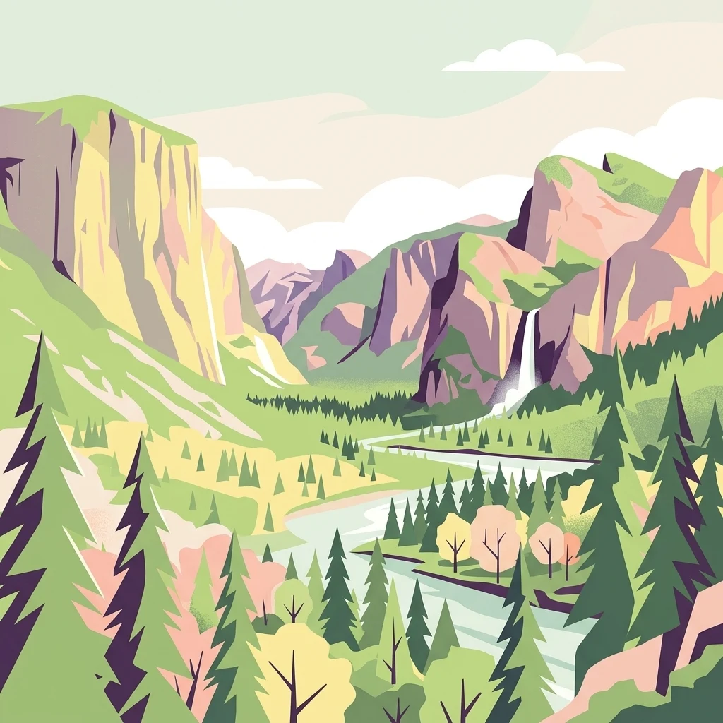
An artistic digital illustration featuring a valley surrounded by steep cliffs and mountains, with a winding river in the center and a waterfall flowing down a rock face in the background.

Golden Gate National Recreation Area

Protected landscape

Park overview

Structured park overview, official facts, and landscape profile for Golden Gate National Recreation Area

Golden Gate National Recreation Area park facts, protected area profile, and essential visitor context

Review the core facts for Golden Gate National Recreation Area, including designation, size, terrain, visitor scale, habitats, and operating context in one park-focused overview.

About Golden Gate National Recreation Area

The Golden Gate National Recreation Area represents a uniquely American experiment in urban conservation: stitching together scores of disconnected parcels of land around one of the country's most recognizable metropolitan areas into a single, federally protected recreation area. Unlike a conventional national park defined by wilderness boundaries, the GGNRA is a deliberately fragmented landscape that interlocks coastal headlands, ocean beaches, forested canyons, freshwater wetlands, former military bases, and culturally iconic sites across three California counties.

The recreation area's geography is exceptionally diverse. Marin County contributes northern areas including the Marin Headlands, Tennessee Valley, Olema Valley, the Point Bonita Lighthouse, and Muir Woods National Monument, which protects one of the last surviving old-growth Coast Redwood groves close to the Bay Area. San Francisco hosts many of the park's most visited sites, including the Presidio, Crissy Field, Baker Beach, Ocean Beach, Lands End, the Sutro District with its Cliff House and Sutro Baths ruins, Fort Mason, Fort Funston, and Alcatraz Island in the bay. San Mateo County extends the recreation area southward with sites like Sweeney Ridge, Milagra Ridge, Phleger Estate, Mori Point, and the more recent Rancho Corral de Tierra addition.

Beyond its natural beauty, the GGNRA carries an unusually deep historical dimension. It preserves fortifications built during the Spanish colonial period, Civil War and World War II coastal defenses, the notorious federal penitentiary on Alcatraz, and decommissioned Cold War-era Nike missile installations that visitors can still tour. Cultural sites such as the San Francisco National Cemetery, the former Sutro estate, and the Fort Mason National Historic Site round out a park experience where ecology, scenic beauty, and multiple centuries of human history are encountered within walking or driving distance of downtown San Francisco.

Quick facts and research context for Golden Gate National Recreation Area

The GGNRA protects roughly 82,116 acres of land spread across San Mateo, San Francisco, and Marin Counties in California. It was established on October 27, 1972, by an act signed by President Richard Nixon, and is administered by the National Park Service under IUCN Category V (protected landscape/seascape) standards. The recreation area carries more than 3,000 documented plant and animal species, includes 59 miles of combined bay and Pacific Ocean shoreline, and is the second-most visited unit of the National Park System in the United States, trailing only the Blue Ridge Parkway.

Protection and recognition

Mixed conservation scope and 1988 designation records for regional land management.

Golden Gate National Recreation Area Protection Status and Designation History

Golden Gate National Recreation Area maintains a documented mixed protection scope established through official designation records from 1988. Structured administration profiles outline management frameworks and baseline conservation boundaries without imported international recognition sources.

Protection details

Protection scope
Mixed
Designated year
1988
Transboundary protection
No
Park context

Deeper park guide and search-rich context for Golden Gate National Recreation Area

Golden Gate National Recreation Area history, landscape, wildlife, and travel context

Explore Golden Gate National Recreation Area through its history, landscape character, ecosystems, wildlife, conservation priorities, cultural context, and seasonal travel timing in a structured park guide built for atlas discovery and search intent.

Why Golden Gate National Recreation Area stands out

The GGNRA is best known for its extraordinary combination of natural and cultural landmarks packed into a major metropolitan region. Visitors come for the towering Coast Redwoods of Muir Woods National Monument, the historic confinement site of Alcatraz Island, the dramatic cliffside views of Lands End and the Marin Headlands, and the Presidio of San Francisco with its restored Crissy Field waterfront. The park is equally notable for preserving centuries of layered military history, from Spanish colonial forts to Civil War coastal defenses and Cold War-era Nike missile sites, all set against the iconic backdrop of the Golden Gate Bridge.

A wide panoramic photograph showing a vast expanse of the San Francisco Bay, with the partial structure of the Golden Gate Bridge on the right and the distant San Francisco skyline visible through a light haze.
Panoramic view of the San Francisco Bay, featuring the Golden Gate Bridge in the foreground and the city skyline in the distance.

Golden Gate National Recreation Area history and protected-area timeline

The Golden Gate National Recreation Area was created through a cooperative legislative effort in the early 1970s led by Congressmen William S. Mailliard and Phillip Burton of San Francisco. An administrator in Mailliard's Washington office, Dr. Robert Busha, conceived the strategy of establishing a non-contiguous national recreation area as a way to circumvent traditional expectations that parks should be made up of contiguous land. The result was a 1972 act signed by President Richard Nixon that allocated $120 million for land acquisition and formally established the GGNRA on October 27, 1972.

Initial parkland was assembled through purchases from the U.S. Army, including Alcatraz Island and Fort Mason, along with a transfer arranged by the Nature Conservancy of Marin Headlands land acquired from the Gulf Oil Corporation, where a failed development known as Marincello had been planned. Over the following three decades, the National Park Service continued acquiring property from the military, private owners, and corporate holders, absorbing decommissioned bases such as Fort Funston, the Presidio, and Crissy Field, alongside cultural landmarks like the Cliff House and Sutro Baths, and natural areas such as Sweeney Ridge and Muir Woods National Monument. Additional expansions followed in the 2000s, including the 2011 transfer of the Rancho Corral de Tierra property through the Peninsula Open Space Trust.

In 1988, the GGNRA and twelve adjacent protected areas were jointly designated by UNESCO as the Golden Gate Biosphere Reserve, recognizing the area's exceptional ecological and geographic value. The recreation area's evolution from a network of obsolete military sites into one of the most visited units of the National Park System is widely regarded as a landmark achievement in American urban conservation policy.

Golden Gate National Recreation Area landscape and geographic character

The landscape of the Golden Gate National Recreation Area is shaped by the meeting of the Pacific Ocean, San Francisco Bay, and the rugged coastal terrain of Northern California. The Marin Headlands rise in steep, windswept ridges immediately north of the Golden Gate Bridge, exposing folded sedimentary rock formations, coastal bluffs, rolling grasslands, and sheltered valleys such as Tennessee Valley and Gerbode Valley. To the south, the San Francisco shoreline forms long arcs of sandy beach at Ocean Beach and Baker Beach, interspersed with rocky promontories and the dramatic, cliff-hugging Coastal Trail at Lands End.

Inland, the recreation area protects quiet forested landscapes dominated by Coast Redwoods at Muir Woods and the Phleger Estate, mixed evergreen forests in the Marin Headlands, and one of the largest remaining untouched Coast Live Oak woodlands in Oakwood Valley. Freshwater features include Rodeo Lagoon, Bolinas Lagoon, and Tomales Bay on the Marin coast, as well as restored wetland and pond systems at Mori Point on the San Mateo County side. Sweeney Ridge offers sweeping upland vistas above the Pacific, while the ridges and canyons of Rancho Corral de Tierra extend the park's terrain southward toward Montara Mountain. Across the bay, Alcatraz Island adds a small but visually prominent rocky landform to the protected landscape.
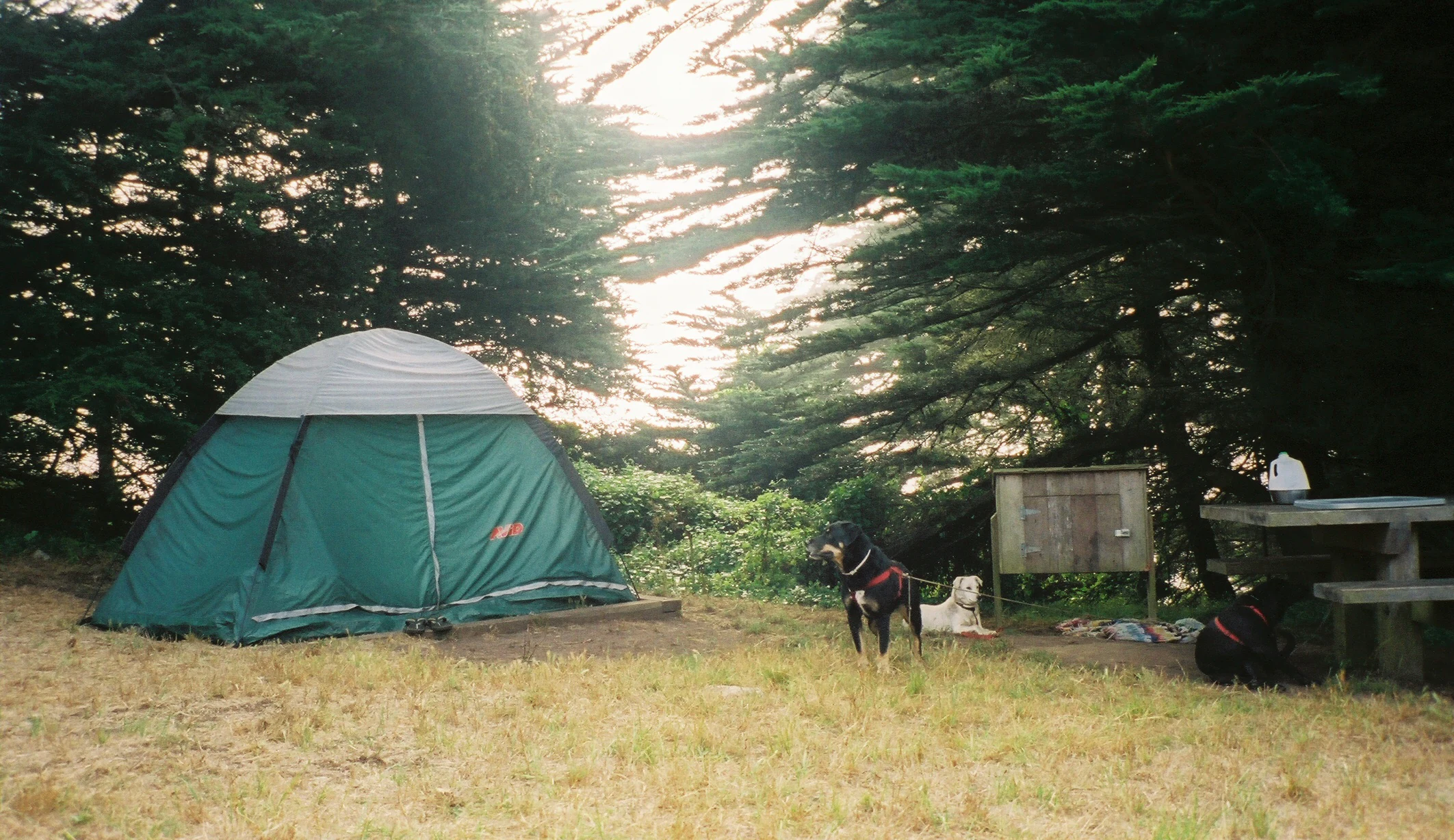
A green dome-style tent pitched in a grassy campground area shaded by large evergreen trees, with two dogs resting nearby and a wooden picnic table to the right.
A green dome tent set up at Bicentennial Campground within the Golden Gate National Recreation Area.

Golden Gate National Recreation Area ecosystems, habitats, and plant life

Ecologically, the GGNRA sustains an unusually rich mosaic of coastal California habitats compressed into a heavily urbanized region. Redwood-dominated forests, mixed Douglas-fir and bay laurel woodlands, coastal scrub, chaparral, freshwater wetlands, dune systems, rocky intertidal zones, and open ocean all fall within park boundaries. Old-growth Coast Redwoods at Muir Woods represent one of the most iconic temperate forest ecosystems in North America, while coastal scrub communities on San Francisco's western edge and the Marin Headlands carry high botanical diversity despite harsh exposure to marine winds and salt spray.

The recreation area also protects important transitional habitats where freshwater, brackish, and marine environments meet. Coastal wetlands and ponds at Mori Point support rare amphibians such as the San Francisco garter snake and the California red-legged frog. Tidepools, kelp forest margins, and dune habitats around Lands End, Ocean Beach, and the Marin coastline provide foraging and nursery grounds for marine life. The 1988 UNESCO designation of the Golden Gate Biosphere Reserve formally acknowledged this combination of habitat types and the ecological significance of preserving them amid one of the densest metropolitan regions in the United States.
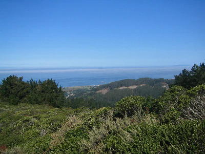
A wide shot looking over dense green coastal shrubs and trees in the foreground, with rolling hills and a hazy coastline visible in the distance under a clear blue sky.
A view overlooking the rolling, vegetated hills of Sweeney Ridge within the Golden Gate National Recreation Area.

Golden Gate National Recreation Area wildlife and species highlights

The GGNRA documents more than 3,000 plant and animal species across its varied habitats, giving the recreation area unusually high biological diversity for an urban-adjacent protected landscape. Marine mammals are a major draw, with The Marine Mammal Center in the Marin Headlands providing rehabilitation for seals, sea lions, and other species along the California coast, and whales visible offshore from several park overlooks.

Estuarine and freshwater sites host wading birds, waterfowl, and shorebirds, while coastal cliffs and offshore rocks provide nesting habitat for seabirds. The Presidio's restored Crissy Field wetlands and Mori Point's ponds attract migratory species and support sensitive amphibians including the San Francisco garter snake, federally listed as endangered, and the California red-legged frog. Across inland portions of the park, larger mammals typical of coastal Northern California share habitats with rich assemblages of raptors, songbirds, and the small mammals and reptiles that thrive in coastal scrub and chaparral communities.

Golden Gate National Recreation Area conservation status and protection priorities

From a conservation standpoint, the Golden Gate National Recreation Area is significant because it preserves substantial natural habitat, open space, and biodiversity immediately adjacent to one of the most densely developed metropolitan regions in the United States. The 1988 designation of the Golden Gate Biosphere Reserve jointly by UNESCO and the GGNRA highlighted the area's role as a refuge for coastal redwood forests, marine mammal habitat, endemic reptile populations such as the San Francisco garter snake, and a wide range of migratory birds. Preserving these ecosystems within sight of downtown San Francisco gives the recreation area an outsized importance relative to its size.

The park's conservation role is reinforced by active habitat restoration projects underway at multiple sites. Crissy Field's former military airfield has been transformed into a 100-acre restored shoreline and tidal marsh, while wetlands at Mori Point have been re-established to benefit endangered amphibians. Land acquisitions such as Sweeney Ridge, Phleger Estate, and the 4,000-plus-acre Rancho Corral de Tierra have broadened the protected habitat base and improved connectivity for wildlife across a landscape otherwise fragmented by urbanization. Together, these actions turn what was largely a patchwork of obsolete military land into a coherent example of large-scale, urban-edge habitat conservation.

Golden Gate National Recreation Area cultural meaning and human context

The GGNRA preserves a layered cultural heritage that reflects the full sweep of the San Francisco Bay Area's history. Spanish colonial exploration is represented at Sweeney Ridge in San Mateo County, where the expedition of Gaspar de Portolà first sighted San Francisco Bay, and at the Presidio, which began as Spain's original military fortification on the site of modern-day San Francisco. Subsequent chapters of the region's history are embodied in Civil War-era works such as Fort Point at the southern base of the Golden Gate Bridge, in Victorian-era attractions such as the Cliff House and Sutro Baths developed by Adolph Sutro in the late 19th century, and in twentieth-century military installations including World War II coastal batteries and Cold War-era Nike missile sites that visitors can still tour.

The park also carries strong associations with more recent American history. Alcatraz Island stands as a powerful symbol of the federal penitentiary system and broader conversations about incarceration and Indigenous activism, while the San Francisco National Cemetery in the Presidio continues to function as an active national burial ground. Cultural programming at sites like the Headlands Center for the Arts in the Marin Headlands and at Fort Mason adds contemporary artistic and civic life to a recreational landscape that historically operated under military jurisdiction.

Top sights and standout views in Golden Gate National Recreation Area

Standout features of the Golden Gate National Recreation Area include the ancient Coast Redwoods of Muir Woods National Monument, the panoramic views from Lands End and the Marin Headlands looking out over the Golden Gate Bridge, and the Presidio of San Francisco with its restored Crissy Field waterfront. Equally memorable are historical sites such as Alcatraz Island, Fort Point National Historic Site at the base of the Golden Gate Bridge, the Sutro Baths ruins, and decommissioned Nike missile installations that bring Cold War history to life within view of the Pacific.

Wildlife-related highlights include tidepooling along the Marin coast, whale watching from clifftop overlooks, and visits to The Marine Mammal Center in the Marin Headlands. Restoration projects at Crissy Field and Mori Point demonstrate how former military and degraded lands have been transformed into vibrant wetland habitat, while long-distance trail experiences such as the Coastal Trail and segments of the Bay Area Ridge Trail showcase the recreation area's geographic scale.

Best time to visit Golden Gate National Recreation Area

The GGNRA's temperate coastal California climate makes it a year-round destination, though each season offers a different character. Spring brings bright wildflower displays on coastal bluffs and headland grasslands, active bird migration through wetland sites such as Crissy Field and Mori Point, and generally mild conditions for hiking trails like those in the Marin Headlands and Lands End. Summer draws the heaviest visitor numbers, with warm temperatures, frequent coastal fog along the Pacific side, and the busiest schedules at popular sites such as Alcatraz, Muir Woods, and Ocean Beach.

Fall is often considered one of the most comfortable seasons for exploring the park, with warmer ocean temperatures, clearer skies over the bay, and reduced crowds relative to summer. Winter brings the greenest landscapes and the most dramatic Pacific surf conditions at Ocean Beach, along with peak whale watching opportunities along the Marin coast and occasional heavy fog across the headlands. Because the recreation area extends from coastal cliffs to sheltered redwood groves, visitors can usually find a microclimate to suit their preferred activity regardless of season.

Monthly climate preview

Trace long-term representative temperature ranges and monthly precipitation patterns across the year

Golden Gate National Recreation Area Climate Normals and Weather by Month

Representative coordinate records show average monthly temperatures ranging from 9.45 degrees Celsius to 17.54 degrees Celsius alongside varying daily precipitation levels. Reviewing the complete twelve-month climate profile provides deeper context for annual meteorological rhythms.
Annual mean14 °C
9 °C18 °C
Jan
Feb10°
Mar11°
Apr12°
May14°
Jun16°
Jul17°
Aug17°
Sep18°
Oct16°
Nov12°
Dec10°
Warmest month
September

17.5 °C

Coolest month
January

9.5 °C

Wettest month
February

4.2 mm/day

Driest month
July

0 mm/day

Park location guide

Geography guide, regional context, and park location map for Golden Gate National Recreation Area

Golden Gate National Recreation Area park geography, regions, and map view in United States of America

Understand where Golden Gate National Recreation Area sits in United States of America through a broader geographic reading of the surrounding landscape, nearby location context, and its mapped position within the national park landscape.

How Golden Gate National Recreation Area fits into United States of America

The United States of America is a federal presidential republic and one of the world's largest countries by area and population. It consists of 50 states across a vast territory spanning multiple time zones, with its capital in Washington, D.C. and largest city in New York City. The nation has a diverse economy, influential political system, and significant cultural and military presence globally.

Wider geography shaping Golden Gate National Recreation Area in United States of America

The United States occupies a vast territory in North America, bordered by Canada to the north and Mexico to the south. The 48 contiguous states stretch from the Atlantic to the Pacific Ocean, while Alaska occupies the northwestern region and Hawaii is an archipelago in the Pacific. The country encompasses diverse terrain including the Rocky Mountains, Appalachian Mountains, Great Plains, and extensive river systems.

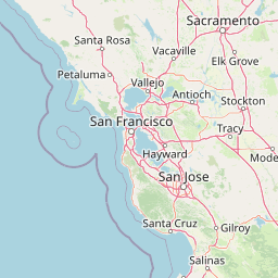
Map view of Golden Gate National Recreation Area

Use this park location map to pinpoint Golden Gate National Recreation Area in United States of America, understand its exact geographic position, and read its mapped placement within the surrounding landscape more clearly.

Pigeon | © OpenStreetMap contributors

Location context for Golden Gate National Recreation Area

California

Visual reference collection showcasing coastal cliffs, redwood forests, and historic bay terrain

Golden Gate National Recreation Area Photos, Landscapes, and Protected Scenery

Visual documentation captures the diverse terrain and protected habitats spanning the Northern California coast. Photographic records reveal the complex geography of marine environments, forested ridges, and historic landmarks across the regional landscape.

A wide panoramic photograph showing a vast expanse of the San Francisco Bay, with the partial structure of the Golden Gate Bridge on the right and the distant San Francisco skyline visible through a light haze.

A wide coastal view showing the Golden Gate Bridge in the distance with the Lands End headlands in the foreground.

A green dome-style tent pitched in a grassy campground area shaded by large evergreen trees, with two dogs resting nearby and a wooden picnic table to the right.

A wide shot looking over dense green coastal shrubs and trees in the foreground, with rolling hills and a hazy coastline visible in the distance under a clear blue sky.

Park atlas

Compare regional coastal terrain and connected protected areas across Northern California

Other Parks Near Golden Gate National Recreation Area and Surrounding Protected Landscapes

Browsing other parks near Golden Gate National Recreation Area allows outdoor enthusiasts to compare surrounding coastal terrain, bay shorelines, and protected redwood forests. Expanding the regional geographic context helps visitors evaluate adjacent conservation lands and discover related protected areas throughout the wider Northern California landscape.
A soft watercolor painting of a shoreline with gentle green hills and pale purple water against a white background.
Marine protected areaCalifornia
About 4.9 km away#1 closest

South

Monterey Bay National Marine Sanctuary: California Marine Protected Area and Coastal Atlas

Mapping deep submarine canyons and expansive Pacific coastal ecosystems.

Monterey Bay National Marine Sanctuary represents one of the most biologically significant marine protected areas in the United States. Spanning 276 miles of California shoreline, the sanctuary encompasses varied aquatic terrain including towering kelp forests, rocky reefs, and the massive Monterey Submarine Canyon. This protected marine landscape serves as a crucial region for oceanic research and environmental conservation.

Area
15,780 km²
Established
1992
Relief
Mixed relief
Climate
Mediterranean
Marine protected areaCalifornia
About 16 km away#2 closest

West

Greater Farallones National Marine Sanctuary: Protected Marine Geography and Atlas Data

Essential marine protected area off the coast of California.

Greater Farallones National Marine Sanctuary protects a vital network of oceanic habitats off California, including sandy beaches, tidal flats, subtidal reefs, and open ocean waters. This marine protected area serves as a critical link in the Pacific coast's network of conservation landscapes, offering a deep look at the geographic connectivity between coastal estuaries and offshore continental shelf environments.

Area
8,530 km²
Established
1981
Relief
Lowland
Climate
Mediterranean
Watercolor painting of soft, rolling green hills and landscape against a pale background.
Protected landscapeMarin County
About 23 km away#3 closest

Northwest

Point Reyes National Seashore: Exploring the Protected Landscapes of Marin County

Geology, coastal estuaries, and Pacific wilderness boundaries

Point Reyes National Seashore offers a deep look into California coastal geography. The protected area features the dramatic San Andreas Fault, expansive Douglas-fir forests, and rich estuarine habitats, providing an essential study of maritime conservation landscapes and rare breeding grounds for elephant seals and tule elk.

Area
287.44 km²
Established
1962
IUCN
V
Visitors
2.3M annual
Marine protected areaCalifornia
About 62 km away#4 closest

West

Cordell Bank National Marine Sanctuary: Geographic Atlas and Marine Protected Area Context

Submerged granite seamount and offshore California marine ecosystem

Cordell Bank National Marine Sanctuary is an expansive protected marine zone situated off the California coast. The sanctuary preserves a rare granite underwater mountain that acts as a biodiversity hotspot. Learn about the submerged terrain, continental shelf boundaries, and ecological importance of this significant North American marine conservation area.

Area
3,330 km²
Established
1989
Relief
Lowland
Climate
Mediterranean
Watercolor illustration of a low lying marsh landscape with distant soft pink hills and green vegetation under a white background.
Nature reserveCalifornia
About 128 km away#5 closest

Southeast

Elkhorn Slough National Estuarine Research Reserve: Protected Landscapes and Coastal Geography

Mapping the tidal ecosystems of Monterey Bay, California

Located near Watsonville, California, this nature reserve protects a vital estuarine ecosystem marked by tidal channels, mudflats, and oak woodlands. It functions as a key site for coastal research, providing a clear window into the ecology and protected terrain of one of the largest salt marshes remaining on the California coastline.

Area
6.9 km²
Relief
Lowland
Climate
Mediterranean
Access
Easy access
A watercolor illustration showing a soft, panoramic view of green trees and rolling hills against pale, pinkish-yellow mountains in the background.
Protected landscapeCalifornia
About 141 km away#6 closest

North

Mendocino National Forest: Mapping California's Remote Protected Mountain Landscape

Examining wilderness boundaries and rugged coastal terrain

Mendocino National Forest serves as a significant protected area in California, known for being the only national forest in the state without major paved access. Its terrain spans 913,000 acres of mountain peaks, deep river canyons, and old-growth conifer forests. Home to the unique tule elk population at Lake Pillsbury, this landscape provides a rare example of wilderness isolation, complex geothermal features, and rugged, largely untouched northern coastal topography.

Area
3,696.02 km²
Established
1907
Relief
Mountain
Climate
Mediterranean
Watercolor painting of a mountain landscape with forested foothills and a valley in the foreground.
Protected landscapeCalifornia
About 165 km away#7 closest

Southeast

Los Padres National Forest: Geography and Protected Landscape Map of Central California

Extensive wilderness corridors and high mountain ridges

Spanning from the Big Sur coastline to the interior ranges of the Santa Lucia and San Rafael mountains, Los Padres National Forest represents a significant protected area in California. The region contains deep gorges, forest-covered canyons, and high-altitude pine ridges that provide essential habitat and support major river headwaters.

Area
7,700 km²
Established
1936
Relief
Mountain
Climate
Mediterranean
National parkCalifornia
About 177 km away#8 closest

Southeast

Pinnacles National Park: California National Park Geographic Discovery and Map Context

Explore unique protected landscape and regional terrain.

Delve into the protected landscape of Pinnacles National Park, a significant natural area within California. This page offers an atlas-centered view of its unique geological formations and mapped terrain, providing essential context for understanding its geographic identity. Explore the park's specific landscape characteristics and its relation to the broader regional geography and protected areas.

Area
107.67 km²
Established
2013
IUCN
II
Visitors
275K annual

Common questions about visiting, size, designation, and location context for Golden Gate National Recreation Area

Golden Gate National Recreation Area FAQs for park facts, access, geography, and protected area context

Find quick answers about Golden Gate National Recreation Area, including protected-area facts, park geography, trail and visitor context, and how the park fits into its surrounding country and regional landscape.
MoriAtlas Explorer

Continue Your Protected Areas Search Across the Global Atlas

Deepen your exploration by continuing the structured search for national parks and protected areas worldwide. Utilize the comprehensive filtering capabilities to compare different conservation landscapes and refine your understanding of global park geography. Discover more about the distribution and characteristics of protected natural areas.

Global natural geography