
Mori Atlas logo
Protected landscapeLos Padres National Forest

Tracing the dramatic transition from Big Sur coastal canyons to the high conifer forests of Mount Pinos

Los Padres National Forest: Exploring the Mapped Boundaries and Protected Landscape Terrain of California

Los Padres National Forest encompasses a massive, mountainous corridor stretching across central and southern California. The terrain spans from sea level at the Pacific coastline to over 8,800 feet in elevation, hosting extensive wilderness areas and critical habitats for the California condor. This protected landscape serves as a vital network of river headwaters, old-growth redwoods, and arid chaparral ridges.

national forestcaliforniacoastal mountainschaparralwildernessold growth
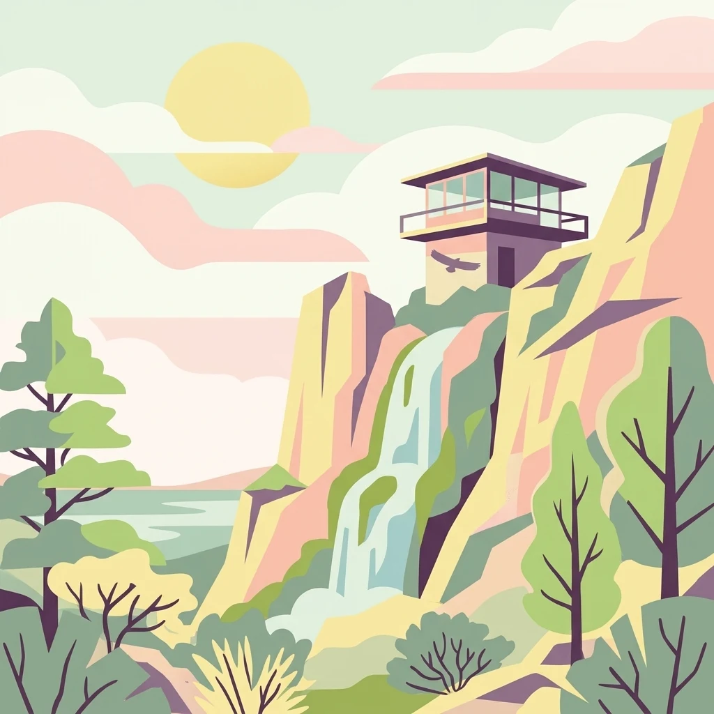
A stylized vector illustration of a fire lookout tower atop a rocky cliff next to a waterfall, surrounded by trees and mountains under a soft-colored sky.

Los Padres National Forest

Protected landscape

Park overview

Structured park overview, official facts, and landscape profile for Los Padres National Forest

Los Padres National Forest park facts, protected area profile, and essential visitor context

Review the core facts for Los Padres National Forest, including designation, size, terrain, visitor scale, habitats, and operating context in one park-focused overview.

About Los Padres National Forest

Los Padres National Forest is one of the most geographically diverse national forests in California, encompassing the mountainous landscapes that link the southern California coast with the interior ranges of the central part of the state. Although it sits near major cities such as Santa Barbara, Ventura, San Luis Obispo, and the outskirts of Los Angeles, the forest retains an unusually wild character, with nearly half of its area officially protected as wilderness. Its northern division hugs the Big Sur coast, while its larger southern division spans the Santa Ynez, Santa Lucia, Sierra Madre, San Rafael, Topatopa, and Sierra Pelona ranges, as well as the western flanks of the San Emigdio Mountains.

The forest's elevation range, from sea level along the rugged Pacific coast to nearly 8,900 feet at its highest peaks, allows it to harbor a striking variety of vegetation types. Chaparral-covered slopes dominate much of the lower and mid-elevation terrain, while coniferous forests of Jeffrey pine, white fir, coast Douglas-fir, and coast redwood occupy cooler and moister sites. Old-growth stands, though limited in extent, remain biologically and ecologically significant and include rare redwood groves in the Big Sur area.

Beyond its ecological role, Los Padres serves as the principal headwaters region for a long list of California rivers, including the Carmel, Salinas, Cuyama, Sisquoc, Santa Ynez, Ventura, Sespe, and Piru. This combination of scenic coast, mountain wilderness, and river source areas has shaped both the forest's conservation importance and its cultural identity. Designated recreation areas, an extensive network of trails, and historic fire lookouts such as the Condor Lookout on Hi Mountain complement its wilderness character, supporting hiking, wildlife watching, and educational visitation in addition to more dispersed outdoor recreation.

Protection and recognition

Terrestrial conservation scope, designation history, and administrative frameworks

Los Padres National Forest Protection Status and International Recognition

Los Padres National Forest maintains a documented terrestrial protection status within its regional administrative framework. Structured conservation records outline management scope and official designation details for the protected area.

Protection details

Protection scope
Terrestrial
Transboundary protection
No
Park context

Deeper park guide and search-rich context for Los Padres National Forest

Los Padres National Forest history, landscape, wildlife, and travel context

Explore Los Padres National Forest through its history, landscape character, ecosystems, wildlife, conservation priorities, cultural context, and seasonal travel timing in a structured park guide built for atlas discovery and search intent.

Why Los Padres National Forest stands out

Los Padres is especially known for its enormous swaths of designated wilderness along the California coast, including the historic San Rafael Wilderness and the Ventana Wilderness in the Santa Lucia Mountains. The forest is closely identified with the recovery of the California condor, with dedicated condor sanctuaries managed within its boundaries. It is also recognized for its dramatic elevation range, from Big Sur beaches and redwood canyons up to conifer-clad ridgelines near Mount Pinos, and for protecting the headwaters of many of southern and central California's most important rivers.

A large California condor with broad wings flying in profile against a backdrop of distant blue-tinted mountain ridges.
A California condor soaring above the rugged terrain of Los Padres National Forest.

Los Padres National Forest history and protected-area timeline

Los Padres National Forest was formally established in December 1936 under its current name, but its origins go back much further. It was assembled from a patchwork of earlier forest reserves and national forests, including the Monterey, San Luis, and parts of the older San Gabriel National Forest, as well as the Pine Mountain and Zaka Lake Forest Reserve and the Santa Ynez Forest Reserve. Several of these predecessor units had themselves absorbed smaller reserves, particularly Pinnacles National Forest and San Benito National Forest, before being consolidated.

Initially administered as the Santa Barbara National Forest, the unit drew criticism from residents and stakeholders in other counties for being too closely identified with a single county. In response to that public pressure, administrators renamed the forest Los Padres in 1936, a name drawn from the Spanish Catholic missionary fathers whose 18th- and 19th-century missions shaped much of California's coastal and inland cultural landscape.

The modern history of Los Padres is also marked by the steady expansion of wilderness protection. The San Rafael Wilderness was among the earliest primitive areas folded into the U.S. wilderness system after the 1964 Wilderness Act, and additional wilderness areas followed through the 1970s and beyond. A major milestone came in 1992 with the Los Padres Condor Range and River Protection Act, which expanded existing wilderness by about 132 square miles and designated roughly 494 square miles of new wilderness, much of it intended to secure habitat for the California condor. Since then, management has increasingly focused on wildfire risk, prescribed burning, and habitat protection, while the forest has also faced recurring major fires, including the 1977 Marble Cone Fire, the 2008 Basin Complex Fire, the 2017 Thomas Fire, and the 2025 Gifford Fire.

Los Padres National Forest landscape and geographic character

Los Padres National Forest occupies a long, broken belt of mountainous terrain that essentially forms the coastal-to-interior backbone of southern and central California. Along the Big Sur division, the forest meets the Pacific Ocean directly, with steep cliffs, coastal canyons, and forested slopes plunging to the sea. Further south, the terrain climbs into long parallel ridges such as the Santa Ynez, Santa Lucia, Sierra Madre, San Rafael, and Topatopa ranges, with broad inland valleys and alluvial plains like the Gaviota Coast bordering the forest's lower edges.

The forest's elevation profile is unusually dramatic for a coastal region. Lower elevations are characterized by rocky canyons, riparian corridors, and chaparral-covered hills, while mid-elevations grade into mixed oak woodlands and conifer stands. The highest country, including Mount Pinos, Cerro Noroeste, and Reyes Peak, rises above 8,000 feet and supports open pine forests and sweeping alpine vistas. Water features are equally varied, with rivers such as the Carmel, Salinas, Cuyama, Sisquoc, Santa Ynez, Ventura, Sespe, and Piru all rising within the forest, contributing to a landscape marked by deep gorges, seasonal waterfalls such as Salmon Creek Falls, and broad, scenic reservoirs.
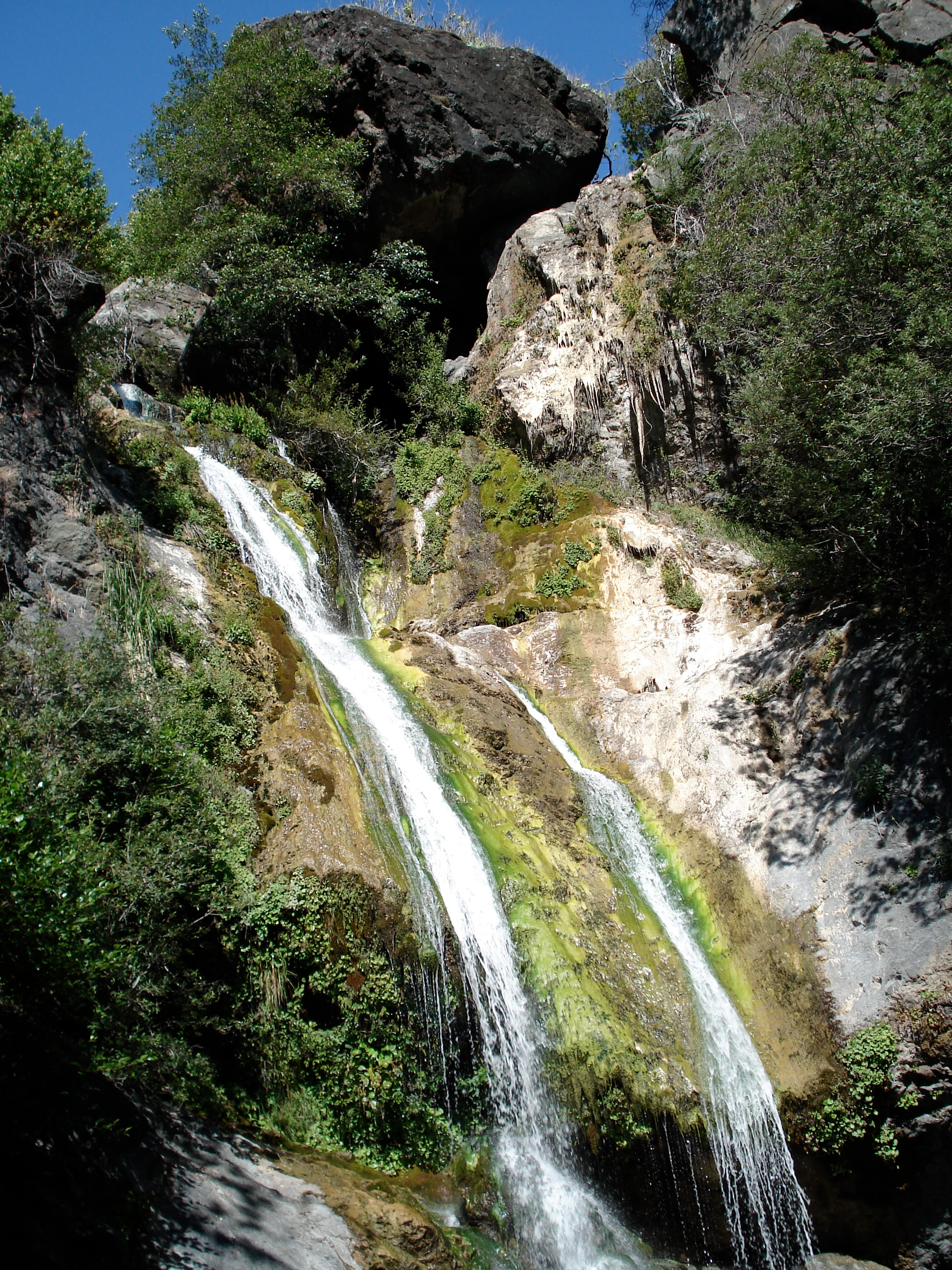
A multi-tiered waterfall flowing down a steep, mossy rock cliff face surrounded by dense green vegetation.
Salmon Creek Falls, a picturesque waterfall cascading over rocky cliffs in Los Padres National Forest.

Los Padres National Forest ecosystems, habitats, and plant life

Los Padres supports a remarkably wide range of vegetation types, shaped by its coastal geography, varied elevation, and position between the moist Pacific influence and the dry interior climate of California. Below roughly 5,000 feet, most slopes are cloaked in chaparral, a dense shrubland of drought-adapted plants that defines much of California's coastal ranges. Above this zone, coniferous forests become increasingly common, particularly in the moister Santa Lucia Mountains of the Ventana Wilderness and around Mount Pinos in northern Ventura County.

Forest composition varies accordingly. Open Jeffrey pine forests dominate much of the high country, while shaded canyons and north-facing slopes harbor stands of white fir, coast Douglas-fir, and the famously tall coast redwood in the northern Big Sur division. Oak woodlands and riparian corridors line many of the forest's larger drainages, and small pockets of old growth, including old-growth redwood mapped by scientist J. Michael Fay in 2008, add to the ecological significance of the forest. Researchers estimate roughly 18,900 acres of old-growth forest remain within the forest overall.
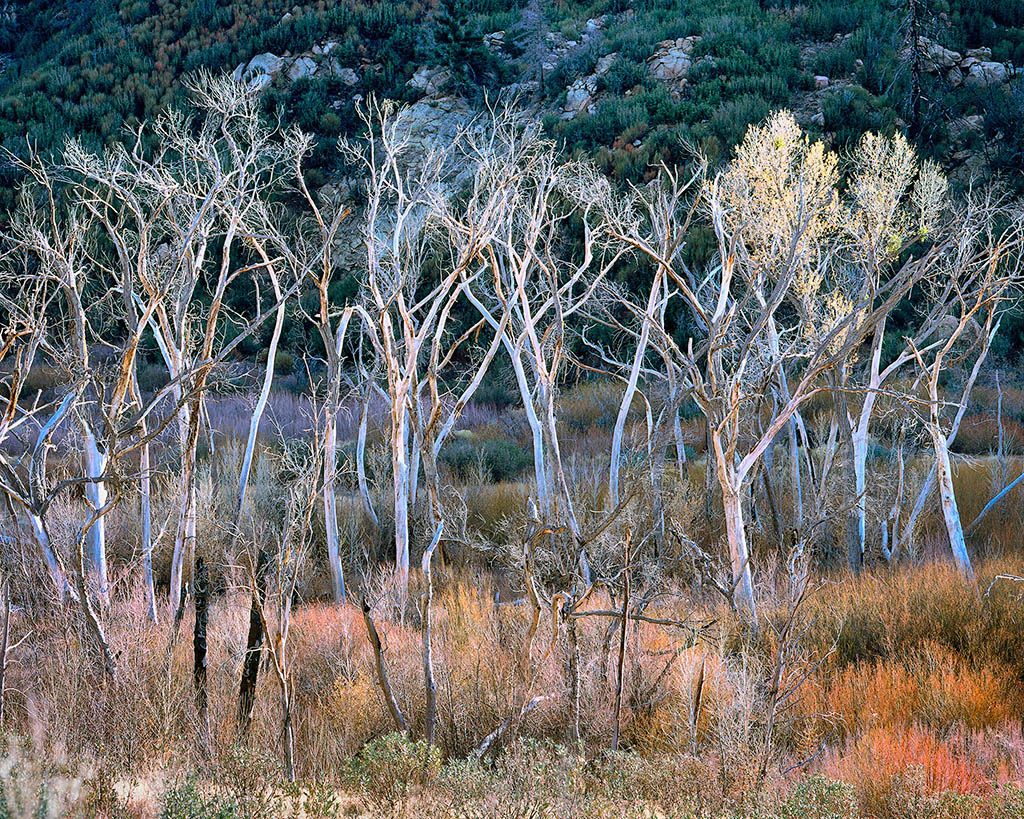
A group of bare, white-barked trees standing in a dry, brushy landscape with a forested hillside in the background.
Leafless trees stand in the Sespe Creek area of Los Padres National Forest.

Los Padres National Forest conservation status and protection priorities

Conservation is central to Los Padres's identity, with nearly half of its area protected as wilderness under the U.S. wilderness system. This includes the San Rafael Wilderness, one of the very first primitive areas included after the Wilderness Act of 1964, as well as the Ventana, Sespe, Dick Smith, Garcia, Matilija, Machesna Mountain, Silver Peak, and Chumash wildernesses, among others. The Los Padres Condor Range and River Protection Act of 1992 further strengthened this framework, expanding wilderness and designating additional acreage specifically to protect California condor habitat.

Beyond wilderness designation, the forest plays a major role in watershed protection. Many of the rivers that supply water to southern and central California cities and farmlands originate within Los Padres, making the forest a critical headwaters landscape. U.S. Forest Service management also includes active preservation of old-growth forests, condor sanctuary programs, and ongoing vegetation management efforts such as prescribed burning and fire-risk thinning projects aimed at reducing wildfire severity while maintaining forest health.

Los Padres National Forest cultural meaning and human context

The cultural identity of Los Padres National Forest is closely tied to the Spanish missionary era that shaped much of coastal and interior California. The name 'Los Padres', meaning 'the Fathers', refers to the Catholic priests of the Spanish missions who proselytized in and around the region during the 18th and 19th centuries, lending the forest a name that reflects the broader colonial and religious history of the area rather than any single local community.

In modern times, the forest has developed its own distinctive cultural layers, including a long tradition of backcountry recreation, historic fire lookout sites such as the Condor Lookout on Hi Mountain in the Santa Lucia Range, and ongoing tensions over rural land use, including illegal cannabis cultivation in remote areas and the legacy of major wildfires that have shaped both ecosystems and communities in the region.

Top sights and standout views in Los Padres National Forest

Nearly half of Los Padres is designated wilderness, giving it one of the largest combined wilderness footprints of any California national forest. The forest spans an unusually wide elevation range, from Big Sur beaches on the Pacific coast to conifer-clad ridges above 8,000 feet near Mount Pinos. It hosts essential habitat for the California condor, with managed sanctuaries dedicated to the species, and protects old-growth stands of coast redwood as well as Jeffrey pine and Douglas-fir forests. The forest is also the headwaters for a long list of major California rivers and contains dramatic landmarks such as Salmon Creek Falls, the Gaviota Coast, and the Ventana and San Rafael wilderness areas.

Best time to visit Los Padres National Forest

Los Padres is shaped strongly by California's Mediterranean climate, with mild, wet winters and hot, dry summers that influence how the forest looks and how it can be enjoyed. Late winter and spring are often the greenest and most florally impressive periods, with wildflower displays such as those on Figueroa Mountain attracting visitors. Summer and early fall bring the highest fire risk, and significant portions of the forest are routinely closed to public entry from around June 1 through mid-November during peak fire season. Fall and early winter, once rains return, can offer quieter conditions, refreshed landscapes, and fewer restrictions, though snow can affect higher elevations such as the Mount Pinos area.
Monthly climate preview

Long-term representative temperature ranges and monthly precipitation data

Los Padres National Forest Climate Normals and Annual Weather Patterns

Historical climatology records outline the measured monthly temperature and precipitation rhythm across representative coordinates within Los Padres National Forest. Exploring the complete twelve-month profile provides deeper context for long-term meteorological trends and regional environmental patterns.
Annual mean16 °C
12 °C22 °C
Jan12°
Feb12°
Mar13°
Apr14°
May16°
Jun19°
Jul21°
Aug22°
Sep21°
Oct18°
Nov15°
Dec12°
Warmest month
August

21.8 °C

Coolest month
February

12 °C

Wettest month
February

3.6 mm/day

Driest month
August

0 mm/day

Park location guide

Geography guide, regional context, and park location map for Los Padres National Forest

Los Padres National Forest park geography, regions, and map view in United States of America

Understand where Los Padres National Forest sits in United States of America through a broader geographic reading of the surrounding landscape, nearby location context, and its mapped position within the national park landscape.

How Los Padres National Forest fits into United States of America

The United States of America is a federal presidential republic and one of the world's largest countries by area and population. It consists of 50 states across a vast territory spanning multiple time zones, with its capital in Washington, D.C. and largest city in New York City. The nation has a diverse economy, influential political system, and significant cultural and military presence globally.

Wider geography shaping Los Padres National Forest in United States of America

The United States occupies a vast territory in North America, bordered by Canada to the north and Mexico to the south. The 48 contiguous states stretch from the Atlantic to the Pacific Ocean, while Alaska occupies the northwestern region and Hawaii is an archipelago in the Pacific. The country encompasses diverse terrain including the Rocky Mountains, Appalachian Mountains, Great Plains, and extensive river systems.

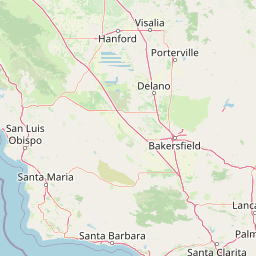
Map view of Los Padres National Forest

Use this park location map to pinpoint Los Padres National Forest in United States of America, understand its exact geographic position, and read its mapped placement within the surrounding landscape more clearly.

Pigeon | © OpenStreetMap contributors

Location context for Los Padres National Forest

California
Recorded earthquake history

Review the Los Padres National Forest Earthquake History and Seismic Records

Access a structured collection of historical earthquake events associated with the terrain of Los Padres National Forest. This catalogue provides direct insight into recorded seismic activity near the region to assist with deeper geographic exploration through the MoriAtlas dataset.

Los Padres National Forest Earthquake History

Catalogued events

3,671 events

Strongest magnitude

Magnitude 6.7

Most recent event

Aug 11, 2026

This history includes earthquakes recorded inside the park or within 50 km of its borders

Visual reference for coastal mountains, wilderness habitats, and rugged terrain

Los Padres National Forest Photos and Landscape Scenery

Photographic records reveal the dramatic elevation range of Los Padres National Forest, spanning from foggy Big Sur coastal canyons up to high pine ridges. Visual documentation helps researchers and visitors analyze the protected landscapes, native wildlife habitats, and varied terrain across central California.

A large California condor with broad wings flying in profile against a backdrop of distant blue-tinted mountain ridges.

A square, elevated fire lookout building with a wrap-around balcony and external metal staircase standing on a grassy hill under a clear blue sky, with three people standing near the base.

A multi-tiered waterfall flowing down a steep, mossy rock cliff face surrounded by dense green vegetation.

A group of bare, white-barked trees standing in a dry, brushy landscape with a forested hillside in the background.

A wide view of layers of hazy mountain ridges under a clear blue sky, with a reservoir visible in the midground and chaparral vegetation in the foreground.

Park atlas

Discover related protected landscapes and regional wilderness areas across central California.

Explore Parks Near Los Padres National Forest and Surrounding Mountain Regions

Browsing other protected areas near Los Padres National Forest reveals the diverse mountain terrain and coastal ecosystems spanning the region. Expanding the geographic comparison provides valuable context on connected conservation corridors and neighbouring wilderness zones.
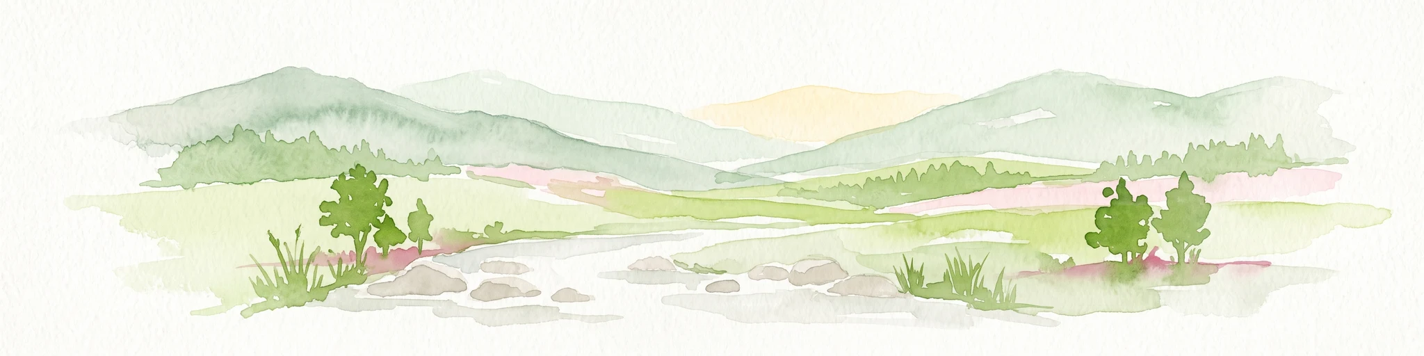
A soft, painterly watercolor illustration depicting layered green mountain ridges and rolling foothills under a bright, open sky.
Protected landscapeCalifornia
Park boundaries overlap#1 closest

East

Angeles National Forest: Mapped Protected Landscapes and Geographic Terrain in California

Mountain wilderness and Mediterranean watershed geography

Spanning the San Gabriel and Sierra Pelona ranges, Angeles National Forest serves as a dramatic ecological transition zone. This analysis of its protected landscape focuses on the interaction between steep canyons, high peaks, and the distinct chaparral and conifer zones that shape California geography.

Area
2,652.26 km²
Established
1908
Relief
Mountain
Climate
Mediterranean
Wildlife reserveSan Luis Obispo County
Park boundaries overlap#2 closest

Northwest

Garcia Wilderness: Mapped Boundaries and Geographic Identity in San Luis Obispo County

Studying the Santa Lucia Range ridge and forest ecosystems

Located in San Luis Obispo County, Garcia Wilderness encompasses 14,100 acres of protected coastal mountains. Its topography features a prominent east-west ridge system that dictates local drainage patterns and vegetative shifts, ranging from lower-slope chaparral to dense oak forests. This area represents a vital segment of the federal conservation efforts established to protect the central California landscape.

Area
57 km²
Established
1992
IUCN
Ib
Relief
Mountain
Watercolor painting of a mountain range with a winding stream, small trees, and grassy foreground on a white background.
Wildlife reserveCalifornia
Mapped location lies within the park boundary#3 closest

East

Matilija Wilderness: A High Elevation Protected Landscape in the Santa Ynez Mountains

Rugged canyon geography and critical California condor habitat

Spanning from deep canyon bottoms to the high rocky ridges of Monte Arido, Matilija Wilderness represents a significant protected unit within California. The area encompasses a dense network of riparian habitats along Matilija Creek, forming a vital ecological corridor for wildlife and preserving the rugged terrain of the southern Santa Ynez Mountains.

Area
118.2 km²
Established
1992
IUCN
Ib
Relief
Mountain
A soft watercolor painting of a shoreline with gentle green hills and pale purple water against a white background.
Marine protected areaCalifornia
Park boundaries overlap#4 closest

Northwest

Monterey Bay National Marine Sanctuary: California Marine Protected Area and Coastal Atlas

Mapping deep submarine canyons and expansive Pacific coastal ecosystems.

Monterey Bay National Marine Sanctuary represents one of the most biologically significant marine protected areas in the United States. Spanning 276 miles of California shoreline, the sanctuary encompasses varied aquatic terrain including towering kelp forests, rocky reefs, and the massive Monterey Submarine Canyon. This protected marine landscape serves as a crucial region for oceanic research and environmental conservation.

Area
15,780 km²
Established
1992
Relief
Mixed relief
Climate
Mediterranean
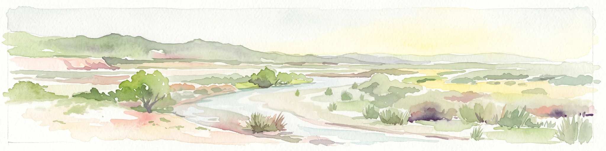
A horizontal watercolor painting depicting a wide, winding river flowing through a coastal valley with rolling hills in the background and sparse green vegetation in the foreground.
Marine protected areaCalifornia
2.3 km away#5 closest

West

Chumash Heritage National Marine Sanctuary: California Marine Protected Area Atlas

Mapping coastal transition zones and submarine seafloor features

Spanning over 4,500 square miles off the Central Coast of California, the Chumash Heritage National Marine Sanctuary represents a critical ecological intersection between northern and southern marine species. The sanctuary includes dramatic underwater terrain like Arguello Canyon, Rodriguez Seamount, and the Santa Lucia Bank, creating a complex habitat that sustains kelp forests and diverse maritime resources.

Area
11,770 km²
Established
2024
IUCN
V
Relief
Mixed relief
National parkCalifornia
21 km away#6 closest

Southeast

Channel Islands National Park: A Protected Landscape within California's Geography

Explore its unique mapped terrain and protected area context.

Channel Islands National Park stands as a key protected area, providing critical insight into California's unique geographic features and natural landscapes. This entry focuses on the park's identity as a protected entity, detailing its mapped boundaries and the surrounding regional geography. It offers an atlas-level view, essential for understanding the park's contribution to the broader landscape context of the United States and its conservation importance.

Area
1,009.94 km²
Established
1980
IUCN
II
Visitors
323.2K annual
National parkCalifornia
21 km away#7 closest

Northwest

Pinnacles National Park: California National Park Geographic Discovery and Map Context

Explore unique protected landscape and regional terrain.

Delve into the protected landscape of Pinnacles National Park, a significant natural area within California. This page offers an atlas-centered view of its unique geological formations and mapped terrain, providing essential context for understanding its geographic identity. Explore the park's specific landscape characteristics and its relation to the broader regional geography and protected areas.

Area
107.67 km²
Established
2013
IUCN
II
Visitors
275K annual
A watercolor illustration of rolling green hills, a small shoreline, and patches of grass against a white background.
Protected landscapeCalifornia
27 km away#8 closest

Southeast

Santa Monica Mountains National Recreation Area: Protected Landscape and Regional Geography

Exploring the ecological and cultural tapestry of Southern California's coastal mountains.

Santa Monica Mountains National Recreation Area comprises a complex array of parks and preserves that protect the unique Mediterranean climate of Southern California. The terrain showcases rugged ridgelines, deeply carved canyons, and vital coastal habitats. As a significant urban protected area, it offers an essential look at how biodiversity, human history, and regional geography coexist within one of the most populated zones in the United States.

Area
638 km²
Established
1978
IUCN
V
Visitors
795.2K annual

Common questions about visiting, size, designation, and location context for Los Padres National Forest

Los Padres National Forest FAQs for park facts, access, geography, and protected area context

Find quick answers about Los Padres National Forest, including protected-area facts, park geography, trail and visitor context, and how the park fits into its surrounding country and regional landscape.
MoriAtlas Explorer

Continue Your Protected Areas Search Across the Global Atlas

Deepen your exploration by continuing the structured search for national parks and protected areas worldwide. Utilize the comprehensive filtering capabilities to compare different conservation landscapes and refine your understanding of global park geography. Discover more about the distribution and characteristics of protected natural areas.

Global natural geography