Mori Atlas logo
National parkPinnacles National Park

Discover the unique mapped terrain and regional context of this National Park.

Pinnacles National Park: California's Protected Landscape and Geographic Atlas

Pinnacles National Park in California offers a distinct protected landscape ripe for geographic exploration. As a national park, it represents a significant area of natural terrain whose mapped boundaries and unique geological features are key to understanding its regional identity. This page serves as an entry point to exploring the park's specific geography, landscape context, and its place within the broader atlas of protected areas in the United States.

volcanic landscapestalus cavesrock climbingCalifornia condorbirdwatchingwilderness protection

Pinnacles National Park

National park

Park overview

Structured park overview, official facts, and landscape profile for Pinnacles National Park

Pinnacles National Park park facts, protected area profile, and essential visitor context

Review the core facts for Pinnacles National Park, including designation, size, terrain, visitor scale, habitats, and operating context in one park-focused overview.

About Pinnacles National Park

Pinnacles National Park occupies a unique position in California's protected landscape system as the eroded remnants of a volcanic field that has literally traveled across the state along the San Andreas Fault. The park lies about 40 miles inland from the Pacific Ocean and roughly 45 miles south of the San Francisco Bay Area, within the southern portion of the Gabilan Range that forms part of the California Coast Ranges. The landscape presents a stark contrast between the stark, exposed volcanic spires of the west division and the more sheltered, riparian corridors of the east. Visitors encounter a terrain shaped by millions of years of volcanic activity, fault movement, and erosion, where andesite and rhyolite formations rise dramatically from the chaparral-covered slopes. The park's wilderness designation covers over 15,985 acres, protecting not only the scenic rock formations but also the ecological communities that depend on this specialized volcanic terrain. Rock climbers from across the country seek out the challenging routes on the breccia formations, while hikers explore the network of trails that traverse the different ecological zones and provide access to the talus caves and high vantage points overlooking the surrounding Salinas Valley.

Quick facts and research context for Pinnacles National Park

Pinnacles National Park encompasses 26,606 acres in San Benito and Monterey counties along the Central California coast. The park was originally established as a national monument by President Theodore Roosevelt in 1908 and was redesignated as the state's ninth national park in 2013. Elevation ranges from 824 feet at the park entrance to 3,304 feet at North Chalone Peak. The park experiences a hot-summer Mediterranean climate with temperatures reaching above 115 degrees Fahrenheit in summer and dropping to around 10 degrees in winter. Over 80 percent of the park is designated as the Hain Wilderness, providing additional protection to the volcanic rock spires and critical habitats.

Protection and recognition

Documenting terrestrial conservation boundaries and official management status

Pinnacles National Park Protection Status and Terrestrial Designation

Researchers can browse the official terrestrial protection status and established designation history for Pinnacles National Park. Verifying the official management profile offers essential geographic context for understanding regional conservation frameworks and protected wilderness areas.

Protection details

Protection scope
Terrestrial
Transboundary protection
No
Core area
64.69 km²
Park context

Deeper park guide and search-rich context for Pinnacles National Park

Pinnacles National Park history, landscape, wildlife, and travel context

Explore Pinnacles National Park through its history, landscape character, ecosystems, wildlife, conservation priorities, cultural context, and seasonal travel timing in a structured park guide built for atlas discovery and search intent.

Why Pinnacles National Park stands out

Pinnacles is best known for its dramatic volcanic rock formations, which form sheer spires and towering walls that have made the park a premier destination for advanced rock climbers. The talus caves, particularly Bear Gulch Cave and Balconies Cave, are unusual geological features that house significant bat populations and offer seasonal exploration opportunities. The park is nationally significant as a California condor release site, with approximately 25 free-flying condors now maintained through a reintroduction program that began in 2003. The high density of breeding prairie falcons represents another notable distinction, with the park supporting some of the largest concentrations of this species in North America.

Pinnacles National Park history and protected-area timeline

The Pinnacles region has a human history extending back approximately 2,000 years, with archaeological evidence indicating Native American habitation at 13 sites within what is now the park. The Chalon and Mutsun groups of the Ohlone people inhabited the area, leaving stone artifacts throughout the region. These native communities declined following the arrival of Spanish missionaries in the 18th century, who established Mission Nuestra Señora de la Soledad nearby and brought diseases that devastated the indigenous population. By 1810, the last Chalon had died or departed the area, and the region remained essentially uninhabited wilderness until Anglo-American settlers arrived around 1865. Interest in the Pinnacles grew during the 1880s as visitors from surrounding communities explored the caves and camped in Bear Valley. Schuyler Hain, a homesteader who arrived in 1891, became the driving force behind preservation efforts after bringing geologist G.K. Gilbert to the area in 1893. Hain's advocacy led Stanford president David Starr Jordan to contact Congressman James C. Needham, who in turn influenced Gifford Pinchot to recommend presidential protection. President Theodore Roosevelt established the Pinnacles Forest Reserve in 1906 and designated Pinnacles National Monument in 1908 under the Antiquities Act. The monument expanded gradually over the following decades through presidential proclamations and land donations, with the National Park assuming management around 1911. The park achieved national park status on January 10, 2013, when President Barack Obama signed legislation authored by Representative Sam Farr, and the Pinnacles Wilderness was renamed the Hain Wilderness to honor Schuyler Hain's conservation contributions.

Pinnacles National Park landscape and geographic character

The defining landscape of Pinnacles National Park consists of towering volcanic spires and sheer rock walls formed from andesite and rhyolite that represent the eroded remnants of the Neenach Volcano. These dramatic formations rise sharply from the surrounding chaparral-covered hills, creating a landscape of exceptional visual contrast. The park is naturally divided into two distinct sections by the rock formations, with the East Division offering shaded canyons, water sources, and the Bear Gulch area, while the West Division features the high walls and exposed peaks that give the park its name. Elevation within the park ranges from 824 feet at the lower boundaries to 3,304 feet at North Chalone Peak, providing significant topographic variation. The talus caves represent another distinctive landscape feature, formed when large rock fragments fell into narrow shear fractures and gorges, creating passages and chambers beneath the jumbled boulders. The landscape is situated within the Gabilan Range, with the Santa Lucia Mountains lying between the park and the Pacific Ocean, creating an rainshadow effect that influences the local climate.

Pinnacles National Park ecosystems, habitats, and plant life

The ecological character of Pinnacles National Park reflects the Mediterranean climate and volcanic terrain of Central California's Coast Ranges. According to the A.W. Kuchler potential natural vegetation classification, the park is characterized by chaparral as the dominant vegetation type, covering approximately 80 percent of the area, with woodlands, riparian corridors, and grasslands interspersed throughout. The warmer portions of the park support extensive stands of greasewood covering slopes, alongside manzanita, gray pine, canyon live oak, and blue oak. Cooler areas at higher elevations contain higher proportions of pines and oaks mixed with California buckeye, hollyleaf cherry, and coffeeberry. Riparian areas along intermittent streams support willows and elderberries. Fire has played a dominant role in shaping the vegetation, both from natural lightning-caused burns and from historical Native American burning practices that maintained open habitats and encouraged preferred food plant species. The remarkable bee diversity discovered through a 1990s survey found over 450 species in the park, representing the highest density of bee species per unit area known anywhere on Earth, with most being solitary bees that complete their brief life cycles during the extended blooming season.

Pinnacles National Park wildlife and species highlights

Pinnacles National Park supports notable wildlife populations, particularly species associated with the volcanic rock formations and talus cave systems. Prairie falcons breed in the park at some of the highest densities recorded anywhere in North America, making the area particularly significant for this species of concern. Peregrine falcons have more recently returned to nest in the park, though in smaller numbers. The California condor reintroduction program, initiated in 2003, has become a major conservation success story for the park, with approximately 25 free-flying condors now maintained through captive breeding and release efforts, including the first wild nest built in 2010. The talus caves provide critical roosting and breeding habitat for at least 13 documented bat species, with an additional three species considered likely to be present. Common mammals inhabiting the park include coyotes, bobcats, gray foxes, raccoons, California quail, and wild turkeys, while golden eagles and great horned owls occupy the raptorial niche. Historically, the region supported tule elk, pronghorn, grizzly bears, and black bears, but these species have been locally extinct from most of Central California since the late 19th century.

Pinnacles National Park conservation status and protection priorities

Pinnacles National Park serves significant conservation functions within California's protected area network. The designation of over 80 percent of the park as the Hain Wilderness provides the highest level of federal protection for the volcanic spires, mountain peaks, and the creeks and canyons that serve as habitat for the endangered California red-legged frog. The park's role in the California condor reintroduction program represents one of the most successful raptor recovery efforts in North America, with Pinnacles now managing a self-sustaining population of free-flying condors that were once on the brink of extinction in the wild. The high-density prairie falcon breeding population qualifies the park as globally significant for this species. A notable conservation achievement involved the eradication of feral pigs from the core of the park through a twenty-year, $1.6 million effort that culminated in spring 2006, with an exclusion fence approximately 26 miles long protecting the pig-free core area from reinvasion by animals from surrounding lands.

Pinnacles National Park cultural meaning and human context

The human history of the Pinnacles region extends to approximately 2,000 years before present, with the Chalon and Mutsun groups of the Ohlone people occupying the area and leaving archaeological evidence at 13 sites within the current park boundaries. These Native American communities utilized the landscape for hunting and gathering, and historical accounts indicate they employed controlled burning to maintain preferred food sources and herd small game. The arrival of Spanish missionaries in the 18th century brought disease and cultural disruption that led to the virtual depopulation of the region by 1810. The modern preservation movement began with Schuyler Hain, a homesteader who arrived in Bear Valley in 1891 and dedicated himself to protecting the Pinnacles after bringing geologist G.K. Gilbert to see the area. Hain's efforts ultimately led to presidential protection, and the 2013 redesignation renamed the Pinnacles Wilderness as the Hain Wilderness in his honor. The park also contains evidence of more recent human activity, including historic trail-building efforts by Civilian Conservation Corps crews in the 1930s and a fire lookout built on Chalone Peak.

Top sights and standout views in Pinnacles National Park

The volcanic spires of Pinnacles National Park create one of California's most distinctive landscapes, with the eroded remnants of the Neenach Volcano now standing as dramatic rock formations that attract rock climbers from across the continent. The talus caves, particularly Bear Gulch Cave and Balconies Cave, offer seasonal exploration opportunities within formations created by boulders wedged into narrow canyons. The California condor reintroduction program has established a population of approximately 25 free-flying birds that can often be spotted soaring on thermal currents above the park. The High Peaks Trail provides hikers with close-up views of the most impressive rock formations, while the "Pig Fence" trail segment offers a unique hiking challenge along a fence installed to prevent feral pig incursion. The park's position along the San Andreas Fault provides geological significance beyond the volcanic formations, with the fault's movement having transported the Pinnacles rocks approximately 195 miles from their original volcanic source.

Best time to visit Pinnacles National Park

The optimal seasons for visiting Pinnacles National Park are spring and fall, when moderate temperatures make hiking comfortable and the landscape displays its most vibrant colors. Spring, particularly March and April, brings widespread wildflower displays across the chaparral and grassland areas, though the spectacle may be limited in years of extreme drought. Summer temperatures can be intense, frequently exceeding 100 degrees Fahrenheit and sometimes reaching as high as 116 degrees, making midday hiking hazardous and much of the park's terrain uncomfortable for visitors. Winter brings cooler temperatures that make hiking more pleasant, though temperatures can drop to around 10 degrees during cold snaps, and snow occasionally falls at higher elevations between mid-December and January. The talus caves may be closed during pupping season to protect bat breeding colonies, and cave conditions can change rapidly during periods of high precipitation when flooding may occur.

Park guides

Targeted answers for navigating volcanic spires and seasonal weather shifts

Pinnacles National Park Published Guides and Focused Terrain Insights

Focused park guides provide structured answers to specific visitor questions regarding remote protected terrain. The published visitor timing reference addresses optimal seasonal windows and temperature patterns across the Gabilan Range.
Monthly climate preview

Long-term monthly precipitation patterns and temperature trends at the park coordinate.

Monthly Climate Normals and Average Temperatures for Pinnacles National Park

Long-term measurements at the representative coordinate of 476 meters reveal a notable shift from cool winter months with sub-zero minimum temperatures to dry summer peaks exceeding 40 degrees Celsius. Accessing the complete monthly profile provides essential context on precipitation rates and temperature spreads based on three decades of observations.
Annual mean15 °C
8 °C23 °C
Jan
Feb
Mar10°
Apr12°
May15°
Jun19°
Jul23°
Aug23°
Sep21°
Oct17°
Nov12°
Dec
Warmest month
July

22.8 °C

Coolest month
December

8.2 °C

Wettest month
February

3.8 mm/day

Driest month
July

0 mm/day

Park location guide

Geography guide, regional context, and park location map for Pinnacles National Park

Pinnacles National Park park geography, regions, and map view in United States of America

Understand where Pinnacles National Park sits in United States of America through a broader geographic reading of the surrounding landscape, nearby location context, and its mapped position within the national park landscape.

How Pinnacles National Park fits into United States of America

The United States of America is a federal presidential republic and one of the world's largest countries by area and population. It consists of 50 states across a vast territory spanning multiple time zones, with its capital in Washington, D.C. and largest city in New York City. The nation has a diverse economy, influential political system, and significant cultural and military presence globally.

Wider geography shaping Pinnacles National Park in United States of America

The United States occupies a vast territory in North America, bordered by Canada to the north and Mexico to the south. The 48 contiguous states stretch from the Atlantic to the Pacific Ocean, while Alaska occupies the northwestern region and Hawaii is an archipelago in the Pacific. The country encompasses diverse terrain including the Rocky Mountains, Appalachian Mountains, Great Plains, and extensive river systems.

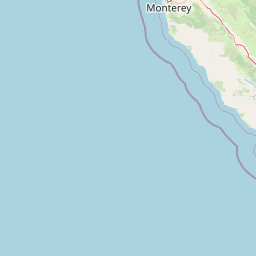
Map view of Pinnacles National Park

Use this park location map to pinpoint Pinnacles National Park in United States of America, understand its exact geographic position, and read its mapped placement within the surrounding landscape more clearly.

Pigeon | © OpenStreetMap contributors

Location context for Pinnacles National Park

CaliforniaMonterey CountySan Benito County
Recorded earthquake history

Explore the Historical Earthquake Records Associated with Pinnacles National Park

MoriAtlas maintains a precise index of documented earthquakes occurring near Pinnacles National Park. Review historical seismic data, including event magnitude and epicentre distance, to understand the recorded activity landscape of this California protected area.

Pinnacles National Park Earthquake History

Catalogued events

1,994 events

Strongest magnitude

Magnitude 5.5

Most recent event

Aug 11, 2026

This history includes earthquakes recorded inside the park or within 50 km of its borders

Park atlas

Map the regional spread of protected landscapes, comparing geographic context and conservation value around Central California.

Discover Nearby National Parks and Protected Areas Beyond Pinnacles National Park

Explore national parks and protected areas near Pinnacles National Park, mapping diverse landscapes in Central California and the broader Gabilan Range. Compare these protected regions to trace unique geological features, chaparral ecosystems, and vital conservation efforts across the surrounding terrain.
Protected landscapeCalifornia
21 km away#1 closest

Southeast

Los Padres National Forest: Geography and Protected Landscape Map of Central California

Extensive wilderness corridors and high mountain ridges

Spanning from the Big Sur coastline to the interior ranges of the Santa Lucia and San Rafael mountains, Los Padres National Forest represents a significant protected area in California. The region contains deep gorges, forest-covered canyons, and high-altitude pine ridges that provide essential habitat and support major river headwaters.

Area
7,700 km²
Established
1936
Relief
Mountain
Climate
Mediterranean
Marine protected areaCalifornia
51 km away#2 closest

West

Monterey Bay National Marine Sanctuary: California Marine Protected Area and Coastal Atlas

Mapping deep submarine canyons and expansive Pacific coastal ecosystems.

Monterey Bay National Marine Sanctuary represents one of the most biologically significant marine protected areas in the United States. Spanning 276 miles of California shoreline, the sanctuary encompasses varied aquatic terrain including towering kelp forests, rocky reefs, and the massive Monterey Submarine Canyon. This protected marine landscape serves as a crucial region for oceanic research and environmental conservation.

Area
15,780 km²
Established
1992
Relief
Mixed relief
Climate
Mediterranean
Nature reserveCalifornia
About 53 km away#3 closest

Northwest

Elkhorn Slough National Estuarine Research Reserve: Protected Landscapes and Coastal Geography

Mapping the tidal ecosystems of Monterey Bay, California

Located near Watsonville, California, this nature reserve protects a vital estuarine ecosystem marked by tidal channels, mudflats, and oak woodlands. It functions as a key site for coastal research, providing a clear window into the ecology and protected terrain of one of the largest salt marshes remaining on the California coastline.

Area
6.9 km²
Relief
Lowland
Climate
Mediterranean
Access
Easy access
Marine protected areaCalifornia
139 km away#4 closest

South

Chumash Heritage National Marine Sanctuary: California Marine Protected Area Atlas

Mapping coastal transition zones and submarine seafloor features

Spanning over 4,500 square miles off the Central Coast of California, the Chumash Heritage National Marine Sanctuary represents a critical ecological intersection between northern and southern marine species. The sanctuary includes dramatic underwater terrain like Arguello Canyon, Rodriguez Seamount, and the Santa Lucia Bank, creating a complex habitat that sustains kelp forests and diverse maritime resources.

Area
11,770 km²
Established
2024
IUCN
V
Relief
Mixed relief
Wildlife reserveSan Luis Obispo County
143 km away#5 closest

Southeast

Garcia Wilderness: Mapped Boundaries and Geographic Identity in San Luis Obispo County

Studying the Santa Lucia Range ridge and forest ecosystems

Located in San Luis Obispo County, Garcia Wilderness encompasses 14,100 acres of protected coastal mountains. Its topography features a prominent east-west ridge system that dictates local drainage patterns and vegetative shifts, ranging from lower-slope chaparral to dense oak forests. This area represents a vital segment of the federal conservation efforts established to protect the central California landscape.

Area
57 km²
Established
1992
IUCN
Ib
Relief
Mountain
Protected landscapeCalifornia
154 km away#6 closest

Northeast

Sierra National Forest: Protected Landscapes of the Central California Sierra Nevada

Geography of alpine lakes, conifer forests, and mountain basins

Spanning from 900 to nearly 14,000 feet in elevation, Sierra National Forest protects a massive vertical range of California terrain. Discover its iconic wilderness areas and reservoir-studded landscape, providing a deep look at the geographic connectivity between major national parks in the central Sierra Nevada.

Area
5,300 km²
Established
1893
Relief
Mountain
Climate
Alpine
Protected landscapeCalifornia
156 km away#7 closest

Northeast

Stanislaus National Forest: Sierra Nevada Mountain Geography and Protected Wilderness Lands

California mountain terrain and forest landscape map

Stanislaus National Forest is a sprawling protected landscape located in the central Sierra Nevada of California. Characterized by volcanic and granite formations, the area protects critical watersheds, Wild and Scenic rivers, and large swaths of old growth forest that define the rugged mountain interior.

Area
3,634.48 km²
Established
1897
Relief
Mountain
Climate
Temperate
Protected landscapeCalifornia
164 km away#8 closest

East

Sequoia National Forest: Protected Sierra Nevada Geography and Mountain Terrain

A vast protected landscape spanning 1.1 million acres in California

Spanning Tulare, Kern, and Fresno counties, Sequoia National Forest preserves iconic giant sequoia groves across multiple river watersheds. The terrain features vertical relief exceeding 11,000 feet, showcasing a range of ecosystems from chaparral slopes and coniferous forests to glacial cirques and granite spires located within the southern Sierra Nevada range.

Area
4,829.17 km²
Established
1908
Relief
Mountain
Climate
Mediterranean

Common questions about visiting, size, designation, and location context for Pinnacles National Park

Pinnacles National Park FAQs for park facts, access, geography, and protected area context

Find quick answers about Pinnacles National Park, including protected-area facts, park geography, trail and visitor context, and how the park fits into its surrounding country and regional landscape.
MoriAtlas Explorer

Continue Your Protected Areas Search Across the Global Atlas

Deepen your exploration by continuing the structured search for national parks and protected areas worldwide. Utilize the comprehensive filtering capabilities to compare different conservation landscapes and refine your understanding of global park geography. Discover more about the distribution and characteristics of protected natural areas.

Global natural geography