
Why Sierra National Forest stands out
Sierra National Forest is best known for the diversity of its Sierra Nevada landscapes, moving from low oak foothills through dense conifer forests and into classic High Sierra country with alpine lakes and granite peaks. Its network of wilderness areas, including the John Muir, Ansel Adams, Dinkey Lakes, Kaiser, and Monarch Wildernesses, gives the forest a strong reputation for backcountry hiking and high-country scenery. The forest is also known for its reservoirs and lakes, particularly Bass Lake, Shaver Lake, Huntington Lake, Courtright Reservoir, and Wishon Reservoir, which support fishing, boating, sailing, and seasonal recreation. The combination of accessible reservoirs near the foothill communities and extensive high-elevation wilderness above them gives the forest an unusually broad recreation profile.
Sierra National Forest history and protected-area timeline
Sierra National Forest has its origins in the proclamation of the Sierra Forest Reserve on February 14, 1893, by President Benjamin Harrison. At the time of its creation it was both the second national forest in California and the largest, covering more than six million acres across the Sierra Nevada and spanning parts of eight counties from Tuolumne in the north to Kern in the south, and extending east into Mono and Inyo counties.
The original reserve was far larger than today's Sierra National Forest. By 1897 the southern half of the reserve had been separated and designated Sierra South, a name that was eventually dropped when the federal forest reserves were reorganized as National Forests on March 4, 1907. In 1908 the Sequoia National Forest, along with Kings Canyon and Sequoia National Parks, was carved out of the southern portion of what had been Sierra National Forest. Eastern lands became the Inyo and Toiyabe National Forests, while northern lands contributed to Yosemite National Park and the Stanislaus National Forest, leaving the present-day Sierra National Forest as a central remnant of the original reserve.
The forest has a deep pre-reservation human history, with artifacts dating back more than 10,000 years reflecting indigenous presence across the region. In the late 1700s, the Fresno River roughly marked the boundary between the Southern Sierra Miwok and the Chukchansi Yokuts, while the Western Mono lived near present-day Bass Lake, with overlapping territories among these groups. The first timber sale on a California National Forest took place in Sierra National Forest in 1899.
In recent decades the forest has also been the focus of a national monument campaign launched in 2015. The proposed Range of Light National Monument would protect about 1.4 million acres, including the entire forest and the San Joaquin Gorge, and would connect Yosemite, Sequoia, and Kings Canyon National Parks into a continuous protected corridor. Supporters include local organizations, scientists, and environmental groups, while opposition has come from logging interests and certain members of Congress.
Sierra National Forest landscape and geographic character
Sierra National Forest sweeps across an unusually wide vertical range of terrain, from the oak-covered foothills at its western edge to the rocky, tundra-like high country along the Sierra crest. Elevations extend from roughly 900 feet near the San Joaquin Valley margin to nearly 14,000 feet in the High Sierra, producing a layered landscape of distinct ecological and visual zones.
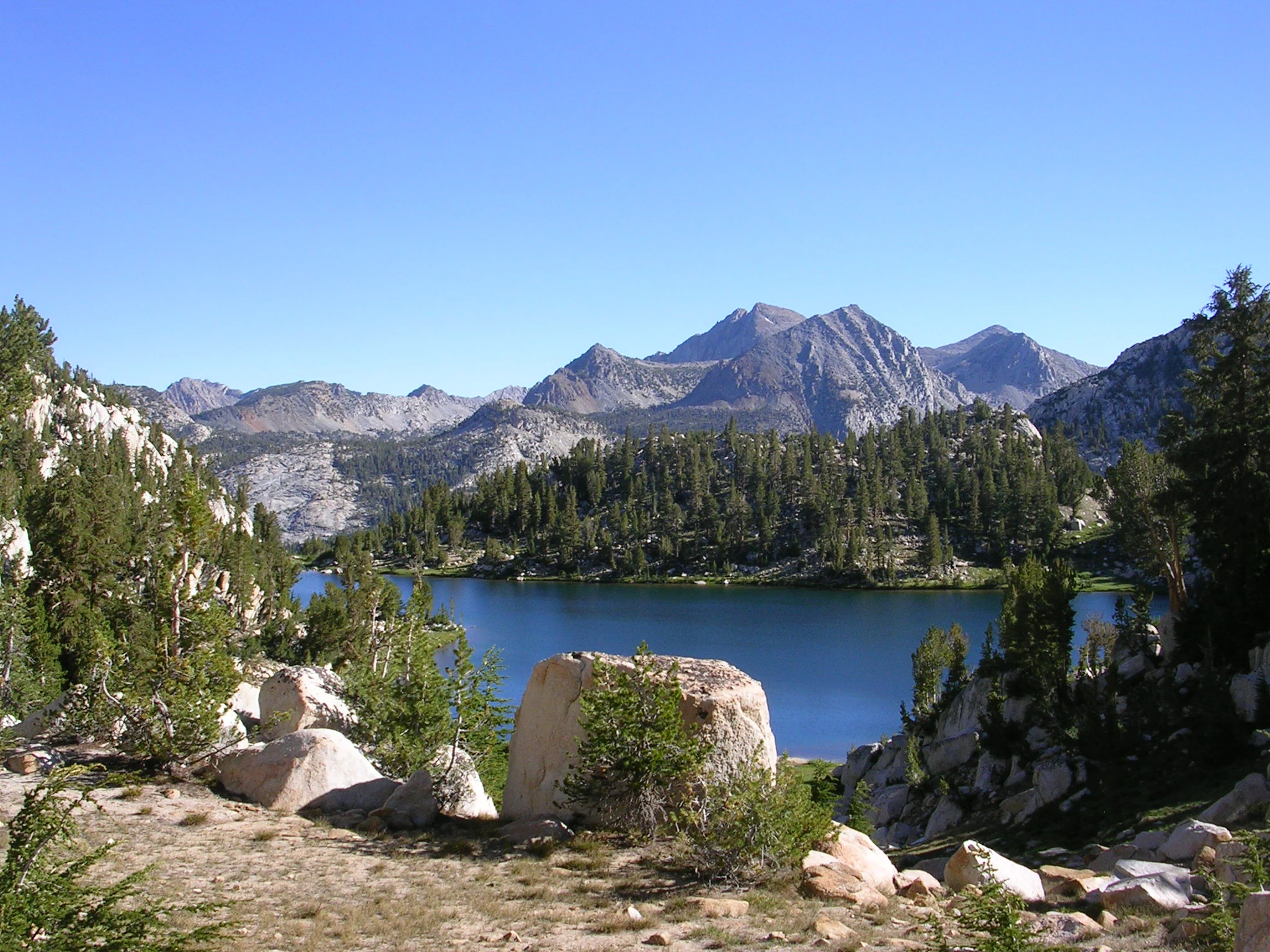
At the lower end, rolling foothills dotted with oak woodlands transition into steep, forested slopes dominated by conifers. Above these middle-elevation forests, the terrain opens up into the classic High Sierra environment of granite peaks, broad basins, glacial cirques, and alpine lakes. Prominent landforms include Fresno Dome, a striking granite feature, and Nelder Grove, a grove of giant sequoias.
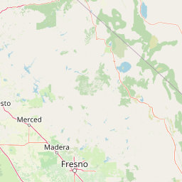
The forest's boundary traces major drainages and landmarks of the central Sierra. The Merced River canyon and the southern boundary of Yosemite National Park frame the north, while Electra Peak, Mount Goethe, and the Kings River canyon define the transition to Yosemite, Inyo, and Kings Canyon. Moving westward and southward, the boundary descends to Pine Flat Lake, Tollhouse, Auberry, North Fork, and Coarsegold, before turning north through Miami Mountain and back to the Merced River. This sweep of boundaries encloses a landscape that contains reservoirs, river canyons, forested ridges, and open alpine terrain within a single continuous national forest.
Sierra National Forest ecosystems, habitats, and plant life
The ecology of Sierra National Forest follows the classic pattern of the western Sierra Nevada, where climate changes sharply with elevation and gives rise to a series of stacked biotic zones. Each zone is marked by a characteristic tree species or by the absence of trees, producing distinct habitat bands as altitude increases.
The foothill woodland zone, found from roughly 1,000 to 3,000 feet, is dominated by interior live oak and represents the dry, warm entry into the forest. Above this, the lower montane zone between about 3,000 and 7,000 feet is characterized by ponderosa pine forests. From 7,000 to 9,000 feet, the upper montane zone transitions into mixed stands of lodgepole pine and red fir, which together form one of the forest's most extensive forest types. The subalpine zone, between roughly 9,000 and 9,500 feet, is defined by whitebark pine, while above 9,500 feet the alpine zone exists beyond the tree line.
Roughly 383,000 acres of the forest are considered old growth, dominated by lodgepole pine and red fir stands that represent some of the most ecologically significant forested terrain in the southern Sierra. These elevation-driven habitat gradients give the forest an unusually complete ecological profile for the western slope of the central Sierra Nevada.
Sierra National Forest conservation status and protection priorities
Sierra National Forest holds considerable ecological and conservation significance because of the size of its old-growth forests and its role as a connective landscape between Yosemite, Sequoia, and Kings Canyon National Parks. Approximately 383,000 acres of lodgepole pine and red fir old growth represent a substantial portion of the mature and old-growth forest remaining on the western slope of the southern Sierra Nevada.
The forest has been central to regional conservation debates, particularly around the proposed Range of Light National Monument. If established, the monument would protect roughly 1.4 million acres, including the entire forest and the adjacent San Joaquin Gorge managed by the Bureau of Land Management, and would prevent new mining operations while phasing out logging and grazing. Supporters argue that the monument would secure old-growth habitat, contribute to broader conservation initiatives, and create a continuous protected corridor between three major national parks.
At a more applied level, conservation work in the forest has included legal action to limit logging in habitat critical to the fisher, a sensitive forest carnivore. The forest's combination of large wilderness areas, extensive old-growth stands, and connectivity to surrounding national parks gives it an important role in landscape-scale conservation planning in the Sierra Nevada.
Sierra National Forest cultural meaning and human context
Long before Sierra National Forest was designated, the area was home to indigenous peoples whose presence is documented by artifacts dating back more than 10,000 years. In the late 1700s, the Fresno River roughly marked the boundary between the Southern Sierra Miwok to the north and the Chukchansi Yokuts to the south, with the Western Mono living near present-day Bass Lake. These territorial boundaries were not strict, and Miwok, Yokuts, and Mono lands often overlapped, reflecting fluid patterns of land use across the western Sierra.
This deep human history adds cultural depth to a landscape that today is administered primarily for recreation, watershed protection, and timber. The forest's identity is shaped both by its role as a long-inhabited mountain homeland and by its later status as one of California's earliest national forest reserves.
Top sights and standout views in Sierra National Forest
Sierra National Forest's most distinctive features include its chain of major reservoirs, particularly Bass Lake, Shaver Lake, Huntington Lake, Courtright Reservoir, and Wishon Reservoir, which anchor the forest's recreation economy. Bass Lake is especially well known for sailing and seasonal tourism, while Huntington Lake offers high-elevation sailing opportunities within the forest's interior.
The forest's five designated wilderness areas stand out as core conservation assets: Ansel Adams, John Muir, Dinkey Lakes, Kaiser, and Monarch Wildernesses. Together they preserve large tracts of high Sierra terrain, including Lake of the Lone Indian in the John Muir Wilderness, and provide opportunities for extended backcountry travel.
Other notable points of interest include Fresno Dome, a prominent granite landmark; Nelder Grove, a sequoia grove; and China Peak, the forest's ski resort. The forest's position between Yosemite and Kings Canyon National Parks makes it a vital connective landscape in the central Sierra Nevada.
Best time to visit Sierra National Forest
Sierra National Forest can be visited across much of the year, but the experience changes dramatically with elevation and season. Late spring through early autumn is the most popular window for visiting the higher elevations, when High Sierra trails, lakes, and wilderness areas become accessible after winter snowmelt and displays of wildflowers often appear in mid to late summer.
Reservoir-oriented recreation near the foothills, including Bass Lake and Shaver Lake, is typically best in late spring and summer, when warmer weather supports boating, sailing, and swimming. Winter brings snow to the upper elevations and transforms the forest into a ski destination at China Peak, while lower elevations often remain accessible year-round. Choosing a visit window largely depends on whether the focus is foothill and reservoir recreation, high-country hiking, or winter sports.