
Mori Atlas logo
Protected landscapeSierra National Forest

Mapping the geographic transitions from oak foothills to High Sierra alpine terrain

Sierra National Forest: A Protected Landscape in the Central Sierra Nevada Mountains

Sierra National Forest covers over 1.3 million acres of diverse terrain on the western slope of the central Sierra Nevada. The landscape rises from low elevation oak woodlands to the granite peaks and alpine basins of the High Sierra, serving as a critical corridor between Yosemite and Kings Canyon National Parks. This region is defined by its layered ecosystems, extensive wilderness areas, and a network of high-elevation reservoirs that anchor the surrounding natural environment.

national forestSierra Nevadamountain forestalpine wildernessreservoirs and lakesconifer forests
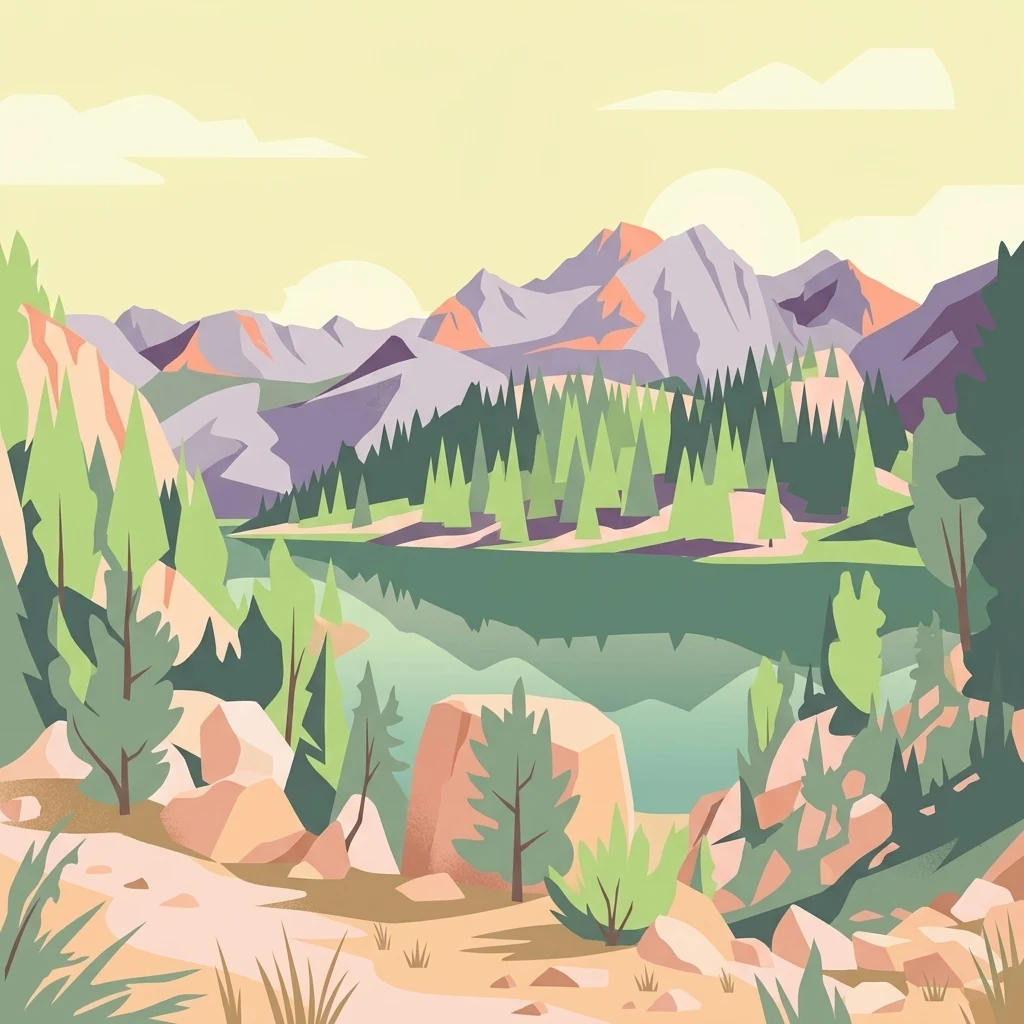
Digital vector-style illustration of a tranquil mountain lake surrounded by pine forests and rocky peaks under a soft, pale sky.

Sierra National Forest

Protected landscape

Park overview

Structured park overview, official facts, and landscape profile for Sierra National Forest

Sierra National Forest park facts, protected area profile, and essential visitor context

Review the core facts for Sierra National Forest, including designation, size, terrain, visitor scale, habitats, and operating context in one park-focused overview.

About Sierra National Forest

Sierra National Forest is one of the largest and most ecologically varied national forests in California's Sierra Nevada. Stretching across more than 1.3 million acres on the western slope of the central range, it captures a complete vertical cross-section of Sierra Nevada environments, from dry foothill woodlands along the San Joaquin Valley margin to alpine terrain above 13,000 feet.

Geographically, the forest reaches deep into the High Sierra and adjoins some of the most iconic protected landscapes in the United States. Its northwestern boundary follows the southern edge of Yosemite National Park near El Portal and Electra Peak, while its southern boundary meets Kings Canyon National Park near Mount Goethe and the Kings River canyon. This positioning places the forest between two major national park systems, creating a continuous band of protected and managed land across the central Sierra.

The forest is administered by the U.S. Forest Service and is divided into the Bass Lake Ranger District in the north and west, the High Sierra Ranger District in the south and east, and a Supervisor's Office in Clovis. Ranger stations and visitor centers serve communities such as North Fork, Prather, and Oakhurst, and the forest maintains close working relationships with research sites such as the Teakettle Experimental Forest and the San Joaquin Experimental Range.

Recreationally, the forest is anchored by a chain of reservoirs used for boating, fishing, and sailing, including Bass Lake near the western edge and Shaver Lake, Huntington Lake, Courtright Reservoir, and Wishon Reservoir deeper in the mountains. China Peak operates as a ski resort under a special use permit, and scenic attractions such as Fresno Dome and Nelder Grove add further points of interest. Wilderness areas within the forest offer extensive backcountry hiking opportunities that complement the more developed recreation sites closer to the foothills.

Quick facts and research context for Sierra National Forest

Sierra National Forest occupies roughly 1.3 million acres on the western slope of the central Sierra Nevada in California, primarily within the eastern portions of Fresno, Madera, and Mariposa counties. The forest's terrain stretches from about 900 feet in elevation up to nearly 14,000 feet, crossing oak foothills, conifer forest belts, subalpine zones, and alpine tundra.

The forest was established on February 14, 1893, when President Benjamin Harrison proclaimed the Sierra Forest Reserve, making it the second national forest in California. It is administered by the U.S. Forest Service within the Pacific Southwest region and is organized into the Bass Lake Ranger District, the High Sierra Ranger District, and the Supervisor's Office, with headquarters in Clovis, California.

Approximately 383,000 acres of the forest are considered old growth, dominated by lodgepole pine and red fir stands. The forest shares borders with two major national parks, contains several designated wilderness areas, and supports large reservoirs that are central to regional recreation.

Protection and recognition

Explore terrestrial conservation records and designated protected area frameworks.

Sierra National Forest Protection Status and International Recognition Data

Sierra National Forest protection status details the documented terrestrial conservation scope and official administrative history. Designated area records outline recognized management boundaries and international framework assignments without referencing external evaluations.

Protection details

Protection scope
Terrestrial
Transboundary protection
No
Park context

Deeper park guide and search-rich context for Sierra National Forest

Sierra National Forest history, landscape, wildlife, and travel context

Explore Sierra National Forest through its history, landscape character, ecosystems, wildlife, conservation priorities, cultural context, and seasonal travel timing in a structured park guide built for atlas discovery and search intent.

Why Sierra National Forest stands out

Sierra National Forest is best known for the diversity of its Sierra Nevada landscapes, moving from low oak foothills through dense conifer forests and into classic High Sierra country with alpine lakes and granite peaks. Its network of wilderness areas, including the John Muir, Ansel Adams, Dinkey Lakes, Kaiser, and Monarch Wildernesses, gives the forest a strong reputation for backcountry hiking and high-country scenery. The forest is also known for its reservoirs and lakes, particularly Bass Lake, Shaver Lake, Huntington Lake, Courtright Reservoir, and Wishon Reservoir, which support fishing, boating, sailing, and seasonal recreation. The combination of accessible reservoirs near the foothill communities and extensive high-elevation wilderness above them gives the forest an unusually broad recreation profile.
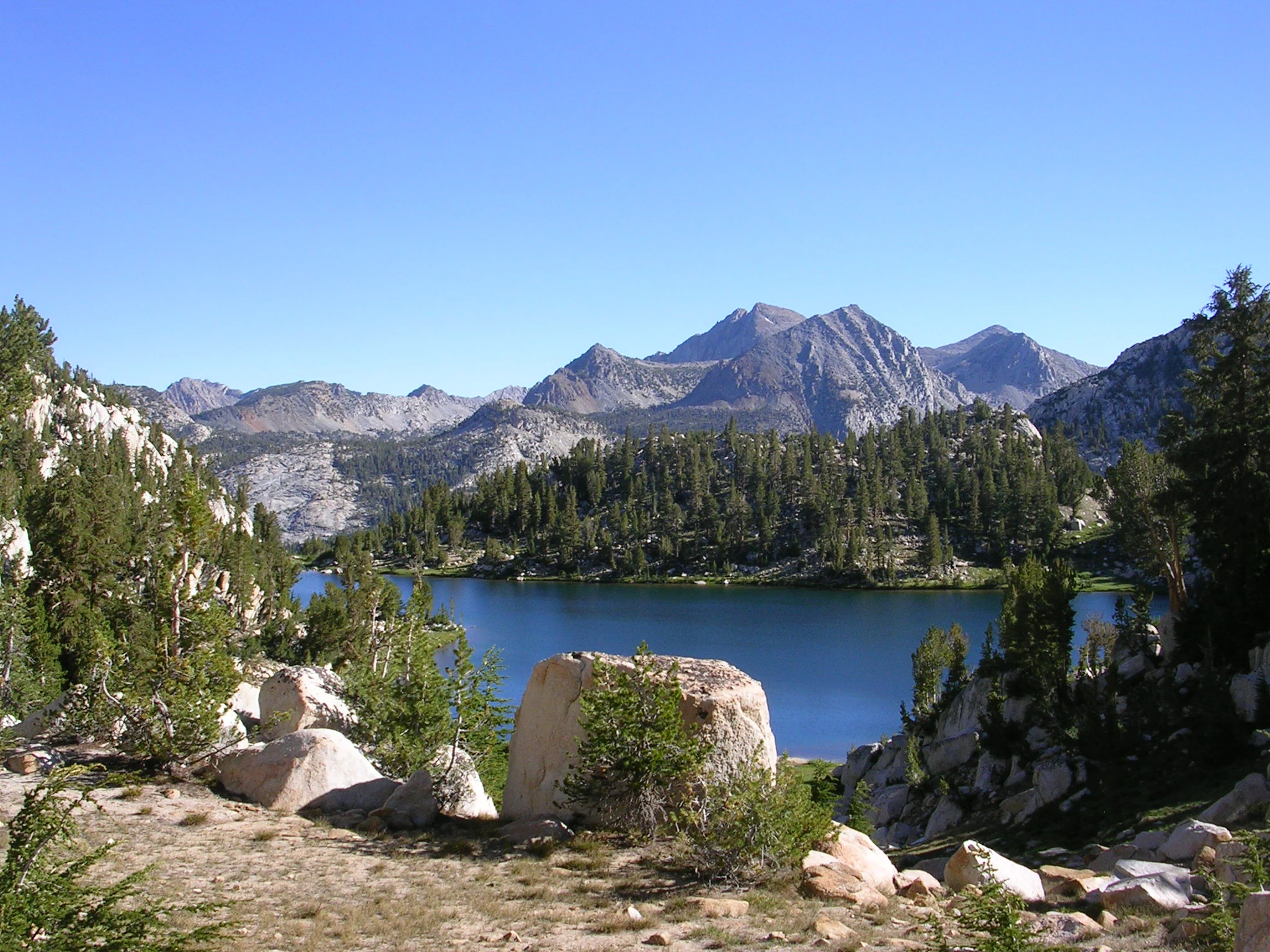
A clear blue alpine lake surrounded by coniferous trees and granite peaks under a cloudless sky.
A scenic view of Lake of the Lone Indian in the John Muir Wilderness.

Sierra National Forest history and protected-area timeline

Sierra National Forest has its origins in the proclamation of the Sierra Forest Reserve on February 14, 1893, by President Benjamin Harrison. At the time of its creation it was both the second national forest in California and the largest, covering more than six million acres across the Sierra Nevada and spanning parts of eight counties from Tuolumne in the north to Kern in the south, and extending east into Mono and Inyo counties.

The original reserve was far larger than today's Sierra National Forest. By 1897 the southern half of the reserve had been separated and designated Sierra South, a name that was eventually dropped when the federal forest reserves were reorganized as National Forests on March 4, 1907. In 1908 the Sequoia National Forest, along with Kings Canyon and Sequoia National Parks, was carved out of the southern portion of what had been Sierra National Forest. Eastern lands became the Inyo and Toiyabe National Forests, while northern lands contributed to Yosemite National Park and the Stanislaus National Forest, leaving the present-day Sierra National Forest as a central remnant of the original reserve.

The forest has a deep pre-reservation human history, with artifacts dating back more than 10,000 years reflecting indigenous presence across the region. In the late 1700s, the Fresno River roughly marked the boundary between the Southern Sierra Miwok and the Chukchansi Yokuts, while the Western Mono lived near present-day Bass Lake, with overlapping territories among these groups. The first timber sale on a California National Forest took place in Sierra National Forest in 1899.

In recent decades the forest has also been the focus of a national monument campaign launched in 2015. The proposed Range of Light National Monument would protect about 1.4 million acres, including the entire forest and the San Joaquin Gorge, and would connect Yosemite, Sequoia, and Kings Canyon National Parks into a continuous protected corridor. Supporters include local organizations, scientists, and environmental groups, while opposition has come from logging interests and certain members of Congress.

Sierra National Forest landscape and geographic character

Sierra National Forest sweeps across an unusually wide vertical range of terrain, from the oak-covered foothills at its western edge to the rocky, tundra-like high country along the Sierra crest. Elevations extend from roughly 900 feet near the San Joaquin Valley margin to nearly 14,000 feet in the High Sierra, producing a layered landscape of distinct ecological and visual zones.

At the lower end, rolling foothills dotted with oak woodlands transition into steep, forested slopes dominated by conifers. Above these middle-elevation forests, the terrain opens up into the classic High Sierra environment of granite peaks, broad basins, glacial cirques, and alpine lakes. Prominent landforms include Fresno Dome, a striking granite feature, and Nelder Grove, a grove of giant sequoias.

The forest's boundary traces major drainages and landmarks of the central Sierra. The Merced River canyon and the southern boundary of Yosemite National Park frame the north, while Electra Peak, Mount Goethe, and the Kings River canyon define the transition to Yosemite, Inyo, and Kings Canyon. Moving westward and southward, the boundary descends to Pine Flat Lake, Tollhouse, Auberry, North Fork, and Coarsegold, before turning north through Miami Mountain and back to the Merced River. This sweep of boundaries encloses a landscape that contains reservoirs, river canyons, forested ridges, and open alpine terrain within a single continuous national forest.

Sierra National Forest ecosystems, habitats, and plant life

The ecology of Sierra National Forest follows the classic pattern of the western Sierra Nevada, where climate changes sharply with elevation and gives rise to a series of stacked biotic zones. Each zone is marked by a characteristic tree species or by the absence of trees, producing distinct habitat bands as altitude increases.

The foothill woodland zone, found from roughly 1,000 to 3,000 feet, is dominated by interior live oak and represents the dry, warm entry into the forest. Above this, the lower montane zone between about 3,000 and 7,000 feet is characterized by ponderosa pine forests. From 7,000 to 9,000 feet, the upper montane zone transitions into mixed stands of lodgepole pine and red fir, which together form one of the forest's most extensive forest types. The subalpine zone, between roughly 9,000 and 9,500 feet, is defined by whitebark pine, while above 9,500 feet the alpine zone exists beyond the tree line.

Roughly 383,000 acres of the forest are considered old growth, dominated by lodgepole pine and red fir stands that represent some of the most ecologically significant forested terrain in the southern Sierra. These elevation-driven habitat gradients give the forest an unusually complete ecological profile for the western slope of the central Sierra Nevada.

Sierra National Forest conservation status and protection priorities

Sierra National Forest holds considerable ecological and conservation significance because of the size of its old-growth forests and its role as a connective landscape between Yosemite, Sequoia, and Kings Canyon National Parks. Approximately 383,000 acres of lodgepole pine and red fir old growth represent a substantial portion of the mature and old-growth forest remaining on the western slope of the southern Sierra Nevada.

The forest has been central to regional conservation debates, particularly around the proposed Range of Light National Monument. If established, the monument would protect roughly 1.4 million acres, including the entire forest and the adjacent San Joaquin Gorge managed by the Bureau of Land Management, and would prevent new mining operations while phasing out logging and grazing. Supporters argue that the monument would secure old-growth habitat, contribute to broader conservation initiatives, and create a continuous protected corridor between three major national parks.

At a more applied level, conservation work in the forest has included legal action to limit logging in habitat critical to the fisher, a sensitive forest carnivore. The forest's combination of large wilderness areas, extensive old-growth stands, and connectivity to surrounding national parks gives it an important role in landscape-scale conservation planning in the Sierra Nevada.

Sierra National Forest cultural meaning and human context

Long before Sierra National Forest was designated, the area was home to indigenous peoples whose presence is documented by artifacts dating back more than 10,000 years. In the late 1700s, the Fresno River roughly marked the boundary between the Southern Sierra Miwok to the north and the Chukchansi Yokuts to the south, with the Western Mono living near present-day Bass Lake. These territorial boundaries were not strict, and Miwok, Yokuts, and Mono lands often overlapped, reflecting fluid patterns of land use across the western Sierra.

This deep human history adds cultural depth to a landscape that today is administered primarily for recreation, watershed protection, and timber. The forest's identity is shaped both by its role as a long-inhabited mountain homeland and by its later status as one of California's earliest national forest reserves.

Top sights and standout views in Sierra National Forest

Sierra National Forest's most distinctive features include its chain of major reservoirs, particularly Bass Lake, Shaver Lake, Huntington Lake, Courtright Reservoir, and Wishon Reservoir, which anchor the forest's recreation economy. Bass Lake is especially well known for sailing and seasonal tourism, while Huntington Lake offers high-elevation sailing opportunities within the forest's interior.

The forest's five designated wilderness areas stand out as core conservation assets: Ansel Adams, John Muir, Dinkey Lakes, Kaiser, and Monarch Wildernesses. Together they preserve large tracts of high Sierra terrain, including Lake of the Lone Indian in the John Muir Wilderness, and provide opportunities for extended backcountry travel.

Other notable points of interest include Fresno Dome, a prominent granite landmark; Nelder Grove, a sequoia grove; and China Peak, the forest's ski resort. The forest's position between Yosemite and Kings Canyon National Parks makes it a vital connective landscape in the central Sierra Nevada.

Best time to visit Sierra National Forest

Sierra National Forest can be visited across much of the year, but the experience changes dramatically with elevation and season. Late spring through early autumn is the most popular window for visiting the higher elevations, when High Sierra trails, lakes, and wilderness areas become accessible after winter snowmelt and displays of wildflowers often appear in mid to late summer.

Reservoir-oriented recreation near the foothills, including Bass Lake and Shaver Lake, is typically best in late spring and summer, when warmer weather supports boating, sailing, and swimming. Winter brings snow to the upper elevations and transforms the forest into a ski destination at China Peak, while lower elevations often remain accessible year-round. Choosing a visit window largely depends on whether the focus is foothill and reservoir recreation, high-country hiking, or winter sports.

Monthly climate preview

Long-term monthly temperature and precipitation rhythm for Sierra National Forest

Sierra National Forest Climate and Average Temperature Normals

Representative coordinate records show measured annual temperature swings and monthly precipitation patterns across a high elevation reference point. Examining the complete monthly climate normals reveals detailed long-term averages for Sierra National Forest weather by month.
Annual mean7 °C
-2 °C18 °C
Jan-2°
Feb-2°
Mar
Apr
May
Jun14°
Jul18°
Aug18°
Sep14°
Oct
Nov
Dec-2°
Warmest month
July

18.3 °C

Coolest month
February

-1.7 °C

Wettest month
January

4.6 mm/day

Driest month
August

0.2 mm/day

Park location guide

Geography guide, regional context, and park location map for Sierra National Forest

Sierra National Forest park geography, regions, and map view in United States of America

Understand where Sierra National Forest sits in United States of America through a broader geographic reading of the surrounding landscape, nearby location context, and its mapped position within the national park landscape.

How Sierra National Forest fits into United States of America

The United States of America is a federal presidential republic and one of the world's largest countries by area and population. It consists of 50 states across a vast territory spanning multiple time zones, with its capital in Washington, D.C. and largest city in New York City. The nation has a diverse economy, influential political system, and significant cultural and military presence globally.

Wider geography shaping Sierra National Forest in United States of America

The United States occupies a vast territory in North America, bordered by Canada to the north and Mexico to the south. The 48 contiguous states stretch from the Atlantic to the Pacific Ocean, while Alaska occupies the northwestern region and Hawaii is an archipelago in the Pacific. The country encompasses diverse terrain including the Rocky Mountains, Appalachian Mountains, Great Plains, and extensive river systems.

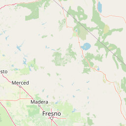
Map view of Sierra National Forest

Use this park location map to pinpoint Sierra National Forest in United States of America, understand its exact geographic position, and read its mapped placement within the surrounding landscape more clearly.

Pigeon | © OpenStreetMap contributors

Location context for Sierra National Forest

California
Natural feature types

Explore the Geographic Landmarks and Diverse Landscapes of Sierra National Forest

Investigate the layered terrain and significant water bodies associated with Sierra National Forest. Use this MoriAtlas index to navigate across the forest's massive vertical geography, tracing named landforms and natural zones from the foothills to the High Sierra crest.
Recorded earthquake history

Examine the Recorded Earthquake History for Sierra National Forest

Access a detailed catalogue of seismic events recorded in the vicinity of Sierra National Forest. This MoriAtlas resource allows for the examination of historical earthquake data including event timing and epicentre proximity within the broader context of the Sierra Nevada region.

Sierra National Forest Earthquake History

Catalogued events

3,364 events

Strongest magnitude

Magnitude 6.4

Most recent event

Aug 14, 2026

This history includes earthquakes recorded inside the park or within 50 km of its borders

Visualizing mountain terrain, conifer forests, and alpine wilderness zones

Sierra National Forest Photos and Landscape Scenery Exploration

Visual records capture the vertical sweep of Sierra National Forest, moving from oak foothills to granite peaks and alpine lakes. Examining these protected landscapes reveals the distinct habitats and rugged topography defining the central Sierra Nevada.

A clear blue alpine lake surrounded by coniferous trees and granite peaks under a cloudless sky.

Park atlas

Compare nearby national parks and connected high-country wilderness areas in the central Sierra Nevada.

Explore Parks Near Sierra National Forest and Surrounding Protected Landscapes

Visitors exploring Sierra National Forest can browse adjacent mountain reserves and protected lands sharing the same central Sierra Nevada geography. Examining surrounding park territory reveals broader ecological patterns and connected conservation corridors across California.
A horizontal watercolor painting depicting a mountain range in the background with rolling hills and a winding river or stream in the foreground.
Protected landscapeCalifornia
Park boundaries overlap#1 closest

North

Inyo National Forest: An Atlas of Protected Landscapes and Sierra Nevada Geography

High altitude wilderness and volcanic terrain in Eastern California

Spanning from the arid Owens Valley floor to the 14,000 foot crest of the Sierra Nevada, Inyo National Forest remains a cornerstone of the American West. This protected landscape contains the Ancient Bristlecone Pine Forest, Mount Whitney, and the Mono Inyo volcanic chain, providing a dense geographic record of glacial, tectonic, and ecological diversity across a vast managed corridor.

Area
7,702.71 km²
Established
1907
IUCN
Ib
Relief
Mountain
A watercolor painting showing a panoramic view of mountain ranges, a treeline, and a calm body of water in the foreground.
Wildlife reserveCalifornia
Park boundaries overlap#2 closest

Southeast

John Muir Wilderness: Sierra Nevada Protected Landscape and High Mountain Geography

California wilderness area with glacial basins and granite peaks

John Muir Wilderness represents one of the largest protected high-elevation areas in the contiguous United States. Spanning the Sierra Nevada crest, its granite terrain is sculpted by Pleistocene glaciation into sharp arêtes, deep canyons, and hundreds of alpine lakes. This wilderness serves as a vital geographic anchor for mountain ecosystems, offering an extensive look at the high-country landscape of eastern California.

Area
2,641.76 km²
Established
1964
IUCN
Ib
Relief
Mountain
Wildlife reserveFresno County
Mapped location lies within the park boundary#3 closest

Southeast

Kaiser Wilderness: Exploring the Alpine Ridges and Glacial Terrain of the Central Sierra Nevada

A federally protected wilderness area in Fresno County, California.

Kaiser Wilderness offers a dense collection of signature Sierra Nevada landforms, including granite cliffs, subalpine forests, and high-altitude lakes. This wildlife reserve preserves a rugged, glacier-scoured interior that provides a distinct contrast to the surrounding regional landscape of the Sierra National Forest, making it a critical entity for understanding mid-elevation mountain ecology.

Area
92 km²
Established
1976
IUCN
Ib
Relief
Mountain
National parkCalifornia
Park boundaries overlap#4 closest

Southeast

Kings Canyon National Park National Park: California Protected Landscape & Geography Atlas

Mapped park boundaries and regional natural context.

Kings Canyon National Park stands as a key protected national park within California, offering a specific focus for geographic understanding and atlas-based exploration. This page details the park's mapped boundaries and its integration into the broader regional geography of California. For users interested in the distribution of protected lands and the mapping of natural landscapes, Kings Canyon National Park provides a crucial point of study within the comprehensive park atlas.

Area
1,869.25 km²
Established
1890
IUCN
II
Visitors
641K annual
Watercolor painting of a panoramic mountain landscape with stylized pine trees and soft green meadows.
Protected landscapeCalifornia
Park boundaries overlap#5 closest

South

Sequoia National Forest: Protected Sierra Nevada Geography and Mountain Terrain

A vast protected landscape spanning 1.1 million acres in California

Spanning Tulare, Kern, and Fresno counties, Sequoia National Forest preserves iconic giant sequoia groves across multiple river watersheds. The terrain features vertical relief exceeding 11,000 feet, showcasing a range of ecosystems from chaparral slopes and coniferous forests to glacial cirques and granite spires located within the southern Sierra Nevada range.

Area
4,829.17 km²
Established
1908
Relief
Mountain
Climate
Mediterranean
Watercolor painting of green rolling hills, a tree-lined foreground, and a soft pink sunset sky.
Protected landscapeCalifornia
Park boundaries overlap#6 closest

Northwest

Stanislaus National Forest: Sierra Nevada Mountain Geography and Protected Wilderness Lands

California mountain terrain and forest landscape map

Stanislaus National Forest is a sprawling protected landscape located in the central Sierra Nevada of California. Characterized by volcanic and granite formations, the area protects critical watersheds, Wild and Scenic rivers, and large swaths of old growth forest that define the rugged mountain interior.

Area
3,634.48 km²
Established
1897
Relief
Mountain
Climate
Temperate
Watercolor painting showing mountains, a winding river, and green forests in the foreground and background
National parkCalifornia
Park boundaries overlap#7 closest

Northwest

Yosemite National Park: Protected Landscape Identity and Geographic Atlas Context

Mapped boundaries and regional setting for a key California national park.

Delve into the protected landscape identity of Yosemite National Park, examining its specific geographic features and its place within the broader atlas of California's natural areas. This entry provides detailed context on its mapped boundaries, regional positioning, and significance as a protected natural site, essential for understanding its landscape and conservation geography.

Area
3,070 km²
Established
1890
IUCN
II
Visitors
3.9M annual
Watercolor painting of a lake bordered by a coniferous forest with mountain silhouettes in the distance.
Wildlife reserveTulare County
13 km away#8 closest

Southeast

Jennie Lakes Wilderness in Tulare County: Sierra Nevada Protected Landscape Map

High-country geography and wilderness boundaries

Jennie Lakes Wilderness offers a distinct look at high Sierra Nevada topography, featuring granite ridges, alpine lakes, and deep canyons. This Tulare County reserve acts as a critical transition zone between adjacent national parks, preserving a diverse mix of subalpine forests and rugged mountain peaks within its 10,500 acre boundary.

Area
42.72 km²
Established
1984
IUCN
Ib
Relief
Mountain

Common questions about visiting, size, designation, and location context for Sierra National Forest

Sierra National Forest FAQs for park facts, access, geography, and protected area context

Find quick answers about Sierra National Forest, including protected-area facts, park geography, trail and visitor context, and how the park fits into its surrounding country and regional landscape.
MoriAtlas Explorer

Continue Your Protected Areas Search Across the Global Atlas

Deepen your exploration by continuing the structured search for national parks and protected areas worldwide. Utilize the comprehensive filtering capabilities to compare different conservation landscapes and refine your understanding of global park geography. Discover more about the distribution and characteristics of protected natural areas.

Global natural geography