
Mori Atlas logo
Nature reserveHohe Ley

Geographic analysis of limestone cliff terrain, forest mosaic, and raptor habitats

Hohe Ley Nature Reserve and Calcareous Forest Protected Landscape in North Rhine-Westphalia

(Naturschutzgebiet Hohe Ley)

Hohe Ley represents a compact nature reserve in North Rhine-Westphalia, Germany, defined by a 96-meter limestone quarry cliff and diverse deciduous forest zones. The protected area forms a significant component of the regional Kalkbuchenwälder network, showcasing a rich intersection of calcareous scree, dry grasslands, and deep ravine woodlands. This geographic mapping examines the unique micro-topography of the ridge and its historical importance as a breeding ground for cliff-nesting raptors like the eagle owl.

nature reservelimestone cliffbeech forestcalcareous grasslandSauerlandabandoned quarry
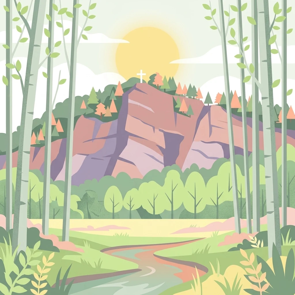
A digital illustration of a sun rising over a rocky hill with a cross on top, framed by foreground trees and a stream flowing through a grassy meadow.

Hohe Ley

Nature reserve

Park overview

Structured park overview, official facts, and landscape profile for Hohe Ley

Hohe Ley park facts, protected area profile, and essential visitor context

Review the core facts for Hohe Ley, including designation, size, terrain, visitor scale, habitats, and operating context in one park-focused overview.

About Hohe Ley

Hohe Ley sits in the southern Sauerland, in a part of North Rhine-Westphalia shaped by Paleozoic limestone geology. The ridge lies east of the Bigge river, just outside the Finnentrop district of Heggen, and rises to a maximum elevation of about 364 meters above sea level. Although the area is small in geographical terms, it accumulates a striking range of habitats within a short distance, making it ecologically richer than its modest size would suggest.

The defining element of Hohe Ley is the abandoned Heggener Kalkwerke quarry. Limestone was extracted here until the 1930s, and the resulting cliff face, around 96 meters high, dominates the protected landscape today. Several small caves have formed within the rock, and the cliff edge supports heat-loving plant communities adapted to thin, calcareous soils. The transition from bare cliff to scree slope to woodland is unusually compressed, giving the reserve a layered ecological profile.

Surrounding the cliff, the woodland is dominated by European beech, with both the woodruff and wavy hair grass beech woodland types represented. Oak and hornbeam stands are also present, alongside smaller patches of ravine forest and slope mixed forest on steeper, moister ground. Where the canopy opens, limestone scree slopes and calcareous dry grasslands contribute additional habitat diversity.

The reserve receives additional protection through its inclusion in the EU Natura 2000 network as part of the larger site Kalkbuchenwälder, Kalkhalbtrockenrasen und -felsen südlich Finnentrop. Hohe Ley is one of ten sub-areas of this Habitats Directive site, indicating that its combination of calcareous woodland, dry grassland, and cliff habitat is considered regionally important at the European level.

Quick facts and research context for Hohe Ley

Hohe Ley is a small nature reserve (Naturschutzgebiet) located east of the Bigge river near the Finnentrop district of Heggen, in the Sauerland area of North Rhine-Westphalia. Established in 1981, the protected area covers roughly 49.75 hectares and includes both forestland and a disused limestone quarry. The reserve forms one component of the larger EU Habitats Directive site Kalkbuchenwälder, Kalkhalbtrockenrasen und -felsen südlich Finnentrop. Its 96-meter quarry cliff and surrounding calcareous woodland are the defining features of the protected landscape.

Protection and recognition

Examine the documented conservation framework and recognition history for Hohe Ley.

Hohe Ley Protection Status and International Recognition Details

Examine the recorded protection status and official designation history assigned to Hohe Ley within international conservation databases. Structured records assemble verified management parameters and administrative classifications for detailed geographic analysis.

Protection details

Transboundary protection
No
Park context

Deeper park guide and search-rich context for Hohe Ley

Hohe Ley history, landscape, wildlife, and travel context

Explore Hohe Ley through its history, landscape character, ecosystems, wildlife, conservation priorities, cultural context, and seasonal travel timing in a structured park guide built for atlas discovery and search intent.

Why Hohe Ley stands out

Hohe Ley is best known for its tall former quarry cliff and its association with cliff-nesting raptors, including a historically documented peregrine falcon breeding record and a present-day eagle owl population. Beyond the cliff, the reserve is valued for its concentration of calcareous forest and grassland habitats, including beech woodland on limestone substrate and nutrient-poor limestone dry grassland.
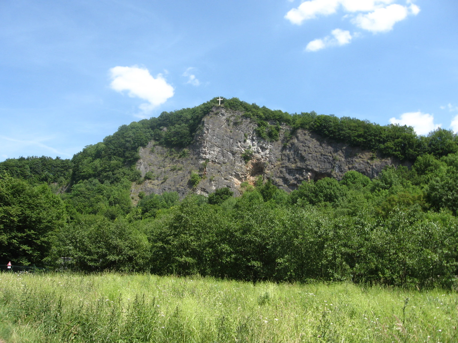
A green, grassy meadow in the foreground leads to a dense forest and a prominent, steep limestone quarry wall with a small cross on its summit against a bright blue sky.
A view of the limestone cliff face in Hohe Ley nature reserve.

Hohe Ley history and protected-area timeline

The Hohe Ley landscape was shaped by industrial limestone extraction at the Heggener Kalkwerke. Quarrying at the site was halted in the 1930s, leaving behind the cliff face and caves that today define the reserve. The wooded ridge and former quarry were formally designated as a nature reserve in 1981, recognizing their ecological and geological value.

The cliff has also left a small but notable mark on ornithological history. In 1938, the first documented breeding record of the peregrine falcon at Hohe Ley was made, and the species continued to use the rock as a breeding site until 1958. Although peregrine falcons no longer breed here, the cliff has retained its importance for cliff-nesting raptors, with eagle owls and common kestrels recorded as current breeding birds by the state information system of North Rhine-Westphalia.

Hohe Ley landscape and geographic character

The Hohe Ley landscape is built around a narrow ridge crowned by a tall limestone cliff. The cliff face rises about 96 meters above the surrounding terrain and reaches a maximum elevation of roughly 364 meters above sea level, making it a conspicuous landmark in the local topography. Several small caves are set into the rock, and weathered limestone forms a calcareous scree slope at the base of the cliff.

Below and around the rock face, the terrain transitions sharply into forest. Steeper, shaded slopes support ravine and mixed slope woodland, while flatter ground carries more uniform beech and beech-oak-hornbeam stands. This compact layering of rock, scree, dry grassland, and woodland within a small area gives the reserve a particularly varied micro-topography for its size.

Hohe Ley ecosystems, habitats, and plant life

The ecological character of Hohe Ley is defined by the interaction of calcareous bedrock with both open and forested habitats. Where the limestone is exposed, the reserve supports thermophilic plant communities specialized for warm, thin, mineral-rich soils, as well as pioneer vegetation on calcareous scree. Small openings within the woodland matrix carry nutrient-poor limestone dry grassland, an increasingly rare habitat type in the region.

Woodland dominates much of the reserve and reflects the underlying geology. Woodruff beech forest occupies richer, moister soils, while wavy hair grass beech forest occurs on more acidic or shallower sites. Oak and hornbeam stands, slope mixed woodland, and small patches of ravine forest add structural diversity. The juxtaposition of these calcareous woodland types with cliff, scree, and dry grassland makes Hohe Ley an unusually concentrated example of limestone-associated ecosystems in the Sauerland.

Hohe Ley wildlife and species highlights

Wildlife interest at Hohe Ley centers on the cliff and the surrounding woodland edge. The quarry cliff provides nesting habitat for raptors adapted to vertical rock faces. A breeding record of the peregrine falcon was documented here in 1938, and the cliff remained in use by the species until 1958. Today, the state authority for nature, environment and consumer protection in North Rhine-Westphalia lists the eagle owl and the common kestrel as breeding birds at the site.

The mosaic of woodland, calcareous dry grassland, scree, and cliff also provides habitat for a range of invertebrates and plant species associated with limestone substrates, although detailed species inventories are not the focus of the public documentation. The combination of cliff-nesting birds and rare calcareous habitats is what gives the reserve its wider conservation relevance.

Hohe Ley conservation status and protection priorities

Hohe Ley was designated as a nature reserve in 1981 because it contains habitats and breeding sites of rare, endangered, and regionally characteristic animal and plant species within a large forest complex. Its protection reflects concerns about the eagle owl, a species listed under Article 4 of the EU Birds Directive, which continues to breed on the cliff.

The reserve is also integrated into the European Natura 2000 network. It constitutes one of ten sub-areas of the Habitats Directive site Kalkbuchenwälder, Kalkhalbtrockenrasen und -felsen südlich Finnentrop, recognizing the regional and European importance of its calcareous beech woodland, dry grassland, and limestone cliff habitats. Beyond its ecological significance, the area is also protected for scientific, natural history, regional geographic, and earth-historical reasons, and as is standard for nature reserves in North Rhine-Westphalia, for its rarity, distinctive character, and outstanding scenic quality.

Hohe Ley cultural meaning and human context

Hohe Ley is closely tied to the industrial and local heritage of Finnentrop. The Heggener Kalkwerke, whose disused quarry now forms the centerpiece of the reserve, operated until the 1930s and are referenced in regional historical materials, including photographs from 1928 preserved by the Heimatbund Finnentrop. The ridge itself serves as a recognizable local landmark visible from surrounding villages and is part of the traditional landscape identity of the Heggen area.

Top sights and standout views in Hohe Ley

Hohe Ley packs a surprising amount of ecological diversity into a compact area. The 96-meter former quarry cliff with its small caves anchors the landscape and continues to provide breeding habitat for eagle owls and common kestrels. Around it, the reserve combines woodruff and wavy hair grass beech forests, oak-hornbeam stands, ravine woodland, calcareous scree, and limestone dry grassland, all rooted in the underlying limestone geology. Its inclusion in the Natura 2000 site Kalkbuchenwälder, Kalkhalbtrockenrasen und -felsen südlich Finnentrop reflects the broader European value of this small but habitat-rich Sauerland reserve.

Best time to visit Hohe Ley

Hohe Ley can be appreciated at any time of year, though spring and early summer are particularly favorable for observing woodland wildflowers in the beech forests and for hearing woodland and cliff-nesting birds. Late spring and early summer also bring out the most visible contrast between the green forest, the pale limestone cliff, and the developing dry grassland vegetation. In autumn and winter the bare cliff face and woodland structure are more exposed and the cliff's vertical scale is easier to appreciate, while cold months can also offer better chances of detecting resident raptors.

Monthly climate preview

Long-term representative point measurements for monthly temperature and precipitation patterns

Hohe Ley Climate Normals and Measured Annual Temperature Rhythm

Representative coordinate records show measured annual temperature variations alongside consistent monthly precipitation rates across the protected landscape. Examining the full twelve-month profile reveals detailed baseline climate normals for comprehensive geographical comparison.
Annual mean8 °C
-1 °C17 °C
Jan-1°
Feb
Mar
Apr
May12°
Jun15°
Jul17°
Aug17°
Sep13°
Oct
Nov
Dec
Warmest month
July

17.4 °C

Coolest month
January

-0.7 °C

Wettest month
December

3 mm/day

Driest month
April

1.8 mm/day

Park location guide

Geography guide, regional context, and park location map for Hohe Ley

Hohe Ley park geography, regions, and map view in Germany

Understand where Hohe Ley sits in Germany through a broader geographic reading of the surrounding landscape, nearby location context, and its mapped position within the national park landscape.

How Hohe Ley fits into Germany

Germany is a federal republic in Western and Central Europe with a population of over 83 million across sixteen constituent states. It is Europe's largest economy by nominal GDP and a major global exporter and importer. The capital is Berlin, and the country borders Denmark, Poland, Czech Republic, Austria, Switzerland, France, Luxembourg, Belgium, and the Netherlands.

Wider geography shaping Hohe Ley in Germany

Germany is located in Western and Central Europe, spanning 357,022 km². It borders Denmark to the north, Poland and the Czech Republic to the east, Austria and Switzerland to the south, and France, Luxembourg, Belgium, and the Netherlands to the west. The country has coastlines on the Baltic Sea and North Sea to the north, with the Alps located in the southern region.

Map view of Hohe Ley

Use this park location map to pinpoint Hohe Ley in Germany, understand its exact geographic position, and read its mapped placement within the surrounding landscape more clearly.

Pigeon | © OpenStreetMap contributors

Location context for Hohe Ley

North Rhine-Westphalia

Visual reference collection for the limestone ridge, beech woods, and raptor habitats of Hohe Ley

Hohe Ley Photos, Limestone Cliff Scenery, and Protected Forest Landscapes

Visual documentation of Hohe Ley reveals the rugged topography of its towering limestone cliff and surrounding deciduous forest. Examining these protected area photographs helps interpret the complex mosaic of calcareous grasslands, rock communities, and ravine woodlands across the ridge.

A green, grassy meadow in the foreground leads to a dense forest and a prominent, steep limestone quarry wall with a small cross on its summit against a bright blue sky.

A wide view of a dense forest floor covered in fallen brown leaves, with tall, thin, light-grey trunks of beech trees rising upwards.

Park atlas

Compare adjacent limestone reserves and forested ridge landscapes across Sauerland

Parks Near Hohe Ley and Related Protected Areas in the Surrounding Region

Browsing other protected areas near Hohe Ley reveals connected limestone habitats and forested ridges across the surrounding region. Extending the geographic comparison helps place compact nature reserves into a broader regional conservation context.
A soft watercolor illustration of a landscape featuring green rolling hills, a meandering river or stream, and distant low mountains under a light sky.
Nature reserveNorth Rhine-Westphalia
About 1.7 km away#1 closest

Southwest

Naturschutzgebiet Ahauser Klippen und Stausee: Protected Area and Limestone Landscape Atlas

A key nature reserve in the Attendorn-Elsper limestone basin of North Rhine-Westphalia.

Naturschutzgebiet Ahauser Klippen und Stausee is a compact yet ecologically rich nature reserve defined by carbonate geology and steep cliff biotopes. The area serves as a core refugial site within the Sauerland, integrating diverse forest stands, rare fissure vegetation, and essential waterbird resting zones at the reservoir edge.

Area
0.239 km²
Established
2003
IUCN
IV
Relief
Upland
Nature reserveKreis Olpe
About 2.5 km away#2 closest

East

Wunderwäldchen Nature Reserve: Mapping Botanical Biodiversity in the District of Kreis Olpe

A cross-boundary woodland refuge in the Sauerland region

Wunderwäldchen is a protected nature reserve spanning the border of two municipalities in Kreis Olpe. This small beech and oak woodland serves as a critical botanical refuge, sustaining rare plant species on its carbonate-enriched soils. It remains a key example of how even minute, fragmented habitats provide essential ecological value within the densely managed landscapes of the Lenne valley.

Area
0.007 km²
Established
1981
IUCN
IV
Relief
Upland
Nature reserveNorth Rhine-Westphalia
About 6.6 km away#3 closest

West

Heinrich-Bernhard-Höhle Nature Reserve and Karst Landscape in North Rhine-Westphalia

Examining the geology and protection status of the Sauerland karst system

The Heinrich-Bernhard-Höhle represents a unique convergence of conservation designations, functioning as a nature reserve, paleontological monument, and FFH habitat area. Centered on a 192-meter limestone cave network, the site preserves essential subterranean geological structures and surface beech forests within the North Rhine-Westphalia region.

Area
0 km²
Established
1934
Relief
Upland
Access
Highly restricted
Nature reserveKreis Olpe
About 11 km away#4 closest

South

Naturschutzgebiet Ahetal und Langes Siepen: Geography and Protected Area Overview

Nature reserve in the Rothaar foothills, Kreis Olpe

Covering the Ahe valley and its headwater catchment, this nature reserve is defined by its exceptionally dense concentration of seepage springs and near-natural brooks. The landscape transitions from shaded alder-lined seepage valleys into open, species-rich grassland, providing a critical refuge for local woodland species. As part of the Rothaarvorhöhen biotope network, it represents a significant, compact example of central upland stream valley geography.

Area
0.407 km²
Established
2020
Water
Major water bodies
A watercolor painting showing a tranquil reservoir surrounded by rolling green hills, forests, and grassy shorelines under a pale sky.
Protected areaNordrhein-Westfalen
About 11 km away#5 closest

Southwest

Listertalsperre Reservoir and Protected Forest Landscape in North Rhine-Westphalia

Historic gravity dam and regional hydrologic landmark.

Explore the detailed geography of Listertalsperre, a unique reservoir site characterized by its historic stone masonry dam and role in the regional water supply. This protected area offers insight into the engineered landscapes of the Sauerland, featuring forest-covered ridges and specialized waterfowl habitats that define this segment of the regional watershed.

Area
1.68 km²
Established
1912
Relief
Upland
Climate
Temperate
Watercolor painting of a soft, rolling landscape with light green fields, scattered trees, and muted pink-toned hills.
Nature reserveNorth Rhine-Westphalia
About 14 km away#6 closest

West

Naturschutzgebiet Oberes Elsetal: Protected Brook Valley Geography in North Rhine-Westphalia

Mapping riparian ecosystems and low mountain range stream habitats.

Naturschutzgebiet Oberes Elsetal offers a detailed look at the structural interplay between spring-fed brooks and adjacent marshy grasslands. This nature reserve in the Südsauerländer Bergland provides an instructive map of how riparian alder gallery woodland, oak-hornbeam forest, and wet meadow communities converge in a compact, highly specialized valley setting.

Area
0.053 km²
Established
1998
Relief
Upland
Scope
Terrestrial
Nature reserveNordrhein-Westfalen
About 14 km away#7 closest

Northwest

Naturschutzgebiet Schlänke: Woodland Conservation in the Märkischer Kreis Region

Protected beech-forest terrain and spring-blooming flora

Spanning roughly 0.6 hectares, Naturschutzgebiet Schlänke is a focused nature reserve dedicated to the preservation of native deciduous woodland. The site occupies a north-facing slope, creating specific moisture conditions that sustain a notable population of spring snowflakes, marking it as a significant botanical patch within the broader forested landscape of Plettenberg.

Area
0.006 km²
Established
1985
Relief
Upland
Climate
Temperate
Nature reserveKreis Olpe
About 15 km away#8 closest

South

Naturschutzgebiet Olpetal und Altenkleusheimer Bachtal: Protected Valley and Brook Geography

Riparian ecosystems in the Kreis Olpe district

Located in the Rothaar foothills, this nature reserve spans nearly 37 hectares of stream valleys and floodplain meadows. The protected landscape includes alder-lined watercourses, spring-fed wetlands, and diverse slope vegetation, serving as a core component of the regional biotope network in North Rhine-Westphalia.

Area
0.372 km²
Established
2020
Relief
Upland
Climate
Temperate

Common questions about visiting, size, designation, and location context for Hohe Ley

Hohe Ley FAQs for park facts, access, geography, and protected area context

Find quick answers about Hohe Ley, including protected-area facts, park geography, trail and visitor context, and how the park fits into its surrounding country and regional landscape.
MoriAtlas Explorer

Continue Your Protected Areas Search Across the Global Atlas

Deepen your exploration by continuing the structured search for national parks and protected areas worldwide. Utilize the comprehensive filtering capabilities to compare different conservation landscapes and refine your understanding of global park geography. Discover more about the distribution and characteristics of protected natural areas.

Global natural geography