
Why Horsens Fjord, the sea east of it, and Endelave stands out
The site is best known for the combination of an inner Danish fjord with extensive coastal meadows, lagoons, and shallow reefs, and a chain of small islands reaching out into the Kattegat. Vorgø stands out as a long-abandoned island that has reverted to old-growth forest, while Endelave carries coastal protection at its northern tip. It is also recognized for stone reefs near Søby Rev and around Endelave, and for sandbanks between Endelave and Tunø that emerge at low tide. Its status as both a Bird Protection Area and a Ramsar wetland means it is particularly valued for waterbirds, waders, and breeding terns along the Jutland coast.
Horsens Fjord, the sea east of it, and Endelave history and protected-area timeline
The protected status of Horsens Fjord, the sea east of it, and Endelave has been built up in several layers. Several local nature reserves predate the Natura 2000 designation: Vorsø Nature Reserve, Lerdrup Bugt Wildlife Reserve, and Endelave Wildlife Reserve are part of the broader area, while Øvre at the northern end of Endelave has been under formal Danish nature protection as a fredning.
The Natura 2000 plan covering the site was adopted in 2011, after which municipal councils and the Danish Nature Agency were tasked with creating binding action plans meant to put the wider plan into practice on the ground. The plan has since been carried forward and adjusted in later planning periods, and it is coordinated with the water plan for the Horsens Fjord main water catchment. At the European level, this is one of many Danish sites contributing to the EU Natura 2000 network, with the area also recognized internationally as both a Bird Protection Area under the Birds Directive and a Ramsar wetland site.
Horsens Fjord, the sea east of it, and Endelave landscape and geographic character
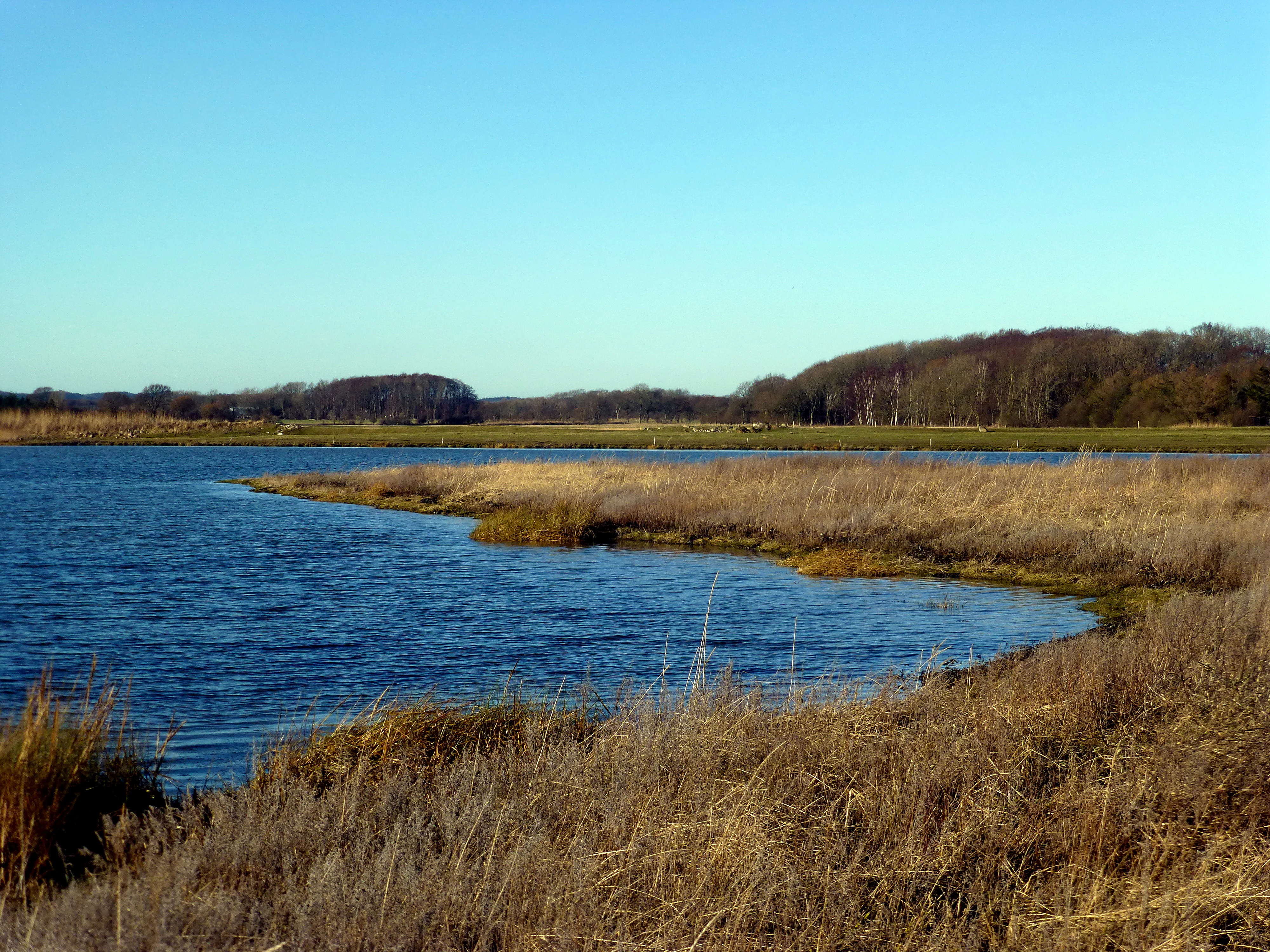
The landscape of the site is shaped by water on three sides. The inner Horsens Fjord provides sheltered, shallow conditions, while the Kattegat coast to the north and east exposes the area to stronger marine dynamics. The result is a varied shoreline featuring soft, low islands, shallow sandbanks, and stony reefs, with the tidal range small enough that the sand flats between Endelave and Tunø are revealed at low tide as broad, shifting surfaces.
On land, the islands of Vorsø, Alrø, Hjarnø, and Endelave are all low and flat, ringed by coastal meadows whose gentle profiles contrast with the vertical elements of beech woodland on richer soils and bog woodland on peat. Stony reefs near Søby Rev and around Endelave add a hard, underwater counterpart to the soft coastal meadows, while the mainland shore mirrors the islands with extensive meadows and small protected patches. Gently undulating dry heath, calcareous grassland, and acidic grassland on the inland edge of the site add further structural variety.
Horsens Fjord, the sea east of it, and Endelave ecosystems, habitats, and plant life
Ecologically, the site ties together several habitat complexes that are individually significant but reinforce each other across this stretch of eastern Jutland. Marine and coastal habitats dominate the area and include sandbanks, mudflats, lagoons, bays, reefs, and beaches with perennial vegetation, all of which support specialized plant and animal communities.
Inland and on the islands, the habitat diversity is just as pronounced. Dry heath, calcareous grassland on shell-rich soils, acidic grassland, seasonally wet meadows, and rich fens create a mosaic of small open landscapes. Freshwater is represented by brown-water lakes and charophyte lakes, while woodlands include beech forest on mull soils, beech forest on acidic mor soils with holly, mixed oak forest, stalked oak scrub, and alder-ash swamp forest on the wetter ground. Together these habitats host a wide range of breeding birds, passage migrants, and two nationally important seal species.
Horsens Fjord, the sea east of it, and Endelave wildlife and species highlights
The site's wildlife significance rests heavily on its bird populations. The bird list includes both breeding species and migrants, with cormorants present year-round and several wildfowl species using the area during passage and winter. Waders such as golden plover and bar-tailed godwit are recorded as passage birds, while coastal breeding species include avocet, common tern, little tern, and sandwich tern, the latter breeding on the low islands and shorelines.
Marine mammals are another notable feature. Grey seal and harbour seal are both formally listed within the site's species interest, reflecting the importance of the shallow reefs, sandbanks, and roosting islands offshore. Together with the rich invertebrate life supported by the meadows, reefs, and tidal flats, the wildlife here gives the area importance well beyond its immediate Danish context.
Horsens Fjord, the sea east of it, and Endelave conservation status and protection priorities
Conservation significance in this area comes from the blend of national, EU, and international recognition. As an EU Habitat Area, the site contributes to the Natura 2000 network and is governed by the 2011 Natura 2000 plan, with binding municipal and agency-level action plans translating that plan into practical management. Its parallel status as a Bird Protection Area under the Birds Directive and as a Ramsar site highlights its value for migratory waterbirds and for the long-term protection of wetland habitats.
A smaller-scale conservation layer sits beneath the international designations. Roughly 700 hectares are protected under section 3 of the Danish Nature Protection Act, covering streams, lakes, bogs, freshwater meadows, coastal meadows, and dry grassland, with an additional several hundred hectares of woodland. Local fredninger at Øvre on Endelave, at Horskær, and at Hou add further protection on top of the three nature and wildlife reserves that fall within the area: Vorsø Nature Reserve, Lerdrup Bugt Wildlife Reserve, and Endelave Wildlife Reserve. The combination is what allows the area to function as a coherent refuge for breeding birds, seals, and habitat diversity along the eastern Jutland coast.
Horsens Fjord, the sea east of it, and Endelave cultural meaning and human context
The cultural dimension of this area is closely tied to life along the fjord and on the islands. Small island communities such as those on Hjarnø and Endelave have a long history of fishing, farming, and ferry connections to the mainland, and these everyday uses still shape the visible landscape today, especially where agriculture continues to dominate parts of the islands.
Vorsø stands as a quieter cultural marker: once farmed like its neighbours, it has now been left to revert to a near-natural forest state, becoming an unusual example within the Danish protected-area network of an island where human land use has effectively been removed. Local fredninger at places like Horskær on the northern fjord shore also reflect a long tradition of small-scale Danish nature protection, where individual coastal tracts have been set aside for conservation over many decades.
Top sights and standout views in Horsens Fjord, the sea east of it, and Endelave
The site brings together a chain of protected landscapes in a single Natura 2000 unit: an inner fjord with low, flat islands, a stretch of Kattegat coastline with reefs and sandbanks, and the larger island of Endelave with its own reserves. Stone reefs near Søby Rev and around Endelave are particularly notable for their size and development.
Equally distinctive is the layering of designations. Being simultaneously an EU Habitat Area, a Bird Protection Area, and a Ramsar site gives this area a weight in conservation policy that few purely terrestrial Danish sites carry, and the combination of breeding terns, passage waders, seals, and old-growth forest on Vorsø makes it unusually varied for a coastal Jutland site.
Best time to visit Horsens Fjord, the sea east of it, and Endelave
Because the site is shaped by water and seasonal bird use, the character of a visit shifts through the year. Late spring and summer are the key period for breeding coastal meadows and tern colonies on the low islands, when salt meadows are green and nesting birds are present. Autumn brings migratory waders and wildfowl moving along the coast, while winter is when large numbers of sea ducks concentrate on the shallow waters and reefs. The islands remain accessible through much of the year by ferry and small boat, but the most visually striking times tend to be the warmer months, when the coastal meadows and inland woodland are most easily experienced on foot.