
Mori Atlas logo
Protected areaStavns Fjord

A sheltered inland sea featuring shallow tidal flats, small islets, and rich bird sanctuary habitats.

Stavns Fjord: Exploring the Coastal Geography and Protected Landscapes of Denmark

(Stavns Fjord Vildtreservat)

Stavns Fjord represents a distinct coastal environment located within the island of Samsø in Denmark. This shallow, nearly circular protected area is defined by its compact network of small islets, tidal flats, and saltmarsh fringes that create a tranquil, sheltered habitat. Beyond its natural terrain, the area is historically significant for its Viking-era canal, medieval castle remains, and coastal fortifications that layer human history into the natural geography.

fjordwetlandshallow fjordcoastal habitatislandsholme
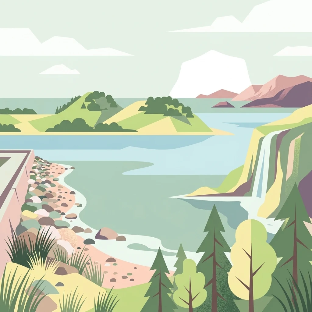
A flat-style vector illustration showing a tranquil fjord or bay with a rocky shoreline, a small waterfall falling from a cliff on the right, and rounded islands in the distance under a pale sky.

Stavns Fjord

Protected area

Park overview

Structured park overview, official facts, and landscape profile for Stavns Fjord

Stavns Fjord park facts, protected area profile, and essential visitor context

Review the core facts for Stavns Fjord, including designation, size, terrain, visitor scale, habitats, and operating context in one park-focused overview.

About Stavns Fjord

Stavns Fjord is a sheltered coastal inlet occupying the interior of Samsø, a Danish island in the Kattegat between Jutland and Zealand. Its almost perfectly circular outline, surrounded on three sides by land and on the fourth by a long natural spit, gives it a rare enclosed character for a fjord reaching the open sea. The fjord forms where the narrow land bridge connecting the northern and southern parts of Samsø closes off the western side, while the curving sand spit of Besser Rev forms the southern boundary and the main entrance opens to the north between Lilleøre and the tip of Besser Rev.

The waters of Stavns Fjord are unusually shallow and the tidal range small, which together with the protected outline produces calm conditions ideal for wading birds, waterfowl, and breeding seabirds. Inside the fjord is a constellation of small low islands called holme, including Hjortholm, the largest, and many smaller named islets such as Karlskold, Mejlesholm, Yderste Holm, Kolderne, Sværm, Ægholm, Hundsholm, Eskeholm, Brokold, and Barnekold. Some of the southern islands are connected to one another and to the shore by tidal footpaths called ebbeveje, walkable at low tide.

The fjord is recognized as a national geological interest area and forms part of a wider Natura 2000 complex that combines bird protection and habitat protection. It is one of Denmark's most significant coastal Ramsar wetland sites, and movement on its islands and spits is restricted during the breeding season in order to protect nesting birds.

Although small in scale, Stavns Fjord sits at the meeting point of ecological richness, cultural heritage, and coastal beauty. Its long history of human use, from Stone Age settlements along its shores to Viking-age canals and modern conservation management, gives the protected area a layered sense of place that complements its natural significance.

Quick facts and research context for Stavns Fjord

Stavns Fjord lies in the middle of Samsø, Denmark, covering roughly 20 square kilometers of sheltered, shallow water. It is bordered by the lands connecting North Samsø and South Samsø to the west and protected by the long natural sand spit of Besser Rev to the south. The fjord contains the main island Hjortholm along with smaller low islands such as Karlskold, Mejlesholm, Yderste Holm, Kolderne, Sværm, Ægholm, Hundsholm, Eskeholm, Brokold, and Barnekold.

The area is protected under multiple layers of Danish and international conservation law. A wildlife reserve was established in 1926, with major protections expanded in 1981 and consolidated in 1999. Stavns Fjord is part of a Ramsar site, contributes to a Natura 2000 bird and habitat area, and is recognized as a national geological interest area. The fjord's name derives from the Old Norse "Stafnes," a place-name element also found in Iceland.

Protection and recognition

Documented conservation frameworks and official Natura 2000 designations for Stavns Fjord

Stavns Fjord Protection Status and International Recognition Records

Conservation records assemble the documented protection status, management scope, and official Natura 2000 designations associated with Stavns Fjord. Structured summaries provide transparent access to verified international recognition sources and administrative frameworks for this protected area.

International recognition

Protection details

Protection scope
Mixed
Transboundary protection
No
Park context

Deeper park guide and search-rich context for Stavns Fjord

Stavns Fjord history, landscape, wildlife, and travel context

Explore Stavns Fjord through its history, landscape character, ecosystems, wildlife, conservation priorities, cultural context, and seasonal travel timing in a structured park guide built for atlas discovery and search intent.

Why Stavns Fjord stands out

Stavns Fjord is best known for its exceptional coastal birdlife, supported by shallow water, tidal flats, low islands, and protected shoreline meadows. The combination of small islets, saltmarsh fringes, and quiet waters makes it a vital staging and breeding ground for waterbirds in Danish waters. The fjord is also notable because it sits entirely within the inhabited island of Samsø, creating a rare inland-like coastal landscape surrounded by farmland. Its curved Besser Rev spit and clear enclosure give Stavns Fjord a distinctive shape and a remarkably sheltered character for such an open-seas location. Beyond the wildlife importance, the fjord is widely recognized among visitors for the layered history visible along its shores, including Viking-age canal works, a medieval fortification site, and fortifications from the Napoleonic-era wars.
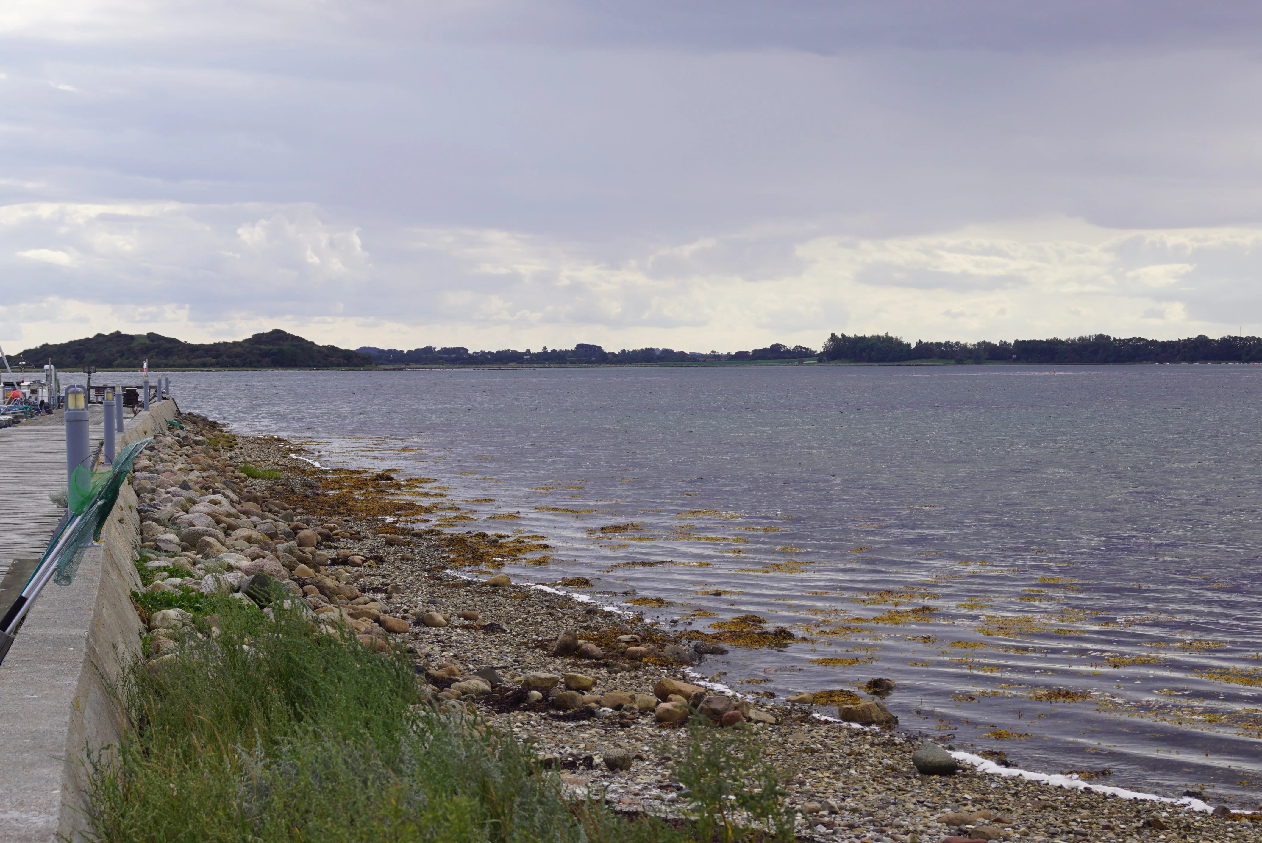
A coastal view of Stavns Fjord featuring a rocky shoreline, a concrete pier edge on the left, and distant low-lying land under a cloudy sky.
A view of the Stavns Fjord coastline seen from Langore.

Stavns Fjord history and protected-area timeline

Stavns Fjord has a long history of human use that reaches back into prehistoric times. Submerged settlements from the Ertebølle period, an Late Mesolithic culture of southern Scandinavia, have been found beneath the waters of the fjord. These underwater dwelling sites reflect how fluctuating sea levels and the sheltered waters of the inlet supported early coastal communities.

During the Viking Age, Stavns Fjord gained one of the most remarkable features associated with it today: the Kanhave Canal, constructed in 726 AD. Running through the narrow connecting land between North and South Samsø, this canal linked the fjord with Sælvig on the western side of the island, creating a sheltered passage through the island. It remains one of the largest surviving Viking-era engineering works in Denmark.

On the largest island within the fjord, Hjortholm, the remains of a medieval fortification known as Hjortholm Slot can still be traced. The site reflects the strategic value of the islands within the fjord during the Middle Ages. In more recent centuries, defensive redoubts were built on the tip of Besser Rev and on Lilleøre to the north as part of the fortifications constructed during the wars with Britain in the early nineteenth century. Off the tip of Besser Rev, the small island of Kyholm once served as a quarantine station.

In modern times, Stavns Fjord has been progressively protected. A wildlife reserve was established in 1926, covering 1,650 hectares, and further land areas were formally protected in 1981. A 1999 revision consolidated the reserves into a unified protection covering the entire fjord, its islands, and parts of its shoreline meadows, including the Bosserne and Lindholm islands. In 1986, the Samsø Nature School was opened at Langør, an important harbor on the north side of the fjord, providing interpretation and education about the area's natural and cultural heritage.

Stavns Fjord landscape and geographic character

Stavns Fjord's defining landscape feature is its compact, almost enclosed shape. Roughly circular and about twenty square kilometers in extent, the fjord sits inside the larger island of Samsø rather than opening straight out to a long coastline. The land bridge that joins North Samsø and South Samsø closes off the west, while the curving natural spit Besser Rev, around five kilometers long, gives the fjord its long south-eastern arm. The opening between Lilleøre and the tip of Besser Rev is the fjord's only true inlet from the sea.

The waters of Stavns Fjord are shallow throughout, with only a small tidal range, around thirty centimeters. These calm conditions have encouraged the growth of tidal flats and underwater meadows, and they help define the visual character of the fjord as a tranquil inland sea rather than an open marine inlet. The numerous low islands inside the fjord add to the impression of a sheltered, almost lake-like waterbody, even though the fjord opens directly into the Kattegat.

The southern islands, including Eskeholm, Brokold, and Barnekold, are so low that at low tide they are joined to one another and to parts of the shore by walkable tidal flats. The northern group of small islands, including Sværm, Ægholm, and Hundsholm, breaks up the inner fjord into channels and bays. Hjortholm, the largest island, lies near the center of the fjord and forms the visual focal point of the inner waters.

Beyond the water itself, Besser Rev is a defining coastal landform. Its long curve channels the inflow of seawater and traps sediment that helps maintain the fjord's sheltered character. Together, these features give Stavns Fjord a distinctive coastal identity shaped as much by its geology and shallow-water dynamics as by its size.
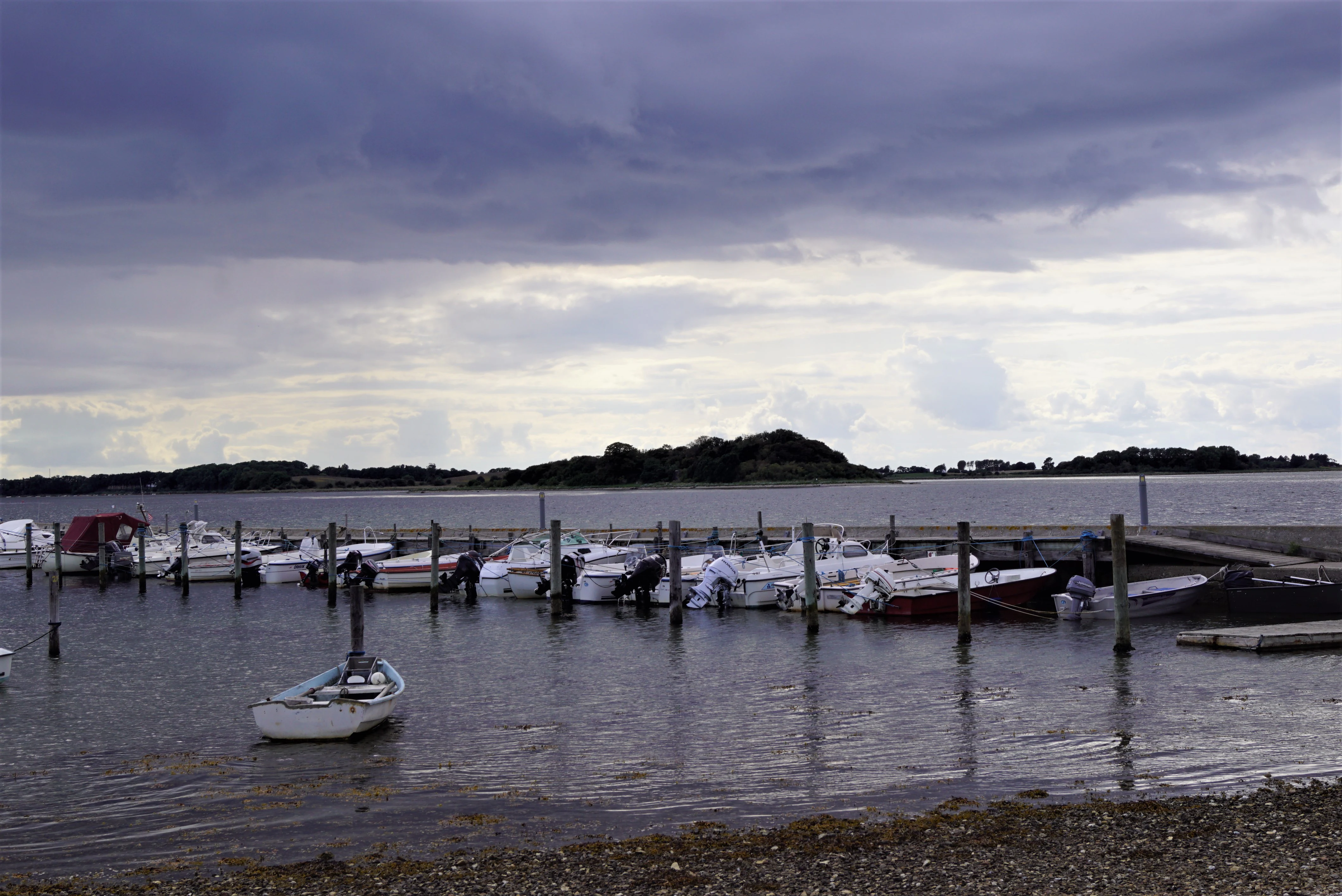
A line of small boats moored in a calm fjord harbor with a cloudy sky overhead.
A view of the small boat harbor at Stavns Fjord under an overcast sky.

Stavns Fjord ecosystems, habitats, and plant life

Stavns Fjord is a textbook example of a sheltered coastal wetland system shaped by shallow water, gentle tides, and a scattering of low islands. Because the fjord is largely enclosed, with limited water exchange at its single northern inlet, the waters are nutrient-rich and the seabed supports extensive beds of aquatic vegetation, including eelgrass and other underwater plants. These meadows form the foundation of a food web that supports fish, invertebrates, and especially waterbirds throughout the year.

Along the edges of the fjord, saltmarsh and shoreline meadows fringe the islands and the lower stretches of coastline. These habitats are particularly valuable because they offer both feeding areas during low tide and undisturbed nesting cover higher up. The combination of open water, tidal flats, marshland, and small islands produces a fine-scaled mosaic of habitats in a compact area.

The fjord is also recognized as a national geological interest area, reflecting the importance of its sediments, former shorelines, and underwater landscape features. Beneath the present-day seabed, preserved landscapes from earlier periods can be explored through these formations, providing insight into how the area has responded to changing sea levels.

In the wider landscape, Stavns Fjord sits between two arms of the larger Samsø landscape, with farmland, woodland patches, and small villages on the surrounding slopes. This surrounding land use shapes the watershed feeding the fjord and influences the quality of its waters, making the protected terrestrial margins an important part of the larger ecological picture.
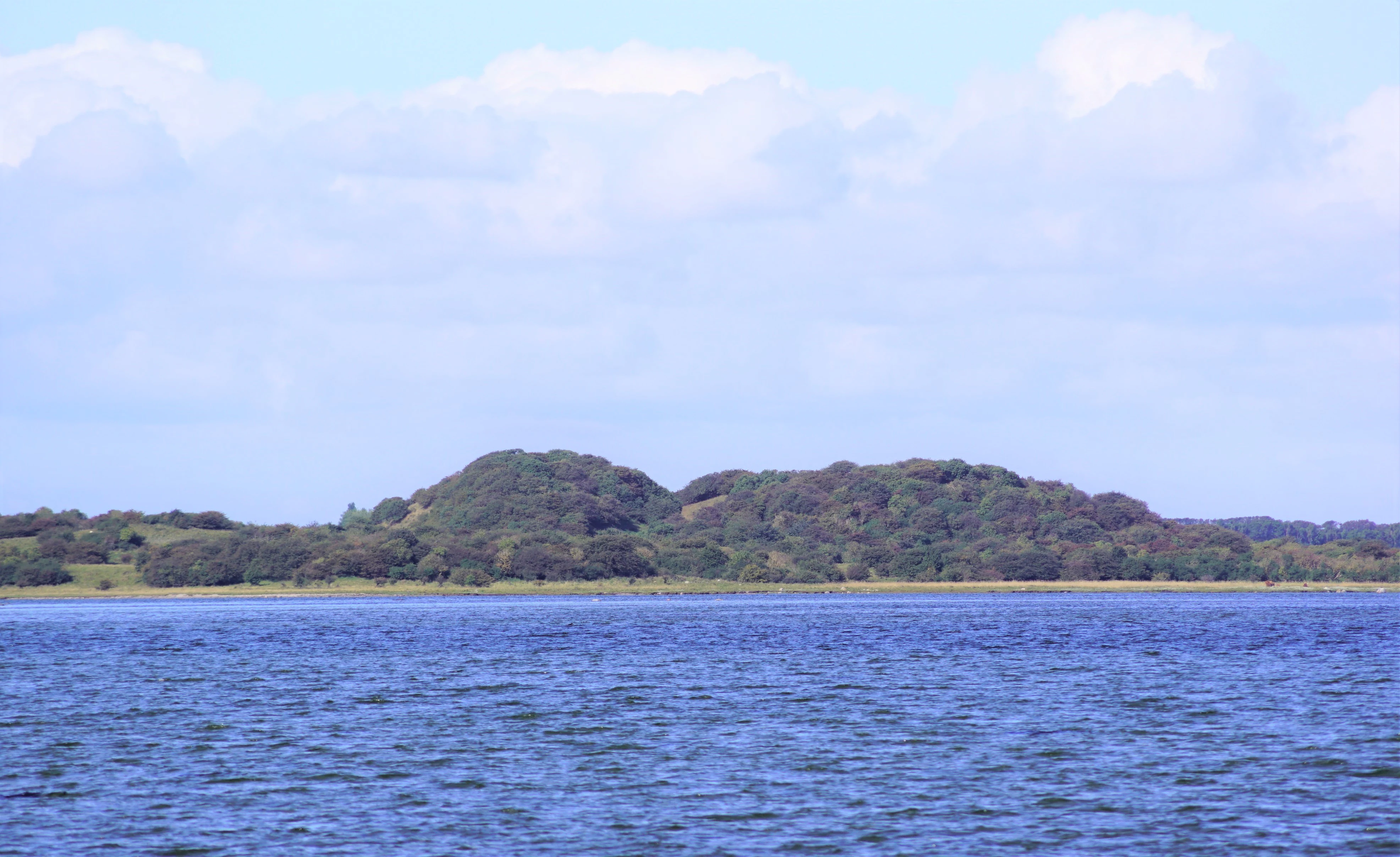
A horizontal landscape photograph showing calm blue fjord water in the foreground, with a low-lying, tree-covered, hilly island or point of land in the midground under a bright sky.
A view of the landscape at Stavns Fjord, featuring coastal vegetation and the Hjortholm area.

Stavns Fjord wildlife and species highlights

Stavns Fjord is one of the most important bird sites in Denmark, recognized internationally through its inclusion in the Ramsar wetlands network and as part of a Natura 2000 area that combines bird and habitat protection. The fjord hosts large numbers of waterbirds and waders, especially during migration and winter, when its shallow water and tidal flats provide rich feeding conditions. The presence of more than a dozen small islands, many of them low and difficult for land predators to reach, also makes the fjord exceptionally valuable for breeding birds.

Nesting terns, gulls, and ducks are regular features of the fjord's islands. Because movement onto the islands and onto the connecting spits is restricted during the breeding season, the area is managed specifically to reduce disturbance to nesting colonies. This management, combined with the natural protection of the islands' offshore position, helps maintain the fjord's value as a breeding ground even in a region where many wetlands are under pressure from human activity.

Outside the breeding period, the fjord's mix of open water, mudflats, saltmarshes, and meadows supports a diverse community of waders, dabbling ducks, diving waterfowl, and predatory birds such as marsh harriers and white-tailed eagles. While these latter species are occasional visitors rather than residents, their presence reflects the wider significance of the Samsø coast and the broader ecological network of the Kattegat.

Beneath the surface, the fjord's submerged meadows support fish populations and a rich invertebrate community. Together with the birds above, these species form a tightly connected food web in which the shallow water and protected condition of the fjord is the central controlling factor.

Stavns Fjord conservation status and protection priorities

Stavns Fjord has been the focus of conservation efforts for nearly a century. A wildlife reserve was established in 1926, covering 1,650 hectares of the fjord area and its islands. By 1981, roughly 1,525 hectares of the surrounding land areas were also placed under formal protection as a nature reserve, recognizing the importance of adjacent meadows and shore habitats. A 1999 revision of these protections consolidated the earlier reserves into a single, comprehensive protection order that covers the full extent of Stavns Fjord, its islands and holme, selected shoreline meadows, and the Bosserne and Lindholm islands.

The fjord forms part of Ramsar site no. 14, an international designation that recognizes wetlands of global importance. It also lies within Natura 2000 area no. 55 "Stavns Fjord, Samsø Østerflak og Nordby Hede," which brings together both the European bird protection framework and the European habitat framework. This means Stavns Fjord is protected for both its bird fauna and the broader habitat values of the surrounding landscape, including the offshore Samsø Østerflak shallows and the heathland of Nordby Hede.

Additional recognition comes from the fjord's inclusion as a national geological interest area, highlighting not only its ecological but also its earth-science value. To safeguard the birdlife, public access to the islands and connecting spits is restricted during the breeding season, limiting disturbance to nesting colonies. The Samsø Nature School, opened in 1986 at Langør, contributes to public understanding of the fjord's ecological and geological significance.

Stavns Fjord cultural meaning and human context

Stavns Fjord sits at the heart of the Danish island of Samsø and has been part of local life for thousands of years. The Stone Age submerged settlements from the Ertebølle period show that hunter-gatherer communities exploited the sheltered waters and rich shallows long before the landscape as we know it had formed. The very name "Stavns," recorded in older Danish sources as "Stauffnes," preserves an Old Norse place-name element, "Stafnes," that also appears in Iceland, reflecting the Viking-era Norse cultural links.

The Viking-age canal at Kanhave, which cut through the connecting land between northern and southern Samsø to join Stavns Fjord with the western harbor of Sælvig, is among the most remarkable surviving Norse engineering works in Denmark. It indicates how strategically important the fjord was as a protected sailing route. The medieval remains of Hjortholm Slot on the largest island show that the inner fjord continued to hold strategic significance after the Viking period.

In the early nineteenth century, the coasts of Samsø were again fortified, and redoubts were built on the tip of Besser Rev and at Lilleøre during the wars with Britain. The island of Kyholm, just outside the spit, later served as a quarantine station. Today, the harbor at Langør, historically the only harbor on Samsø capable of taking larger vessels, is home to the Samsø Nature School, an important site of public engagement with the fjord's natural and cultural history.

Top sights and standout views in Stavns Fjord

Stavns Fjord's strongest features are its exceptional birdlife, its unique enclosed coastal geography within the island of Samsø, and its deep historical layering. The combination of shallow water, tidal flats, saltmarshes, and more than a dozen small islands within a compact, protected inlet makes the fjord one of the most ecologically dense coastal sites in Denmark. Its Ramsar status, Natura 2000 coverage, and national geological interest recognition together reflect a coherent picture of conservation, geological, and ecological importance.

The visitor experience is shaped by the fjord's visual simplicity: a calm, island-studded inland sea framed by farmland and village edges. Long views across the water toward Hjortholm, walks along the curving Besser Rev, and quiet moments at Langør all contribute to a strong sense of place. The Viking canal, medieval castle ruins, and Napoleonic-era fortifications add historical depth, allowing the fjord to combine ecological richness with cultural significance in a single protected landscape.

Best time to visit Stavns Fjord

Stavns Fjord has distinct seasonal character throughout the year. Spring and early summer are the most ecologically sensitive months, when colonies of terns, gulls, and other waterbirds nest on the islands and spits, and access to these areas is restricted. The landscape during this period is especially lush, with flowering shoreline meadows and calm waters ideal for birdwatching from the surrounding shores.

Late summer and autumn bring a quieter atmosphere, with migratory waders and ducks moving through the fjord. Winter can be one of the most rewarding periods for bird-focused visits, when large flocks of waterfowl gather on the shallow water, and the surrounding landscape often takes on a remote, atmospheric appearance. Because the fjord's character is strongly defined by these natural rhythms, visitors often return in different seasons to appreciate how its wildlife and scenery change.


Monthly climate preview

Long-term representative measurements defining the monthly weather cycle across Stavns Fjord

Stavns Fjord Climate Normals, Annual Temperature and Precipitation Rhythm

Stavns Fjord exhibits a measured annual temperature and precipitation rhythm derived from long-term coordinate sampling across the landscape. Reviewing twelve-month climate normals provides detailed context for monthly temperature ranges and precipitation patterns.
Annual mean9 °C
2 °C17 °C
Jan
Feb
Mar
Apr
May11°
Jun15°
Jul17°
Aug17°
Sep14°
Oct10°
Nov
Dec
Warmest month
August

17.5 °C

Coolest month
February

1.5 °C

Wettest month
August

2.5 mm/day

Driest month
April

1.3 mm/day

Park location guide

Geography guide, regional context, and park location map for Stavns Fjord

Stavns Fjord park geography, regions, and map view in Denmark

Understand where Stavns Fjord sits in Denmark through a broader geographic reading of the surrounding landscape, nearby location context, and its mapped position within the national park landscape.

How Stavns Fjord fits into Denmark

Denmark is a constitutional monarchy and Nordic country in Northern Europe. It is the southernmost of the Scandinavian countries, bordering Germany to the south, Norway to the north, and Sweden to the southwest. The country consists of the Jutland peninsula and an archipelago of islands, with Copenhagen as its capital and largest city. Denmark has a population of over 6 million and is characterized by flat, arable land, sandy coasts, and a temperate climate.

Wider geography shaping Stavns Fjord in Denmark

Denmark occupies the Jutland peninsula and roughly 406 islands in Northern Europe. It is situated between the North Sea to the west and the Baltic Sea to the east. The country borders Germany to the south and is connected to Sweden via the Øresund Bridge. Denmark is predominantly flat terrain with low elevation, the highest point being Møllehøj at 170.86 meters.

Map view of Stavns Fjord

Use this park location map to pinpoint Stavns Fjord in Denmark, understand its exact geographic position, and read its mapped placement within the surrounding landscape more clearly.

Pigeon | © OpenStreetMap contributors
Recorded earthquake history

Examine Recorded Seismic Activity and Earthquake History Near Stavns Fjord

MoriAtlas provides a structured record of historical earthquakes associated by location with Stavns Fjord. Navigate this catalogue to investigate regional seismic data, including event magnitudes and mapped epicentres within the geography of the Danish Kattegat region.

Stavns Fjord Earthquake History

Catalogued events

3 events

Strongest magnitude

Magnitude 3.2

Most recent event

Feb 3, 2005

This history includes earthquakes recorded inside the park or within 50 km of its borders

Explore the terrain, tidal flats, and protected island environments of Samsø through visual photography

Stavns Fjord Landscape Photos and Scenery: Visualizing Danish Coastal Habitats

Visual documentation reveals the shallow waters, curved sand spits, and low islets that define the protected geography of Stavns Fjord. Examining these field photographs provides a deeper understanding of the coastal habitats and unique geological formations found within the Danish island.

A coastal view of Stavns Fjord featuring a rocky shoreline, a concrete pier edge on the left, and distant low-lying land under a cloudy sky.

A view across the calm blue water of Stavns Fjord towards the small, tree-covered island of Eskeholm in the distance under a partly cloudy sky.

A line of small boats moored in a calm fjord harbor with a cloudy sky overhead.

A horizontal landscape photograph showing calm blue fjord water in the foreground, with a low-lying, tree-covered, hilly island or point of land in the midground under a bright sky.

Park atlas

Compare surrounding wetlands, shallow marine habitats, and regional Danish nature reserves.

Parks Near Stavns Fjord and Related Coastal Protected Areas

Browsing other protected areas near Stavns Fjord reveals similar coastal wetlands and sheltered marine habitats across the surrounding region. Extending the geographic comparison helps place these island ecosystems and shallow waters into a broader conservation context.
Nature reserveRegion Midtjylland
Mapped location lies within the park boundary#1 closest

Northeast

Natura 2000-område nr. 55 Stavns Fjord, Samsø Østerflak og Nordby Hede Protected Landscapes

Coastal lagoons and glacial islands in Region Midtjylland

Gain insight into the expansive marine and terrestrial geography of this protected site. The area spans a diverse mosaic of salt meadows, dunes, and shallow reefs while supporting critical habitats for waterbirds and seals within the Kattegat sea.

Area
156.63 km²
Established
1981
Relief
Lowland
Climate
Temperate
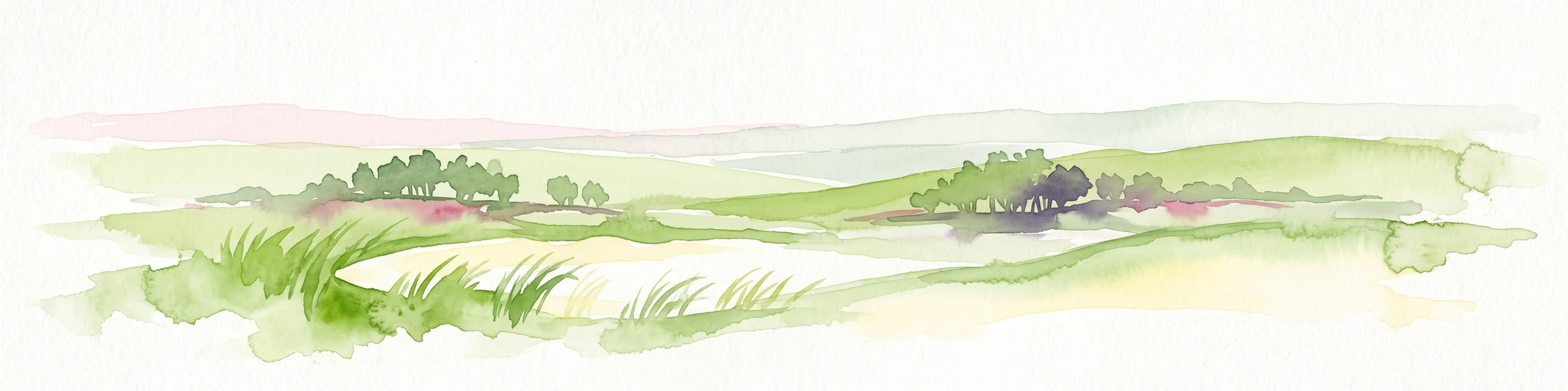
Watercolor painting depicting a gentle, rolling green landscape leading to a distant blue sea under a pale sky.
Protected areaRegion Midtjylland
2.1 km away#2 closest

Northwest

Nordby Bakker Protected Area: Glacial Moraine and Grasslands in Region Midtjylland

Coastal cliffs, dunes, and rare calcareous ecosystems

Nordby Bakker preserves one of the largest continuous dry grassland complexes in Denmark, set upon a prominent glacial terminal moraine. Located at the northern tip of Samsø, this protected area features a unique synthesis of coastal dunes, beach ridges, and inland lakes that support a distinct array of rare plant and insect species within the central Kattegat region.

Area
6.28 km²
Relief
Upland
Climate
Temperate
Scope
Mixed
A horizontal watercolor painting depicting a soft, rolling landscape with green grassy fields, small clusters of trees, and tall grasses in the foreground.
Protected areaCentral Denmark Region
7.9 km away#3 closest

West

Horsens Fjord, havet øst for og Endelave: Protected Coastal Landscape and Map Context

Mapping island habitats, reefs, and fjord geography in Denmark

Examine the geographic composition of Horsens Fjord, havet øst for og Endelave, a significant Natura 2000 site. This protected area connects inland fjord waters to open Kattegat coastlines, featuring a chain of islands, tidal sand flats, and submerged stone reefs that define this distinct ecological region.

Area
458.23 km²
Established
2011
Relief
Lowland
Climate
Temperate
Watercolor illustration showing rolling hills, a lake, pink flowering trees, and distant mountains
National parkDenmark
14 km away#4 closest

North

Mols Bjerge National Park: Glacial Geography and Protected Terrain in Central Jutland

Mapping the coastal cliffs and rolling heathland of Denmark

Mols Bjerge National Park protects a sweeping mosaic of glacial hills, woodlands, and coastal zones on the Djursland peninsula. With a landscape shaped by ancient ice sheets, the park offers a detailed view into Denmark's geological history, preserved ancient barrows, and rich botanical diversity along the Kattegat sea.

Area
180 km²
Established
2009
IUCN
II
Relief
Upland
Protected areaRegion Midtjylland
22 km away#5 closest

Northwest

Kysing Fjord Protected Area: Coastal Lagoon and Saltmarsh Geography in Region Midtjylland

Mapped coastal lagoon and wetland protected area

Kysing Fjord serves as a significant coastal lagoon system on the eastern Jutland coast. This protected area in Region Midtjylland integrates shallow lagoon waters, saltmarsh meadows, and riverine terrain, offering a precise look at managed coastal landscapes and their ecological importance for wintering bird populations.

Area
3.7 km²
Established
1942
Relief
Lowland
Climate
Temperate
A horizontal watercolor illustration showing a calm coastal bay with grassy banks, winding water channels, and rolling hills in the background under a soft yellow sky.
Protected areaRegion Midtjylland
About 23 km away#6 closest

North

Natura 2000-område nr. 51 Begtrup Vig og kystområder ved Helgenæs Geography and Maps

Coastal grasslands and marine habitats in Region Midtjylland

Examine the complex terrain of Natura 2000-område nr. 51 Begtrup Vig og kystområder ved Helgenæs, an expansive protected area characterized by its diverse coastal cliff systems and large calcareous grasslands. This site documents the evolution of the Kattegat shoreline through its unique recurved spits and lifted seabed formations, providing a window into the natural landscape history of the Helgenæs peninsula.

Area
17.71 km²
Established
2011
Relief
Lowland
Climate
Temperate
Watercolor painting of a calm coastal bay with soft, layered green hills in the distance and a pale shoreline in the foreground.
Protected areaDenmark
About 23 km away#7 closest

North

Begtrup Vig Protected Area: Glacial Terrain and Coastal Geography in Denmark

Coastal landscape and regional protected area mapping

Begtrup Vig is a distinct coastal bay defined by its glacial history, stretching across the southern Djursland peninsula in Denmark. Within the broader Mols Bjerge national park framework, the area features varied topography including stony shores, sandy coves, and pastoral meadows. This record provides a focused look at the environmental boundaries and geographic significance of this protected habitat, bridging natural terrain with the regional landscape context.

Relief
Upland
Scope
Mixed
Water
Water-dominated
Season
Year-round
Nature reserveKalundborg Municipality
23 km away#8 closest

Southeast

Saltbæk Vig Nature Reserve: Geography and Protected Wetland Landscapes in Kalundborg Municipality

A brackish lagoon basin shaped by historic land reclamation efforts.

Saltbæk Vig is a major coastal water body on the northwestern edge of Zealand, Denmark, defined by shallow waters and low-lying wetland terrain. This nature reserve serves as an important regional landmark, where historic drainage embankments now form unique boundaries that define the lagoon's ecological character and protected status.

Area
26 km²
Established
1992
Relief
Lowland
Climate
Temperate

Common questions about visiting, size, designation, and location context for Stavns Fjord

Stavns Fjord FAQs for park facts, access, geography, and protected area context

Find quick answers about Stavns Fjord, including protected-area facts, park geography, trail and visitor context, and how the park fits into its surrounding country and regional landscape.
MoriAtlas Explorer

Continue Your Protected Areas Search Across the Global Atlas

Deepen your exploration by continuing the structured search for national parks and protected areas worldwide. Utilize the comprehensive filtering capabilities to compare different conservation landscapes and refine your understanding of global park geography. Discover more about the distribution and characteristics of protected natural areas.

Global natural geography