
Mori Atlas logo
Nature reserveJagsttal Dörzbach-Krautheim

Mapped limestone slopes, karst caves, and riparian forest ecosystems in southwestern Germany

Jagsttal Dörzbach-Krautheim Nature Reserve: A Detailed Geographic Atlas of Protected River Valleys

(FFH-Gebiet Jagsttal Dörzbach-Krautheim)

Jagsttal Dörzbach-Krautheim represents a significant protected corridor within the Baden-Württemberg landscape, defined by its near-natural river systems and limestone geology. This atlas provides a structured look at its diverse habitats, ranging from orchid-rich calcareous grasslands on steep slopes to mature beech forests and karst cave systems. By tracing the Jagst valley topography, users can understand the ecological connectivity and land mosaic that characterize this unique Natura 2000 site.

Natura 2000 siteFFH habitat siteriver valleycalcareous grasslandbeech forestfloodplain woodland
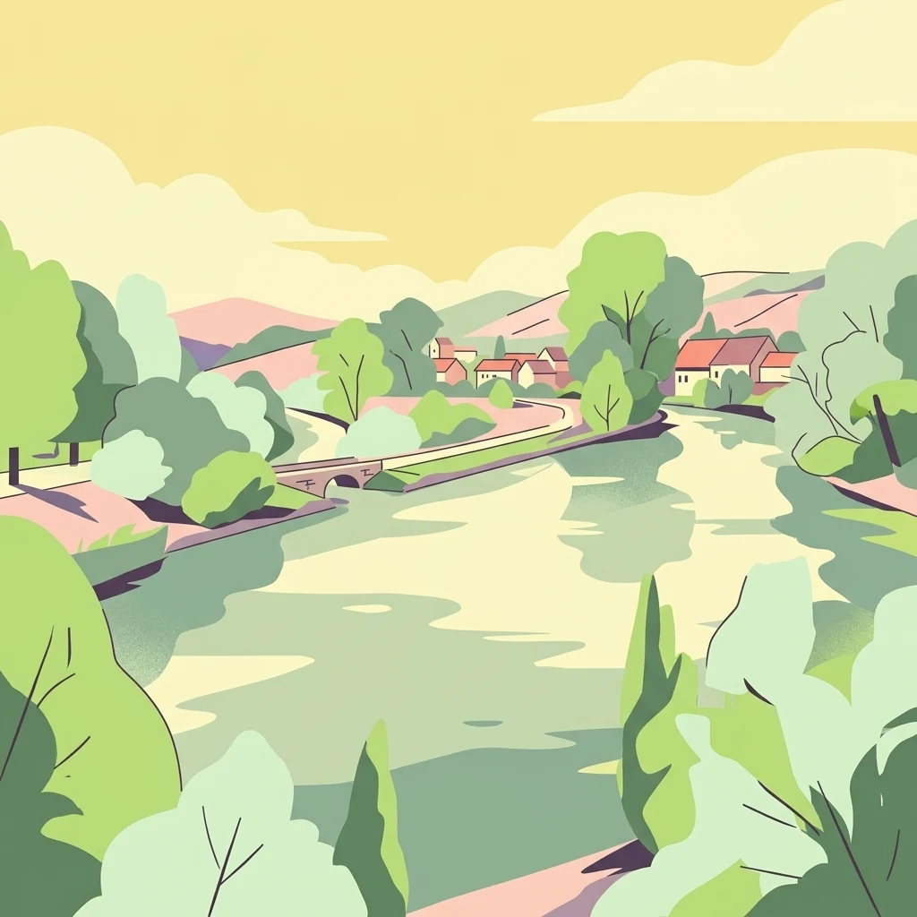
A stylized, flat-color digital illustration depicting a river flowing through a forested valley with a small stone bridge and a cluster of buildings in the distance.

Jagsttal Dörzbach-Krautheim

Nature reserve

Park overview

Structured park overview, official facts, and landscape profile for Jagsttal Dörzbach-Krautheim

Jagsttal Dörzbach-Krautheim park facts, protected area profile, and essential visitor context

Review the core facts for Jagsttal Dörzbach-Krautheim, including designation, size, terrain, visitor scale, habitats, and operating context in one park-focused overview.

About Jagsttal Dörzbach-Krautheim

Jagsttal Dörzbach-Krautheim is a protected river-valley landscape in northern Baden-Württemberg, situated where the districts of Hohenlohekreis and Main-Tauber-Kreis meet. The site follows the Jagst, a tributary of the Neckar, as it flows past the small towns of Dörzbach and Krautheim. In geographic terms it sits on the transition zone between the Hohenlohe plain and the limestone landscapes that lead toward the Tauber valley, and this transitional character shapes much of what the area protects.

The core value of the site lies in the way very different habitat types are pressed together by the local topography. The Jagst and its side streams have carved into limestone bedrock, creating steep, often south-facing dry slopes above narrow floodplains. On those exposed slopes, centuries of grazing and the calcareous substrate have produced semi-natural dry grassland communities, including some that are especially rich in orchids. Above the slopes, the plateau carries extensive broadleaf forest, while the cool, shaded north-facing ravines support further woodland communities that depend on humidity and stable microclimates.

The site also includes nine caves, the most notable of which are the rock-shelters and cave features of St. Wendel zum Stein, a site of both natural and cultural interest. These caves add a karst dimension to the area and provide undisturbed subterranean habitat. The combination of surface and underground features, river and slope, and dry and wet habitats gives Jagsttal Dörzbach-Krautheim a distinctly layered identity within the Baden-Württemberg Natura 2000 network.

From a conservation perspective the site matters not in isolation but as a link in a broader chain. It borders other FFH sites along the Jagst, including Jagsttal bei Schöntal und Klosterwald upstream and Jagsttal Langenburg-Mulfingen further along the valley, helping to maintain ecological continuity through one of southern Germany's most important river corridors.

Quick facts and research context for Jagsttal Dörzbach-Krautheim

Jagsttal Dörzbach-Krautheim is a Habitats Directive (FFH) site in Baden-Württemberg. It lies across the Hohenlohekreis and Main-Tauber-Kreis, centered on the area between the towns of Dörzbach and Krautheim along the Jagst river. The site carries the national identifier DE-6623-341 and the Natura 2000 code DE6623341, and has a World Database on Protected Areas entry as well.

It was proposed by the Regierungspräsidium Stuttgart under the European Habitats Directive in 2005 and was formally designated as a Site of Community Importance by regulation of the same authority on 30 October 2018, with the designation taking legal effect on 11 January 2019. Administration of the site falls under the Stuttgart regional presidency. The protected landscape includes the Jagst and its tributaries, dry south-facing slopes, stone-ridge terrain, large deciduous forests, and a cluster of nine caves.

Protection and recognition

Documented terrestrial protected area designation history and official Natura 2000 records

Jagsttal Dörzbach-Krautheim Protection Status and International Recognition

Jagsttal Dörzbach-Krautheim maintains a documented terrestrial protection status established in 2019 alongside official Natura 2000 recognition sources. Structured designation records outline the management scope and conservation framework assigned to this protected area.

International recognition

Protection details

Protection scope
Terrestrial
Designated year
2019
Transboundary protection
No
WDPA ID
555521633
Park context

Deeper park guide and search-rich context for Jagsttal Dörzbach-Krautheim

Jagsttal Dörzbach-Krautheim history, landscape, wildlife, and travel context

Explore Jagsttal Dörzbach-Krautheim through its history, landscape character, ecosystems, wildlife, conservation priorities, cultural context, and seasonal travel timing in a structured park guide built for atlas discovery and search intent.

Why Jagsttal Dörzbach-Krautheim stands out

The site is recognized above all for the variety of calcareous habitats concentrated in one valley system: orchid-rich limestone grasslands, pioneer vegetation on limestone scree, and open rock communities alongside beech-dominated forests and ash-alder floodplain woodland. Equally distinctive is the length of near-natural river and stream habitat associated with the Jagst itself, including stretches with tufa-forming springs, floating water vegetation, and fine-sediment banks. The combination of river, slope, plateau forest, and karst features gives the area a layered ecological character unusual even within the well-inventoried Jagst valley network.
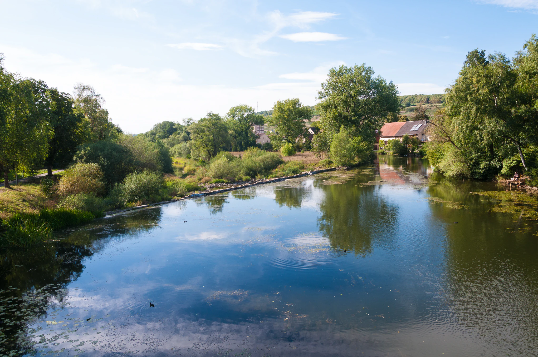
A view of a calm, reflective river surrounded by lush trees and green banks under a clear blue sky, with a small residential building visible on the bank.
The Jagst River flowing through the protected nature area of Dörzbach, Germany.

Jagsttal Dörzbach-Krautheim landscape and geographic character

The landscape of Jagsttal Dörzbach-Krautheim is defined by the Jagst river and the terrain it has shaped. The valley is narrow and geologically active, with limestone cliffs, exposed rock faces, and rocky slopes alternating with softer terrain on the plateau above. Long stretches of the Jagst and its tributaries here retain a near-natural form, with meanders, gravel bars, vegetated banks, and associated small floodplain features.

Above the river the slopes are the most visually distinctive element. Steep, south-facing hillsides carry the typical combination of dry grassland, scrub, and open rock, while north-facing slopes are densely wooded. The plateau above the valley is comparatively flat and supports large tracts of deciduous forest. Across this terrain runs the traditional stone-ridge landscape of the region: dry stone walls and rock clearings that reflect centuries of agricultural land use and now contribute to the mosaic of habitats found in the site.

The karst character of the area adds a further dimension. Limestone outcrops, rock shelters, and the cluster of nine caves make this a landscape where surface topography and underground features belong to the same system. The caves, including the well-known formations near St. Wendel zum Stein, are integral to the visual and ecological identity of the protected area, even though most of them are not open for tourist visits.

Jagsttal Dörzbach-Krautheim ecosystems, habitats, and plant life

Ecologically, the site is notable for the strong contrast between dry calcareous habitats on the slopes and humid, forest-dominated habitats on the plateaus and ravines, all set within a functioning river valley. The calcareous substrate supports specialized grassland communities, including orchid-rich variants, as well as pioneer grasslands on shallow soils and open vegetation in rock fissures. Calcareous scree slopes add another stage of succession, often sparsely vegetated but ecologically distinctive.

Woodland is the dominant habitat across much of the surface area. Mature beech forests of the woodruff-beech and orchid-calcareous beech types cover large portions of the plateau and the cooler slopes. In the ravines and along the river, mixed slope forests and ash-alder floodplain woodlands take over. These communities are tied to particular moisture, soil, and microclimate conditions and are among the most important targets of the site's protection.

The aquatic and semi-aquatic habitats are equally varied. The Jagst and its tributaries include reaches with tufa-forming springs, where calcium-rich water creates distinctive deposits, as well as stretches with submerged vegetation and fine-sediment banks that host characteristic plant communities. Small, near-natural standing water bodies add lentic habitat, while tall herb communities along the river margins form the wetter edge between forest and open water. Altogether, the site compresses a remarkable range of Central European habitat types into a relatively compact valley system.

Jagsttal Dörzbach-Krautheim wildlife and species highlights

Because of its habitat diversity, the site supports a rich mix of species tied to river, forest, grassland, and rock environments. The near-natural river sections and their associated banks are important for fish, aquatic invertebrates, and the birdlife that depends on riparian habitat. The calcareous grasslands, including the orchid-rich variants, are valued for invertebrates and for plant diversity that has developed under long-standing low-intensity use.

Forest habitats host typical central European woodland fauna, with the older beech, mixed slope, and floodplain forests providing structural complexity that benefits bats, woodland birds, and a wide range of invertebrates. The caves and rock shelters are of particular interest for cave-dwelling species, including bats that use these underground spaces as roosts or seasonal shelters.

The overall wildlife significance of the area is less about charismatic single species and more about the persistence of communities across the full range of habitats the valley contains. Maintaining this combination of river, slope, plateau forest, and karst features is central to the site's conservation purpose.

Jagsttal Dörzbach-Krautheim conservation status and protection priorities

Jagsttal Dörzbach-Krautheim is part of the European Natura 2000 network, and its conservation value is tied directly to its role within that system. The site was proposed by the Regierungspräsidium Stuttgart under the EU Habitats Directive in 2005 and was formally designated by regulation of the same authority on 30 October 2018, taking legal effect on 11 January 2019. Its administration falls to the Regierungspräsidium Stuttgart.

The conservation purpose of the site is to maintain and restore the habitat types listed under Annex I of the Habitats Directive that occur here, among them calcareous tufa springs, orchid-rich calcareous grasslands, tall herb fringes, species-rich hay meadows, limestone scree, limestone rock communities, mixed slope and ravine forests, ash-alder floodplain forests, non-tourist caves, beech forests of several types, rivers with characteristic muddy-bank vegetation, pioneer calcareous grasslands, flowing waters with submerged vegetation, and nutrient-rich standing waters with pondweed or frogbit communities. The list reflects the unusually high habitat diversity within a relatively limited area.

Beyond the individual habitats, the site contributes to conservation at the landscape scale. As a protected section of the Jagst valley, it links to neighboring Natura 2000 sites along the same river, helping to maintain ecological continuity along one of Baden-Württemberg's major river corridors and strengthening the overall effectiveness of the regional network.

Jagsttal Dörzbach-Krautheim cultural meaning and human context

The valley has long been shaped by human activity, and several cultural features are closely tied to the habitats now protected. The dry south-facing slopes carry a tradition of extensive grazing, and the small-scale agricultural use of these slopes over centuries is part of what has produced the orchid-rich calcareous grasslands and the open, rock-flecked terrain the site protects today. The stone-ridge landscapes scattered across the area are both a cultural artifact of this land-use history and a present-day component of the habitat mosaic.

The caves, especially those near St. Wendel zum Stein, also carry cultural weight. They have significance both as natural features and as places with a long history of local use and perception. Integrating this cultural dimension with the site's ecological protection is part of how the area is understood, even though the conservation designation itself is based on natural-habitat criteria.

Top sights and standout views in Jagsttal Dörzbach-Krautheim

Among the site's most notable qualities is the concentration of calcareous habitat types within a single valley system, from orchid-rich dry grasslands to limestone scree, rock fissures, and beech forests of several kinds. The river habitats are equally varied, with near-natural reaches, tufa-forming springs, and characteristic marginal communities all present within the same protected boundary.

The karst component, centered on nine caves including the well-known features of St. Wendel zum Stein, adds an underground dimension that is rare even among Baden-Württemberg's protected areas. Together with its position in a continuous chain of Jagst valley Natura 2000 sites, the area offers both internal ecological richness and a meaningful role in regional connectivity.

Best time to visit Jagsttal Dörzbach-Krautheim

The character of the valley shifts noticeably through the year, though access options are not detailed here. Spring is a rewarding period for observing the increasingly active water and the early stages of bloom in the calcareous grasslands, including some of the orchid-rich communities for which the area is noted. Summer brings the strongest display of flowers and insects on the dry slopes and the densest foliage in the forests, while the riverside vegetation reaches its full development along the Jagst and its side streams.

Autumn shifts attention toward the broadleaf forests, with changing leaves across the beech and ash-alder stands, and to the lower-flow conditions in the rivers and side streams. Winter offers a quieter perspective, with the structure of the valley, its rock faces, dry stone walls, and bare deciduous woodland becoming more visible. Across all seasons, the cave features, rock shelters, and stone-ridge landscapes provide year-round points of interest.

Monthly climate preview

Long-term temperature ranges and monthly precipitation distributions across representative coordinates

Jagsttal Dörzbach-Krautheim Climate Normals and Annual Weather Patterns

Historical measurements from 1991 to 2000 trace the measured annual temperature and precipitation rhythm recorded at a representative elevation of 328 meters within Jagsttal Dörzbach-Krautheim. Examining the complete twelve-month climate profile reveals comprehensive statistical variations across every recorded observation period.
Annual mean9 °C
0 °C19 °C
Jan
Feb
Mar
Apr
May13°
Jun17°
Jul19°
Aug19°
Sep15°
Oct
Nov
Dec
Warmest month
July

19.5 °C

Coolest month
January

-0.5 °C

Wettest month
July

2.5 mm/day

Driest month
April

1.5 mm/day

Park location guide

Geography guide, regional context, and park location map for Jagsttal Dörzbach-Krautheim

Jagsttal Dörzbach-Krautheim park geography, regions, and map view in Germany

Understand where Jagsttal Dörzbach-Krautheim sits in Germany through a broader geographic reading of the surrounding landscape, nearby location context, and its mapped position within the national park landscape.

How Jagsttal Dörzbach-Krautheim fits into Germany

Germany is a federal republic in Western and Central Europe with a population of over 83 million across sixteen constituent states. It is Europe's largest economy by nominal GDP and a major global exporter and importer. The capital is Berlin, and the country borders Denmark, Poland, Czech Republic, Austria, Switzerland, France, Luxembourg, Belgium, and the Netherlands.

Wider geography shaping Jagsttal Dörzbach-Krautheim in Germany

Germany is located in Western and Central Europe, spanning 357,022 km². It borders Denmark to the north, Poland and the Czech Republic to the east, Austria and Switzerland to the south, and France, Luxembourg, Belgium, and the Netherlands to the west. The country has coastlines on the Baltic Sea and North Sea to the north, with the Alps located in the southern region.

Map view of Jagsttal Dörzbach-Krautheim

Use this park location map to pinpoint Jagsttal Dörzbach-Krautheim in Germany, understand its exact geographic position, and read its mapped placement within the surrounding landscape more clearly.

Pigeon | © OpenStreetMap contributors

Location context for Jagsttal Dörzbach-Krautheim

Baden-Württemberg
Recorded earthquake history

Review the Documented Earthquake History Near Jagsttal Dörzbach-Krautheim

Explore the historical seismic catalogue associated with the Jagsttal Dörzbach-Krautheim landscape. This resource provides a structured collection of recorded events, allowing for the analysis of seismic data within this Baden-Württemberg region through MoriAtlas.

Jagsttal Dörzbach-Krautheim Earthquake History

Catalogued events

2 events

Strongest magnitude

Magnitude 3

Most recent event

Oct 21, 1993

This history includes earthquakes recorded inside the park or within 50 km of its borders

Visual exploration of limestone slopes, river valleys, and forest habitats

Jagsttal Dörzbach-Krautheim Photos and Protected Landscape Scenery

Visual records capture the limestone cliffs, meandering riverbanks, and steep forested slopes that define the protected terrain of Jagsttal Dörzbach-Krautheim. Examining these ecological features provides a clearer understanding of the rare calcareous habitats and valley landscapes preserved across the region.

A view of a calm, reflective river surrounded by lush trees and green banks under a clear blue sky, with a small residential building visible on the bank.

Park atlas

Compare adjacent river corridors and regional protected landscapes across Baden-Württemberg.

Exploring Parks Near Jagsttal Dörzbach-Krautheim and Surrounding Protected Valleys

Browsing other parks near Jagsttal Dörzbach-Krautheim reveals connected river corridors and protected limestone landscapes across Baden-Württemberg. Comparing adjacent valley reserves provides broader geographic context for the regional conservation network.
Nature reserveBaden-Württemberg
Park boundaries overlap#1 closest

West

Jagsttal bei Schöntal und Klosterwald: Protected Nature Reserve Landscape Overview

Geographic profile of the Jagst-Kocher plateau in Baden-Württemberg

Spanning the high plateau between the Jagst and Kocher rivers, this protected area features a unique vertical transition from continuous beech forest canopy to steep ravines and calcareous valley slopes. The landscape encompasses a complex mix of traditional orchard meadows, dry grasslands, and specialized freshwater tufa springs, serving as a representative example of the regional ecological heritage in southwest Germany.

Area
12.605 km²
Established
2019
Relief
Upland
Climate
Temperate
A wide watercolor illustration showing a landscape of rolling green hills and trees under a pastel pink and yellow sky.
Protected landscapeGermany
About 16 km away#2 closest

East

Niederstetten (Landschaftsschutzgebiet) Protected Landscape Map and Regional Terrain Data

Protected landscape and topographic features in Baden-Württemberg

Covering 1,786 hectares, the Niederstetten (Landschaftsschutzgebiet) serves as a vital protected landscape within the Hohenlohe region. It is recognized for its deeply incised side valleys, stream-fed corridors, and traditional dry-stone wall boundaries that define this portion of the German countryside.

Area
17.86 km²
Established
1992
Relief
Upland
Climate
Temperate
Protected landscapeBaden-Württemberg
About 17 km away#3 closest

Northeast

Weikersheim Protected Landscape: Mapping the Tauberland Terrain in Baden-Württemberg

Historic stone ridges and forested Klingen valleys.

Encompassing a wide stretch of the Tauberland, the Weikersheim Protected Landscape represents a significant conservation effort in Baden-Württemberg. The territory features a varied patchwork of slopes, meadows, and woodlands, anchored by rare dry-stone ridge formations that trace the historic patterns of regional agriculture. Examine the geographic boundaries and habitat distribution within this extensive protected landscape zone.

Area
27.18 km²
Established
1993
IUCN
V
Scope
Terrestrial
Watercolor painting of a river winding through a gentle green valley with distant hills.
Nature reserveBaden-Württemberg
18 km away#4 closest

Southeast

Jagst bei Kirchberg und Brettach Nature Reserve: Protected River Landscapes of Baden-Württemberg

River valleys, calcareous grasslands, and limestone terrain in Southwestern Germany.

The Jagst bei Kirchberg und Brettach nature reserve preserves a diverse corridor of natural river meanders, floodplain meadows, and beech forests. Situated in the Baden-Württemberg region, this protected area spans nearly 900 hectares, offering a rich study in limestone geology and riparian ecology within the Kocher-Jagst plains.

Area
8.93 km²
Established
2019
Relief
Upland
Climate
Temperate
A soft watercolor painting of a river valley with green fields, distant hills, and a prominent tree in the foreground on the right.
Protected areaBaden-Württemberg
19 km away#5 closest

Southeast

Bühlertal Vellberg-Geislingen: Protected River Valley and Karst Geography

A concentrated habitat corridor in Baden-Württemberg

This protected area follows the Bühler river through a series of tight meanders and dramatic limestone formations. The landscape is characterized by a transition from wet floodplain woods and tall-herb fringes to dry calcareous grasslands and hillside forests. Covering over 800 hectares, the site serves as a vital ecological link across the Kocher-Jagst plains and the forested ridges of the Schwäbisch-Fränkische Waldberge.

Area
8.474 km²
Established
2019
Relief
Upland
Climate
Temperate
A soft watercolor illustration of rolling hills and gentle terrain in shades of pale green and muted earth tones against a white background.
Protected landscapeMittelfranken
26 km away#6 closest

East

Naturpark Frankenhöhe Protected Landscape: Geography, Map, and Regional Conservation Context

Explore the diverse natural terrain of the Mittelfranken region in Bavaria.

Naturpark Frankenhöhe serves as a significant protected landscape in western Mittelfranken, encompassing a unique mosaic of forests, vineyards, and agricultural valleys. This geographic entity is shaped by the European Main Watershed, where rivers divide between the Rhine and Danube systems. Its terrain provides a study in transitions, from higher forested crests to open orchard meadows that define the local Bavarian countryside.

Area
1,104.06 km²
Established
1974
Relief
Mixed relief
Climate
Temperate
Watercolor painting of a winding river valley surrounded by rolling green hills.
Nature reserveBaden-Württemberg
About 27 km away#7 closest

West

Elzbachtal und Odenwald Neckargerach Nature Reserve: Regional Geography and Habitat Atlas

A protected landscape bridging the Odenwald and Neckar Valley.

Elzbachtal und Odenwald Neckargerach serves as a core conservation unit within Baden-Württemberg. This area features a striking geomorphological contrast between river-carved slopes and high-plateau forests, offering a detailed case study in Central European ecosystem protection and terrain dynamics.

Area
16.436 km²
Established
2019
Relief
Upland
Climate
Temperate
A horizontal watercolor illustration depicting a soft, pastel landscape with rolling hills in the background, a small pond, and several green and light pink flowering trees.
Nature reserveBaden-Württemberg
28 km away#8 closest

Southeast

Crailsheimer Hart und Reusenberg: Protected Nature Reserve and Karst Landscape Geography

Jagst valley protected habitat in Baden-Württemberg

Crailsheimer Hart und Reusenberg represents a key conservation unit in southwest Germany. This nature reserve is recognized for its distinctive gypsum keuper geology, which creates a network of dolines, semi-dry grasslands, and near-natural floodplain forests. Understanding its boundaries provides insight into habitat connectivity within the broader Baden-Württemberg protected-area network.

Area
7.14 km²
Established
2019

Common questions about visiting, size, designation, and location context for Jagsttal Dörzbach-Krautheim

Jagsttal Dörzbach-Krautheim FAQs for park facts, access, geography, and protected area context

Find quick answers about Jagsttal Dörzbach-Krautheim, including protected-area facts, park geography, trail and visitor context, and how the park fits into its surrounding country and regional landscape.
MoriAtlas Explorer

Continue Your Protected Areas Search Across the Global Atlas

Deepen your exploration by continuing the structured search for national parks and protected areas worldwide. Utilize the comprehensive filtering capabilities to compare different conservation landscapes and refine your understanding of global park geography. Discover more about the distribution and characteristics of protected natural areas.

Global natural geography