Reservoirs
Distribution Tank
1,967 m

A broad protected boundary spanning major relief and coniferous habitats
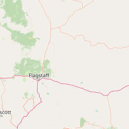
Trace Kaibab National Forest across a recorded 6,500 km² boundary in Arizona, United States of America. Elevation rises from 1,676 to 3,175 metres through mountain and plateau relief, with cliffs, majority forest cover, lakes, rivers, and minor water presence. Temperate coniferous forest, montane forest, and alpine meadow classifications add habitat context.
A vast national forest encircling both rims of the Grand Canyon in northern Arizona.
Kaibab National Forest is a large, federally administered national forest in north-central Arizona that borders both the North Rim and the South Rim of the Grand Canyon. Spanning roughly 1.6 million acres across three noncontiguous sections, it is one of the most distinctive forests in the American Southwest because the Grand Canyon itself physically separates its northern and southern portions. The forest rises from elevations of about 5,500 feet in the southwestern corner to over 10,000 feet at the summit of Kendrick Peak, producing dramatic shifts in vegetation from high-elevation conifers to pinyon and juniper woodlands. Its terrain includes the broad Kaibab Plateau, deeply cut tributary canyons of the Colorado River, and plateau rims overlooking the Grand Canyon. Managed by the United States Forest Service and headquartered in Williams, Arizona, Kaibab National Forest plays an important dual role as a working landscape and a conservation area. It hosts four designated wilderness areas, supports sizeable populations of elk and mule deer, and forms an essential forested buffer around Grand Canyon National Park.
Recorded country and regional administrative context in Arizona
Mapped regional geometry and recorded area measurements
Mountain relief span from 1676 meters to 3175 meters
Reservoirs
1,967 m
Reservoirs
1,975 m
Reservoirs
1,811 m
Reservoirs
2,000 m
Reservoirs
2,099 m
Reservoirs
2,418 m
Temperate Coniferous Forest, Mountain Relief, and Seasonal Plateau Habitats
Mountains · Plateau · Cliffs · Forest · Lakes · Rivers
Temperate coniferous forest · Montane forest · Alpine meadow
Compare regional park geography and adjacent protected areas across the northern Arizona plateau.
South

Explore mapped boundaries and regional atlas context.
Grand Canyon National Park stands as a premier national park, showcasing a unique protected landscape within Arizona's diverse geography. This detailed entry focuses on the park's specific geographic identity, its mapped boundaries, and its significance within the regional atlas. Discover the contours of this protected area and its place in the natural terrain of the American Southwest.
Northwest
Extensive tributary canyon systems and plateau terrain
Kanab Creek Wilderness represents a vast protected area in northern Arizona, defined by deep gorges and vertical cliffs etched into the Kanab and Kaibab Plateaus. This geographic atlas entry provides insights into the canyon network that feeds the Colorado River, highlighting the extreme elevation gradients and archaeological significance of this rugged wilderness.
South
Regional geography and protected terrain map of the Bradshaw Mountains
Spanning over one million acres, Prescott National Forest represents a defining outdoor landscape in Arizona. The terrain transitions from high desert chaparral to dense ponderosa pine forests, featuring eight distinct wilderness areas, rugged canyon systems, and essential watershed corridors that shape the regional ecology near Prescott.
South
Canyon landscapes and high mesa terrain in Arizona
Red Rock-Secret Mountain Wilderness serves as a significant protected block near Sedona, featuring a complex network of slot canyons, natural arches, and sandstone pinnacles. This wilderness area preserves the ecological transition from the high-elevation forested rim down into warmer, arid canyon bottoms, offering a deep look at the geology of the Colorado Plateau edge.
South
High-altitude volcanic terrain and alpine ecosystems
Kachina Peaks Wilderness is a protected area in northern Arizona centered on the San Francisco Peaks. This geography includes the state's highest elevation at Humphreys Peak and a rare volcanic caldera known as the Inner Basin. The terrain transitions from dense mountain forests into an Arctic-Alpine zone, offering a distinct landscape for analyzing mountain evolution and high-elevation ecological patterns.
South
Arizona high-desert wilderness and canyon-edge geography
Located southeast of Sedona, Munds Mountain Wilderness encompasses roughly 18,150 acres of dramatic sandstone cliffs and elevated plateaus. This area serves as a key site for observing the convergence of pinyon-juniper woodlands with iconic desert rock formations, providing a clear window into the rugged topography of central Arizona.
Northeast
Colorado Plateau canyons, sandstone strata, and reservoir environments
Explore the geological architecture of Glen Canyon National Recreation Area, a vast federal protected landscape. The area showcases towering Navajo Sandstone cliffs, deep blue reservoir arms, and remote backcountry canyons that exemplify the distinct high desert terrain of the Colorado Plateau in the United States.
Northwest
Explore the mapped terrain and regional context of this Utah national park.
Zion National Park represents a key protected area within Utah, ideal for detailed geographic exploration. This canonical page offers insights into the park's specific mapped boundaries, its inherent landscape character, and its regional geographic setting. It is designed for users seeking to understand the atlas-level significance of Zion National Park as a national park entity, focusing on its protected terrain and natural geography.
Examine the diverse high-country environment of Kaibab National Forest, where dramatic elevation shifts and canyon-rim geography create a unique ecological mosaic. MoriAtlas provides the tools to trace the forest's divided landscape across Arizona, offering a comprehensive perspective on its wilderness areas, volcanic peaks, and plateau-based topography.