
Mori Atlas logo
Protected landscapeKaibab National Forest

Understanding the high-elevation forest fragments and canyon-rim topography across the Kaibab Plateau.

Kaibab National Forest: Mapped Geography and Protected Landscapes of the Arizona Plateau

Kaibab National Forest defines a complex, noncontiguous protected landscape across north-central Arizona, physically separated by the massive chasm of the Grand Canyon. This expansive forest environment transitions from high-elevation mixed conifer and aspen stands at the summit of Kendrick Peak to expansive pinyon and juniper woodlands. By tracing the plateau boundaries and canyon-margin terrain, the map reveals an intricate ecological bridge supporting vital wilderness areas and significant elk and mule deer habitats.

national forestGrand Canyon regionkaibab plateauponderosa pine forestmixed conifer forestaspen groves
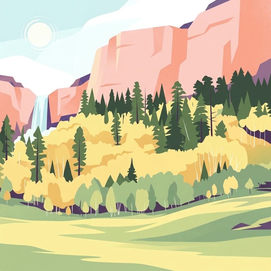
An illustration showing steep, light-colored rocky cliffs behind a forest of evergreen and yellow-leafed deciduous trees, with a small waterfall on the left and a green meadow in the foreground.

Kaibab National Forest

Protected landscape

Park overview

Structured park overview, official facts, and landscape profile for Kaibab National Forest

Kaibab National Forest park facts, protected area profile, and essential visitor context

Review the core facts for Kaibab National Forest, including designation, size, terrain, visitor scale, habitats, and operating context in one park-focused overview.

About Kaibab National Forest

Kaibab National Forest occupies a singular place in the landscape of northern Arizona. Its roughly 1.6 million acres wrap around the Grand Canyon on both sides, a geographic circumstance that gives the forest an unusual, almost split personality. The North Kaibab sits atop the Kaibab Plateau, a high forested tableland bounded on the south by the Grand Canyon, on the east and west by tributary canyons feeding the Colorado River, and on the north by stepped cliffs rising out of the desert.

South of the canyon, the forest consists of the Tusayan Ranger District near the South Rim village and the Williams Ranger District farther south, which together form the South Kaibab. Although the South Kaibab covers a larger total area, it sits at generally lower elevations and includes portions of the higher volcanic terrain such as Kendrick Peak. Together, the three districts create a forest whose character shifts sharply with elevation, exposure, and underlying geology.

The forest is administered by the United States Forest Service and is divided into the North Kaibab, Tusayan, and Williams Ranger Districts. Headquarters are in Williams, Arizona, and each district maintains its own local office. The Tusayan Ranger District falls partly within the boundaries of the Baaj Nwaavjo I'tah Kukveni, Ancestral Footprints of the Grand Canyon National Monument, where land management responsibilities overlap with the monument's protected status.

Visitors encounter a strong gradient of vegetation and scenery within a relatively compact geographic footprint. Ponderosa pine, Douglas-fir, Engelmann spruce, aspen, and blue spruce dominate the mid to upper elevations, while pinyon pine, juniper, and oak take over at lower elevations. As conditions become drier and more exposed, the trees give way to bitterbrush, Gambel oak, sagebrush, and cliffrose, with some open areas supporting little or no tree growth at all.

Beyond its forests and canyon views, Kaibab National Forest also encompasses four designated wilderness areas: the Kanab Creek Wilderness and Saddle Mountain Wilderness in the North Kaibab, plus the Kendrick Mountain Wilderness and Sycamore Canyon Wilderness in the Williams Ranger District. These wildernesses reinforce the forest's conservation role and provide backcountry settings that complement the more heavily visited areas nearby.

Quick facts and research context for Kaibab National Forest

Kaibab National Forest covers about 1.6 million acres in north-central Arizona, making it one of the larger national forests in the region. It is divided into three ranger districts: the North Kaibab District (administered from Fredonia), the Tusayan District within the Grand Canyon area, and the Williams District, with the overall forest headquarters in Williams.

The forest is physically split by the Grand Canyon, with its north and south sections connected only by the canyon crossing. Elevations range from roughly 5,500 feet up to more than 10,000 feet, producing highly variable vegetation and climate across the landscape. The forest contains four designated wilderness areas, supports both the Grand Canyon Game Preserve legacy, and is co-managed with surrounding national park, monument, and tribal land interests.

Protection and recognition

Documented protection history and official international recognition records

Kaibab National Forest Protection Status and Terrestrial Conservation Scope

Kaibab National Forest maintains a documented terrestrial protection scope within its designated conservation boundaries. Structured recognition records outline the official status and administrative framework governing the protected landscape.

Protection details

Protection scope
Terrestrial
Transboundary protection
No
Park context

Deeper park guide and search-rich context for Kaibab National Forest

Kaibab National Forest history, landscape, wildlife, and travel context

Explore Kaibab National Forest through its history, landscape character, ecosystems, wildlife, conservation priorities, cultural context, and seasonal travel timing in a structured park guide built for atlas discovery and search intent.

Why Kaibab National Forest stands out

Kaibab National Forest is best known for its unique position flanking both rims of the Grand Canyon, a feature more than any other that defines the forest's identity. Rather than forming a single contiguous block of timberland, the forest exists as two main forested masses separated by the canyon, a rare configuration in the National Forest System. The North Kaibab, situated on the Kaibab Plateau, stands out as a high-elevation forested island rising above surrounding arid country. Across all districts, the forest is recognized for its dramatic elevation range, its mixed conifer and aspen forests, its elk and mule deer habitat, and its four designated wilderness areas, including the Sycamore Canyon Wilderness and the Kendrick Mountain Wilderness.
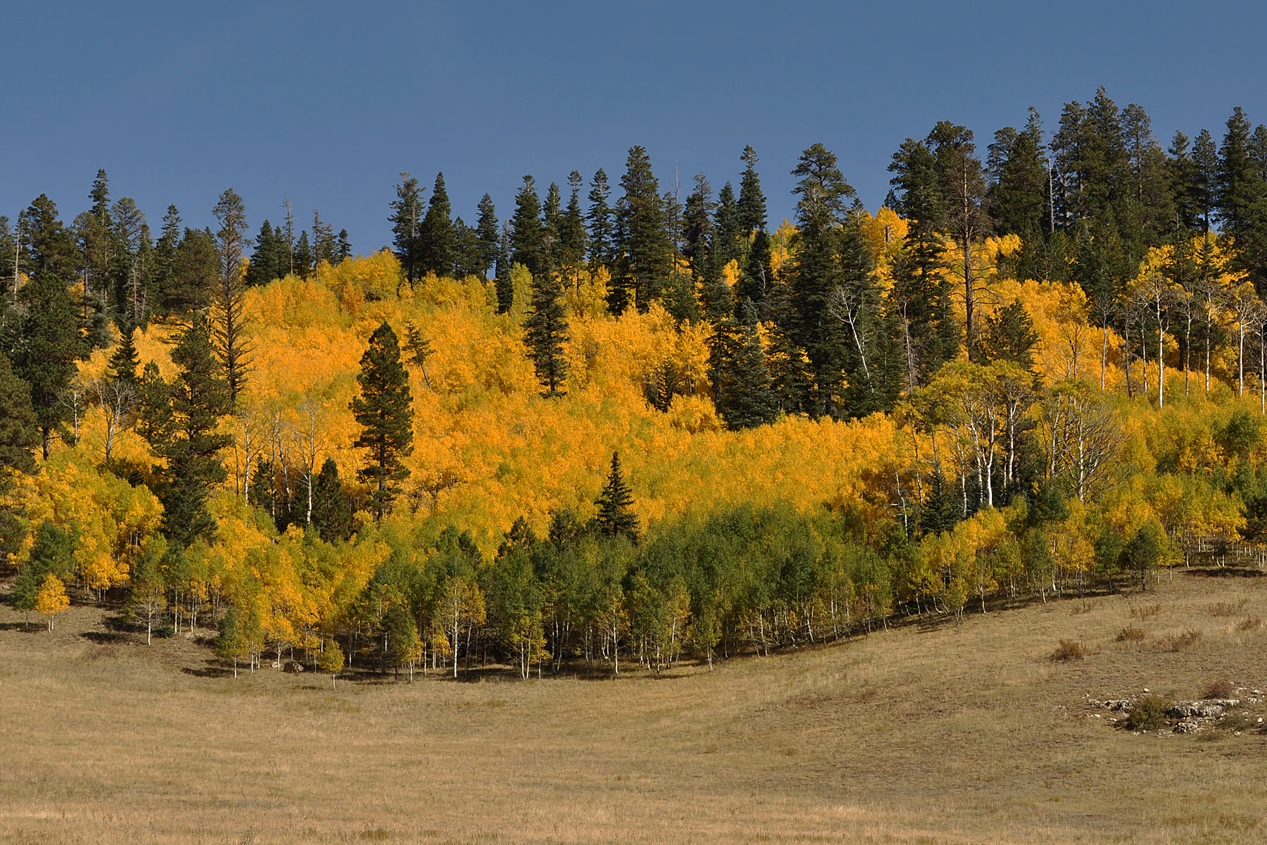
A hillside covered in a dense stand of yellow aspen trees mixed with evergreen conifers, set against a clear blue sky above a dry grassy meadow.
Aspen trees displaying vibrant autumn foliage within the North Kaibab Ranger District.

Kaibab National Forest history and protected-area timeline

The history of Kaibab National Forest stretches back to the late nineteenth century, when northern Arizona's forested lands began to receive federal attention. The lands that now form the North Kaibab Ranger District were withdrawn from the public domain in 1893 and included in the Grand Canyon Forest Reserve, one of the earliest federal forest reserves in the region.

In 1906, President Theodore Roosevelt created the Grand Canyon Game Preserve within this landscape, setting aside hundreds of thousands of acres as breeding habitat for game animals and birds. Two years later, in 1908, the forest reserve north of the Grand Canyon, including the game preserve, was renamed Kaibab National Forest. By 1919, the area immediately surrounding the canyon was split off to form Grand Canyon National Park, removing the canyon itself from Forest Service management.

The forest's modern shape was completed in 1934, when the Tusayan National Forest south of the Grand Canyon was consolidated into the Kaibab National Forest. This merger created the two-section configuration that persists today, with the Grand Canyon cutting between the North Kaibab and the combined South Kaibab districts.

For decades, the North Kaibab was split into two separate ranger districts, Big Springs and Jacob Lake, both with relatively remote headquarters. In 1972, the two districts were combined into the present North Kaibab Ranger District, and the district office was moved to Fredonia. As part of this consolidation, the Williams office became the headquarters for the entire forest. Historic structures from this administrative history, including the Spring Valley Cabin and Hull Cabin, still survive within the forest and are listed in cultural heritage registers.

Kaibab National Forest landscape and geographic character

Kaibab National Forest encompasses an unusually varied landscape for a single administrative unit, with elevations climbing from roughly 5,500 feet in the southwestern corner to more than 10,000 feet at the summit of Kendrick Peak. This vertical range produces strong contrasts in climate, vegetation, and scenery across short horizontal distances.

The North Kaibab section centers on the Kaibab Plateau, a broad, high-elevation landform that effectively functions as an ecological island. The plateau rises to elevations approaching 9,200 feet and is bordered on the south by the Grand Canyon, on the east and west by tributary canyons of the Colorado River, and on the north by a series of stepped cliffs leading down to lower country. The plateau's flat, forested upper surface contrasts sharply with the deeply dissected canyon rims that surround it, giving the North Kaibab a distinct plateau-and-cliff character.

In the South Kaibab, the landscape shifts toward volcanic terrain and rolling high country. The Williams Ranger District includes Kendrick Peak and other uplifted terrain, while the Tusayan Ranger District lies closer to the South Rim of the Grand Canyon. Together, these southern districts feature a combination of forested highlands, open plateaus, and canyon-margins tied to the greater Grand Canyon watershed.

Across the forest, the terrain also incorporates smaller lakes, including the Williams District's Scholz Lake, as well as a network of seasonal tanks and drainages that support both aquatic ecosystems and recreational fishing. The combination of plateau, canyon margins, volcanic uplands, and forested basins gives the forest a layered landscape that is unusually rich for its region.
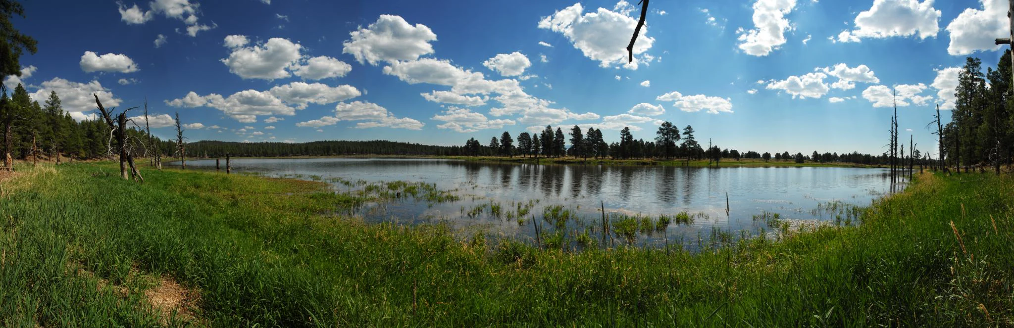
A wide panoramic photograph of a calm lake surrounded by grassy shores and a coniferous forest under a bright blue sky with scattered clouds.
A panoramic view of Scholz Lake within the Kaibab National Forest.

Kaibab National Forest ecosystems, habitats, and plant life

Vegetation in Kaibab National Forest varies strongly with elevation and aspect, producing a clear zonation from low to high country. At middle and upper elevations, forests are dominated by ponderosa pine, Douglas-fir, Engelmann spruce, aspen, blue spruce, and oak, with aspen stands providing some of the most visually striking seasonal displays, particularly in the North Kaibab. Cool, shaded slopes support denser mixed-conifer stands, while more exposed ridges tend to favor pines and oaks.

As elevation decreases, the mixed-conifer forests transition into open woodlands of pinyon pine and juniper. Further down, trees thin out and give way to shrubs such as bitterbrush, Gambel oak, sagebrush, and cliffrose, with patches that are entirely free of tree cover. This gradient creates a vegetation mosaic that changes visibly over short vertical distances, especially where the forest steps down toward the Grand Canyon.

The forest's plant communities play important ecological roles beyond their scenic value. Tree cover holds soil on the canyon's steep margins, reduces erosion, moderates the local microclimate, and provides food and shelter for a wide range of wildlife. The mix of dense forest, open meadows, shrublands, and bare rock contributes to a habitat mosaic that supports both forest-adapted species and those associated with the drier terrain that surrounds the forest.
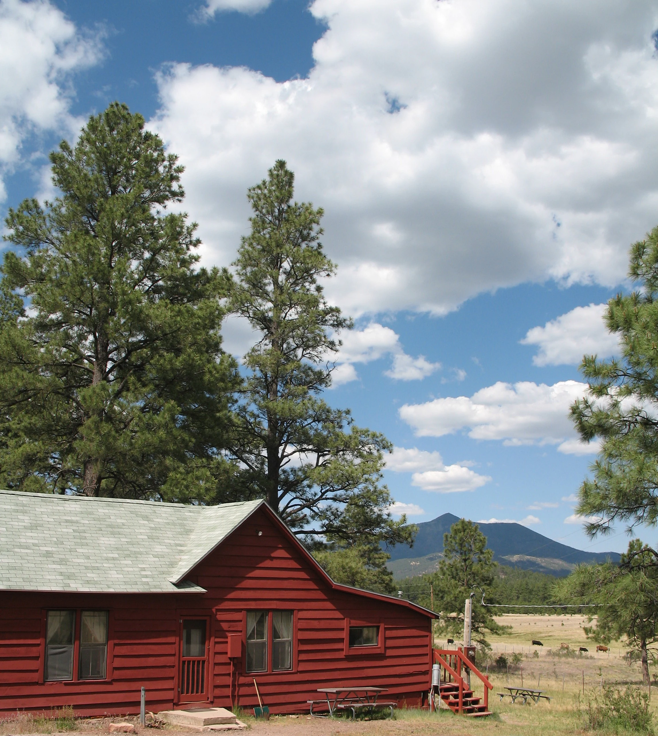
A red wooden historic cabin with a grey shingled roof surrounded by tall pine trees; a mountain peak is visible in the distant background under a blue sky with white clouds.
The historic Spring Valley Cabin located within the Williams Ranger District of Kaibab National Forest.

Kaibab National Forest wildlife and species highlights

Kaibab National Forest supports a diverse wildlife community shaped by its mix of high-elevation forest, plateau woodland, and lower-elevation shrublands. Large mammals are a defining feature of the forest, with mule deer, Coues white-tailed deer, elk, pronghorn, and wild turkey among the most commonly observed species. Coyotes are widespread, while predators such as cougars, bobcats, and black bears are present but more elusive.

The forest is also home to a population of American bison that graze within both the forest and adjacent national park lands. These bison are managed by the state of Arizona, which issues hunting permits within the national forest. They trace their origin to early twentieth-century ranching operations that introduced bison to northern Arizona for crossbreeding experiments with cattle.

Smaller mammals are abundant and include chipmunks, ground squirrels, and Abert's squirrels, the latter strongly associated with ponderosa pine forests of the region. Porcupines are less commonly observed, as are reptiles such as lizards and rattlesnakes that inhabit the drier, lower-elevation areas.

Birdlife in the forest reflects its range of habitats. Common species include bluebirds, robins, Steller's jays, nuthatches, flickers and other woodpeckers, crows, various hummingbirds, common ravens, and a range of hawks. Bats also occupy the forest, adding to its nighttime ecological activity. Many of these species are drawn to specific vegetation zones, such as Steller's jays and nuthatches in the conifer canopy, hummingbirds in flowering shrub areas, and raptors along the open canyon edges.

Kaibab National Forest conservation status and protection priorities

Kaibab National Forest holds significant conservation value within the broader Northern Arizona landscape, both as a substantial forested reserve in its own right and as a buffer around Grand Canyon National Park. The forest's protection history dates to 1893, when lands on the Kaibab Plateau were included in the Grand Canyon Forest Reserve, making them among the earlier federal forest reserves in the region.

The 1906 creation of the Grand Canyon Game Preserve by President Theodore Roosevelt added an explicit wildlife protection mandate covering more than 600,000 acres within what is now the forest, with the stated purpose of protecting game animals and birds and serving as a breeding ground for them. This legacy continues to shape the forest's modern identity as habitat for healthy populations of elk, mule deer, and other game species.

Four designated wilderness areas further reinforce the forest's conservation role: Kanab Creek Wilderness and Saddle Mountain Wilderness in the North Kaibab, and Kendrick Mountain Wilderness and Sycamore Canyon Wilderness in the Williams Ranger District. These lands provide higher levels of protection within the forest and contribute to ecological connectivity across the broader landscape.

The forest also intersects with other conservation designations, including the Baaj Nwaavjo I'tah Kukveni, Ancestral Footprints of the Grand Canyon National Monument, where the Tusayan Ranger District overlaps with national monument protections. Together, the wilderness areas, the game preserve legacy, and the national monument overlap give the forest a layered conservation framework that extends well beyond ordinary multiple-use management.

Kaibab National Forest cultural meaning and human context

The cultural landscape of Kaibab National Forest is closely tied to the long human history of the Grand Canyon region. The South Kaibab, including the Tusayan Ranger District, overlaps with the Baaj Nwaavjo I'tah Kukveni, Ancestral Footprints of the Grand Canyon National Monument, which protects areas with deep ties to ancestral Indigenous cultures of the Colorado Plateau. This overlap reflects the continuing significance of the region to the tribes that trace their history to the greater Grand Canyon area.

European-American history is more recent but still visible in the forest's built environment. The Spring Valley Cabin, built in 1917 near Parks, Arizona, served as a residence for rangers working at the local guard station, with a bunkhouse that functioned as the original office. The Hull Cabin, located about one mile south of the Grand Canyon, is the oldest surviving historic cabin near the South Rim. Built in 1889 as part of a sheep ranch, it was acquired by the Forest Service in 1907 and placed on the National Register of Historic Places in 1985. Both cabins now serve as reminders of the early Forest Service period and the longer agricultural and ranching heritage of northern Arizona.

Top sights and standout views in Kaibab National Forest

Kaibab National Forest's most distinctive highlight is its unusual geographic configuration, with forest lands on both sides of the Grand Canyon and the canyon itself cutting the forest into two separate masses. This setting alone sets the forest apart from most other units in the National Forest System.

The North Kaibab, on the Kaibab Plateau, is a high forested island surrounded by canyon country, with strong populations of elk and mule deer and a climate that produces deep winter snowpack. The South Kaibab combines the canyon-edge Tusayan Ranger District with the volcanic and lake country of the Williams Ranger District, including Kendrick Peak and Scholz Lake.

Four designated wilderness areas, a legacy rooted in the Theodore Roosevelt era, the Grand Canyon Game Preserve, and surviving historic cabins such as Spring Valley and Hull Cabin all add depth to the forest's identity. Together, these elements give Kaibab National Forest a layered character that blends Grand Canyon scenery, mountain terrain, working forest, and conservation heritage.

Best time to visit Kaibab National Forest

The North Kaibab, with its high plateau climate, experiences cold, snowy winters and mild summers, with summer days warm and nights cool and a pronounced North American Monsoon bringing most of the late summer rainfall. The South Kaibab districts are somewhat drier and warmer overall, though still subject to winter snow at higher elevations.

Spring and early summer are often favorable for viewing wildflowers, green vegetation, and active wildlife at moderate elevations. Summer months remain accessible at lower elevations, though afternoon thunderstorms become more frequent. Fall brings strong color in the aspen stands of the North Kaibab, making it a visually striking season, while winter turns the higher districts, including Jacob Lake and Bright Angel, into snow-laden landscapes that attract winter recreation.
Monthly climate preview

Long-term temperature and precipitation patterns across representative coordinates

Kaibab National Forest Climate Normals and Monthly Weather Statistics

Representative coordinates record measured monthly averages from subzero winter lows to high summer warmth alongside varying daily precipitation rates. Examining the full twelve-month profile reveals complete temperature rhythms and long-term climatic variations across the protected landscape.
Annual mean12 °C
0 °C25 °C
Jan
Feb
Mar
Apr10°
May16°
Jun22°
Jul25°
Aug24°
Sep19°
Oct12°
Nov
Dec
Warmest month
July

25 °C

Coolest month
December

-0.2 °C

Wettest month
August

1.3 mm/day

Driest month
June

0.2 mm/day

Park location guide

Geography guide, regional context, and park location map for Kaibab National Forest

Kaibab National Forest park geography, regions, and map view in United States of America

Understand where Kaibab National Forest sits in United States of America through a broader geographic reading of the surrounding landscape, nearby location context, and its mapped position within the national park landscape.

How Kaibab National Forest fits into United States of America

The United States of America is a federal presidential republic and one of the world's largest countries by area and population. It consists of 50 states across a vast territory spanning multiple time zones, with its capital in Washington, D.C. and largest city in New York City. The nation has a diverse economy, influential political system, and significant cultural and military presence globally.

Wider geography shaping Kaibab National Forest in United States of America

The United States occupies a vast territory in North America, bordered by Canada to the north and Mexico to the south. The 48 contiguous states stretch from the Atlantic to the Pacific Ocean, while Alaska occupies the northwestern region and Hawaii is an archipelago in the Pacific. The country encompasses diverse terrain including the Rocky Mountains, Appalachian Mountains, Great Plains, and extensive river systems.

Map view of Kaibab National Forest

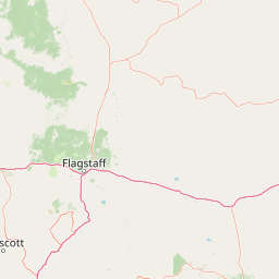
Use this park location map to pinpoint Kaibab National Forest in United States of America, understand its exact geographic position, and read its mapped placement within the surrounding landscape more clearly.

Pigeon | © OpenStreetMap contributors

Location context for Kaibab National Forest

Arizona
Natural feature types

Explore the Geographic Features and Natural Landscapes of Kaibab National Forest

Navigate the structured natural feature collection to understand the complex elevation and landform patterns of Kaibab National Forest. Use this dataset to study the spatial relationships between the forest's volcanic uplands, plateau rims, and diverse woodland zones across the Arizona region.
Recorded earthquake history

View Recorded Earthquake History Near Kaibab National Forest

Examine the historical record of seismic events documented near Kaibab National Forest boundaries. This MoriAtlas catalogue provides reliable, location-based access to USGS data for those interested in the regional geographic and seismic history of north central Arizona.

Kaibab National Forest Earthquake History

Catalogued events

97 events

Strongest magnitude

Magnitude 5.3

Most recent event

Jun 15, 2025

This history includes earthquakes recorded inside the park or within 50 km of its borders

Visualizing high elevation plateaus, canyon rims, and mixed conifer habitats

Kaibab National Forest Landscape and Scenery Photography

Visual records capture the distinctive topography of Kaibab National Forest, ranging from high elevation plateaus to deep canyon margins flanking the Grand Canyon. Protected area photography reveals changing vegetation zones, mixed conifer forests, and volcanic terrain across the northern and southern districts.

A hillside covered in a dense stand of yellow aspen trees mixed with evergreen conifers, set against a clear blue sky above a dry grassy meadow.

A brown and white entrance sign for De Motte Campground in Kaibab National Forest stands in the foreground, with a golden aspen and evergreen forest in the background under a blue sky with scattered clouds.

A wide panoramic photograph of a calm lake surrounded by grassy shores and a coniferous forest under a bright blue sky with scattered clouds.

A red wooden historic cabin with a grey shingled roof surrounded by tall pine trees; a mountain peak is visible in the distant background under a blue sky with white clouds.

Park atlas

Compare regional park geography and adjacent protected areas across the northern Arizona plateau.

Explore Parks Near Kaibab National Forest and Surrounding Protected Landscapes

Compare Kaibab National Forest with adjacent protected areas and nearby national parks across the surrounding plateau country. Broaden your geographic understanding by examining connected regional ecosystems, high-elevation forests, and canyon-margin terrain.
National parkArizona
Park boundaries overlap#1 closest

South

Grand Canyon National Park: Arizona National Park Protected Landscape & Geography

Explore mapped boundaries and regional atlas context.

Grand Canyon National Park stands as a premier national park, showcasing a unique protected landscape within Arizona's diverse geography. This detailed entry focuses on the park's specific geographic identity, its mapped boundaries, and its significance within the regional atlas. Discover the contours of this protected area and its place in the natural terrain of the American Southwest.

Area
4,926.08 km²
Established
1919
IUCN
II
Visitors
4.9M annual
A minimalist watercolor painting depicting a pale desert landscape with soft green hills and light reddish rock formations against a white background.
Wildlife reserveArizona
Park boundaries overlap#2 closest

Northwest

Kanab Creek Wilderness: Protected Canyon Landscapes and Geography of Northern Arizona

Extensive tributary canyon systems and plateau terrain

Kanab Creek Wilderness represents a vast protected area in northern Arizona, defined by deep gorges and vertical cliffs etched into the Kanab and Kaibab Plateaus. This geographic atlas entry provides insights into the canyon network that feeds the Colorado River, highlighting the extreme elevation gradients and archaeological significance of this rugged wilderness.

Area
305 km²
Established
1984
IUCN
Ib
Relief
Upland
Watercolor painting of a calm lake surrounded by green forests and distant mountain ridges.
Protected areaArizona
Park boundaries overlap#3 closest

South

Prescott National Forest: Geographic Overview of Arizona Protected Landscapes and Wilderness

Regional geography and protected terrain map of the Bradshaw Mountains

Spanning over one million acres, Prescott National Forest represents a defining outdoor landscape in Arizona. The terrain transitions from high desert chaparral to dense ponderosa pine forests, featuring eight distinct wilderness areas, rugged canyon systems, and essential watershed corridors that shape the regional ecology near Prescott.

Area
5,100 km²
Established
1908
Relief
Mountain
Climate
Temperate
A watercolor painting showing a winding river flowing through a forested valley with gentle hills in the background.
Wildlife reserveArizona
5 km away#4 closest

South

Red Rock-Secret Mountain Wilderness: A Geographic Overview of Arizona Protected Lands

Canyon landscapes and high mesa terrain in Arizona

Red Rock-Secret Mountain Wilderness serves as a significant protected block near Sedona, featuring a complex network of slot canyons, natural arches, and sandstone pinnacles. This wilderness area preserves the ecological transition from the high-elevation forested rim down into warmer, arid canyon bottoms, offering a deep look at the geology of the Colorado Plateau edge.

Area
191 km²
Established
1984
IUCN
Ib
Relief
Mountain
A horizontal watercolor illustration showing rolling green hills and a treeline against a pale sky.
Wildlife reserveArizona
11 km away#5 closest

South

Kachina Peaks Wilderness; Geography and Protected Landscape Atlas of Arizona

High-altitude volcanic terrain and alpine ecosystems

Kachina Peaks Wilderness is a protected area in northern Arizona centered on the San Francisco Peaks. This geography includes the state's highest elevation at Humphreys Peak and a rare volcanic caldera known as the Inner Basin. The terrain transitions from dense mountain forests into an Arctic-Alpine zone, offering a distinct landscape for analyzing mountain evolution and high-elevation ecological patterns.

Area
75 km²
Established
1984
IUCN
Ib
Relief
Mountain
A horizontal watercolor illustration depicting a desert landscape with distant purple mountain peaks, rolling green hills, and a winding path, rendered in soft, light colors.
Wildlife reserveArizona
27 km away#6 closest

South

Munds Mountain Wilderness Protected Area and Red Rock Landscape Mapping

Arizona high-desert wilderness and canyon-edge geography

Located southeast of Sedona, Munds Mountain Wilderness encompasses roughly 18,150 acres of dramatic sandstone cliffs and elevated plateaus. This area serves as a key site for observing the convergence of pinyon-juniper woodlands with iconic desert rock formations, providing a clear window into the rugged topography of central Arizona.

Area
73.45 km²
Established
1984
IUCN
Ib
Relief
Mountain
A horizontal watercolor painting showing a soft-focus landscape with a pale river winding through desert terrain under a hazy sky, with stylized cacti in the foreground.
Protected landscapeUnited States of America
35 km away#7 closest

Northeast

Glen Canyon National Recreation Area: Protected Landscape and High Desert Geography Map

Colorado Plateau canyons, sandstone strata, and reservoir environments

Explore the geological architecture of Glen Canyon National Recreation Area, a vast federal protected landscape. The area showcases towering Navajo Sandstone cliffs, deep blue reservoir arms, and remote backcountry canyons that exemplify the distinct high desert terrain of the Colorado Plateau in the United States.

Area
5,075.23 km²
Established
1972
Visitors
5.2M annual
Relief
Upland
National parkUtah
38 km away#8 closest

Northwest

Zion National Park National Park: Detailed Mapped Geography and Protected Landscape Identity

Explore the mapped terrain and regional context of this Utah national park.

Zion National Park represents a key protected area within Utah, ideal for detailed geographic exploration. This canonical page offers insights into the park's specific mapped boundaries, its inherent landscape character, and its regional geographic setting. It is designed for users seeking to understand the atlas-level significance of Zion National Park as a national park entity, focusing on its protected terrain and natural geography.

Area
593.26 km²
Established
1919
IUCN
II
Visitors
4.9M annual

Common questions about visiting, size, designation, and location context for Kaibab National Forest

Kaibab National Forest FAQs for park facts, access, geography, and protected area context

Find quick answers about Kaibab National Forest, including protected-area facts, park geography, trail and visitor context, and how the park fits into its surrounding country and regional landscape.
MoriAtlas Explorer

Continue Your Protected Areas Search Across the Global Atlas

Deepen your exploration by continuing the structured search for national parks and protected areas worldwide. Utilize the comprehensive filtering capabilities to compare different conservation landscapes and refine your understanding of global park geography. Discover more about the distribution and characteristics of protected natural areas.

Global natural geography