

Mori Atlas logo
Marine protected areaKimberley Marine Park

Tracing submerged ancient coastlines, continental shelf habitats, and critical migratory corridors

Kimberley Marine Park: Mapping Protected Marine Environments and Coastal Geography in Western Australia

Kimberley Marine Park represents a vast protected marine landscape off the coast of northwestern Western Australia, spanning from tidal shallows to depths of 800 metres. The park protects diverse seafloor topographies, including continental slopes, plateaus, and deep valleys that support complex fish communities. This marine expanse serves as a crucial corridor for migratory species and highlights the ecological link between the rugged Kimberley coastline and the deep Indian Ocean.

marine parkmarine protected areaKimberley coasttropical marine habitatsmigratory marine specieshumpback whale corridor

Kimberley Marine Park

Marine protected area

Park overview

Structured park overview, official facts, and landscape profile for Kimberley Marine Park

Kimberley Marine Park park facts, protected area profile, and essential visitor context

Review the core facts for Kimberley Marine Park, including designation, size, terrain, visitor scale, habitats, and operating context in one park-focused overview.

About Kimberley Marine Park

The Kimberley Marine Park is a major Commonwealth marine protected area in the Indian Ocean, situated off the rugged Kimberley coast of northwestern Western Australia. The park extends across a broad stretch of ocean, from shallow nearshore waters to deep offshore environments reaching around 800 metres in depth. It captures a remarkable cross-section of tropical marine habitats that reflect the transition between northern coastal waters and the broader Indo-Pacific marine environment.

A defining feature of the park is its ecological importance for migratory and threatened marine species. The waters serve as a key migration pathway and nursery area for humpback whales that travel along the Western Australian coast each year. Foraging dugongs, dolphins, seabirds, and several migratory marine turtle species all rely on the marine park's habitats for feeding and movement. The park is also adjacent to nesting beaches used by green turtles and to important habitats for sawfish, including pupping areas in nearby waters.

The seafloor environments within the park are similarly rich and varied. Continental shelf, slope, plateau, pinnacles, terraces, banks, shoals, and deep valleys are all represented across the protected area. These underwater landscapes span multiple provincial and meso-scale marine bioregions, including the Northwest Shelf Transition, Northwest Shelf Province, Timor Province, and the Kimberley, Canning, Northwest Shelf, and Oceanic Shoals bioregions. The presence of an ancient submerged coastline enhances local productivity by concentrating baitfish, which in turn supports larger predators and migratory visitors. The continental slope demersal fish communities within the park rank among the richest in Australia.

The park was originally proclaimed as the Kimberley Commonwealth Marine Reserve under the EPBC Act in December 2013. It was renamed Kimberley Marine Park in October 2017, and the management plan with its zoning and protection measures came into effect on 1 July 2018. The park is now administered as part of the broader North-west Marine Parks Network and overlaps with a number of state-managed marine parks that have been developed in collaboration with Traditional Owners, reflecting the cultural significance of these waters to Indigenous communities.

Quick facts and research context for Kimberley Marine Park

Kimberley Marine Park is a Commonwealth marine protected area located in the Indian Ocean, off the Kimberley coast of Western Australia. It was proclaimed in December 2013 and its management arrangements took effect on 1 July 2018, replacing the earlier Commonwealth marine reserve designation.

The park covers approximately 74,469 square kilometres of ocean and is one of thirteen parks in the North-west Marine Parks Network managed by Parks Australia. It is assigned IUCN category VI overall, but contains zones ranging from highly protected National Park (IUCN II) zones to Multiple Use zones. The park overlaps with several state-managed marine parks developed in collaboration with Traditional Owners.

Protection and recognition

Documented marine protection scope, management timeline, and international recognition records

Kimberley Marine Park Protection Status and Designation History

Kimberley Marine Park maintains a documented marine protection status established in 2013 with structured management scope and designation records. Review official recognition sources, regional governance parameters, and baseline conservation status details associated with the protected area.

Protection details

Protection scope
Marine
Designated year
2013
Transboundary protection
No
Park context

Deeper park guide and search-rich context for Kimberley Marine Park

Kimberley Marine Park history, landscape, wildlife, and travel context

Explore Kimberley Marine Park through its history, landscape character, ecosystems, wildlife, conservation priorities, cultural context, and seasonal travel timing in a structured park guide built for atlas discovery and search intent.

Why Kimberley Marine Park stands out

Kimberley Marine Park is best known for its role as a migration corridor and feeding ground for humpback whales travelling along Australia's northwest coast. The waters are also recognised as significant habitat for dugongs, marine turtles, dolphins, and sawfish, giving the park strong international conservation value for migratory marine species. The park's seafloor is equally distinctive, encompassing continental shelf, slope, plateau, pinnacles, terraces, banks, shoals, and deep valleys. This variety of underwater topography, combined with the influence of an ancient submerged coastline, supports rich demersal fish communities and makes the Kimberley Marine Park one of the most ecologically diverse marine protected areas in Australian waters.

Kimberley Marine Park history and protected-area timeline

The Kimberley Marine Park was formally proclaimed under Australia's Environment Protection and Biodiversity Conservation Act on 14 December 2013, at which time it was known as the Kimberley Commonwealth Marine Reserve. The reserve was established as part of a wider expansion of Commonwealth marine protection in Australian waters during the early 2010s.

On 9 October 2017 it was renamed the Kimberley Marine Park, aligning it with Australia's broader marine park naming conventions and signalling its inclusion in the country's consolidated marine park system. The new management arrangements and protection measures for the park then came into effect on 1 July 2018, introducing the current zoning framework and operational rules.

From its inception, the park has been designed to operate alongside a network of state-managed marine parks along the Kimberley coast. Several of these state-based parks, including Lalang-garram/Camden Sound and North Kimberley Marine Park, were developed through collaboration between the Government of Western Australia's Department of Biodiversity, Conservation and Attractions and Traditional Owners of the region, marking a notable step in jointly managed marine conservation in northern Australia.

Kimberley Marine Park landscape and geographic character

Although the Kimberley Marine Park is a purely marine protected area, its physical character is defined by the underwater landscape that extends from the Kimberley coastline outward into the Indian Ocean. The seafloor within the park includes continental shelf and slope environments, along with plateaus, pinnacles, terraces, banks, shoals, and deep valleys. Water depths across the park range from less than 15 metres inshore to about 800 metres offshore, producing a wide variety of seabed conditions within a single protected area.

The presence of an ancient submerged coastline is one of the most notable physical features of the park. This submerged geography is associated with elevated marine productivity, as it concentrates baitfish and other forage species, which in turn attract larger predators and migratory megafauna. The continental slopes within the park host the second-richest demersal fish communities recorded in Australia, reinforcing the area's standing as a physically diverse and biologically productive marine environment.

Above the waterline, the Kimberley Marine Park is framed by one of Australia's most iconic coastlines: the steep cliffs, rugged islands, and remote estuaries of the Kimberley region. While the terrestrial landscape itself lies outside the marine park boundary, its influence on nearshore waters, sediment patterns, and productivity is significant, making the marine park inseparable from the broader Kimberley geography.

Kimberley Marine Park ecosystems, habitats, and plant life

The Kimberley Marine Park protects a wide gradient of tropical marine habitats, ranging from shallow tidal and shelf waters to deep offshore environments. This habitat diversity reflects the park's location at the interface between nearshore Kimberley ecosystems and offshore Indian Ocean systems, blending tropical reef, shelf, and slope communities within a single managed area.

The park falls within several recognised marine bioregions, including the Northwest Shelf Transition, Northwest Shelf Province, and Timor Province at the provincial scale, and the Kimberley, Canning, Northwest Shelf, and Oceanic Shoals meso-scale bioregions. The diversity of benthic and pelagic habitats represented across these bioregions supports complex ecological communities, which in turn support the migratory species and higher predators that depend on the park.

Productivity within the marine park is strongly influenced by the ancient submerged coastline that crosses the area. This feature enhances biological activity by aggregating prey species and channelling nutrients through the food web, creating conditions that benefit fisheries, foraging megafauna, and seabird populations alike. Together, these characteristics give the Kimberley Marine Park a notably rich and layered ecological identity among Australia's marine reserves.

Kimberley Marine Park wildlife and species highlights

The Kimberley Marine Park is recognised primarily for its importance to migratory marine megafauna. Its waters host important foraging areas for migratory seabirds, dugongs, dolphins, and several species of threatened and migratory marine turtles. The park also serves as a key migration and nursery zone for humpback whales, providing protected conditions during a critical phase of their annual journey along the Western Australian coast.

Adjacent waters include important foraging and pupping habitats for sawfish, one of the most threatened groups of marine fish in the world, as well as nesting beaches used by green turtles. These surrounding areas complement the protections offered within the marine park, creating a broader seascape of interconnected habitats for vulnerable species.

Beneath the surface, the park supports rich demersal fish communities on the continental slope, which rank as the second-richest in Australia. Combined with abundant baitfish populations supported by the ancient submerged coastline, the park sustains a food web capable of supporting large predators, seabirds, and marine mammals, reinforcing its significance for marine biodiversity in northern Australia.

Kimberley Marine Park conservation status and protection priorities

The Kimberley Marine Park represents an important piece of Australia's Commonwealth marine conservation framework, providing formal protection for habitats and species that were previously exposed to a mix of fishing pressure and unmanaged offshore activity. By placing large sections of Kimberley coastal waters under a formal zoning system, the park helps secure long-term habitat integrity for species that depend on these waters for migration, breeding, and feeding.

A key conservation feature of the park is its tiered zoning approach. While the park as a whole is assigned IUCN category VI, individual zones range from strictly protected National Park zones (IUCN II), which exclude fishing, through Habitat Protection zones (IUCN IV) to Multiple Use zones (IUCN VI). This structure allows the highest-protection areas to act as reference zones for scientific study and ecological preservation, while broader zones accommodate sustainable activities such as regulated commercial and recreational fishing.

The park also holds particular value because of its overlap with multiple state-managed marine parks developed in partnership with Traditional Owners. This joint approach has been important for integrating Indigenous Sea Country management with Commonwealth and state conservation planning, providing a model for collaborative marine conservation in remote northern Australia.

Kimberley Marine Park cultural meaning and human context

The waters encompassed by the Kimberley Marine Park lie within the Sea Country of several Aboriginal groups of the Kimberley region, including the Bardi Jawi, Dambimangari, and Uunguu peoples. For Traditional Owners, these waters carry deep cultural, spiritual, and economic significance, and are closely linked to neighbouring coastal Country.

The development of several overlapping state-managed marine parks, such as the Lalang-garram / Camden Sound, Lalang-garram / Horizontal Falls, North Kimberley, and Maiyalam marine parks, has been driven through collaboration between the Western Australian government and Traditional Owners. These co-designed arrangements have been described as the first marine parks jointly planned with Traditional Owners and the state, marking a significant step in recognising Indigenous governance of marine spaces alongside formal Commonwealth protection.

Top sights and standout views in Kimberley Marine Park

The Kimberley Marine Park spans roughly 74,469 square kilometres of ocean off northwestern Australia, anchoring one of the country's largest networks of Commonwealth marine protection. Its combination of shallow shelf, deep slope, and submerged ancient coastline creates habitat diversity rarely matched in a single marine reserve.

The park's significance rests equally on its ecological richness, its role as a migration corridor and nursery area for humpback whales, and its importance for dugongs, marine turtles, dolphins, and sawfish. Layered Commonwealth and state protections, co-designed with Traditional Owners, give it both ecological and cultural weight, making it a flagship example of integrated marine conservation in northern Australia.

Best time to visit Kimberley Marine Park

Because the Kimberley Marine Park is an offshore Commonwealth marine reserve rather than a readily accessible visitor destination, seasonal visitation tends to reflect general Kimberley regional patterns. The dry season, roughly from May to October, is widely regarded as the most favourable period for activity along the Kimberley coast, with calmer seas, drier weather, and more reliable conditions for boat-based excursions and wildlife observation.

The wet season months, from roughly November to April, bring heavy rainfall, tropical cyclones, and significant runoff from the Kimberley coast. These conditions limit boat access and can reduce visibility and safety at sea, though this is also a period associated with strong marine productivity. Humpback whale movements typically peak during the cooler months, making the dry season a particularly rewarding period for those interested in marine wildlife.
Monthly climate preview

Long-term representative measurements detailing monthly temperature ranges and precipitation patterns

Kimberley Marine Park Climate Normals, Annual Temperature, and Precipitation Rhythm

Representative coordinates indicate sustained warm mean temperatures alongside distinct seasonal precipitation shifts across the year. Examining the full twelve-month profile provides complete monthly climate normals for regional analysis.
Annual mean28 °C
26 °C29 °C
Jan29°
Feb29°
Mar29°
Apr29°
May28°
Jun27°
Jul26°
Aug26°
Sep26°
Oct27°
Nov29°
Dec29°
Warmest month
April

29.4 °C

Coolest month
August

25.7 °C

Wettest month
January

10.1 mm/day

Driest month
August

0.1 mm/day

Park location guide

Geography guide, regional context, and park location map for Kimberley Marine Park

Kimberley Marine Park park geography, regions, and map view in Australia

Understand where Kimberley Marine Park sits in Australia through a broader geographic reading of the surrounding landscape, nearby location context, and its mapped position within the national park landscape.

How Kimberley Marine Park fits into Australia

Australia is a constitutional monarchy and federal parliamentary democracy comprising six states and ten territories. With a population of nearly 28 million, it is one of the world's most urbanised countries, with most people concentrated on the eastern seaboard. The country has a high Human Development Index and is known for its cultural diversity, ancient Aboriginal heritage, and unique wildlife.

Wider geography shaping Kimberley Marine Park in Australia

Australia occupies the entire Australian continent, the island of Tasmania, and numerous smaller islands. It is the world's flattest and driest inhabited continent, featuring vast deserts in the interior (the Outback), tropical rainforests along the eastern coast, and a coastline bordering the Indian and Pacific Oceans.

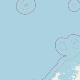
Map view of Kimberley Marine Park

Use this park location map to pinpoint Kimberley Marine Park in Australia, understand its exact geographic position, and read its mapped placement within the surrounding landscape more clearly.

Pigeon | © OpenStreetMap contributors

Location context for Kimberley Marine Park

Western Australia
Recorded earthquake history

Review the Kimberley Marine Park Earthquake History Catalogue

Examine the historical record of seismic events associated with the Kimberley Marine Park. This dataset offers clear insight into recorded activity near the park, providing essential geographic context for those exploring the seismic history of the northwest Australian coastline.

Kimberley Marine Park Earthquake History

Catalogued events

18 events

Strongest magnitude

Magnitude 4.8

Most recent event

Apr 17, 2022

This history includes earthquakes recorded inside the park or within 50 km of its borders

Park atlas

Compare adjacent marine reserves and regional conservation areas along northwestern Australia

Explore Parks Near Kimberley Marine Park and Surrounding Protected Areas

Browse other protected areas and marine reserves situated near Kimberley Marine Park to compare regional biodiversity and offshore habitats. Expanding the view beyond these coastal waters reveals broader patterns in northern Australian conservation geography.
National parkKimberley
20 km away#1 closest

Northeast

Niiwalarra Islands National Park: Protected Area and Kimberley Geography Explorer

Mapped landscape context for this Australian national park.

Gain a comprehensive atlas-style understanding of Niiwalarra Islands National Park, a designated national park situated in Australia's Kimberley region. This dedicated page provides insight into its protected landscape, its precise geographic boundaries as mapped within the region, and its overall significance as a natural area. Explore the structured geographic data that defines this park's identity and its unique place in the Australian atlas.

Area
33.52 km²
Established
2019
IUCN
Ia
Scope
Mixed
National parkWestern Australia
39 km away#2 closest

East

Prince Regent National Park: Protected Landscape and Geographic Context in Western Australia

Explore mapped boundaries of this Western Australian national park.

Prince Regent National Park represents a distinct protected area within the expansive territory of Western Australia. This national park serves as a focal point for understanding regional geography and mapped landscape features. Users can explore its specific park boundaries and discover its contribution to the atlas of Western Australia's natural heritage, offering a deep dive into its protected status and geographic placement.

Area
5,764 km²
Established
1964
IUCN
II
Relief
Mountain
National parkWestern Australia
54 km away#3 closest

East

Mitchell River National Park: Mapped Geography and Protected Plateau Landscapes

Remote sandstone wilderness within Western Australia

Mitchell River National Park offers a deep look into the geomorphology of the Mitchell Plateau, featuring iconic sandstone features and permanent waterholes like Surveyors Pool. This protected wilderness in Western Australia serves as a critical study area for biodiversity, encompassing tropical savanna habitats, ancient rock art sites, and complex river systems that remain essential to the ecological integrity of the Kimberley region.

Area
1,153.25 km²
Established
2000
IUCN
II
Relief
Highland
Marine protected areaNorthern Territory
57 km away#4 closest

Northeast

Oceanic Shoals Marine Park: A Regional Overview of Protected Marine Geography

Explore the seafloor features and protected shelf waters of Northern Australia.

Oceanic Shoals Marine Park is a sprawling marine protected area located off the coast of the Northern Territory. It serves as a cornerstone of the North Marine Parks Network, featuring distinctive geological formations such as the Van Diemen Rise and the pinnacles of the Bonaparte Basin. This atlas entry details the park's bathymetric diversity, ranging from shallow carbonate banks to the deep shelf break of the Arafura Sea, highlighting its role as a productive corridor for migratory marine megafauna and reef ecosystems.

Area
71,743 km²
Established
2018
IUCN
VI
Relief
Lowland
National parkWestern Australia
68 km away#5 closest

East

Lawley River National Park: A Protected National Park in Western Australia's Geography

Understanding its landscape and mapped boundaries.

Lawley River National Park is a designated national park offering a focused exploration of its protected landscape and geographic identity within Western Australia. This entry provides structured details essential for understanding the park's mapped boundaries and its role in the regional conservation atlas. Examine the park's specific geographic context and its significance as a protected natural area without requiring travel logistics or visitor advice.

Area
175.72 km²
Established
2000
Access
Highly restricted
Scope
Terrestrial
Marine protected areaWestern Australia
75 km away#6 closest

West

Argo-Rowley Terrace Marine Park: Mapped Geography and Marine Protected Area Context

Expansive oceanic territory within the Western Australian region

Argo-Rowley Terrace Marine Park represents a vast offshore environment protecting diverse aquatic life and unique seafloor features. This marine protected area bridges the gap between the isolated Rowley Shoals and deep-water abyssal hills. The region is essential for understanding the structural geology of the ocean floor, encompassing everything from shallow reefs to abyssal plains in the remote north-west of Australia.

Area
146,003 km²
Established
2018
IUCN
VI
Relief
Lowland
National parkWestern Australia
109 km away#7 closest

East

Drysdale River National Park: Western Australia National Park Geographic Atlas Entry

Mapped protected landscape and regional context.

Delve into the protected landscape of Drysdale River National Park, a designated national park located in Western Australia. This page serves as a focused entry point for understanding its geographic placement, mapped boundaries, and contribution to the broader regional atlas. Explore the specific terrain and protected area context of Drysdale River National Park, aiding in structured geographic discovery within Australia's vast natural areas.

Area
4,482.64 km²
Established
1974
IUCN
II
Relief
Mountain
Marine protected areaWestern Australia
About 181 km away#8 closest

Southwest

Rowley Shoals Marine Protected Area: Geographic Boundaries and Regional Atlas Context

Offshore coral atoll systems in Western Australia

Rowley Shoals consists of three vertical reef structures emerging from the Indian Ocean off Western Australia. This content explores the mapped boundaries, nested lagoons, and remote coral formations that define this marine protected area, offering a clear perspective on its role within the broader northwestern continental shelf landscape.

Established
1990
Relief
Lowland
Climate
Tropical
Access
Remote access

Common questions about visiting, size, designation, and location context for Kimberley Marine Park

Kimberley Marine Park FAQs for park facts, access, geography, and protected area context

Find quick answers about Kimberley Marine Park, including protected-area facts, park geography, trail and visitor context, and how the park fits into its surrounding country and regional landscape.
MoriAtlas Explorer

Continue Your Protected Areas Search Across the Global Atlas

Deepen your exploration by continuing the structured search for national parks and protected areas worldwide. Utilize the comprehensive filtering capabilities to compare different conservation landscapes and refine your understanding of global park geography. Discover more about the distribution and characteristics of protected natural areas.

Global natural geography