
Planning Guide
When Is the Best Time to Visit Kobuk Valley National Park
Visiting Kobuk Valley National Park requires a clear understanding of the tension between its extreme Arctic environment and the limited windows of accessibility. For most travellers, the best time to visit is during the brief summer period from June through August. This window provides the only reliable opportunity to experience the park without the profound logistical hazards of deep winter. During these months, the environment transitions from the final thaw to the fleeting warmth of the high Arctic, allowing for river-based travel and terrestrial exploration of the Great Kobuk Sand Dunes. However, choosing to arrive during this period necessitates accepting the realities of a wilderness that remains cold and unpredictable even at its warmest.
Balancing Daylight and Temperature
The primary factor driving the decision of when to arrive is the dramatic oscillation in daylight and thermal conditions. The park experiences a total reversal of environments throughout the year, with deep-winter darkness contrasted by the midnight sun of early summer. While the warmest mean temperatures occur in July, reaching around 11.8 degrees Celsius, visitors must balance this with the reality of precipitation patterns. July and August are historically the wettest months, with rainfall normals reaching over 3 mm per day. This moisture, combined with the presence of wind, can significantly reduce the perceived temperature, making even mid-summer days feel raw and biting. Travellers aiming for the longest days will find late June most rewarding, as the sun remains visible for nearly 24 hours, providing maximum flexibility for backcountry movement.
The Logistical Reality of Arctic Access
The decision on when to visit is equally tied to the physical state of the landscape. Because there are no roads into the park, all access is dependent on small aircraft, which are heavily influenced by local weather conditions. The transitional seasons are particularly volatile, with spring thaw and autumn freeze-up creating periods where landing on the landscape becomes hazardous or impossible. Even during the peak of summer, sudden weather shifts can ground flights and delay travel for days. Visitors must view the summer window not as a guaranteed period of ease, but as a period of reduced risk. Those seeking the unique experiences of the Great Kobuk Sand Dunes or witnessing the caribou migration must be prepared for a trip defined by self-reliance, as the environmental extremes of this Arctic valley ensure that no month is truly mild or predictable.
Seasonal Windows
Best Months to Visit Kobuk Valley National Park at a Glance
The Primary Summer Window: June through August
For most travelers, the months of June, July, and August represent the only viable window for visiting the park. During this period, temperatures reach their annual peak, with average daily highs fluctuating between 18 and 22 degrees Celsius. This narrow timeframe is defined by the return of liquid water to the Kobuk River and the potential for drier, more stable ground conditions, which are essential for backcountry navigation. Travelers prioritizing hiking, particularly exploration of the Great Kobuk Sand Dunes, will find this the most feasible window, as the risk of extreme sub-zero temperatures is lowest. However, this season carries the inherent trade-off of increased precipitation and higher humidity levels compared to the rest of the year, alongside the persistent logistical reality that access depends entirely on bush plane availability, which remains weather-dependent regardless of the calendar month.
Early Summer and the Midnight Sun: June
June stands out for the combination of rapidly increasing temperatures and nearly continuous daylight. With the sun remaining above the horizon, visitors gain maximum utility for travel and exploration. The transition from late spring, where average lows can still hover near freezing, to the mild warmth of early summer makes this a productive time for those focused on landscape photography and initial river navigation. The compromise during this period is the lingering potential for muddy terrain and high water levels as the seasonal thaw concludes. It is a period of rapid environmental change that requires high flexibility in travel schedules.
The Peak of Activity: July and August
July represents the statistical peak of the park's thermal profile, offering the warmest average conditions for those sensitive to the Arctic cold. This is the period when ground conditions are typically most reliable for walking across the dunes and riverbars. August begins a noticeable transition toward shorter daylight hours and cooling temperatures, with average lows starting to dip back below freezing. For the visitor, August offers a distinct trade-off, as it often sees the highest precipitation levels of the year, potentially impacting visibility and the comfort of backcountry camping. The cooling trend in late August also serves as a harbinger of the approaching winter, effectively marking the conclusion of the primary visitor season before the transition to autumn conditions.
Transitioning Away from the Peak
By September, the park enters a rapid period of decline in both daylight and temperature, with averages falling significantly. While early September may still allow for limited access, the increasing frequency of wind, frost, and the potential for early snowfall makes this a period suited only for highly experienced wilderness travelers with specialized gear. Outside of the June through August window, the park shifts toward a regime of extreme cold, minimal daylight, and frozen landscapes that present severe challenges to access, safety, and logistical support. Planning a trip outside of the summer months involves risks related to air transport reliability and environmental exposure that exceed the capabilities of standard recreational travel.
Annual Climate Overview
Arctic Weather and Climate Patterns by Month in Kobuk Valley
Environmental Normals and the Arctic Cycle
Kobuk Valley experiences a profound, subarctic climate defined by extreme swings in daylight and temperature that dictate the rhythm of the year. It is critical to recognize that long-term climate normals, derived from data collected between 1991 and 2020 at an elevation of approximately 377 meters, offer a baseline for expectations rather than a local weather forecast. Arctic conditions are notoriously volatile, and travelers should view these monthly averages as a framework for the seasonal shift, acknowledging that specific terrain, such as the Great Kobuk Sand Dunes or river basins, may experience localized wind patterns and temperature gradients not captured in broad station metrics.
The Shift from Darkness to Midnight Sun
Daylight is the most influential factor in the park's annual rhythm. The transition from the depths of December, when daylight is reduced to a negligible 0.11 hours, to the near-constant sunlight of June at 23.86 hours, represents a fundamental environmental pivot. This surge in light acts as the primary driver for biological activity and accessibility. By late May, the park experiences nearly 20 hours of sun, which accelerates the thawing of the landscape. Visitors planning their travel around these shifts will find that early summer provides the maximum window for activity, while the rapid contraction of daylight starting in August signals the end of the prime visitation season.
Temperature Thresholds and Seasonal Stability
The park's thermal profile is characterized by a brief, intense summer followed by a long, deep winter. Mean temperatures rise above freezing only during the peak summer months, with June averaging 10.17 degrees Celsius and July reaching a peak of 11.83 degrees Celsius. These months represent the narrow threshold where the landscape remains relatively free of deep snow, though average minimums in June can still hover near -0.46 degrees Celsius. August marks a clear transition as mean temperatures begin to drop to 8.18 degrees Celsius, accompanied by an increase in nocturnal risk. Outside of this three-month summer window, temperatures drop sharply, with October through April remaining firmly below the freezing mean, often reaching extreme minimums that emphasize the park's status as a remote Arctic wilderness.
Precipitation and Wind Dynamics
Humidity and moisture follow a distinct seasonal pattern that impacts the feel of the Arctic summer. Precipitation is highest during the summer months, with July and August recording the highest daily averages of 3.1 millimeters and 3.6 millimeters, respectively. Visitors often find that these warmer, wetter months contrast with the drier, colder winter months where precipitation occurs primarily as snow. Relative humidity remains high throughout the year, consistently exceeding 80 percent, which can make cooler summer days feel significantly damp. Wind speeds also fluctuate according to the seasons, with the most stable air occurring during the calmer summer months of June and July, when wind speeds average around 3.2 to 3.3 meters per second. This reduction in wind is a critical factor for backcountry comfort, as higher average wind speeds during the winter months, combined with extreme cold, significantly increase the environmental challenge of the region. Travelers should expect these variables to change rapidly; the reliance on averages does not preclude the possibility of summer rain or high-wind events occurring at any time, which are common characteristics of this vast, mountain-ringed valley.
Seasonal dynamics
Understanding Arctic Seasonal Transitions in Kobuk Valley National Park
The Arctic Shift: Moving Beyond Four Seasons
Kobuk Valley does not adhere to the traditional four-season calendar found in temperate latitudes. Instead, the park functions through two primary environmental states: the long, dormant period of total Arctic winter and the brief, volatile pulse of the subarctic growing season. Understanding the transition between these states is vital, as the park lacks the gradual shift in conditions typically expected by visitors.
The Extended Winter Dormancy: October to May
The longest phase of the year begins in October, when temperatures drop rapidly below freezing and the daylight hours diminish toward the winter solstice. This period is defined by extreme cold, significant snowfall, and a landscape that is largely inaccessible for standard travel. From November through February, the park remains in a state of polar night, with minimal solar influence and sustained temperatures often falling well below -20 degrees Celsius. While this season offers the distinct potential for aurora borealis viewing, the lack of daylight and the severity of the cold create profound logistical barriers that effectively pause recreational park use for most travellers.
The Rapid Spring Transition: May to Early June
The arrival of spring is not a gradual warming but a compressed period of intense transition. By May, the daylight cycle expands dramatically, moving toward 20 hours of light. This phase acts as a bridge between the deep freeze of winter and the short summer. During this time, the snowpack begins to retreat, and the landscape enters a period of high instability. Travel during this window is complicated by breaking ice on the Kobuk River and the saturation of the valley floor, which creates significant challenges for foot travel and small-aircraft landings. It is not a reliable window for recreation, but rather a necessary natural reset that sets the stage for the limited summer activity period.
The Arctic Summer Window: June to August
Summer is the only period where the environment supports standard backcountry access. This phase is characterized by the presence of the midnight sun, which sustains vegetation growth and provides near-constant light for exploration. June begins this period with the peak of light, while July often represents the most stable thermal window. However, August signals a swift contraction of this state. As daylight decreases and precipitation normals rise, the park begins a quick shift back toward autumn conditions. Visitors should recognize that even during this peak phase, the Arctic climate remains unpredictable, with rapid drops in temperature and sudden, intense weather shifts that can occur without warning, reflecting the persistent, underlying influence of the subarctic geography.
Seasonal Experiences
What to Expect Across the Seasons in Kobuk Valley National Park
Navigating the Great Kobuk Sand Dunes
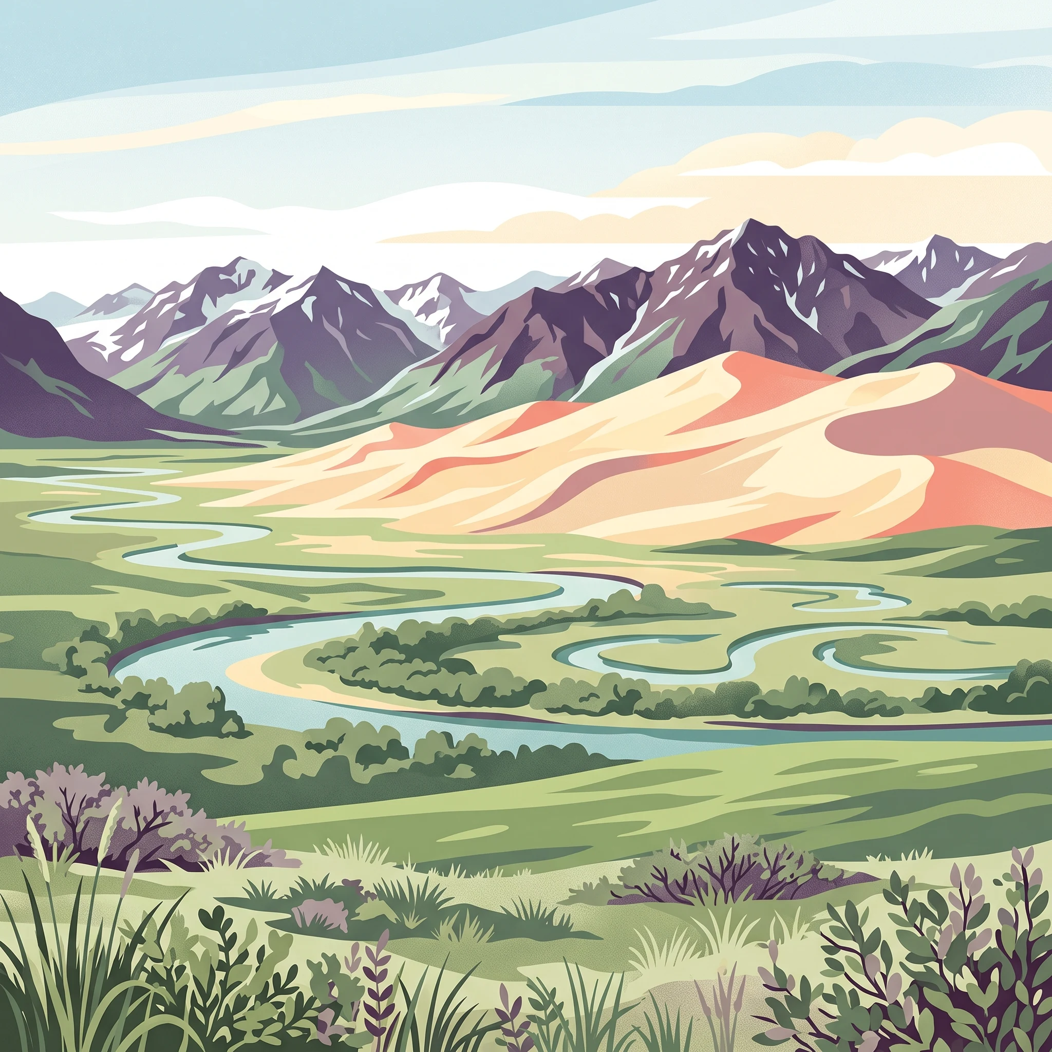
The Great Kobuk Sand Dunes are the defining feature of the park, and their accessibility is intrinsically linked to the short summer window. Visiting between late June and early August is essential for hikers hoping to traverse this active Arctic dune field. During these months, the ground surface conditions are most stable, as the lingering effects of the long winter thaw begin to recede, allowing for safer, more navigable walking across the sandy landscape. In contrast, visiting too early in June can involve traversing areas of saturated, muddy terrain as the ground thaws, while late August brings a rapid shift in temperature and an increase in the frequency of damp weather that can make dune exploration significantly more challenging.
Timing for Wildlife Observation and River Access
The Kobuk River serves as the primary artery for movement through this vast wilderness, and its availability dictates when you can realistically hope to observe the annual caribou migration. Visitors hoping to witness this historic event should note that migration timing is variable and largely dictated by the animals themselves rather than set dates. However, the period from mid-July through August provides the highest likelihood of coinciding with the movement of portions of the Western Arctic caribou herd. River travel during this time benefits from higher water levels following the spring melt, facilitating easier boat navigation for those attempting to reach remote backcountry sites. Early season river travellers in June should be prepared for colder water temperatures and a landscape still shedding the remnants of winter, which may limit the reach of river-based exploration.
Experiencing the Cultural Landscape of Onion Portage
Onion Portage represents a profound historical intersection where human history meets the landscape, with archaeological evidence of occupation spanning millennia. Accessing this site is most feasible during the height of the summer season when the river is fully ice-free and travel by small aircraft and boat is reliable. Because this area is a sensitive archaeological district, exploring it requires a focus on stewardship and patience. The long daylight hours of June and July offer an advantage here, providing extended periods of light for observing the topography of the river bend where caribou have historically been hunted. As daylight hours wane toward the end of August, the atmosphere of the site shifts, and the logistical window for reaching these remote coordinates begins to narrow, highlighting the importance of planning your visit within the reliable mid-summer peak to ensure you have sufficient time on the ground to appreciate the historical significance of the valley without the pressure of imminent seasonal closure.
Visitor Priorities
Optimizing Your Kobuk Valley Trip by Activity and Interest
Prioritizing Thermal Comfort and Mild Conditions
For travelers seeking the most moderate temperature profile, early July stands as the most defensible period. With mean temperatures peaking around 11.83°C and daily maximums reaching nearly 22°C, this window offers the warmest conditions recorded in the park. The primary trade-off for these higher temperatures is a significant increase in precipitation, which averages 3.1 mm per day in July. While this warmth is relative for an Arctic location, it is the only time of year when visitors can reasonably expect daily highs that do not require specialized extreme-cold gear. However, the higher moisture levels mean that persistent cloud cover and damp ground conditions are more likely during this period than in the drier, albeit cooler, shoulder months.
Targeting Lower Precipitation for Ground Travel
If the priority is minimizing precipitation to facilitate hiking across the Great Kobuk Sand Dunes, the latter half of June provides a distinct advantage. While June has a mean temperature of 10.17°C, which is cooler than July, the recorded precipitation is lower at 2.03 mm per day. Visitors choosing this timeframe benefit from the residual stability of the landscape before mid-summer moisture peaks. The compromise here involves navigating the transition from the spring thaw, where ground conditions can remain saturated or muddy from the melting snowpack. Additionally, while June offers the maximum daylight duration,approaching 24 hours of light,the wind speeds remain relatively consistent, meaning that hiking objectives must be balanced against the reality of frequent, cool breezes that persist throughout the season.
Maximizing Daylight for Extended Exploration
Those whose primary interest is the phenomenon of the midnight sun should plan for mid-to-late June. During this period, the park experiences its greatest intensity of daylight, with the sun effectively remaining above the horizon. This duration allows for flexible exploration schedules, as the light remains constant regardless of the hour. The significant trade-off for this extended daylight is that the physical environment is at its most transitional state. Hikers may encounter lingering snow in shaded areas or saturated terrain, and the sheer volume of constant light can disrupt sleep cycles, requiring proactive preparation for managing rest in the wilderness. It is important to remember that these climate normals are not forecasts, and even during the brightest months, the Arctic environment remains volatile with the potential for rapid weather changes regardless of the hour.
Balancing Experience and Logistical Reality
Visitors often attempt to weigh the benefits of these periods against one another. If the goal is dry walking, June is preferred over the wetter late summer months of August. If the goal is warmth, July is the most consistent. Every preference carries the immutable compromise of the Arctic: there is no time of year in this park where extreme, rapid weather shifts are not a possibility. Travellers should choose their dates based on which environmental challenge they are best equipped to mitigate, rather than searching for a period of guaranteed benign weather.
Access and Logistics
Seasonal Access and Operational Logistics in Kobuk Valley National Park
Access to this Arctic wilderness is dictated by its remote geography and the total absence of traditional road infrastructure. Because the park relies entirely on aerial and non-motorized entry methods, the timing of your visit is intrinsically tied to the availability of air taxi services and the physical state of the landscape. Unlike parks with managed visitor centers or entrance stations, this region demands that all logistics be finalized well in advance through independent coordination with regional aviation providers.
Air-Based Entry Logistics
Most visitors reach the park by hiring small aircraft from hubs such as Bettles or Kotzebue. These operations function throughout the year but are highly sensitive to prevailing weather conditions. During the June to August window, flight activity increases to support backcountry excursions, yet weather-related flight delays or cancellations remain a constant reality. You must verify current air taxi operators, as local aviation services change periodically. Always treat advertised flight schedules as tentative, particularly when planning arrivals or departures during the shoulder seasons where unpredictable Arctic storms can disrupt flight paths for multiple days.
Navigating the Wilderness Environment
Once you arrive, there are no established trails, maintained campgrounds, or cellular signals. The park is a vast expanse where you must rely on your own navigational skills, topographic maps, and satellite communication devices. While summer months provide the clearest window for river travel, even July and August can bring rapid environmental shifts that impact mobility. For instance, the Kobuk River acts as the primary corridor for movement, but water levels fluctuate based on upstream rainfall and mountain runoff, which can affect the feasibility of boat travel. You are responsible for ensuring your own equipment is suited for the specific demands of the Arctic terrain, as there are no rental services or mechanical assistance available within park boundaries.
Essential Verification for Trip Planning
Because operational details can change, do not rely on historical accounts of access or past service availability. Always consult the official National Park Service website or contact regional ranger stations before you finalize your travel dates or book non-refundable transport. Verification should include confirming current permit requirements for backcountry stays, checking for temporary area closures due to wildlife migration or fire activity, and understanding any subsistence-related restrictions that prioritize local Inupiat use of the land. By centering your planning around the necessity of self-sufficiency and verifying current operational status with official authorities, you reduce the risk of logistical failure in this remote setting.
Safety and Preparation
Weather Expectations and Seasonal Safety in Kobuk Valley National Park
Navigating Arctic Environmental Hazards
Preparation for this park is fundamentally different from standard wilderness travel because of the complete lack of infrastructure. The environment is defined by its remoteness, which necessitates a high degree of self-sufficiency. Visitors must anticipate that assistance is not readily available in the event of injury, gear failure, or changing weather conditions. Because cellular service is non-existent within the park boundaries, effective safety planning requires the use of reliable satellite communication devices and personal locator beacons. Relying solely on local knowledge or standard public signals is insufficient for safety in this latitude.
Adapting Gear to Arctic Climate Patterns
Weather expectations should be anchored in the understanding that the brief summer window of June through August contains both the warmest mean temperatures and the highest likelihood of precipitation. July experiences the highest average daily rainfall, while August sees temperatures begin their descent toward freezing. Preparation must account for these rapid fluctuations. A system of high-quality, wind-resistant, and waterproof outer layers is essential regardless of the month, as coastal weather systems can shift conditions within hours. Given that the ground can remain saturated or soft during the early summer transition, footwear choices must prioritize stability and moisture management.
Managing Wildlife and Wilderness Risks
Safety in this park includes respectful distance from local wildlife, particularly bears and moose, which are common throughout the valley. Rather than relying on rigid protocols or specific commercial devices, visitors should educate themselves on current park-specific wildlife encounter guidelines. Because the park serves as a migration corridor, animal behavior can be unpredictable, especially during peak movement periods. Always check official alerts before departure, as these notifications provide the most current context regarding animal activity, river conditions, and potential route closures. Do not attempt backcountry travel in the winter months unless you possess documented expertise in Arctic survival and extreme cold weather management. For those visiting during the summer, the primary safety strategy is constant situational awareness, including the ability to identify terrain hazards and the discipline to maintain a safe distance from all wildlife observed in the valley.
Trip Decision Framework
How to choose the right time to visit Kobuk Valley National Park
Selecting the right time for an expedition to this Arctic wilderness ultimately depends on which environmental trade-offs you are best prepared to manage. Because the park lacks permanent infrastructure and relies on flight-based access, your window for visiting is fundamentally compressed into the summer months. Choosing between June, July, and August requires a clear prioritization of your own tolerance for shifting weather, daylight, and the physical demands of a roadless landscape.
Prioritizing Your Arctic Objectives
If your primary goal is maximizing available light for backcountry navigation and dune photography, the period from mid-June to early July offers the highest degree of illumination. During this window, you benefit from the phenomenon of the midnight sun, which simplifies travel by removing the constraints of a traditional day-night cycle. However, this early period often involves navigating lingering moisture on the landscape as the ground thaws. If your priority is instead focused on the thermal stability of the mid-summer season, July remains the most consistent choice. While this month typically records the highest precipitation averages, it also provides the most moderate daily mean temperatures, which can be critical for comfortable camping and extended river-based activities.
Evaluating Environmental and Operational Risk
August represents a distinct shift toward autumn, characterized by cooling trends and increasing weather volatility. While the landscape remains accessible, the risk of early seasonal transitions increases significantly. Visitors who prioritize a sense of total isolation may find the tail end of the season attractive, provided they are equipped for the rapid onset of colder nights and potential precipitation shifts. Regardless of the month you choose, your decision must be tempered by the reality that these climate normals represent long-term averages rather than localized weather forecasts.
Finalizing Your Decision
Before finalizing your travel dates, ensure you have verified current operating status and potential service limitations with local air taxi operators and the National Park Service. Because this park is a remote and autonomous environment, there is no single month that guarantees ideal conditions. Your success relies on your ability to monitor real-time weather alerts and maintain the flexibility to adjust your itinerary as conditions dictate. Rather than searching for the perfect month, assess your personal comfort levels against these seasonal patterns to determine which period best aligns with your objectives for a remote Arctic experience.