
Trip Planning Essentials
When Is the Best Time to Visit Komodo National Park
Navigating the Seasonal Patterns of Komodo National Park
For most travelers, the best time to visit Komodo National Park is during the dry season, which typically extends from April through November. This period provides the most stable conditions for the park's primary activities: trekking to spot Komodo dragons on Rinca and Komodo islands, and exploring the diverse marine ecosystems of the Coral Triangle. Choosing these months minimizes the risk of travel disruption caused by heavy rainfall and ensures clearer visibility for underwater activities. However, the decision to visit during this window involves a trade-off, as these months coincide with the park's most popular period for tourism.
Balancing Weather Stability and Visitor Trends
The climate at Komodo National Park is defined by a significant contrast between the arid, rain-sparse dry season and the more humid, wet summer months. From December to March, the park experiences higher precipitation and increased humidity, which can affect accessibility to some of the more remote sites and influence the conditions of the trails. While the rainfall during these months is a defining climatic feature, it also brings a transformation to the island landscapes, turning the usually parched savannahs into vibrant green environments. Travelers who prioritize lush scenery over perfect hiking weather may find this transitional window appealing, though they should be prepared for more variable conditions.
Key Environmental Factors Shaping Your Visit
Understanding the regional climate requires looking beyond simple temperature data. While average temperatures remain consistently warm throughout the year, the interaction between wind, humidity, and rainfall creates distinct visitor experiences. The dry season is characterized by lower relative humidity and more consistent wind patterns, which are vital for maintaining the water clarity sought by divers and snorkelers. As the calendar shifts toward the end of the year, the rise in daily precipitation and humidity levels reflects the broader tropical monsoon pattern impacting the Lesser Sunda Islands.
Rather than seeking a single ideal month, effective trip planning involves matching your specific priorities,such as wildlife observation, underwater visibility, or landscape photography,with these climatic rhythms. The park is a dynamic environment where the landscape and accessibility evolve significantly with the seasons. By recognizing the trade-offs between the arid, accessible dry months and the wetter, more secluded period, you can select the timing that aligns best with your travel goals while remaining aware that weather is a variable element, not a fixed guarantee.
Seasonal Planning
Best Months to Visit Komodo National Park for Every Traveler
Peak Windows for Wildlife and Marine Exploration
The most effective window for terrestrial trekking to see Komodo dragons and engaging in open-water marine activities occurs between May and October. During these months, precipitation levels drop significantly, often falling below 2 mm per day, which stabilizes the rugged terrain on Komodo, Rinca, and Padar islands. The persistent trade winds that characterize this period help moderate the tropical heat, creating conditions that are generally more comfortable for the intensive hiking required to spot dragons in their natural habitat. For divers and snorkelers, this window corresponds with clearer water conditions, though ocean currents remain a powerful and constant feature of the local topography that requires local expertise regardless of the month.
Transition Periods and Shoulder Seasons
April and November serve as crucial bridge months that define the transitions between the distinct wet and dry phases. April represents the end of the heavy rainfall period as conditions begin to dry out, often resulting in lush, green landscapes that have not yet succumbed to the intense evaporation of the peak dry season. Conversely, November marks the onset of the transition back toward wetter weather, characterized by increasing humidity and rising rainfall averages. Travelers choosing these months should prepare for variable conditions, as the onset of localized rain showers can be unpredictable. These periods are often identified by a slight shift in visitor dynamics, as the heavy seasonal travel peaks associated with the middle of the year begin to fade or have not yet reached their maximum intensity.
Managing the Tropical Wet Season
From December through March, the park experiences its highest levels of precipitation, with daily rainfall often exceeding 7 mm. Humidity levels climb toward their annual peaks, consistently remaining above 78 percent. While the park remains a distinct, biodiverse environment during these months, the increased frequency of rain impacts trekking routes and sea accessibility. Travelers planning trips during this period must account for a higher likelihood of weather-related disruptions to boat schedules, as sea conditions can become rougher during the monsoon-influenced months. This season is best suited for those who are prepared for humidity and flexible with their itineraries, as the primary objective of observing dragons in the wild is subject to both weather and the natural behavior of the species. When planning during this window, visitors should prioritize operators with significant experience navigating the region's complex marine conditions.
Annual Climate Overview
Monthly Weather and Climate Patterns in Komodo National Park
Interpreting the Annual Climate Cycle
Understanding the climate patterns of this park requires moving beyond simple temperature averages to look at the interaction between humidity, rainfall, and wind. While the park is located in a tropical zone, it functions with a distinct environmental rhythm governed by the monsoon cycle. Long-term climate normals (1991 to 2020) show a clear divide between the parched, breezy months of the mid-year and the more humid, rain-prone transition periods at the start and end of the calendar. It is essential for visitors to recognize that these figures represent historical, localized averages rather than day-to-day forecasts. Local topography, which includes rugged volcanic hills rising over 700 meters, can create micro-climates that differ significantly from these regional station normals.
The Dry Mid-Year Transition
The most stable atmospheric conditions occur between June and September. During this period, precipitation levels drop to their lowest point of the year, with August often recording the minimal rainfall of the annual cycle. This is accompanied by a noticeable decrease in relative humidity, which typically dips toward 70 percent in August and September. These months are characterized by consistent wind patterns, which can reach averages of over 4 meters per second in July. For travelers, this implies a period of high visibility and clear skies, though the combination of heat and dry winds across the savanna-covered hills is a defining feature of the season. Temperatures during these peak dry months remain high, often reaching daily maximums exceeding 30 degrees Celsius in September, creating a hot, arid environment that contrasts sharply with the humid atmosphere of the wet season.
The Build-Up of Humidity and Rainfall
As the year moves toward December and January, the environmental character of the park shifts. Rainfall begins to increase significantly, with precipitation levels rising from fewer than 2 millimeters per day in October to nearly 8 millimeters per day by January. This rise in moisture is mirrored by a steady climb in relative humidity, which trends toward 80 percent or higher in the early months of the year. While average temperatures do not fluctuate as dramatically as precipitation, the increased humidity makes the environment feel substantially more oppressive for those trekking in exposed terrain. The wind speeds generally calm during these months compared to the mid-year peak, which can lead to stiller, more stagnant air in the valleys between the volcanic ridges.
Seasonal Daylight and Thermal Patterns
Daylight hours remain relatively stable due to the park's low-latitude location, varying by less than an hour across the entire year. The longest days occur in December, with approximately 12.5 hours of light, while the shortest days are found in June, offering roughly 11.5 hours. This narrow variation means that planning for daylight is less of a concern than planning for the temperature shifts and rainfall cycles. Thermal patterns show that the warmest average maximums typically occur in the latter half of the year, peaking in October and November just before the onset of the heaviest rains. Travelers should remember that while these climate normals provide a baseline for what to expect, they do not account for the intense solar radiation often experienced on the park's exposed slopes, which can elevate local temperatures significantly above the recorded mean.
Seasonal Climate Patterns
Understanding Seasonal Weather Phases in Komodo National Park
Defining the Annual Climate Rhythm
Rather than a traditional four-season model based on temperature fluctuations, the park operates on a distinct biennial cycle defined by moisture and wind. The rhythm of the archipelago is driven by the interaction between the dry trade winds and the seasonal monsoon shifts. This creates two primary meteorological phases: the prolonged dry season and the shorter, more humid wet season, separated by transitional windows that often determine the quality of outdoor experiences.
The Dry Phase: Peak Stability
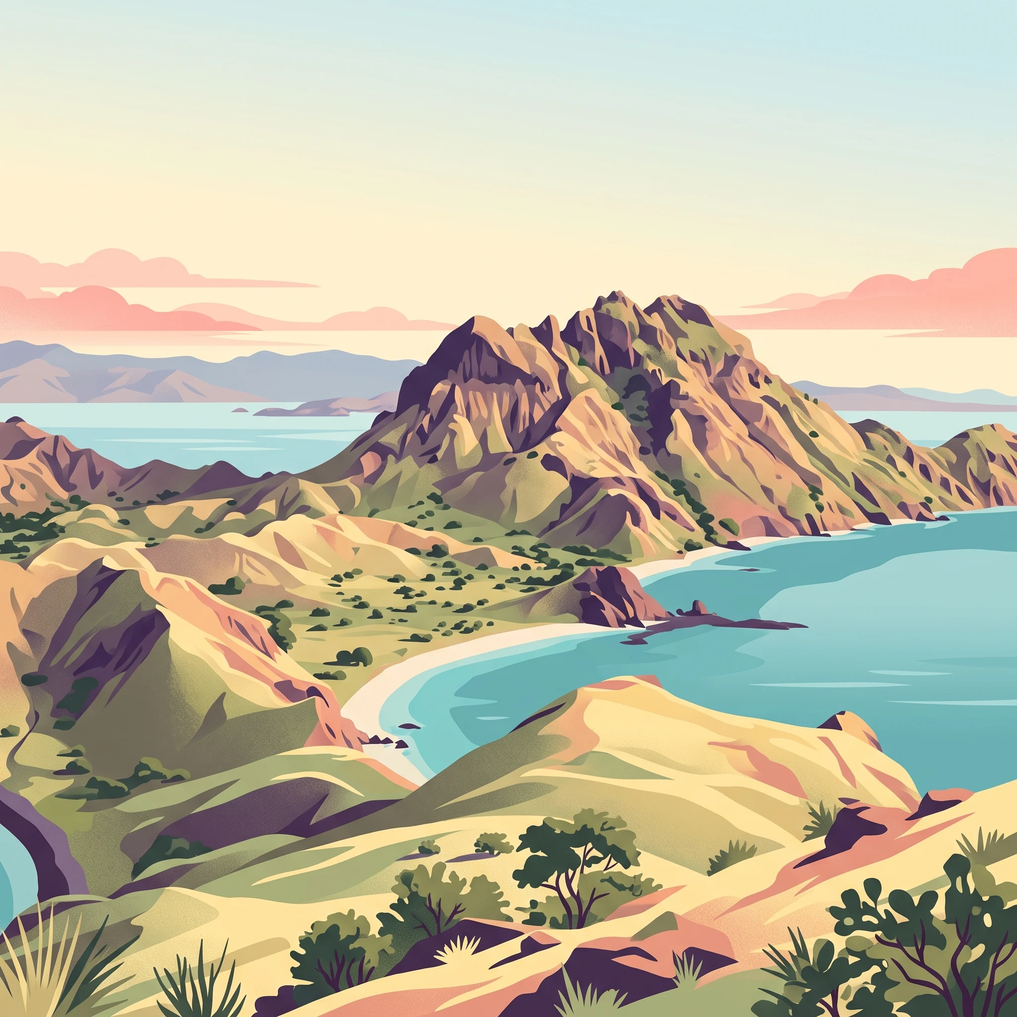
The dry season typically commands the calendar from April through November. This period is defined by low precipitation and high humidity stability. During the heart of this phase, particularly from June to September, the landscape undergoes a marked change as the savanna vegetation dries, turning the hills into a stark, golden-brown contrast against the deep blue of the surrounding seas. Travelers during these months encounter the most reliable conditions for trekking on Komodo and Rinca islands, as trail surfaces remain firm and humidity levels are at their annual minimums. This is also the period when sustained winds, while manageable, are most common, influencing sea conditions around the archipelago. By October and November, temperatures tend to reach their annual peaks before the humidity begins its steady climb.
The Wet Phase: Humid Transformation
Beginning in December and extending through March, the wet season introduces a shift toward frequent rainfall and higher relative humidity. While this period is frequently associated with increased precipitation, it rarely results in continuous, day-long storms. Instead, travelers often experience intense, short-duration tropical showers followed by periods of clearing. The humidity levels during these months remain consistently high, which can increase the perceived temperature, especially when combined with the lack of cooling breeze found during the peak dry months. The primary implication for visitors is not merely the rain itself, but the impact of wind and sea currents on marine access and the logistics of inter-island transport, which can become less predictable compared to the mid-year window.
Navigating the Transitional Windows
Transitions between these two dominant phases occur at the turn of the calendar and again as the year progresses toward the mid-year dry spell. April acts as a critical shoulder month, marking the conclusion of the wettest patterns and the onset of drier, more stable days. Conversely, November serves as the bridge from the dry heat of late autumn into the earliest onset of the monsoon. These transition months are characterized by meteorological unpredictability, where local conditions may fluctuate more rapidly than in the mid-dry or mid-wet seasons. Travelers visiting during these periods should expect a mix of environmental conditions, as the climate has not yet fully settled into its stable seasonal norm. While these times often see fewer visitors, the trade-off is a lower guarantee of the specific weather conditions preferred for intensive island trekking or sensitive marine activities.
Seasonal Experiences
What Visiting Komodo National Park Is Like Throughout the Year
Dragon Trekking and Terrestrial Exploration
The primary terrestrial experience in the park, guided trekking to observe Komodo dragons, is most consistent during the dry season months of April through November. During this window, the savanna landscapes of Komodo and Rinca islands are at their most accessible. The reduced rainfall keeps trails firmer and easier to navigate, while the thinner, lower-growing vegetation common in the dry season improves visibility for spotting dragons in their natural habitat. Travelers aiming for these specific land-based encounters benefit from the lower humidity levels of the mid-year months, which makes trekking under the direct tropical sun more manageable compared to the humid peak of the wet season.
Marine Biodiversity and Diving Logistics
The park's reputation as a premier marine destination is defined by the underwater visibility and sea conditions of the dry season. Sites such as Batu Bolong, Castle Rock, and Manta Alley are typically most rewarding when the winds are stable and rainfall is minimal. The dry months of June, July, and August offer generally calmer sea conditions, facilitating smoother boat trips and liveaboard excursions between the scattered islands. Divers should note that while the dry season is associated with better visibility, the park's dynamic currents remain a constant feature of the Sape Strait regardless of the month, necessitating reliance on experienced local operators for all maritime activities. When planning marine itineraries, the transitional months of April and November often present a balance of manageable sea states before the onset or full retreat of the wetter conditions.
Seasonal Variability in Outdoor Activities
Beyond trekking and diving, specialized outdoor pursuits like sea kayaking and stand-up paddleboarding (SUP) are highly dependent on wind and sea surface conditions. Expedition-style trips that traverse the more exposed waters between the smaller islands are most commonly supported between April and November. The higher wind speeds recorded in the middle of the year require significant skill and appropriate vessel selection, as the waters can shift rapidly from calm to challenging. Because these activities often involve camping on remote, uninhabited beaches, the dry season's predictable weather patterns provide the necessary stability for these excursions. Travelers interested in these self-powered explorations should verify current operator schedules and safety standards, as the logistical requirements for these trips are strictly tied to the park's maritime conditions and weather patterns.
Travel Priorities
Optimizing Your Komodo National Park Visit Based on Travel Priorities
Targeting the Driest Conditions for Trekking
For travelers whose primary goal is the classic Komodo dragon observation trek, the peak dry months from July through September offer the most reliable conditions. During this period, the island landscape is characterized by its signature arid, golden-brown savanna, which provides excellent visibility for spotting dragons against the terrain. These months feature the lowest daily precipitation levels in the park, with August recording as little as 0.39 mm per day. The clear skies and persistent sun reduce the risk of trail closures due to mud or extreme localized rain, allowing for consistent access to established trekking paths on Rinca and Komodo. The trade-off is the intensity of the heat, as peak temperatures regularly exceed 30 degrees Celsius. Travelers should be prepared for high sun exposure and limited shade while navigating these open, volcanic hills.
Prioritizing Marine Visibility and Stable Sea Conditions
Visitors focused on underwater experiences, such as snorkeling or scuba diving, find their most favorable window between April and June, and again in October. While the mid-year months are driest, they also bring higher wind speeds which can occasionally lead to choppy sea conditions in the Sape Strait. By choosing the transition months of April or October, you benefit from lower wind speeds (often dropping below 2.6 meters per second) while still enjoying the benefit of the dry season's reduced rainfall. These periods offer a vital balance: enough clarity for underwater photography and stable enough water for comfortable transit between the islands on liveaboards or day boats. Compromising here often means accepting slightly higher humidity levels compared to the August peak, but the improved maritime comfort is typically considered a worthwhile trade-off for those sensitive to seasickness or reliant on small boat transport.
Seeking Milder Temperatures and Longer Daylight
If your priority is mitigating the heat of the midday sun, the shoulder period of April offers a subtle advantage. As the region transitions away from the peak rainy season, temperatures remain moderate compared to the late-year extremes, and the landscape retains more of its lush, green character before the long drought fully sets in. With nearly 11.8 hours of daylight, you have sufficient time for early-morning activities to avoid the most intense heat. Conversely, if you require the maximum amount of daylight for long-range photography or multi-island excursions, the months of November and December provide the longest windows of light, averaging over 12.4 hours. However, these months coincide with the onset of the wet season. Choosing this period requires a willingness to accept intermittent, sometimes heavy, rainfall and potentially unpredictable sea conditions as a trade-off for the extended daylight hours. Always verify current marine weather warnings before scheduling these trips, as high wind and swell can shift quickly, regardless of the seasonal trend.
Visitor Access and Logistics
Seasonal Access and Practical Planning for Komodo National Park
Navigating Marine Logistics and Island Access
Access to the islands is fundamentally tied to the interplay between seasonal sea conditions and local transport availability. While the park is accessible year-round, the transition from the relatively calm dry season to the more turbulent wet season directly influences the feasibility of small-boat travel. During the peak dry months, the sea is generally more stable, making it easier to reach remote snorkeling sites and outer islands. Conversely, during the wetter months from December to March, increased precipitation and wind shifts can lead to choppy waters, occasionally impacting the frequency of local boat operations or specific sea-based excursions.
Most travelers arrive at the park via the gateway town of Labuan Bajo on the island of Flores, which acts as the primary hub for both flight arrivals and the majority of boat charters. Travelers should note that ferry connections to and from the region can be subject to delays or cancellations when weather conditions deteriorate. Because these maritime logistics are susceptible to change, it is essential to monitor local weather reports and confirm with local boat operators or transport providers before finalizing your travel dates. Always verify the current status of ferry services or chartered vessel operations directly with your service provider or local authorities shortly before your departure.
Requirements for Park Permits and Official Documentation
Effective visitor planning requires staying informed about the current regulatory environment. Access to the main islands,including Komodo, Rinca, and Padar,often involves navigating specific permit requirements, which can change based on local management policies or conservation efforts. These regulations are not static, and it is crucial to consult the official park administration or authorized local tourism offices for the most accurate information regarding current permit costs, access rules, or mandatory guide services before you arrive.
Visitors should not assume that historical, word-of-mouth, or third-party web information accurately reflects current access protocols. Because permit systems, visitor center operations, and official park rules are updated periodically, always cross-reference your itinerary with the official park website or authorized tourism portals. By focusing on verified, up-to-date information, you ensure that your trip planning accounts for the most recent administrative guidelines, allowing you to focus on the logistics of timing your visit to match your environmental and activity-based priorities.
Safety and Preparation
Seasonal Weather Hazards and Practical Packing for Komodo National Park
Navigating Seasonal Thermal and Solar Exposure
The most significant safety challenge for any visitor revolves around the sustained heat and intense solar radiation characteristic of the park, particularly during the dry season from April through November. With average maximum temperatures consistently hovering around 30 degrees Celsius, the exposed, arid savanna terrain on islands like Komodo and Rinca offers almost no natural shade. During the peak of the dry season, the lack of cloud cover and relatively low humidity can exacerbate dehydration risks. Prepare by recognizing that the climate data indicates consistent exposure throughout the day, requiring a strategy centered on moisture management and limiting exertion during the peak sun hours. Always consult with your assigned park ranger regarding current trail conditions and heat advisories before departing for any trekking activity, as they provide the most reliable oversight for daily endurance limits.
Preparing for Variable Marine and Coastal Conditions
Marine safety is inherently tied to the park's transition between weather phases. While the dry season is associated with calmer seas, current patterns in the Sape Strait remain powerful year-round. If you are planning water-based activities, recognize that wind speeds and sea states can shift rapidly. During the transition months and the wetter period between December and March, precipitation and wind intensity can create more challenging maritime conditions. Packing for marine excursions should prioritize visibility, reliable flotation gear where necessary, and dry storage for electronic equipment. Always verify current weather alerts and local marine forecasts through your boat operator or official park authorities before planning any significant crossings between islands. Do not assume that a clear morning sky guarantees calm water conditions for the duration of a trip.
Essential Gear for Terrestrial and Wildlife Encounters
When trekking to observe wildlife, preparation must focus on footwear and protective clothing suitable for rugged, rocky volcanic terrain. The park's landscape is uneven and abrasive, necessitating sturdy, closed-toe footwear with reliable grip. Given the presence of wildlife, long-sleeved, breathable clothing provides essential protection against both sun exposure and minor trail hazards like thorny vegetation. Regarding wildlife encounters, the fundamental rule is to maintain professional distance and never wander from your ranger. The park's guides are trained to navigate encounters with large reptiles and monitor the immediate environment for safety. Carry only essential items on hikes to ensure mobility, and ensure that all gear is kept organized within a secure bag to avoid dropping objects on trails. Because conditions change based on the specific island and trail segment, confirm with your guide what specific safety gear is mandatory for your chosen route on the day of your visit.
Decision Framework
How to Choose the Right Time to Visit Komodo National Park
Balancing Climate Stability with Personal Priorities
Choosing when to travel involves reconciling the park’s long-term climate normals with your specific goals for the trip. The most reliable conditions for terrestrial trekking and marine visibility are found within the dry season, specifically from May through October. During these months, the relative humidity remains at its annual low, and lower precipitation minimizes the risk of travel disruption. If your primary objective is exploring the rugged hilltops of Rinca or Komodo or diving the high-current sites within the Coral Triangle, these months offer the most consistent environmental backdrop.
Weighing Humidity and Heat Against Convenience
Those who prefer to avoid the peak heat and drier conditions of late summer can look toward the transition months of April and November. These periods bridge the gap between the wet and dry seasons, often providing a compromise in temperature and wind speed. While you may encounter more humidity than in the heart of the dry season, these months generally avoid the heaviest rainfall seen from December through March. If your schedule allows, these shoulder periods can provide a balance between accessible trails and a slightly different, more verdant landscape, though they require a higher degree of flexibility regarding daily weather patterns.
Finalizing Your Decision
Your final decision should reflect your tolerance for variable conditions versus the desire for predictability. The dry months offer high levels of sunshine and stable seas, making them ideal for those who prioritize the classic, arid landscape experience and underwater clarity. Conversely, the transition months are better suited for travelers willing to accept occasional rainfall in exchange for smaller crowds and a more humid, lush environment.
Regardless of the season you choose, remember that climate records are based on multi-year averages and do not function as a predictive tool for your specific dates. Current conditions, including sea state, trail accessibility, and park-wide alerts, change frequently due to local maritime weather patterns. Before finalizing your booking or arriving at the park, always verify the latest operational information through official channels to ensure your plans align with the realities on the ground.