
Mori Atlas logo
Protected areaKosi Bay

A detailed geographic study of estuarine channels, coastal dune forests, and mapped wetland terrain.

Kosi Bay Protected Area and the Interconnected Lake Systems of Maputaland, KwaZulu-Natal

Kosi Bay comprises a unique sequence of four interconnected lakes in the Maputaland region of KwaZulu-Natal, South Africa. This protected landscape extends from a pristine estuarine mouth on the Indian Ocean through freshwater channels and reed beds, representing a vital wetland system of international importance. Gain insight into the coastal forest margins, dune woodlands, and the complex hydrology that supports this rare blend of marine and freshwater environments.

coastal lakesestuaryMaputalandKwaZulu-NataliSimangaliso Wetland ParkRamsar Wetland
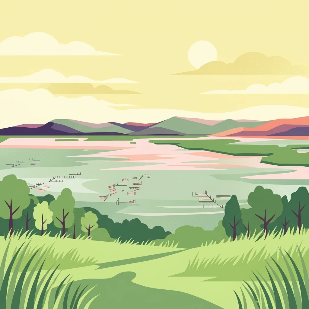
An illustration of Kosi Bay at sunrise, showing grassy foreground, trees, calm interlinked lakes with small wooden fish trap structures, and rolling hills in the background.

Kosi Bay

Protected area

Park overview

Structured park overview, official facts, and landscape profile for Kosi Bay

Kosi Bay park facts, protected area profile, and essential visitor context

Review the core facts for Kosi Bay, including designation, size, terrain, visitor scale, habitats, and operating context in one park-focused overview.

About Kosi Bay

Kosi Bay occupies a distinctive position at the meeting point of freshwater, estuarine, and marine ecosystems on South Africa's northern KwaZulu-Natal coast. The system is composed of four lakes that connect gradually, shifting from slightly saline to fully freshwater conditions as they progress inland from the ocean. This natural gradient creates overlapping habitats that support an unusually broad spectrum of life, from submerged aquatic vegetation and mangrove swamps to dune forest and palm-fringed shorelines.

Because the bay lies within the iSimangaliso Wetland Park, it shares in the protection of one of South Africa's flagship conservation landscapes, a UNESCO World Heritage Site that stretches along the Maputaland coast. The estuary itself is known for exceptionally clear water, giving snorkellers and visitors the impression of looking into an aquarium, while the broader lakes and channels shelter Nile crocodiles and hippopotamus alongside mangrove forests and cycad populations. Five mangrove species coexist here, an ecological feature highlighted by scientists as globally unusual.

The bay also carries a strong cultural and historical identity. It is regarded as the cultural capital of the ancient Thonga Tembe kingdom and is closely associated with the historical AmaThonga people, whose traditional fish traps have operated along these waters for around a thousand years. Today, Kosi Bay is both a working cultural landscape and a destination for visitors who come to experience quiet beaches, coastal forest walks, dune traverses, and the wildlife-rich estuary system.

Quick facts and research context for Kosi Bay

Kosi Bay lies in far northeastern KwaZulu-Natal, close to the Mozambique border and within the larger iSimangaliso Wetland Park UNESCO World Heritage Site. It has been designated a Ramsar Wetland since 28 June 1991. The protected area is managed by Ezemvelo KZN Wildlife. The system consists of four connected lakes that drain toward an exceptionally clear estuary mouth on the Indian Ocean. The closest service town is Manguzi, roughly 13 kilometres inland, with the nearest major South African city being Richards Bay and the nearest international city Maputo, just across the border in Mozambique.

Protection and recognition

Documented conservation status and Ramsar designation history for Kosi Bay

Kosi Bay Protection Status and International Wetland Recognition

Examine the official protection status and international Ramsar wetland recognition recorded for Kosi Bay. Review the documented conservation framework supporting this protected coastal wetland ecosystem.
Park context

Deeper park guide and search-rich context for Kosi Bay

Kosi Bay history, landscape, wildlife, and travel context

Explore Kosi Bay through its history, landscape character, ecosystems, wildlife, conservation priorities, cultural context, and seasonal travel timing in a structured park guide built for atlas discovery and search intent.

Why Kosi Bay stands out

Kosi Bay is best known for its chain of interlinked coastal lakes and a remarkably clear estuary often called "the aquarium" because of its fish abundance and water visibility. It is one of very few places in the world where five species of mangrove are found side by side, and it hosts animals ranging from freshwater hippos and estuarine crocodiles to bull sharks, whale sharks, and manta rays. The area is also culturally significant as the heartland of the AmaThonga people and their centuries-old fish-trap tradition.
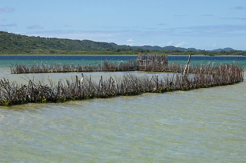
A V-shaped wooden fence constructed of sticks embedded in the shallow, clear water of an estuary, forming a traditional fish trap.
A traditional Thonga fish trap in the shallow waters of the Kosi Bay estuary system, South Africa.

Kosi Bay history and protected-area timeline

Kosi Bay has a human history stretching back roughly a millennium, when the ancestors of the AmaThonga people established themselves in this part of Maputaland. The area became the cultural core of the ancient Thonga Tembe kingdom, and the lakes took on lasting importance for traditional fishing using ingenious traps built from reeds, branches, and woven materials. These fish traps still define the Kosi Bay shoreline today and represent one of the most enduring traditional fishing practices on the South African coast. The wider region was historically known as Tembeland or Thongaland, names that fell out of common use in the early twentieth century.

During the colonial period, the bay became a borderland. Britain annexed Kosi Bay to the Colony of Natal, while Maputo Bay on the other side of the same coastal system was annexed to Portuguese Mozambique. This split identity echoes in the present geography: Kosi Bay's estuary is only about two kilometres from the Mozambique border, and visitors can walk from there to the Mozambican resort town of Ponta do Ouro in roughly an hour.

In modern times, the bay's ecological significance led to formal conservation recognition. It became part of what is now the iSimangaliso Wetland Park, a UNESCO World Heritage Site, and on 28 June 1991 it was designated a Ramsar Wetland of international importance. Today the area is managed by Ezemvelo KZN Wildlife as a protected natural area integrated into the broader iSimangaliso system.

Kosi Bay landscape and geographic character

Kosi Bay's landscape is defined by a transition from ocean to inland lake system. The estuary mouth on the Indian Ocean gives way to a sequence of four interconnected lakes that grow progressively more freshwater as they extend inland. The shoreline shifts from open sandy beach and dunes to channels lined with mangroves, then to reed beds, and finally to forested margins along the freshwater lakes.

Coastal forest grows along the dune fringes and is interspersed with characteristic palm species, including the Kosi palm, which produces the largest leaf of any plant on earth. Black Rock beach, a notable local landmark, hosts specialised coastal vegetation such as Sophora inhambanensis. Inland of the lakes the terrain becomes more wooded, with dune forest gradually giving way to broader Maputaland woodland. The combination of dunes, estuarine channels, lake surfaces, reed beds, and forested ridges gives the area an unusually varied visual character despite its relatively compact footprint.
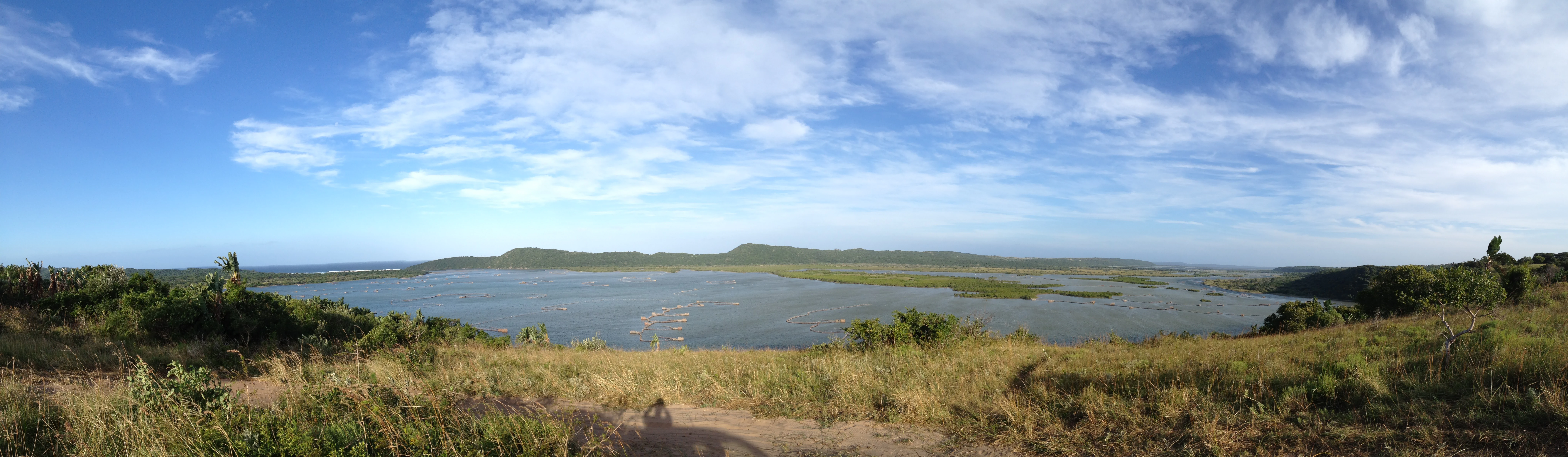
A wide panoramic landscape shot of the Kosi Bay estuary, featuring a calm expanse of water stretching toward distant green hills under a bright, cloudy blue sky.
A panoramic view of the Kosi Bay estuary system, showing the interlinked lakes surrounded by coastal vegetation.

Kosi Bay ecosystems, habitats, and plant life

Ecologically, Kosi Bay is a textbook example of a coastal lake-to-estuary gradient. The system supports estuarine fishes, mangrove forests of five coexisting species, reed and papyrus beds, coastal dune forest, and inland woodland types typical of the Maputaland region. This proximity of marine, brackish, and freshwater habitats produces a dense concentration of biodiversity and ecological complexity within a small area.

The area carries several endemic or locally significant plant species, including the Kosi cycad and the Kosi fern. The Kosi palm is a defining feature of the lakeshore. The mangrove assemblage itself is globally notable, with five mangrove species found together making it one of only a handful of places on earth where this occurs. Wetland sedges, reeds, and aquatic vegetation in the lakes form the base of a food web that stretches from small invertebrates up to large predators such as sharks and crocodiles.
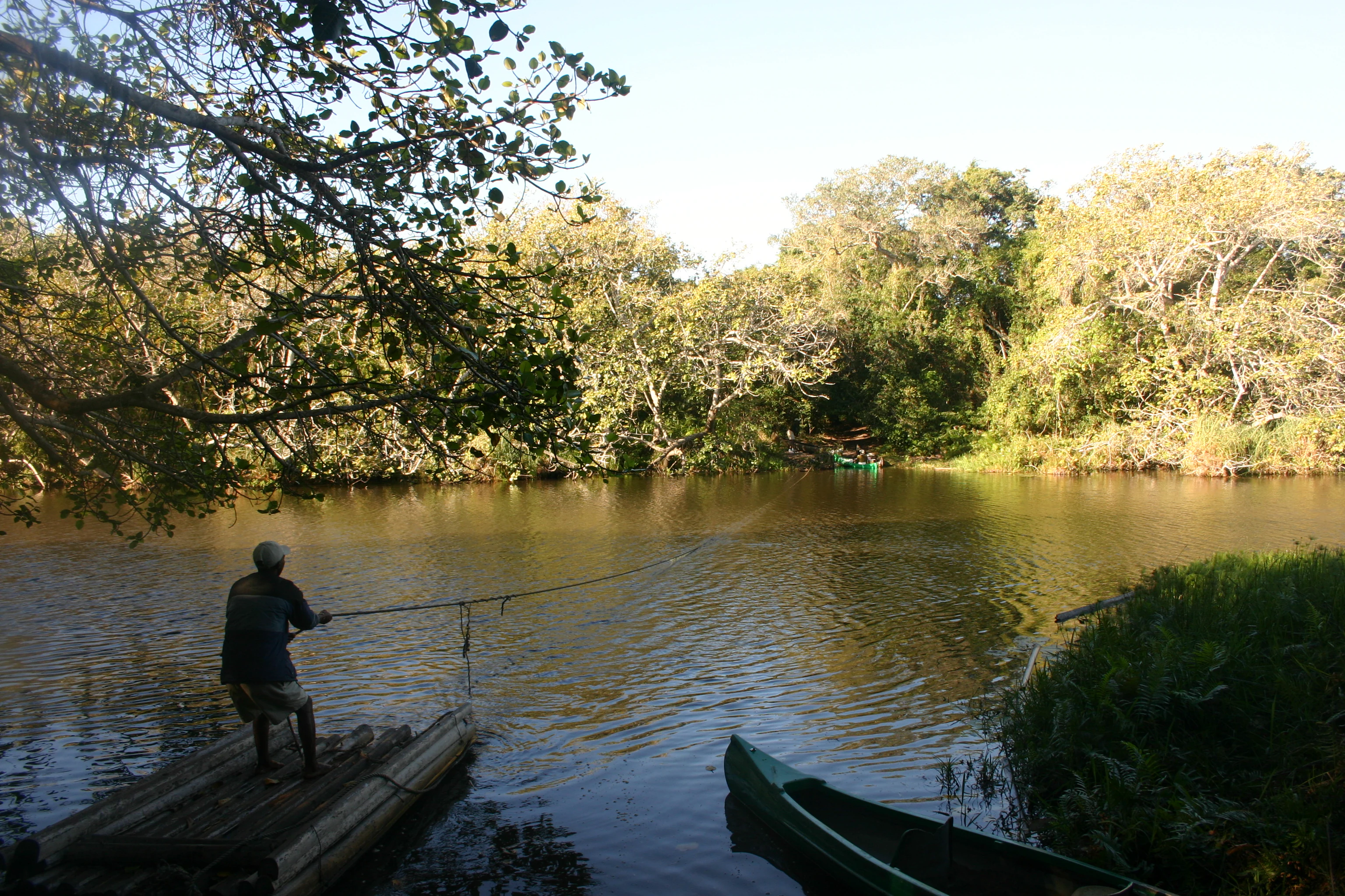
A person stands on a small wooden raft in a calm river or lake, pulling a fishing line, with a canoe nearby and dense trees lining the shore.
A person fishing from a traditional bamboo raft on the waters of Kosi Bay.

Kosi Bay wildlife and species highlights

Kosi Bay hosts a particularly rich wildlife mix because of its combination of freshwater, estuarine, and marine environments. The lakes and channels are home to hippopotamus and Nile crocodiles, while the estuary mouth and nearshore waters hold an aggressive population of bull sharks, locally known as zambesi. These sharks make the river mouth one of the more wildlife-rich estuaries on the coast, alongside seasonal visitors such as whale sharks and manta rays. Whale watching has become a growing attraction, primarily targeting humpback whales and various dolphin species.

Birdlife is exceptional. The forests, lakes, and estuary attract species such as the palm-nut vulture, Pel's fishing owl, the white-backed night-heron, and a wide range of kingfishers, all of which benefit from the combination of large trees and rich fishing waters. Mammals in the surrounding bush include small antelope such as duiker. The beaches are an important nesting ground for sea turtles, with loggerhead turtles and the endangered leatherback turtle laying their eggs along sections of the coast. This mix of marine megafauna, river wildlife, dense birdlife, and rare plants gives Kosi Bay an unusually complete coastal wildlife profile.
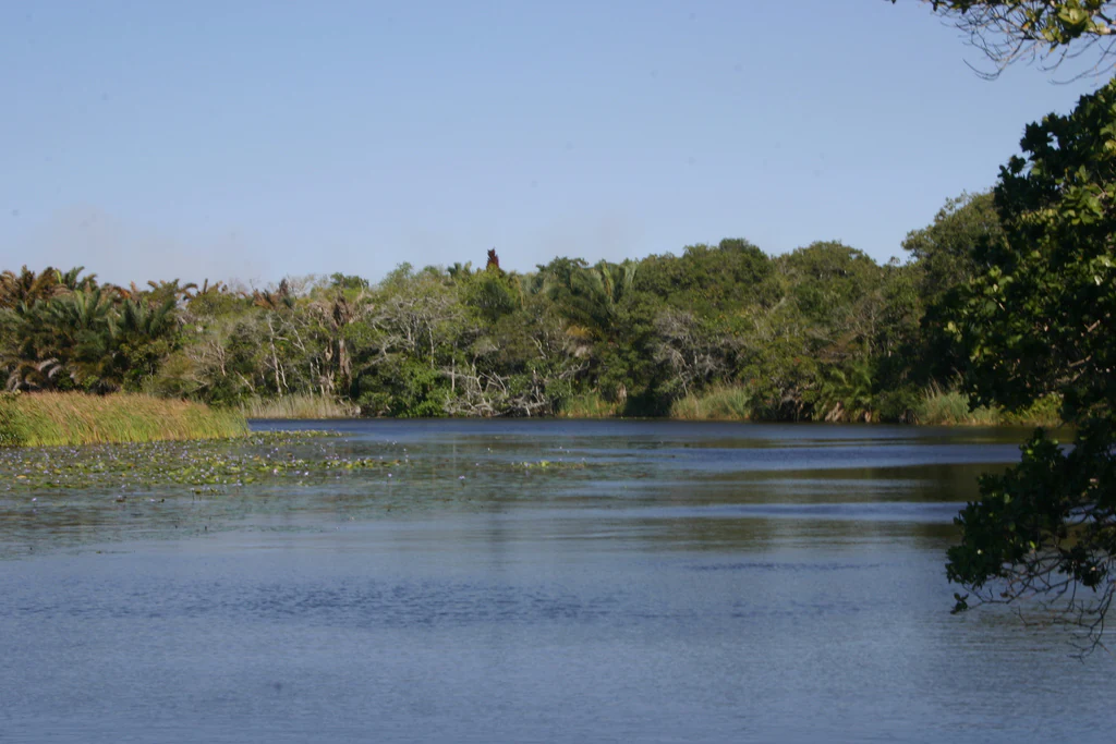
A wide view of a calm, dark blue lake surrounded by dense green trees and shrubs under a clear blue sky.
A serene view of the calm waters of Kosi Bay, surrounded by dense coastal vegetation.

Kosi Bay conservation status and protection priorities

Kosi Bay is significant both nationally and internationally from a conservation perspective. It forms part of the iSimangaliso Wetland Park, a UNESCO World Heritage Site that protects a long stretch of Maputaland coast. Independently, the bay itself has been recognised as a Ramsar Wetland since 28 June 1991, placing it among internationally important wetland sites under the Ramsar Convention. This dual designation reflects the outstanding ecological value of its lake and estuary system.

The conservation importance of Kosi Bay lies in the rare combination of five mangrove species coexisting, the connectivity between freshwater, estuarine, and marine ecosystems, the presence of endangered marine turtles, and the rich birdlife supported by intact coastal forest. The area also provides a refuge for hippos, crocodiles, and bull sharks, as well as regular seasonal visits from whale sharks, manta rays, and migrating cetaceans. Management by Ezemvelo KZN Wildlife integrates the bay into the broader iSimangaliso conservation framework, helping to maintain habitat integrity across the lake, estuary, and dune-forest systems.

Kosi Bay cultural meaning and human context

Kosi Bay is the cultural capital of the ancient Thonga Tembe kingdom and the historical home of the AmaThonga people, whose presence on this land extends back roughly a thousand years. Traditional fishing using fish traps built from local plant materials has been practised on these lakes for centuries and remains a defining cultural feature of the bay today. The Kosi traps are widely recognised as one of South Africa's most iconic examples of indigenous fishing heritage.

Historically, the wider region was known as Tembeland or Thongaland. Although those names fell into disuse in the early 1900s, the Thonga cultural and linguistic identity remains strong in communities around the bay, particularly in the town of Manguzi. The bay's proximity to the Mozambique border also gives it a sense of cultural continuity with Maputaland communities across the frontier, an identity that pre-dates modern colonial borders.

Top sights and standout views in Kosi Bay

Kosi Bay's standout features include its chain of four linked lakes flowing into a famously clear estuary known locally as "the aquarium," and the rare coexistence of all five mangrove species in one area. The bay also stands out for its wildlife mix of hippos, crocodiles, bull sharks, seasonal whale sharks, manta rays, humpback whales, dolphins, and nesting loggerhead and leatherback turtles. Culturally, its centuries-old Thonga fish-trap tradition adds a heritage dimension that complements its natural importance.

Best time to visit Kosi Bay

Kosi Bay's character shifts meaningfully with the seasons. The dry winter months tend to bring calmer seas, clearer visibility in the estuary, and quieter beaches, which also favour turtle nesting periods for leatherback and loggerhead turtles. The warmer, wetter summer months coincide with the arrival of humpback whales and other migrating marine life along the coast, as well as more rainfall that can affect lake levels and trail conditions. Many visitors consider the cooler months better for walking trails and seeing the area's forests and lakes at their most tranquil, while the warmer months offer more marine-life encounters.
Monthly climate preview

Long-term representative averages tracking annual temperature and precipitation cycles

Kosi Bay Climate Normals, Monthly Temperature and Precipitation Patterns

Representative coordinates record measured monthly temperature ranges and precipitation rhythms across the Kosi Bay protected landscape from 1991 to 2020. Examining the complete twelve-month climatology profile reveals detailed long-term averages for every seasonal interval.
Annual mean24 °C
21 °C26 °C
Jan26°
Feb26°
Mar26°
Apr25°
May24°
Jun22°
Jul21°
Aug21°
Sep22°
Oct22°
Nov24°
Dec25°
Warmest month
February

26.3 °C

Coolest month
August

21.3 °C

Wettest month
January

4.9 mm/day

Driest month
July

0.7 mm/day

Park location guide

Geography guide, regional context, and park location map for Kosi Bay

Kosi Bay park geography, regions, and map view in South Africa

Understand where Kosi Bay sits in South Africa through a broader geographic reading of the surrounding landscape, nearby location context, and its mapped position within the national park landscape.

How Kosi Bay fits into South Africa

South Africa is the southernmost country in Africa, spanning 1.22 million km² with a population of over 63 million. The country operates with three capital cities, Pretoria (executive), Cape Town (legislative), and Bloemfontein (judicial), and is renowned for its biodiversity, national parks, and multicultural society.

Wider geography shaping Kosi Bay in South Africa

South Africa occupies the southernmost region of Africa, with coastline along both the Atlantic Ocean to the west and the Indian Ocean to the east. The interior features elevated plateaus including the Highveld, with the Drakensberg escarpment marking the eastern highlands. The country shares borders with Namibia, Botswana, Zimbabwe, Mozambique, Eswatini, and Lesotho.

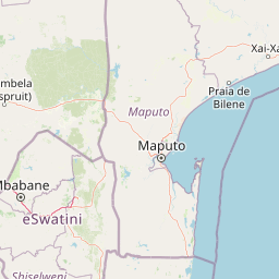
Map view of Kosi Bay

Use this park location map to pinpoint Kosi Bay in South Africa, understand its exact geographic position, and read its mapped placement within the surrounding landscape more clearly.

Pigeon | © OpenStreetMap contributors

Location context for Kosi Bay

KwaZulu-Natal

Explore the terrain, interlinked lakes, and coastal forest environments through field photography.

Kosi Bay Photos and Protected Area Scenery: Visualizing Maputaland Habitats

Visual records capture the distinctive transition from marine estuaries to inland freshwater lakes across the Maputaland coastal ecosystem. Examining protected area photography reveals the complex channel networks, dune woodlands, and diverse habitats defining Kosi Bay.

A V-shaped wooden fence constructed of sticks embedded in the shallow, clear water of an estuary, forming a traditional fish trap.

A close-up view of a Sophora inhambanensis shrub with silvery-green foliage, surrounded by smaller green plants on a sandy beach, with a rolling coastline and ocean in the background.

A wide panoramic landscape shot of the Kosi Bay estuary, featuring a calm expanse of water stretching toward distant green hills under a bright, cloudy blue sky.

A person stands on a small wooden raft in a calm river or lake, pulling a fishing line, with a canoe nearby and dense trees lining the shore.

A wide view of a calm, dark blue lake surrounded by dense green trees and shrubs under a clear blue sky.

Park atlas

Compare adjacent coastal lakes, wetland reserves, and regional conservation areas

Explore Parks Near Kosi Bay and Surrounding Protected Landscapes in Maputaland

Browsing other protected areas near Kosi Bay reveals connected coastal ecosystems, estuarine channels, and diverse wildlife habitats across the Maputaland region. Examining these adjacent conservation landscapes provides broader geographic context for regional terrain and regional park distribution.
Protected areaKwaZulu-Natal
16 km away#1 closest

South

Lake Sibaya Protected Area: Mapping the Freshwater Heart of the KwaZulu-Natal Coast

Freshwater wetlands and coastal dune forest topography

Lake Sibaya encompasses the largest freshwater basin in South Africa, defined by its position near the Maputaland coast. The landscape represents a significant freshwater interface between coastal dune forests and the Indian Ocean, serving as an important protected study site for catchment ecosystems, water-bird habitats, and regional hydrological diversity.

Area
64 km²
Established
1991
Relief
Lowland
Climate
Subtropical
A watercolor landscape illustration showing soft, blended washes of light green, yellow, and pale pink, depicting rolling hills and sparse trees against a white background.
Wildlife reserveKwaZulu-Natal
43 km away#2 closest

West

Ndumo Game Reserve: Geographic Atlas and Protected Landscape Overview

Wetlands and riverine ecosystems of Maputaland, KwaZulu-Natal

Ndumo Game Reserve represents a distinct protected landscape where the Pongola and Great Usutu rivers shape a dense mosaic of pans, floodplains, and sand forests. As a Ramsar site, this compact wildlife reserve serves as an essential case study in regional geography and the conservation of riverine corridors along the Mozambique border.

Area
102 km²
Established
1924
Relief
Lowland
Climate
Subtropical
Nature reserveKwaZulu-Natal
About 88 km away#3 closest

Southwest

Phongolo Nature Reserve: Mapped Protected Landscapes of Northern KwaZulu-Natal

Historic reserve terrain at the Lebombo escarpment

Spanning over 10,000 hectares, Phongolo Nature Reserve represents a critical geographic unit defined by the Pongolapoort Dam and the surrounding Lebombo range. Its terrain transitions from clay-rich lowveld plains to dramatic high-altitude rocky escarpments, forming a complex protected environment within the KwaZulu-Natal borderlands. Explore the mapped extent and structural biodiversity of this long-standing South African conservation site.

Area
104.85 km²
Established
1894
IUCN
IV
Relief
Mountain
National parkEswatini
About 119 km away#4 closest

Northwest

Hlane Royal National Park: Eswatini's Vast Protected Savanna Woodland Landscape

Mapped geography and protected area context in northeastern Eswatini.

Delve into Hlane Royal National Park, Eswatini's most extensive protected territory, a prime example of lowland bushveld savanna. This national park is defined by its expansive woodland terrain, dotted with ancient trees and seasonal water pans, creating a dynamic landscape. It is an essential component for understanding the regional geography and the distribution of protected areas within Southern Africa, offering significant opportunities for landscape exploration.

Area
300 km²
IUCN
VI
Relief
Lowland
Climate
Subtropical
Nature reserveKwaZulu-Natal
About 143 km away#5 closest

Southwest

Hluhluwe, Imfolozi Park Nature Reserve: Detailed Protected Area and Regional Geography

Explore mapped boundaries and landscape context in KwaZulu-Natal.

Hluhluwe, Imfolozi Park, designated as a nature reserve, offers a distinct protected landscape within KwaZulu-Natal, South Africa. This entity page provides an atlas-focused view, emphasizing the park's mapped boundaries and its contribution to the region's protected area network. Understand its geographic setting and unique landscape character through structured data, essential for any explorer keen on mapping protected lands.

Area
960 km²
Established
1895
Relief
Mountain
Climate
Subtropical
Wildlife reserveKwaZulu-Natal
About 148 km away#6 closest

West

Ithala Game Reserve: Mapping the Protected Landscape and Ancient Geology of KwaZulu-Natal

A rugged wilderness reserve defined by dramatic escarpment and river valley topography.

Ithala Game Reserve represents a critical protected area in South Africa where deep river valleys meet the high-altitude grasslands of the Ngotshe Mountains. Its topography provides a unique study in vertical relief, featuring exposed sandstone cliffs and dolerite spires. The reserve serves as a prime example of ecological diversity within the region, combining ancient geological formations with a successfully reestablished mosaic of bushveld, savanna, and forest habitats.

Area
296.53 km²
Established
1973
IUCN
IV
Relief
Mountain
National parkSouth Africa
180 km away#7 closest

North

Kruger National Park: South Africa's Iconic National Park for Geographic Discovery

Explore savanna landscapes and mapped protected area boundaries.

Kruger National Park serves as a paramount example of a protected landscape, offering a rich tapestry of savanna ecosystems and varied terrain across South Africa's Lowveld. This canonical entry details its vast geographic scope, approximately 19,623 square kilometres, and its status as the nation's first national park. Understand the park's environmental context, from the Lebombo Mountains to the Limpopo River, and its integral role within larger transfrontier conservation initiatives, providing critical insight for atlas-based geographic exploration.

Area
19,623 km²
Established
1926
IUCN
II
Visitors
1.7M annual
Wildlife reserveKwaZulu-Natal
About 188 km away#8 closest

Southwest

Thula Thula Private Game Reserve: Protected Wildlife Habitats and Geography

Bushveld and riverine geography in the KwaZulu-Natal Zululand corridor

Thula Thula Private Game Reserve features a unique intersection of bushveld habitats and river systems within South Africa. This reserve provides important protected land for elephants, rhinoceros, and over 350 avian species. It remains a key geographic entity for understanding the Royal Zulu Biosphere and the conservation history of the northeastern KwaZulu-Natal region.

Area
45 km²
Established
1911
Scope
Terrestrial

Common questions about visiting, size, designation, and location context for Kosi Bay

Kosi Bay FAQs for park facts, access, geography, and protected area context

Find quick answers about Kosi Bay, including protected-area facts, park geography, trail and visitor context, and how the park fits into its surrounding country and regional landscape.
MoriAtlas Explorer

Continue Your Protected Areas Search Across the Global Atlas

Deepen your exploration by continuing the structured search for national parks and protected areas worldwide. Utilize the comprehensive filtering capabilities to compare different conservation landscapes and refine your understanding of global park geography. Discover more about the distribution and characteristics of protected natural areas.

Global natural geography