

Mori Atlas logo
Wildlife reserveLake Kutubu

Analyzing the protected basin, highland terrain, and freshwater ecosystem boundaries within the Southern Highlands Province

Lake Kutubu Wildlife Reserve: An Authoritative Geographic Profile of Papua New Guinea's Largest Upland Lake

Lake Kutubu sits as a significant highland basin within the rugged interior of the Southern Highlands Province, marking its status as the largest upland body of water in Papua New Guinea. This wildlife reserve serves as a critical freshwater habitat, defined by its clear waters fed by subterranean sources and mountain streams. Mapped boundaries showcase its deep connection to the Kikori River system, illustrating a unique lacustrine terrain that remains a focal point for regional conservation and ecological research.

highland lakeRamsar wetlandfreshwater endemismmontane forestwildlife management areaupland catchment

Lake Kutubu

Wildlife reserve

Park overview

Structured park overview, official facts, and landscape profile for Lake Kutubu

Lake Kutubu park facts, protected area profile, and essential visitor context

Review the core facts for Lake Kutubu, including designation, size, terrain, visitor scale, habitats, and operating context in one park-focused overview.

About Lake Kutubu

Lake Kutubu occupies a distinctive place in Papua New Guinea's physical and ecological geography. Tucked into a depression of the rugged interior mountains of Southern Highlands Province, the lake forms the centerpiece of a highland catchment that drains into the Kikori River basin, one of the country's major westward-flowing systems. At approximately 826 meters above sea level and covering more than 50 square kilometers, it is the largest upland lake in the country and one of the few that has formed naturally within the central highlands rather than along the coastal lowlands.

The lake's water is notably clear and deep, with a maximum depth of around 70 meters, sustained by streams fed largely from underground sources in the surrounding mountains. Several small islands dot its waters, the largest of which is Wasemi in the northern portion. The catchment itself extends across roughly 328 square kilometers and is home to 33 villages inhabited primarily by two ethnic groups: the Foe to the south and the Fasu to the north, together representing a population of nearly 11,000 people.

Ecologically, Lake Kutubu's profile is exceptional. It holds thirteen endemic fish species and an endemic crayfish species, a level of biological uniqueness that has placed it within the WWF Global 200 network of priority ecoregions alongside Lake Sentani. The surrounding forests and watersheds also contribute to its conservation value, though the region faces ongoing pressures from oil and gas development, population growth, and land-use change.

Quick facts and research context for Lake Kutubu

Lake Kutubu lies in the Nipa-Kutubu District of Southern Highlands Province, Papua New Guinea, about 50 kilometers southwest of the provincial capital Mendi. It sits at an elevation of approximately 826 meters and covers a surface area of roughly 52 square kilometers within a catchment of more than 300 square kilometers. The lake is one of the few in the country that occupies a natural depression in the rugged interior highlands.

The site was designated a Wetland of International Significance under the Ramsar Convention in 1998, with the protected boundary matching the Lake Kutubu Wildlife Management Area. It is also nested within the tentatively listed Kikori River Basin and Great Papuan Plateau World Heritage nomination. Economically and historically, the lake gave its name to Papua New Guinea's first commercial oil development, the Kutubu Oil Project, which began production in 1992.

Protection and recognition

Documented terrestrial protection scope, designation year 1998, and Ramsar wetland recognition

Lake Kutubu Protection Status and International Recognition Data

Lake Kutubu holds recorded terrestrial protected area status established in 1998 alongside official recognition as a designated Ramsar wetland site. Reviewing these documented conservation records provides clear context regarding the international designation history and management scope associated with the reserve.

International recognition

Protection details

Protection scope
Terrestrial
Designated year
1998
Transboundary protection
No
Park context

Deeper park guide and search-rich context for Lake Kutubu

Lake Kutubu history, landscape, wildlife, and travel context

Explore Lake Kutubu through its history, landscape character, ecosystems, wildlife, conservation priorities, cultural context, and seasonal travel timing in a structured park guide built for atlas discovery and search intent.

Why Lake Kutubu stands out

Lake Kutubu is best known as a globally significant freshwater biodiversity hotspot, hosting an extraordinary concentration of endemic fish species. Thirteen fish species are found only in the lake, along with an endemic crayfish, making it the most unusual lacustrine fish habitat in the New Guinea-Australia region. This level of endemism in a single lake system is rare and reflects long evolutionary isolation. Equally defining is the lake's setting as the largest upland lake in Papua New Guinea, resting in a highland basin at over 800 meters elevation. Its combination of clear, deep waters, surrounding rugged terrain, and designation as a Ramsar wetland of international importance has made it a benchmark site for highland freshwater conservation in the Pacific.
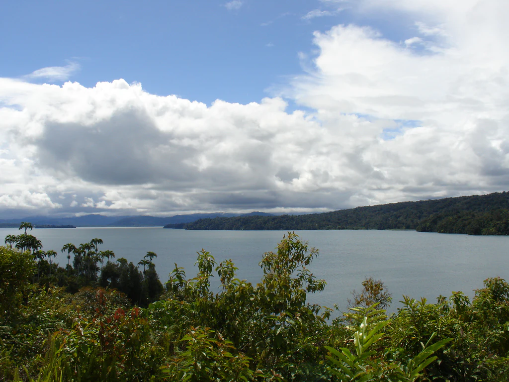
A wide, eye-level view of a large, calm lake surrounded by lush green forested hills under a sky filled with large white clouds.
A view of the waters and surrounding forest of Lake Kutubu in Papua New Guinea.

Lake Kutubu history and protected-area timeline

Lake Kutubu's modern history has been shaped by the intersection of traditional highland cultures with one of Papua New Guinea's most significant resource development projects. The lake gave its name to the Kutubu Oil Project, the country's first commercial oilfield development, which began production in 1992 under the operation of Oil Search. The project brought substantial economic activity to a previously remote highland region and drew in-migration from across the country.

This development transformed the catchment's demographic and environmental profile. Rapid population growth introduced new pressures on the lake ecosystem, including pollution, forest clearance, and overfishing of native species. Concerns over how to balance industrial development with the protection of Lake Kutubu's unique biodiversity prompted formal conservation recognition.

In 1998, the area was designated a Wetland of International Significance under the Ramsar Convention, with the protected boundary corresponding to the Lake Kutubu Wildlife Management Area. Conservation planning efforts followed, including catchment management studies led by the World Wildlife Fund, intended to serve as a model for other Papua New Guinea catchments. The lake and its surroundings are also part of the tentative Kikori River Basin and Great Papuan Plateau World Heritage nomination, reflecting ongoing international interest in the region's natural values.

Lake Kutubu landscape and geographic character

Lake Kutubu sits within a striking highland landscape of the Papua New Guinea interior, occupying a natural basin amid steep, rugged mountains. The surrounding terrain is densely forested and dissected by streams and gullies that feed the lake, with the Hamua Creek the largest of several inflowing waterways.

The lake itself is elongated, stretching roughly 19 kilometers in length and up to 4.5 kilometers across at its widest point. A number of small islands break the surface, the largest being Wasemi in the northern reaches. The shoreline reflects the surrounding mountain topography, with forested slopes rising sharply from the water's edge in many sections.

At an elevation of around 826 meters above sea level, Lake Kutubu lies well above the surrounding lowland river valleys of the Kikori system into which it eventually drains through the Soro River outflow. This highland basin setting, combined with the clarity of the water and the rugged surrounding ridgelines, gives the lake its distinctive visual and ecological character.

Lake Kutubu ecosystems, habitats, and plant life

The lake and its catchment form a highland freshwater ecosystem of exceptional biological importance. Lake Kutubu's waters are clear and relatively deep, sustained by underground sources and forested mountain streams, providing stable conditions that have enabled the evolution of a highly specialized aquatic fauna.

Surrounding the lake are montane and lower montane forests typical of Papua New Guinea's central cordillera, supporting a wide range of terrestrial species in addition to the aquatic communities. The catchment acts as a hydrological and ecological buffer, filtering water and sustaining habitats for both resident and migratory species across the highland basin.

As a recognized WWF Global 200 ecoregion, in conjunction with Lake Sentani, Lake Kutubu represents one of the most significant freshwater conservation priorities in the New Guinea-Australia region. Its ecological relevance extends well beyond the lake's shoreline, encompassing the broader mosaic of forest, stream, and highland terrain that defines the catchment.

Lake Kutubu wildlife and species highlights

Lake Kutubu is most renowned for its extraordinary freshwater fauna, particularly its remarkable concentration of endemic fish species. Thirteen fish species are found nowhere else but the lake, including the Kutubu tandan, Lake Kutubu rainbowfish, Kutubu hardyhead, Adamson's grunter, and several mogurnda species such as the black mogurnda, Lake Kutubu mogurnda, blotched mogurnda, variegated mogurnda, and striped mogurnda. Two additional gobies in the genus Glossogobius remain undescribed scientifically. This level of endemism makes Lake Kutubu the most unusual lacustrine habitat for fishes across the entire New Guinea-Australia region.

In addition to its fish, the lake supports an endemic parastacid crayfish, Cherax papuanus, further underscoring the evolutionary isolation of its freshwater ecosystem. Surrounding forests provide habitat for the broader highland fauna typical of the Southern Highlands, although the lake's defining wildlife significance remains its aquatic endemism. This biological distinctiveness has driven the area's international recognition as a freshwater conservation priority.

Lake Kutubu conservation status and protection priorities

Lake Kutubu's conservation importance is recognized at the international level. In 1998 the site was designated a Wetland of International Significance under the Ramsar Convention, with the protected area aligned to the Lake Kutubu Wildlife Management Area covering roughly 240 square kilometers.

The lake and catchment have been included in the WWF Global 200 list of priority ecoregions, together with Lake Sentani, reflecting their global significance for freshwater biodiversity. They also form part of the tentative nomination for the Kikori River Basin and Great Papuan Plateau World Heritage Site. Conservation planning efforts led by the World Wildlife Fund have aimed to develop a catchment management plan intended to serve as a model for other Papua New Guinea watersheds.

Despite these protections, the lake faces significant ongoing threats. The Kutubu Oil Project, which began production in 1992, has driven rapid in-migration into the catchment, contributing to pollution, deforestation, and overfishing. Proposed gas pipeline and road developments have raised further concerns about ecological degradation unless carefully managed to safeguard the lake's unique endemic fauna and water quality.

Lake Kutubu cultural meaning and human context

The Lake Kutubu catchment is home to diverse highland communities whose cultures are closely tied to the lake and surrounding forests. Two principal ethnic groups inhabit the area: the Foe, who live predominantly in the southern parts of the catchment, and the Fasu, who occupy the northern side. Together, their 33 villages form a population of nearly 11,000 people whose livelihoods and traditions are shaped by the lake's resources and the surrounding mountain environment.

Kutubuan and other Trans-New Guinea languages remain spoken throughout the region, reflecting its deep linguistic and cultural continuity within the broader highland cultural sphere of Papua New Guinea. The arrival of the Kutubu Oil Project in the early 1990s transformed local economies and demographics, bringing new settler communities alongside the established Foe and Fasu populations and reshaping traditional relationships with the land and water.

Top sights and standout views in Lake Kutubu

Lake Kutubu's most distinctive highlight is its unparalleled freshwater endemism, with thirteen native fish species and an endemic crayfish found only in its waters. This single-lake concentration of unique species has placed it among the most important lacustrine ecosystems in the New Guinea-Australia region and within the WWF Global 200 network of priority ecoregions.

As Papua New Guinea's largest upland lake and a Ramsar Wetland of International Significance, it combines highland scenic value with globally recognized conservation importance. The surrounding catchment, inhabited by the Foe and Fasu communities and home to dense montane forests connected to the wider Kikori River basin, gives the lake an interconnected ecological and cultural significance that extends well beyond its shoreline.

Best time to visit Lake Kutubu

Like much of Papua New Guinea's highland interior, the Lake Kutubu catchment experiences a tropical climate moderated by elevation, with relatively consistent warm temperatures year-round and significant rainfall distributed across the year. The most accessible period for visiting the region generally corresponds to the drier months, when forest trails are more navigable and the lake's clear waters and surrounding ridgelines are easier to view. Seasonal variation is more about rainfall patterns than temperature extremes, and visitors will find that the lake's highland forest setting maintains its lush green character throughout the year.

Monthly climate preview

Long-term monthly averages for temperature and precipitation patterns

Lake Kutubu Climate Normals and Annual Temperature Rhythm

Lake Kutubu exhibits measured long-term annual temperature and precipitation rhythms across its representative elevation. Examining the complete twelve-month meteorological record provides deeper baseline context for understanding regional climate variations.
Annual mean21 °C
20 °C22 °C
Jan22°
Feb21°
Mar21°
Apr21°
May21°
Jun21°
Jul20°
Aug20°
Sep21°
Oct22°
Nov22°
Dec22°
Warmest month
November

21.9 °C

Coolest month
August

20.4 °C

Wettest month
April

10.5 mm/day

Driest month
August

4.2 mm/day

Park location guide

Geography guide, regional context, and park location map for Lake Kutubu

Lake Kutubu park geography, regions, and map view in Papua New Guinea

Understand where Lake Kutubu sits in Papua New Guinea through a broader geographic reading of the surrounding landscape, nearby location context, and its mapped position within the national park landscape.

How Lake Kutubu fits into Papua New Guinea

Papua New Guinea is an island nation in the southwestern Pacific Ocean, comprising the eastern half of the island of New Guinea and hundreds of offshore islands. It gained independence from Australia in 1975 and operates as a constitutional monarchy within the Commonwealth. The country is renowned for having the world's highest linguistic diversity, with over 840 known languages.

Wider geography shaping Lake Kutubu in Papua New Guinea

Papua New Guinea occupies the eastern half of the island of New Guinea and hundreds of smaller islands in Melanesia. It shares a land border with Indonesia to the west and has maritime boundaries with Australia to the south and the Solomon Islands to the east. The terrain is predominantly mountainous, with the land supporting extraordinary biodiversity.

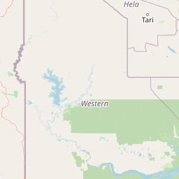
Map view of Lake Kutubu

Use this park location map to pinpoint Lake Kutubu in Papua New Guinea, understand its exact geographic position, and read its mapped placement within the surrounding landscape more clearly.

Pigeon | © OpenStreetMap contributors

Location context for Lake Kutubu

Southern Highlands Province

Explore the landscapes, montane forests, and protected freshwater habitats of Papua New Guinea

Lake Kutubu Photos and Scenery: Visualizing the Upland Highland Basin

Visual records capture the steep forested slopes, clear waters, and rugged highland terrain surrounding the upland catchment of Lake Kutubu. Photographic documentation reveals the physical scale and protected-area environment that define this unique freshwater ecosystem in the Southern Highlands.

A wide, eye-level view of a large, calm lake surrounded by lush green forested hills under a sky filled with large white clouds.

Park atlas

Compare regional highland conservation areas and connected upland catchments

Exploring Parks Near Lake Kutubu and Surrounding Protected Landscapes

Browse other protected areas and regional conservation zones situated throughout the rugged interior mountains. Comparing nearby highland terrain helps contextualize the unique freshwater ecosystems found across the surrounding catchment.
Nature reserveWestern Highlands Province
About 136 km away#1 closest

Northeast

Baiyer River Sanctuary: Protected Highland Rainforest and River Valley Geography

Nature reserve in the Western Highlands Province of Papua New Guinea.

Located within the Western Highlands, Baiyer River Sanctuary protects 740 hectares of dense oak-dominated rainforest. This nature reserve provides essential habitat for birds-of-paradise, maintaining a continuous canopy across high-rainfall mountain slopes that bridges the transition between lowland and alpine ecosystems.

Area
7.4 km²
Established
1968
Relief
Upland
Climate
Tropical
Wildlife reserveChimbu Province
About 188 km away#2 closest

East

Crater Mountain Wildlife Management Area: Geography and Protected Land Boundaries in Chimbu Province

Central highland rainforest and cordillera wilderness terrain.

Crater Mountain Wildlife Management Area encompasses a massive tract of undisturbed highland rainforest across the central cordillera of Papua New Guinea. This protected zone demonstrates a unique intersection of tropical montane biodiversity and community-led conservation, providing an essential refuge defined by steep topography, persistent moisture, and continuous forest cover that stretches across the Chimbu Province.

Relief
Highland
Water
Major water bodies
Stylized illustration of a mountain with waterfalls, river, and trees under a bright sky with clouds
Protected areaPapua New Guinea
About 200 km away#3 closest

East

Mount Wilhelm Protected Area: Papua New Guinea's Highest Peak and Alpine Terrain

Mapped geography and protected landscape context for a key Oceania peak.

Mount Wilhelm represents a significant protected area and the highest mountain in Papua New Guinea. Situated within the Bismarck Range, its dramatic granite peak defines a unique alpine environment, transitioning from dense rainforests to high-altitude grasslands. The presence of twin glacial lakes, Piunde and Aunde, adds to its distinctiveness, offering insight into the region's varied natural terrain and its role as a key geographical landmark.

Relief
Mountain
Climate
Alpine
Access
Moderate access
Scope
Terrestrial
National parkSouth Papua
About 314 km away#4 closest

Southwest

Wasur National Park National Park: Mapped Protected Boundaries in South Papua

Explore the geographic context and park boundaries.

Delve into the specific protected area identity of Wasur National Park, a national park situated within the South Papua region. This page offers detailed geographic context, focusing on its mapped boundaries and its significance as a protected landscape. It provides a factual basis for understanding the park's place within Indonesia's network of natural areas for structured atlas exploration.

Area
4,138 km²
Established
1990
IUCN
II
Visitors
2.3K annual
Wildlife reserveWestern Province
About 349 km away#5 closest

Southwest

Tonda Wildlife Management Area: Atlas of Protected Wetlands and Savanna Landscapes

Geographic overview of Papua New Guinea's largest wetland conservation zone

Spanning nearly 6,000 square kilometres of floodplain, Tonda Wildlife Management Area is defined by its exceptionally flat terrain and shifting mosaic of monsoon forest, tidal channels, and freshwater marshes. This protected landscape functions as an essential ecological bridge within the Trans-Fly ecoregion, maintaining deep connections to international conservation partners while preserving the integrity of its native bird and mammal habitats.

Area
5,900 km²
Established
1975
National parkMorobe Province
About 377 km away#6 closest

East

McAdam National Park; Geographic Atlas of Protected Highland Forests in Morobe Province

Highland montane forest and rugged ridge landscapes

McAdam National Park preserves a rugged stretch of montane rainforest in Papua New Guinea's Bulolo region. Rising over 1,200 meters, this protected area features steep forested slopes and narrow valleys that define the geography of the Morobe interior. Our atlas provides insights into the park's boundaries and its position within the broader highland ecosystem of the province.

Relief
Mountain
Scope
Terrestrial
Water
Minor water
Wildlife reserveMorobe Province
About 388 km away#7 closest

East

YUS Conservation Area: Mapping the Geographic Range of a Community-Led Wildlife Reserve

Protected tropical forest landscapes in Morobe Province, Papua New Guinea

YUS Conservation Area represents a significant shift in regional conservation, protecting a massive altitudinal gradient on the Huon Peninsula. From coastal coral reef environments to the rugged ridges of the Saruwaged Mountains, the area preserves critical montane habitats and riverine corridors. This dataset provides insight into its unique geography, spanning lowland forests to highland peaks while showcasing a model of land management driven by customary community agreements.

Area
760 km²
Established
2009
Relief
Mountain
Climate
Tropical
Protected areaQueensland
About 396 km away#8 closest

Southwest

Warul Kawa Indigenous Protected Area: A Geographic Profile of a Remote Torres Strait Sand Cay

Protecting northern Australian reef platforms and marine habitats

Warul Kawa Indigenous Protected Area, or Deliverance Island, defines a unique landscape of sand cays and shallow algal reef platforms in the far north of Queensland. As a key site for flatback turtle breeding and migratory green turtles, the area offers a rare example of a near-pristine marine environment. Its geography highlights the intersection of Indigenous land management and high-integrity tropical island ecosystems.

Established
2001
Relief
Lowland
Climate
Tropical
Access
Remote access

Common questions about visiting, size, designation, and location context for Lake Kutubu

Lake Kutubu FAQs for park facts, access, geography, and protected area context

Find quick answers about Lake Kutubu, including protected-area facts, park geography, trail and visitor context, and how the park fits into its surrounding country and regional landscape.
MoriAtlas Explorer

Continue Your Protected Areas Search Across the Global Atlas

Deepen your exploration by continuing the structured search for national parks and protected areas worldwide. Utilize the comprehensive filtering capabilities to compare different conservation landscapes and refine your understanding of global park geography. Discover more about the distribution and characteristics of protected natural areas.

Global natural geography

