
Mori Atlas logo
Wildlife reserveLittle Jacks Creek Wilderness

Mapping the basalt plateaus and deep stream-cut canyons of this remote high desert wilderness

Little Jacks Creek Wilderness: A Comprehensive Geographic Atlas of Idaho Protected Lands

Little Jacks Creek Wilderness defines a stark and expansive high-desert environment within the Owyhee Canyonlands of southwestern Idaho. This protected area features deep rhyolite-walled gorges carved into flat basalt plateaus, offering a distinct example of Basin and Range geography. Through mapped boundaries and terrain analysis, users can understand how these stream-cut canyons create a continuous protected landscape alongside neighboring wilderness sectors.

sagebrush steppehigh desertbasalt plateauriver canyonwild riverOwyhee Canyonlands
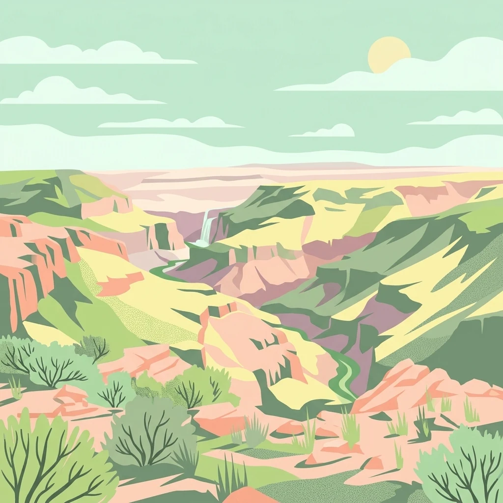
A flat-style digital illustration of a desert canyon with layered rock formations, sparse shrubs, and a distant waterfall under a pale sky.

Little Jacks Creek Wilderness

Wildlife reserve

Park overview

Structured park overview, official facts, and landscape profile for Little Jacks Creek Wilderness

Little Jacks Creek Wilderness park facts, protected area profile, and essential visitor context

Review the core facts for Little Jacks Creek Wilderness, including designation, size, terrain, visitor scale, habitats, and operating context in one park-focused overview.

About Little Jacks Creek Wilderness

Little Jacks Creek Wilderness sits in a part of Idaho that feels far removed from the state's better-known mountain and lake country. Instead of forested peaks and alpine lakes, visitors encounter a sun-baked high desert of flat basalt plateaus, sudden canyon breaks, and a scattering of rugged rhyolite outcrops. The wilderness covers more than fifty thousand acres of this terrain in Owyhee County, anchoring the southwestern edge of Idaho along the border zone with Oregon and Nevada.

The defining feature of the area is the network of canyons that drop sharply from the plateau surface. Geologically, the landscape was built up from successive basalt flows, later carved by streams such as Little Jacks Creek into gorges that can run close to a thousand feet deep. The mixture of dark basalt and reddish rhyolite gives the canyon walls a layered, multi-toned appearance, and the plateau tops are blanketed in grass and sagebrush that contrast with the vertical rock below.

Ecologically, the wilderness belongs to the northern Basin and Range ecoregion, an arid landscape characterized by wide temperature swings, sparse vegetation cover, and wildlife adapted to dry conditions. Although visually it resembles classic Great Basin desert, its hydrology ties it to the Snake River Plain and the broader Columbia River watershed. This combination of desert ecology and Pacific Northwest drainage helps support unusual mixtures of plant and animal life, including isolated populations of native fish in the deeper canyon streams.

For travelers, the wilderness represents one of the more challenging and least-visited landscapes in the lower 48 states. There are no roads or maintained facilities within its boundaries, and accessing its interior typically requires long drives on unpaved tracks followed by徒步 rough routes on foot or horseback. As a result, the area functions less as a destination in the conventional park sense and more as a reserve of open, undeveloped public land where solitude and rugged scenery are the principal attractions.

Quick facts and research context for Little Jacks Creek Wilderness

Little Jacks Creek Wilderness is a Bureau of Land Management wilderness of roughly 50,929 acres in southwestern Idaho, sitting entirely within Owyhee County. It lies on the high basalt plateaus of the Owyhee Desert, part of the northern Basin and Range ecoregion, but its waters drain into the Snake River and ultimately the Columbia River system. The wilderness was established by the Omnibus Public Land Management Act of 2009 and is one of six Owyhee Canyonlands wilderness areas designated at the same time.

Protection and recognition

Documented terrestrial protection scope and international recognition records

Little Jacks Creek Wilderness Protection Status and Recognition Data

Little Jacks Creek Wilderness maintains a terrestrial protection scope within its designated conservation boundaries. Documented records outline the established protection status, management scope, and international recognition details for this protected area.

Protection details

Protection scope
Terrestrial
Transboundary protection
No
Park context

Deeper park guide and search-rich context for Little Jacks Creek Wilderness

Little Jacks Creek Wilderness history, landscape, wildlife, and travel context

Explore Little Jacks Creek Wilderness through its history, landscape character, ecosystems, wildlife, conservation priorities, cultural context, and seasonal travel timing in a structured park guide built for atlas discovery and search intent.

Why Little Jacks Creek Wilderness stands out

Little Jacks Creek Wilderness is best known for its dramatic, deeply incised river canyons carved into high basalt plateaus, with walls reaching roughly 1,000 feet in depth. The area is recognized for its largely undisturbed sagebrush steppe habitat, its wild river segment along Little Jacks Creek, and its role as part of the Owyhee Canyonlands, one of the most significant American wilderness expansions of the early twenty-first century.
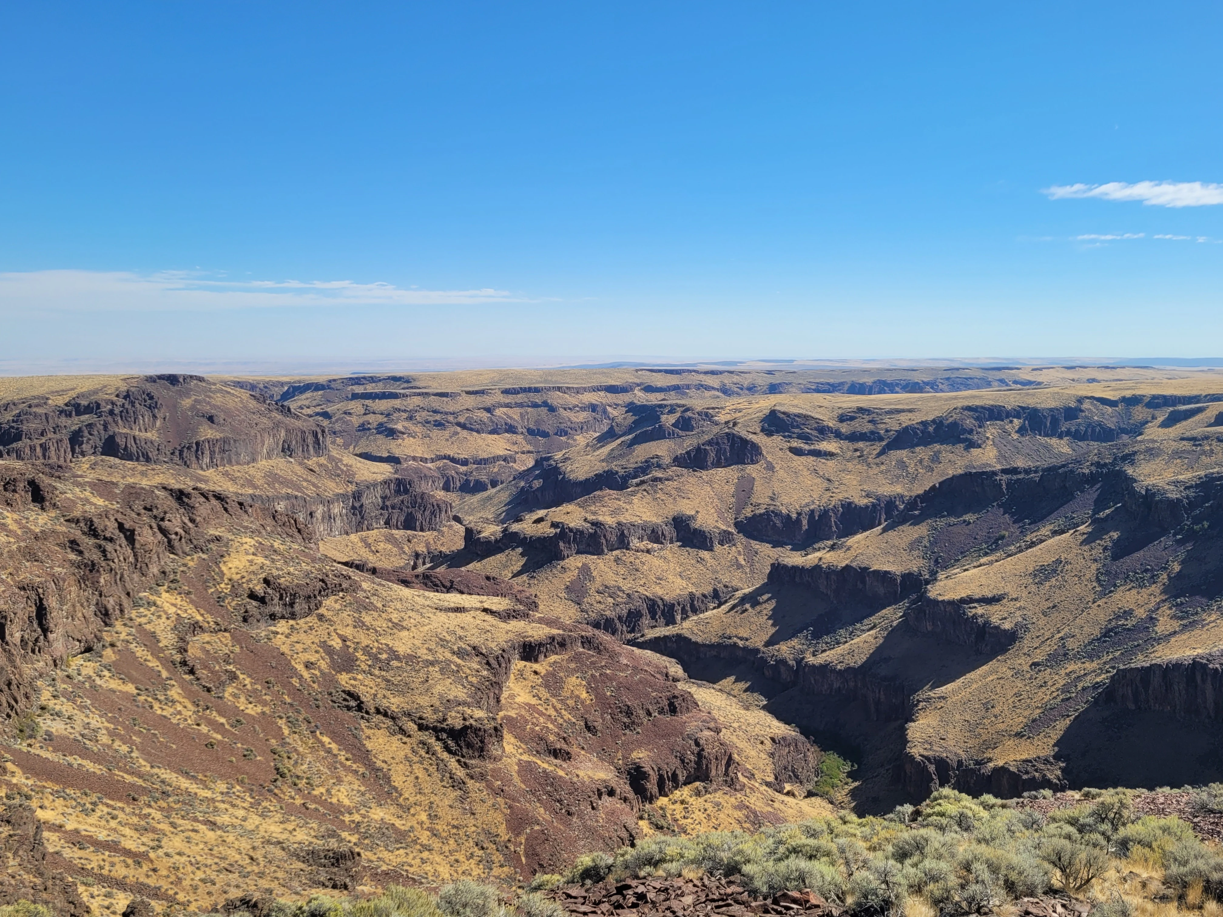
A wide, high-angle landscape shot of a deep, arid basalt canyon system under a clear blue sky, showing rocky cliffs and dry, scrub-covered plateaus.
A view overlooking the rugged basalt canyons of Rattlesnake Canyon within the Little Jacks Creek Wilderness.

Little Jacks Creek Wilderness history and protected-area timeline

Little Jacks Creek Wilderness did not exist as a protected area until the late 2000s. For most of its history, the surrounding landscape was used for ranching and widely seen as remote, dry public land with relatively little formal protection. Congressional interest in safeguarding large blocks of southwestern Idaho canyon country grew through the early 2000s, ultimately culminating in the Omnibus Public Land Management Act of 2009.

On March 30, 2009, President Barack Obama signed the Act into law, creating Little Jacks Creek Wilderness along with five other wilderness areas in Owyhee County: the Bruneau-Jarbidge Rivers, Big Jacks Creek, North Fork Owyhee, Owyhee River, and Pole Creek wildernesses. Together, these six units are often referred to as the Owyhee Canyonlands Wilderness Areas. In a single legislative act, Idaho gained more than 517,000 acres of new wilderness, with Little Jacks Creek contributing roughly 50,929 acres to that total.

Wilderness designation under the 1964 Wilderness Act brought a firmly protected status that prohibits motorized vehicles, mechanical equipment, new roads, buildings, logging, and mining. Camping, fishing with proper permits, and seasonal hunting are allowed, but the area is otherwise managed to preserve its undeveloped character. The creation of the wilderness filled a long-standing gap in protection for the Owyhee landscape and ensured that Little Jacks Creek and its canyon system would remain in a largely unaltered state.

Little Jacks Creek Wilderness landscape and geographic character

The landscape of Little Jacks Creek Wilderness is dominated by high, flat basalt plateaus broken abruptly by deep, narrow canyons. The plateau surfaces are rolling and largely treeless, covered with grasses and sagebrush that emphasize the openness of the terrain. Where streams such as Little Jacks Creek have cut downward over time, the surface drops into gorges that, in several places, reach depths of approximately 1,000 feet.

Geologically, the area combines dark basalt flows with prominent exposures of red rhyolite. A distinctive large brown basalt dome rises above the surrounding terrain and serves as one of the more recognizable landforms within the wilderness. The colour contrast between the rust-toned rhyolite cliffs, the darker basalt layers, and the muted greens and greys of the desert vegetation gives the canyons a layered, painterly appearance.

Canyons are the central landscape feature of the wilderness. Rattlesnake Canyon is one of many tributary gorges that feed into the Little Jacks Creek system. The combination of steep walls, narrow bottoms, and sparsely vegetated rims produces a landscape that feels both immense and contained, with long sight lines across the plateau interrupted by sudden, dramatic drops into rock-walled drainages.

Little Jacks Creek Wilderness ecosystems, habitats, and plant life

Little Jacks Creek Wilderness lies within the Owyhee Desert, part of the broader northern Basin and Range ecoregion, which stretches across much of the inland American West. This ecoregion is defined by alternating basins and fault-block ranges, arid climate, and vegetation adapted to low rainfall and large temperature swings. In the wilderness, the characteristic vegetation is sagebrush steppe, with scattered grasses and hardy desert shrubs covering the plateau surfaces.

Despite the arid setting, the canyon bottoms and permanent streams support a different ecological world. Cooler, moister microclimates along Little Jacks Creek and its tributaries allow native fish such as Columbia River redband trout to persist in isolated stream reaches. Riparian vegetation along these waterways contrasts with the open uplands, creating narrow ribbons of green habitat that are ecologically significant in an otherwise dry landscape.

The combination of sagebrush uplands, rocky canyon walls, and riparian corridors produces a mosaic of habitats unusually compressed into a relatively small geographic area. This diversity, paired with the absence of roads and development, makes the wilderness an important stronghold for species that struggle in more fragmented parts of the surrounding region.

Little Jacks Creek Wilderness wildlife and species highlights

Wildlife in Little Jacks Creek Wilderness reflects the broader character of the northern Basin and Range, with species strongly tied to sagebrush country and rugged canyon terrain. Mule deer move through the plateau and canyon-edge habitats, using the mix of open range and cover that the landscape provides. Mountain quail are among the more distinctive upland birds present in the area, occupying the rougher, brushier draws.

Sage grouse, a species closely tied to healthy sagebrush ecosystems, also inhabit the wilderness and surrounding lands. Their presence underscores the ecological importance of the unbroken sagebrush steppe that the wilderness protects. Along the streams, native Columbia River redband trout occupy the cooler, permanent waters of Little Jacks Creek and its tributaries, representing one of the more localized wildlife values of the area.

Birds of prey, smaller mammals suited to arid environments, and a variety of reptiles typical of the high desert likely inhabit the canyons and plateaus as well. The relatively undisturbed nature of the landscape, combined with the absence of motorized access, gives the area refuge value that is increasingly rare across the broader region.

Little Jacks Creek Wilderness conservation status and protection priorities

Little Jacks Creek Wilderness plays a meaningful role in the conservation of the northern Basin and Range, a region facing substantial pressure from grazing, mineral development, invasive species, and habitat fragmentation. By locking in protections under the 1964 Wilderness Act, the designation preserves a large, contiguous block of sagebrush steppe and canyon habitat from new roads, motorized use, logging, and mining.

The wilderness is part of the larger Owyhee Canyonlands complex designated in 2009, which collectively added more than 500,000 acres of wilderness in Idaho. This scale matters: many wildlife species of the region, including sage grouse and mule deer, require large, connected landscapes, and the Owyhee Canyonlands now provide one of the more intact such blocks in the state. The protection of roughly twelve miles of Little Jacks Creek as a wild river further strengthens the conservation profile of the area, safeguarding both the stream itself and its associated riparian habitat.

In a regional context, the wilderness helps buffer some of the most ecologically important features of the Owyhee Desert, including canyon-stream ecosystems that support isolated native trout populations. While the area is not immune to external threats such as invasive grasses and changing climate, its protected status gives it a durable level of security that is unusual for lower-elevation desert landscapes in the western United States.

Little Jacks Creek Wilderness cultural meaning and human context

The human cultural context of Little Jacks Creek Wilderness is shaped primarily by ranching and the long-standing identity of southwestern Idaho as open, sparsely populated range country. The area lies within traditional grazing landscapes, and ranching heritage remains one of the most visible cultural threads in the broader Owyhee region.

The wilderness itself, however, contains little in the way of built cultural features. Its remoteness, lack of roads, and absence of structures reflect both its ruggedness and the conservative, hands-off approach that wilderness designation imposes on land use. As such, the cultural significance of the area today is as much about what is intentionally absent from the landscape as about any specific heritage feature within it.

Top sights and standout views in Little Jacks Creek Wilderness

Little Jacks Creek Wilderness stands out for the sheer depth and drama of its canyon system within an otherwise flat, expansive plateau landscape. The interplay of basalt and red rhyolite, the roughly 1,000-foot canyon walls, and the unbroken sagebrush uplands above create a striking visual contrast.

Equally significant is its role within the 2009 Owyhee Canyonlands designation, a major moment for wilderness conservation in Idaho. The wilderness also protects a wild river segment of Little Jacks Creek, ensuring that its ecological and scenic qualities remain intact for the long term.

Best time to visit Little Jacks Creek Wilderness

Spring and early summer tend to be the most accessible seasons in the Owyhee region for visiting Little Jacks Creek Wilderness, when cooler temperatures and occasional spring moisture improve conditions for徒步 hiking and horseback travel and bring brief greening to the sagebrush steppe. Wildlife is generally easier to observe as animals concentrate around remaining water sources during this period.

Late summer and early autumn can also be rewarding, with stable, dry weather and clear views across the plateau edges into the canyons, though temperatures rise sharply. Winter brings snow to the higher elevations and can make access difficult due to remote road conditions, but offers exceptional solitude for experienced visitors prepared for cold, narrow daylight hours and unpredictable weather in the high desert.
Monthly climate preview

Long-term monthly temperature and precipitation patterns across representative coordinates

Little Jacks Creek Wilderness Climate Normals and Annual Temperature Rhythm

Measured coordinates record average monthly temperatures ranging from sub-zero winter lows to summer maximums exceeding thirty-six degrees Celsius alongside varying daily precipitation rates. Examining the full twelve-month profile provides complete historical averages for detailed environmental analysis.
Annual mean9 °C
-3 °C23 °C
Jan-3°
Feb-1°
Mar
Apr
May12°
Jun17°
Jul23°
Aug22°
Sep16°
Oct
Nov
Dec-3°
Warmest month
July

23 °C

Coolest month
December

-2.9 °C

Wettest month
December

1.6 mm/day

Driest month
August

0.3 mm/day

Park location guide

Geography guide, regional context, and park location map for Little Jacks Creek Wilderness

Little Jacks Creek Wilderness park geography, regions, and map view in United States of America

Understand where Little Jacks Creek Wilderness sits in United States of America through a broader geographic reading of the surrounding landscape, nearby location context, and its mapped position within the national park landscape.

How Little Jacks Creek Wilderness fits into United States of America

The United States of America is a federal presidential republic and one of the world's largest countries by area and population. It consists of 50 states across a vast territory spanning multiple time zones, with its capital in Washington, D.C. and largest city in New York City. The nation has a diverse economy, influential political system, and significant cultural and military presence globally.

Wider geography shaping Little Jacks Creek Wilderness in United States of America

The United States occupies a vast territory in North America, bordered by Canada to the north and Mexico to the south. The 48 contiguous states stretch from the Atlantic to the Pacific Ocean, while Alaska occupies the northwestern region and Hawaii is an archipelago in the Pacific. The country encompasses diverse terrain including the Rocky Mountains, Appalachian Mountains, Great Plains, and extensive river systems.

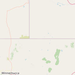
Map view of Little Jacks Creek Wilderness

Use this park location map to pinpoint Little Jacks Creek Wilderness in United States of America, understand its exact geographic position, and read its mapped placement within the surrounding landscape more clearly.

Pigeon | © OpenStreetMap contributors

Location context for Little Jacks Creek Wilderness

Idaho

Visual reference of basalt plateaus, deep river canyons, and high desert terrain

Little Jacks Creek Wilderness Photos and Landscape Scenery

Visual documentation of Little Jacks Creek Wilderness reveals the stark topography of its high basalt plateaus and deep rhyolite river canyons. Examining these protected area photographs provides clear insight into the remote sagebrush steppe and rugged terrain of the Owyhee Canyonlands.

A wide, high-angle landscape shot of a deep, arid basalt canyon system under a clear blue sky, showing rocky cliffs and dry, scrub-covered plateaus.

A wide, eye-level landscape photograph looking down into a deep, steep-sided basalt canyon carved into a dry, grassy, shrub-dotted plateau under a bright blue sky with scattered clouds.

Park atlas

Compare nearby canyon systems and connected high desert landscapes in Idaho

Explore Parks Near Little Jacks Creek Wilderness and Surrounding Protected Lands

Browse other protected areas near Little Jacks Creek Wilderness to examine continuous basalt plateaus and deep river gorges across the surrounding regional terrain. Comparing adjacent wilderness units provides deeper geographic context on remote high desert ecosystems and protected canyon networks.
Watercolor painting depicting a panoramic view of rolling hills in soft pastel pinks, yellows, and greens with scattered trees in the foreground.
Wildlife reserveIdaho
About 29 km away#1 closest

Southwest

Pole Creek Wilderness: A Deep Dive into Idaho Volcanic Canyons and Protected Landscapes

Geographic analysis of the Owyhee Desert wilderness and basalt plateau terrain.

Discover the complex volcanic topography of the Pole Creek Wilderness, where seasonal whitewater flows through deep, sheer-walled gorges. This protected area represents an essential segment of the Owyhee Canyonlands, preserving trail-free sagebrush steppe and basalt plateau environments that characterize the remote reaches of southwestern Idaho.

Area
50.72 km²
Established
2009
IUCN
Ib
Relief
Upland
A watercolor painting showing soft green hills, distant pink-hued mountains, and a pale blue lake in a serene, stylized landscape.
Protected landscapeNevada
About 80 km away#2 closest

South

Humboldt, Toiyabe National Forest: Protected Landscape and Regional Mountain Geography

A vast network of Nevada mountain ranges and alpine wilderness

Humboldt, Toiyabe National Forest serves as a defining public land entity across Nevada and eastern California. As the largest national forest in the contiguous United States, it preserves a striking collection of isolated mountain ranges, including the Ruby Mountains and the rugged Jarbidge wilderness, within a broader basin-and-range landscape. Examine the boundaries and terrain that characterize this complex, high-desert ecosystem.

Area
25,454 km²
Established
1908
Relief
Mountain
Access
Easy access
Wildlife reserveNevada
About 114 km away#3 closest

Southeast

Jarbidge Wilderness: Protected Mountain Terrain and Geographic Map Context in Nevada

High-altitude wilderness geography and canyon landscapes

Located in the remote Jarbidge Mountains, this wilderness area transitions from arid sagebrush steppe to dense subalpine forests and dramatic river canyons. The region preserves headwater streams and over a dozen significant summits, offering a complex look at the natural topography of the northern Great Basin in Nevada.

Area
457.97 km²
Established
1964
IUCN
Ib
Relief
Mountain
Watercolor painting of a calm lake surrounded by forested shores and distant mountains, depicted in soft pastel tones.
Protected landscapeIdaho
About 116 km away#4 closest

Northeast

Sawtooth National Forest: Geographic Overview and Protected Mountain Boundaries

Central Idaho mountain systems and wilderness corridors

Spanning over two million acres, Sawtooth National Forest defines the heart of the Rocky Mountains in Idaho. This protected landscape contains a complex network of glacial basins, alpine lakes, and varied ecosystems ranging from arid sagebrush foothills to high-altitude peaks. Explore the internal boundaries, drainage systems, and structural geography of this significant wilderness area.

Area
8,540.52 km²
Established
1905
Visitors
1.2M annual
Relief
Mountain
Watercolor painting of a tranquil lake surrounded by green forests and soft mountain ridgelines against a white background.
Protected landscapeIdaho
About 153 km away#5 closest

Northeast

Sawtooth National Recreation Area: Mapping the Protected Landscape of Central Idaho

A vast mountain wilderness of granite peaks and glacier-carved lakes.

The Sawtooth National Recreation Area encompasses a quintessential northern Rocky Mountain terrain defined by the dramatic Sawtooth, White Cloud, and Boulder ranges. This protected landscape preserves over 700,000 acres of high-elevation wilderness, ranging from jagged granite arêtes to the broad, U-shaped Sawtooth Valley, serving as a critical hydrologic anchor for the rivers of the American West.

Area
2,957.7 km²
Established
1972
Relief
Mountain
Climate
Alpine
Protected landscapeIdaho
About 192 km away#6 closest

North

Payette National Forest: Geographic Overview of Idaho's Rugged Mountain Wilderness

Protected granite landscapes and glacial basin geography

Encompassing a vast portion of central Idaho, Payette National Forest represents a significant protected wilderness corridor. The forest geography transitions from granite-based alpine peaks and deep river gorges to dense coniferous slopes, providing essential habitat and extensive trail connectivity throughout the Northern Rockies.

Area
9,419.55 km²
Established
1944
Relief
Mountain
Access
Access unknown
Soft watercolor illustration of a rolling mountain landscape with a forested foreground and faded, distant peaks.
Protected landscapeIdaho
About 195 km away#7 closest

Northeast

Salmon, Challis National Forest: Geography and Protected Land Map in Central Idaho

Extensive alpine ridges and wild river corridors

Spanning over 4.2 million acres, Salmon, Challis National Forest is a foundational protected landscape in Idaho. This area includes the highest peaks in the state, such as Borah Peak, and holds the majority of the Frank Church, River of No Return Wilderness. Utilize this atlas resource to examine the intricate mountain topography, expansive river systems, and the contiguous wild corridors that define this significant portion of the northern Rockies.

Area
17,142.2 km²
Established
1908
Relief
Mountain
Climate
Temperate
A horizontal watercolor illustration depicting a winding river flowing through a forested valley surrounded by soft, hazy mountain silhouettes.
Wildlife reserveIdaho
About 201 km away#8 closest

North

Frank Church, River of No Return Wilderness: Idaho Protected Mountain and River Landscapes

Discover massive roadless geography and river-carved mountain terrain.

Spanning over 2.3 million acres in central Idaho, the Frank Church, River of No Return Wilderness represents one of the most significant intact roadless landscapes in the lower 48 states. This protected area features a complex mosaic of coniferous forests, high-altitude alpine ridges, and the steep, jagged canyons of the Salmon River, creating a unique geographic profile for regional exploration.

Area
9,578.21 km²
Established
1980
IUCN
Ib
Relief
Mountain

Common questions about visiting, size, designation, and location context for Little Jacks Creek Wilderness

Little Jacks Creek Wilderness FAQs for park facts, access, geography, and protected area context

Find quick answers about Little Jacks Creek Wilderness, including protected-area facts, park geography, trail and visitor context, and how the park fits into its surrounding country and regional landscape.
MoriAtlas Explorer

Continue Your Protected Areas Search Across the Global Atlas

Deepen your exploration by continuing the structured search for national parks and protected areas worldwide. Utilize the comprehensive filtering capabilities to compare different conservation landscapes and refine your understanding of global park geography. Discover more about the distribution and characteristics of protected natural areas.

Global natural geography