
Trip Timing
When to Visit Llullaillaco National Park: The Essential Timing Overview
Navigating the High-Altitude Climate Constraints
The best time to visit Llullaillaco National Park is during the austral summer months of December through February, when the park offers its most stable thermal profile and longest daylight windows. Because this protected area sits within the Central Andean dry puna ecoregion, its climate is defined by extreme altitude rather than seasonal rainfall, which remains minimal year-round. Travelers who prioritize accessibility and milder daytime temperatures should target this period to navigate the park's rugged volcanic landscape, which includes the imposing summit of the Llullaillaco volcano and surrounding semi-desert plains.
The Relationship Between Altitude and Temperature
Visitors must recognize that the primary constraint on timing a trip here is the consistent and extreme elevation, which averages well above 3,500 meters across the park terrain. While December to February brings the highest mean temperatures, typically peaking near 23 degrees Celsius during the day, the altitude ensures that nighttime temperatures consistently dip below freezing regardless of the season. This sharp diurnal temperature variation is a permanent feature of the high-altitude desert environment. Planning a visit requires preparing for these internal swings, where the intensity of the sun during the day contrasts with profound cold as soon as the sun drops behind the Cordillera Domeyko.
Assessing Trade-offs in Seasonal Travel
Choosing the appropriate period for your journey involves balancing environmental exposure against physical demands. The austral summer months facilitate exploration of the Inca road systems and wildlife viewing, as the warmer days allow for more comfort during outdoor activity. However, these months do not grant immunity from the rapid weather shifts typical of the Andes. Even in the height of summer, visitors face intense solar radiation and the necessity of managing altitude exposure. Conversely, winter months such as June and July present significantly colder mean temperatures and shorter daylight hours, which can make sustained exploration of the remote landscape more taxing for the unprepared.
Planning Beyond Seasonal Normals
While the austral summer provides a theoretical window of manageable conditions, you must verify the viability of your trip through official channels before finalizing any travel arrangements. The park's location in a remote sector of the Antofagasta Region means that access roads and route status can be impacted by factors outside of standard seasonal weather patterns. Reliable access depends on current maintenance and the ability to traverse high-altitude terrain, regardless of what the annual climate trends suggest. Always consult the appropriate Chilean authorities to confirm that your chosen dates align with current regional access policies and safety guidelines before planning a visit to this high-altitude environment.
Seasonal Visiting Windows
Best Months to Experience Llullaillaco National Park
Peak Daylight and Thermal Stability: December through February
For travelers prioritizing consistent, albeit still frigid, daytime conditions, the summer period from December through February represents the most suitable window. During these months, the park experiences its longest daylight hours, peaking at over 13.5 hours in December. This extended solar exposure is critical for high-altitude trekking and navigation, as it provides a wider safety buffer for maneuvering across the remote Andean terrain. While mean daily temperatures reach their annual high during this phase, nighttime lows remain near the freezing point, necessitating robust thermal gear despite the warmer afternoons. This period offers the most manageable environment for those intent on experiencing the park's volcanic landscapes, though visitors must acknowledge that these months do not eliminate the inherent dangers of the high-altitude climate.
The Transition Windows: March, April, October, and November
The shoulder months act as a bridge between the peak summer warmth and the harsher conditions of the deep winter. March and November offer a middle ground for those seeking to avoid the peak solar intensity of mid-summer while maintaining relatively stable access. As the daylight hours begin to recede in March, afternoon maximums stay above 20 degrees Celsius, providing a comfortable contrast to the rapidly cooling nights. Conversely, October and November signal the start of the warming trend, with increasing daylight length and climbing daytime highs. These months are appropriate for travelers who prefer to balance moderate daylight with the reality of lower humidity and increasing wind speeds as the seasons shift. The primary compromise during these times is the increased variability in daily weather, which requires a more cautious approach to route planning than the peak summer months.
Managing Cold and Wind: May through September
The winter period, spanning May through September, presents the most significant challenges for visitation. While the clear skies of the Atacama region remain, the atmospheric conditions become increasingly punishing due to lower mean temperatures and persistent wind patterns. In July, the coldest month, average minimum temperatures plummet well below freezing, and the daylight period shortens to approximately 10.5 hours. For most visitors, this period is less ideal for extended exploration or high-altitude activities. Travelers who venture into the park during this window must be prepared for extreme cold, limited windows of sunlight, and the heightened potential for rapid weather shifts that can obscure the volcano's slopes and make movement across the rugged terrain difficult. Access during these months is frequently more precarious, and the experience should be reserved for those with specific experience in high-altitude desert environments who are fully equipped for severe winter conditions.
Annual Climate Overview
Understanding the High-Altitude Climate and Weather Patterns in Llullaillaco National Park
Understanding the climate of this high-altitude protected area requires shifting focus from standard four-season expectations to the rhythm of extreme elevation. Situated at nearly 3,600 meters in the Central Andean dry puna, the park experiences a climate dominated by intense solar radiation and significant diurnal temperature fluctuations. These climate normals provide a historical baseline for planning, but they are not accurate forecasts. Because the region is part of a high-desert ecosystem, visitors should expect weather conditions to change rapidly regardless of the calendar month.
The Relationship Between Sunlight and Diurnal Swings
The most consistent climatic factor across the year is the radical difference between daytime highs and nighttime lows. Even during the warmest months of December through February, where average daytime temperatures reach roughly 23 degrees Celsius, the average minimums frequently drop near or below freezing. This persistent nocturnal cold is an inherent characteristic of the high-altitude environment, regardless of the solar gain during the day. Daylight duration peaks in December at over 13.5 hours, providing the longest windows for activity, but the rapid transition from peak sun to sub-zero temperatures once the sun dips behind the volcanic horizon is a critical factor for any visitor to navigate.
Patterns in Moisture and Air Humidity
Rainfall in this environment is exceptionally scarce, adhering to the characteristics of the hyper-arid Atacama region. While some months record slightly higher precipitation values, these measurements represent minimal averages, not periods of sustained wet weather or monsoon-like conditions. Relative humidity remains consistently low throughout the year, often dipping below 25 percent during the colder, mid-year months. This low moisture content contributes to the harshness of the air, which can exacerbate physical strain at such high elevations. Travelers should view the annual cycle not as a choice between wet and dry months, but as a spectrum of extreme dryness that influences skin health, hydration needs, and the overall feel of the air.
Wind Dynamics and Seasonal Shifts
Wind serves as a primary driver of perceived temperature within the park. While the climate data indicates relatively stable wind speeds across the year, averaging between 4 and 4.6 meters per second, even moderate gusts at this altitude significantly lower the effective temperature. The wind intensity appears to reach its relative peak in the transition months of September and October, as the atmosphere adjusts between the winter and summer patterns. During these times, the combination of mounting solar exposure and increased wind can make the conditions feel significantly more volatile than the temperature readings alone might suggest.
Variability Beyond Historical Averages
It is essential to distinguish between these long-term climate normals and the reality of mountain weather. The recorded values provide a general expectation for the 3,598-meter elevation sample point, but they do not account for the specific microclimates found near the base of the volcano or in the deeper ravines. Furthermore, because these figures are long-term averages based on data from 1991 to 2020, they do not reflect anomalous weather events or year-to-year shifts in regional atmospheric patterns. Visitors must treat these figures as a foundation for understanding the park's environment rather than a predictive tool for their specific dates of arrival.
Seasonal Environment
Seasonal Weather Patterns and Climatic Shifts in Llullaillaco National Park
The High-Altitude Thermal Divide
Llullaillaco National Park does not follow the classic four-season calendar typical of lower latitudes. Instead, the environment is governed by two distinct thermal phases defined by the relentless solar intensity of the high Andean plateau. The primary rhythm involves a warmer window during the austral summer, followed by a significantly colder, more arid period that spans the remainder of the year. Because the park sits at an extreme elevation, the diurnal temperature swing is a constant factor that often outweighs seasonal shifts in absolute temperature. Even during the warmest months, nightly temperatures frequently drop below freezing, making the concept of a mild season inapplicable to this landscape.
The Summer Warmth Window
Spanning from December through February, this period represents the most stable thermal window for those venturing into the park. Visitors will notice the longest daylight hours of the year, which provides a critical buffer for navigating the challenging terrain and reaching high-altitude sites before the rapid temperature drop at dusk. While this phase is referred to as summer, it is defined more by its manageable daytime highs and increased solar radiation than by any significant uptick in precipitation. Humidity levels remain low, ensuring that even when temperatures are at their peak, the air stays extremely dry. This phase is characterized by the highest mean temperatures of the year, yet the daily cycle of freezing nighttime lows persists, necessitating preparation for cold regardless of the calendar month.
The Arid Winter Transition
From May through August, the park enters a phase of peak thermal stress. Daytime temperatures remain significantly lower than the summer averages, and the reduction in daylight hours creates a compressed window for safe exploration. This period is the most arid of the year, with minimal moisture in the atmosphere, which contributes to the harsh, clear, and cold conditions that define the Andean puna in winter. During this time, the wind factor becomes increasingly important, as it often exacerbates the sensation of cold, further lowering the effective temperature for visitors exposed on the open plains or volcanic slopes. The transition into this phase usually begins in late April as daylight duration decreases and average temperatures begin a steady, noticeable decline.
Transitional Months and Environmental Flux
March, April, October, and November function as transitional buffers between the thermal extremes. In the autumn transition during March and April, the park experiences a cooling trend where the solar-driven heat of the summer fades into the cold of the coming winter. Conversely, October and November serve as the spring warming phase, where the environment begins to shed the extreme winter chill. These months are characterized by unpredictable shifts where visitors might encounter the clear skies typical of winter alongside the rising daylight potential of summer. Because the park lacks the moderating influence of heavy vegetation or proximity to large bodies of water, these transitions are marked by a rapid recalibration of daily temperature averages rather than gradual, sustained seasonal changes.
Seasonal Experiences
Experiencing the Andean Landscapes of Llullaillaco Through the Year
Navigating High-Altitude Terrain and Inca Heritage
The experience of visiting this park is dictated primarily by the extreme elevation, which remains a constant factor regardless of the time of year. Because the landscape is a protected high-altitude desert, visitor experiences such as navigating the arid plains or viewing the ancient Inca road segments are best attempted during periods of maximum daylight and slightly higher mean temperatures. From December to February, the extended daylight hours provide more time to safely explore the volcanic vistas and terrain around the Río Frio area. During these summer months, the slightly warmer mean temperatures mean that the early morning hours, while still cold, are less punishing for those walking near the heritage sites.
Wildlife Observation and Seasonal Rhythms
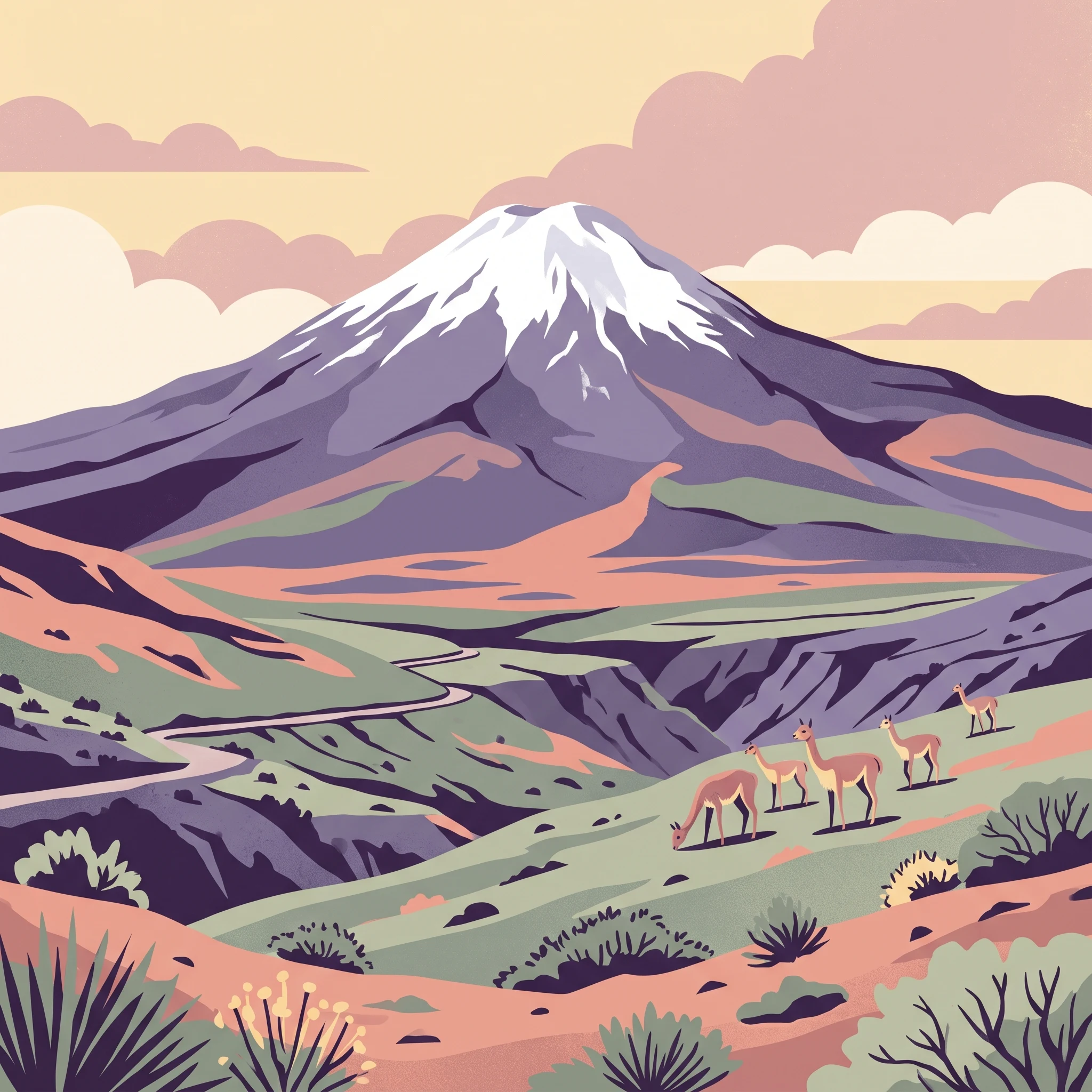
Observing the wild vicuña herds is one of the defining activities in this park. These camelids are highly adapted to the altiplano environment and are visible throughout the year, but their movement patterns and the visitor's ability to spot them can be influenced by the availability of water and seasonal shifts in the semi-desert vegetation. During the warmer months, animals may be more active during the limited temperate windows of the day. In contrast, the harsh winter period between May and August, when mean temperatures drop significantly, forces more conservative movement patterns for both wildlife and human visitors. The extreme diurnal temperature swings during these winter months, where nighttime lows frequently drop well below freezing, make stationary wildlife viewing exceptionally demanding on equipment and personal endurance.
Impact of Solar Intensity on Exploration
The park's location in the high-altitude Andean range means that solar radiation is high year-round. This has a direct impact on the viability of outdoor activities. Visiting in the shoulder months, such as October and November or March, offers a balance where the UV intensity is still significant but the extreme wind patterns typical of the late winter transition may be slightly less consistent. Travelers planning to explore the volcanic slopes should prioritize the midday and early afternoon periods when solar warming provides the most thermal comfort. Conversely, the cooler, shorter days of June and July restrict the window for outdoor movement, necessitating careful planning for those who intend to spend time away from sheltered areas. Because the park lacks dense forest cover or natural shelter, every activity is inherently tied to the immediate weather conditions of the day, making flexibility an essential part of any itinerary.
Visitor Priorities
Optimizing Your Llullaillaco National Park Trip by Experience and Interest
Balancing Diurnal Swings for Thermal Comfort
If your primary goal is to minimize the severity of the park's extreme temperature drops, focus your travel in the height of the austral summer, specifically December through February. During these months, the average daily maximum temperatures reach their peak, often exceeding 23 degrees Celsius. While this creates a more manageable environment during daylight hours, the diurnal swing remains a constant factor. Even in the warmest months, minimum temperatures frequently hover near or below freezing. The trade-off for choosing this window is accepting that you must remain prepared for rapid cooling the moment the sun dips behind the high Andean peaks, regardless of how warm the afternoon felt.
Prioritizing Longer Daylight for Landscape Exploration
Visitors whose activities involve traversing the vast volcanic plains or exploring the remote remnants of the ancient Inca road system will benefit most from the extended daylight hours of December and January. With daylight duration exceeding 13.5 hours in mid-summer, you gain a vital safety buffer for navigation and terrain assessment. Longer days are essential when moving through the high-altitude landscape where the scarcity of landmarks and the physical demands of high-elevation exertion make time management critical. Opting for these months means you gain maximum operational hours for your daily itinerary, though you must weigh this against the higher solar intensity, which requires robust protection against ultraviolet radiation that is significantly stronger than at lower altitudes.
Selecting for Consistent Dryness and Wind Patterns
While precipitation is consistently low throughout the year at these elevations, the months of August and September offer the lowest average humidity, which can be beneficial if you prefer the crisp, dry air associated with high-altitude deserts. However, this period is characterized by a subtle uptick in wind speeds compared to the mid-summer months. Stronger winds can significantly lower the felt temperature, potentially turning a pleasant, sunny afternoon into a challenging experience. Choosing this period prioritizes structural stability and clear, stable skies for extended views of the Llullaillaco volcano, but it requires higher-grade thermal layering and wind-resistant outer gear compared to a mid-summer visit. If you prioritize protection from the wind, the months of March and April provide a calmer atmospheric environment, though with a reduction in daily maximum temperatures as the transition into the colder part of the year begins.
Visitor Access
Seasonal Access and Practical Planning for Llullaillaco National Park
Navigating Access and Regional Logistics
Reaching this remote high-altitude park requires significant advance planning, as the terrain is geographically isolated and lacks standard visitor infrastructure. The park is situated roughly 275 kilometers from Antofagasta, with the final approach involving travel through arid, unpaved Andean routes. Because of the extreme elevation and the nature of the high-altitude desert environment, road conditions can shift rapidly. Visitors should not rely on generic map data for route viability. Before embarking on any journey, contact the regional CONAF (Corporación Nacional Forestal) office in Antofagasta to verify the current state of access roads and any potential restrictions due to seasonal weather patterns or maintenance activities.
Official Requirements and Permitting
Compliance with Chilean park regulations is mandatory for all visitors. The management of the area is overseen by CONAF, and specific authorization is required for entry. If your travel plans include climbing the volcano, the administrative threshold is higher: you must submit a formal climbing permit and a signed disclaimer of liability to the park authorities. These documents are designed to manage risk in an environment where emergency services are severely limited by distance and altitude. Beyond the climbing-specific forms, all visitors, regardless of their activity, must complete the standard entrance registration. These procedures are subject to change, so you should check the official CONAF website or reach out to the Antofagasta office directly to confirm if current registration requires physical form submission, email, or an online digital portal.
Operational Windows and Verification
While weather patterns provide a rough guide for seasonal planning, operational schedules are distinct from climate averages. Reports may indicate the park is officially open for a specific window, such as from early September through late May, but this status can be suspended at any time due to unforeseen environmental conditions, road blockages, or safety concerns. Never assume that a calendar window guarantees access. Always verify the current opening dates with official sources before booking transport or finalizing your itinerary. Because the park serves as a conservation area for sensitive species like the vicuña, authorities may also implement temporary closures or limit access to certain sectors of the park to protect wildlife and habitat. Checking with the park office in Antofagasta shortly before departure is the only way to ensure your visit aligns with current regulations and site availability.
Safety and Preparation
Weather Exposure and Safety Preparation for Llullaillaco National Park
Navigating Extreme Diurnal Temperature Swings
Preparation for this park centers on managing the environment's severe diurnal temperature fluctuations rather than seasonal rain or snow. Because of the high-altitude, semi-desert nature of the puna, ground-level temperatures can plummet from a comfortable daytime high to well below freezing as soon as the sun dips below the horizon. Regardless of the month you choose for your visit, your layering system must account for these rapid shifts. During the austral summer months of December through February, you may experience maximum temperatures exceeding 20°C, yet overnight lows frequently drop below 0°C. This cycle requires clothing that can be adjusted continuously to manage moisture and core warmth, as sudden changes in wind or cloud cover will alter the perceived temperature even during daylight hours.
Addressing High-Altitude Exposure and Air Quality
The most significant factor for any visitor is the extreme elevation. The lowest areas of the park sit at approximately 3,500 meters, which is comparable to high-altitude regions in the Himalayas, while locations such as Aguas Calientes reach beyond 5,000 meters. Exposure to this environment requires careful planning regarding physical exertion and pace. Because the humidity levels are consistently low, often dropping below 25 percent, dehydration occurs more rapidly than at lower elevations. Planning for your visit should prioritize a strategy for gradual ascent and consistent monitoring of your physical well-being. Unlike temperate parks, you cannot rely on local infrastructure to assist with issues related to altitude; you must be prepared to manage your own health and timing, including having the discipline to turn back if you experience symptoms of altitude sickness or if the environmental conditions become too challenging to navigate.
Seasonal Wind and Radiation Considerations
Wind is a consistent element that significantly alters the safety profile of the park. While average wind speeds remain relatively stable throughout the year, their impact is magnified by the lack of vegetation and the exposure of the volcanic plains. High wind events can quickly lower the wind chill factor, making even mild days feel harsh and significantly increasing the difficulty of outdoor navigation or site photography. Furthermore, the region's high solar radiation levels are a constant regardless of the season. Visitors should prepare for intense UV exposure by using high-quality protective gear. Always verify current weather forecasts and regional wind alerts through Chilean government sources before departing for the park, as these local conditions can vary wildly from regional long-term climate averages. Official bulletins are the only reliable way to assess current accessibility and safety levels for the remote terrain you intend to traverse.
Finalizing Your Visit
How to Choose the Right Time to Visit Llullaillaco National Park
Balancing Environmental Extremes for Your Visit
Choosing the right time to visit this high-altitude volcanic landscape requires a personal assessment of your tolerance for extreme conditions. There is no singular ideal window that guarantees perfect weather, as the park is defined by an environment where temperature, light, and wind oscillate independently of the calendar. Your decision should center on whether you prioritize the thermal stability and longer daylight hours of the austral summer or the atmospheric clarity and lower wind intensity found during the transitional shoulder periods. By focusing on your core objective, you can match your itinerary to the environmental realities of this unique Chilean destination.
Prioritizing Your Travel Objectives
If your primary goal is maximizing outdoor time for viewing the high-altitude volcanic scenery or tracking vicuña across the plains, the period from December through February offers the most predictable daylight schedule. During these months, the slightly warmer mean temperatures and reduced risk of severe thermal plunges during the day provide a wider margin for error when navigating remote ravines or exploring the remnants of the Inca road. However, these months also demand high preparation for intense solar radiation and the requirement to remain flexible should access routes change due to sudden shifts in mountain conditions.
Conversely, travelers who prefer the stark beauty of clearer, colder days might look toward the transitional months of October, November, or March. While you will encounter shorter daylight windows and more significant temperature drops as the sun descends, these periods often offer a balance between manageable daytime highs and a sense of isolation that characterizes this remote Andean region. Regardless of the month you select, you must remain aware that the park is an uncontrolled environment. The climate data from the past three decades serves as a guide for what is typical, but it cannot predict the specific conditions you will encounter. Always verify current road accessibility, regional weather alerts, and mandatory permit requirements with the relevant Chilean authorities in Antofagasta before finalizing your travel dates. By treating climate norms as a broad framework rather than a forecast, you ensure your planning remains rooted in the practical realities of a remote, high-altitude volcanic park.