
Mori Atlas logo
Protected areaMalinská skála

Mapping the high-elevation rock formations and expansive upland landscapes of the Žďárské vrchy

Malinská skála: A Protected Gneiss Landmark and Geologic Viewpoint in the Czech Highlands

(Přírodní památka Malinská skála)

Malinská skála is a significant natural monument rising within the Czech-Moravian Highlands, characterized by complex gneiss rock towers and frost-weathered boulder fields. As a primary viewpoint in the Žďárské vrchy, the summit offers clear sightlines over the surrounding forested ridges and distant mountain ranges. This protected landscape documents essential geological processes and provides an essential reference for understanding the geomorphological development of the upland region.

natural monumentrock formationgeological heritageuplandsforestspruce woodland
An illustration in a flat design style depicting a mountain valley, a prominent rock formation with a waterfall, coniferous forest, and small structures in the distance.

Malinská skála

Protected area

Park overview

Structured park overview, official facts, and landscape profile for Malinská skála

Malinská skála park facts, protected area profile, and essential visitor context

Review the core facts for Malinská skála, including designation, size, terrain, visitor scale, habitats, and operating context in one park-focused overview.

About Malinská skála

Malinská skála occupies a defining position along the central ridge of the Žďárské vrchy, the most prominent subunit of the Hornosvratecká vrchovina within the Czech-Moravian Highlands. The site combines a compact summit rock group with a broader boulder field, forming one of the geologically richest protected natural monuments in the Vysočina region. The entire ridge can be traced eastward from the better-known Devět skal massif toward Dráteníčky, and Malinská skála marks a key waypoint along this chain of gneiss outcrops that have resisted weathering while softer surrounding material has worn away over millions of years.

The peak itself sits at roughly 813 meters above sea level, with vertical walls that fall sharply from the upper edge of the plateau, allowing visitors who climb to the summit an unusually clear view of the rolling upland below. From this vantage, the eye sweeps across villages such as Blatiny, Křižánky, Samotín and Sněžné, and takes in nearby rock landmarks such as Buchtův kopec, Pasecká skála and the distinctive Čtyři palice. The surrounding landscape is shaped by cold-climate processes: freeze-thaw cycles over many millennia have shattered the gneiss, producing both the towering rock walls and the chaotic boulder stream now preserved within the natural monument.

The site lies within the territory of the CHKO Žďárské vrchy Protected Landscape Area and has been protected as a přírodní památka since 1987, with conservation oversight provided by the Agency for Nature Conservation and Landscape Protection of the Czech Republic. Because it sits within easy reach of nearby communities, Malinská skála has become a year-round recreational hub, attracting hikers, climbers, cyclists and, in winter, cross-country skiers, while still functioning as a reference locality for gneiss geomorphology and upland forest ecology in the Czech Republic.

Quick facts and research context for Malinská skála

Malinská skála is a protected natural monument (přírodní památka) in the Czech Republic, located in the Vysočina Region, Žďár nad Sázavou district, near the villages of Blatiny and Sněžné na Moravě. It lies in the Hornosvratecká vrchovina, specifically in the Devítiskalská vrchovina subunit of the Žďárské vrchy within the broader Českomoravská vrchovina (Czech-Moravian Highlands). The summit reaches approximately 813 meters above sea level, with rock walls up to 20 meters high forming part of a continuous gneiss ridge system.

The protected area covers roughly 5.76 hectares and was declared in 1987 by the District National Committee of Žďár nad Sázavou. It is managed by the Agency for Nature Conservation and Landscape Protection of the Czech Republic through the CHKO Žďárské vrchy Protected Landscape Area administration. The site's principal scientific value lies in its gneiss rock formations and associated boulder field, which together document cryogenic sculpting at the highest elevations of the Žďárské vrchy.

Protection and recognition

Terrestrial protected area designation records and governance scope

Malinská skála Protection Status and Regional Conservation Framework

Malformed administrative frameworks and terrestrial protection status details outline the verified conservation boundaries established for Malinská skála. Documented recognition metrics compile available international frameworks to establish baseline geographic context for the terrain.

Protection details

Protection scope
Terrestrial
Transboundary protection
No
Park context

Deeper park guide and search-rich context for Malinská skála

Malinská skála history, landscape, wildlife, and travel context

Explore Malinská skála through its history, landscape character, ecosystems, wildlife, conservation priorities, cultural context, and seasonal travel timing in a structured park guide built for atlas discovery and search intent.

Why Malinská skála stands out

Malinská skála is most renowned for its dramatic gneiss rock formations rising out of a forested upland ridge, including several named towers and walls up to 20 meters high. It stands out as one of the principal viewpoints of the Žďárské vrchy, a vantage point from which much of the Czech-Moravian Highlands and, in clear conditions, distant mountain ranges such as the Orlické hory and Krkonoše can be seen. The protected natural monument also holds strong geomorphological significance: the rock group and its adjacent boulder stream are textbook examples of frost-weathering and cryogenic modeling of the highest gneiss ridges in the Žďárské vrchy, making the site a reference point for understanding the geological history of the entire upland.
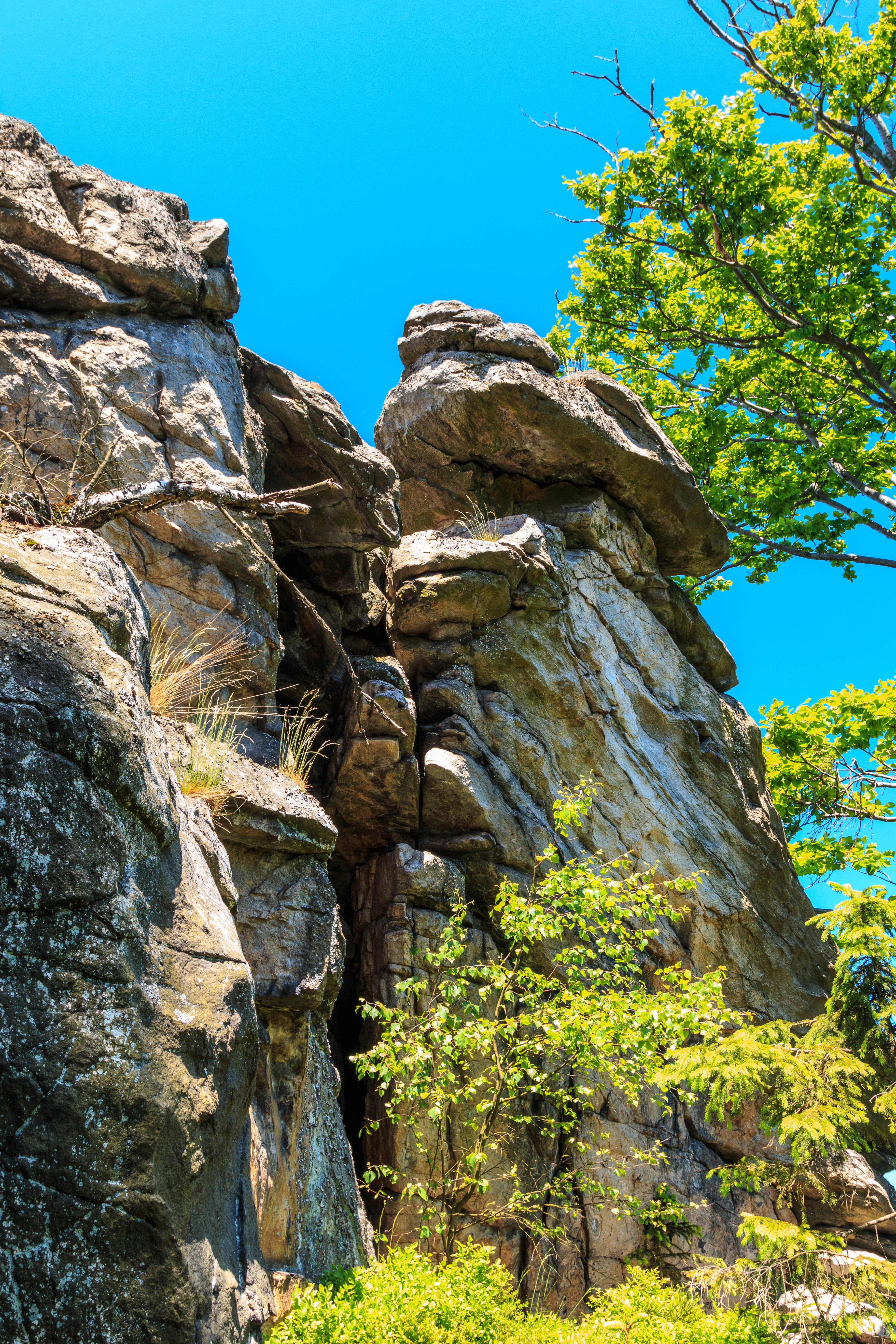
Rugged, weathered grey rock cliffs forming a vertical crevice against a clear bright blue sky, with bright green foliage in the foreground and to the side.
A close view of the rock formations at Malinská skála in the Czech Republic.

Malinská skála history and protected-area timeline

Malinská skála was formally recognized as a přírodní památka, or natural monument, in 1987, when the District National Committee of Žďár nad Sázavou declared the rocky summit and its surrounding boulder field a protected site. The selection was driven primarily by the geological value of the area: the outcrop preserves one of the clearest examples of cryogenic, or frost-driven, sculpting of gneiss ridges at the highest elevations of the Žďárské vrchy, and it complements the broader conservation strategy of the then-developing protection framework around the Czech-Moravian Highlands.

Following its declaration, the natural monument has been administered by the Agency for Nature Conservation and Landscape Protection of the Czech Republic through its regional office responsible for the CHKO Žďárské vrchy. The site today forms part of an interconnected set of protected rock localities along the central Žďárské vrchy ridge, and recreational infrastructure, including trails connecting it to nearby rock formations such as Drátenická skála and Lisovská skála, has developed around it without altering its protected status.

Malinská skála landscape and geographic character

The landscape of Malinská skála is defined by a tight, compact rock group crowning a forested ridge plateau. Gneiss walls, the tallest reaching around 20 meters, rise sharply from spruce-dominated slopes. The named formations, including Výspa, Srnčí věž, Škuner and Buldok, give the summit a complex silhouette of towers, ledges and overhangs that contrasts with the softly rolling upland around the protected area.

Beneath and around the rock walls lies an extensive boulder field, a classic example of a frost-shattered debris slope. These angular blocks of gneiss, displaced downslope over many freeze-thaw cycles, blend into the surrounding forest and contribute to the rugged character that distinguishes Malinská skála from the smoother terrain typical of the wider Czech-Moravian Highlands. From the summit, the landscape unfolds into a broad panorama of upland ridges, scattered rock formations like Buchtův kopec, Pasecká skála and Čtyři palice, and on exceptionally clear days, the distant silhouettes of the Orlické hory, Králický Sněžník and the Hrubý Jeseník.
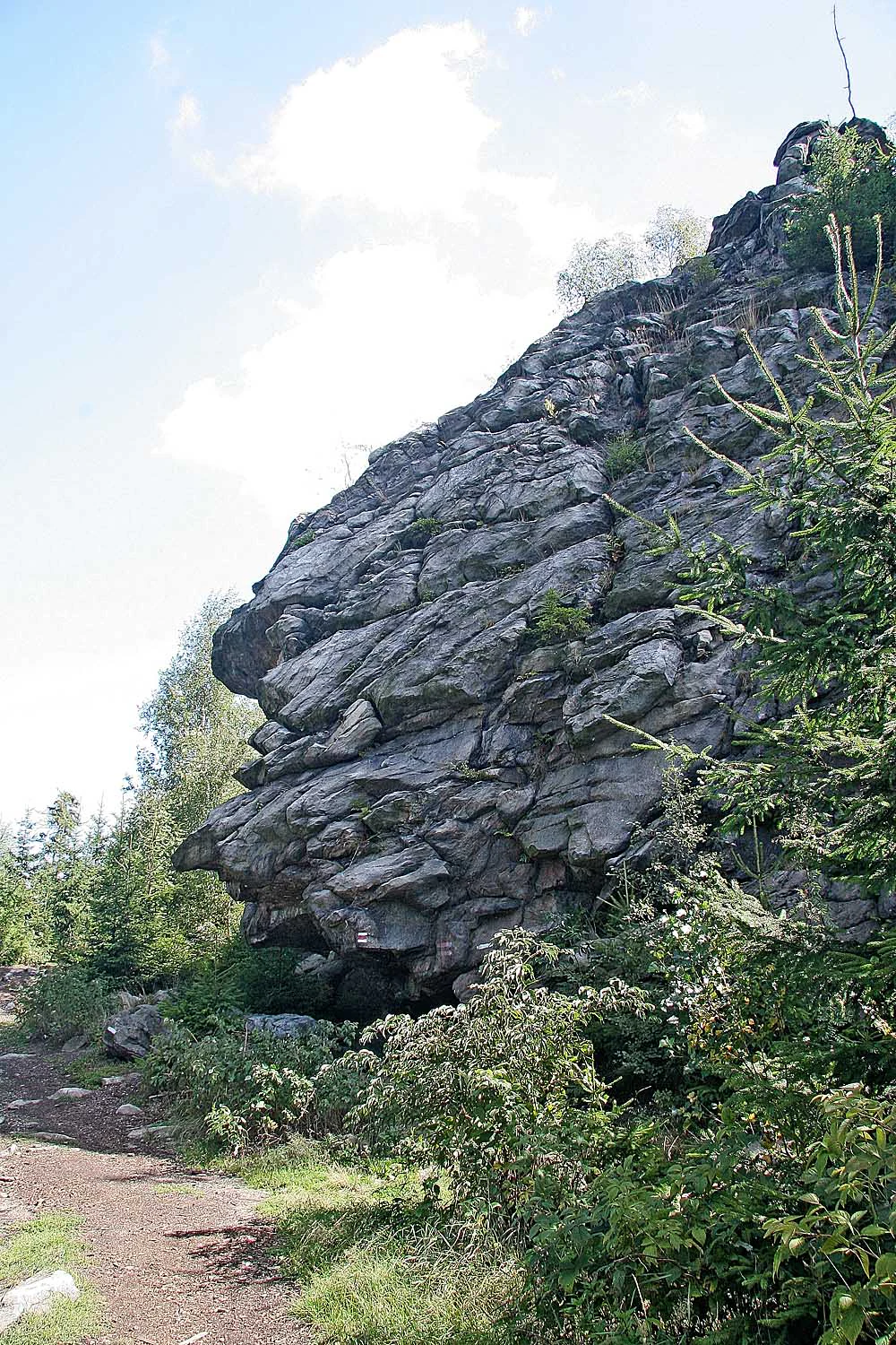
A large, craggy gray rock formation rises above a dirt trail, with evergreen trees and sparse vegetation surrounding its base under a partly cloudy sky.
The prominent rock formation at Malinská skála in the Zdar Hills, Czech Republic.

Malinská skála ecosystems, habitats, and plant life

The natural monument occupies an upper-forest zone of the Žďárské vrchy where managed spruce woodland dominates, broken by scattered beech and a thin herb layer adapted to acidic, nutrient-poor soils. Typical ground vegetation includes bilberry, wood sorrel, wavy hair-grass and several shield fern species, all of which form a sparse but characteristic understory beneath the conifer canopy.

The exposed rock faces and boulder surfaces of Malinská skála are colonized by crustose and foliose lichen communities, forming patchy mosaics of grey, orange and pale yellow growth across the gneiss. These lichen communities are ecologically important both as indicators of air quality and as components of the specialized rock habitat that distinguishes the site from the closed forest around it. The combination of dense spruce cover, lichen-clad rock outcrops and boulder fields produces a mosaic of shaded forest, open rock and transitional debris habitats that supports the diverse birdlife of the protected area.
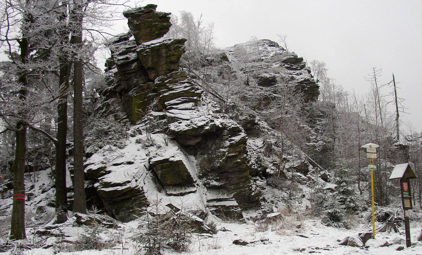
A large, craggy rock outcrop partially covered in snow and ice, surrounded by bare trees under a cloudy sky.
The rock formation of Malinská skála in the Žďárské vrchy mountains during winter.

Malinská skála wildlife and species highlights

Malinská skála supports a typical upland forest bird community, with common woodland species occurring throughout the spruce-dominated slopes. What makes the site notable within the Žďárské vrchy is the presence of several scarcer species that are drawn to the combination of mature forest and undisturbed rocky terrain.

Among the rarer breeding birds documented in the natural monument are the tawny owl, the spotted nutcracker, the common crossbill, the common raven and the Eurasian eagle owl. The eagle owl in particular depends on the cliff-like rock walls for nesting, while the crossbill is closely tied to the spruce-dominated canopy. Together these species underscore the conservation value of the site as both a forest and rock habitat, even though the area is relatively small.
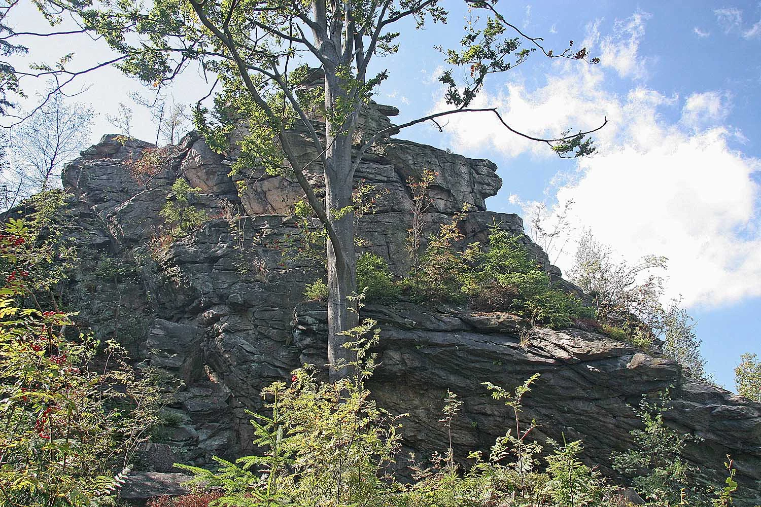
A large, craggy rock formation surrounded by trees under a partly cloudy sky.
The Malinská skála rock formation in the Žďárské vrchy landscape area.

Malinská skála conservation status and protection priorities

The principal conservation value of Malinská skála lies in its geomorphology. The protected area preserves a textbook example of frost weathering and boulder-stream formation on the highest gneiss ridges of the Žďárské vrchy, making it an important reference site for understanding the long-term evolution of the Czech-Moravian Highlands under cold-climate conditions.

Beyond its geological importance, the natural monument contributes to the broader ecological network of the CHKO Žďárské vrchy by protecting old-growth forest patches, lichen communities on exposed rock and habitats for specialized bird species. Climbing routes and other recreational uses are regulated, with climbing generally restricted to the second half of the year, allowing natural processes and nesting wildlife to persist with minimal disturbance. The site exemplifies how a very small protected area can hold disproportionate scientific and ecological significance when it safeguards rare landforms and the habitats associated with them.

Top sights and standout views in Malinská skála

A summit rock group of named gneiss towers rising up to 20 meters above the forest; one of the best panoramic viewpoints in the Žďárské vrchy, with visibility extending on clear days to the Orlické hory and Krkonoše; a clear demonstration of frost-shattered boulder fields on the Czech-Moravian Highlands; a year-round recreational focus that links hiking, climbing, cycling and cross-country skiing on a shared trail network.
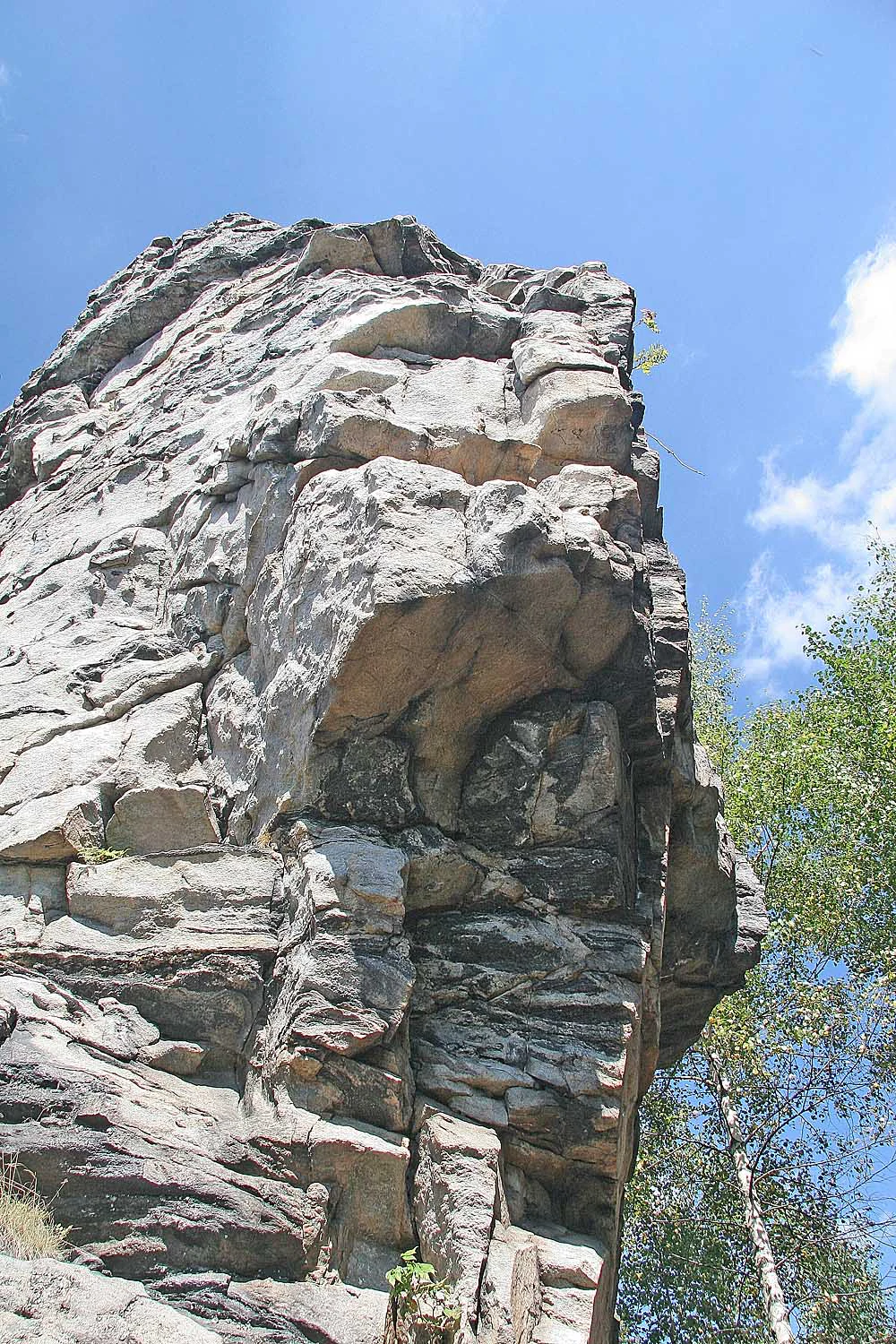
A low angle view of the rugged Malinska skala rock formation against a clear blue sky with some green trees on the right.
The prominent rock formation of Malinska skala in the Zdarske vrchy region.

Best time to visit Malinská skála

Late spring through early autumn offers the most rewarding combination of stable footing on trails, clear views from the summit and the warmest conditions for exploring the surrounding rock formations. In summer, the longer days and typically low humidity of the upland maximize the chances of seeing the distant mountain ranges across the horizon. Winter transforms the site into a quieter destination for cross-country skiing and snowshoeing, when snow accumulation can reveal the sculptural outlines of the rock walls against an open white landscape, though some rocky sections may be slippery and access depends on conditions.

Monthly climate preview

Track monthly temperature ranges and precipitation averages across the protected terrain

Malinská skála Climate Normals and Long-Term Weather by Month

Representative coordinate sampling records the annual temperature progression and daily precipitation rates from 1991 through 2020. Examining the complete monthly climate profile reveals detailed temperature bounds and precipitation rhythms across the protected area.
Annual mean7 °C
-4 °C18 °C
Jan-4°
Feb-2°
Mar
Apr
May12°
Jun16°
Jul18°
Aug18°
Sep13°
Oct
Nov
Dec-3°
Warmest month
July

18.5 °C

Coolest month
January

-3.8 °C

Wettest month
July

2.8 mm/day

Driest month
February

1.2 mm/day

Park location guide

Geography guide, regional context, and park location map for Malinská skála

Malinská skála park geography, regions, and map view in Czechia

Understand where Malinská skála sits in Czechia through a broader geographic reading of the surrounding landscape, nearby location context, and its mapped position within the national park landscape.

How Malinská skála fits into Czechia

Czech Republic is a landlocked Central European country with a population of approximately 10.9 million people. The nation was established as an independent state on January 1, 1993, following the dissolution of Czechoslovakia. Its capital and largest city is Prague, with other major urban centers including Brno, Ostrava, Plzeň, and Liberec.

Wider geography shaping Malinská skála in Czechia

The Czech Republic is a landlocked country in Central Europe. It is bordered by Germany to the west, Austria to the south, Poland to the northeast, and Slovakia to the southeast. The landscape is predominantly hilly, with the territory covering 78,871 square kilometers.

Map view of Malinská skála

Use this park location map to pinpoint Malinská skála in Czechia, understand its exact geographic position, and read its mapped placement within the surrounding landscape more clearly.

Pigeon | © OpenStreetMap contributors

Explore detailed imagery of rocky peaks, alpine viewpoints, and forest environments across the upland terrain.

Malinská skála Photos and Landscapes: Visualizing the Protected Gneiss Formations

Visual records capture the dramatic gneiss rock towers, boulder fields, and forested ridges that define the protected landscape character of Malinská skála. Examining these high-resolution environmental photographs reveals the unique geological features and expansive upland panoramas of the reserve.

Rugged, weathered grey rock cliffs forming a vertical crevice against a clear bright blue sky, with bright green foliage in the foreground and to the side.

A high angle view from a rocky outcrop overlooking a dense evergreen forest that stretches toward rolling hills in the distance under a clear sky.

A large, craggy gray rock formation rises above a dirt trail, with evergreen trees and sparse vegetation surrounding its base under a partly cloudy sky.

A large, craggy rock outcrop partially covered in snow and ice, surrounded by bare trees under a cloudy sky.

A large, craggy rock formation surrounded by trees under a partly cloudy sky.

A high-angle view looking over a patchwork of green meadows, small farmhouses, and dense coniferous forests in the Czech countryside.

A low angle view of the rugged Malinska skala rock formation against a clear blue sky with some green trees on the right.

Park atlas

Compare regional protected areas and adjacent upland terrain across the highlands

Explore Other Parks Near Malinská Skála and Connected Protected Landscapes

Browsing nearby parks helps place Malinská skála within the wider geological context of the surrounding region. Comparing adjacent protected landscapes reveals broader patterns in upland terrain and forest ecosystems.
A soft watercolor illustration featuring rolling hills in pink and green tones with stylized coniferous trees, set against a white background.
Natural monumentPardubický kraj
About 6.4 km away#1 closest

Northeast

Rybenské Perničky: Natural Monument and Geological Landmark of the Bohemian-Moravian Highlands

Geological rock outcrops and protected upland terrain in the Pardubice Region

Investigate the geological structure of Rybenské Perničky, a protected natural monument featuring unique orthogneiss outcrops and characteristic bowl-shaped weathering basins. Situated in the Pardubice Region, this site offers a focused look at the crystalline rock formations and undulating plateau terrain of the Bohemian-Moravian Highlands, providing essential geographic context for this noteworthy natural landmark.

Area
0.141 km²
Established
1980
Relief
Upland
Climate
Temperate
A watercolor painting showing a soft landscape of rolling hills, grassy meadows, and patches of vegetation in a pastel color palette.
Natural monumentKraj Vysočina
About 7.7 km away#2 closest

Southwest

Sklenské louky Natural Monument: Wetland Landscapes in Kraj Vysočina

Highland geography and protected peatland habitats

Sklenské louky functions as a concentrated nature monument within the Kraj Vysočina region, preserving vital moisture-loving vegetation and peat-based ecosystems. The terrain features a characteristic mix of open meadows and spruce groupings, illustrating the diverse landscape character of the Bohemian-Moravian Highlands. This protected area provides a clear view into the region's unique upland hydrological and botanical patterns.

Area
0.063 km²
Established
1985
IUCN
IV
Relief
Upland
Natural monumentKraj Vysočina
About 8.4 km away#3 closest

South

Vávrova skála Natural Monument: Geological Exploration in the Kraj Vysočina Region

Metamorphic rock outcrops and highland protected habitats

Vávrova skála stands as a protected natural monument near Pohledec, showcasing a distinct orthogneiss formation shaped by Quaternary weathering. This site serves as a vital reference for the geological diversity of the Bohemian-Moravian highlands, protecting rare summit heath and dry grassland within the larger Žďárské vrchy protected landscape.

Area
0.001 km²
Established
1983
IUCN
III
Relief
Upland
A soft watercolor painting showing a quiet pond landscape with grassy banks, reeds, and distant trees against a pale background.
Nature reservePardubický kraj
About 15 km away#4 closest

Northwest

Ratajské rybníky Protected Nature Reserve: Highland Wetland Geography and Mapped Boundaries

A core wetland refuge for rare flora and fauna in the Pardubický kraj region

The Ratajské rybníky reserve represents a vital highland wetland ecosystem characterized by its three connected fishponds and surrounding quaking bogs. This mapped protected area provides an essential habitat for endangered butterfly populations, the rare moss Hamatocaulis vernicosus, and dense amphibian breeding grounds, set against the backdrop of the forested Železné hory mountain ridge.

Established
1990
IUCN
IV
Relief
Upland
Climate
Temperate
A soft watercolor painting of a serene landscape featuring a calm lake surrounded by trees and gentle rolling hills in the background.
Natural monumentKraj Vysočina
About 17 km away#5 closest

Southwest

Rozštípená skála Natural Monument: Geological Mapping of the Vysočina Gneiss Outcrops

Protected rocky terrain in the Bohemian-Moravian Highlands

Rozštípená skála features a striking gneiss cliff formation split by long weathered fissures. Located in the Vysočina Region, this natural monument provides a focal point for understanding the geological patterns and river valley landscapes that define the mid-altitude terrain of the Czech Republic.

Area
0.008 km²
Established
1974
IUCN
III
Relief
Upland
A soft, horizontal watercolor painting showing a green meadow in the foreground leading to a line of trees and distant rolling hills.
Natural monumentKraj Vysočina
About 18 km away#6 closest

Southeast

Na Ostrážné Natural Monument: Geographic Boundaries and Protected Meadow Landscapes

A vital Natura 2000 site in the Bohemian-Moravian Highlands

The Na Ostrážné natural monument encompasses a compact meadow ecosystem situated on an ecologically expressive slope. This area serves as a critical refuge for rare invertebrate species, maintaining traditional grassland characteristics within the Svratecká hornatina. Its status as both a national monument and a European site makes it a key focus for understanding habitat preservation in the Vysočina Region.

Area
0.014 km²
Established
2015
IUCN
IV
Relief
Upland
A watercolor painting of a soft, rolling landscape with green hills, patches of trees, and a pale sky.
Natural monumentPardubický kraj
About 20 km away#7 closest

Northeast

Sněženky ve Vysokém lese: Exploring the Protected Natural Monument and Forest Geography

A small-scale Bohemian botanical reserve and valley landscape

Located in the Svitavy district of Pardubický kraj, Sněženky ve Vysokém lese is a natural monument dedicated to preserving a dense, naturally occurring population of wild snowdrops. The protected hollow, carved into the broader Vysoký les spruce woodland, illustrates how specific moisture conditions and soil patterns create essential habitats for rare local wildflowers within the Czech landscape.

Area
0.022 km²
Established
1994
IUCN
IV
Relief
Upland
Nature reserveKraj Vysočina
About 23 km away#8 closest

Southeast

Pyšolec Nature Reserve: Protected Forest Geography and Mapped Terrain in Kraj Vysočina

Biodiverse woodland and historic castle ruin protected area

Pyšolec is a significant nature reserve characterized by mature broadleaf forests and steep, rocky terrain in the Czech Vysočina Region. The site provides a critical habitat for specialized invertebrates and rare species within its unique forest-castle mosaic, mapped here for geographic context and ecological study.

Area
0.342 km²
Established
2021
IUCN
IV
Relief
Upland

Common questions about visiting, size, designation, and location context for Malinská skála

Malinská skála FAQs for park facts, access, geography, and protected area context

Find quick answers about Malinská skála, including protected-area facts, park geography, trail and visitor context, and how the park fits into its surrounding country and regional landscape.
MoriAtlas Explorer

Continue Your Protected Areas Search Across the Global Atlas

Deepen your exploration by continuing the structured search for national parks and protected areas worldwide. Utilize the comprehensive filtering capabilities to compare different conservation landscapes and refine your understanding of global park geography. Discover more about the distribution and characteristics of protected natural areas.

Global natural geography