
Mori Atlas logo
Protected areaMeulenwald

Tracing the sandstone topography and exotic botanical transitions across the Moselle Eifel region.

Meulenwald Protected Landscape: A Geographical Atlas of the Eifel Forested Hill Range

The Meulenwald serves as a significant protected forested range within the Eifel, characterized by its Buntsandstein geology and the transition between dense southern pine woodlands and the open northern Heckenland mosaic. Located between the Kyll and Salm river systems, this landscape features a unique internal topography of ridges, sheltered valleys, and an extensive arboretum containing over 350 exotic tree species. Beyond its ecological role, the range stands as a defined recreational and cultural landmark near the city of Trier.

EifelBuntsandsteinsandstonelow mountain rangemixed forestpine forest
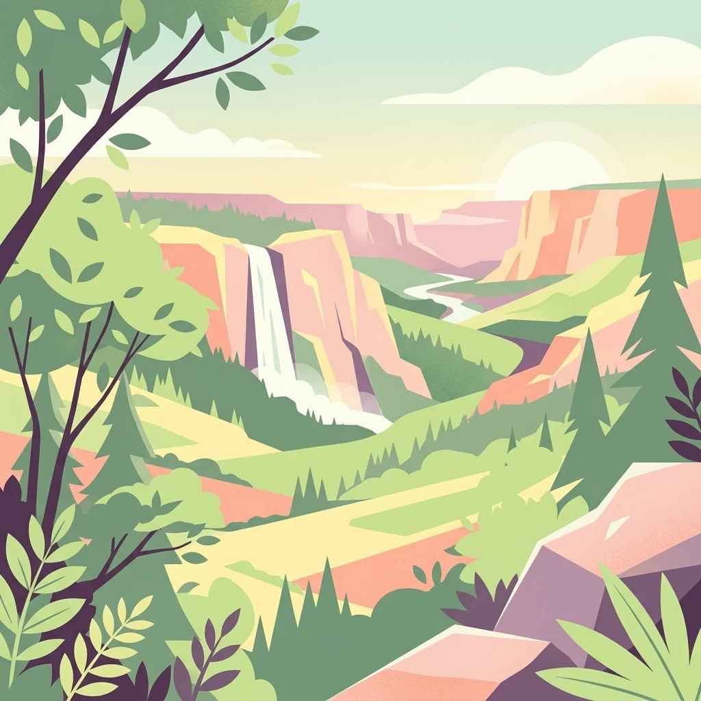
Stylized vector illustration showing a mountainous valley with a waterfall, winding river, and surrounding forests under a soft sunset sky.

Meulenwald

Protected area

Park overview

Structured park overview, official facts, and landscape profile for Meulenwald

Meulenwald park facts, protected area profile, and essential visitor context

Review the core facts for Meulenwald, including designation, size, terrain, visitor scale, habitats, and operating context in one park-focused overview.

About Meulenwald

The Meulenwald stretches as part of the Moselle Eifel from the northern outskirts of the city of Trier in the southwest to the Wittlich Basin near Salmtal in the northeast. It sits between the communities of Zemmer to the west and Hetzerath to the east, and its slopes descend toward the Kyll river in the southwest and the Salm river in the northeast, both tributaries of the Moselle. Internally, the range is drained by the Quintbach and Föhrenbach, which flow toward the Moselle, as well as the Bendersbach, which flows toward the Salm. The Meulenwald is thus geographically embedded in a transitional zone where the forested uplands of the Eifel meet the deeply cut valleys of the Moselle river system.

Geologically, the Meulenwald is built on red sandstone (Buntsandstein), which gives it its reddish soils and characteristic gentle to moderately rugged topography. Its highest peak, the Kellerberg, reaches approximately 449 meters above sea level, followed by other named summits such as the Steinenberg, Zoonenberg, Heidekopf, Römerberg, and the lower Rothenberg near Quint and Issel. The combination of sandstone geology, varied elevation, and a position between major river valleys produces a landscape of mixed woodland, narrow valleys, and small plateau-like areas that define the visual and ecological character of the range.

Ecologically, the forest shows a clear north-to-south gradient. The southern part is almost continuously forested, with pine as the characteristic tree, while the northern part opens up into the so-called Heckenland, where woodland is interspersed with shrub-rich clearings and hedgerows. This mosaic supports a rich variety of habitats and contributes to the biodiversity that prompted the forest's landscape protection designation and its national recognition as Forest Area of the Year.

The Meulenwald also holds scientific and educational significance due to the exotic tree collection near Trier-Quint. Planted largely in the 1950s, this collection includes species from North America, East Asia, the Caucasus, and the Mediterranean, giving the forest an unusual character that blends native Central European woodland with a living experiment in global arboreal diversity. A roughly 3.8-kilometer circular trail near the Forsthaus in der Quint now allows visitors to explore many of these specimens.

Quick facts and research context for Meulenwald

The Meulenwald is a Buntsandstein (red sandstone) hill range in the southern Eifel, located in Rhineland-Palatinate, Germany. It spans parts of the Trier-Saarburg district, the Bernkastel-Wittlich district, and the city of Trier. Its highest point is the Kellerberg at roughly 449 meters above sea level. Within Germany's natural region classification, it forms a distinct sub-unit (270.7) within the Moselle Eifel main unit, part of the broader Osteifel group. Portions of the forest are protected under the Meulenwald und Stadtwald Trier landscape protection area, designated in 1990 and covering about 133 square kilometers. In 2012, the Meulenwald was named Germany's first "Forest Area of the Year" by the Bund Deutscher Forstleute.

Protection and recognition

Documented conservation records, registry identifiers, and protected area designations.

Meulenwald Protection Status and International Recognition Data

Examine the official protection status, management framework, and international recognition records established for Meulenwald. Review the verified database entries, designation history, and administrative classifications associated with the protected landscape.

Protection details

WDPA ID
322963
Park context

Deeper park guide and search-rich context for Meulenwald

Meulenwald history, landscape, wildlife, and travel context

Explore Meulenwald through its history, landscape character, ecosystems, wildlife, conservation priorities, cultural context, and seasonal travel timing in a structured park guide built for atlas discovery and search intent.

Why Meulenwald stands out

The Meulenwald is best known for two complementary features: its extensive native woodland landscape of pine and mixed forest transitioning into the traditional Heckenland mosaic of woodland and shrubby clearings, and its unusual collection of more than 350 exotic tree species concentrated near Trier-Quint. This exotic arboretum stands out for containing roughly 40 giant sequoias, including dawn redwoods once thought extinct, as well as Douglas firs reaching heights of up to 65 meters, which are widely regarded as the tallest trees in Rhineland-Palatinate. The forest is also recognized for its protected landscape status and its selection as Germany's inaugural Forest Area of the Year in 2012.
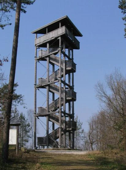
A tall wooden observation tower with a zigzagging staircase stands in a clearing within a forest under a clear blue sky.
The Kellerberg observation tower, a wooden lookout structure in the Meulenwald region.

Meulenwald history and protected-area timeline

The Meulenwald does not have a dramatic formal protection history in the sense of a national park founding, but it has gained modern recognition through landscape protection and symbolic cultural honors.

Large parts of the Meulenwald, together with the adjacent Stadtwald Trier (Trier city forest), were designated as a protected landscape area (Landschaftsschutzgebiet) in 1990 under the designation Meulenwald und Stadtwald Trier. This designation recognized the joint ecological, scenic, and recreational value of the forest and the Trier municipal woodland, covering an area of roughly 133 square kilometers and reflecting decades of growing awareness of the forest's importance in the regional landscape.

In 2012, the Bund Deutscher Forstleute (BDF) named the Meulenwald the first Forest Area of the Year (Waldgebiet des Jahres) in Germany. The award was explicitly created that year as a recurring national brand, designed to draw public attention to the beauty, biodiversity, and human usefulness of forest landscapes across the country. The Meulenwald's selection marked the beginning of an ongoing annual tradition of honoring German forests.

Beyond modern conservation history, the forest carries older cultural and legendary associations. According to local tradition, Archbishop Milo of Trier (circa 718 to 758), son of Archbishop Liutwin, died in a hunting accident in the Meulenwald, and his spirit is said to haunt the area. Another legend speaks of the spirit of a Roman governor, Rictius Varus, a 3rd-century persecutor of Christians, also said to roam the forest. While these legends are not historical evidence, they form part of the long-standing cultural memory associated with the Meulenwald in the Trier region.

Meulenwald landscape and geographic character

The Meulenwald is a relatively compact but visually varied hill range with a Buntsandstein (red sandstone) geological base. Its profile is dominated by gently rounded ridges and summits rather than sharp peaks, with the highest point, the Kellerberg, reaching approximately 449 meters above sea level near Dierscheid. The Steinenberg, Zoonenberg, Heidekopf, Römerberg, and Rothenberg form a scattered chain of summits that give the forest its characteristic relief.

The range's position between two major river systems, the Kyll to the southwest and the Salm to the northeast, both of which feed into the Moselle, means that the forest's flanks gradually descend into deeply incised tributary valleys. Within the Meulenwald itself, small streams such as the Quintbach, Föhrenbach, and Bendersbach cut narrow valleys through the sandstone, creating a varied internal topography of ridges, sheltered valleys, and small plateau-like sections.

This sandstone-based terrain produces reddish soils and supports a forest landscape with a distinctive dual character: dense, almost continuous woodland in the south, and a more open Heckenland mosaic of woodland interspersed with shrubby clearings, hedgerows, and former agricultural land in the north. The contrast between the closed southern forest and the open, hedgerow-rich northern landscape is one of the defining visual identities of the Meulenwald.

Meulenwald ecosystems, habitats, and plant life

Ecologically, the Meulenwald functions as a transitional landscape between the higher, more montane parts of the Eifel and the warmer, lower-lying Moselle valley. Its sandstone geology and varied topography create a patchwork of habitats, including dense coniferous and mixed forest in the south, more open woodland-clearings in the north, and valley-edge habitats along its numerous small streams.

The southern, more heavily forested portion is dominated by pine, which has adapted well to the relatively dry, acidic sandstone soils typical of Buntsandstein landscapes in this part of the Eifel. The northern Heckenland section, by contrast, is characterized by a dynamic mosaic of forest patches and shrub-rich clearings, with hedgerows and bushy margins that increase habitat diversity and edge effects. This structural diversity is widely recognized as an important element of the forest's ecological value and contributed to its selection as a protected landscape.

In addition to its native woodland, the Meulenwald hosts one of the most unusual arboreal collections in Germany. Near Trier-Quint, more than 350 exotic tree species were planted largely in the 1950s as a scientific and observational planting. The collection includes Douglas firs, giant sequoias, dawn redwoods, Nordmann firs from the Caucasus, Japanese larches, and many others. The presence of extraordinarily tall Douglas firs, reaching up to 65 meters in height and regarded as the tallest trees in Rhineland-Palatinate, makes this section of the forest ecologically distinctive in a national context.

Meulenwald wildlife and species highlights

The Meulenwald is primarily a forest ecosystem whose wildlife value is closely tied to its habitat structure rather than to any single flagship species. Because the Meulenwald is not documented as a national park or strict nature reserve, detailed fauna inventories are not central to the available source material. As a result, a detailed species-by-species wildlife profile cannot be reliably constructed from the current source.

That said, the forest's structural diversity, ranging from dense pine-dominated stands in the south to the hedgerow-rich woodland-open-land mosaic in the northern Heckenland, supports a range of woodland and edge-adapted species typical of the southern Eifel. Mixed forest, exposed sandstone ridges, bushy clearings, and small stream valleys each offer distinct conditions for birds, small mammals, and invertebrates. The protected landscape status of the Meulenwald reflects, among other values, the importance of maintaining this mosaic for regional biodiversity.

Meulenwald conservation status and protection priorities

The Meulenwald's principal conservation significance lies in its formal recognition as part of the Meulenwald und Stadtwald Trier protected landscape area (Landschaftsschutzgebiet), designated in 1990. This designation covers roughly 133 square kilometers and reflects the joint ecological, scenic, and recreational value of the Meulenwald and the adjacent Trier city forest. While the protected landscape status is a less restrictive category than a national park or nature reserve, it provides the framework within which the forest's character is maintained.

In addition, the nearby Ried am Föhrenbach nature reserve, designated in 1991, lies in close southeastern proximity to the Meulenwald and adds a complementary layer of stricter habitat protection to the broader regional landscape. Together, these designations underline the region's importance for protecting sandstone woodland, hedgerow mosaics, and valley habitats in the transition zone between the Eifel and the Moselle valley.

The Meulenwald's broader conservation recognition reached a national level in 2012, when the Bund Deutscher Forstleute selected it as Germany's first Forest Area of the Year. This award emphasized the forest's biodiversity, its scenic qualities, and its value as a recreational landscape close to the city of Trier, helping to raise public awareness of the importance of forests beyond strict protected-area categories.

Meulenwald cultural meaning and human context

The Meulenwald sits within a culturally rich region shaped by its proximity to Trier, one of Germany's oldest cities, with Roman, medieval, and ecclesiastical layers of history. The forest itself has long been woven into local legends and oral tradition.

According to local legend, Archbishop Milo of Trier (718 to 758), son of Archbishop Liutwin, died in a hunting accident in the Meulenwald, and his spirit is said to continue to haunt the forest. A separate tradition links the Meulenwald to a Roman-era figure, Rictius Varus, described as a Roman governor and persecutor of Christians in the 3rd century, whose ghost is also said to linger in the woods. While these stories are not historical evidence, they reflect a long-standing cultural association between the forest, the nearby city of Trier, and figures from both ecclesiastical and Roman history.

In modern times, the Meulenwald also plays a recreational and educational role for the urban population of Trier and surrounding municipalities. Forest paths, viewpoints such as the Kellerberg observation tower, and the exotic tree trail near the Forsthaus in der Quint make the forest an accessible cultural and natural landscape for residents and visitors alike.

Top sights and standout views in Meulenwald

The Meulenwald combines the character of a traditional German low-mountain forest with an unusually rich collection of exotic trees, making it distinctive at both regional and national levels. Its sandstone-based landscape transitions from continuous pine-dominated forest in the south to the open Heckenland mosaic in the north, providing a clear and visually striking ecological gradient within a relatively compact area.

At the same time, the exotic tree collection near Trier-Quint, with more than 350 species, including giant sequoias and towering Douglas firs recognized as some of the tallest trees in Rhineland-Palatinate, gives the forest a unique botanical character rarely found elsewhere in Germany. Combined with its protected landscape status and its role as Germany's inaugural Forest Area of the Year in 2012, the Meulenwald stands out as a forest landscape of both ecological and cultural importance in the southern Eifel.

Best time to visit Meulenwald

As a forested sandstone hill range with a continental-influenced Central European climate, the Meulenwald shows clear seasonal variation. Late spring and early summer typically bring the most lush vegetation, full canopy, and comfortable temperatures for hiking and viewing exotic tree collections such as the one near the Forsthaus in der Quint. Autumn offers a different appeal, with leaf color changes in the mixed and broadleaf portions of the forest and cooler, often clearer conditions for panoramic views from higher points such as the Kellerberg observation tower.

Winter visits emphasize the structural character of the pine-dominated southern forest, with bare deciduous trees in the northern Heckenland opening up views across the mosaic landscape. Because the source material does not contain specific seasonal access or operational details, broader evergreen patterns are emphasized here rather than precise month-by-month recommendations.

Monthly climate preview

Track monthly temperature ranges and precipitation averages across the representative coordinate.

Meulenwald Climate Normals, Long Term Temperature and Precipitation Patterns

Long term data records reveal marked shifts in average monthly temperatures and daily precipitation rates across the representative coordinate. Reviewing the complete twelve month profile provides deeper insight into measured meteorological patterns and long term climate behavior.
Annual mean9 °C
0 °C18 °C
Jan
Feb
Mar
Apr
May12°
Jun16°
Jul18°
Aug18°
Sep14°
Oct
Nov
Dec
Warmest month
July

18.2 °C

Coolest month
January

-0.3 °C

Wettest month
December

2.5 mm/day

Driest month
April

1.6 mm/day

Park location guide

Geography guide, regional context, and park location map for Meulenwald

Meulenwald park geography, regions, and map view in Germany

Understand where Meulenwald sits in Germany through a broader geographic reading of the surrounding landscape, nearby location context, and its mapped position within the national park landscape.

How Meulenwald fits into Germany

Germany is a federal republic in Western and Central Europe with a population of over 83 million across sixteen constituent states. It is Europe's largest economy by nominal GDP and a major global exporter and importer. The capital is Berlin, and the country borders Denmark, Poland, Czech Republic, Austria, Switzerland, France, Luxembourg, Belgium, and the Netherlands.

Wider geography shaping Meulenwald in Germany

Germany is located in Western and Central Europe, spanning 357,022 km². It borders Denmark to the north, Poland and the Czech Republic to the east, Austria and Switzerland to the south, and France, Luxembourg, Belgium, and the Netherlands to the west. The country has coastlines on the Baltic Sea and North Sea to the north, with the Alps located in the southern region.

Map view of Meulenwald

Use this park location map to pinpoint Meulenwald in Germany, understand its exact geographic position, and read its mapped placement within the surrounding landscape more clearly.

Pigeon | © OpenStreetMap contributors

Explore Meulenwald photos showcasing sandstone terrain, native pine woodland, and exotic tree arboretums.

Meulenwald Landscapes and Scenery: Visualizing the Protected Forest Environment

Visual records capture the distinctive character of Meulenwald, highlighting dense southern forests and the open northern Heckenland mosaic. Photographic documentation provides clear insight into regional topography, geological formations, and protected-area habitats.

A tall wooden observation tower with a zigzagging staircase stands in a clearing within a forest under a clear blue sky.

A wide, elevated view from a wooden observation platform looking out over dense green forest, fields, and rolling hills at twilight.

Park atlas

Compare adjacent forest reserves, regional hill ranges, and protected natural terrain.

Explore Other Parks Near Meulenwald and Surrounding Protected Landscapes

Continue geographic comparison by browsing other protected areas located near Meulenwald and the surrounding regional uplands. Examining adjacent woodland terrain and nearby reserves provides broader context for understanding low-mountain conservation landscapes.
Watercolor illustration of a lush wetland landscape with reed beds, rolling green hills, and soft pastel colors.
Nature reserveRheinland-Pfalz
About 2.3 km away#1 closest

Southeast

Ried am Föhrenbach Nature Reserve: Geographic Overview and Protected Wetland Boundaries

Wetland mosaic and reedbed landscape in Rhineland-Palatinate

The Ried am Föhrenbach nature reserve in Rhineland-Palatinate encompasses a unique, elongated strip of wetland terrain along the Föhrenbach stream. Known for its extensive common reed stands and moist grassland, this protected area acts as a vital environmental buffer and habitat refuge within the regional landscape, set against the backdrop of the Moselle hill country and major transport infrastructure.

Area
0.465 km²
Established
1991
Relief
Lowland
Scope
Terrestrial
Nature reserveRheinland-Pfalz
About 14 km away#2 closest

Northeast

Mesenberg bei Wittlich Nature Reserve: Protected Landscape and Habitat Map in Rhineland-Palatinate

Examining the sand-rich mosaics and woodland gradients of the Wittlicher Senke

Mesenberg bei Wittlich represents a structurally diverse nature reserve in Rhineland-Palatinate, Germany. The area contains a rare density of shifting sand pioneer communities, dry grasslands, and deadwood-rich deciduous forest. By maintaining these fine-grained ecological gradients, the protected land provides a critical window into the historical landscape characteristics of the Eifel foothills.

Area
1.52 km²
Established
2004
Relief
Lowland
Scope
Terrestrial
A minimalist watercolor painting featuring soft, abstract layers of green hills, purple distant ridges, and a pale yellow sky against a white background.
Nature reserveRheinland-Pfalz
About 15 km away#3 closest

Southwest

Gillenbachtal Nature Reserve: Geography and Protected Woodland Boundaries in Rheinland-Pfalz

A rare forest gorge and orchid habitat near the city of Trier.

Trace the boundaries and ecological features of Gillenbachtal, a designated nature reserve characterized by its steep-sided forest gorge and varied microclimates. This area serves as a critical protected enclave featuring deadwood habitats, limestone outcrops, and traditional orchard meadows that contrast with the urban development of nearby Trier.

Area
38.49 km²
Established
1995
Watercolor painting of a rolling green forest landscape with a winding path and soft, abstract hills in the background.
Nature reserveRhineland-Palatinate
About 17 km away#4 closest

Southwest

Mattheiser Wald Nature Reserve: A Protected Forest Landscape in Rhineland-Palatinate

Ecological mapping of urban forest and valley terrain

Mattheiser Wald represents a vital nature reserve and Natura 2000 site in the Trier region. The area is characterized by high-value oak and hornbeam woodland, abandoned military disturbance zones that host rare wildlife, and an intricate stream valley system. This atlas entry provides a detailed look at the reserve's topography and its status as a critical conservation landscape within an urban environment.

Area
4.47 km²
Established
2003
Relief
Upland
Climate
Temperate
Watercolor painting of a green, rolling hillside landscape with faint pink floral details in the foreground.
Nature reserveRheinland-Pfalz
About 25 km away#5 closest

Southwest

Perfeist bei Wasserliesch: Protected Grassland and Botanical Mapping in Rheinland-Pfalz

A regional sanctuary for rare orchids and calcareous meadow flora.

Perfeist bei Wasserliesch represents a significant protected area within the German Moselle landscape. Spanning 22 hectares of dry, sun-exposed calcareous soil on the Liescher Berg, the reserve offers a focused look at open grassland ecology. Its unique status as a botanical reference point highlights how small-scale protected land maintains rare plant species and fragile meadow habitats against the backdrop of the surrounding Moselle valley hill country.

Area
0.22 km²
Established
1986
Nature reserveRhineland-Palatinate
About 25 km away#6 closest

Southwest

Wiltinger Saarbogen: Mapping the Natural Saar River Meander and Floodplain Habitats

A critical protected nature reserve in the Rhineland-Palatinate river landscape.

Wiltinger Saarbogen remains a rare, natural river arc within the Saar valley. This protected area offers a deep look into riverine geography, featuring a concentrated mosaic of gravel banks, reed-fringed wetlands, and riparian forests that stand in contrast to the engineered shipping canals of the region.

Area
1.67 km²
Established
1997
A horizontal watercolor painting depicting a calm lake surrounded by rolling hills and soft greenery, with a purple-toned ridgeline in the distance.
Nature reserveRheinland-Pfalz
About 26 km away#7 closest

North

Meerfelder Maar Nature Reserve: Volcanic Basin and Protected Eifel Landscape Mapping

Detailed volcanic crater geography and lake basin analysis

Discover the geological structure and protected habitats of Meerfelder Maar. This classic Eifel crater lake spans roughly 125 hectares, combining open water with fringing wetlands and forested slopes to create a unique natural landmark in Rheinland-Pfalz.

Area
2.6 km²
Established
1985
IUCN
IV
Relief
Upland
Watercolor painting of a forested landscape with rolling hills and distant mountains under a pale sky
National parkSaarland
About 26 km away#8 closest

Southeast

Hunsrück-Hochwald National Park: Saarland Protected Area Atlas and Landscape Context

Explore the mapped terrain and protected geography of this German national park.

Delve into the specific geography and protected landscape of Hunsrück-Hochwald National Park in Saarland. This detail page provides an atlas-centric view of the park's mapped boundaries, regional context, and its role as a national park. It serves as a foundational point for understanding the park's landscape features and its placement within the broader geographic atlas.

Area
100 km²
Established
2015
IUCN
II
Relief
Mountain

Common questions about visiting, size, designation, and location context for Meulenwald

Meulenwald FAQs for park facts, access, geography, and protected area context

Find quick answers about Meulenwald, including protected-area facts, park geography, trail and visitor context, and how the park fits into its surrounding country and regional landscape.
MoriAtlas Explorer

Continue Your Protected Areas Search Across the Global Atlas

Deepen your exploration by continuing the structured search for national parks and protected areas worldwide. Utilize the comprehensive filtering capabilities to compare different conservation landscapes and refine your understanding of global park geography. Discover more about the distribution and characteristics of protected natural areas.

Global natural geography