
Mori Atlas logo
National parkHunsrück-Hochwald National Park

Discover the mapped boundaries and geographic context of this Saarland national park.

Hunsrück-Hochwald National Park: Saarland's Protected Landscape for Atlas Exploration

(Nationalpark Hunsrück-Hochwald)

Hunsrück-Hochwald National Park represents a significant protected natural area within the Saarland region of Germany. This page offers an atlas-driven exploration of its protected landscape, focusing on its mapped boundaries and its place within the broader regional geography. Users can visually understand the park's setting and its significance as a designated national park, leveraging MoriAtlas for structured geographic discovery.

national parkGermanylow mountain rangebeech forestmoorlandupland forest
Stylized illustration showing a river flowing through a forested valley with mountains in the background

Hunsrück-Hochwald National Park

National park

Park overview

Structured park overview, official facts, and landscape profile for Hunsrück-Hochwald National Park

Hunsrück-Hochwald National Park park facts, protected area profile, and essential visitor context

Review the core facts for Hunsrück-Hochwald National Park, including designation, size, terrain, visitor scale, habitats, and operating context in one park-focused overview.

About Hunsrück-Hochwald National Park

Hunsrück-Hochwald National Park occupies a distinctive position in Germany's system of protected areas as the newest and only national park spanning both Rhineland-Palatinate and Saarland. The park was established through a state treaty between the two federal states in 2014, with official opening celebrations held during the Pentecost weekend of 2015. The creation of the park fulfilled a long-held ambition to protect the remaining wild areas of the Hunsrück highlands and connect them to the broader ecological network of central European forests.

The park's mission, as defined by the National Park Act, aims to allow natural processes to unfold without human intervention across 75 percent of its territory. This ambitious goal distinguishes Hunsrück-Hochwald from many older German national parks that still contain significant managed forest areas. The park is organized into wilderness zones where development is already occurring naturally, development zones that are being actively restored toward wilderness conditions over a 30-year period, and a surrounding maintenance zone that buffers the core wilderness areas and preserves culturally valuable semi-natural landscapes such as traditional orchard meadows and species-rich grasslands.

Beyond pure nature conservation, the park is designed to serve as an economic and cultural catalyst for the surrounding rural region. The National Park Act explicitly calls for the park to promote sustainable tourism, support local value chains in forestry and agriculture, and strengthen regional cooperation. Three visitor centers, called Nationalparktore, are planned to provide gateway experiences for visitors, with the Hunsrückhaus at Erbeskopf already operational.

Quick facts and research context for Hunsrück-Hochwald National Park

Hunsrück-Hochwald National Park covers roughly 10,000 hectares across two German states, making it the sixteenth national park in Germany and the newest. The park protects the Idarwald and Schwarzwälder Hochwald mountain regions at elevations between 400 and 700 meters above sea level. The climate features annual precipitation exceeding 800 millimeters and average temperatures around 8°C. The park is administered by a dedicated National Park Office based in Birkenfeld with a secondary office in Nonnweiler, and is embedded within the larger 2,055 square kilometer Naturpark Saar-Hunsrück. The Saar-Hunsrück-Steig long-distance hiking trail traverses the park.

Protection and recognition

Documenting terrestrial designation and management framework for the protected landscape

Protection Status and Land Designation of Hunsr'uck-Hochwald National Park

Map data outlines the terrestrial protection status and conservation framework governing Hunsr'uck-Hochwald National Park. Documented designation records clarify how the terrestrial zone fits into broader regional preservation networks and conservation databases.

Protection details

Protection scope
Terrestrial
Transboundary protection
No
Park context

Deeper park guide and search-rich context for Hunsrück-Hochwald National Park

Hunsrück-Hochwald National Park history, landscape, wildlife, and travel context

Explore Hunsrück-Hochwald National Park through its history, landscape character, ecosystems, wildlife, conservation priorities, cultural context, and seasonal travel timing in a structured park guide built for atlas discovery and search intent.

Why Hunsrück-Hochwald National Park stands out

Hunsrück-Hochwald is best known as Germany's newest national park, representing a modern approach to wilderness restoration in the densely forested central European low mountain ranges. The park is renowned for its extensive beech-dominated forests, of which the potential natural vegetation would be acid-loving beech forest on quartzite substrates. The landscape features distinctive hangmoors, or elevated bogs, that have formed on the slopes of the quartzite ridges, along with rare block slope formations from the glacial period. The European wildcat, a rare and elusive predator, has established populations in the park's extensive old-growth forest areas. The park also contains the Ringwall von Otzenhausen, an ancient Celtic fortification site that provides a window into the region's prehistoric human occupation.
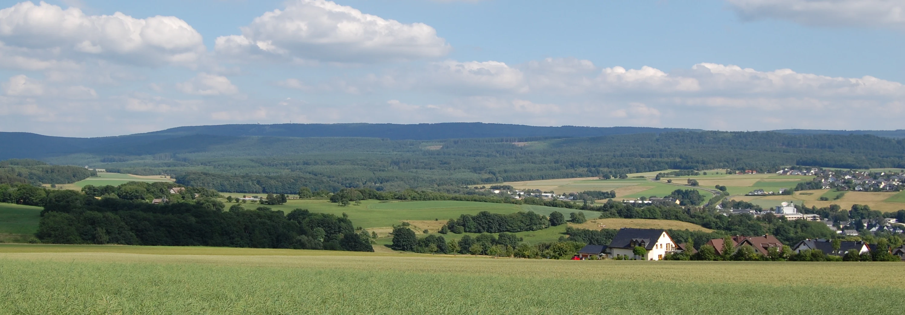
Expansive green fields in the foreground, with a small village including a church tower, surrounded by rolling hills under a partly cloudy sky
Landscape view of Hunsrück-Hochwald National Park featuring Erbeskopf and Hochwald

Hunsrück-Hochwald National Park history and protected-area timeline

The establishment of Hunsrück-Hochwald National Park followed more than a decade of planning, negotiation, and public consultation between the governments of Rhineland-Palatinate and Saarland. The process began in earnest in 2013 when most municipalities within the proposed park boundaries voted to support the concept, demonstrating unusual local consensus for a project of this scope. In 2014, the two state governments finalized the park's name and brought enabling legislation through their respective parliaments in the form of a inter-state treaty, the Staatsvertrag über die Errichtung und Unterhaltung des Nationalparks Hunsrück-Hochwald.

The park's creation was part of a broader wave of national park expansion in Germany that began in the late 1990s and accelerated in the 2000s, with new parks established in the Black Forest, Kellerwald, and Eifel regions. Hunsrück-Hochwald was preceded by the Nationalpark Schwarzwald, established in 2014, making it the sixteenth German national park and the youngest. The decision to create a park crossing state boundaries was itself notable, as most German national parks lie entirely within a single federal state. The dual-state administration required the creation of novel governance structures, including the inter-state National Park Office and the National Park Assembly that brings together elected representatives from both states.

Hunsrück-Hochwald National Park landscape and geographic character

The landscape of Hunsrück-Hochwald National Park reflects the geological character of the Hunsrück low mountain range, built upon Devonian slate and quartzite substrates that form the backbone of this western German highland region. The park encompasses the Idarwald in the north and the Schwarzwälder Hochwald in the south, two interconnected forest-covered ridges that rise to elevations between 400 and 700 meters above sea level. The highest point, Erbeskopf, reaches 816 meters and offers panoramic views across the forested highlands to the Rhine valley beyond.

The park contains a remarkable variety of terrain features shaped by geological processes and the passage of ice during the last glacial period. The Mörschieder Burr, a prominent block slope of granite boulders accumulated during the glacial maximum, represents one of the most visually striking landscape features. Steep-sided valleys, such as those carved by the Idarbach and its tributaries, descend sharply from the plateau, creating dramatic changes in elevation and exposing rocky cliff faces along their banks. The upland plateaus are punctuated by numerous springs and seeps that have given rise to extensive hangmoor complexes, where peat-forming vegetation has developed on the moisture-retentive slopes.
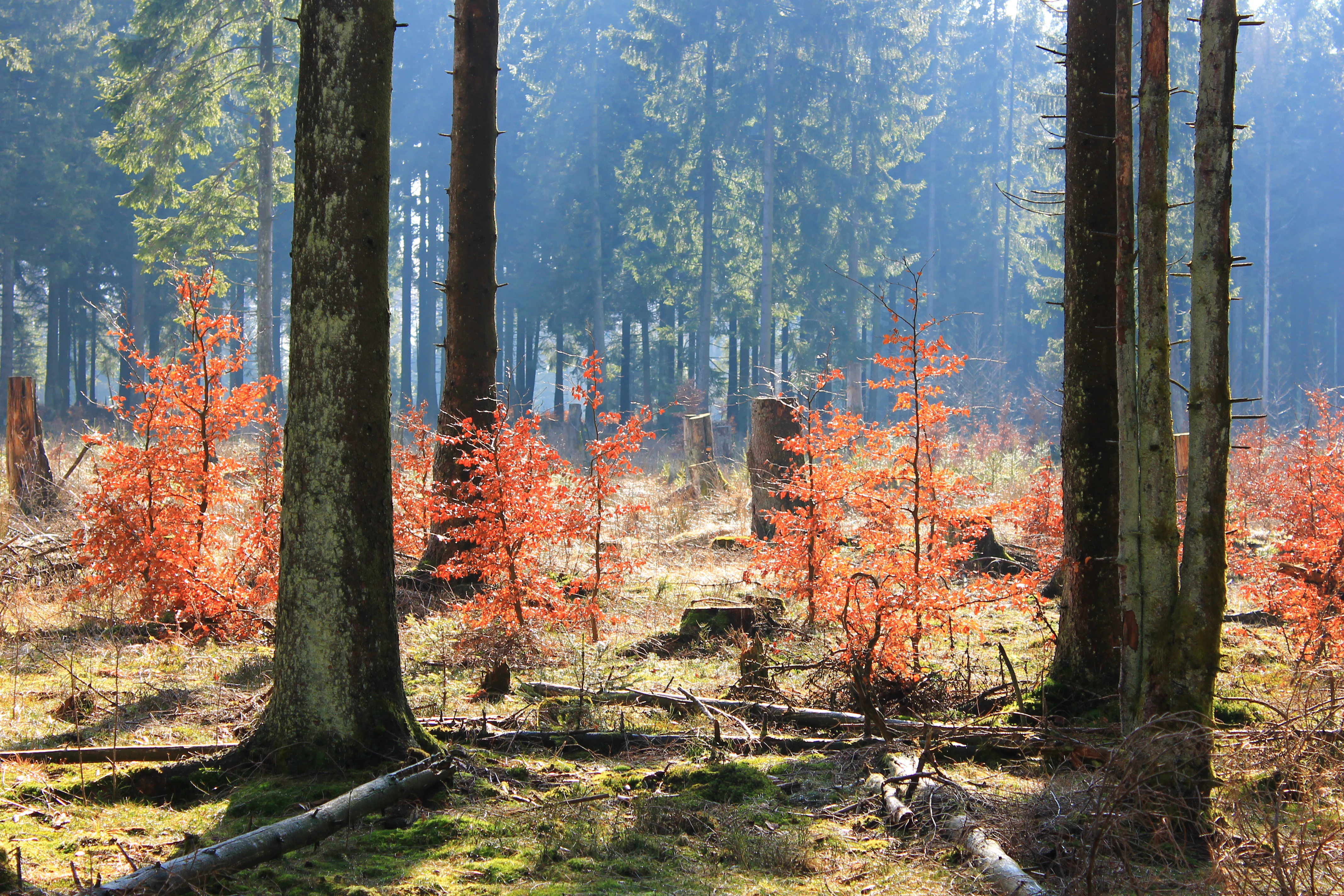
Forest scene with tall trees, young beech trees with orange autumn foliage, and sunlight filtering through the canopy
Autumn foliage of young beech trees near Sandkopf in Hunsrück-Hochwald National Park

Hunsrück-Hochwald National Park ecosystems, habitats, and plant life

The ecological character of Hunsrück-Hochwald is defined by its extensive forest ecosystems, which cover the vast majority of the park's area. The potential natural vegetation across most of the park would be acid-loving beech forest growing on the quartzite-dominated substrates, reflecting the cool, moist climate of the highlands with more than 800 millimeters of annual precipitation. However, decades of commercial forestry have replaced much of the original beech forest with planted spruce monocultures, and one of the park's primary ecological missions is the conversion of these artificial plantations back toward more natural deciduous forest conditions.

The park lies within one of Germany's designated biodiversity hotspots, the Saar-Ruwer-Hunsrück region recognized for its exceptional concentration of characteristic species and habitats. The old-growth beech forests and spruce stands with large deadwood volumes support specialized species including the Black Woodpecker, Three-toed Woodpecht, and the Pygmy Owl, all of which require substantial tree cavities for nesting. The park's wetlands and moorlands, though limited in total extent, provide crucial habitat for species adapted to permanently moist conditions, and the mosaic of forest types with open grassland creates edge habitats that support diverse communities of insects, including numerous butterfly species.
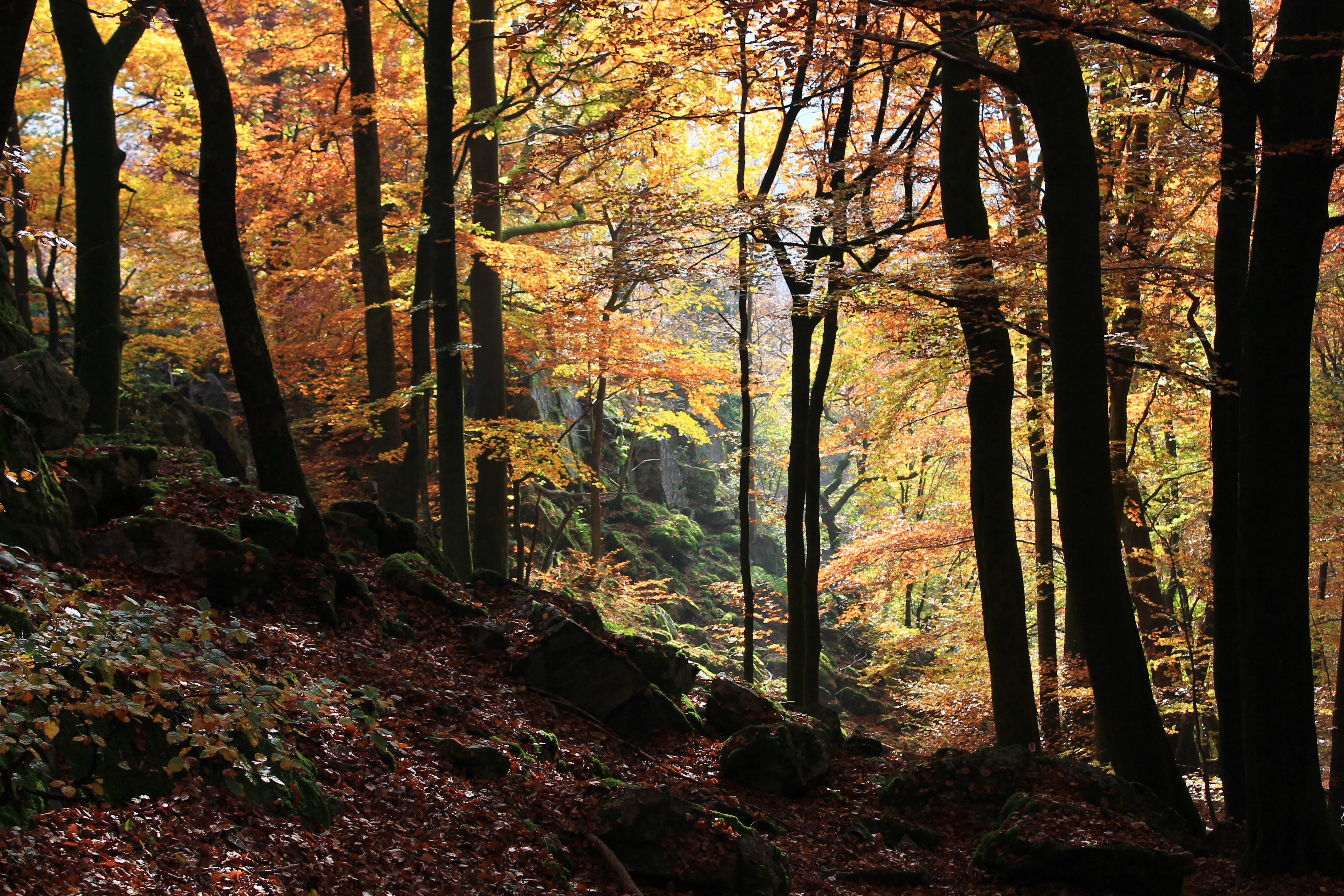
Sunlight filtering through autumn-colored beech trees in a forest with fallen leaves and rocks on the ground
Autumn beech forest in Hunsrück-Hochwald National Park

Hunsrück-Hochwald National Park wildlife and species highlights

Hunsrück-Hochwald supports a diverse community of forest-dwelling species that have benefited from the protection afforded by the national park designation. The European Wildcat, a rare and elusive predator that was driven to near-extinction across much of central Europe during the nineteenth and twentieth centuries, has established viable populations in the extensive forested areas of the park. This shy felid prefers dense, structurally diverse woodland with ample prey populations of small mammals and birds. The Red Deer, representing the largest wild herbivore in the region, is present throughout the park and can be observed particularly at dawn and dusk in the more open areas and forest clearings.

The bird community of the park is notably rich, with species such as the Black Woodpecker, Three-toed Woodpecker, and Pygmy Owl representing characteristic inhabitants of old-growth forest environments. The Wasp Buzzard, a specialized raptor that feeds primarily on social wasps and their larvae, hunts across the park's open woodland and clearings. The Bechstein's Bat, one of Europe's rarest bat species, roosts in tree cavities within the park's old trees and forages through the insect-rich forest habitats. The Hazel Grouse, a ground-dwelling bird of coniferous and mixed forest understory, survives in the remaining coppice woodlands and scrubby areas of the park.
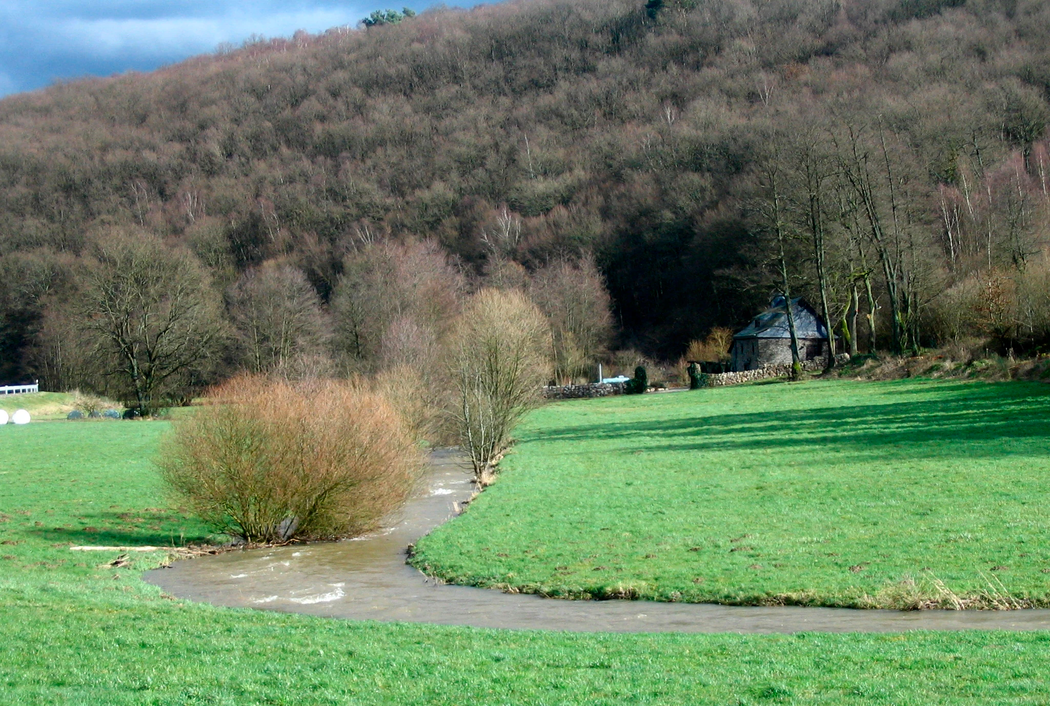
A winding river flows through lush green fields with a forested hillside in the background under a partly cloudy sky
River flowing through green fields with forested hills in the background

Hunsrück-Hochwald National Park conservation status and protection priorities

Hunsrück-Hochwald represents Germany's commitment to expanding wilderness protection in the heavily forested and densely populated heart of central Europe. The park is designated as both an EU Birds Directive Special Protection Area and a Fauna-Flora-Habitat Directive site, integrating it into the continental network of protected areas known as Natura 2000. This double designation reflects the exceptional ecological value of the forest, moorland, and grassland habitats that the park protects.

The park's management strategy emphasizes allowing natural processes to proceed without active intervention across the majority of its territory, reflecting the IUCN Category II criteria for national parks. This approach distinguishes Hunsrück-Hochwald from many older German protected areas that continue to manage forests for timber production or other extractive uses. The conversion of former spruce plantations toward more natural deciduous forest conditions represents a long-term ecological restoration project that will unfold over several decades. The park also functions as a node in the federal biotope network, connecting to surrounding landscapes and contributing to broader conservation objectives for mobile species that require large territories.

Hunsrück-Hochwald National Park cultural meaning and human context

The Hunsrück highlands have been inhabited by humans for thousands of years, and the park contains evidence of this long occupation. The Ringwall von Otzenhausen, a Celtic hillfort dating to the Iron Age, represents one of the most significant archaeological sites in the region. This fortification, constructed between 500 and 200 BCE, sits on a prominent hilltop within the park and demonstrates that the forested highlands were not merely a wilderness to be avoided but an area of strategic and economic importance to prehistoric communities. The Celtic name for the Idarwald, "id ar" meaning forest height above the land, indicates that this landscape has been recognized as distinct and significant throughout human history.

The park region was shaped by traditional agricultural practices that created and maintained the semi-open landscapes of meadows, orchards, and rough grasslands that surround the core forest areas. These traditional cultural landscapes, now protected as part of the park's maintenance zone, provide habitat for many species that require the transition between forest and open land. The village of Börfink, an enclave within the park boundaries, represents the human dimension of this landscape and illustrates how communities have historically lived in close association with the forest.
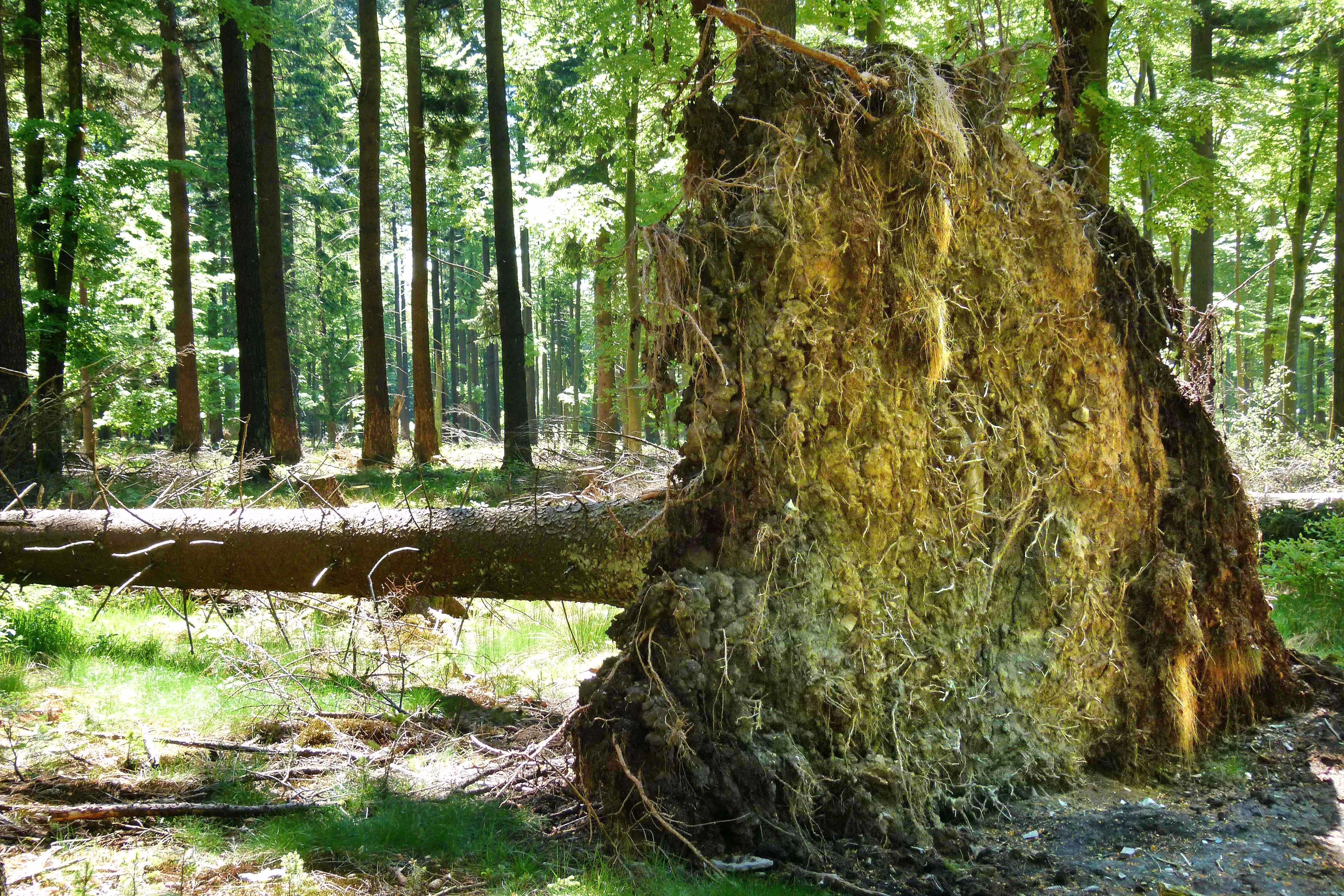
Fallen tree with exposed roots and moss-covered trunk in a forested area
Fallen tree in Hunsrück-Hochwald National Park

Top sights and standout views in Hunsrück-Hochwald National Park

The park offers several distinctive experiences for visitors seeking to explore its natural and cultural values. Erbeskopf, accessible by hiking trails and road, provides the highest viewpoint in the Hunsück with a visitor center and the Windklang sculpture that commemorates the park's establishment. The Saar-Hunsrück-Steig long-distance hiking trail passes through the park on its way from the Saarland to the Rhine, offering experienced hikers access to the most scenic sections. The hangmoors, with their elevated bog vegetation and wooden walkway systems, provide accessible encounters with wetland ecosystems that are otherwise rare in Germany's low mountain ranges. The Wildfreigehege Wildenburg enclosure allows visitors to observe red deer and other forest animals in a semi-natural setting.
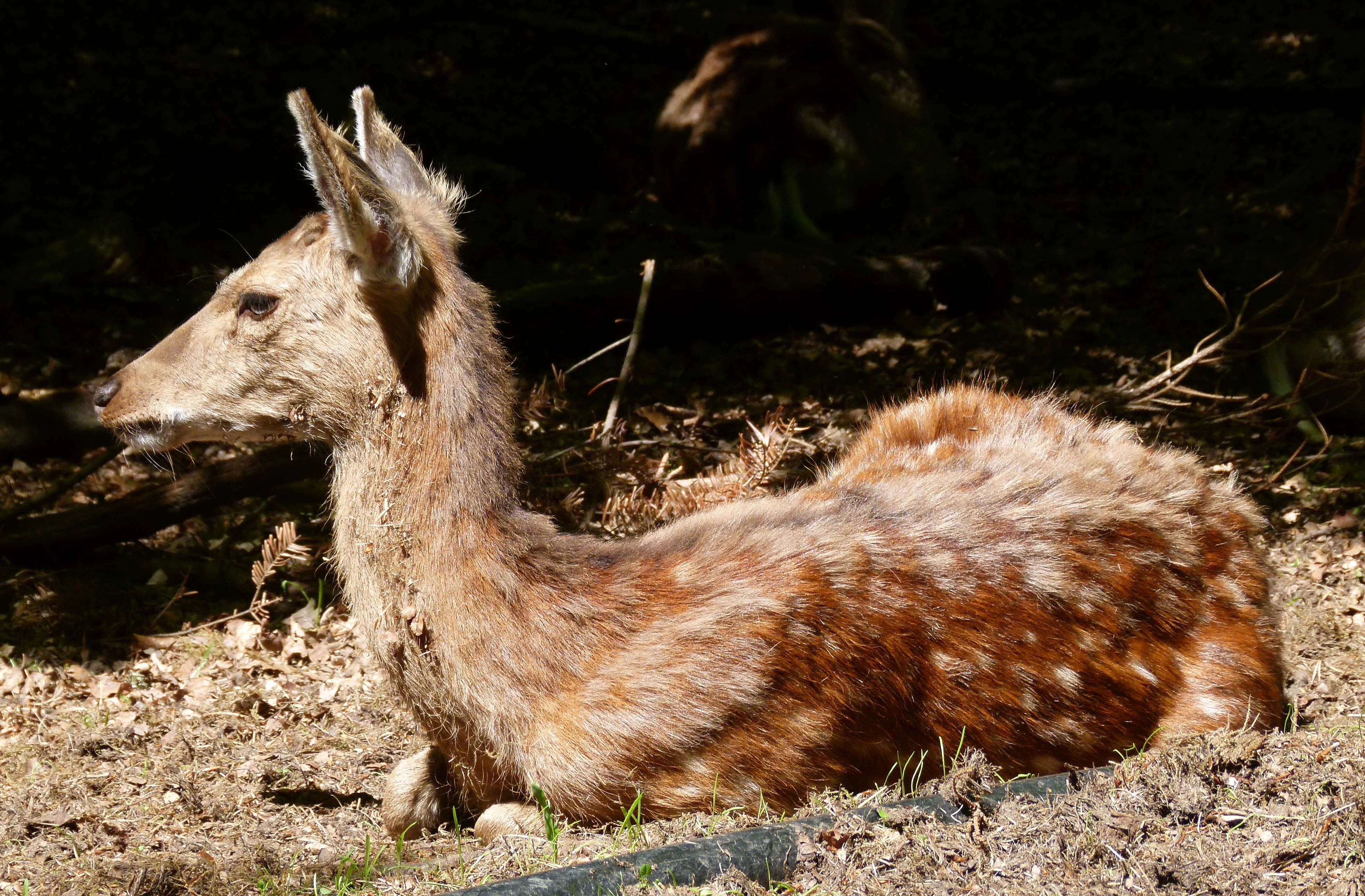
Young deer with spotted fur lying on the ground in a natural enclosure setting
Young deer resting in a wildlife enclosure at Hunsrück-Hochwald National Park

Best time to visit Hunsrück-Hochwald National Park

The park can be explored year-round, though each season offers distinct experiences. Spring brings the awakening of the forest, with fresh leaf growth and the return of migratory birds, while the damp conditions of early summer make the moors particularly vibrant with flowering vegetation. Autumn transforms the beech forests with spectacular color, and this season often sees the largest numbers of visitors attracted by the striking fall foliage. Winter, while quieter, reveals the stark beauty of the leafless forest and offers opportunities to track wildlife in the snow, though some trails may be difficult to navigate. The shoulder seasons of spring and autumn generally provide the most comfortable conditions for hiking and wildlife observation.

Monthly climate preview

Long-term temperature averages and monthly precipitation profiles for the Saarland protected landscape

Climate and Monthly Weather Normals for Hunsrück-Hochwald National Park

Long-term climate data at 366 meters elevation reveals monthly mean temperatures between -0.17 and 18.6 degrees Celsius with consistent precipitation patterns. Accessing the complete monthly climate normals for Hunsrück-Hochwald National Park reveals detailed weather by month, including historical temperature extremes and average daily rainfall trends.
Annual mean9 °C
0 °C19 °C
Jan
Feb
Mar
Apr
May12°
Jun16°
Jul19°
Aug18°
Sep14°
Oct
Nov
Dec
Warmest month
July

18.6 °C

Coolest month
January

-0.2 °C

Wettest month
December

2.9 mm/day

Driest month
April

1.7 mm/day

Park location guide

Geography guide, regional context, and park location map for Hunsrück-Hochwald National Park

Hunsrück-Hochwald National Park park geography, regions, and map view in Germany

Understand where Hunsrück-Hochwald National Park sits in Germany through a broader geographic reading of the surrounding landscape, nearby location context, and its mapped position within the national park landscape.

How Hunsrück-Hochwald National Park fits into Germany

Germany is a federal republic in Western and Central Europe with a population of over 83 million across sixteen constituent states. It is Europe's largest economy by nominal GDP and a major global exporter and importer. The capital is Berlin, and the country borders Denmark, Poland, Czech Republic, Austria, Switzerland, France, Luxembourg, Belgium, and the Netherlands.

Wider geography shaping Hunsrück-Hochwald National Park in Germany

Germany is located in Western and Central Europe, spanning 357,022 km². It borders Denmark to the north, Poland and the Czech Republic to the east, Austria and Switzerland to the south, and France, Luxembourg, Belgium, and the Netherlands to the west. The country has coastlines on the Baltic Sea and North Sea to the north, with the Alps located in the southern region.

Map view of Hunsrück-Hochwald National Park

Use this park location map to pinpoint Hunsrück-Hochwald National Park in Germany, understand its exact geographic position, and read its mapped placement within the surrounding landscape more clearly.

Pigeon | © OpenStreetMap contributors

Location context for Hunsrück-Hochwald National Park

Rhineland-PalatinateSaarland
Natural feature types

Browse the Full Collection of Natural Features in Hunsrück-Hochwald National Park

Examine the detailed registry of natural landscape markers found across Hunsrück-Hochwald National Park. By browsing this geographic collection, MoriAtlas users can visualize the distribution of moorlands, slopes, and ridges that define the park terrain.
Recorded earthquake history

Examine the Recorded Earthquake History for Hunsrück-Hochwald National Park

Browse the documented catalogue of seismic activity occurring in the vicinity of Hunsrück-Hochwald National Park. This MoriAtlas resource maps historical event data to the regional landscape, helping you understand the record of seismic occurrences documented within the highland geography.

Hunsrück-Hochwald Earthquake History

Catalogued events

178 events

Strongest magnitude

Magnitude 4.5

Most recent event

Sep 28, 2008

This history includes earthquakes recorded inside the park or within 50 km of its borders

Explore the visual character of its upland forests, distinctive hangmoors, and rocky slopes across the Hunsrück highlands.

Hunsrück-Hochwald National Park Landscapes: Explore Photos of Germany's Newest Protected Area

Dive into comprehensive imagery of Hunsrück-Hochwald National Park to visually grasp its diverse landscapes, including extensive beech forests, unique hangmoors, and rugged block slopes. These detailed views provide essential context for understanding the park's protected area character, its varied habitats, and the distinct terrain of Germany's Hunsrück highlands.

Expansive green fields in the foreground, with a small village including a church tower, surrounded by rolling hills under a partly cloudy sky

Green Hairstreak butterfly perched on a green leaf with visible plant buds and stem

Forest scene with tall trees, young beech trees with orange autumn foliage, and sunlight filtering through the canopy

Sunlight filtering through autumn-colored beech trees in a forest with fallen leaves and rocks on the ground

A winding river flows through lush green fields with a forested hillside in the background under a partly cloudy sky

Moss-covered tree branches and forest floor with fallen leaves in a dense deciduous forest

Fallen tree with exposed roots and moss-covered trunk in a forested area

Young deer with spotted fur lying on the ground in a natural enclosure setting

Beech sapling with two green leaves on forest floor surrounded by moss and dry leaves

Moss-covered rocks surrounded by green vegetation in a forest setting

Wooden boardwalk leading through a grassy bog area with a large tree stump and forest in the background

A shallow stream with clear water reflecting trees, surrounded by dense green forest

Modern visitor center building with wooden facade and glass windows featuring green circular logos, located in grassy area with tree and forest background under clear blue sky

Tall trees in a dense forest with sunlight filtering through the canopy

Park atlas

Map adjacent national parks and protected areas, comparing their geographic spread and conservation landscapes in Rhineland-Palatinate and Saarland.

Discover Other National Parks and Protected Areas Near Hunsrück-Hochwald National Park

Continue your park discovery by exploring other national parks and protected areas within the Hunsrück region and surrounding German states. This allows for direct geographic comparison, revealing the distinct forest ecosystems, moorlands, and river valleys that characterize central European conservation landscapes beyond Hunsrück-Hochwald National Park.
A horizontal watercolor illustration depicting rolling green hills, a forest, a winding river, and hazy distant mountains.
Nature reserveRhineland-Palatinate
Mapped location lies within the park boundary#1 closest

Northeast

Mörschieder Burr Nature Reserve: Geological Identity and Protected Forest Boundaries in Rhineland-Palatinate

A mapped quartzite summit within the Hunsrück forest landscape.

Spanning nearly 20 hectares, Mörschieder Burr preserves a rare expanse of vegetation-free scree slopes and Taunus quartzite outcrops in western Germany. The reserve acts as a geological anchor within the Idarwald forest, offering a concentrated look at the unique rocky terrain that defines this part of the Hunsrück-Hochwald National Park buffer zone.

Area
0.197 km²
Established
1940
Watercolor painting of rolling green hills, small forest patches, and rocky outcrops under a soft, white background.
National parkRheinland-Pfalz
Park boundaries overlap#2 closest

Northeast

Nationalpark Hunsrück-Hochwald: An Atlas and Geographic Overview of Protected Lands

Upland forest ecosystems and quartzite mountain terrain

The Hunsrück-Hochwald region showcases the transition of industrial-era forests toward near-natural wilderness. Its mapped territory integrates significant beech wood blocks with smaller wetland systems, reflecting a commitment to long-term biodiversity within the German uplands. Explore the structural composition and landscape features that define this protected zone.

Area
101.2 km²
Established
2015
IUCN
II
Relief
Mountain
Nature reserveSaarland
0.1 km away#3 closest

South

Wiesenkomplex bei Eisen Nature Reserve: Geography and Protected Habitat Mapping in Saarland

A mosaic of meadow and riparian stream ecosystems

Located in northern Saarland, Wiesenkomplex bei Eisen protects a mosaic of traditionally managed wet and semi-dry grasslands. The reserve, centered on the Krippbach stream, supports essential floodplain gallery forests and diverse meadow types. This mapping of four non-contiguous sites underscores the role of structured management in preserving remnant cultural landscape habitats within the region.

Area
0.9 km²
Established
2016
IUCN
IV
Relief
Lowland
Nature reserveRhineland-Palatinate
About 4.4 km away#4 closest

Northeast

Naturschutzgebiet Spring Nature Reserve: Protected Wetland and Headwater Landscape Geography

Mapped upland habitats in the Hunsrück, Rhineland-Palatinate

Naturschutzgebiet Spring protects a specialized wetland complex, featuring headwater streams and peatland formations within the Idarwald. This conservation area highlights the fragile, water-dependent ecology of the Hunsrück, providing a clear geographic view of preserved mire and swamp forest terrain within Rhineland-Palatinate.

Area
0.74 km²
Established
1988
Relief
Upland
Scope
Terrestrial
Nature reserveSaarland
6.7 km away#5 closest

Southwest

Wadrilltal Nature Reserve: Geographic Context and Mapped Protected Landscapes in Saarland

A protected stream valley habitat in the Hochwald region of Germany.

Wadrilltal represents a crucial nature reserve that shelters a near-natural stream valley system within the Saarland municipality of Wadern. The area preserves a structural diversity of wet meadows, montane mat-grass swards, and floodplain forests that form part of the Natura 2000 network. Gain geographic insight into the valley's slopes and river corridor, which extend across state boundaries to maintain significant regional biodiversity.

Area
1.67 km²
Established
2016
Scope
Terrestrial
Water
Major water bodies
Nature reserveSaarland
6.8 km away#6 closest

South

Südteil des Nohfeldener Rhyolith-Massivs: Saarland Nature Reserve and Volcanic Highland Terrain

Protected montane grasslands and rare bog woodland habitats.

This nature reserve protects 73 hectares of critical habitat within the Saarland uplands. Defined by the rhyolite massif geology between Losenberg and Leißberg, the protected area maintains rare montane mat-grass swards and fragile bryophyte communities. The site serves as a vital example of volcanic landscape conservation, highlighting the intersection of acidic silicate soils and specific ecological biodiversity in Germany.

Area
0.73 km²
Established
2017
IUCN
IV
Nature reserveSaarland
9.9 km away#7 closest

Southwest

Wiesenlandschaft bei Überroth: Nature Reserve Geography and Mapped Meadow Habitats

Essential protected land analysis in the Saarland region of Germany

Wiesenlandschaft bei Überroth functions as a core protected area for species-rich meadows in southwestern Germany. This detailed entry maps its two-part configuration and explains its role within the regional Saarland habitat network, providing a clear geographic perspective on its conservation status and semi-natural terrain characteristics.

Area
2.87 km²
Established
2015
IUCN
IV
Relief
Lowland
Protected areaRheinland-Pfalz
About 17 km away#8 closest

East

Truppenübungsplatz Baumholder: Protected Area and Geological Landmark in Rheinland-Pfalz

A vast military training ground and Natura 2000 ecological sanctuary.

Truppenübungsplatz Baumholder is a expansive protected landscape in Rheinland-Pfalz, functioning as both an active military installation and a preserved natural habitat. The terrain features a striking mix of dense deciduous forest, open firing corridors, and unusual volcanic geological remnants like rare lava flows and agate deposits. This site serves as a critical study in how restricted access shapes regional biodiversity.

Area
116 km²
Established
1937
Relief
Upland
Access
Highly restricted

Common questions about visiting, size, designation, and location context for Hunsrück-Hochwald National Park

Hunsrück-Hochwald National Park FAQs for park facts, access, geography, and protected area context

Find quick answers about Hunsrück-Hochwald National Park, including protected-area facts, park geography, trail and visitor context, and how the park fits into its surrounding country and regional landscape.
MoriAtlas Explorer

Continue Your Protected Areas Search Across the Global Atlas

Deepen your exploration by continuing the structured search for national parks and protected areas worldwide. Utilize the comprehensive filtering capabilities to compare different conservation landscapes and refine your understanding of global park geography. Discover more about the distribution and characteristics of protected natural areas.

Global natural geography