
Mori Atlas logo
Nature reserveNass- und Feuchtgrünlandkomplex östlich Holzwipper

Examining the mosaic of wet grassland, sedge communities, and riparian valley geography in Nordrhein-Westfalen.

Nass- und Feuchtgrünlandkomplex östlich Holzwipper Nature Reserve and Protected Landscape Atlas

(Naturschutzgebiet „Nass- und Feuchtgrünlandkomplex östlich Holzwipper“)

Nass- und Feuchtgrünlandkomplex östlich Holzwipper stands as a significant nature reserve within the Oberbergischer Kreis, representing a tightly structured wet valley landscape. This protected area showcases a dense mosaic of tall oat-grass meadows, large-sedge reedbeds, and riparian woodland along the Wipper river. The site provides a focused look at the characteristic damp valley systems that define the geography of the Bergisches Land.

wet grasslandnature reserveOberbergischer KreisBergisches LandNorth Rhine-Westphaliasedge communities
A flat, vector-style illustration of a natural landscape showing a foreground of green fields, a line of trees in the middle distance, and reddish cliffs with a small waterfall under a soft sun in the background.

Nass- und Feuchtgrünlandkomplex östlich Holzwipper

Nature reserve

Park overview

Structured park overview, official facts, and landscape profile for Nass- und Feuchtgrünlandkomplex östlich Holzwipper

Nass- und Feuchtgrünlandkomplex östlich Holzwipper park facts, protected area profile, and essential visitor context

Review the core facts for Nass- und Feuchtgrünlandkomplex östlich Holzwipper, including designation, size, terrain, visitor scale, habitats, and operating context in one park-focused overview.

About Nass- und Feuchtgrünlandkomplex östlich Holzwipper

Nass- und Feuchtgrünlandkomplex östlich Holzwipper is one of many small nature reserves that together define the protected landscape mosaic of the Oberbergischer Kreis in the Bergisches Land region of North Rhine-Westphalia. Although far from the grand scale of mountainous parks or coastal reserves, the site carries a focused, habitat-specific conservation role. Its roughly 2.3 hectares safeguard a section of the upper Wipper valley, adding a locally significant contribution to the preservation of wet-grassland communities that have become increasingly rare across central Europe due to drainage and agricultural intensification.

The reserve extends in a narrow east-west band, roughly 400 meters long and on average 70 meters wide, immediately east of the small settlement of Holzwipper and just northeast of Marienheide's town core. A road called Zur Wupperquelle runs along its southern side, while the Wipper itself flows just outside the reserve's northern boundary, shaded by a strip of riparian woodland and tall-herb vegetation that ecologists consider a natural extension of the protected wet valley. Comments in the official Fachinformationsdienst description even suggest that the boundary could be expanded to include the stream fringe itself.

The protective goal of the reserve, as stated by the North Rhine-Westphalian specialist information service, is the preservation and development of a wet to damp meadow valley containing large and small sedge beds as well as extensively cultivated meadows (extensives Grünland). The reserve therefore functions not as a strict wilderness area but as a managed habitat complex, where traditional low-intensity meadow use continues to shape the vegetation and where characteristic meadow species are allowed to persist alongside sedge-dominated wetland patches.

Within the wider context of the Oberbergischer Kreis, the reserve belongs to a network of small protected sites surrounding Marienheide, including the Quellgebiet der Wupper (Wupper source area), the Wipperaue Eulenbecke, and the Wupperaue bei Gogarten. Together, these sites reflect the region's broader effort to protect remaining valley wetlands, source springs, and extensively used grasslands in this part of the Bergisches Land.

Quick facts and research context for Nass- und Feuchtgrünlandkomplex östlich Holzwipper

Nass- und Feuchtgrünlandkomplex östlich Holzwipper is a North Rhine-Westphalian nature reserve (Naturschutzgebiet) covering about 2.3 hectares in the municipality of Marienheide, Oberbergischer Kreis. Designated in 1998 and recorded under the official code GM-051, the reserve sits in the valley of the Wipper, the upper reach of the Wupper river, between the hamlet of Holzwipper and the road Zur Wupperquelle. It lies at elevations between roughly 384 and 392 meters above sea level. Administered under the active landscape plan by the lower landscape authority of the Oberbergischer Kreis, it is classified as an IUCN Category IV Habitat/Species Management Area.

Protection and recognition

Examine documented protected area designation records, international recognition sources, and management parameters.

Nass- und Feuchtgrünlandkomplex östlich Holzwipper Protection Status and Registry Data

Nass- und Feuchtgrünlandkomplex östlich Holzwipper protection status details bring together documented designation records and international registry data. Protected area designation parameters offer clear insight into conservation frameworks and administrative scope.

Protection details

WDPA ID
329530
Park context

Deeper park guide and search-rich context for Nass- und Feuchtgrünlandkomplex östlich Holzwipper

Nass- und Feuchtgrünlandkomplex östlich Holzwipper history, landscape, wildlife, and travel context

Explore Nass- und Feuchtgrünlandkomplex östlich Holzwipper through its history, landscape character, ecosystems, wildlife, conservation priorities, cultural context, and seasonal travel timing in a structured park guide built for atlas discovery and search intent.

Why Nass- und Feuchtgrünlandkomplex östlich Holzwipper stands out

The reserve is best known for its compact but richly structured mosaic of wet and moist grassland habitats. Within an area of only around 400 meters in length and an average of 70 meters in width, it brings together a tall oat-grass meadow, an extensively cut hay meadow with abundant meadow bistort, small-sedge communities of the common sedge, and large-sedge reedbeds of the slender sedge and panicled sedge. The bordering riparian woodland and tall-herb fringe along the Wipper stream add a further wetland element, making the site a textbook example of a small, ecologically dense wet-grassland valley in the Bergisches Land.
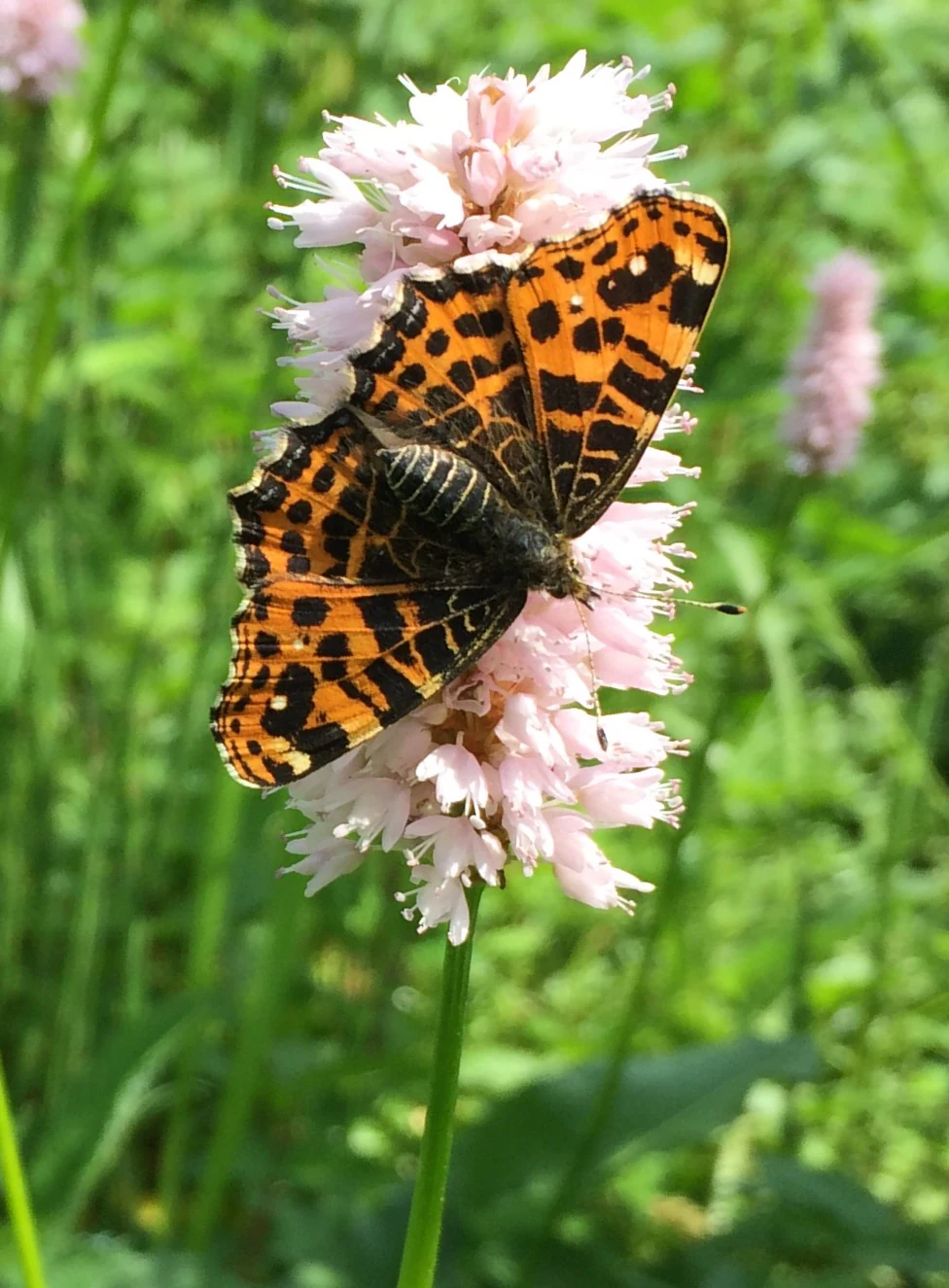
An orange and black patterned Map butterfly perched on a cluster of small, pale pink common bistort flowers against a blurry green meadow background.
A first-generation Map butterfly resting on a common bistort flower.

Nass- und Feuchtgrünlandkomplex östlich Holzwipper history and protected-area timeline

The Nass- und Feuchtgrünlandkomplex östlich Holzwipper was placed under formal nature protection in 1998. Its protection was subsequently incorporated into the legally valid landscape plan (Landschaftsplan) of the region adopted in 2005, which continues to provide the statutory framework for its management. The reserve has been assigned the official identification code GM-051 and was entered into the international World Database on Protected Areas under the WDPA identifier 329530.

Administrative responsibility rests with the Untere Landschaftsbehörde des Oberbergischen Kreise, the lower landscape authority of the district. The reserve's history therefore reflects the typical pattern of medium-sized North Rhine-Westphalian nature reserves: initial designation under state nature-conservation law, followed by long-term management under the district's landscape plan, with the Fachinformationsdienst des Landesamtes für Natur, Umwelt und Verbraucherschutz providing official ecological descriptions. There is no indication of earlier formal protection status for the area, and the reserve should be understood as a modern, habitat-focused conservation designation rather than a historical landscape or park entity.

Nass- und Feuchtgrünlandkomplex östlich Holzwipper landscape and geographic character

Physically, the reserve occupies a narrow ribbon of valley floor within the gently rolling uplands of the Bergisches Land. Its terrain lies between approximately 384 and 392 meters above sea level, with an average elevation of about 388 meters, placing the area firmly within the mid-elevation landscape that characterizes the eastern part of the Oberbergischer Kreis. The valley cross-section is shallow but clearly defined by the Wipper stream, which shapes both the soils and the vegetation patterns within the protected strip.

The land surface is shaped by the interplay of meadow, sedge, and stream-side woodland. In the narrower eastern part of the reserve, a tall oat-grass meadow (Glatthaferwiese) sits on slightly drier ground, separated from the rest of the area by a small brook flanked by riparian shrubs. The central portion is dominated by an extensively cut hay meadow with prominent meadow bistort (Wiesenknöterich), while the northwest corner contains a tight mosaic of two large-sedge reedbeds, moist meadow with meadowsweet and wood club-rush, and a willow-lined riverside thicket. The Wipper, although flowing just outside the reserve, runs along the northern edge under the protective shade of a continuous strip of Ufergehölz and tall-herb vegetation.
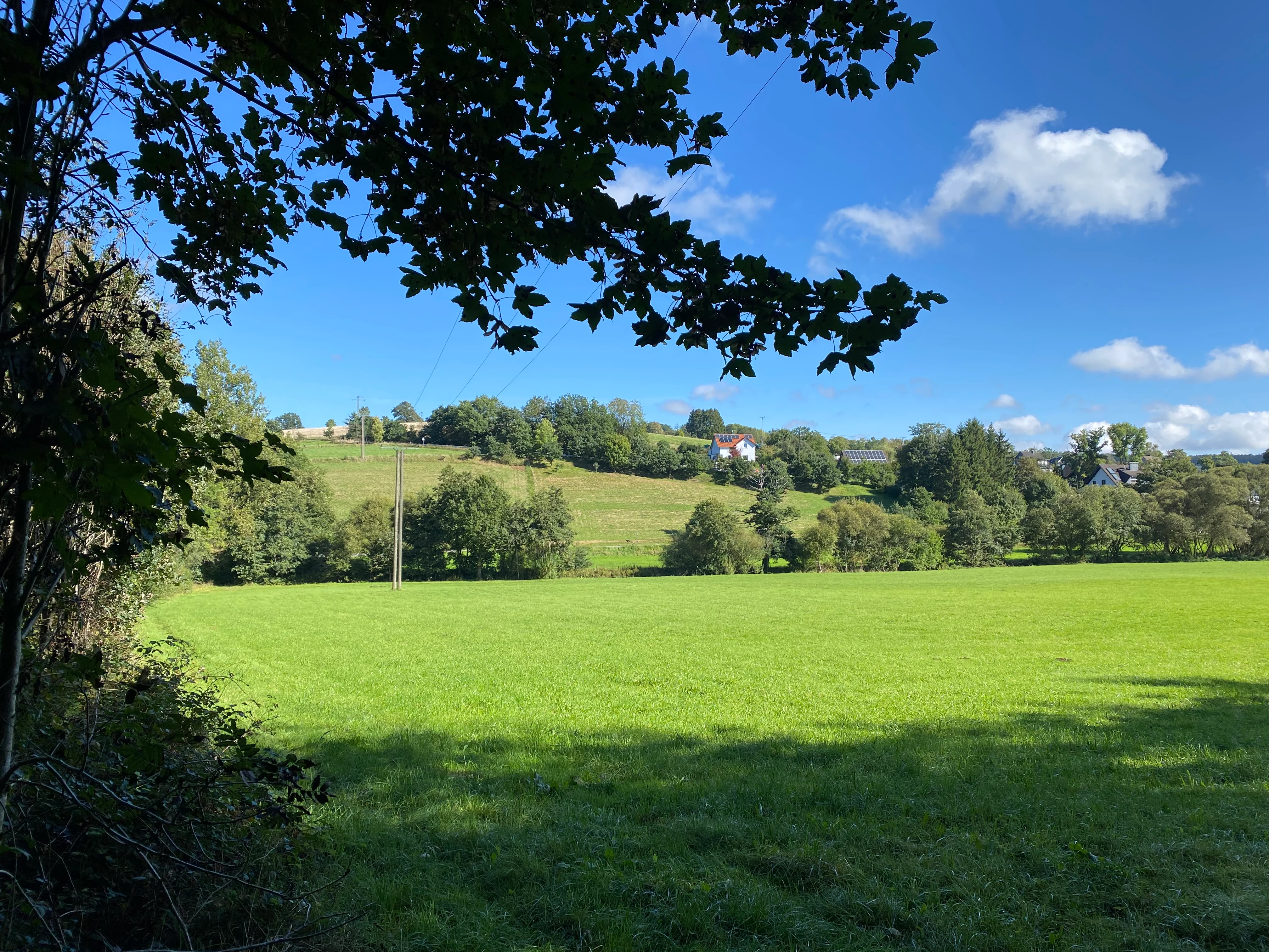
A bright, sunny view of a green meadow in the foreground with rolling hills, trees, and small buildings in the distance under a blue sky.
A view of the open meadows and surrounding treelines in the Nass- und Feuchtgrünlandkomplex östlich Holzwipper nature reserve.

Nass- und Feuchtgrünlandkomplex östlich Holzwipper ecosystems, habitats, and plant life

The ecological character of the reserve is defined by a tightly interwoven sequence of wet and moist grassland communities, a pattern that gives the area its name and its conservation significance. Small-sedge communities of the common sedge (Wiesensegge) are interspersed within the broader hay-meadow matrix, while two large-sedge reedbeds formed by the slender sedge (Schlanksegge) and the panicled sedge (Rispensegge) occupy the wetter northwestern portion. Moist grassland with meadowsweet (Mädesüß) and wood club-rush (Waldsimse) adds another structural layer, and willow-dominated riparian shrubland edges the stream fringe.

The vegetation across the reserve is managed in a low-intensity, ecologically targeted manner. The dominant hay meadow is cut only once per year (einschürige Wiese), preserving high proportions of meadow bistort, while the Glatthaferwiese in the east represents a slightly drier facies within the valley system. A narrow strip of Hochstaudenflur (tall-herb vegetation) and Ufergehölz accompanies the Wipper along the northern boundary, linking the grassland complex to the stream ecosystem. Together these habitat types form a continuous wet-valley gradient from the streambank outward, making the area a representative example of a Bergisches Land damp meadow valley.
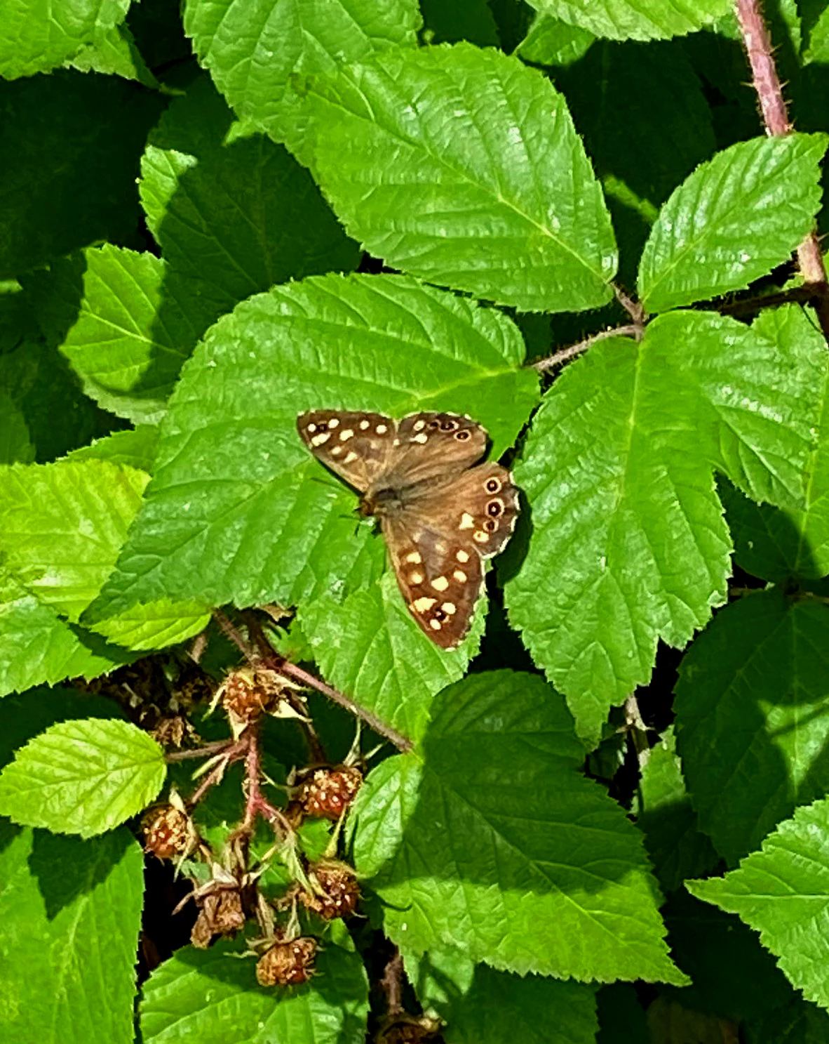
A brown butterfly with cream colored spots resting on serrated green leaves.
A speckled wood butterfly resting on vibrant green leaves within the nature reserve.

Nass- und Feuchtgrünlandkomplex östlich Holzwipper wildlife and species highlights

The wildlife profile of the reserve is characterized primarily by butterflies and other invertebrates associated with its traditional wet meadows. The source material explicitly references the Landkärtchen (Araschnia levana), a map butterfly found here on meadow bistort (Bistorta officinalis), as well as the Waldbrettspiel (Pararge aegeria), the speckled wood butterfly, photographed in the area. Such species are meaningful indicators of the reserve's continuing ecological quality, because both rely on the presence of essentially undisturbed, extensively managed meadows, moist woodland edges, and healthy host-plant populations.

By inference from the habitats present, the area is also likely to host the typical invertebrate, amphibian, and small-mammal communities of Bergisches Land wet valleys: dragonflies and damselflies along the Wipper and sedge beds, amphibians in the saturated sedge and reedbed patches, and small mammals along the willow-dominated riparian fringe. The descriptions and images, however, do not provide a formal faunal species list, so this interpretation should be read as a habitat-based contextualization rather than a documented inventory of the reserve's full animal life.
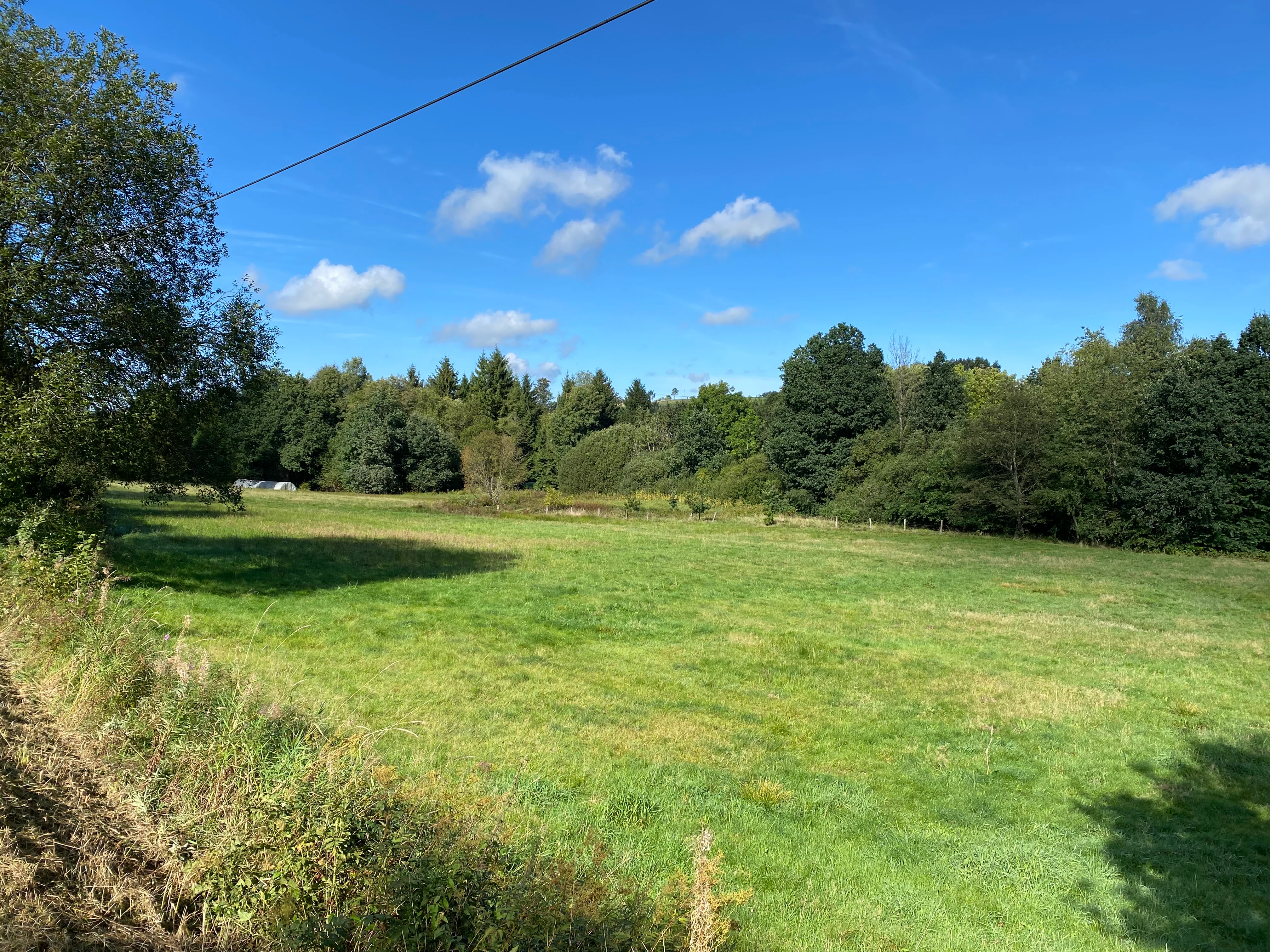
A sunny, open green meadow in the foreground with a dense wall of deciduous trees in the background under a blue sky.
A view of the wetland and grassland habitat complex within the Nass- und Feuchtgrünlandkomplex östlich Holzwipper nature reserve.

Nass- und Feuchtgrünlandkomplex östlich Holzwipper conservation status and protection priorities

From a conservation perspective, the reserve belongs to the IUCN Category IV classification of Habitat/Species Management Areas, reflecting its role as a managed landscape where active conservation targets are pursued alongside traditional land use. Its designation in 1998 and its integration into the legally valid landscape plan in 2005 underline its function as part of the long-term, plan-based conservation framework of North Rhine-Westphalia.

The explicit protection objective is the preservation and development of a moist to wet meadow valley containing both large-sedge and small-sedge reedbed communities, as well as extensively used meadows. This objective aligns with broader European conservation priorities for damp meadows, which have declined markedly due to drainage, fertilization, and conversion to more intensive grassland or cropland. By maintaining low-intensity hay cutting and tolerating a high proportion of meadow bistort, the reserve helps sustain habitat conditions for characteristic meadow flora such as meadowsweet, ragged robin, marsh marigold, and brown knapweed, which are increasingly uncommon in intensively farmed landscapes.

The Fachinformationsdienst also noted the ecological logic of expanding the boundary to include the Wipper and its accompanying strip of riparian woodland and tall-herb vegetation, as these elements naturally completed the wet-valley system. This framing reflects the reserve's broader conservation identity: the area is valued not as a stand-alone patch but as the core of a small valley ecosystem whose ecological integrity depends on connectivity with the adjoining stream corridor.

Nass- und Feuchtgrünlandkomplex östlich Holzwipper cultural meaning and human context

The reserve reflects the deep cultural identity of the Bergisches Land as a landscape shaped by long-standing, low-intensity grassland farming in narrow stream valleys. The traditional single-cut hay meadow management, the small-scale mosaic of meadows and sedge beds, and the survival of species-rich wet meadows all speak to a long regional history of extensive agricultural use rather than intensive cultivation. The fact that meadows such as these still carry regionally significant populations of ragged robin and marsh marigold is in itself a marker of cultural-landscape continuity.

The naming of local features also embeds the reserve in regional identity: the stream running along the reserve's northern boundary is locally known as the Wipper, an old form still used for the upper Wupper river in this district, while the settlement of Holzwipper and the road Zur Wupperquelle both refer to the Wupper's source region. The reserve is thus part of a wider cultural narrative of the Oberbergischer Kreis, where small valley grasslands, named streams, and historically meaningful hamlet names remain intertwined with modern nature-conservation practice.
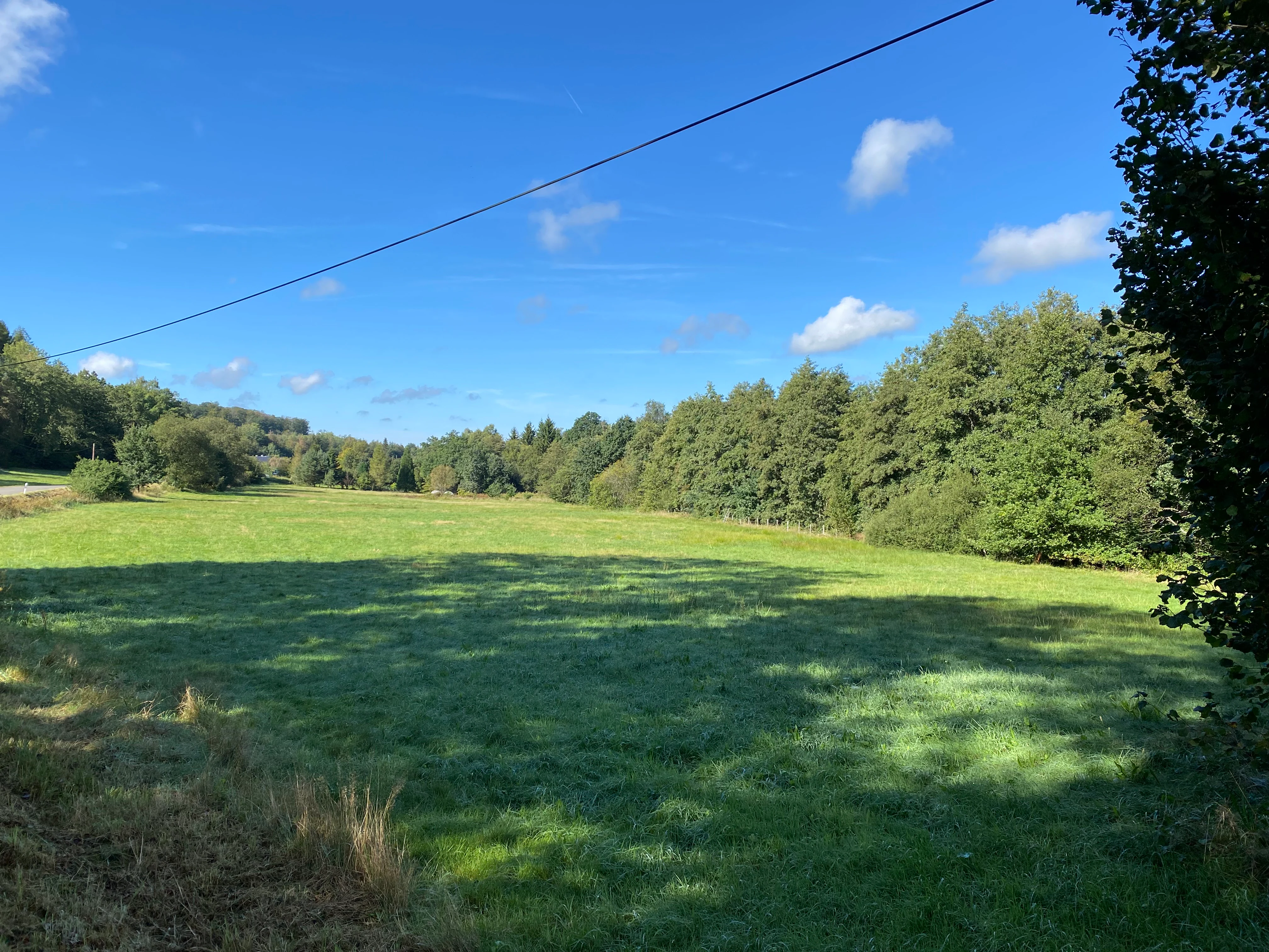
A wide, open green field bordered by a dense line of trees under a clear blue sky, with a power line stretching across the upper portion of the frame.
A view of the wetland grassland complex in the nature reserve east of Holzwipper.

Top sights and standout views in Nass- und Feuchtgrünlandkomplex östlich Holzwipper

The reserve's main highlights are its compact wet-grassland mosaic, its long-running single-cut hay meadow rich in meadow bistort, and the rare coexistence of small-sedge and large-sedge communities within an area of just a couple of hectares. The narrow strip of riparian woodland and tall-herb vegetation along the Wipper adds an additional ecological anchor, and the protected meadow flora, including meadowsweet, ragged robin, and marsh marigold, gives the area a clear botanical identity. As a representative example of a Bergisches Land wet valley, the reserve offers a tightly focused, scientifically meaningful snapshot of a small but ecologically rich protected habitat system.

Best time to visit Nass- und Feuchtgrünlandkomplex östlich Holzwipper

As a wet-grassland reserve, the area is most expressive in late spring and early summer, when the characteristic meadow flowers such as ragged robin and brown knapweed are in bloom and the sedge communities are fully developed. Late spring through midsummer is also typically the best period for observing butterflies and other insects associated with meadow bistort and the riparian fringe. In high summer the meadows take on a drier, more golden character, while autumn brings muted colors and the first signs of the traditional single hay cut. Visits in winter are possible but reveal less of the reserve's botanical character, as the herbaceous vegetation dies back and the area becomes quieter and visually less distinctive.

Monthly climate preview

Long-term representative temperature and precipitation patterns across the annual cycle

Nass- und Feuchtgrünlandkomplex östlich Holzwipper Climate Normals and Monthly Weather

Representative coordinates record long-term monthly temperatures ranging from winter lows near negative nine degrees to summer maximums exceeding thirty degrees with steady daily precipitation. Examining the complete twelve-month climatology profile reveals detailed variations in temperature extremes and precipitation averages across the protected area.
Annual mean9 °C
0 °C18 °C
Jan
Feb
Mar
Apr
May13°
Jun16°
Jul18°
Aug18°
Sep14°
Oct
Nov
Dec
Warmest month
July

18.3 °C

Coolest month
January

0.3 °C

Wettest month
December

3 mm/day

Driest month
April

1.8 mm/day

Park location guide

Geography guide, regional context, and park location map for Nass- und Feuchtgrünlandkomplex östlich Holzwipper

Nass- und Feuchtgrünlandkomplex östlich Holzwipper park geography, regions, and map view in Germany

Understand where Nass- und Feuchtgrünlandkomplex östlich Holzwipper sits in Germany through a broader geographic reading of the surrounding landscape, nearby location context, and its mapped position within the national park landscape.

How Nass- und Feuchtgrünlandkomplex östlich Holzwipper fits into Germany

Germany is a federal republic in Western and Central Europe with a population of over 83 million across sixteen constituent states. It is Europe's largest economy by nominal GDP and a major global exporter and importer. The capital is Berlin, and the country borders Denmark, Poland, Czech Republic, Austria, Switzerland, France, Luxembourg, Belgium, and the Netherlands.

Wider geography shaping Nass- und Feuchtgrünlandkomplex östlich Holzwipper in Germany

Germany is located in Western and Central Europe, spanning 357,022 km². It borders Denmark to the north, Poland and the Czech Republic to the east, Austria and Switzerland to the south, and France, Luxembourg, Belgium, and the Netherlands to the west. The country has coastlines on the Baltic Sea and North Sea to the north, with the Alps located in the southern region.

Map view of Nass- und Feuchtgrünlandkomplex östlich Holzwipper

Use this park location map to pinpoint Nass- und Feuchtgrünlandkomplex östlich Holzwipper in Germany, understand its exact geographic position, and read its mapped placement within the surrounding landscape more clearly.

Pigeon | © OpenStreetMap contributors

Location context for Nass- und Feuchtgrünlandkomplex östlich Holzwipper

Nordrhein-Westfalen

Visual reference of wet grassland habitats, sedge communities, and Wipper valley terrain

Nass- und Feuchtgrünlandkomplex östlich Holzwipper Photos and Landscape Scenery

Visual documentation captures the fine mosaic of wet meadows, sedge reedbeds, and riparian woodland defining the protected valley floor. Examining photographic records reveals the ecological structure and vegetative character of this upland nature reserve.

An orange and black patterned Map butterfly perched on a cluster of small, pale pink common bistort flowers against a blurry green meadow background.

A green open meadow surrounded by trees under a blue sky with scattered white clouds.

A bright, sunny view of a green meadow in the foreground with rolling hills, trees, and small buildings in the distance under a blue sky.

A brown butterfly with cream colored spots resting on serrated green leaves.

A sunny, open green meadow in the foreground with a dense wall of deciduous trees in the background under a blue sky.

A wide view of an open green meadow bordered by a line of mature trees under a blue sky with scattered white clouds.

A wide, open green field bordered by a dense line of trees under a clear blue sky, with a power line stretching across the upper portion of the frame.

Park atlas

Compare nearby protected areas and connected valley landscapes across the Oberbergischer Kreis

Other Parks Near Nass- und Feuchtgrünlandkomplex östlich Holzwipper for Regional Comparison

Browse protected areas and wetland reserves located near Nass- und Feuchtgrünlandkomplex östlich Holzwipper in North Rhine-Westphalia. Comparing adjacent valley habitats helps contextualize regional conservation networks and surrounding stream ecosystems.
Nature reserveOberbergischer Kreis
About 1.9 km away#1 closest

West

Wipperaue Eulenbecke: A Detailed Map of Protected Riparian Landscapes and Habitats

Ecological geography within the Oberbergischer Kreis region

Wipperaue Eulenbecke protects a structured headwater stream and associated floodplain fragments along the upper Wupper river. Through its network of wet meadows, alluvial woodland, and tributary valleys, the reserve demonstrates the importance of small-scale aquatic conservation in a forested, mid-elevation landscape. Access detailed geographic data on its terrain, stream morphology, and connectivity within the wider regional conservation network.

Area
0.219 km²
Established
2005
IUCN
IV
Relief
Upland
Nature reserveOberbergischer Kreis
About 5.3 km away#2 closest

West

Wupperaue bei Gogarten Nature Reserve: Protected River Valley and Riparian Habitat

Geographic overview of the Wipper river corridor in North Rhine-Westphalia

Located in the Oberbergischer Kreis, this nature reserve protects a seven hectare stretch of the Wipper valley. The landscape is characterized by alder riparian forests, steep river banks, and moist flood meadows that function as an essential biological stepping stone for riverine biodiversity.

Area
0.07 km²
Established
2005
IUCN
IV
Relief
Lowland
A flat, vector-style illustration of a valley with a winding path in the foreground, coniferous trees, a waterfall, and rocky cliffs under a light sky.
Nature reserveOberbergischer Kreis
About 9.3 km away#3 closest

Northwest

Ibachtal und Nebenbäche Nature Reserve: Geographic Overview and Protected Stream Landscape

Stream valley connectivity in the Oberbergischer Kreis

Trace the landscape of the Ibachtal und Nebenbäche nature reserve through its distinct stream valleys, alder gallery forests, and botanically diverse wet meadows. This area serves as a primary example of stream-based ecological protection in the Bergisches Land, characterized by narrow ravine-like tributaries and expansive floodplain grassland.

Area
0.268 km²
Established
2013
IUCN
IV
Nature reserveNorth Rhine-Westphalia
About 18 km away#4 closest

West

Wupperaue bei Westenbrücke Nature Reserve Landscape and Geographic Mapping

Protected riparian floodplain in the Oberbergischer Kreis

This nature reserve protects a vital 2.3 kilometer segment of the Wupper river valley. Its landscape is characterized by a mosaic of wet meadows, alder and willow stands, and riparian corridors, providing a crucial stepping-stone habitat within the Hückeswagen area of North Rhine-Westphalia.

Area
0.318 km²
Established
2013
IUCN
IV
Watercolor painting of a soft, rolling landscape with light green fields, scattered trees, and muted pink-toned hills.
Nature reserveNorth Rhine-Westphalia
About 18 km away#5 closest

Northeast

Naturschutzgebiet Oberes Elsetal: Protected Brook Valley Geography in North Rhine-Westphalia

Mapping riparian ecosystems and low mountain range stream habitats.

Naturschutzgebiet Oberes Elsetal offers a detailed look at the structural interplay between spring-fed brooks and adjacent marshy grasslands. This nature reserve in the Südsauerländer Bergland provides an instructive map of how riparian alder gallery woodland, oak-hornbeam forest, and wet meadow communities converge in a compact, highly specialized valley setting.

Area
0.053 km²
Established
1998
Relief
Upland
Scope
Terrestrial
A watercolor painting showing a tranquil reservoir surrounded by rolling green hills, forests, and grassy shorelines under a pale sky.
Protected areaNordrhein-Westfalen
About 18 km away#6 closest

East

Listertalsperre Reservoir and Protected Forest Landscape in North Rhine-Westphalia

Historic gravity dam and regional hydrologic landmark.

Explore the detailed geography of Listertalsperre, a unique reservoir site characterized by its historic stone masonry dam and role in the regional water supply. This protected area offers insight into the engineered landscapes of the Sauerland, featuring forest-covered ridges and specialized waterfowl habitats that define this segment of the regional watershed.

Area
1.68 km²
Established
1912
Relief
Upland
Climate
Temperate
Watercolor painting of a rolling landscape with soft green hills, forest patches, and a winding stream.
Nature reserveGermany
About 18 km away#7 closest

West

Schwarzenbachtal Nature Reserve: Regional Protected Landscape and Stream Valley Atlas

A mapped overview of protected habitats in North Rhine-Westphalia

Schwarzenbachtal serves as a vital protected area in Germany, defined by its elongated brook valley and intricate transitions between wet meadows and dry grassland mosaics. As part of the Bergisches Land stream network, this nature reserve illustrates the ecological significance of small-scale valley landscapes and their role in regional conservation geography.

Area
0.082 km²
Established
2013
Relief
Upland
Climate
Temperate
A soft watercolor illustration of a green valley with a central stream or river winding through meadows towards distant hills.
Nature reserveOberbergischer Kreis
About 19 km away#8 closest

Northwest

Leiverbachtal und Talhänge: Protected Stream Valley and Forest Habitat in Oberbergischer Kreis

Examining the geography of a Bergisches Land nature reserve

Leiverbachtal und Talhänge stands as a significant nature reserve within the Oberbergischer Kreis, defined by its near-natural meandering stream and diverse riparian ecosystem. The site offers a detailed look at floodplain meadows, slope forest transitions, and the ongoing shift toward broadleaf woodland within the German Mittelgebirg landscape.

Area
0.92 km²
Established
2006
IUCN
IV
Relief
Upland

Common questions about visiting, size, designation, and location context for Nass- und Feuchtgrünlandkomplex östlich Holzwipper

Nass- und Feuchtgrünlandkomplex östlich Holzwipper FAQs for park facts, access, geography, and protected area context

Find quick answers about Nass- und Feuchtgrünlandkomplex östlich Holzwipper, including protected-area facts, park geography, trail and visitor context, and how the park fits into its surrounding country and regional landscape.
MoriAtlas Explorer

Continue Your Protected Areas Search Across the Global Atlas

Deepen your exploration by continuing the structured search for national parks and protected areas worldwide. Utilize the comprehensive filtering capabilities to compare different conservation landscapes and refine your understanding of global park geography. Discover more about the distribution and characteristics of protected natural areas.

Global natural geography