
Mori Atlas logo
Nature reserveSchwarzenbachtal

Analyzing the mapped geography and grassland habitats within the Bergische Hochflächen

Schwarzenbachtal Nature Reserve and Protected Stream Valley Landscapes in Germany

(Naturschutzgebiet Schwarzenbachtal)

Schwarzenbachtal represents a characteristic nature reserve in the Oberbergischer Kreis of Germany, centered on the open valley of the Schwarzenbach brook. This protected area showcases a complex mosaic of wet meadows, tall-herb fens, and nutrient-poor grasslands that form an essential part of the broader stream network in the Bergisches Land uplands. By tracing the valley boundaries and riparian transitions, the mapped landscape offers a clear look at traditional grassland conservation in a regional context.

nature reservestream valleybrookwet meadowdry grasslandfloodplain
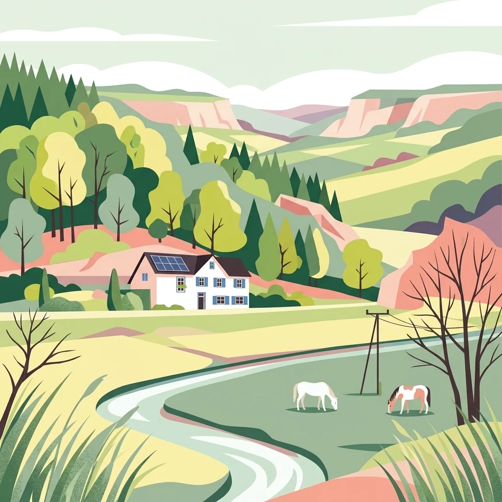
A colorful digital illustration showing a river valley with a white farmhouse, rolling hills, coniferous and deciduous trees, and two horses grazing in a foreground pasture.

Schwarzenbachtal

Nature reserve

Park overview

Structured park overview, official facts, and landscape profile for Schwarzenbachtal Nature Reserve

Schwarzenbachtal Nature Reserve park facts, protected area profile, and essential visitor context

Review the core facts for Schwarzenbachtal Nature Reserve, including designation, size, terrain, visitor scale, habitats, and operating context in one park-focused overview.

About Schwarzenbachtal Nature Reserve

Schwarzenbachtal Nature Reserve lies on the Bergische Hochflächen, a gently undulating upland in the eastern part of the Bergisches Land, and forms part of the network of protected stream valleys that characterize the Oberbergischer Kreis. The reserve covers 8.2 hectares and is officially designated under the German nature conservation system as a Naturschutzgebiet, carrying the administrative code GM-105. Its elevation is modest, ranging from about 210 to 220 meters, which places it firmly within the lower upland landscape rather than a high mountain environment.

The defining feature of the reserve is the upper and middle course of the Schwarzenbach, a small stream that originates from several tributaries, including deeply incised spring brooks known locally as Quellsiefen, near the hamlets of Lamsfuß and Oberholl. North of the small settlement of Unterschwarzen, the brook splits into two arms, but only the western arm, which flows along the woodland–open-land boundary, is included within the protected area. This choice emphasizes the ecological interface between closed forest and open valley, where the interchange between shaded and sunny conditions supports a particularly rich plant community.

The valley floor is mainly covered by grassland. Much of it is used as relatively intensive meadow or pasture, but the middle section, where a wider floodplain has developed, and the lower upper course host more ecologically valuable vegetation. Here, narrow strips of wet meadow and tall-herb fen vegetation survive, with plant communities dominated by moisture-loving species such as meadowsweet and marsh marigold. The northwestern portion contains a concentration of nutrient-poor grassland, creating an unusual close coexistence between wet and dry meadow habitats that has been highlighted as a key conservation feature. Botanists have documented an array of characteristic meadow species, including ragged robin, yellow iris, sneezewort, devil's-bit scabious, common knapweed, and harebell, giving the valley a striking seasonal flower display in early to mid summer.

The brook itself is a small but ecologically meaningful element of the wider Fließgewässerverbund, the stream network of the Bergisches Land, and connects southward to the Kürtener Sülz, which acts as the receiving watercourse at Buchholz. The reserve's conservation goals focus on maintaining the open character of the valley, restoring more flower-rich grassland through extensive mowing rather than grazing, and avoiding nitrogen fertilizer inputs that would favor competitive grasses over wildflowers. Additional long-term objectives include improving the stream's ecological condition by planting a narrow strip of floodplain woodland along its banks, which historically has been largely absent from this stretch.

Protection and recognition

Documented terrestrial protection metrics and official designation records

Schwarzenbachtal Protection Status and International Recognition Data

Schwarzenbachtal features recorded terrestrial protection data covering management scope and official administrative records. Verified database entries provide transparent baseline facts regarding designated conservation status.

Protection details

Protection scope
Terrestrial
Transboundary protection
No
WDPA ID
555560701
Park context

Deeper park guide and search-rich context for Schwarzenbachtal Nature Reserve

Schwarzenbachtal Nature Reserve history, landscape, wildlife, and travel context

Explore Schwarzenbachtal Nature Reserve through its history, landscape character, ecosystems, wildlife, conservation priorities, cultural context, and seasonal travel timing in a structured park guide built for atlas discovery and search intent.

Why Schwarzenbachtal Nature Reserve stands out

Schwarzenbachtal is best known for its open brook valley landscapes, including species-rich wet meadows, tall-herb fens, and isolated patches of nutrient-poor grassland that together highlight the small-scale habitat diversity of the Bergische Hochflächen.
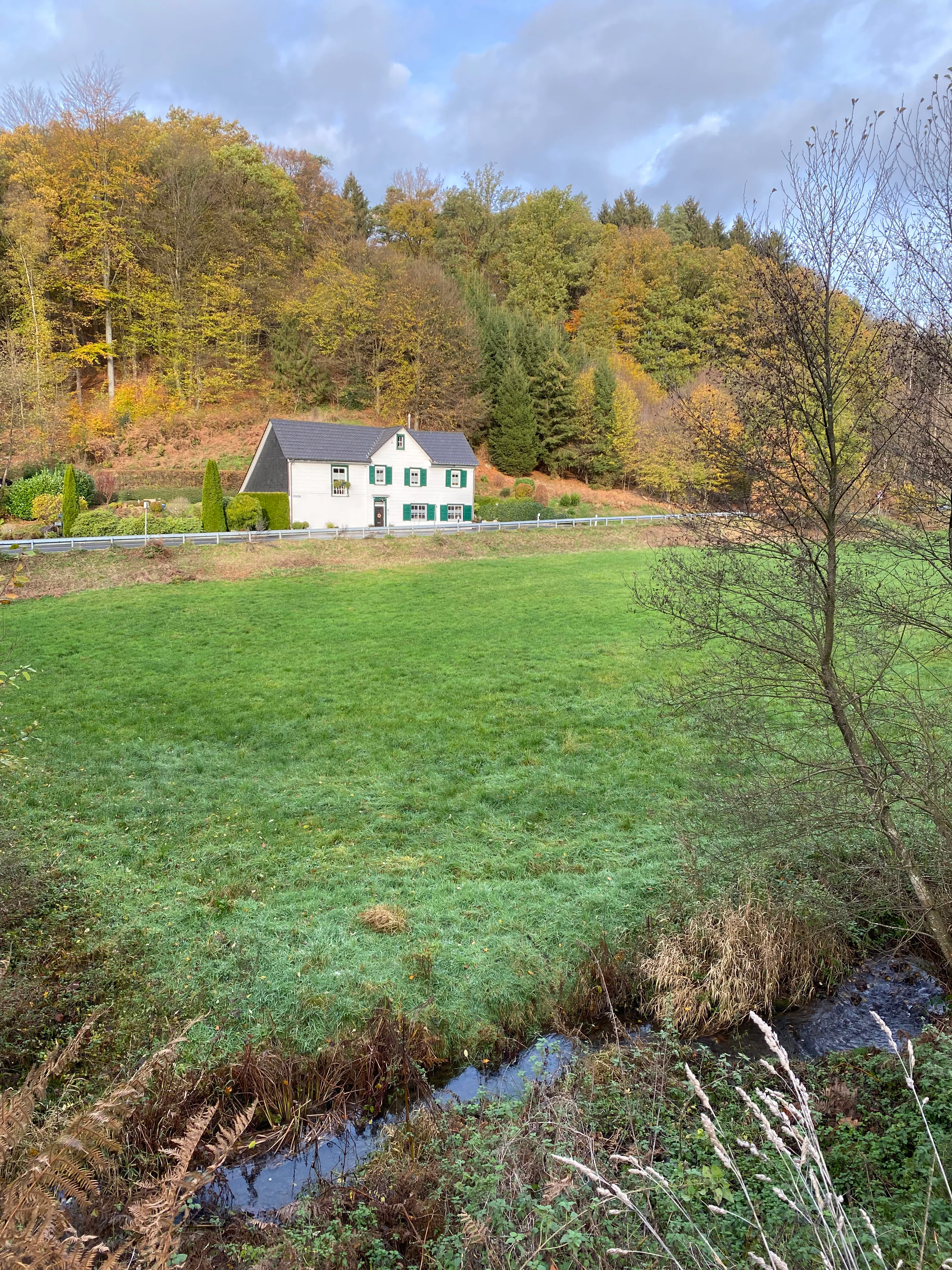
A white two-story house with dark shutters sits between a green meadow in the foreground and a forested hillside in the background, with a small stream flowing through the lower right corner.
A rural house nestled along the edge of the Schwarzenbachtal nature reserve, bordered by a meadow and the Schwarzenbach stream.

Schwarzenbachtal Nature Reserve history and protected-area timeline

The Schwarzenbachtal Nature Reserve was formally established in 2013 as part of the broader landscape planning framework for the Oberbergischer Kreis in North Rhine-Westphalia. Its designation followed the standard German approach of integrating smaller, ecologically valuable valleys into a coherent network of protected areas. The reserve was created through the Landschaftsplan process, under the responsibility of the Untere Landschaftsbehörde des Oberbergischen Kreises.

The 2013 designation built on a long-standing tradition of agricultural use of the valley floor, primarily as hay meadows and pasture for livestock. The decision to protect the area reflected the recognition that, despite intensive use in much of the valley, surviving fragments of wet meadow, tall-herb fen, and nutrient-poor grassland preserved a representative cross-section of the Bergische Hochflächen' natural heritage worth safeguarding for the future.

Schwarzenbachtal Nature Reserve landscape and geographic character

The landscape of Schwarzenbachtal is shaped by a gently sloping, elongated open valley set within the broader Bergische Hochflächen, a region of plateaus and rounded ridges typical of the eastern Bergisches Land. The reserve sits at a relatively low elevation, generally between 210 and 220 meters, and contains the upper and middle reach of a small brook rather than any steep or dramatic relief.

The most characteristic landscape features are the open valley bottom with its meadows and pastures, the narrow strips of wet grassland along the floodplain, and the bordering mixed forest on the valley slopes. Where the western arm of the Schwarzenbach flows along the woodland edge, the resulting transition zone creates the visual and ecological backbone of the reserve. In the deeper side valleys, small Quellsiefen cut narrow, shaded incisions into the slopes, adding finer-scale geomorphic detail to the otherwise gentle valley form.
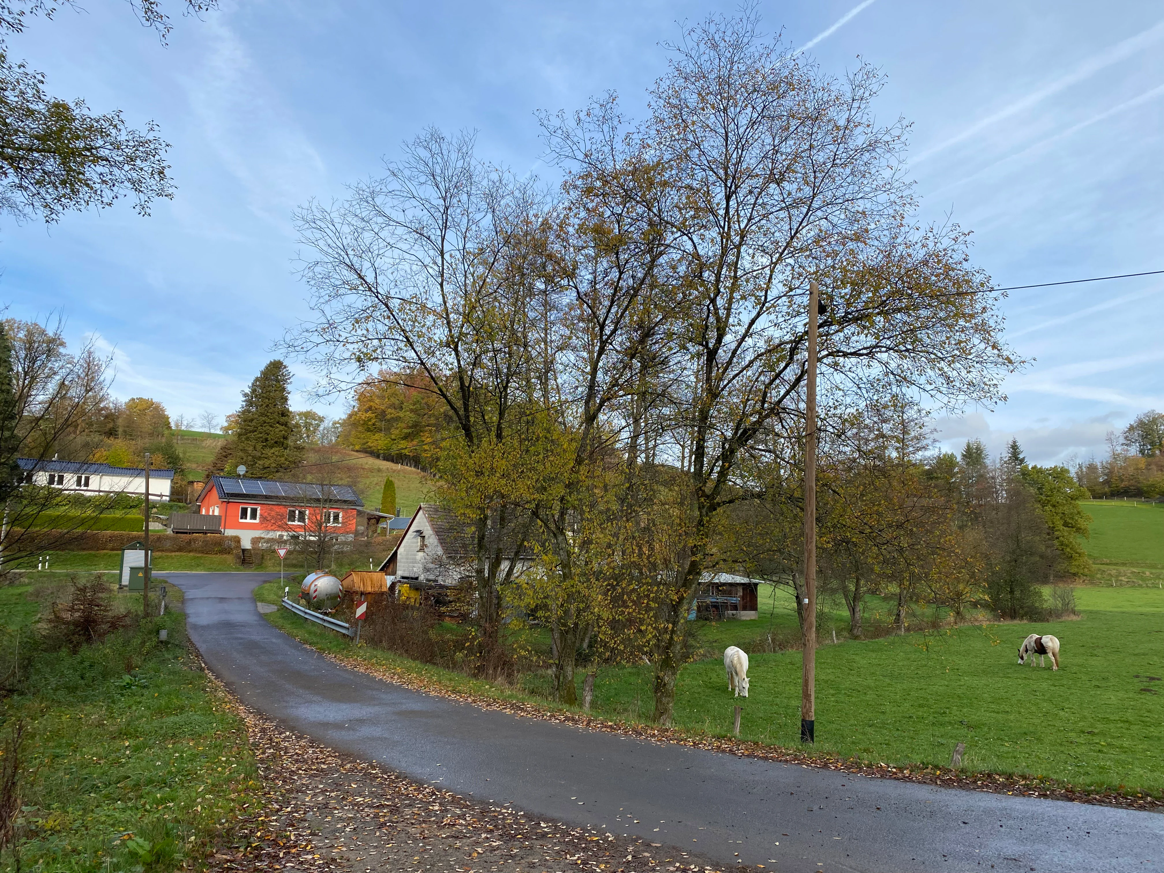
A paved country road leading past a green meadow with grazing horses towards a cluster of rural houses and trees in the background.
A rural landscape with a country road and grazing horses in the Schwarzenbachtal area.

Schwarzenbachtal Nature Reserve ecosystems, habitats, and plant life

Ecologically, Schwarzenbachtal is a small but well-structured example of a Bergisches Land stream valley, where the interplay between open floodplain and surrounding woodland supports a layered system of habitats. The valley sits within the natural region of the Bergische Hochflächen, and the reserve is regarded as a representative fragment of that landscape type.

The habitat mosaic is dominated by agriculturally used grassland, with two particularly important natural elements standing out. The first is the wet-meadow and tall-herb fen vegetation, including marshy meadows dominated by meadowsweet, marsh marigold, and yellow iris, along with tussocky fen vegetation where waterlogging persists. The second is the nutrient-poor dry grassland that appears in the northwestern part of the reserve, often featuring devil's-bit scabious, common knapweed, and harebell. The unusual proximity of these wet and dry meadow types is one of the reserve's defining ecological features.

Alongside the meadows, the stream itself provides linear aquatic and semi-aquatic habitat, which in turn supports moisture-dependent plant communities in its immediate surroundings. Although the reserve is not large, the combination of stream, wet meadows, dry meadows, spring brooks, and adjacent forest gives it a comparatively high habitat diversity for its size.

Schwarzenbachtal Nature Reserve conservation status and protection priorities

Schwarzenbachtal is protected as a German Naturschutzgebiet under the Nature Conservation Act of North Rhine-Westphalia and falls within the IUCN Category IV framework for Habitat and Species Management Areas. Its primary conservation value lies in preserving a representative cross-section of the natural valley landscapes of the Bergische Hochflächen, and in safeguarding surviving fragments of wet meadow and nutrient-poor grassland that have become increasingly rare in the densely populated region between Cologne and the Sauerland.

The reserve contributes to the broader conservation network of stream valleys in the Oberbergischer Kreis and links the Schwarzenbach into the hydrological and ecological system of the Kürtener Sülz. Management goals focus on sustaining the open character of the valley, enhancing the flower-rich quality of the meadows through extensive mowing and the avoidance of nitrogen fertilization, and gradually improving the ecological condition of the brook itself. A long-term measure under consideration is the reintroduction of a narrow strip of floodplain woodland along parts of the stream where it has historically been absent, in order to stabilize banks and enhance aquatic habitat quality.

Schwarzenbachtal Nature Reserve cultural meaning and human context

The Schwarzenbachtal lies within a rural area of the Oberbergischer Kreis characterized by long-established small hamlets and dispersed farmsteads, including the settlements of Wipperfeld, Unterschwarzen, Lamsfuß, Oberholl, and Buchholz. The valley's long-standing agricultural use, primarily as hay meadow and pasture, has shaped both the open landscape character and the persistence of traditionally managed meadow types, many of which are now protected as part of the reserve's conservation goals.

Top sights and standout views in Schwarzenbachtal Nature Reserve

The reserve's principal highlight is the compact but varied juxtaposition of habitats along the Schwarzenbach: open brook, wet meadows, tall-herb fen, nutrient-poor grassland, and adjacent woodland edge, all packed into an 8.2-hectare protected valley. The species-rich meadows, particularly the wet meadows near Julsiefen and the wet-and-dry grassland mosaic in the northwest, are widely noted as features of regional conservation significance.

Equally important is the reserve's role as a piece of the larger Bergisches Land stream network, linking the upper Schwarzenbach to the Kürtener Sülz, and as a representative example of the valley landscapes that define the Bergische Hochflächen. Despite its small size, Schwarzenbachtal offers an unusually clear illustration of how traditional agricultural use and ecological diversity can coexist in a single protected valley.

Best time to visit Schwarzenbachtal Nature Reserve

Late spring and early summer are the most rewarding seasons for visiting Schwarzenbachtal, when the species-rich wet and dry meadows reach their flowering peak. Meadowsweet, ragged robin, and marsh marigold light up the wetter sections, while harebell, devil's-bit scabious, and common knapweed add color to the drier grassland patches.

Monthly climate preview

Long-term representative temperature and precipitation rhythms across the protected landscape

Schwarzenbachtal Climate Normals and Measured Annual Weather Patterns

Historical data records mean monthly temperatures spanning sub-zero winter minimums to warm summer maximums alongside consistent daily precipitation rates. Examining the full monthly sequence clarifies the complete baseline thermal rhythm measured at this protected coordinate.
Annual mean9 °C
0 °C18 °C
Jan
Feb
Mar
Apr
May13°
Jun16°
Jul18°
Aug18°
Sep14°
Oct
Nov
Dec
Warmest month
July

18.3 °C

Coolest month
January

0.3 °C

Wettest month
December

3 mm/day

Driest month
April

1.8 mm/day

Park location guide

Geography guide, regional context, and park location map for Schwarzenbachtal Nature Reserve

Schwarzenbachtal Nature Reserve park geography, regions, and map view in Germany

Understand where Schwarzenbachtal Nature Reserve sits in Germany through a broader geographic reading of the surrounding landscape, nearby location context, and its mapped position within the national park landscape.

How Schwarzenbachtal Nature Reserve fits into Germany

Germany is a federal republic in Western and Central Europe with a population of over 83 million across sixteen constituent states. It is Europe's largest economy by nominal GDP and a major global exporter and importer. The capital is Berlin, and the country borders Denmark, Poland, Czech Republic, Austria, Switzerland, France, Luxembourg, Belgium, and the Netherlands.

Wider geography shaping Schwarzenbachtal Nature Reserve in Germany

Germany is located in Western and Central Europe, spanning 357,022 km². It borders Denmark to the north, Poland and the Czech Republic to the east, Austria and Switzerland to the south, and France, Luxembourg, Belgium, and the Netherlands to the west. The country has coastlines on the Baltic Sea and North Sea to the north, with the Alps located in the southern region.

Map view of Schwarzenbachtal Nature Reserve

Use this park location map to pinpoint Schwarzenbachtal Nature Reserve in Germany, understand its exact geographic position, and read its mapped placement within the surrounding landscape more clearly.

Pigeon | © OpenStreetMap contributors

Explore detailed imagery of wet meadows, stream corridors, and upland habitats in the Bergische Hochflächen

Schwarzenbachtal Photos and Landscape Scenery: Visualizing the Protected Brook Valley

Visual records capture the open brook valley landscapes, diverse wetland habitats, and protected grassland mosaics that define the reserve. Examining these detailed field photographs helps researchers and visitors understand the terrain and ecological character of the protected area.

A white two-story house with dark shutters sits between a green meadow in the foreground and a forested hillside in the background, with a small stream flowing through the lower right corner.

A close up view of a purple Devil's bit scabious flower head with a small bee on top, set against a blurry green meadow background.

A paved country road leading past a green meadow with grazing horses towards a cluster of rural houses and trees in the background.

Park atlas

Discover related protected landscapes and regional valley reserves across the Bergisches Land

Explore Parks Near Schwarzenbachtal and Surrounding Protected Natural Areas

Compare Schwarzenbachtal with other protected areas and stream valley reserves situated throughout the surrounding region. Extended geographic browsing reveals connected upland habitats and similar protected ecosystems across the wider terrain.
A horizontal watercolor illustration depicting rolling hills, forest patches, and a soft, hazy valley against a white background.
Nature reserveNorth Rhine-Westphalia
About 3.3 km away#1 closest

West

Mausbachtal Nature Reserve in North Rhine-Westphalia: Protected Stream Valley and Forest Landscapes

Regional stream valley network and deciduous forest landscape

This protected area in the Oberbergischer Kreis offers a window into the Bergische Hochflächen topography. The reserve highlights a mosaic of near-natural beech forest, wet meadows, and floodplain woodland, forming an integral link in the regional stream network connected to the Große Dhünn.

Area
0.237 km²
Established
2013
IUCN
IV
Nature reserveNorth Rhine-Westphalia
About 6.5 km away#2 closest

North

Wupperaue bei Westenbrücke Nature Reserve Landscape and Geographic Mapping

Protected riparian floodplain in the Oberbergischer Kreis

This nature reserve protects a vital 2.3 kilometer segment of the Wupper river valley. Its landscape is characterized by a mosaic of wet meadows, alder and willow stands, and riparian corridors, providing a crucial stepping-stone habitat within the Hückeswagen area of North Rhine-Westphalia.

Area
0.318 km²
Established
2013
IUCN
IV
Nature reserveRheinisch-Bergischer Kreis
About 6.8 km away#3 closest

Southwest

Naturschutzgebiet Olpebachtal: Nature Reserve and Protected Stream Valley Geography

A protected landscape mosaic in Rheinisch-Bergischer Kreis

Naturschutzgebiet Olpebachtal protects a unique, near-natural section of the Olpebach stream valley. Characterized by wide floodplains, wet meadows, and narrow tributary ravines, the reserve functions as a critical habitat linkage within the rolling terrain of the Bergische Hochflächen. Its geography provides a clear window into the stream-floodplain systems that define the natural character of the broader region.

Area
0.251 km²
Established
1990
IUCN
IV
A soft watercolor illustration of a green valley with a central stream or river winding through meadows towards distant hills.
Nature reserveOberbergischer Kreis
About 9.6 km away#4 closest

North

Leiverbachtal und Talhänge: Protected Stream Valley and Forest Habitat in Oberbergischer Kreis

Examining the geography of a Bergisches Land nature reserve

Leiverbachtal und Talhänge stands as a significant nature reserve within the Oberbergischer Kreis, defined by its near-natural meandering stream and diverse riparian ecosystem. The site offers a detailed look at floodplain meadows, slope forest transitions, and the ongoing shift toward broadleaf woodland within the German Mittelgebirg landscape.

Area
0.92 km²
Established
2006
IUCN
IV
Relief
Upland
A flat, vector-style illustration of a valley with a winding path in the foreground, coniferous trees, a waterfall, and rocky cliffs under a light sky.
Nature reserveOberbergischer Kreis
About 11 km away#5 closest

Northeast

Ibachtal und Nebenbäche Nature Reserve: Geographic Overview and Protected Stream Landscape

Stream valley connectivity in the Oberbergischer Kreis

Trace the landscape of the Ibachtal und Nebenbäche nature reserve through its distinct stream valleys, alder gallery forests, and botanically diverse wet meadows. This area serves as a primary example of stream-based ecological protection in the Bergisches Land, characterized by narrow ravine-like tributaries and expansive floodplain grassland.

Area
0.268 km²
Established
2013
IUCN
IV
Nature reserveNorth Rhine-Westphalia
About 11 km away#6 closest

Southwest

Naturschutzgebiet Ölsiefental Protected Area and Stream Valley Map in North Rhine-Westphalia

Representative valley landscape with moist deciduous forest and spring mire habitats

Naturschutzgebiet Ölsiefental preserves a compact yet diverse mosaic of brook, swamp, and floodplain forest. This protected area in North Rhine-Westphalia follows the Ölsiefen stream from its source to the Sülz river, providing a valuable study of intact valley relief, wet meadow ecology, and historical coppice woodland management in the Bergisches Land region.

Area
0.05 km²
Established
1990
IUCN
IV
A horizontal watercolor painting depicting a soft landscape with distant rolling hills, mid-ground green forests, and a foreground area of wetland and water.
Nature reserveNordrhein-Westfalen
About 11 km away#7 closest

Southwest

Naturschutzgebiet Alemigsiefental: Nature Reserve Geography and Protected Valley Landscapes

Protected riparian habitat in the Bergisches Land of Germany

Examine the mapped boundaries and natural terrain of Naturschutzgebiet Alemigsiefental. This nature reserve in Nordrhein-Westfalen protects an essential stream corridor, wet meadows, and floodplain forests, serving as a critical habitat within the regional network of protected watercourses.

Area
0.101 km²
Established
1990
IUCN
IV
Relief
Upland
Nature reserveNordrhein-Westfalen
About 11 km away#8 closest

Southwest

Naturschutzgebiet Scherfbachtal: Protected Stream Valley and Spring Landscape Analysis

Regional protected geography in Nordrhein-Westfalen

Delve into the protected terrain of Naturschutzgebiet Scherfbachtal, which preserves a rare network of spring basins, wet meadows, and floodplain forests. This site exemplifies the ecological value of small, interconnected valley habitats within the wider Bergisches Land region of North Rhine-Westphalia, providing essential sanctuary for local stream-dependent ecosystems.

Established
2012
IUCN
IV

Common questions about visiting, size, designation, and location context for Schwarzenbachtal Nature Reserve

Schwarzenbachtal Nature Reserve FAQs for park facts, access, geography, and protected area context

Find quick answers about Schwarzenbachtal Nature Reserve, including protected-area facts, park geography, trail and visitor context, and how the park fits into its surrounding country and regional landscape.
MoriAtlas Explorer

Continue Your Protected Areas Search Across the Global Atlas

Deepen your exploration by continuing the structured search for national parks and protected areas worldwide. Utilize the comprehensive filtering capabilities to compare different conservation landscapes and refine your understanding of global park geography. Discover more about the distribution and characteristics of protected natural areas.

Global natural geography