
Mori Atlas logo
Protected landscapeNaturpark Münden

Tracing the Forested Ridges, River Valleys, and Cultural Terrain of this Regional Nature Park

Naturpark Münden: A Comprehensive Geographic Profile of the Protected Landscape in Lower Saxony

Naturpark Münden encompasses a sprawling, forested protected landscape within the Landkreis Göttingen region of southern Lower Saxony. Defined by the confluence of the Fulda and Werra rivers and the extensive woodland crests of the Kaufunger Wald, Bramwald, and Dransfelder Stadtwald, this terrain represents the quintessential central German low mountain experience. Its geography integrates deep valleys, historic river crossings, and long ridgelines that anchor the area to both its natural ecology and a rich heritage of medieval sites.

nature parkforest landscapelow mountain rangeriver confluenceWeser Valleyhiking
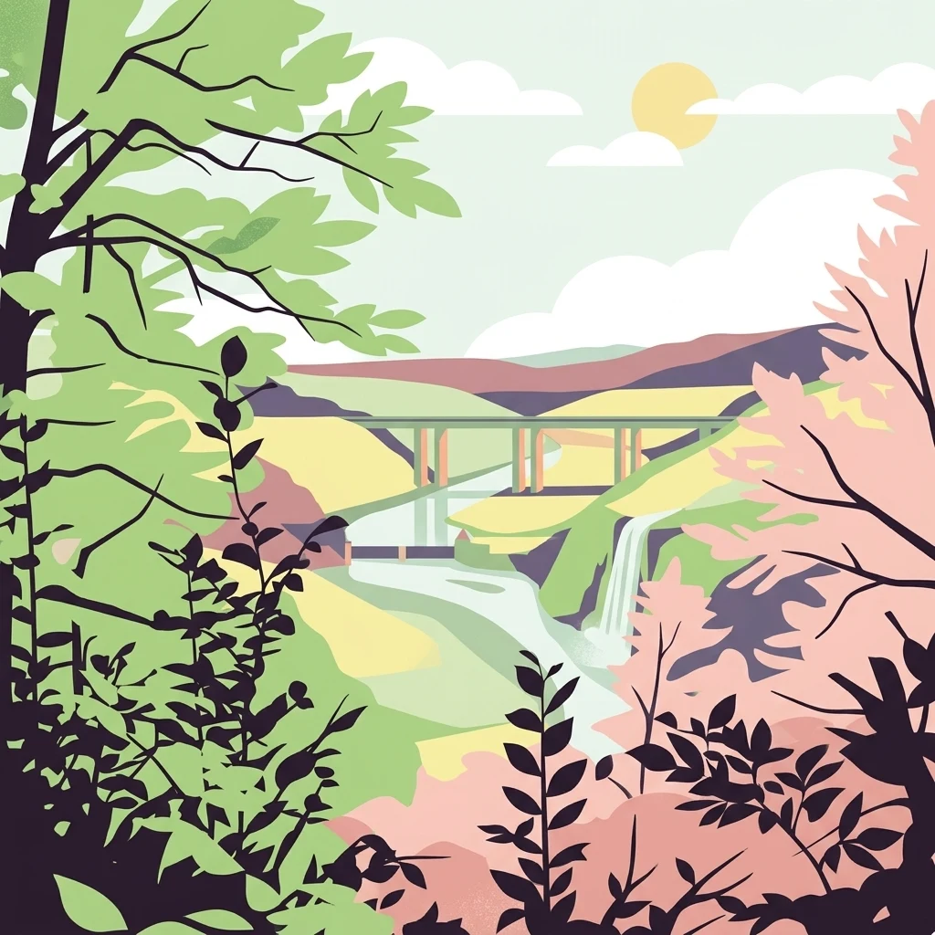
A flat-style digital illustration of a forested valley with a river, a bridge, and a small waterfall, framed by silhouetted tree branches in the foreground.

Naturpark Münden

Protected landscape

Park overview

Structured park overview, official facts, and landscape profile for Naturpark Münden

Naturpark Münden park facts, protected area profile, and essential visitor context

Review the core facts for Naturpark Münden, including designation, size, terrain, visitor scale, habitats, and operating context in one park-focused overview.

About Naturpark Münden

Naturpark Münden occupies a meaningful place in the network of German nature parks as a classic example of a low-mid-elevation forested landscape shaped by long river valleys. Its setting at the Weser confluence gives it a strong connective identity: the Werra and Fulda valleys frame the park on the south and west, while heavily wooded ridgelines extend northward into the Bramwald and Dransfelder Stadtwald. The effect is a continuous, walkable transition from the deeply incised Werra valley, with its villages, castles, and the A7 highway, up over forested spurs and through quiet beech and mixed forest toward the small historic town of Hann. Münden.

Visitors typically encounter a landscape dominated by forest cover, with ridges like the Hoher Hagen, the Staufenberge, the Steinberg ridge, and the Totenberg standing out above the canopy. Marked viewpoints give broad views over the Werra valley and toward the surrounding hills of northern Hesse. The Dransfelder Stadtwald is in particular a recognizable subregion of the park, centered on the Dransberg and the well-known Hoher Hagen with its Gauß tower.

The cultural and recreational overlay of the park is unusually rich. Besides the standard set of themed long-distance paths like the Frau-Holle-Pfad, the Märchenlandweg, the Kassel-Steig, and the Werraburgensteig, the park is dotted with medieval ruins such as Brackenburg and Sichelnstein, the Bramburg fortress, the historical Spiegelburg in Hann. Münden, the Roman camp at Hedemünden, and the model medieval village of Steinrode. Smaller features, including altar stones near Dransfeld, the Schalenstein of Wiershausen, and a barefoot path near Nienhagen, complement the park's identity as both a natural reserve and an open-air heritage landscape of the southern Weser region.

Quick facts and research context for Naturpark Münden

Naturpark Münden is a roughly 374 square kilometer nature park located west, south, and east of Hann. Münden, near the Fulda-Werra-Weser river confluence. It was established in 1959 by the former Landkreis Münden and covers parts of the Kaufunger Wald, Bramwald, and Dransfelder Stadtwald. The park lies in the district of Göttingen in southern Lower Saxony and borders the state of Hesse to the south. It is crossed by the A7 motorway and the Hanover-Würzburg high-speed rail line. The area is characterized primarily by dense mixed forest, gentle ridgelines, and numerous small summits, the tallest within the park reaching above 580 meters.

Park context

Deeper park guide and search-rich context for Naturpark Münden

Naturpark Münden history, landscape, wildlife, and travel context

Explore Naturpark Münden through its history, landscape character, ecosystems, wildlife, conservation priorities, cultural context, and seasonal travel timing in a structured park guide built for atlas discovery and search intent.

Why Naturpark Münden stands out

Naturpark Münden is best known for its location at the classic confluence of the Fulda and Werra into the Weser, a setting surrounded by extensive, undulating mixed forest typical of the central German low mountain region. The park's profile is shaped by the long, forested ridges of the Kaufunger Wald, Bramwald, and Dransfelder Stadtwald, with summits like the Haferberg, Kleiner and Großer Steinberg, Hoher Hagen, Brunsberg, and Totenberg forming its overlooks. It is also recognized for combining natural landscape features with a dense cultural layer of medieval castles, ruins, historical villages, river crossings, and themed walking paths, making it a textbook example of an integrated German nature park experience.
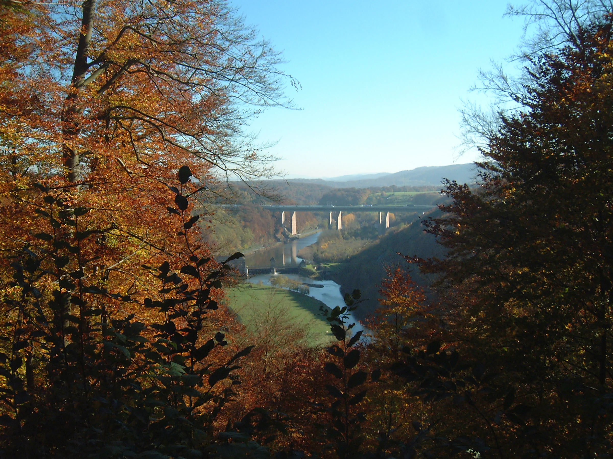
A valley view through an autumn forest featuring a river and long viaduct bridges in the distance.
A scenic autumn view of the Werra Valley, framed by forested slopes in Naturpark Münden.

Naturpark Münden history and protected-area timeline

Naturpark Münden traces its establishment to 1959, when the administration of the former Landkreis Münden formally designated the area in its existing borders as a waldreicher Naturpark, or forest-rich nature park. The park was created during the early wave of the German nature park movement, which sought to combine landscape preservation with public access, recreation, and regional identity-building. The original administrative body no longer exists, but the park's boundaries have been preserved within the modern Landkreis Göttingen.

The commemorative stone marking the 1959 foundation still stands near the Kleiner Steinberg in the Kaufunger Wald, signaling the park's roots in the post-war tradition of regional nature and landscape stewardship. Over subsequent decades the park's role expanded beyond conservation to include curated hiking experiences, the restoration and interpretation of historical sites, and cooperation with neighboring protected areas, especially the Geo-Naturpark Frau-Holle-Land to the south and southeast.

The 20th and 21st centuries brought additional developments to the surrounding landscape: major infrastructure projects, including the A7 motorway and the Hanover-Würzburg high-speed rail line, crossed the Werra valley within or adjacent to the park, including visually prominent structures such as the Werratalbrücke. These interventions, while altering the valley floor's appearance, did not interrupt the park's role as a connective swath of forest and recreational landscape, and the park's identity today remains closely tied to its 1959 founding intent.

Naturpark Münden landscape and geographic character

The landscape of Naturpark Münden is shaped by the gentle ridges, broad forested crests, and river-cut valleys of the central German Mittelgebirge. The dominant elevations are the wooded summits of the Kaufunger Wald, Bramwald, and Dransfelder Stadtwald, with the highest points in the park including the Haferberg at above 580 meters, the Kleiner and Großer Steinberg near 542 meters, and ridges such as the Hoher Hagen, Brunsberg, Brackenberg, and Totenberg at elevations between roughly 480 and 400 meters. Lower hills like the Staufenberg, the Backenberg, the Blümer Berg, and the Speeler Kopf mark the transitions to the river valleys below.

The Werra valley defines the park's southern and southeastern edge, while the Fulda and the Weser shape its western and northern watersheds. The famous confluence of Fulda and Werra to form the Weser lies just outside the park proper, anchoring the area's geographic identity. The Werra valley within the park is framed by traffic corridors, including the A7 autobahn and the high-speed rail line, which the park's topographic setting has accommodated through visible crossings such as the Werratalbrücke.

Forest dominates the interior: mixed woodland of beech, oak, and spruce covers most slopes and summit areas, broken by small clearings, villages, agricultural edges, and historic castle sites. The terrain produces long ridgelines suitable for panoramic hikes and a series of deeply sheltered valleys with villages like Hemeln and historic river crossings such as the Weserfähre Veckerhagen, tying the natural landscape to the long history of human settlement in the Weser region.

Naturpark Münden ecosystems, habitats, and plant life

Naturpark Münden is ecologically defined by extensive, well-connected mixed forest on sandstone and limestone-derived soils typical of the central German uplands. The Kaufunger Wald in the south, the Bramwald in the center, and the Dransfelder Stadtwald in the north together form a continuous forested block that supports stable populations of woodland birds, mammals of the beech-oak zone, and the typical understory flora of mesophilic central European forests. The unbroken forest cover over much of the park helps maintain quiet, humid microclimates and well-developed soil layers on the gentler slopes.

The river valleys of the Werra, Fulda, and upper Weser contribute additional habitat diversity, with riparian corridors, small meadows, and occasional wetland patches along tributaries and valley floors. These river reaches serve as transition zones between the dense forest cover and human settlement, and they are important for amphibians, aquatic invertebrates, and birds associated with flowing water habitats. The high coverage of woodland, the relatively low intensity of land use across most of the park, and the protected-area status all contribute to a coherent forest-dominated ecological profile.

Naturpark Münden wildlife and species highlights

Thanks to the dominance of continuous broadleaf and mixed forest, the wildlife of Naturpark Münden is characteristic of central European upland woodlands. Typical forest mammals, including red deer, roe deer, wild boar, and small predators such as fox and marten, are present across the park's three large forest areas. Smaller woodland mammals, bats using old-growth and veteran trees, and a rich community of forest birds including woodpeckers, owls, and typical songbirds associated with beech-oak habitats are part of the regular fauna.

The riparian habitats of the Werra, Fulda, and Weser headwaters add further diversity, supporting waterbirds, kingfishers, and species associated with structured riverbanks and small floodplain fragments. While no single flagship species defines the park, its value lies in the cumulative richness of the forest and valley mosaic rather than in any one charismatic animal. Earlier additions to the park's wildlife infrastructure, such as the former small game enclosure at the Rinderstall Alm, reflect past efforts to make the fauna more directly visible to visitors, though such facilities have been reduced in modern times.

Naturpark Münden conservation status and protection priorities

Naturpark Münden functions as a connective protected landscape rather than a strict nature reserve, and its principal conservation value lies in maintaining a large, intact block of mixed forest surrounded by traditionally managed rural land. The park's 374 square kilometer footprint ties the otherwise fragmented forests of the Kaufunger Wald, Bramwald, and Dransfelder Stadtwald into a single managed whole, supporting long-term ecological processes such as forest regeneration, soil development, and habitat connectivity for woodland species.

Its position adjacent to the Geo-Naturpark Frau-Holle-Land strengthens its role in a larger cross-border conservation network, linking Lower Saxony and Hesse through joint landscape management. The park's proximity to the Weser confluence also gives it additional hydrological significance, since the forested ridges filter and regulate runoff into the Werra, Fulda, and Weser systems. While the park does not focus on a single endangered ecosystem, it provides an effective umbrella for the broader low-mountain forest landscape and its associated cultural landscapes.

Naturpark Münden cultural meaning and human context

The cultural context of Naturpark Münden is woven deeply into the medieval and early modern history of the Weser region. The Werra valley and surrounding ridges are marked by an unusually dense concentration of castles, ruins, and lookout points, including Bramburg, Brackenburg, Sichelnstein, the Spiegelburg in Hann. Münden, and historic sites like the Römerlager Hedemünden. The medieval village of Steinrode is preserved as a model settlement near the Jugendwaldheim Steinberg, illustrating traditional Weser-region building culture.

Local folklore and regional identity are also central to the park's character. Themed long-distance paths like the Frau-Holle-Pfad and the Märchenlandweg reflect the region's deep connection to German folk tales, particularly those associated with the Brothers Grimm and the Frau Holle landscape of the neighboring Geo-Naturpark. Smaller features, such as the altar stones near Dransfeld, the Schalenstein of Wiershausen, and the Weserfähre Veckerhagen linking Hemeln to Veckerhagen, mark the everyday cultural and folk heritage of the area. The park's geologically themed paths, such as the Geologiepfad at the Hoher Hagen, also embed scientific heritage into the visitor experience, giving the landscape a strong identity beyond scenery alone.

Top sights and standout views in Naturpark Münden

Naturpark Münden's strongest features are its extensive forested ridges, the iconic Weser-confluence setting, and the unusually dense cultural overlay of medieval castles, ruins, and themed trails. The combination of three large contiguous forests, the Kaufunger Wald, Bramwald, and Dransfelder Stadtwald, forms a backbone of woodland hiking, while the Werra valley adds dramatic views, river crossings, and historic villages. The Gaußturm on the Hoher Hagen, the Bramburg and other castle ruins, the Spiegelburg in Hann. Münden, the Geologiepfad, and themed routes like the Frau-Holle-Pfad and the Märchenlandweg give the park rare depth as both natural and cultural landscape.

Best time to visit Naturpark Münden

Naturpark Münden is rewarding throughout much of the year, with each season offering a different character. Spring and early summer bring fresh green foliage, the active birdlife of beech-oak forest, and pleasant temperatures for hiking the steep ridges of the Kaufunger Wald and Bramwald. Summer offers the longest daylight and best access to longer routes such as the Frau-Holle-Pfad, the Märchenlandweg, and the Werraburgensteig, though the forested nature of the park means that visits remain cooler than in the open lowlands.

Autumn is widely considered a particularly atmospheric season, when the broadleaf forests turn color and the panoramic ridges, including the Hoher Hagen and the Steinberg ridge, are most visually striking. The Gaußturm and other high viewpoints are especially scenic at this time, while forest trails and castle sites take on a quieter, more contemplative mood. Winter brings a quieter, lower-volume character to the park, with snow occasionally highlighting the ridgelines and valley castles; colder temperatures make the Werra valley views particularly crisp, though some higher paths can be more demanding. As always in a forested low-mountain park, conditions vary with elevation, and visitors should plan around the local weather.

Monthly climate preview

Track monthly temperature variations and precipitation averages across representative coordinates.

Naturpark Münden Climate Normals, Long-Term Temperature and Precipitation Rhythms

Naturpark Münden exhibits a measured annual temperature and precipitation rhythm based on long-term historical records from representative park coordinates. Examining the complete twelve-month meteorological profile reveals detailed seasonal variations in monthly averages.
Annual mean8 °C
-1 °C18 °C
Jan-1°
Feb
Mar
Apr
May12°
Jun16°
Jul18°
Aug18°
Sep14°
Oct
Nov
Dec
Warmest month
July

18 °C

Coolest month
January

-0.6 °C

Wettest month
July

2.5 mm/day

Driest month
April

1.5 mm/day

Park location guide

Geography guide, regional context, and park location map for Naturpark Münden

Naturpark Münden park geography, regions, and map view in Germany

Understand where Naturpark Münden sits in Germany through a broader geographic reading of the surrounding landscape, nearby location context, and its mapped position within the national park landscape.

How Naturpark Münden fits into Germany

Germany is a federal republic in Western and Central Europe with a population of over 83 million across sixteen constituent states. It is Europe's largest economy by nominal GDP and a major global exporter and importer. The capital is Berlin, and the country borders Denmark, Poland, Czech Republic, Austria, Switzerland, France, Luxembourg, Belgium, and the Netherlands.

Wider geography shaping Naturpark Münden in Germany

Germany is located in Western and Central Europe, spanning 357,022 km². It borders Denmark to the north, Poland and the Czech Republic to the east, Austria and Switzerland to the south, and France, Luxembourg, Belgium, and the Netherlands to the west. The country has coastlines on the Baltic Sea and North Sea to the north, with the Alps located in the southern region.

Map view of Naturpark Münden

Use this park location map to pinpoint Naturpark Münden in Germany, understand its exact geographic position, and read its mapped placement within the surrounding landscape more clearly.

Pigeon | © OpenStreetMap contributors

Location context for Naturpark Münden

Lower Saxony

Visual exploration of forested ridges, river valleys, and low mountain terrain

Naturpark Münden Photos and Protected Landscape Scenery

Visual records capture the dense mixed beech forests, broad woodland crests, and river valley transitions that shape the low mountain terrain of Naturpark Münden. Photographic documentation reveals the rugged topography and protected habitats defining this central German nature park environment.

A valley view through an autumn forest featuring a river and long viaduct bridges in the distance.

A large stone slab sitting in a grassy area, engraved with the words Naturpark Münden, the year 1959, and an outline drawing of a bird.

Park atlas

Compare surrounding low mountain ranges and connected regional nature parks

Explore Protected Areas and Parks Near Naturpark Münden

Visitors comparing Naturpark Münden can browse adjacent forested ridges and protected river valleys across southern Lower Saxony. Expanding the search reveals how neighboring conservation landscapes share similar Mittelgebirge terrain and historical river networks.
A horizontal watercolor illustration depicting a river flowing through a lush green floodplain with trees and distant hills under a soft, light-colored sky.
Nature reserveHessen
About 7.8 km away#1 closest

Southwest

Fuldaschleuse Wolfsanger Nature Reserve: Geography and Protected Riverine Terrain

A restored floodplain ecosystem in the Hessen region.

Fuldaschleuse Wolfsanger stands as a masterfully restored nature reserve along the River Fulda. This compact 14-hectare site features a man-made island, shallow-water zones, and softwater floodplain forests that support over 120 bird species. Its layout provides a rare example of integrated conservation within a modern urban-edge environment, demonstrating the success of deliberate floodplain engineering for biodiversity.

Area
0.14 km²
Established
1985
IUCN
IV
Watercolor painting of a soft landscape featuring green trees and rolling hills in muted tones against a white background.
Nature reserveGermany
About 8.3 km away#2 closest

Northwest

Bruchwald am Gahrenberg Nature Reserve: A Protected Wetland Atlas of the Reinhardswald

Mapped terrain, bog woodland, and hydrological headwaters in Hessen

Located in the Reinhardswald forest massif, Bruchwald am Gahrenberg protects critical marsh and bog woodland habitats. The area serves as a primary source for regional streams, offering a dense, spring-fed landscape that stands out within the broader northern German wilderness.

Area
0.41 km²
Established
1992
Relief
Upland
Climate
Temperate
A horizontal watercolor illustration depicting rolling green hills, patches of forest, and a calm river in the foreground, rendered in soft, pastel tones.
Nature reserveHesse
About 8.7 km away#3 closest

West

Kragenhof bei Fuldatal Nature Reserve: Mapped Floodplain Landscapes in Hesse, Germany

Protected riparian ecosystems and river meander geography

Located in the state of Hesse, Kragenhof bei Fuldatal is a significant nature reserve protecting a complex mosaic of Fulda River floodplain habitats. The area features shifting currents, small wooded islands, and open grassland within a distinctive meander-driven landscape. Explore the geographic boundaries and ecological structure of this important regional waterbird refuge.

Area
0.077 km²
Established
1981
A minimalist watercolor painting featuring soft green trees and rolling hills in the background against a light, airy white backdrop.
Nature reserveWerra-Meißner-Kreis
About 9.9 km away#4 closest

East

Ermschwerder Heegen Nature Reserve: Muschelkalk Ridge and Floodplain Geography

Protected mosaic of forests, marshes, and meadows in northern Hesse

Ermschwerder Heegen preserves a compact but ecologically significant landscape in the Werra-Meißner-Kreis. Its unique topography features a limestone ridge dropping into the Werra valley, supporting a rich mixture of forest, orchard, and wetland habitats that rank among the most important in the region for biodiversity.

Area
0.37 km²
Established
1985
IUCN
IV
Protected areaEllerode
About 9.9 km away#5 closest

East

Kreideberg bei Ellerode Protected Area: Geography, Boundaries, and Landscape Map

A diverse calcareous forest habitat in northern Hesse

The Kreideberg bei Ellerode reserve showcases a unique geological character with its chalk-influenced substrate and rich botanical communities. This protected landscape encompasses old-growth beech stands, semi-dry grasslands, and rare calcareous spring features. The site represents an essential, compact habitat corridor within the broader Werra-Meißner-Kreis regional geography.

Area
0.571 km²
Established
1995
Relief
Upland
Climate
Temperate
A soft watercolor illustration depicting a green, marshy landscape with small pools of water, a line of forest, and rolling hills in the background under a pale sky.
Nature reserveHesse
About 11 km away#6 closest

Northwest

Bruch an der Eichkanzel im Reinhardswald: Protected Nature Reserve Geography in Hesse

Mapped birch swamp forests and highland bog terrain

Examine the geographic profile of Bruch an der Eichkanzel im Reinhardswald, a nature reserve in Hesse defined by its upland plateau. Learn about the interaction between its birch swamp forests and open moorland habitats, characterized by sphagnum mosses and aquatic features, within the broader context of the Reinhardswald forest region.

Area
0.175 km²
Established
1992
Relief
Upland
Scope
Terrestrial
A horizontal watercolor painting showing a winding river flowing through a lush valley with forested hills in the background.
Protected areaHesse
About 11 km away#7 closest

East

Freudenthal bei Witzenhausen Protected Landscape and Wetland Geography in Hesse

A restored gravel pit wetland system in the northern Hesse Werra valley.

Freudenthal bei Witzenhausen represents a high-value conservation landscape within Hesse, serving as a primary site for breeding and migratory waterbirds. The reserve comprises three interconnected quarry lakes surrounded by alluvial woodland, ruderal vegetation, and meadows. This habitat mosaic is part of the Natura 2000 network, providing essential ecological connectivity within the riverine corridor of the lower Werra valley.

Area
0.76 km²
Established
1980
Relief
Lowland
Climate
Temperate
A horizontal watercolor illustration depicting rolling green hills, scattered trees, and soft mountain silhouettes against a pale sky.
Protected areaGermany
About 11 km away#8 closest

Southeast

Kalkmagerrasen bei Roßbach: Protected Calcareous Grassland and Juniper Landscape in Germany

Geographic atlas and protected area overview in Hesse

Kalkmagerrasen bei Roßbach consists of five distinct plots that protect rare Enzian Schillergras Rasen communities on shallow Zechstein limestone soils. This site remains a critical stronghold for diverse orchid populations and protected butterfly species within the Werra Meißner region. The mosaic of juniper, flowering herbs, and historic cherry orchards creates a unique Mediterranean character rarely found in central German hill country.

Area
0.551 km²
Established
1996
Relief
Upland
Climate
Temperate

Common questions about visiting, size, designation, and location context for Naturpark Münden

Naturpark Münden FAQs for park facts, access, geography, and protected area context

Find quick answers about Naturpark Münden, including protected-area facts, park geography, trail and visitor context, and how the park fits into its surrounding country and regional landscape.
MoriAtlas Explorer

Continue Your Protected Areas Search Across the Global Atlas

Deepen your exploration by continuing the structured search for national parks and protected areas worldwide. Utilize the comprehensive filtering capabilities to compare different conservation landscapes and refine your understanding of global park geography. Discover more about the distribution and characteristics of protected natural areas.

Global natural geography