Mori Atlas logo
Protected landscapeNaturpark Reinhardswald

Mapping the forest ecosystems, limestone valleys, and historic woodland pasture landscapes

Naturpark Reinhardswald Protected Landscape: A Geographic Atlas of Northern Hessen Nature

Naturpark Reinhardswald serves as a significant protected landscape in northern Hessen, spanning a complex mosaic of terrain that ranges from dense acidic sandstone forests to the calcareous grasslands of the Diemel valley. This atlas entry provides a detailed look at the regional geography, including the basalt-capped hills, the riverine terraces of the Weser and Fulda, and the ancient oak woodlands that define the park territory. Through this geographic record, examine the distribution of protected natural habitats and the transition between wooded uplands and open valley landscapes.

nature parkbroadleaf forestsandstone forestcalcareous grasslandriver valleywooded upland

Naturpark Reinhardswald

Protected landscape

Park overview

Structured park overview, official facts, and landscape profile for Naturpark Reinhardswald

Naturpark Reinhardswald park facts, protected area profile, and essential visitor context

Review the core facts for Naturpark Reinhardswald, including designation, size, terrain, visitor scale, habitats, and operating context in one park-focused overview.

About Naturpark Reinhardswald

Naturpark Reinhardswald sits at the geographic crossroads of northern Hesse, occupying a strategic position between the Reinhardswald, the Bramwald, and the lower Weser and Fulda river valleys. Although it is one of the more recently designated nature parks in Germany, having been formally established in 2017, it encompasses some of the most ecologically distinctive terrain in the region.

The core of the park is the Reinhardswald itself, a large, predominantly wooded upland deeply shaped by the underlying Triassic Buntsandstein, a reddish, nutrient-poor sandstone that produces acidic soils favorable to mixed broadleaf and coniferous forest. Together with the adjoining Bramwald, which extends across the Hessian border into Lower Saxony, the forests here form a vast, predominantly forested backdrop to the park. Many of the older stands include traditional Hutewald structures: wooded pasture with ancient oaks that have grown in open conditions over centuries, producing a distinctive, park-like woodland character.

To the east, the park includes sections of the lower Fulda valley and the Weser valley, with river terraces and floodplain elements that contrast with the dense forests inland. Northward, the protected area reaches toward the town of Bad Karlshafen and the historic settlements of Helmarshausen and Lippoldsberg, which lie within the park's boundaries. To the west, the landscape changes again as the Buntsandstein gives way to the Muschelkalk, or shell limestone, of the Diemel valley. Here the terrain becomes more open, undulating, and agriculturally shaped, and the soils support extensive calcareous grasslands, many of which are protected as nature reserves. This juxtaposition, of mineral-poor, acidic forest upland against calcareous, herb-rich valley grasslands, is one of the defining ecological contrasts of the park.

The transitional zone between these two worlds takes the form of the Hofgeismar Rötsenke, a soft sedimentary basin producing gentle, rolling country that rises in places into basalt-capped hills. The Gahrenberg within the Reinhardswald, the Schöneberg, Heuberg, and Westberg near Hofgeismar, and the Deiselberg near Trendelburg all give the park a varied and visually distinctive skyline.

Approximately 40 percent of the park's total area receives some form of official protection, from nature reserves and natural monuments to landscape protection areas and Natura 2000 sites. Beyond its strictly conserved zones, much of the park remains a working, inhabited, and economically active landscape of villages, small towns, traditional forestry, and farmland, with the city of Hofgeismar itself excluded from the boundaries together with parts of the most intensively cultivated lowlands.

The park is closely linked to its neighbors. Across the Weser on the Lower Saxon side lies Naturpark Münden; to the north sits Naturpark Solling-Vogler; and to the west in North Rhine-Westphalia borders Naturpark Teutoburger Wald/Eggegebirge. Together these contiguous parks create a substantial cross-border network of protected, semi-natural landscapes in central Germany.

Quick facts and research context for Naturpark Reinhardswald

Naturpark Reinhardswald is located in the north of Hesse, entirely within the Landkreis Kassel. It covers roughly 44,851 hectares and was formally designated in 2017.

The park surrounds the namesake Reinhardswald forest, extends into the Bramwald to the south, includes sections of the Weser valley and lower Fulda valley, and reaches westward into parts of the Diemel valley in the Oberwälder Land. Roughly 40 percent of its area carries some form of conservation designation, including nature reserves, landscape protection areas, Natura 2000 sites, and natural monuments.

It is managed as a registered association (eingetragener Verein), with the Landkreis Kassel, the state forest authority Hessen-Forst, and several local municipalities as members. Key landmarks within the park include the Sababurg castle, the Tierpark Sababurg, and the nearby Urwald Sababurg primeval forest reserve.

Protection and recognition

Documented terrestrial protection metrics and official designation scope

Naturpark Reinhardswald Protection Status and International Recognition

Terrestrial protection status records outline the documented management scope and official administrative framework governing Naturpark Reinhardswald. International recognition metrics aggregate verified conservation data without assuming specific ecological outcomes.

Protection details

Protection scope
Terrestrial
Park context

Deeper park guide and search-rich context for Naturpark Reinhardswald

Naturpark Reinhardswald history, landscape, wildlife, and travel context

Explore Naturpark Reinhardswald through its history, landscape character, ecosystems, wildlife, conservation priorities, cultural context, and seasonal travel timing in a structured park guide built for atlas discovery and search intent.

Why Naturpark Reinhardswald stands out

Naturpark Reinhardswald is especially known for the meeting of three distinct landscape regions: the sandstone-dominated, largely coniferous and broadleaf forests of the Reinhardswald and Bramwald, the open calcareous grasslands of the Diemel valley, and the transitional landscapes of the Hofgeismar Rötsenke with its rounded hills and basalt outcrops. The park is also strongly associated with traditional forms of forest use that have shaped parts of its character for centuries, including Hutewald, a historic form of wooded pasture with old, gnarled oaks. The Urwald Sababurg, a near-natural primeval forest reserve near the Sababurg castle, is among the most prominent nature destinations within the park and exemplifies the value of near-natural, unmanaged broadleaf forest. In addition, the park stands out for its concentration of protected areas. A substantial share of its territory falls under Natura 2000, nature reserve, or landscape protection designations, demonstrating the ecological significance of both its woodland and its calcareous grassland habitats.
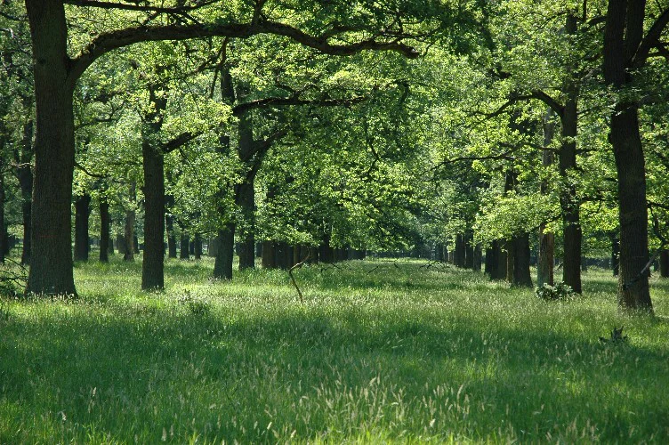
A sunlit meadow surrounded by mature, widely spaced deciduous trees under a leafy canopy.
A bright, open Hutewald forest clearing with mature trees and lush grass in the Reinhardswald.

Naturpark Reinhardswald history and protected-area timeline

Naturpark Reinhardswald is a relatively recent addition to Germany's nature park system, having been officially designated in 2017 after a planning process that traced back to earlier proposals. The initial 2016 draft envisioned a somewhat larger area than what was ultimately approved, as some municipalities opted, through political negotiation, to reduce the territory included in the final designation.

Following designation, the park was structured as an independent registered association (eingetragener Verein). Its founding members included Landkreis Kassel, the state forest authority Hessen-Forst, and the municipalities of Bad Karlshafen, Grebenstein, Hofgeismar, Immenhausen, Liebenau, and Trendelburg. The park's early management was led by Erik Aschenbrand, who subsequently moved on to the Biosphärenreservat Mittelelbe. He was succeeded by Bianka Zydek, who in turn moved to Landkreis Kassel in 2022, with Manuela Greipel taking on the role of managing director from 2023 onward. By that time, the park's office supported seven staff, and its funding combined Hessian state support with contributions from its member municipalities. During its three-year start-up phase, the Land Hessen provided an initial funding package totaling 450,000 euros.

A separate support organization, the Förderverein – Freunde des Naturparks Reinhardswald, was established in 2020 to back the park's work and had grown to roughly 50 members by 2025. While the nature park itself is recent, the landscapes it protects have long histories of human shaping, particularly in the Hutewald woodlands and the calcareous grasslands of the Diemel valley, which reflect centuries of traditional land use.

Naturpark Reinhardswald landscape and geographic character

The landscape of Naturpark Reinhardswald is defined above all by the underlying geology. In the Reinhardswald and Bramwald, the surface is built largely from Buntsandstein, a reddish Triassic sandstone that is comparatively nutrient-poor. These acidic substrates support broad expanses of coniferous and mixed broadleaf forest, producing the dense, wooded character that dominates the park's interior. The relief is rolling rather than alpine, with broad ridges and valleys covered by continuous forest cover, broken occasionally by historic woodland pastures and ancient oaks.

West of the forests, the geology changes sharply. The Diemel valley is carved into Muschelkalk, or shell limestone, a younger Triassic sequence that produces more calcareous, base-rich soils. Here the forest cover thins dramatically, and the valleys, slopes, and dry hills are instead home to extensive calcareous grasslands (Kalkmagerrasen), most of which are formally protected as nature reserves. These open habitats are among the park's most ecologically valuable features and contrast vividly with the wooded uplands nearby.

Between the two zones lies the Hofgeismar Rötsenke, a basin of soft Röt sediments that produces gentle, undulating country with rounded landforms rather than the steeper slopes of the sandstone and limestone regions. Above this basin rise several basalt-capped hills, including the Gahrenberg in the Reinhardswald, the Schöneberg, Heuberg, and Westberg near Hofgeismar, and the Deiselberg near Trendelburg, giving parts of the park a more pronounced silhouette.

The Weser and Fulda valleys on the eastern edge of the park add a further landscape element, bringing riverine terraces, alluvial deposits, and floodplain features into the protected area. Together, the combination of acidic sandstone forests, open limestone grasslands, rolling basin landscapes, basalt hills, and river valleys makes Naturpark Reinhardswald a particularly varied nature park in geographical terms.

Naturpark Reinhardswald ecosystems, habitats, and plant life

Ecologically, Naturpark Reinhardswald sits at the meeting point of two very different habitat systems, and this contrast is central to its nature conservation value.

On the acidic sandstone substrates of the Reinhardswald and Bramwald, the dominant vegetation is forest. Mixed broadleaf stands with oak and beech, often interspersed with spruce and pine, cover much of the interior. Within these forests, historic Hutewald structures with old, open-grown oaks are particularly notable, functioning as a semi-natural habitat in their own right. Near-natural forest remnants such as the Urwald Sababurg, close to the Sababurg castle, are particularly valued as close-to-primeval broadleaf forest stands that have developed with minimal direct management.

The calcareous grasslands of the Diemel valley represent the park's other major ecological character. These species-rich, dry grasslands are widely recognized as important habitats for specialized flora and fauna and are predominantly protected as nature reserves. The combination of woodland and open calcareous habitat within a single park boundary gives the area considerable habitat diversity over a relatively compact geographic span.

Rivers add a third ecological thread. Sections of the lower Fulda and the Weser bring riparian and alluvial influences into the park, creating transitional habitats along valley floors. Overall, the park combines forest-dominated upland, open calcareous grassland, and river-influenced valley habitats in a way that reflects the underlying geological transitions of northern Hesse.

Naturpark Reinhardswald wildlife and species highlights

The combination of forest, calcareous grassland, and river valley habitats in Naturpark Reinhardswald supports a correspondingly diverse fauna, although the available source material focuses more strongly on habitats and protected-area categories than on specific species accounts.

The extensive acidic forests of the Reinhardswald and Bramwald provide habitat typical of central German low mountain woodland, including populations associated with mature and near-natural broadleaf stands, particularly in the ancient oak woodlands and the near-natural Urwald Sababurg reserve. Such forests are important for woodland bird species, bats, and a range of forest-dwelling invertebrates tied to old trees and deadwood.

The calcareous grasslands of the Diemel valley, by contrast, support fauna characteristic of dry, open habitats, including specialized invertebrates and plant species associated with base-rich soils. These open landscapes are particularly important for grassland-related biodiversity and stand as a key reason these areas are protected as nature reserves.

The Weser and Fulda valley sections of the park add riverine and wetland-associated habitats that further broaden the wildlife context. Regionally, the park forms part of a larger network of ecologically significant forests, valleys, and grasslands that extends across Hesse, Lower Saxony, and North Rhine-Westphalia.

Naturpark Reinhardswald conservation status and protection priorities

Naturpark Reinhardswald holds considerable conservation significance, not only because of its protected status as a nature park, but because of the unusually high proportion of its area covered by more strictly defined conservation designations.

Roughly 1,270 hectares within the park are designated as nature reserves, with a further approximately 34 hectares classified as natural monuments and around 3,964 hectares classified as landscape protection areas. Approximately 18,960 hectares are part of the Natura 2000 network, primarily as Fauna-Flora-Habitat (FFH) sites. Because these categories overlap, the combined share of the park under some form of conservation protection is around 40 percent of its total area, which is notably high within the German nature park system.

The conservation value of the park rests heavily on the contrast between two habitat systems. The acidic sandstone forests of the Reinhardswald and Bramwald, including the near-natural Urwald Sababurg, support woodland biodiversity and provide refuges for old-growth forest species. The calcareous grasslands of the Diemel valley, largely protected as nature reserves, support specialized grassland flora and fauna on shell limestone soils. The park's location, bordered by Naturpark Münden to the east, Naturpark Solling-Vogler to the north, and Naturpark Teutoburger Wald/Eggegebirge to the west, places it within a broader network of protected landscapes that strengthens its overall conservation role.

Naturpark Reinhardswald cultural meaning and human context

The landscapes of Naturpark Reinhardswald carry strong traces of long-term human use, much of it tied to traditional forestry and pastoral systems.

The presence of Hutewald, historically grazed woodland with old, open-grown oaks, is one of the most visible cultural-landscape signatures in the park. These woodland pastures reflect a centuries-old practice of combining grazing with forest management, producing distinctive park-like forest structures that remain biologically and culturally significant today.

The calcareous grasslands of the Diemel valley likewise reflect traditional land use, having long been maintained through grazing and other historical practices that shaped their species composition. Settlements such as Bad Karlshafen, Helmarshausen, and Lippoldsberg lie within the park boundaries, contributing to the area's character as a living, inhabited cultural landscape rather than a strictly wilderness area. The Sababurg castle and the adjoining Tierpark Sababurg are prominent cultural and recreational landmarks within the park, and the larger region has deep historical associations with the Weser Renaissance and the broader cultural heritage of northern Hesse.

Top sights and standout views in Naturpark Reinhardswald

Among the standout features of Naturpark Reinhardswald are the ancient oak woodlands of the Hutewald tradition and the near-natural broadleaf forest reserve at Urwald Sababurg, both of which give the park a distinctive forest character rarely matched elsewhere in the region.

Across the western side of the park, the calcareous grasslands of the Diemel valley form a striking ecological and visual contrast to the forested interior, much of this habitat protected as nature reserves. The transitional basin landscape of the Hofgeismar Rötsenke, punctuated by basalt-capped hills such as the Gahrenberg, Schöneberg, Heuberg, Westberg, and Deiselberg, adds further visual interest.

The Sababurg castle and the Tierpark Sababurg function as a major recreational and educational focal point, with an on-site visitor center, while the park's high proportion of Natura 2000 and other protected designations underscores its standing as one of the more ecologically significant nature parks in northern Hesse.

Best time to visit Naturpark Reinhardswald

Naturpark Reinhardswald is a predominantly forested, gently rolling landscape, and its seasonal character follows the rhythm of central German woodland. Spring brings fresh growth in the broadleaf stands and active birdlife, including the period when the calcareous grasslands of the Diemel valley are at their most floristically expressive. Summer offers full canopy cover and warm conditions suited to longer walks through the woods and visits to the Sababurg area, while autumn is particularly notable for the colors of the mixed broadleaf forests, especially in stands containing oak and beech.

Winter emphasizes the structural character of the park, with leafless canopies making ancient oaks in the Hutewald areas and the near-natural stands around Urwald Sababurg more visually prominent. Visitors interested in quiet walking and landscape structure often favor these colder months, while those interested in grassland flora and forest birdlife typically favor late spring and early summer. As with much of northern Hesse, weather conditions should be expected to vary, and the park's mixed assets of forest, valley, and grassland mean that no single season defines the experience.

Monthly climate preview

Long term temperature and precipitation records measured at representative park coordinates

Naturpark Reinhardswald Climate Normals and Monthly Weather Statistics

Naturpark Reinhardswald maintains a recorded annual cycle spanning sub zero winter minimums and warm summer maximums alongside steady daily precipitation averages. Examining complete monthly climate normals reveals detailed long term atmospheric patterns across the protected landscape.
Annual mean8 °C
-1 °C18 °C
Jan-1°
Feb
Mar
Apr
May12°
Jun16°
Jul18°
Aug18°
Sep14°
Oct
Nov
Dec
Warmest month
July

18 °C

Coolest month
January

-0.6 °C

Wettest month
July

2.5 mm/day

Driest month
April

1.5 mm/day

Park location guide

Geography guide, regional context, and park location map for Naturpark Reinhardswald

Naturpark Reinhardswald park geography, regions, and map view in Germany

Understand where Naturpark Reinhardswald sits in Germany through a broader geographic reading of the surrounding landscape, nearby location context, and its mapped position within the national park landscape.

How Naturpark Reinhardswald fits into Germany

Germany is a federal republic in Western and Central Europe with a population of over 83 million across sixteen constituent states. It is Europe's largest economy by nominal GDP and a major global exporter and importer. The capital is Berlin, and the country borders Denmark, Poland, Czech Republic, Austria, Switzerland, France, Luxembourg, Belgium, and the Netherlands.

Wider geography shaping Naturpark Reinhardswald in Germany

Germany is located in Western and Central Europe, spanning 357,022 km². It borders Denmark to the north, Poland and the Czech Republic to the east, Austria and Switzerland to the south, and France, Luxembourg, Belgium, and the Netherlands to the west. The country has coastlines on the Baltic Sea and North Sea to the north, with the Alps located in the southern region.

Map view of Naturpark Reinhardswald

Use this park location map to pinpoint Naturpark Reinhardswald in Germany, understand its exact geographic position, and read its mapped placement within the surrounding landscape more clearly.

Pigeon | © OpenStreetMap contributors

Location context for Naturpark Reinhardswald

Hessen

Visual reference for sandstone forests, ancient oak stands, and open limestone grasslands

Naturpark Reinhardswald Landscape Photos and Protected Area Scenery

Visual records capture the distinctive mosaic of dense upland forests and protected limestone valleys across Naturpark Reinhardswald. Photographic documentation reveals the underlying terrain, ancient woodland pastures, and diverse habitats that define the protected landscape.

A sunlit meadow surrounded by mature, widely spaced deciduous trees under a leafy canopy.

Park atlas

Compare adjacent forest reserves and cross border conservation areas

Parks Near Naturpark Reinhardswald and Related Protected Landscapes

Browsing other parks near Naturpark Reinhardswald reveals connected regional geography and contrasting protected terrain across the surrounding territory. Extending the geographic comparison helps trace broader protected landscape patterns beyond individual forest boundaries.
A watercolor painting showing a tranquil river landscape with soft green hills and reflections in calm water.
Nature reserveHessen
About 4.8 km away#1 closest

East

Ochsenhof Nature Reserve: Wetland Geography and Weser Floodplain Protected Areas

A riparian landscape mosaic in northern Hessen, Germany.

Located at the border of the vast Reinhardswald forest, Ochsenhof protects a valuable riverine corridor featuring reclaimed gravel-pit lakes and diverse wetland vegetation. This nature reserve provides essential habitat for waterfowl along the Weser, functioning as a sheltered landscape pocket within the regional protected-area network of northern Hessen.

Area
0.24 km²
Established
1981
IUCN
IV
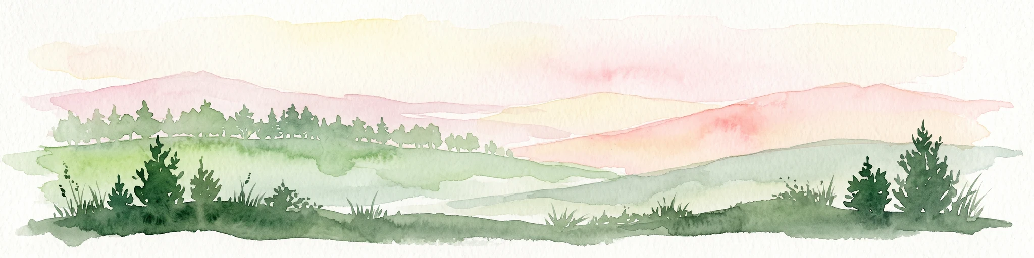
A soft watercolor painting of gentle green rolling hills and meadows under a faint pink sky.
Nature reserveHesse
About 10 km away#2 closest

West

Flohrberg und Ohmsberg bei Deisel Nature Reserve; Calcareous Landscape and Park Boundaries

A protected Hessian site near Trendelburg

Situated in the Landkreis Kassel, Flohrberg und Ohmsberg bei Deisel encompasses 107 hectares of calcareous ground, disused quarries, and sheep-grazed grasslands. The area provides a critical landscape context for orchid-rich flora and rare butterfly fauna within the northern Hessian hill country, acting as a protected link between open farmland and the Reinhardswald forest edge.

Area
0.418 km²
Established
1990
A soft watercolor illustration showing rolling green hills, distant mountains, and forested slopes on a white background.
Nature reserveHesse
About 11 km away#3 closest

West

Dingel und Eberschützer Klippen: Protected Landscapes and Geography in Hesse, Germany

A dense mosaic of limestone slopes, juniper scrub, and beech forest communities.

Discover the geographic identity of Dingel und Eberschützer Klippen, a combined nature reserve and Natura 2000 site in northern Hesse. The protected area features a unique concentration of orchid-rich habitats, south-facing limestone slopes, and broadleaf forest blocks that define this essential part of the Reinhardswald region.

Area
1.123 km²
Established
1987
Relief
Upland
Climate
Temperate
A soft watercolor illustration depicting a green, marshy landscape with small pools of water, a line of forest, and rolling hills in the background under a pale sky.
Nature reserveHesse
About 11 km away#4 closest

South

Bruch an der Eichkanzel im Reinhardswald: Protected Nature Reserve Geography in Hesse

Mapped birch swamp forests and highland bog terrain

Examine the geographic profile of Bruch an der Eichkanzel im Reinhardswald, a nature reserve in Hesse defined by its upland plateau. Learn about the interaction between its birch swamp forests and open moorland habitats, characterized by sphagnum mosses and aquatic features, within the broader context of the Reinhardswald forest region.

Area
0.175 km²
Established
1992
Relief
Upland
Scope
Terrestrial
Nature reserveNiedersachsen
About 12 km away#5 closest

North

Wälder im südlichen Solling Nature Reserve: A Detailed Atlas of German Protected Woodlands

Ecological mapping of Niedersachsen's southern Solling forest complexes.

Navigate the protected boundaries and landscape character of Wälder im südlichen Solling. This nature reserve provides an essential study in forest conservation, highlighting the intersection of traditional wood-pasture management and steep, near-natural slope forest ecosystems within the Solling-Vogler upland.

Area
10.16 km²
Established
2020
Relief
Upland
Climate
Temperate
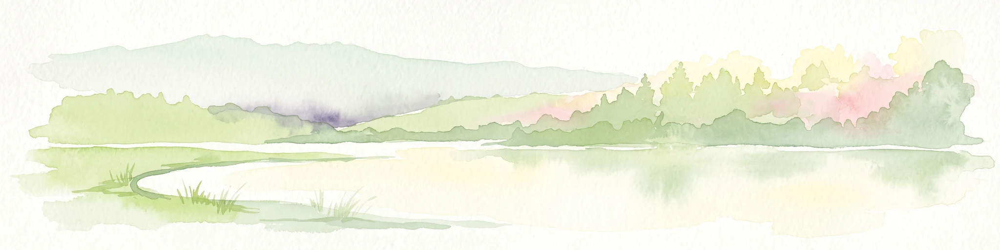
A soft watercolor illustration showing a band of green trees reflecting in calm water, with a light hilly background.
Nature reserveHessen
About 12 km away#6 closest

South

Bennhäuser Teich und Rothbalzer Teich bei Immenhausen: Protected Nature Reserve and Landscape Atlas

Mapped woodland and wetland habitats in Hessen, Germany.

This nature reserve centers on historic impoundment ponds and complex valley hydrology. Its landscape features rare dragonfly habitats and successional carr woodlands that define the ecological identity of this protected area within the northern Hessen countryside.

Area
0.315 km²
Established
1998
Nature reserveLower Saxony
About 13 km away#7 closest

Northeast

Wälder am Schäferstein und am Hohen Rott bei Verliehausen: Protected Nature Reserve Landscape

Ancient woodland geography in the Southern Solling uplands

A significant nature reserve in Lower Saxony, these forest tracts at Schäferstein and Hohen Rott protect near-natural beech and oak stands. The site is characterized by an exceptional density of deadwood and historical relict oak pastures, serving as a vital sanctuary for specialized saproxylic beetles and cavity-nesting birds within the broader Solling ridge system.

Area
1.02 km²
Established
2020
Relief
Mountain
Climate
Temperate
A soft watercolor illustration showing rolling green hills, small groups of conifer trees, and a pale pink and peach sky in the background.
Natural monumentEberschütz
About 13 km away#8 closest

West

Der Bunte Berg bei Eberschütz: Natural Monument and Landscape Geography

Limestone ridge and calcareous grassland habitat in Germany

Examine the topography and protected land features of Der Bunte Berg bei Eberschütz. This compact reserve provides a critical study of limestone-influenced terrain, transitioning from mature pine and beech woodland to specialized juniper heath and dry grassland habitats essential for regional biodiversity.

Common questions about visiting, size, designation, and location context for Naturpark Reinhardswald

Naturpark Reinhardswald FAQs for park facts, access, geography, and protected area context

Find quick answers about Naturpark Reinhardswald, including protected-area facts, park geography, trail and visitor context, and how the park fits into its surrounding country and regional landscape.
MoriAtlas Explorer

Continue Your Protected Areas Search Across the Global Atlas

Deepen your exploration by continuing the structured search for national parks and protected areas worldwide. Utilize the comprehensive filtering capabilities to compare different conservation landscapes and refine your understanding of global park geography. Discover more about the distribution and characteristics of protected natural areas.

Global natural geography