

Mori Atlas logo
Nature reserveNaturschutzgebiet Schluchtwald Helle

Examining the ecological structure and mapped stream valley boundaries of this protected woodland

Naturschutzgebiet Schluchtwald Helle: A Protected Ravine Forest Landscape in the Sauerland Highlands

Naturschutzgebiet Schluchtwald Helle protects a distinctive ravine forest landscape in the upland terrain east of Winterberg, Germany. This reserve features steep slopes, perennial springs, and an old-growth forest character centered on the headwaters of the Helle stream. By preserving this damp, structurally complex microclimate, the area sustains rare fern species and floristic communities typical of the Sauerland region while maintaining critical freshwater and woody debris habitats.

ravine forestSchluchtwaldheadwater streamfreshwater habitatold-growth forestdeadwood habitat
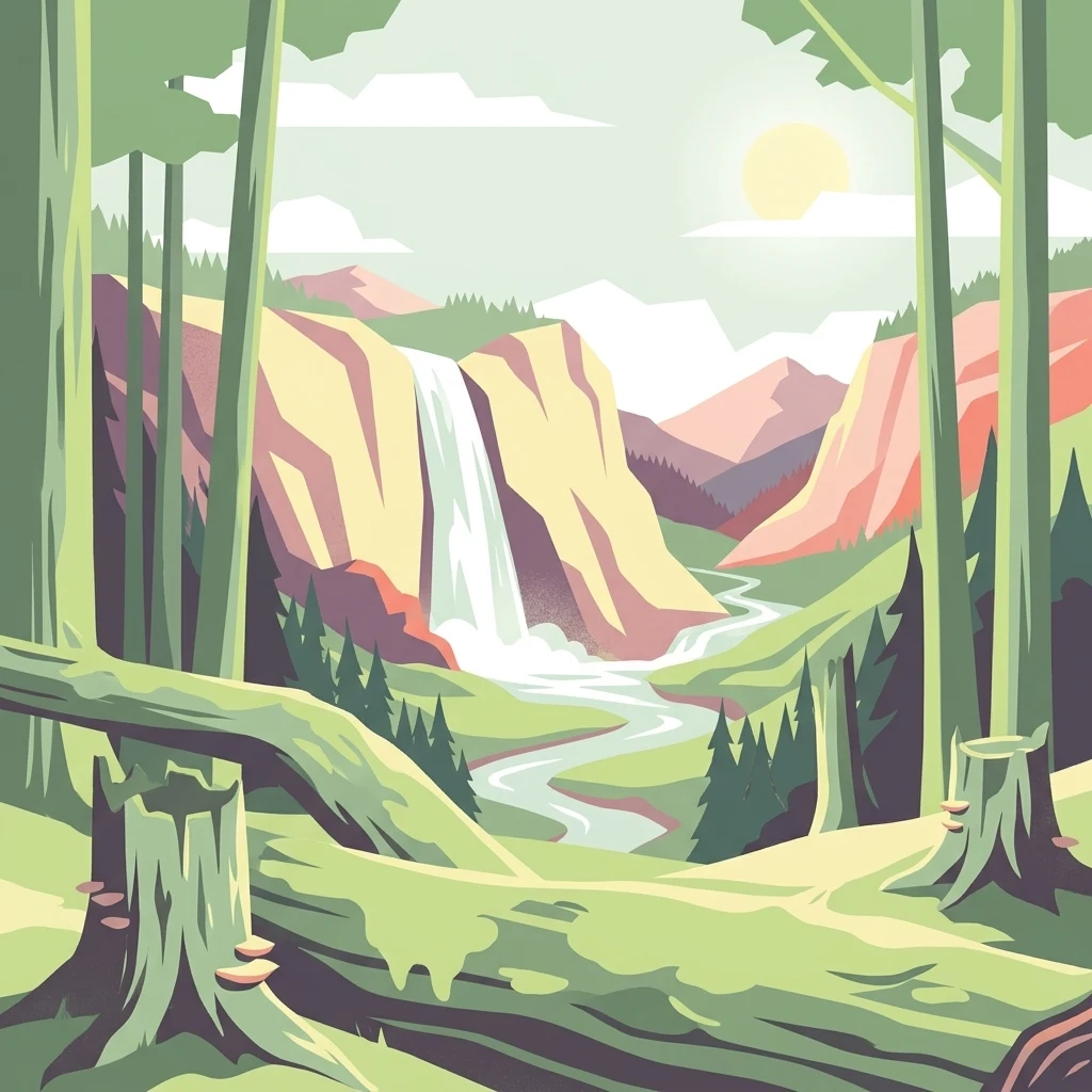
A graphic illustration of a mountain landscape featuring a waterfall flowing into a river, framed by foreground tree stumps and forest trees under a sunlit sky.

Naturschutzgebiet Schluchtwald Helle

Nature reserve

Park overview

Structured park overview, official facts, and landscape profile for Naturschutzgebiet Schluchtwald Helle

Naturschutzgebiet Schluchtwald Helle park facts, protected area profile, and essential visitor context

Review the core facts for Naturschutzgebiet Schluchtwald Helle, including designation, size, terrain, visitor scale, habitats, and operating context in one park-focused overview.

About Naturschutzgebiet Schluchtwald Helle

Naturschutzgebiet Schluchtwald Helle is a focused, ecologically intensive nature reserve in the eastern Sauerland, in the uplands surrounding Winterberg in North Rhine-Westphalia. At about 58 hectares it is modest in areal extent, but it is deliberately targeted on one of the region's most valuable and most threatened forest types: the ravine woodland, or Schluchtwald, that forms where steep slopes and cold, fast-running spring streams create a distinctly cool and humid microclimate within an otherwise upland landscape.

The reserve's core element is the headwater area, or Quellgebiet, of the Helle, a stream that eventually joins the Orke. The protected area includes both the natural spring and the near-natural upper course of the Helle, together with the surrounding closed-canopy forest that has developed in the sheltered, north-facing valley conditions. Standing and fallen deadwood, mossy boulders, ferns, and moisture-loving herbaceous plants give the forest its characteristically wild, unmanaged appearance, and the site functions as a refuge for species that have largely disappeared from more intensively used forests elsewhere in the region.

In conservation administration, the area is doubly protected: as a national German Naturschutzgebiet under the Hochsauerlandkreis landscape planning framework, and at the European level as an FFH area contributing to the Natura 2000 network of sites designated under the EU Habitats Directive. This dual designation underlines both the local rarity of the ravine forest type and its broader biogeographical significance within the central European uplands.

Beyond its ecological role, the reserve is also a place where conservation policy meets recreational pressure. The Sauerland is a popular destination for hiking, cycling, and especially mountain biking, and the Helle valley had been affected by increasing numbers of informal trails and unauthorized bike routes. The 2025 agreement between the city of Winterberg, the Biologische Station Hochsauerland, and the Verein für Natur- und Vogelschutz im Hochsauerlandkreis represents a renewed effort to reconcile forest protection with public access by tightening the trail network around the most sensitive core zones.

Quick facts and research context for Naturschutzgebiet Schluchtwald Helle

Naturschutzgebiet Schluchtwald Helle lies east of Winterberg in the Hochsauerlandkreis, North Rhine-Westphalia, within the Rothaargebirge foothills of the Sauerland region. It covers 58.05 hectares and carries the official designation code HSK-424, with a corresponding World Database on Protected Areas entry of 389894. The reserve was established in 2008 under the Winterberg landscape plan and is administered by the lower landscape authority of the Hochsauerlandkreis. The protected area is also classified as an FFH site under the name Schluchtwald Helle bei Winterberg, placing it under the European Union Habitats Directive in addition to its German Naturschutzgebiet status. Its IUCN management category is IV, indicating that it is managed primarily as a habitat and species management area rather than a strictly preserved wilderness zone.

Protection and recognition

Documented protection scope and international recognition data

Naturschutzgebiet Schluchtwald Helle Protection Status and Records

Terrestrial protected area records outline the established conservation framework for Naturschutzgebiet Schluchtwald Helle. Official database entries compile available designation details and administrative boundaries for analytical review.

Protection details

Protection scope
Terrestrial
Transboundary protection
No
WDPA ID
389894
Park context

Deeper park guide and search-rich context for Naturschutzgebiet Schluchtwald Helle

Naturschutzgebiet Schluchtwald Helle history, landscape, wildlife, and travel context

Explore Naturschutzgebiet Schluchtwald Helle through its history, landscape character, ecosystems, wildlife, conservation priorities, cultural context, and seasonal travel timing in a structured park guide built for atlas discovery and search intent.

Why Naturschutzgebiet Schluchtwald Helle stands out

Naturschutzgebiet Schluchtwald Helle is best known for protecting one of the Sauerland's characteristic Schluchtwald, or ravine forest, habitats: a humid, cool, structurally complex woodland that develops along narrow, steep-sided stream valleys. The reserve centers on the spring-fed source of the Helle stream and the surrounding old, mossy broadleaf forest with abundant decaying wood, ferns, and shade-loving wildflowers. The site also stands out for the concentration of montane and submontane plant species found within a small footprint, including rare ferns, characteristic spring flora, and woodland understorey species that depend on the stable, damp microclimate of the ravine. This combination of small size, ecological richness, and dual national and European protection status makes it a representative example of Sauerland ravine forest conservation.
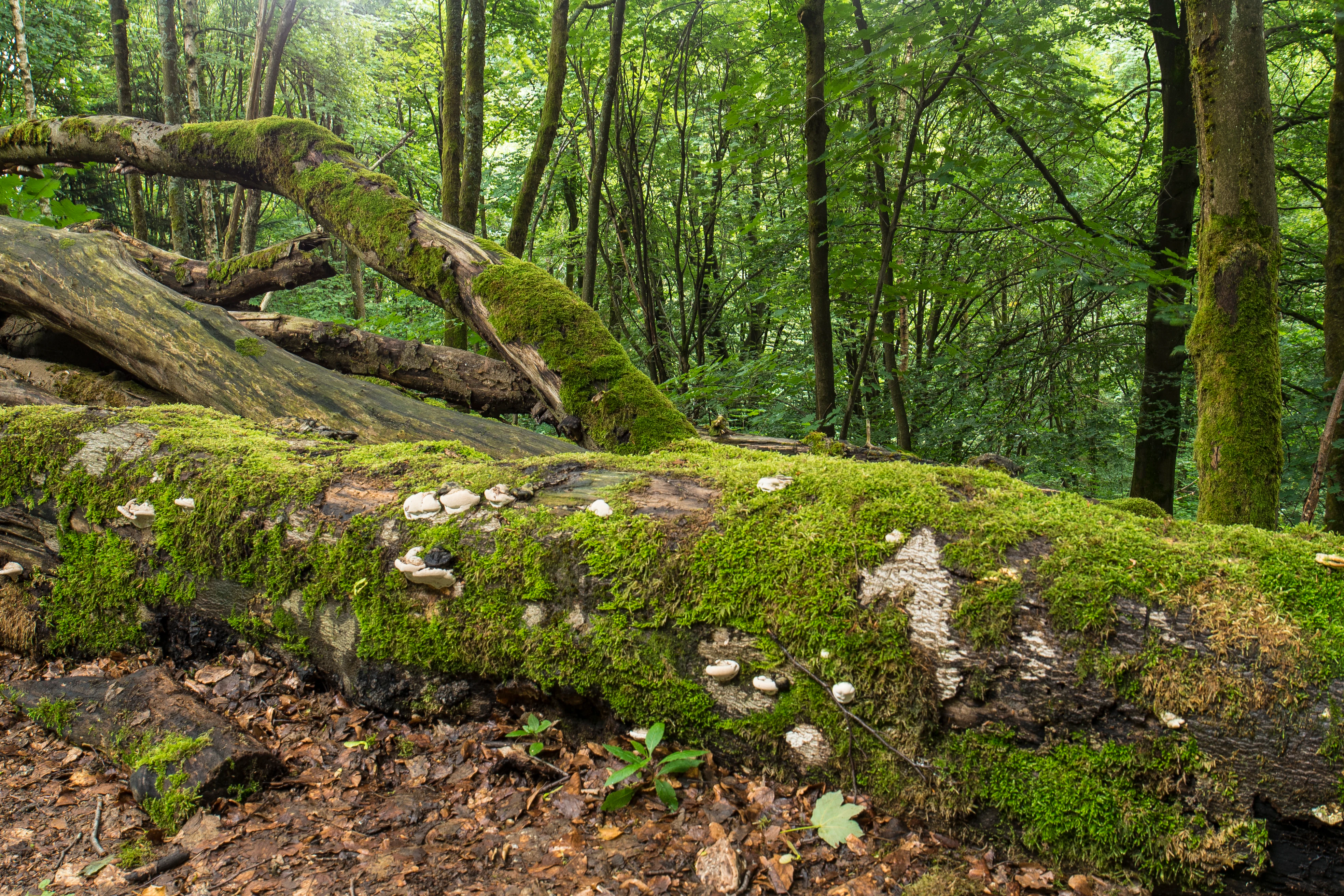
A fallen tree trunk covered in vibrant green moss and shelf fungi, resting on the forest floor in a lush deciduous woodland.
A moss-covered fallen tree trunk in the Schluchtwald Helle nature reserve.

Naturschutzgebiet Schluchtwald Helle history and protected-area timeline

The ravine forest of the Helle valley was recognized as worthy of formal protection through the Winterberg landscape planning process. In 2008, the Hochsauerlandkreis designated the area as a Naturschutzgebiet by incorporating it into the Winterberg landscape plan, which set the conditions for management, allowed uses, and protective objectives for nature reserves across the municipal area.

From its establishment onward, the site has been jointly recognized as an FFH area under the European Union Habitats Directive, which meant that its conservation significance was acknowledged both at the regional level in North Rhine-Westphalia and within the broader European Natura 2000 framework. Management is carried out by the Untere Landschaftsbehörde, the lower landscape authority, of the Hochsauerlandkreis, and supported in practice by specialist conservation bodies including the Biologische Station Hochsauerland and the local Verein für Natur- und Vogelschutz im Hochsauerlandkreis.

In March 2025, the city of Winterberg, the Biologische Station Hochsauerland, and the Verein für Natur- und Vogelschutz im Hochsauerlandkreis agreed on a revised trail concept for the reserve. The plan was prompted by documented damage, including the loss of rare plant sites caused by overuse, trampling from old, informal paths, and high volumes of mountain bike traffic. The new concept provides for closing sensitive paths and excluding mountain bikes from the protected area entirely, marking the most significant management intervention since the reserve's 2008 designation.

Naturschutzgebiet Schluchtwald Helle landscape and geographic character

The protected area lies in the wooded highlands east of Winterberg, where the Rothaargebirge and broader Sauerland hills create a dissected terrain of narrow valleys, spring basins, and steep slopes. The Helle stream originates within the reserve and has cut a characteristic narrow ravine through this upland, producing the cool, sheltered conditions under which Schluchtwald vegetation develops.

The valley walls of the Helle rise sharply above the watercourse within a short horizontal distance, giving the protected area its compact but deeply incised topography. In the ravine bottom, perennial seeps, mossy boulders, and accumulated coarse woody debris create a structurally complex surface, while the surrounding slopes are cloaked in closed forest that has been allowed to develop with minimal active management.

Although the site is small at roughly 58 hectares, its steep relief and associated microclimate variation produce a range of habitats within a restricted area, from damp, fern-rich ravine bottoms to drier upper-slope forest on the valley margins. This mosaic of slopes, springs, stream channels, and deadwood-rich forest is the defining physical and visual character of the Schluchtwald Helle landscape.

Naturschutzgebiet Schluchtwald Helle ecosystems, habitats, and plant life

Ecologically, the reserve is defined by its ravine forest character, a forest type that depends on the combination of steep terrain, cold, well-oxygenated, spring-fed running water, high atmospheric humidity, and a forest history with relatively little direct management. The result is a structurally complex woodland rich in mosses, ferns, liverworts, and shade-loving herbaceous plants, and supported by large amounts of standing and fallen deadwood, which is essential for many of the species associated with this habitat.

The documented vascular flora reflects this microlayered habitat. Recorded species include wild garlic, or Bärlauch, opposite-leaved golden saxifrage, hollowroot, woodland forget-me-not related species such as the spring water chickweed, and characteristic spring flora such as white butterbur. Ferns are particularly significant in the reserve: alongside common species like the wood fescue, wood sedge, and greater woodrush, rarer ferns such as the green-stalked strap fern and the lobed shield fern have been recorded, marking the site as a notable refugium for pteridophyte diversity in the region.

At the wider habitat level, the reserve fits into a network of FFH sites across North Rhine-Westphalia that protect representative examples of Annex I habitat types of European conservation interest. The Schluchtwald here is valued not only for its plant diversity but also because the combination of decaying wood, seepage flow paths, and undisturbed forest interior supports a wide range of invertebrates, fungi, and bryophyte communities typical of long-established central European ravine woodland.

Naturschutzgebiet Schluchtwald Helle wildlife and species highlights

Wildlife documentation in the reserve has focused primarily on characteristic birdlife of the upland forest and stream environment. The state agency for nature, environment, and consumer protection of North Rhine-Westphalia has recorded mountain wagtail, known in German as Gebirgsstelze, along the Helle stream, as well as stock dove, referred to as Hohltaube, both of which are considered indicators of relatively undisturbed, structurally varied woodland with mature trees offering nesting cavities.

Although the recorded species list is modest, the ecological value of the reserve for fauna lies in the habitat conditions rather than headline species counts. The combination of perennial running water, dense canopy cover, decaying wood, and a humid microclimate supports invertebrate assemblages, amphibians, and small forest mammals typical of long-established central European ravine forests.

Naturschutzgebiet Schluchtwald Helle conservation status and protection priorities

As a formally designated Naturschutzgebiet within the Hochsauerlandkreis and simultaneously an FFH area under the European Habitats Directive, the Schluchtwald Helle is protected through a layered conservation framework. National designation under the German nature conservation framework gives it binding protection against damaging uses, while its FFH status ties its management to the broader European effort to maintain a coherent network of protected habitat sites.

The stated purpose of the designation is the preservation and development of a forest and habitat for endangered animal and plant species, with explicit acknowledgement that the area qualifies as a nature reserve because of its landscape beauty and uniqueness as well as its ecological value. In practice, this means active efforts to maintain the natural forest structure, including the retention of deadwood, the protection of rare plant populations, and the prevention of disturbance to the source area of the Helle stream.

Pressures on the reserve, particularly from recreational overuse and mountain bike traffic, have prompted renewed management action. The 2025 trail agreement marks a shift toward stricter access control, with core zones to be closed to paths and the entire reserve excluded from mountain bike use, thereby reinforcing the long-term conservation function of what is otherwise a small but ecologically dense protected area.

Naturschutzgebiet Schluchtwald Helle cultural meaning and human context

The Sauerland around Winterberg has a long tradition of small-scale forestry and pasture use, and the cultural landscape is shaped by centuries of interaction between upland farming, woodland management, and the development of mountain villages. The protected ravine forests, with their steep terrain, were typically left as relatively unmanaged woodland even when surrounding slopes were exploited for timber, grazing, or charcoal production.

In the present day, the cultural context of the reserve is largely defined by its role in the regional network of protected areas and by the relationship between conservation institutions and the municipalities of the Sauerland. Cooperation between the city of Winterberg and regional conservation bodies, such as the Biologische Station and the local nature and bird protection association, reflects a tradition of civic engagement with nature conservation in the Hochsauerlandkreis, and the Schluchtwald Helle has become a focal point for discussions about how to reconcile outdoor recreation with the protection of sensitive habitats in a heavily visited upland recreation region.

Top sights and standout views in Naturschutzgebiet Schluchtwald Helle

Naturschutzgebiet Schluchtwald Helle stands out for the unusually dense ecological value packed into a small area: a near-natural Schluchtwald, or ravine forest, surrounding the headwater springs of the Helle stream in the Sauerland uplands near Winterberg. The combination of pristine spring ecology, structurally complex old forest with abundant deadwood, and populations of rare ferns and montane understorey species makes it a representative example of central European ravine woodland.

The dual designation as a German Naturschutzgebiet and an EU FFH site underlines both its regional and European significance, while the 2025 management agreement reflects a renewed commitment to protecting the area from overuse. Visitors and ecologists alike encounter here a small but exemplary Sauerland landscape where forest protection, freshwater conservation, and biodiversity preservation converge within a single compact valley.

Best time to visit Naturschutzgebiet Schluchtwald Helle

The reserve is most rewarding to visit in late spring and early summer, when the spring flora of the ravine forest, including species such as wild garlic and other characteristic woodland plants, is at its peak and the stream channels of the Helle carry steady flow from the spring-fed source area. Cool, overcast days in this period tend to bring out the humid, mossy character of the ravine woodland most strongly, and bird activity along the stream, including species such as the mountain wagtail, is at its most visible.

Late summer and early autumn offer a quieter atmosphere with reduced recreational pressure, cooler temperatures in the shady ravine, and a more muted palette of greens and browns that emphasizes the structural complexity of the forest itself. Winter visits are possible but are more demanding due to steep terrain, and the closed-canopy forest then provides limited visibility of the wider valley, although the mossy, undisturbed character of the woodland becomes more visually prominent in the absence of foliage.

Monthly climate preview

Long-term representative coordinate measurements for annual temperature and precipitation patterns

Naturschutzgebiet Schluchtwald Helle Climate Normals and Temperature Rhythms

Representative coordinates record long-term monthly temperature and precipitation normals, tracing annual climate patterns across the protected landscape. Examining the full twelve-month profile provides detailed meteorological context for this protected area.
Annual mean8 °C
-1 °C18 °C
Jan-1°
Feb
Mar
Apr
May12°
Jun15°
Jul18°
Aug17°
Sep13°
Oct
Nov
Dec
Warmest month
July

17.6 °C

Coolest month
January

-1 °C

Wettest month
July

2.6 mm/day

Driest month
April

1.7 mm/day

Park location guide

Geography guide, regional context, and park location map for Naturschutzgebiet Schluchtwald Helle

Naturschutzgebiet Schluchtwald Helle park geography, regions, and map view in Germany

Understand where Naturschutzgebiet Schluchtwald Helle sits in Germany through a broader geographic reading of the surrounding landscape, nearby location context, and its mapped position within the national park landscape.

How Naturschutzgebiet Schluchtwald Helle fits into Germany

Germany is a federal republic in Western and Central Europe with a population of over 83 million across sixteen constituent states. It is Europe's largest economy by nominal GDP and a major global exporter and importer. The capital is Berlin, and the country borders Denmark, Poland, Czech Republic, Austria, Switzerland, France, Luxembourg, Belgium, and the Netherlands.

Wider geography shaping Naturschutzgebiet Schluchtwald Helle in Germany

Germany is located in Western and Central Europe, spanning 357,022 km². It borders Denmark to the north, Poland and the Czech Republic to the east, Austria and Switzerland to the south, and France, Luxembourg, Belgium, and the Netherlands to the west. The country has coastlines on the Baltic Sea and North Sea to the north, with the Alps located in the southern region.

Map view of Naturschutzgebiet Schluchtwald Helle

Use this park location map to pinpoint Naturschutzgebiet Schluchtwald Helle in Germany, understand its exact geographic position, and read its mapped placement within the surrounding landscape more clearly.

Pigeon | © OpenStreetMap contributors

Location context for Naturschutzgebiet Schluchtwald Helle

Nordrhein-Westfalen

Visualizing the ravine forest habitats, steep terrain, and upland stream environments

Naturschutzgebiet Schluchtwald Helle Photos and Protected Landscape Scenery

Examine detailed photographs of Naturschutzgebiet Schluchtwald Helle to observe the steep ravine topography, mossy stream channels, and old-growth broadleaf woodland. Visual documentation reveals the microclimatic character and complex structural habitats preserved within this protected Sauerland valley.

A fallen tree trunk covered in vibrant green moss and shelf fungi, resting on the forest floor in a lush deciduous woodland.

A dense forest interior with tall trees, lush green canopy, and a rocky, shaded ground area suggesting a ravine.

Park atlas

Compare adjacent ravine forests and upland reserves across the Sauerland region

Parks near Naturschutzgebiet Schluchtwald Helle and Surrounding Protected Areas

Visitors exploring Naturschutzgebiet Schluchtwald Helle can browse other protected areas, regional forest reserves, and headwater habitats throughout the surrounding Sauerland highlands. Examining adjacent conservation landscapes reveals broader geographic patterns in upland stream valleys, old growth woodland management, and mountain terrain.
Nature reserveNorth Rhine-Westphalia
About 3.7 km away#1 closest

North

Naturschutzgebiet Oberes Ruhrtal: Mapping the Sauerland Headwater Valley Landscape

Protected grassland and river valley geography

Discover the topography and protected boundaries of Naturschutzgebiet Oberes Ruhrtal. This nature reserve in North Rhine-Westphalia preserves a classic headwater valley, where the young Ruhr meanders through nutrient-poor meadows, wet grasslands, and varied riparian terrain, offering a clear example of traditional agricultural landscape conservation.

Area
0.553 km²
Established
2008
IUCN
IV
Relief
Upland
Nature reserveNorth Rhine-Westphalia
About 5.6 km away#2 closest

Southwest

Naturschutzgebiet Odeborn-Talsystem: Protected Valley and Meadow Geography

Nature reserve terrain in the Rothaar Mountains of North Rhine-Westphalia.

Naturschutzgebiet Odeborn-Talsystem protects a vital valley system featuring traditionally managed mountain grasslands and the winding course of the Odeborn stream. This nature reserve provides essential habitat connectivity within the broader North Rhine-Westphalia region, representing a unique intersection of stream, forest, and open-field topography managed for conservation.

Area
0.575 km²
Established
2008
IUCN
IV
Relief
Upland
Nature reserveNorth Rhine-Westphalia
About 6 km away#3 closest

Northeast

Naturschutzgebiet Oberes Dittelsbachtal - Klokenbruch: Regional Protected Area Map

Sauerland brook valley and meadow landscape

This nature reserve protects 14 hectares of the upper Dittelsbach stream and surrounding damp grasslands. The landscape is defined by its compact valley form, spring-fed mires, and traditional grazing patches, serving as an important link for bird protection in the Medebacher Bucht region of North Rhine-Westphalia.

Area
0.139 km²
Established
2003
Scope
Terrestrial
Water
Major water bodies
Nature reserveNorth Rhine-Westphalia
About 6.1 km away#4 closest

South

Naturschutzgebiet Ahretalsystem: Mapped Protected Brook Valley and Low Mountain Landscape

Ecological terrain analysis of the Sauerland uplands

Naturschutzgebiet Ahretalsystem protects a refined valley system in the Rothaargebirge, showcasing the intricate interplay between near-natural stream courses and traditional mountain pastures. This reserve serves as a key site for montane brook conservation, hosting significant botanical populations within its mosaic of wet meadows and dry slope grasslands across the Winterberg landscape.

Area
0.358 km²
Established
2008
Relief
Mountain
Climate
Temperate
Nature reserveNorth Rhine-Westphalia
About 7.3 km away#5 closest

Southwest

Naturschutzgebiet Oberes Lennetal: Protected Stream Valley and Meadow Ecosystem Atlas

Geographic analysis of the Upper Lenne valley conservation area.

Naturschutzgebiet Oberes Lennetal serves as a cornerstone of habitat protection along the upper Lenne River in North Rhine-Westphalia. The reserve features a unique combination of near-natural stream channels and traditionally managed valley meadows. This atlas entry details the site's role in the regional network of protected lands, emphasizing its hydrological features and diverse mountain grassland character within the Sauerland.

Area
0.256 km²
Established
2008
IUCN
IV
Nature reserveNordrhein-Westfalen
About 8.1 km away#6 closest

North

Hoppecke-Quellbäche Nature Reserve: Protected Headwater Landscapes in Nordrhein-Westfalen

Highland spring and mountain brook habitats within the Rothaargebirge

Hoppecke-Quellbäche safeguards essential headwater habitats across the mid-slopes of the Clemensberg and the high ground leading to the Langenberg. This nature reserve, organized into three distinct parcels, maps the hydrological connections that feed the upper Hoppecke stream within the broader protected-area network of the northern Sauerland region.

Area
0.169 km²
Established
2008
IUCN
IV
Relief
Mountain
A horizontal watercolor painting depicting a soft, pastel-colored landscape with rolling hills in the background, a line of trees in the midground, and a small winding stream or boggy area in the foreground.
Nature reserveHessen
About 8.4 km away#7 closest

Northeast

Naturschutzgebiet Alter Hagen bei Willingen: Protected Nature Reserve and Wetland Atlas

Landscape and geographic overview in the Hessen region

Naturschutzgebiet Alter Hagen bei Willingen covers a significant floodplain system in the Hessen uplands. This nature reserve serves as a critical habitat for diverse butterfly communities and relict woodland flora, centered on the headwaters of the River Itter. Its mix of swamps, bogs, and beech-dominated forest makes it a key site for understanding the geography of protected mire ecosystems in Central Germany.

Area
1.436 km²
Established
1989
IUCN
IV
Relief
Upland
Nature reserveWaldeck-Frankenberg
About 8.6 km away#8 closest

Northeast

Naturschutzgebiet Jägers Weinberg: Geographic Profile of a Protected Upland Wetland

A mapped nature reserve in the Waldeck-Frankenberg district of northern Hesse

Naturschutzgebiet Jägers Weinberg is a protected wetland landscape in northern Hesse, Germany. This area preserves a rare combination of raised bog and birch swamp forest, functioning as a vital botanical refuge in the Waldeck-Frankenberg district. Its mapped boundaries highlight a specialized ecological site that offers clear insights into the micro-topography and natural history of the local Upland terrain.

Area
0.254 km²
Established
1979
IUCN
IV
Relief
Upland

Common questions about visiting, size, designation, and location context for Naturschutzgebiet Schluchtwald Helle

Naturschutzgebiet Schluchtwald Helle FAQs for park facts, access, geography, and protected area context

Find quick answers about Naturschutzgebiet Schluchtwald Helle, including protected-area facts, park geography, trail and visitor context, and how the park fits into its surrounding country and regional landscape.
MoriAtlas Explorer

Continue Your Protected Areas Search Across the Global Atlas

Deepen your exploration by continuing the structured search for national parks and protected areas worldwide. Utilize the comprehensive filtering capabilities to compare different conservation landscapes and refine your understanding of global park geography. Discover more about the distribution and characteristics of protected natural areas.

Global natural geography