
Mori Atlas logo
Nature reserveNiederrodenbacher Steinbrüche

Tracing the geological character and habitat diversity of a former industrial limestone site

Niederrodenbacher Steinbrüche Nature Reserve: Mapped Protected Landscapes in Hessen, Germany

(Naturschutzgebiet Niederrodenbacher Steinbrüche)

Niederrodenbacher Steinbrüche represents a distinct protected area in the Main-Kinzig-Kreis district of Hessen, where historic Zechstein limestone quarrying has transformed into a mosaic of dry grassland, rock faces, and species-rich meadows. This nature reserve provides essential habitat for rare insect communities and specialized flora, serving as a significant example of post-industrial ecological restoration. The surrounding terrain creates a complex landscape boundary where open, sun-warmed quarry floors meet cooling woodland fringes.

nature reservequarry habitatlimestone landscapecalcareous meadowinsect conservationabandoned quarry
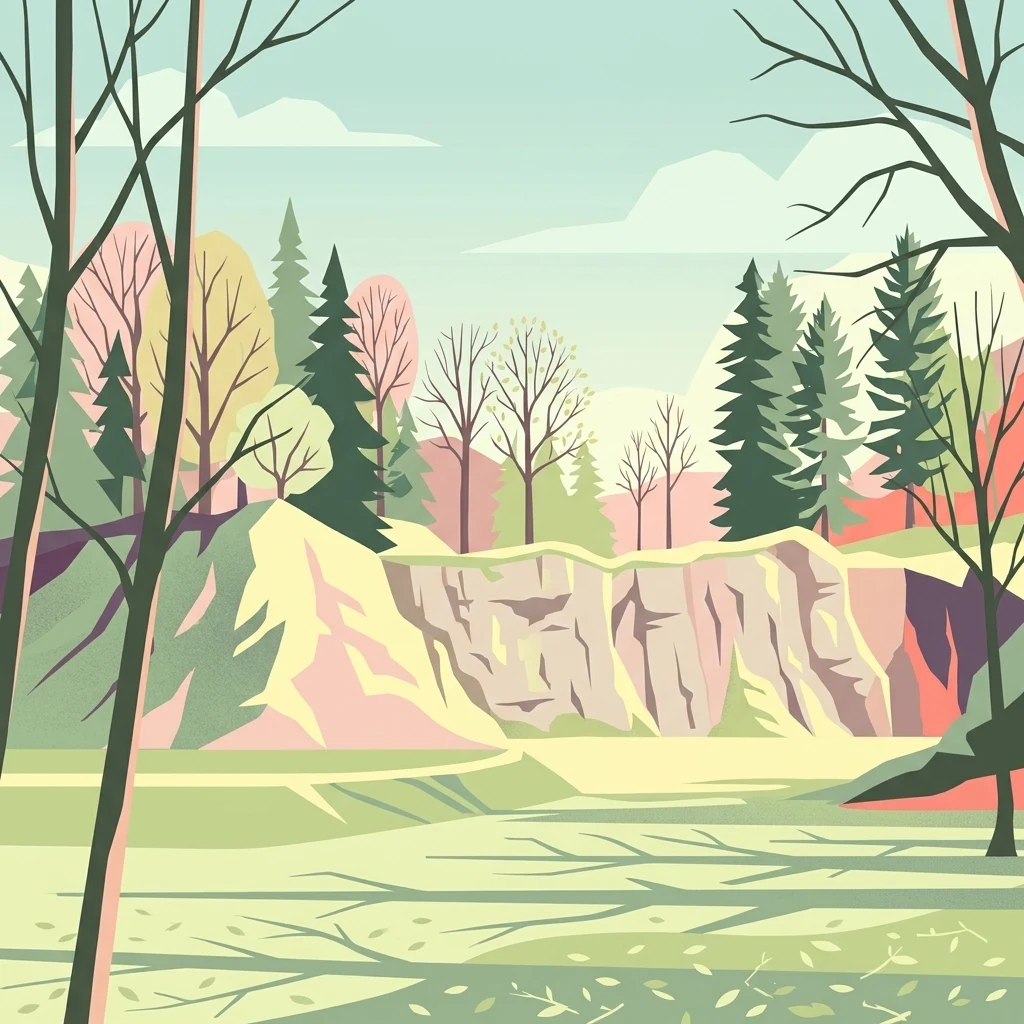
A stylized digital illustration of a nature reserve featuring a rocky limestone quarry wall framed by trees and foliage.

Niederrodenbacher Steinbrüche

Nature reserve

Park overview

Structured park overview, official facts, and landscape profile for Niederrodenbacher Steinbrüche

Niederrodenbacher Steinbrüche park facts, protected area profile, and essential visitor context

Review the core facts for Niederrodenbacher Steinbrüche, including designation, size, terrain, visitor scale, habitats, and operating context in one park-focused overview.

About Niederrodenbacher Steinbrüche

The Niederrodenbacher Steinbrüche is a compact but ecologically rich nature reserve in the eastern part of the Main-Kinzig-Kreis, in the state of Hesse. It occupies a transitional zone between the northern fringe of the Spessart foothills and the densely settled landscape of the Rhine-Main region, sitting just south of Niederrodenbach and very close to the border with Bavaria. Despite its modest size, the area illustrates how abandoned industrial sites can become important pockets of biodiversity when their specific conditions are actively maintained.

The reserve is built around several disused limestone quarries and the adjoining Bindernagelswiese, a meadow whose ecological character strongly depends on traditional management. The quarries have exposed calcareous rock and weathered scree that create warm, dry microhabitats very different from the surrounding woodlands. The Bindernagelswiese contributes richer, flower-filled grassland, while the bordering forest ties the site into a wider landscape mosaic that includes agricultural land, villages, and forested hills.

Because the quarry surfaces and meadow clearings are the ecological heart of the area, the reserve is actively managed by regular mowing and shrub control to prevent re-forestation. This active stewardship is the reason the site continues to host plant and insect communities that would otherwise be lost to succession, and it is also the reason the Niederrodenbacher Steinbrüche is cited as a textbook example of conservation through habitat maintenance in a culturally shaped landscape.

Quick facts and research context for Niederrodenbacher Steinbrüche

The Niederrodenbacher Steinbrüche is a nature reserve in the Main-Kinzig-Kreis district of Hesse, Germany, near the village of Niederrodenbach close to the Bavarian border. It has been protected since 1979 under the designation 1435008 and covers roughly 37 hectares of former quarry land, meadows, and surrounding woodland. The site is managed primarily to conserve calcareous quarry habitats and a notable community of rare and protected insects.

Protection and recognition

Review documented conservation metrics and official protected area records.

Niederrodenbacher Steinbrüche Protection Status and International Recognition Facts

Niederrodenbacher Steinbrüche holds structured conservation records detailing verified protection status and administrative history. Protected area records outline formal designation frameworks and international database identifiers for accurate geographic research.

Protection details

WDPA ID
82247
Park context

Deeper park guide and search-rich context for Niederrodenbacher Steinbrüche

Niederrodenbacher Steinbrüche history, landscape, wildlife, and travel context

Explore Niederrodenbacher Steinbrüche through its history, landscape character, ecosystems, wildlife, conservation priorities, cultural context, and seasonal travel timing in a structured park guide built for atlas discovery and search intent.

Why Niederrodenbacher Steinbrüche stands out

The reserve is best known for its old Zechstein dolomite limestone quarries, which were worked at least since the Middle Ages before quarrying finally stopped in the 1950s. After abandonment, the exposed rock faces, scree, and sun-warmed clearings developed into a refuge for warm-loving plants and a rich fauna of rare insects. It is also recognized for the Bindernagelswiese, an adjoining species-rich meadow that, together with the quarry openings, forms a varied mosaic of dry grassland, bare rock, scrub, and woodland edge. This combination of habitats supports unusual plant species such as columbines, orchids, moonwort, and swallow-wort, alongside protected insect communities that are the formal reason for the site's protection.
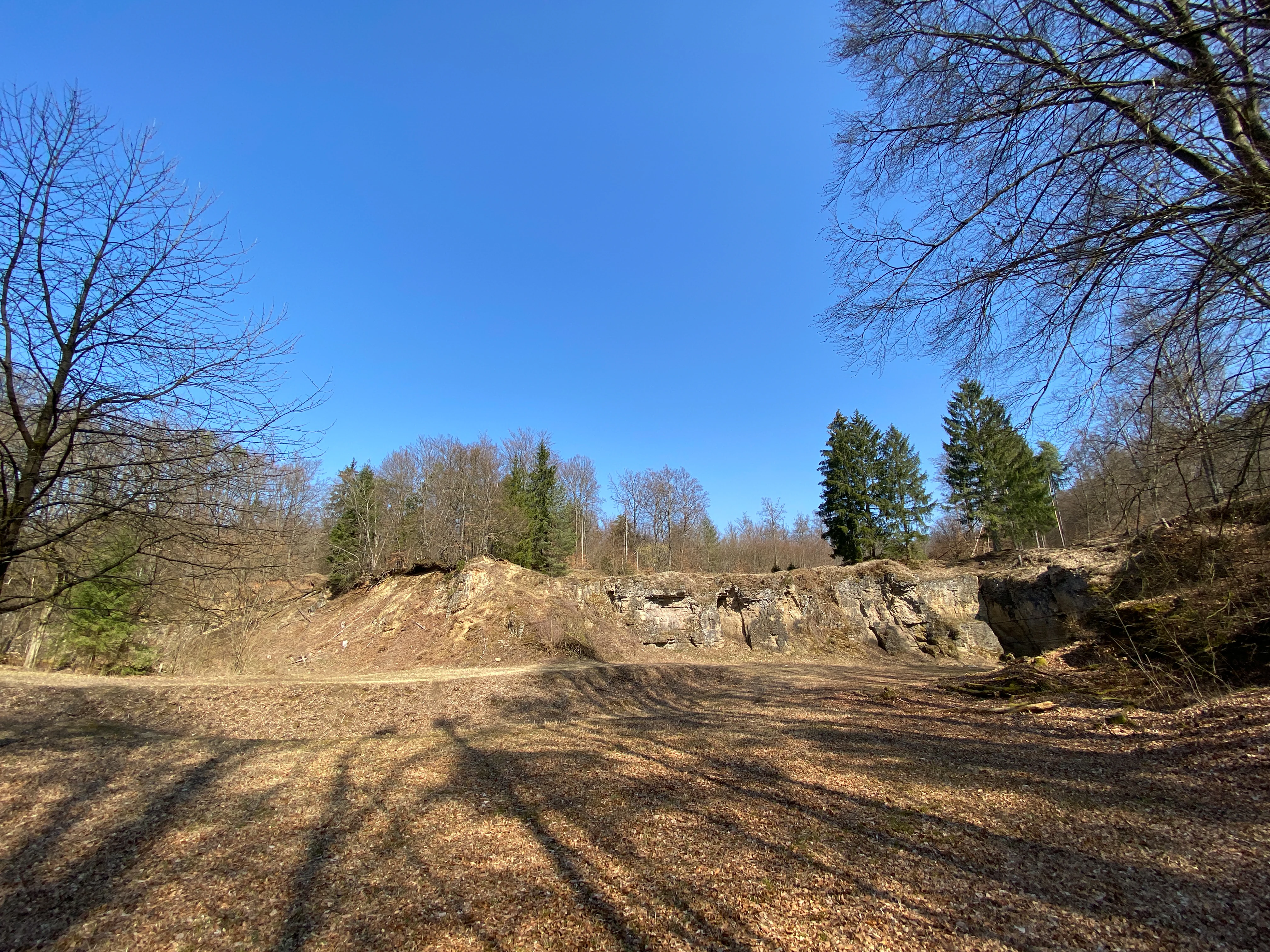
An eye level, wide view of a limestone quarry wall with sparse forest, clear blue sky, and a dry ground surface in the foreground.
A view of the limestone quarry at the Niederrodenbacher Steinbrüche nature reserve.

Niederrodenbacher Steinbrüche history and protected-area timeline

The geological substrate of the Niederrodenbacher Steinbrüche is Zechstein dolomitic limestone, a sedimentary rock laid down during the Permian period when the Zechstein Sea covered this part of central Europe. This bedrock has been quarried locally for centuries; limestone mining was already taking place in the Middle Ages, supplying building stone for historic structures in Niederrodenbach, including the old town hall, the Protestant church, and the town's fortifications.

Industrial-scale quarrying continued into the twentieth century but finally came to an end in the 1950s. The vacated quarries, with their freshly exposed rock, quarry floors, and sunny clearings, were gradually colonized by plants and animals. Local recognition of the resulting biodiversity led to formal protection in 1979, when the area was designated as a nature reserve under the name Niederrodenbacher Steinbrüche to safeguard the quarry habitats, the meadow, and their associated insect fauna.

Since designation, management of the site has focused on keeping the quarry openings and the Bindernagelswiese open. Without regular mowing and removal of encroaching scrub, the clearings would revert to woodland, and the very habitats that justify the reserve's existence would be lost.

Niederrodenbacher Steinbrüche landscape and geographic character

The landscape of the Niederrodenbacher Steinbrüche is defined by the contrast between raw quarry terrain and softer agricultural and forest surroundings. Active quarrying has long since stopped, but the former workings still dominate the topography, with steep rock faces, ledges, rubble slopes, and flattened quarry floors creating a rugged micro-topography within an otherwise gentle hilly landscape.

The Zechstein dolomite is pale, weathered, and locally bare, producing hot, dry conditions in summer that contrast with the cooler, shaded woodland margins that frame the quarries. The Bindernagelswiese adds a flatter, more fertile element, a flower-rich meadow that opens up views to the surrounding hills and provides a softer visual counterpoint to the angular quarry walls.

Forest frames the reserve on several sides, turning the quarry-mosaic-meadow complex into an island of open habitat embedded in a broader wooded landscape. The terrain rises and falls gently beyond the reserve, giving way to the surrounding farmland and forest typical of the eastern Main-Kinzig area near the Bavarian border.

Niederrodenbacher Steinbrüche ecosystems, habitats, and plant life

The ecological identity of the Niederrodenbacher Steinbrüche rests on the unusual combination of calcareous quarry habitat, dry meadow, and forest edge within a very small area. The limestone substrate is the decisive factor, producing soils that are thin, stony, and alkaline, and supporting plant communities adapted to warm, dry conditions rather than the more acidic woodland flora typical of much of the surrounding region.

The former quarries act as warm refuges where light-demanding species survive in an otherwise shaded landscape. Rock faces, scree, and bare ground provide nesting and basking sites for invertebrates, while the meadow adds nectar resources, host plants, and structural diversity. The bordering woodland contributes shade, leaf litter, and transitional habitats, creating a compact but unusually varied ecological mosaic.

Because the quarries and meadow are kept open by active management, the site retains habitats that have largely disappeared from the wider regional landscape. This has turned the reserve into an important refuge for several plant and insect species of conservation interest, particularly those associated with old quarry sites and species-rich, semi-dry grassland on calcareous soils.

Niederrodenbacher Steinbrüche wildlife and species highlights

The wildlife significance of the Niederrodenbacher Steinbrüche lies primarily in its insect fauna, which is the formal reason for the site's protection as a nature reserve. The reserve hosts a notable community of protected, partially protected, and rare insect species that depend on the combination of warm bare rock, dry quarry slopes, and flower-rich meadow for their survival.

The reserve's mosaic structure matters greatly for this fauna. Quarries provide basking sites and breeding grounds for many invertebrates, while the meadow contributes pollen, nectar, and host plants throughout the growing season. Transitions between rocks, scrub, and meadow create the structural variety that supports more diverse insect communities than any single habitat type could provide on its own.

Beyond insects, the surrounding woodland and scrub edges provide habitat for typical central German woodland fauna, including common small mammals, woodland birds, and a variety of butterflies and other pollinators that benefit from the open meadow. However, the site's defining wildlife value resides clearly in the rare and protected insect assemblages associated with its calcareous quarry and dry meadow habitats.

Niederrodenbacher Steinbrüche conservation status and protection priorities

The Niederrodenbacher Steinbrüche has been a designated nature reserve since 1979, when it was placed under protection with the explicit aim of conserving the limestone quarry habitats, the adjacent Bindernagelswiese, and their associated insect fauna. Protection focuses on preserving both the calcareous quarry environment and the meadow as a biologically valuable biotope, with particular attention to species that are fully protected, partially protected, or rare in regional terms.

Conservation management is active rather than passive. Because the most valuable habitats are open areas, the reserve authorities carry out regular mowing and shrub-clearing work to prevent the abandoned quarries and meadow from being reclaimed by forest. Without this ongoing intervention, ecological succession would gradually close the open areas and eliminate the very conditions that support the protected species.

The site is also a useful local case study for how small, post-industrial landscapes can acquire high conservation value when their specific conditions are properly understood and maintained. In this respect, the Niederrodenbacher Steinbrüche demonstrates the importance of targeted management in preserving calcareous quarry habitats and rare insect communities within a heavily used central European landscape.

Niederrodenbacher Steinbrüche cultural meaning and human context

The Niederrodenbacher Steinbrüche is closely tied to the building history of Niederrodenbach itself. Limestone from these quarries was used at least from the Middle Ages onward, providing the stone for the historic town hall, the Protestant church, and the town's old defensive walls. This long-standing link between the quarry and the local settlement is part of what gives the site its regional identity, even though quarrying itself ceased in the 1950s.

The reserve continues to function as a local landmark and as a point of community engagement with nature. Local organizations, including the NABU branch in Rodenbach, have taken an active interest in the site, helping to communicate its ecological importance and to support the management of its meadow and quarry habitats. The Bindernagelswiese in particular reflects a long regional tradition of small-scale meadow use that has shaped the cultural landscape of the Main-Kinzig area.

Together, the quarry heritage and the meadow tradition give the reserve a layered cultural profile that complements its natural significance, anchoring the site in the everyday life and historical memory of the surrounding villages.

Top sights and standout views in Niederrodenbacher Steinbrüche

The most distinctive feature of the Niederrodenbacher Steinbrüche is its combination of abandoned Zechstein limestone quarries and the adjoining Bindernagelswiese, producing a rare mosaic of calcareous rock, dry quarry habitat, and flower-rich meadow within a small, protected footprint. This unusual structure of habitats is the reason the site was protected in 1979 and remains the foundation of its ecological identity today.

Another highlight is the active conservation management that keeps the open habitats from being lost to forest succession. Regular mowing and shrub control are central to the site's value, preserving conditions that support rare and protected insects. The reserve also serves as a long-running example of how small, post-industrial sites can be transformed into valued ecological landscapes through deliberate and sustained stewardship.

Best time to visit Niederrodenbacher Steinbrüche

Late spring through early summer is generally the most rewarding period to experience the Niederrodenbacher Steinbrüche, when the Bindernagelswiese comes into full bloom and a wide range of calcareous meadow plants can be seen at their most expressive. The dry, warm conditions typical of the quarry slopes during this season are also the best context in which to observe the insect life for which the reserve is officially protected.

Late summer and early autumn can also be rewarding, especially for butterfly and other pollinator activity, when the meadow continues to flower on a reduced scale. Winter visits offer a very different impression, with the bare quarry walls, exposed rock structures, and calmer atmosphere emphasizing the geological character of the former Zechstein limestone workings behind the site's biological interest.

Because the reserve's habitats are strongly seasonal in their appearance and ecological activity, visitors interested in its full character may find it worthwhile to see the area in more than one season. Even short walks along the edges of the site offer changing impressions as the meadow, scrub, and quarry walls respond to temperature, moisture, and management through the year.


Monthly climate preview

Long-term representative point measurements tracking monthly temperature and precipitation patterns

Niederrodenbacher Steinbrüche Climate Normals and Annual Temperature Rhythm

Representative coordinate records for Niederrodenbacher Steinbrüche outline a measured annual progression of average minimum and maximum temperatures alongside daily precipitation rates from 1991 to 2020. Examining the complete twelve-month climatology profile reveals deeper numerical context for long-term regional weather variations across this protected terrain.
Annual mean10 °C
0 °C21 °C
Jan
Feb
Mar
Apr10°
May14°
Jun18°
Jul21°
Aug20°
Sep15°
Oct10°
Nov
Dec
Warmest month
July

20.6 °C

Coolest month
January

0.2 °C

Wettest month
July

2.2 mm/day

Driest month
April

1.4 mm/day

Park location guide

Geography guide, regional context, and park location map for Niederrodenbacher Steinbrüche

Niederrodenbacher Steinbrüche park geography, regions, and map view in Germany

Understand where Niederrodenbacher Steinbrüche sits in Germany through a broader geographic reading of the surrounding landscape, nearby location context, and its mapped position within the national park landscape.

How Niederrodenbacher Steinbrüche fits into Germany

Germany is a federal republic in Western and Central Europe with a population of over 83 million across sixteen constituent states. It is Europe's largest economy by nominal GDP and a major global exporter and importer. The capital is Berlin, and the country borders Denmark, Poland, Czech Republic, Austria, Switzerland, France, Luxembourg, Belgium, and the Netherlands.

Wider geography shaping Niederrodenbacher Steinbrüche in Germany

Germany is located in Western and Central Europe, spanning 357,022 km². It borders Denmark to the north, Poland and the Czech Republic to the east, Austria and Switzerland to the south, and France, Luxembourg, Belgium, and the Netherlands to the west. The country has coastlines on the Baltic Sea and North Sea to the north, with the Alps located in the southern region.

Map view of Niederrodenbacher Steinbrüche

Use this park location map to pinpoint Niederrodenbacher Steinbrüche in Germany, understand its exact geographic position, and read its mapped placement within the surrounding landscape more clearly.

Pigeon | © OpenStreetMap contributors

Location context for Niederrodenbacher Steinbrüche

Hessen

Visualizing abandoned limestone quarries, dry grasslands, and rare calcareous habitats in Hesse

Niederrodenbacher Steinbrüche Photos and Protected Landscape Scenery

Visual documentation of Niederrodenbacher Steinbrüche reveals the rugged topography of abandoned Zechstein dolomite quarries and adjacent species-rich meadows. Examining these protected area photographs clarifies how post-industrial terrain and warm limestone habitats support specialized ecological communities.

An eye level, wide view of a limestone quarry wall with sparse forest, clear blue sky, and a dry ground surface in the foreground.

Park atlas

Compare nearby nature reserves and regional protected terrain across central Germany

Exploring Parks Near Niederrodenbacher Steinbrüche and Surrounding Protected Landscapes

Browse other parks and protected areas located near Niederrodenbacher Steinbrüche to compare similar limestone terrain and regional conservation landscapes. Expanding the geographic scope reveals connected natural habitats and diverse protected environments throughout the surrounding region.
Nature reserveHessen
About 3.5 km away#1 closest

North

Kinzigaue von Langenselbold: Nature Reserve and Protected Floodplain in Hessen

Riparian ecosystems, alluvial forests, and wetland geography

Spanning 129 hectares, Kinzigaue von Langenselbold represents a well-preserved riverine corridor in central Germany. The reserve integrates the meandering Kinzig river, mature gallery forests, and the Ruhlsee into a compact, protected landscape that serves as an essential habitat for diverse bird species and rare floodplain vegetation.

Area
1.287 km²
Established
1980
IUCN
IV
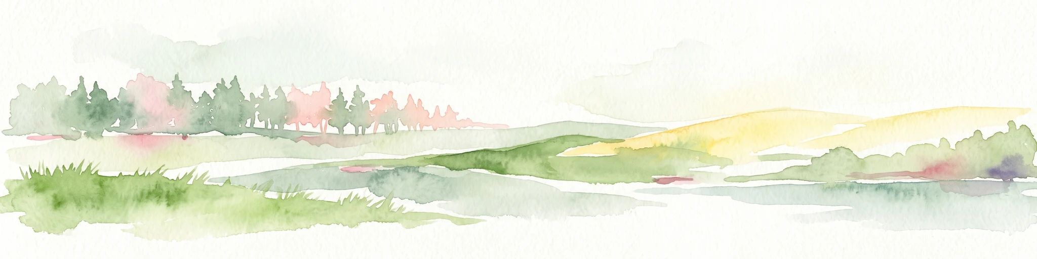
A pale, horizontal watercolor painting showing a grassy floodplain, scattered deciduous trees, a gentle path or stream winding through the center, and a soft, pastel-toned sky.
Nature reserveHessen
About 9.6 km away#2 closest

Southwest

Pechgraben bei Klein-Krotzenburg Nature Reserve in the Hessen Protected Landscape Network

A preserved mosaic of ancient floodplain terrain and wetland habitats.

Located in the Offenbach district, this nature reserve protects a rare post-glacial flood channel of the Main river. The site exhibits a diverse landform mosaic, ranging from near-natural broadleaf forests to expansive sedge marshes. It functions as a critical protected geography for regional species, maintaining its ecological character against the surrounding agricultural and residential development of the Lower Main valley.

Area
0.341 km²
Established
1998
IUCN
IV
Relief
Lowland
Watercolor illustration of a soft rolling landscape with grassy fields, scattered trees, and rolling hills in shades of green and yellow.
Nature reserveHessen
About 9.9 km away#3 closest

West

Amerikafeld und Schindkaute bei Steinheim: Nature Reserve and Protected Grassland Map

Rare sand dry grassland habitat within the Hessen metropolitan region.

Amerikafeld und Schindkaute bei Steinheim is a protected nature reserve in Hanau that shelters scarce sand dry grasslands. The terrain, defined by ice-age sandy deposits, remains an important ecological island, maintaining an open steppe-like character through historic grazing practices in a landscape otherwise dominated by urban growth.

Area
16 km²
Established
1995
A horizontal watercolor painting showing a stylized, layered forest scene in muted green, pink, and yellow tones on a white background.
Nature reserveHesse
About 11 km away#4 closest

West

Lauternsee bei Klein-Auheim Nature Reserve: Geography and Protected Bog Landscape

A historic high terrace habitat within the Hesse woodland region.

Lauternsee bei Klein-Auheim represents a specialized Flachmoor habitat that emerged from a former river channel of the Main. This nature reserve serves as an important ecological anchor in the lower Main valley, protecting essential wetlands, amphibian populations, and unique marsh plant communities within an expansive forest setting.

Established
1987
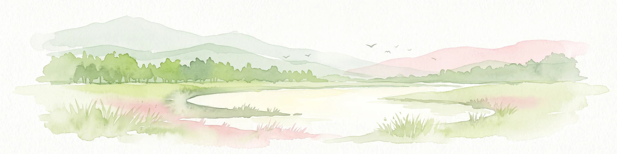
A soft watercolor illustration of a wetland scene with a calm pool of water, grassy banks, a line of trees, and distant rolling hills against a white background.
Nature reserveHesse
About 11 km away#5 closest

South

Affelderchen und Rettichbruch von Klein-Welzheim: Protected Wetland Nature Reserve in Hesse

Examining the ecological landscape and hydrology of this German protected area

Affelderchen und Rettichbruch von Klein-Welzheim is a notable nature reserve in Hesse characterized by its wet meadows and marshy woodland. This geographic study covers the protected site's transition from an agricultural lowland depression to a dynamic, beaver-influenced wetland system that supports endangered plant species and diverse breeding avian populations.

Area
0.512 km²
Established
1983
Relief
Lowland
Scope
Terrestrial
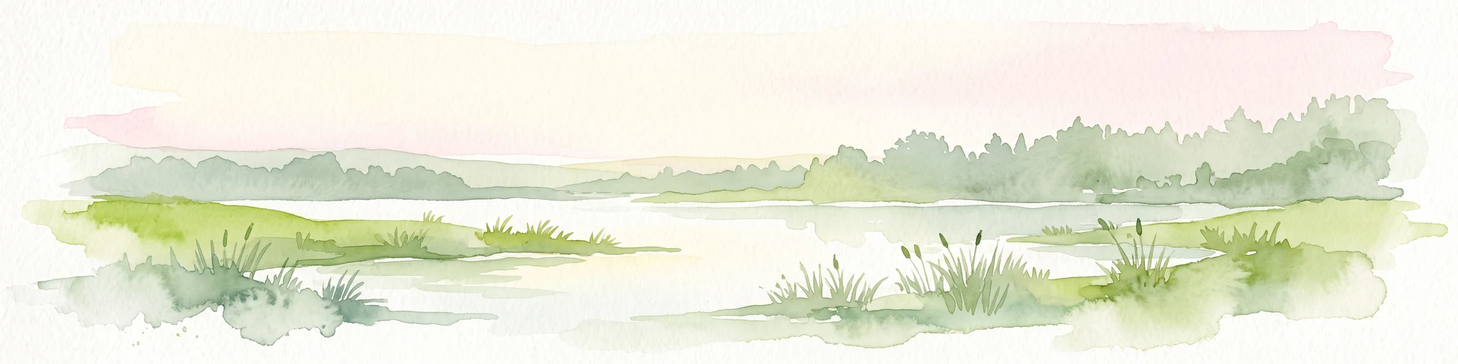
A soft watercolor painting of a serene landscape featuring a central body of water surrounded by green banks, shrubs, and gentle rolling hills in the background.
Nature reserveHessen
About 11 km away#6 closest

West

Oberwaldsee von Dietesheim Nature Reserve: Atlas and Geographic Landscape Overview

Protected basalt terrain in the Hessen region

Discover the geographic character of Oberwaldsee von Dietesheim, a protected nature reserve in Hessen defined by flooded basalt quarries and open sandy dry-grassland. This site serves as a vital ecological stepping stone within the Untermain lowlands, offering a study in microtopography and habitat diversity. Access detailed mapping and protected-area context for this essential German nature reserve within the Rhine-Main metropolitan corridor.

Area
0.335 km²
Established
1989
IUCN
IV
Nature reserveLandkreis Offenbach
About 11 km away#7 closest

Southwest

Kortenbach bei Froschhausen Nature Reserve: Geographic Mapping and Protected Forest Overview

Hardwood floodplain woodland in Landkreis Offenbach

Kortenbach bei Froschhausen protects a compact, groundwater-influenced forest ecosystem within the Offenbach district. This nature reserve acts as a critical refuge for mature broadleaf trees, including the rare European white elm. Our atlas entry focuses on the site's stream-fed terrain and its role as a preserved forest fragment amidst surrounding agricultural and transport infrastructure.

Area
0.405 km²
Established
1998
IUCN
IV
A soft watercolor painting of a wetland area with grasses, water, and a tree line in the background.
Nature reserveHessen
About 12 km away#8 closest

South

Bong’sche Kiesgrube und Mainufer bei Mainflingen: Protected Wetland and River Geography

Explore the lake and riparian terrain within the Hessen river system.

Formed from former gravel extraction sites and floodplain stretches, Bong’sche Kiesgrube und Mainufer bei Mainflingen provides a vital ecological link along the Main river. The reserve preserves a distinct mosaic of open water, reeds, and willow-dominated woodland, serving as a critical habitat for diverse waterbirds in central Germany.

Area
94.52 km²
Established
1977
IUCN
IV

Common questions about visiting, size, designation, and location context for Niederrodenbacher Steinbrüche

Niederrodenbacher Steinbrüche FAQs for park facts, access, geography, and protected area context

Find quick answers about Niederrodenbacher Steinbrüche, including protected-area facts, park geography, trail and visitor context, and how the park fits into its surrounding country and regional landscape.
MoriAtlas Explorer

Continue Your Protected Areas Search Across the Global Atlas

Deepen your exploration by continuing the structured search for national parks and protected areas worldwide. Utilize the comprehensive filtering capabilities to compare different conservation landscapes and refine your understanding of global park geography. Discover more about the distribution and characteristics of protected natural areas.

Global natural geography