
Mori Atlas logo
Protected landscapePark Krajobrazowy Beskidu Śląskiego

Mapped Ridges, Hydrological Landmarks, and Protected Montane Terrain in the Silesian Voivodeship

Park Krajobrazowy Beskidu Śląskiego: A Comprehensive Geographic Atlas of Protected Carpathian Forests

Park Krajobrazowy Beskidu Śląskiego represents a vital protected landscape in the Polish Western Carpathians. This atlas page maps the diverse geography of the Czantoria and Barania Góra ranges, defined by dense spruce and beech forests, unique flysch rock outcrops, and an extensive cave system. Users can examine the origin points of the Vistula River, where the Biała Wisełka and Czarna Wisełka streams emerge from high mountain slopes to carve the region's characteristic narrow valleys.

Western Carpathiansmountain landscapeflysch geologybeech forestspruce forestcave systems
A flat-style digital illustration of a mountain valley at sunset, featuring a tall waterfall cascading into a winding stream, framed by pine trees, rocky cliffs, and a soft pink sky.

Park Krajobrazowy Beskidu Śląskiego

Protected landscape

Park overview

Structured park overview, official facts, and landscape profile for Park Krajobrazowy Beskidu Śląskiego

Park Krajobrazowy Beskidu Śląskiego park facts, protected area profile, and essential visitor context

Review the core facts for Park Krajobrazowy Beskidu Śląskiego, including designation, size, terrain, visitor scale, habitats, and operating context in one park-focused overview.

About Park Krajobrazowy Beskidu Śląskiego

Park Krajobrazowy Beskidu Śląskiego is one of the largest landscape parks in southern Poland, focused on the forested ridges and valleys of the Silesian Beskid Mountains in the western Carpathians. Created in 1998 by regional regulation, it consolidates protections across a landscape that had previously been preserved fragmentarily through scattered nature reserves. Today it forms a unified management framework across fourteen municipalities, anchored by the twin ridge systems of Czantoria in the west and Barania Góra in the east.

The park's geographic identity is strongly linked to the upper Vistula River basin. The Biała Wisełka and Czarna Wisełka rise on the slopes of Barania Góra within the park, joined there to form the Vistula, which then flows north across Poland to the Baltic Sea. This unusual combination of a substantial protected area and a nationally symbolic river source gives the park a significance that extends well beyond regional land conservation.

Ecologically, the landscape alternates between steep, forested ridges, deep stream valleys, and small mountain pastures and meadows shaped by long-standing traditional land use. Carpathian flysch bedrock, formed of layered sandstones, shales, and conglomerates, has been sculpted into sharp ridges, isolated rock outcrops, mushroom-shaped tors, and a network of caves. Several caves, including Jaskinia Wiślańska, Jaskinia w Trzech Kopcach, Jaskinia Malinowska, and Jaskinia Lodowa w Szczyrku, lie within park boundaries and are protected as natural monuments.

For visitors and researchers, the park also functions as a cultural mountain landscape. Settlements such as Wisła, Ustroń, Szczyrk, Brenna, Istebna, and Koniaków retain strong traditions of highland pastoralism, woodworking, and folk craft. The park thus preserves not only natural systems but also the broader highland landscape mosaic of forests, meadows, streams, and inhabited valleys that has long shaped the identity of Polish Silesia.

Quick facts and research context for Park Krajobrazowy Beskidu Śląskiego

Park Krajobrazowy Beskidu Śląskiego is a regional protected landscape park established in 1998 in the Silesian Voivodeship of southern Poland. It covers roughly 38,620 hectares of the Silesian Beskids, with an additional buffer zone of about 22,285 hectares, and spans parts of fourteen municipalities stretching from Bielsko-Biała in the north to Istebna and Węgierska Górka in the south.

The park encompasses the Czantoria and Barania Góra ranges and includes eight nature reserves, two of which lie in the surrounding buffer zone. The landscape is dominated by Carpathian flysch geology, producing distinctive ridges, sandstone-capped summits, rocky outcrops, and numerous caves. The park also marks the hydrological birthplace of the Vistula River.

Protection and recognition

Examine the documented terrestrial boundaries and official recognition data

Park Krajobrazowy Beskidu Śląskiego Protection Status and Designation Records

Park Krajobrazowy Beskidu Śląskiego maintains a designated terrestrial conservation framework within its regional mountain terrain. Structured protection records detail the established management scope and administrative status governing the landscape.

Protection details

Protection scope
Terrestrial
Transboundary protection
No
Buffer area
222.85 km²
Park context

Deeper park guide and search-rich context for Park Krajobrazowy Beskidu Śląskiego

Park Krajobrazowy Beskidu Śląskiego history, landscape, wildlife, and travel context

Explore Park Krajobrazowy Beskidu Śląskiego through its history, landscape character, ecosystems, wildlife, conservation priorities, cultural context, and seasonal travel timing in a structured park guide built for atlas discovery and search intent.

Why Park Krajobrazowy Beskidu Śląskiego stands out

The park is best known as the area of origin of the Vistula, Poland's longest river, whose two headwater streams, the Biała Wisełka and Czarna Wisełka, both rise within park boundaries near Barania Góra. This hydrological identity, paired with the park's dense Carpathian forests, gives it a distinctive place in Polish environmental consciousness. It is equally recognized for its extensive system of nature reserves, which together protect the most intact examples of Carpathian forest types in the Silesian Beskids: upper montane spruce forests, lower montane beech forests, mixed fir-spruce stands, ash-alder riparian woods, and rare rock and cave habitats including the Jaskinia Wiślańska, the longest non-karst cave in Poland.
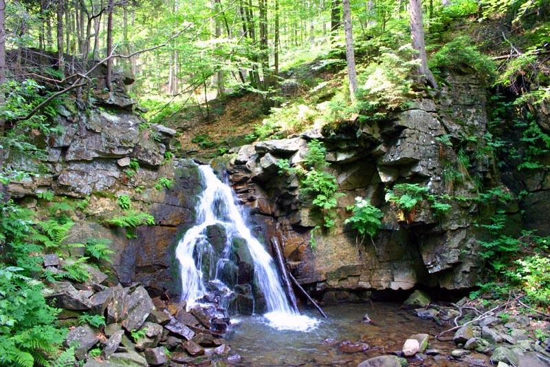
A small waterfall flowing over a rocky ledge into a pool, surrounded by lush green forest vegetation and ferns.
A small waterfall cascades over rocky cliffs within the forested terrain of the Silesian Beskids.

Park Krajobrazowy Beskidu Śląskiego history and protected-area timeline

The park was formally established on 16 June 1998 by Regulation No. 10/98 of the Bielsko regional authority, creating a unified landscape protection framework across the Silesian Beskids. Its creation built on a longer history of piecemeal protection, since several of the reserves enclosed within its boundaries predate the park by decades.

The oldest reserves, Barania Góra and Stok Szyndzielni, were designated in 1953, both focused on representative examples of Carpathian forest communities. The faunistic Wisła reserve followed in 1959 to protect the local population of native brook trout, one of the earliest such reserves in Poland. The broader reserve network expanded in subsequent decades: Zadni Gaj (1957) safeguarded a rare natural stand of European yew; Czantoria and Kuźnie were created in 1996 to protect mixed montane forests and cave systems; Dolina Łańskiego Potoku was added in 1998 in the buffer zone, the same year the park itself was created; and Jaworzyna, established in 2003, continued the pattern of targeted forest protection along the Dolina Wapienicy.

Together, the 1998 park establishment and these reserves represent a phased recognition that the Silesian Beskids' forests, hydrological sources, and geological features warranted integrated landscape-scale conservation rather than isolated protection.

Park Krajobrazowy Beskidu Śląskiego landscape and geographic character

The terrain of Park Krajobrazowy Beskidu Śląskiego is shaped by the typical rhythm of the Carpathian flysch mountains: long, parallel forested ridges separated by narrow stream valleys. The two principal ranges within the park are the Czantoria range to the west and the Barania Góra range to the east, with summits such as Skrzyczne, Klimczok, Błatnia, Równica, and Stożek forming recognizable landmarks across the area.

Geologically, the park sits on layered formations of the Silesian and Godula series, including shales and limestones, Godula sandstones, and Istebna conglomerates. These rocks have weathered to produce solitary rock outcrops known locally as ostance: pulpit-like ambony, mushroom-shaped grzyby, rock ledges, and sheer rock faces such as Malinowska Skała and the Skały Grzybowe near Stożek. The flysch also hosts a notable cave system, including several protected caves protected as natural monuments and the Kuźnie reserve protecting cave-bearing slopes above the village of Twardorzeczka.

Hydrologically, the park defines the headwaters of the Vistula. Deep valleys carved by the Biała Wisełka, Czarna Wisełka, and their tributaries thread between the ridges, with small waterfalls such as the cascade on the slopes of Barania Góra marking the river's emergence. Above the timberline extends a pattern of highland meadows, pastures, and small glades, remnants of the traditional pastoral economy that still defines the human presence in these mountains.
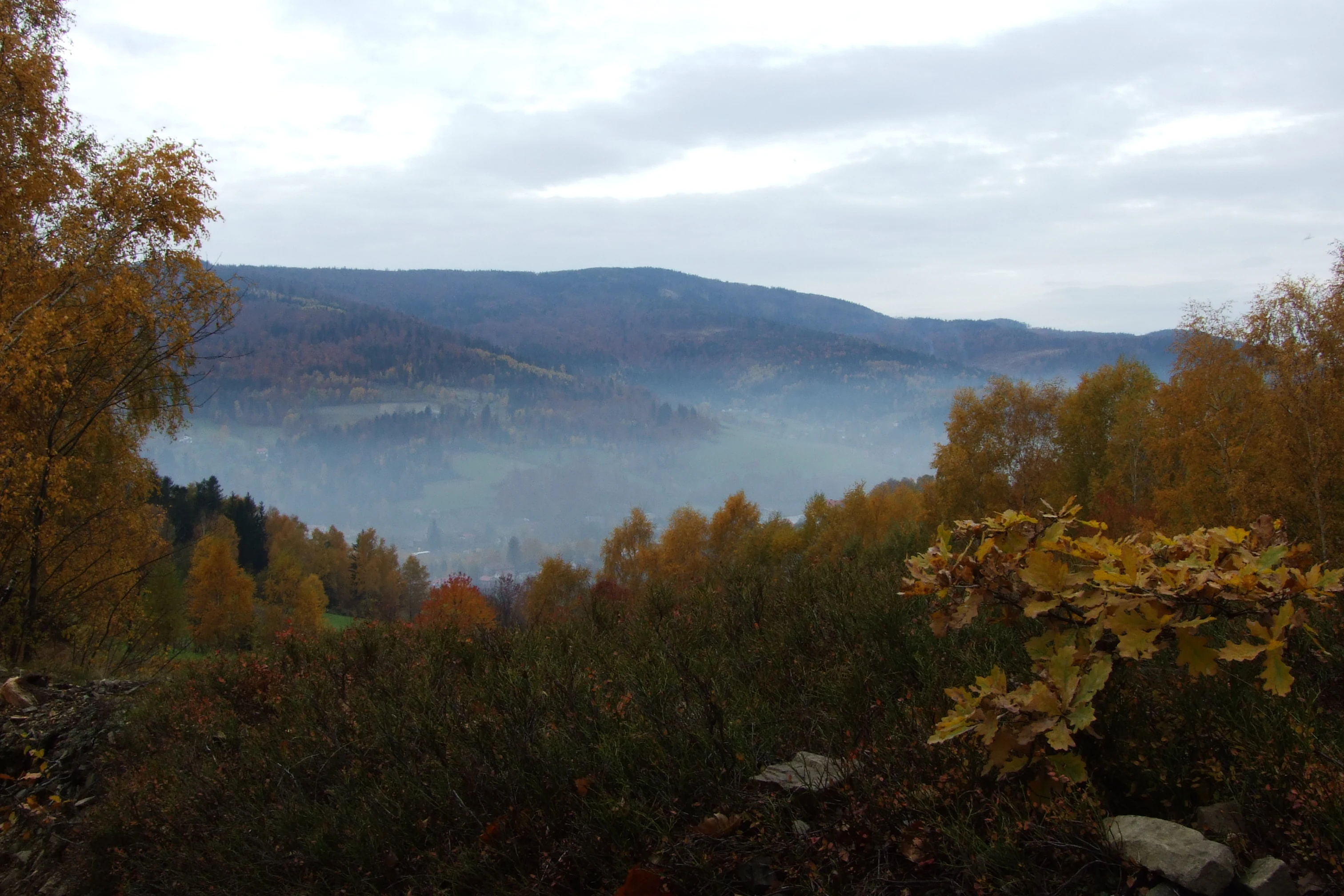
A wide view of rolling forested mountains during autumn, with golden and orange foliage and a misty valley below.
Autumnal view over the forested hills of the Silesian Beskids.

Park Krajobrazowy Beskidu Śląskiego ecosystems, habitats, and plant life

Ecologically, Park Krajobrazowy Beskidu Śląskiego represents a large, continuous tract of Carpathian forest, much of it shaped by historical exploitation. The original mixed oak-hornbeam grądy forests of the foothills have largely disappeared, replaced by more extensive stands of fir-spruce forest and pure spruce forest, with reduced coverage of the lower montane beech forests that once dominated.

In the foothill zone, streams are bordered by ash floodplain forests (podgórski łęg jesionowy), mountain alder gallery woods, and valley-floor spruce mire forests on peat. The lower montane zone is dominated by spruce, with scattered patches of acidic mountain beech forest and the richer Carpathian beech forest, the latter notable for hosting ż ywiec dziewięciolistny, a regionally characteristic herb. Steep slopes support sycamore maple forests (jaworzyna górska) and, fragmentarily, Carpathian sycamore stands, while high-elevation sections give way to fir-spruce forest and, at the upper limits, well-developed upper montane spruce forest, best preserved in the Barania Góra reserve.

Open habitats also play a role: meadows, pastures, montane tall-forb communities along streams (łopuszyny), and small spring mires (młaki) contribute to habitat diversity and sustain species that would not persist in fully forested terrain.
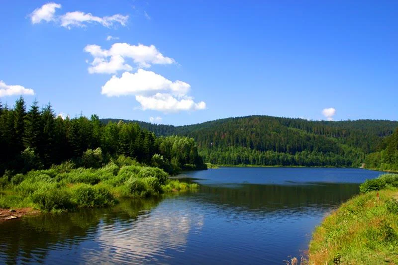
A wide view of a calm, dark blue lake surrounded by dense green pine forests and rolling hills under a bright blue sky with light clouds.
Czernianskie Lake, a reservoir on the Vistula River within the Beskid Slaski Landscape Park.

Park Krajobrazowy Beskidu Śląskiego wildlife and species highlights

The park supports a Carpathian fauna that includes several species of strong conservation interest in Poland. Birds are particularly well represented, with ring ouzel, water pipit, western capercaillie, and hazel grouse among the rarer breeding species, reflecting the presence of both open mountain habitats and mature coniferous forests.

Larger mammals include the gray wolf, the Eurasian lynx, and on an occasional basis the brown bear, which uses the Silesian Beskids as part of a wider Carpathian range. The park's cave systems are important for bats, supporting populations of lesser horseshoe bat, Geoffroy's bat, and whiskered bat. Stream fauna is notable for threatened native fish species such as the Danubian sculpin and the common sculpin, the latter protected within the Wisła faunistic reserve.

Among invertebrates, the park is home to rare and declining saproxylic beetles and butterflies, including the hermit beetle, a species associated with old broadleaf trees, and the scarce large blue, a butterfly of conservation concern. Recording these species underlines the importance of retaining veteran trees and undisturbed deadwood across the reserve network.
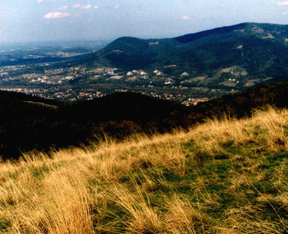
Panoramic view from a grassy mountain slope looking down into a forested valley with a distant mountain ridge under a light sky.
A view looking out from the slopes of Wielka Czantoria over the Silesian Beskids.

Park Krajobrazowy Beskidu Śląskiego conservation status and protection priorities

The park's conservation value lies in its combination of scale, ecological continuity, and the integrity of its forest communities. By covering roughly 38,620 hectares of the Silesian Beskids along with a 22,285-hectare buffer zone, it provides landscape-level protection that complements the strictly protected nature reserves within it. These reserves together form a representative cross-section of the Carpathian forest habitats that have elsewhere been fragmented by intensive forestry.

Certain habitats are of outsize importance for conservation. The upper montane spruce forests of the Barania Góra reserve represent one of the better-preserved examples of this forest type in the Silesian Beskids. The Zadni Gaj reserve safeguards one of the few natural European yew stands in the region. The Kuźnie reserve protects underground karst-like systems in flysch and associated spruce forest, including caves that are themselves natural monuments. Finally, the Wisła reserve anchors the conservation of native brook trout in a section of the upper Vistula still shaped by natural conditions.

Together, these reserves manage forest structure (including the retention of old trees and deadwood), preserve hydrological function at the source of the Vistula, and maintain habitat conditions for specialist species such as capercaillie, lynx, and cave-dwelling bats. The buffer zone extending to 222.85 square kilometers allows land uses outside the strict core to remain compatible with the park's ecological targets.

Park Krajobrazowy Beskidu Śląskiego cultural meaning and human context

The park overlays a deeply rooted highland cultural landscape. Mountain communities such as Wisła, Ustroń, Szczyrk, Brenna, Istebna, Koniaków, and Jaworze maintain a strong regional identity shaped by pastoral traditions, forestry, and folk craft. Traditional wooden architecture, local dialects, and customary land-management practices continue to define the inhabited valleys alongside the forested ridges.

Traditional economic activities have shaped the park's vegetation as well as its visible landscape. The open meadows and pastures that dot the ridges were created and maintained by centuries of grazing and haymaking. Even after the formal designation of the protected landscape, many of these traditions persist as part of the living mountain culture of the area. The convergence of intact Carpathian nature and a sustained highland way of life is one of the park's less obvious but defining qualities.
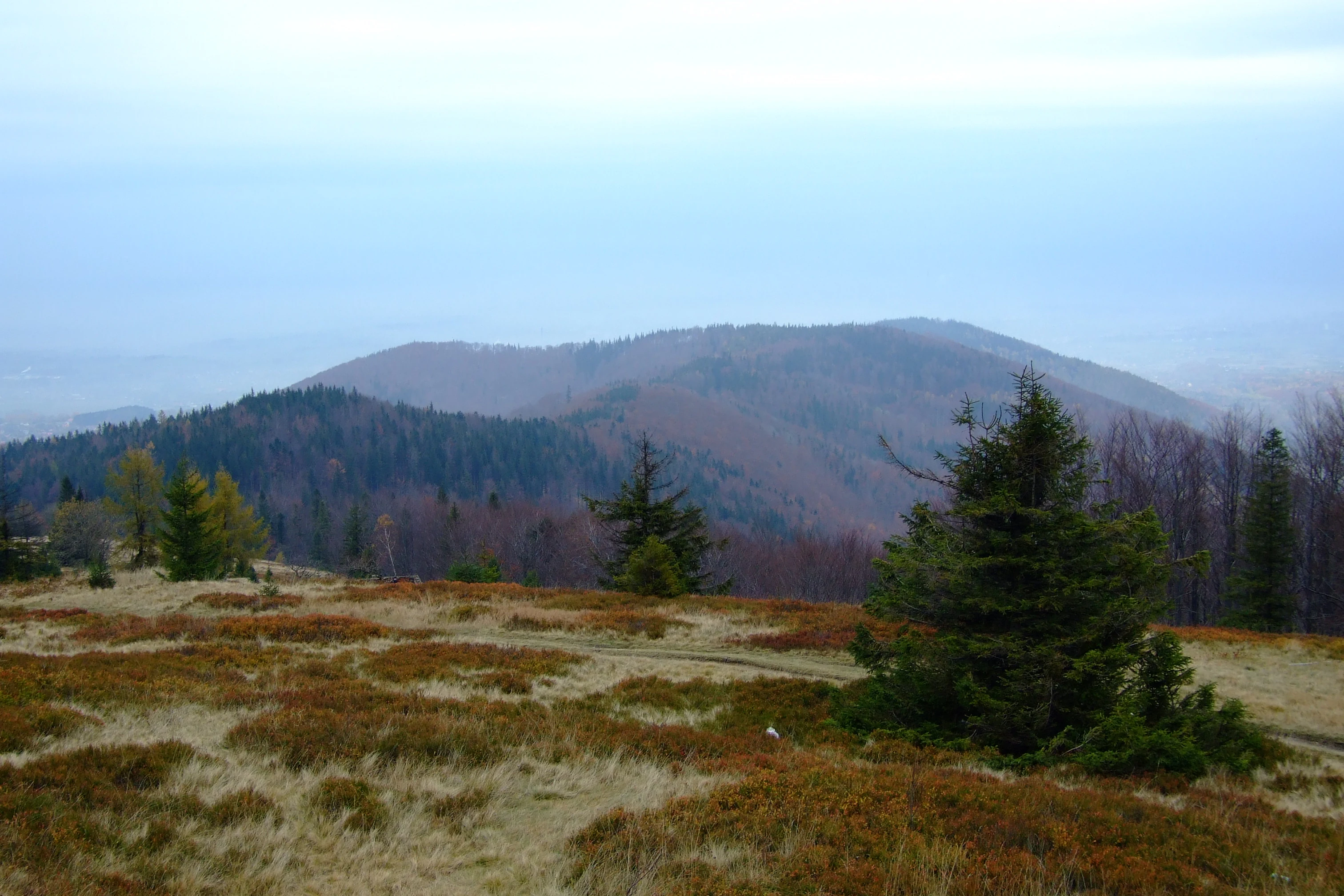
A wide mountain landscape view featuring rolling hills covered in dense, dark coniferous and deciduous forests, viewed from a grassy, autumn-toned meadow at the Blatnia summit under an overcast sky.
A view of the mountain ranges of the Silesian Beskids from the summit of Blatnia.

Top sights and standout views in Park Krajobrazowy Beskidu Śląskiego

The park's most distinctive highlights revolve around the convergence of hydrology, geology, and forest conservation. The headwaters of the Vistula on the slopes of Barania Góra form its signature natural landmark, marked by cascades and a stone monument, while Jaskinia Wiślańska, the longest non-karst cave in Poland, anchors the park's significance for cave science. The eight reserves within and around the park protect the best surviving fragments of Carpathian forest communities, from the upper spruce forests of Barania Góra to the yew stands of Zadni Gaj and the beech forests of Jaworzyna and Stok Szyndzielni.

Beyond these defining sites, the park offers extended ridgelines, panoramic summits including Skrzyczne and Czantoria Wielka, traditional highland villages such as Istebna and Koniaków, and a dense network of marked hiking trails connecting the Bielsko-Biała urban area with the southern communities around Wisła and Węgierska Górka.
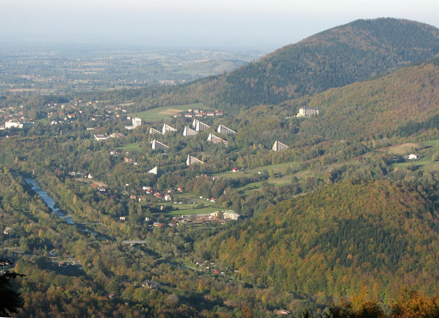
A wide angle high perspective view of a valley with forested mountains, a small town with several distinctive triangular buildings, and a river flowing through the center.
A view overlooking the town of Ustroń and the surrounding slopes of the Silesian Beskids.

Best time to visit Park Krajobrazowy Beskidu Śląskiego

The park's character changes strongly with season, and each period offers a different kind of experience. Late spring and early summer are especially rewarding for vegetation and flower-rich beech and sycamore forests, when the lower montane zone greens up and waterfalls on the Biała and Czarna Wisełka are at their fullest from snowmelt and rainfall.

Autumn is typically considered the most visually rich time for visitors interested in the broader mountain landscape, when mixed forests turn color, mushroom foraging enlivens the valleys, and wildlife observation improves as mammals become more active. Winter brings snow cover to the higher ridges of Skrzyczne and Klimczok and supports a small, localized ski infrastructure around Szczyrk and Wisła, while also emphasizing the silent, dark character of the upper spruce forest. Mid-summer remains warm and pleasant but is generally busier, particularly around the most accessible summits.

Monthly climate preview

Long term monthly temperature and precipitation data for Silesian Voivodeship

Park Krajobrazowy Beskidu Śląskiego Climate Normals and Temperature Rhythms

Representative coordinate records show measured monthly temperature and precipitation averages across the protected landscape from 1991 to 2020. Examining the complete twelve month profile provides deeper insight into annual meteorological patterns and regional climate behavior.
Annual mean7 °C
-4 °C18 °C
Jan-4°
Feb-3°
Mar
Apr
May12°
Jun16°
Jul18°
Aug18°
Sep12°
Oct
Nov
Dec-3°
Warmest month
July

17.6 °C

Coolest month
January

-4.4 °C

Wettest month
July

3.9 mm/day

Driest month
December

1.9 mm/day

Park location guide

Geography guide, regional context, and park location map for Park Krajobrazowy Beskidu Śląskiego

Park Krajobrazowy Beskidu Śląskiego park geography, regions, and map view in Poland

Understand where Park Krajobrazowy Beskidu Śląskiego sits in Poland through a broader geographic reading of the surrounding landscape, nearby location context, and its mapped position within the national park landscape.

How Park Krajobrazowy Beskidu Śląskiego fits into Poland

Poland, officially the Republic of Poland, is a Central European country spanning from the Baltic Sea in the north to the Carpathian Mountains in the south. It borders Germany, Czech Republic, Slovakia, Ukraine, Belarus, Lithuania, and Kaliningrad Oblast. The country has a temperate climate, diverse landscapes, and is known for its rich history, cultural heritage, and strong economic position within the EU.

Wider geography shaping Park Krajobrazowy Beskidu Śląskiego in Poland

Poland occupies 312,696 km2 in Central Europe, extending from the Baltic Sea coast in the north to the Sudetes and Carpathian Mountains in the south. It borders Germany to the west, Czech Republic and Slovakia to the south, Ukraine and Belarus to the east, and Lithuania and Kaliningrad Oblast to the northeast. The landscape includes lowland plains, uplands, and mountain ranges.

Map view of Park Krajobrazowy Beskidu Śląskiego

Use this park location map to pinpoint Park Krajobrazowy Beskidu Śląskiego in Poland, understand its exact geographic position, and read its mapped placement within the surrounding landscape more clearly.

Pigeon | © OpenStreetMap contributors

Location context for Park Krajobrazowy Beskidu Śląskiego

Silesian Voivodeship
Recorded earthquake history

View the Historical Earthquake Catalogue for Park Krajobrazowy Beskidu Śląskiego

Review recorded seismic activity associated with the landscapes of Park Krajobrazowy Beskidu Śląskiego through our structured geographic database. MoriAtlas provides a clear view of historical earthquake data to support your interest in the regional geological history of the Silesian Beskids.

Beskidu Śląskiego Earthquake History

Catalogued events

169 events

Strongest magnitude

Magnitude 5.1

Most recent event

Jan 27, 2025

This history includes earthquakes recorded inside the park or within 50 km of its borders

Visual exploration of Carpathian ridges, forests, and protected habitats

Park Krajobrazowy Beskidu Śląskiego Photos and Landscape Scenery

Visual documentation captures the forested mountain ridges, steep rock formations, and river headwaters defining Park Krajobrazowy Beskidu Śląskiego. Photographic reference material reveals the terrain character and natural habitats spanning the Silesian Beskids.

A small waterfall flowing over a rocky ledge into a pool, surrounded by lush green forest vegetation and ferns.

A wide shot of a snowy mountain summit with rime-covered trees, a wooden fence, and a blue sky with light clouds.

A wide view of rolling forested mountains during autumn, with golden and orange foliage and a misty valley below.

A wide view of a calm, dark blue lake surrounded by dense green pine forests and rolling hills under a bright blue sky with light clouds.

Panoramic view from a grassy mountain slope looking down into a forested valley with a distant mountain ridge under a light sky.

A wide, sunny landscape view of rolling, green, forested hills and meadows in the Beskid mountains, with scattered houses and haystacks visible in the foreground and on the hillsides.

A wide mountain landscape view featuring rolling hills covered in dense, dark coniferous and deciduous forests, viewed from a grassy, autumn-toned meadow at the Blatnia summit under an overcast sky.

A wide angle high perspective view of a valley with forested mountains, a small town with several distinctive triangular buildings, and a river flowing through the center.

A multi-story stone mountain hut with a red roof, enclosed by a rustic wooden picket fence, seen under a cloudy sky.

A wide view of a forested mountain slope known as Kolowrot peak in the Silesian Beskids, with a low-rise building and trees visible in the foreground.

Park atlas

Compare nearby protected landscapes, regional mountain ranges, and adjacent Carpathian terrain.

Explore Other Parks Near Park Krajobrazowy Beskidu Śląskiego and Surrounding Protected Areas

Compare Park Krajobrazowy Beskidu Śląskiego with other protected areas across the surrounding mountain terrain. Broaden your geographic perspective by examining adjacent reserves and regional park networks.
A horizontal watercolor painting depicting a soft green landscape with rolling hills, distant light purple mountain ridges, and a central water feature, rendered in a light, atmospheric style.
Protected landscapeSilesian Voivodeship
Mapped location lies within the park boundary#1 closest

Northeast

Dolina Wapienicy: Protected Landscape and Carpathian Mountain Valley in Silesian Voivodeship

Mapped terrain, forest ecosystems, and ridge geography

Dolina Wapienicy acts as a protected landscape complex within the urban-adjacent geography of the northern Silesian Beskids. The area encompasses mature Carpathian beech forests and rare upper montane spruce stands, organized around the Wapienica River and the Mościcki Dam reservoir. It remains a focal point for understanding how mountain valley systems maintain biodiversity and near-natural wilderness characteristics in close proximity to major urban settlements.

Area
15.19 km²
Established
1993
Relief
Mountain
Climate
Temperate
A watercolor painting showing a rolling landscape with distant mountains, soft green and pink trees, and gentle hills on a plain white background.
Protected landscapeBielsko-Biała
About 0.5 km away#2 closest

Northeast

Cygański Las Protected Landscape: Mapped Geography and Foothill Forest in Bielsko-Biała

An expansive 593-hectare woodland corridor in the Silesian Beskids.

Cygański Las functions as a formal protected landscape complex, preserving diverse forest communities from fertile beech stands to mountain sycamore on the slopes of Bielsko-Biała. This terrain serves as the essential southern trailhead for the Silesian Beskids, connecting the urban fabric of the city with the rugged elevations of Szyndzielnia, Klimczok, and Magurka Wilkowicka through a network of historic trails.

Area
5.93 km²
Established
1997
Relief
Mountain
Climate
Temperate
Nature reservePoland
1.2 km away#3 closest

Northwest

Kościół w Górkach Wielkich: Nature Reserve and Protected Habitat in Silesian Voivodeship

Mapping cultural heritage and ecological sanctuary boundaries

Explore the geography of Kościół w Górkach Wielkich, a specialized Natura 2000 protected site situated within the Brenna commune. This entry provides context on the church architecture and the local protected terrain that creates a essential roost for regional bat populations in the Silesian Beskids foothills.

Relief
Lowland
Scope
Terrestrial
Water
Minor water
Protected landscapeSilesian Voivodeship
3.2 km away#4 closest

Southeast

Żywiecki Park Krajobrazowy: Geographic Atlas and Protected Landscape Overview

A detailed look at Beskid mountain terrain and Silesian regional geography.

Żywiecki Park Krajobrazowy encompasses a diverse mountain environment within the Silesian Voivodeship, where parallel ridges and deeply incised valleys create a complex dendritic structure. This protected landscape is marked by its transition from dense beech and spruce forests to high-mountain zones, featuring unique karst formations and significant waterfall systems along its river networks.

Area
358.7 km²
Established
1986
Relief
Mountain
Climate
Temperate
Nature reserveSilesian Voivodeship
About 3.2 km away#5 closest

North

Morzyk Nature Reserve: A Protected Forest Landscape in the Silesian Foothills of Southern Poland

Mapping forest communities and ravine terrain within the Silesian Voivodeship.

Morzyk Nature Reserve protects a rich mosaic of deciduous woodlands and beech-dominated stands in southern Poland. This compact forest reserve offers deep insight into the ecological character of the Silesian Foothills, featuring well-preserved ravines and old-growth trees that anchor the regional geography.

Area
0.103 km²
Established
1996
Relief
Upland
Climate
Temperate
Nature reserveWojewództwo śląskie
About 15 km away#6 closest

Southeast

Rezerwat przyrody Muńcoł: Protected Beech Forest and Mountain Landscape in Poland

Floristic nature reserve in the Beskid Żywiecki region

Spanning over 45 hectares, Rezerwat przyrody Muńcoł protects a rare Carpathian beech forest community on the eastern slopes of the Kotarz massifs. This reserve acts as a core area for submontane botanical research and provides an essential look at the montane forest dynamics found across the Województwo śląskie province of Poland.

Area
0.452 km²
Established
1998
Relief
Mountain
Scope
Terrestrial
A horizontal watercolor illustration depicting rolling, soft green mountains under a pale pink sky, with simple plant motifs in the foreground.
Protected landscapeSilesian Voivodeship
17 km away#7 closest

East

Park Krajobrazowy Beskidu Małego: Geographic Overview and Protected Mountain Landscape

Twin ridges and sandstone terrain in the western Carpathians

Trace the geography of Park Krajobrazowy Beskidu Małego, a protected landscape in southern Poland covering 257 square kilometers of the Little Beskids. This detailed atlas entry provides insights into the park's twin-ridged structure, sandstone bedrocks, and the ecological significance of its nature reserves and valley corridors located within the Silesian Voivodeship.

Area
257.7 km²
Established
1998
Relief
Mountain
Climate
Temperate
Watercolor painting of a meandering river landscape with green grasses, shrubs, and soft pink hills in the background.
Natural monumentMoravskoslezský kraj
About 25 km away#8 closest

West

Meandry Lučiny Natural Monument: Protected Riverine Geography and Floodplain Habitat Maps

Natural river meanders in the Moravian-Silesian landscape

This protected natural monument preserves a vital lowland river corridor where the Lučina River flows in an unregulated course. Through its shifting meanders and diverse floodplain habitats, the area highlights the ecological importance of maintaining natural hydrological processes in a heavily urbanized region of the Czech Republic.

Area
0.406 km²
Established
1992
IUCN
III
Relief
Lowland

Common questions about visiting, size, designation, and location context for Park Krajobrazowy Beskidu Śląskiego

Park Krajobrazowy Beskidu Śląskiego FAQs for park facts, access, geography, and protected area context

Find quick answers about Park Krajobrazowy Beskidu Śląskiego, including protected-area facts, park geography, trail and visitor context, and how the park fits into its surrounding country and regional landscape.
MoriAtlas Explorer

Continue Your Protected Areas Search Across the Global Atlas

Deepen your exploration by continuing the structured search for national parks and protected areas worldwide. Utilize the comprehensive filtering capabilities to compare different conservation landscapes and refine your understanding of global park geography. Discover more about the distribution and characteristics of protected natural areas.

Global natural geography