
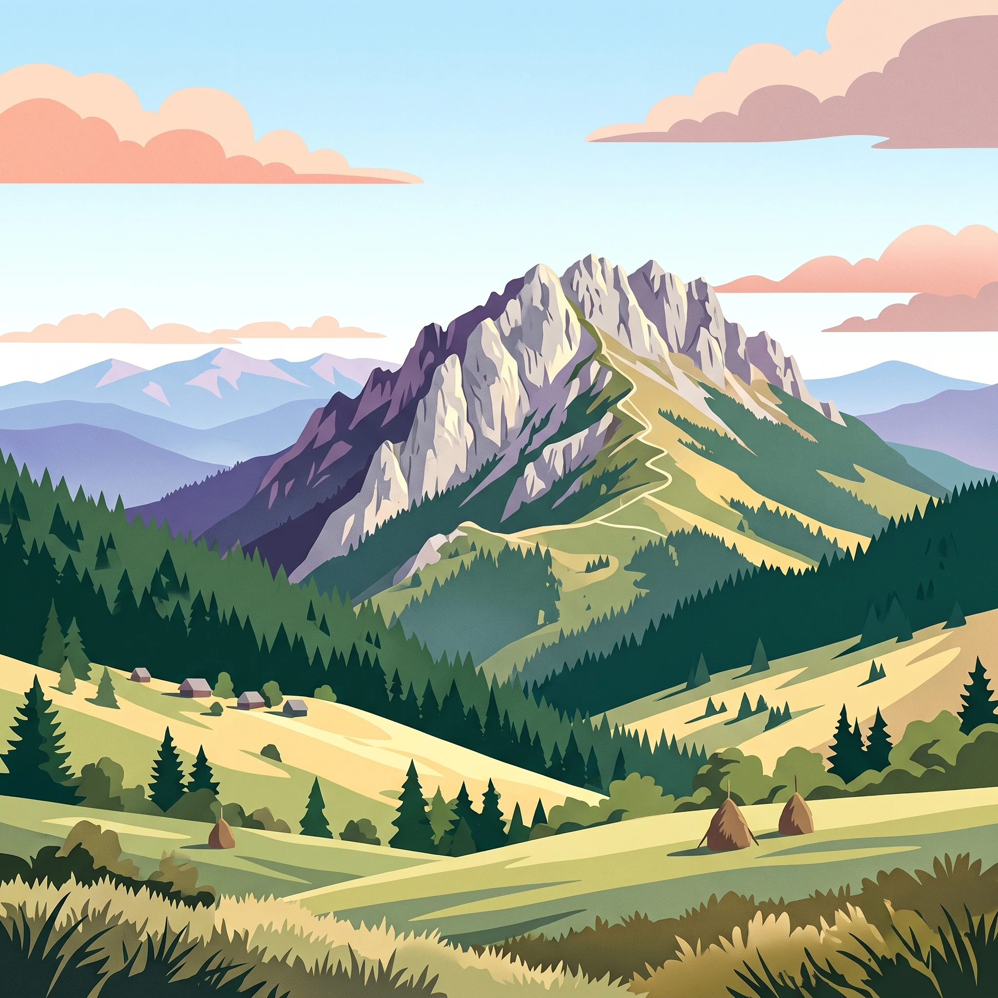
Visitor Planning
Best Time to Visit Piatra Craiului National Park: A Quick Overview
The best time to visit Piatra Craiului National Park is during the mid-summer months of July and August, when the alpine landscape is most stable and accessible for those planning to traverse the iconic limestone ridge. While the park is a year-round entity, the specific combination of altitude, climate patterns, and terrain complexity makes these two months the most favorable for high-elevation hiking and safe navigation of the narrow, exposed crests that define this Carpathian range.
The Impact of Elevation and Climate on Timing
Visitors should understand that the park's topography,centered on a dramatic, saw-like ridge peaking at over 2,200 meters,dictates the constraints of your trip. The primary timing factor is the persistent cold at higher altitudes, which creates a sharp disparity between the mild temperatures in the surrounding foothills and the freezing conditions often found on the ridges, even outside of deep winter. Precipitation patterns also play a critical role; throughout the warmer months, the risk of rapid, mountain-driven weather shifts remains a reality that shapes every ascent. These environmental variables mean that regardless of your preferred arrival date, you must view the timing of your trip through the lens of safety and the physical toll of navigating limestone terrain.
Balancing Experience and Accessibility
Planning your visit requires weighing the trade-off between the desire for warmer, more stable conditions and the nature of the park’s primary experiences. Outside of the core summer window, the shoulder seasons offer a distinct atmosphere with cooler air and shifting light, but they bring an increased likelihood of unpredictable trail conditions, including late-season snow or early autumn storms that can impact the narrow crest paths. Choosing to go during peak summer provides the greatest duration of daylight and the most consistent climate, yet it necessitates careful planning around the popularity of the main trails. Conversely, opting for periods with lower visitor density, such as late spring or early autumn, rewards travellers with quieter paths, but this benefit comes with the requirement for greater self-sufficiency and deeper preparation for the park's characteristic climate volatility. Your decision should prioritize your familiarity with alpine environments and your primary goals within the park, whether that involves traversing the full range or exploring the deep gorges and lower forested paths.
Seasonal Planning
Best Months to Visit Piatra Craiului National Park for Seasonal Activities
The Peak Summer Window for High-Altitude Hiking
For travelers prioritizing the classic two-day ridge traverse, the window between July and August represents the most reliable period. During these months, the park experiences its highest mean temperatures, with daily maximums frequently reaching above 25°C. The reduction in precipitation compared to the late spring transition allows for more stable conditions on the exposed, narrow limestone spine. Daylight hours remain robust, providing the necessary time for longer treks across the Vârful La Om massif. The primary trade-off is the popularity of these months, as the stable weather attracts more hikers to the narrow trails, which can impact the sense of solitude often associated with the Carpathians.
Transitioning into the Shoulder Seasons
Visiting in June or September provides a distinct alternative for those who prefer cooler, more brisk conditions. June serves as a transitional month where the park reaches its peak daylight length, though hikers should remain aware of residual moisture from spring thaw cycles and more frequent afternoon rain patterns. September offers perhaps the most balanced trade-off, characterized by stable, clear skies and lower humidity levels compared to the peak summer heat. Daytime temperatures remain comfortable for vigorous movement, while the nights begin to cool significantly as winter approaches. This period is favored by those seeking to avoid the humidity of mid-summer while still benefiting from generally accessible trail conditions, though the shorter daylight compared to July necessitates earlier starts for any technical mountain routes.
Planning Around Late Autumn and Spring Volatility
The months of April, May, and October represent periods of high variability where the climate does not support standard high-altitude exploration. April and May are marked by rapid warming in the foothills, but this surface-level change masks significant temperature drops and snow risks at elevations above 2,000 meters. Similarly, October sees the first substantial signs of winter as mean temperatures drop toward freezing. While these months can be visually rewarding due to spring flowering or autumn foliage, they demand advanced preparedness for mixed weather. These windows are better suited for lower-altitude explorations within the valleys or the base of the karst gorges, as the main ridge becomes increasingly challenging to navigate safely. Travelers aiming for these periods should prioritize flexibility in their itinerary to account for rapid weather changes that are common in this karst terrain.
Annual Climate Analysis
Understanding Piatra Craiului National Park Weather and Climate by Month
The Annual Temperature Cycle in the Southern Carpathians
Piatra Craiului experiences a dramatic annual temperature shift typical of high-elevation mountain environments in Romania. From a base perspective, winters are characterized by deep freezes, with mean temperatures dropping below -5 degrees Celsius in January and December. As spring transitions toward summer, the warming trend accelerates, pushing mean temperatures into double digits by May. July and August stand as the warmest months, consistently showing mean daily temperatures around 16 to 17 degrees Celsius. However, these figures represent averages from an intermediate elevation of roughly 1,100 meters, meaning that those traversing the high ridge or standing on peaks like Vârful La Om will encounter significantly lower temperatures, regardless of the calendar month.
Patterns in Precipitation and Humidity
Rainfall and humidity follow a distinct pattern that influences ground conditions throughout the year. The wettest phase of the year occurs between May and June, coinciding with snowmelt in the higher altitudes. During these months, precipitation rates reach their annual peaks, often accompanied by higher relative humidity levels that frequently exceed 75 percent. Conversely, late summer and early autumn represent a drier period. August, in particular, exhibits a noticeable reduction in average precipitation compared to the spring months, creating a more stable atmospheric window for high-altitude activities. By autumn, while rainfall totals remain modest, the return of cooler air contributes to a steady rise in relative humidity as the year approaches winter.
Shifts in Daylight and Solar Exposure
Daylight duration serves as a primary logistical constraint for planning time in the park. The seasonal swing is substantial, ranging from just under 9 hours of daylight in the heart of December to over 15 hours during the peak of June and July. This six-hour differential fundamentally alters how much time visitors have to navigate the technical ridge or traverse long forest paths. In the depths of winter, the narrow window of usable light creates a significant safety margin for any movement through the park. While these daylight figures reflect the sun above the horizon, the deep karst gorges and steep northern slopes of the range can cast shadows much earlier in the day than these statistics suggest, an important consideration for hikers relying on ambient light.
Interpreting Climate Normals vs. Local Forecasts
The climate data presented here is derived from long-term observations between 1991 and 2020 at a fixed elevation. These numbers describe the general environmental character of the region rather than current weather patterns or precise forecasts. Mountain microclimates in Piatra Craiului are highly variable; a clear day in a valley does not guarantee stable conditions on the exposed limestone ridge. Visitors should treat these annual patterns as a framework for seasonal expectations rather than a substitute for checking live weather reports, storm warnings, or official mountain rescue alerts before heading into the park. Environmental conditions, including wind chill and rapid temperature drops, can be extreme at higher altitudes and often diverge significantly from the general climate norms recorded at lower, more sheltered monitoring stations.
Seasonal Weather Patterns
Understanding Annual Weather and Seasonal Transitions in Piatra Craiului
Transitioning from Frozen Peaks to Alpine Warmth
The annual cycle in Piatra Craiului does not conform to a traditional four-season calendar. Instead, the massif undergoes distinct environmental phases defined by the rapid shift from long-term winter dormancy to intense summer heat. The primary transition period, typically occurring between April and May, is characterized by rapid temperature rises. While mean temperatures hover near freezing, daytime maximums begin to climb into the low 20s. This phase is defined by ground-level instability and high humidity, making the lower valleys distinct from the high-altitude ridge, which often remains treacherous long after the foothills suggest the arrival of spring.
The Peak Summer Stability Window
The most clearly defined period for mountain activity encompasses July and August. This phase represents the meteorological plateau of the year, featuring the most reliable, albeit still changeable, conditions for trekking. During these months, the daily temperature range is at its most compressed, with mean values peaking near 16-17 degrees Celsius. While humidity is at its annual low during this time, the atmospheric environment remains prone to sudden afternoon shifts common in karst landscapes. This window is not simply a summer season, but a narrow, high-altitude operational opportunity where the combination of maximum daylight hours (exceeding 15 hours in June and July) and moderated wind speeds allow for safer navigation of the narrow limestone spine.
The Rapid Autumn Cool-Down
September marks a definitive break in the annual rhythm, initiating a transition that is more abrupt than the slow creep of spring. By October, average minimum temperatures plummet below freezing, effectively ending the stable period of the previous two months. This phase is characterized by a sharper decline in daylight, which drops from over 12 hours in September to roughly 10.5 hours by the end of October. Visitors often perceive this as a shift toward winter, but the lower levels of precipitation during this month compared to the early summer wet pulse make it a distinct window. The mountain environment shifts from a lush, active landscape to one of dormancy and early frost, setting the stage for the extended winter period that dominates the park from November through March.
Winter Dormancy and High-Altitude Risks
From December through February, the park enters its most stable, yet most restrictive, phase. With mean temperatures consistently dropping well below zero and humidity levels exceeding 90 percent, the massif is locked in a cycle of freeze-thaw and snow accumulation. This is not merely a colder season; it is a period where the high-altitude ridge becomes a fundamentally different entity compared to the summer months. The climate data confirms that while winter months see the lowest precipitation rates, the extreme cold and persistent wind speeds create a hostile environment. This period is effectively closed to casual trekking, as the geological constraints of the ridge,sharp, narrow, and exposed,are compounded by winter climate patterns that render trails largely inaccessible to those without specialized mountaineering expertise and equipment.
Seasonal Experiences
Seasonal Character and Activities in Piatra Craiului National Park
Ridge Traverses and High Altitude Hiking
The defining physical experience of Piatra Craiului remains the narrow, jagged limestone ridge. Because the traverse involves significant exposure and steep, technical sections, the window for this activity is dictated by weather stability and the absence of snow. The months of July and August provide the most reliable conditions for this challenging trek, as the ridge remains free of late-spring snow patches and benefits from the lowest relative humidity of the year. During these months, the extended daylight provides a necessary buffer for hikers completing the full north-south traverse. While September often maintains good trail conditions, the rapid drop in average temperatures and reduced daylight hours beginning in mid-autumn make the ridge significantly more demanding and prone to sudden temperature shifts.
Karst Landscapes and Gorge Exploration
The Prăpăstiile Zărneștiului gorge offers a distinct experience that is more accessible than the ridge. These towering limestone walls remain sheltered from the high-altitude winds that frequently buffet the summits. Visiting these lower-elevation features is viable for a wider portion of the year, spanning from late spring through early autumn. During the warmer months, the shaded nature of the canyon walls provides a respite from the peak afternoon temperatures, which can climb towards 28 degrees Celsius in August. Conversely, in the transition months of April and May, the gorge is often wetter due to snowmelt, which can influence the experience for those seeking dry conditions for casual walking or photography.
Wildlife Observation Cycles
Large carnivore territories within the park, including populations of brown bears, wolves, and lynx, are influenced by the surrounding environmental cycles. Wildlife viewing, often supported by specialized guides, generally follows an annual cycle from March through November. The presence of bears, in particular, is a critical factor for hikers planning trips into the backcountry. Activity is highest in the warmer months when natural food sources are abundant, but the park's dense forests and remote terrain mean that encounters remain a matter of chance rather than timing alone. Visitors interested in observing or tracking wildlife should prioritize the mid-season windows, such as late spring or early autumn, when cooler daily temperatures make extended periods in the field more comfortable than in the peak heat of mid-summer.
Cultural Landscapes and Mountain Village Access
The mountain villages of Magura and Pestera serve as gateways to the park, offering a different pace of life compared to the technical challenges of the higher range. Access to these communities is generally consistent throughout the year, but the experiential focus shifts with the seasons. Spring brings the vibrancy of meadows, while autumn highlights the pastoral transitions of the traditional sheepfolds. While transport to these villages is maintained during most conditions, visitors should anticipate that off-season periods, particularly late autumn and winter, will fundamentally change the activity profile to focus on landscape viewing and cultural heritage rather than mountain trekking.
Travel Priorities
Timing Your Piatra Craiului Visit Based on Activity and Comfort
Balancing Stable Ridge Conditions with Pleasant Hiking Temperatures
Visitors prioritising comfortable walking weather over maximum ridge stability should target the shoulder windows of early summer or late autumn. While July and August offer the most consistent daylight and the lowest probability of precipitation for the iconic two-day ridge traverse, the daytime highs at mid-mountain elevations often climb toward the mid-20s Celsius. Hikers sensitive to heat may find the cooling temperatures of September more manageable for strenuous ascents. During September, the average maximum temperature drops to roughly 23.8 degrees Celsius compared to August highs of 28.3 degrees. This transition provides a comfortable compromise, balancing enough daylight for long days on the trails with a reduction in the thermal intensity experienced on exposed limestone sections.
Prioritising Dry Weather for Technical Terrain
For travellers whose primary goal is rock climbing in the Prăpăstii Zărneștilor gorge or navigating the more technical, narrow sections of the ridge, dryness is the most critical variable. High-altitude environments are prone to rapid weather shifts, but historical climate data points to August as the month with the most favourable precipitation profile, averaging 2.42 millimetres per day. While June records higher precipitation levels of 3.63 millimetres per day, August offers a more reliable window for those seeking to avoid wet limestone, which becomes significantly more treacherous for climbing or high-exposure trekking. The trade-off for this relative dryness is the potential for mid-summer afternoon thunderstorms, which, while typical of mountain ranges, require visitors to remain flexible and prioritise early starts to clear the ridge before mid-afternoon clouds develop.
Choosing for Extended Daylight and Alpine Exploration
If the priority is maximizing time on the mountain, June and July are the superior choices. These months provide the longest daylight hours, with June peaking at 15.43 hours and July following closely at 15.09 hours. This extra time is invaluable for hikers tackling the longer, more demanding routes that loop through the alpine meadows or connect distant karst features. The compromise for selecting these long-day months is that the vegetation is often at its most lush, which can sometimes obscure minor trail markers, and the probability of summer afternoon rain is higher than in the leaner, drier months of late summer. Visitors who choose the long-day window in June should also be prepared for lingering snow patches in the highest north-facing cirques, as the mountain retains the remnants of winter well into the early summer period.
Selecting for Wildlife Observation and Stable Lower Valley Access
For those interested in large carnivore observation or visiting the traditional mountain villages of Măgura and Peștera, the priority shifts from high-altitude stability to moderate, consistent mountain conditions. The period from late spring through autumn offers the broadest window for wildlife activity, specifically for those utilizing authorised observatories. While the high ridge becomes the focus for many, the lower elevations and forest fringes remain accessible and pleasant from May through October. The trade-off here is one of focus: by prioritizing these lower-elevation wildlife-viewing experiences, travellers essentially trade the high-altitude ridge traverse for more stable, lower-effort access to the park's biodiversity and cultural landscape.
Access and Logistics
Seasonal Access and Practical Trip Planning for Piatra Craiului National Park
Navigating Access Points and Regional Connectivity
Access to the park is primarily facilitated through a series of gateway towns and villages that ring the base of the massif. Zarnesti serves as the most prominent northern entry point, offering the most direct connectivity from regional hubs such as Brasov. On the southern and western flanks, visitors typically utilize Dambovicioara, Bran, Moeciu, Fundata, and Sirnea. These villages provide varying levels of proximity to the main trailheads leading into the karst heart of the range. Because road accessibility and local transport options are subject to seasonal maintenance and shifting service schedules, travelers must confirm current road status and public transit timetables directly with local authorities or municipal tourism offices before finalizing travel arrangements.
Practical Logistics for Regional Travel
Moving between the valley settlements and the immediate vicinity of the park often requires a flexible approach to local transport. While public buses link larger towns like Brasov to centers such as Podul Dimbovitei, the final segments toward specific trailheads or remote mountain accommodation often lack synchronized public transit. Travelers relying on regional bus routes should account for the fact that these services may not run at high frequencies or cater specifically to recreational traffic. If you are planning an itinerary that involves point-to-point hiking or traversing the ridge, it is essential to arrange local logistics in advance or verify the availability of private transfer services that are known to operate in the region. Do not assume that schedules found in older guidebooks or online forums remain current; verify these details with the local administration responsible for the park zone you intend to visit.
Verifying Official Park Status and Rules
As a protected national park, the Piatra Craiului region maintains specific regulations regarding access, conservation, and permitted activities. While the park is a destination for year-round mountain activity, specific paths, cave systems, or sensitive wildlife corridors may experience temporary closures for ecological management or maintenance reasons. Regulations regarding entrance fees, permits for specialized activities, or mandatory registration for certain technical routes can change based on current administrative policy. Readers should always check the official website of the Piatra Craiului National Park authority or contact the visitor center directly to confirm the current status of the trails you intend to hike. Never assume a route is open simply because it is historically popular or because weather conditions appear favorable; always defer to the most recent official alerts regarding park operations, facility availability, and safety requirements.
Safety and Preparation
Seasonal Weather Hazards and Packing for Piatra Craiului National Park
Interpreting Mountain Conditions for Safety
Preparation for Piatra Craiului requires acknowledging the stark contrast between the sheltered valley villages and the exposed, high-altitude limestone ridge. While valley temperatures may feel mild, the summit region often experiences significantly more intense weather. The most critical aspect of your planning should be the recognition that seasonal averages provide only a broad baseline. The limestone landscape is sensitive to rapid changes, meaning you must check current meteorological reports, such as those provided by the National Meteorological Administration, and consult official park alerts before setting out on any traverse.
Preparing for Variable Terrain and Exposure
The narrow, saw-like nature of the ridge means there is limited shelter during unexpected shifts in conditions. Regardless of the month, the wind speed and humidity levels significantly influence your experience on the mountain. In summer, while average maximum temperatures can reach into the mid-twenties Celsius, the ridge remains susceptible to afternoon convective weather patterns. You should prepare for the possibility of rapid cooling if clouds gather, as visibility can diminish quickly. When packing, focus on layering options that allow for quick adjustments to changing thermal conditions, rather than relying on a single heavy outer garment.
Managing Daylight and Elevation Challenges
Daylight hours fluctuate significantly throughout the year, impacting your window for safe movement in the backcountry. In winter months, daylight may drop below nine hours, drastically shortening your timeframe for high-altitude treks. Conversely, the long days of June and July offer more flexibility, but the intensity of the sun at higher elevations requires consistent protection. Regardless of when you visit, ensure your itinerary accounts for the actual daylight hours available to avoid being caught on the ridge after dark. If your plans involve technical sections or the multi-day ridge traverse, allow extra time beyond standard trekking estimates, as the rough limestone terrain requires careful footing and is significantly more tiring than established valley trails.
Verifying Route Status and Local Guidance
Seasonal safety is not just about personal attire but also about respecting current trail conditions. Residual snow patches may linger into late spring, and paths can become notably slippery after rainfall due to the character of the limestone rock. Before departure, contact park rangers or visit the nearest mountain rescue (Salvamont) post for the most current information regarding trail integrity and potential hazards. Do not assume that a trail marked on a map is open or accessible until you have verified the status with local authorities, as conditions in the Carpathians can change due to recent weather events that do not appear in seasonal climate statistics.
Trip Planning
How to Choose the Right Time for a Piatra Craiului National Park Visit
Navigating Seasonal Trade-offs for Your Trip
Choosing the right window for a visit to Piatra Craiului relies on matching your personal tolerance for environmental variability against the specific demands of the limestone massif. The primary decision factor is the contrast between the stability of the mid-summer months and the volatility of the shoulder and winter periods. If your objective is accessing the high-altitude ridge, the data suggests that July and August provide the most reliable conditions, characterized by longer daylight hours and the lowest frequency of severe weather events. However, these months also see the highest probability of peak-season crowding and require vigilance against late-afternoon thunderstorms that frequently occur in mountainous karst landscapes.
Prioritizing Activity Goals Against Climate Realities
For travelers prioritizing moderate temperatures, September represents a distinct alternative. The reduction in average maximum temperatures compared to August, combined with a lower probability of heavy precipitation, creates a favorable environment for sustained hiking. While daylight hours decrease as autumn progresses, this period often benefits from clearer visibility and a marked reduction in the rapid convective weather patterns that define earlier months. In contrast, those considering a visit during the spring transition should anticipate significant lingering effects from winter, such as saturated trails, potential snow patches at higher elevations, and unpredictable temperature swings that require a versatile approach to layering and planning.
Establishing Your Final Decision Framework
Ultimately, the most successful visits are defined by the willingness to adjust plans according to real-time variables rather than relying solely on historical climate averages. Climate normals offer a baseline, but they cannot account for the microclimate shifts or the specific path conditions that characterize the Piatra Craiului range. You should treat the provided monthly data as a guide for selecting the general season, while your final itinerary must be contingent upon checking current alerts from park authorities and local mountain rescue services. If your primary goal is the safety and accessibility of the ridge, focus on the peak summer stability. If you prefer quieter trails and cooler weather, the transition periods offer a rewarding experience provided you are prepared for rapid environmental shifts. Regardless of the chosen month, always verify the status of mountain huts, trail accessibility, and official weather warnings shortly before your departure to ensure your visit aligns with current park conditions.