
Mori Atlas logo
Protected landscapePisgah National Forest

A historic forest featuring rugged mountain terrain, deep river gorges, and high-elevation ridges.

Pisgah National Forest: Mapping the Protected Appalachian Landscapes of Western North Carolina

Pisgah National Forest encompasses over half a million acres of mountainous terrain in western North Carolina, serving as a vital conservation anchor within the southern Appalachian Mountains. This protected landscape is defined by its dramatic elevation changes, reaching above 6,000 feet, and its complex network of watersheds, rocky balds, and temperate rainforest zones. Beyond its role in regional ecological management, the forest preserves a significant legacy of American scientific forestry and offers extensive backcountry access across diverse Appalachian geological features.

Appalachian Mountainsnational forestold-growth forestwaterfallsmountain bikinghiking trails
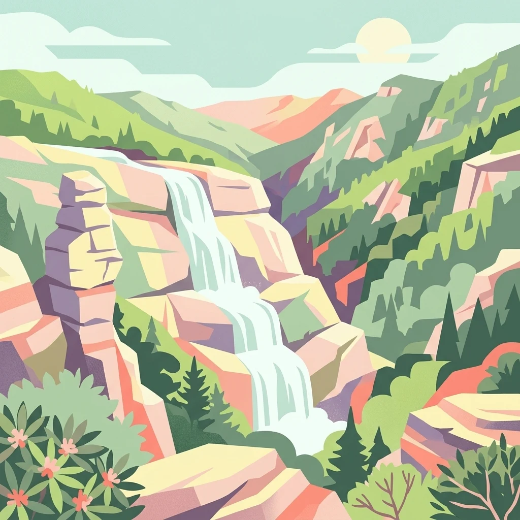
A digital illustration of a multi-tiered waterfall cascading down rock cliffs in a mountain valley, surrounded by evergreen trees and flora, under a bright sun.

Pisgah National Forest

Protected landscape

Park overview

Structured park overview, official facts, and landscape profile for Pisgah National Forest

Pisgah National Forest park facts, protected area profile, and essential visitor context

Review the core facts for Pisgah National Forest, including designation, size, terrain, visitor scale, habitats, and operating context in one park-focused overview.

About Pisgah National Forest

Pisgah National Forest occupies a central place in the geography of western North Carolina. It stretches across the southern Appalachian Mountains, extending from the high ridges near the Tennessee border southward through the Blue Ridge and the Great Balsam Mountains. The forest surrounds portions of Asheville and Brevard and extends into parts of 12 counties, creating a substantial green backbone for one of the most naturally diverse regions in the eastern United States.

The terrain is unusually varied for an eastern forest. Elevations rise above 6,000 feet, with prominent summits including Black Balsam Knob at 6,214 feet, Mount Hardy at 6,110 feet, and the famous Cold Mountain at 6,030 feet. Mount Mitchell, the highest peak east of the Mississippi at 6,684 feet, lies just outside the forest in Mount Mitchell State Park. Beneath these summits, the forest drops into steep gorges, including Linville Gorge, one of the wildest and most remote areas in the East, as well as densely forested slopes laced with streams, waterfalls, and high-elevation grassy balds.

Pisgah is also ecologically significant as part of the Appalachian temperate rainforest, receiving substantial rainfall that sustains mossy hardwood and conifer communities, rhododendron thickets, and a network of wild trout streams. About 46,600 acres of old-growth forest have been identified within its boundaries, including roughly 10,000 acres in the Linville Gorge. These forests give the area much of its character and provide habitat for a wide range of native species.

Recreation is woven throughout the forest. Hikers can follow the Appalachian Trail, Mountains-to-Sea Trail, Art Loeb Trail, and Shut-In Trail, while mountain bikers have made trails such as Farlow Gap and Black Mountain Loop legendary in the sport. Waterfall-hopping, rock climbing, fishing, hunting, and scenic drives along the Blue Ridge Parkway make the forest one of the most visited public landscapes in the Southeast.

Quick facts and research context for Pisgah National Forest

Pisgah National Forest is wholly within North Carolina and is administered by the U.S. Forest Service. It encompasses roughly 512,758 acres across parts of 12 western counties, including Transylvania, Haywood, Madison, McDowell, Buncombe, and Yancey. The forest was first established on October 17, 1916, making it among the earliest national forests in the American East and one of the first tracts acquired under the Weeks Act of 1911.

It spans three ranger districts (Grandfather, Appalachian, and Pisgah) and contains three designated wilderness areas, a noted portion of the Appalachian temperate rainforest, and approximately 46,600 acres of identified old-growth forest. The Blue Ridge Parkway transects the southern portion of the forest, and major streams such as the French Broad, Mills, Davidson, and Bent Creek rivers originate within or flow through it.

Protection and recognition

Examine documented terrestrial protection scope and official recognition details.

Pisgah National Forest Protection Status and International Recognition Facts

Pisgah National Forest maintains a documented terrestrial protection scope within its primary conservation landscape. Official records outline baseline management frameworks and formal recognition data for this protected area.

Protection details

Protection scope
Terrestrial
Transboundary protection
No
Park context

Deeper park guide and search-rich context for Pisgah National Forest

Pisgah National Forest history, landscape, wildlife, and travel context

Explore Pisgah National Forest through its history, landscape character, ecosystems, wildlife, conservation priorities, cultural context, and seasonal travel timing in a structured park guide built for atlas discovery and search intent.

Why Pisgah National Forest stands out

Pisgah National Forest is best known for being one of the original eastern national forests and for the unusually rich Appalachian landscape it protects. Its terrain includes some of the tallest mountains east of the Mississippi, a remarkable concentration of waterfalls (including Looking Glass Falls and Upper Creek Falls), and a network of rugged blue ridges and gorges. Equally defining is the forest's history as the cradle of American forestry, anchored by the Biltmore Forest School and the early scientific forestry work of Carl Schenk and Gifford Pinchot. These combined natural and historical layers give Pisgah a distinct identity among national forests: a landscape where conservation, recreation, working forest, and forest-science heritage all meet.
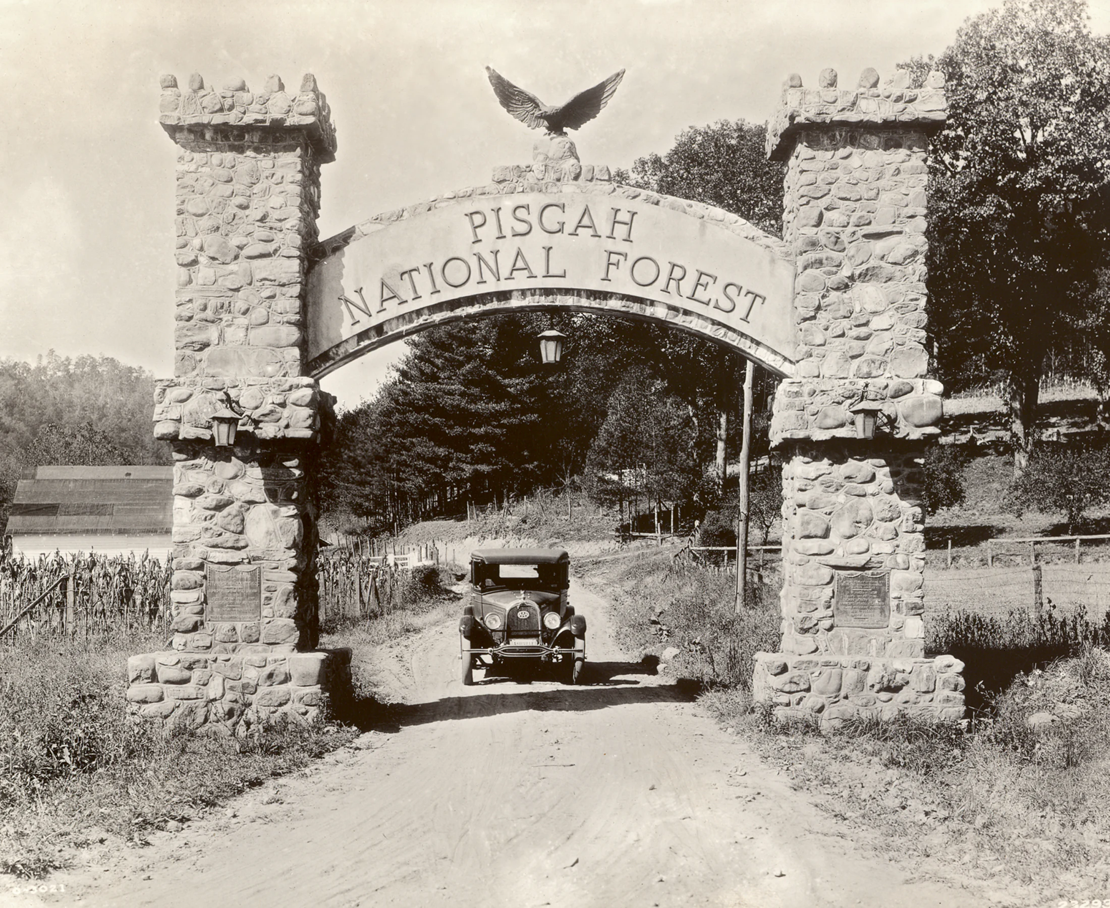
A black and white historic photograph of a stone archway spanning a dirt road at the entrance to Pisgah National Forest, with an early 20th-century vehicle visible beneath the arch.
A vintage photograph showing a historic stone entrance archway to Pisgah National Forest with a classic car driving through.

Pisgah National Forest history and protected-area timeline

Pisgah National Forest has roots in both Gilded Age estate planning and early 20th-century conservation policy. The forest's nucleus came from approximately 86,700 acres that had been part of George Washington Vanderbilt II's Biltmore Estate. In 1914, Edith Vanderbilt sold these lands to the federal government; two years later, on October 17, 1916, they were formally designated as Pisgah National Forest, one of the first national forests in the eastern United States.

The forest was also a proving ground for the Weeks Act of 1911, which gave the federal government the authority to purchase private land for national forests in the East. Some of the tracts that became part of Pisgah were among the very first acquired under this new authority. In 1921, the former Boone National Forest was absorbed into Pisgah, and in 1936, much of the Unaka National Forest was added, substantially expanding its footprint. By 1954, Pisgah was administratively combined with the Croatan and Nantahala national forests under a shared management structure, later joined by the Uwharrie National Forest.

Pisgah is widely regarded as the birthplace of American professional forestry. The Biltmore Forest School, founded in 1898 on estate land in what is now the southern Pisgah, was the first school of forestry in the United States. It was established under Carl Schenk, a German forester recruited after Gifford Pinchot's resignation, with Vanderbilt's support. The Cradle of Forestry interpretive area and the Bent Creek Campus of the Appalachian Forest Experiment Station, listed on the National Register of Historic Places in 1993, preserve this legacy. These sites tie Pisgah not only to conservation but to the institutional origins of the U.S. Forest Service itself.

Pisgah National Forest landscape and geographic character

Pisgah's landscape is a textbook expression of the southern Appalachians. High ridges such as the Pisgah Ridge and the Great Balsam Mountains dominate the south, while the northern districts include the Linville Gorge, the Toe and Cane river watersheds, and the iconic Roan Mountain balds. Elevations climb above 6,000 feet, and the terrain shifts quickly from exposed rocky summits and grassy balds to deep, shaded coves and steep-walled gorges.

Water defines much of the scenery. Bent Creek, the Mills River, and the Davidson River (all major tributaries of the French Broad) carve through the Pisgah Ranger District. Waterfalls are abundant and varied, from powerful plunges such as Looking Glass Falls and Upper Creek Falls near Linville, to smaller cascades like Cathey's Creek Falls, Cove Creek Falls, Daniel Ridge Falls, and Elk River Falls. Each reflects a different combination of geology, forest type, and access.

The Blue Ridge Parkway threads through the southern portion of the forest, weaving together scenic overlooks, trailheads, and river valleys. The result is a landscape that combines grand vistas with intimate, switchback-laden creek corridors and some of the most concentrated backcountry terrain in the eastern U.S.
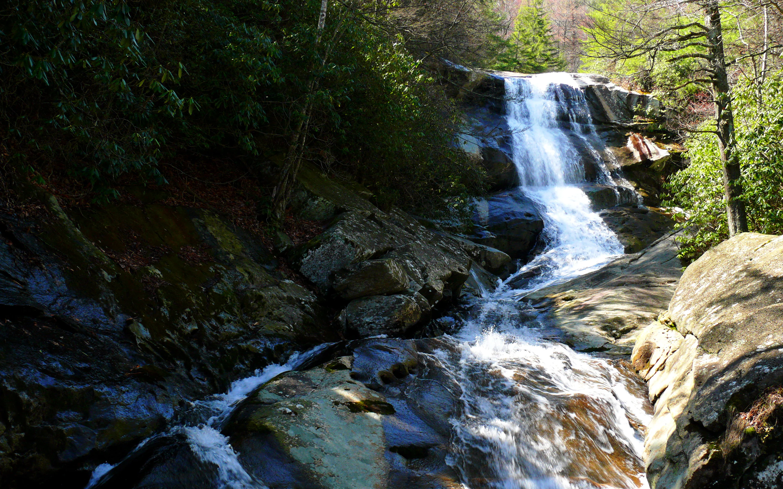
A multi-tiered waterfall cascades down dark, wet rock faces surrounded by dense green forest foliage.
Upper Creek Falls flows over rugged rock formations in Pisgah National Forest.

Pisgah National Forest ecosystems, habitats, and plant life

Pisgah sits within the Appalachian temperate rainforest, an ecoregion distinguished by high rainfall, persistent humidity, and lush, moss-draped forests. This moisture sustains dense stands of red spruce and Fraser fir at the highest elevations, while lower slopes support mixed hardwood forests of oaks, hickories, tulip poplars, and birches. Rhododendron and mountain laurel form thick understory layers, particularly along streams and along the crest of the Blue Ridge.

The forest contains a substantial proportion of old-growth habitat, with roughly 46,600 acres identified as old growth, including about 10,000 acres in the Linville Gorge. These stands feature large-diameter trees, complex canopy structure, and downed woody debris that support rich ecological communities.

Wild trout streams are a central feature of the aquatic ecology, with cool, well-oxygenated waters fed by steady Appalachian rainfall. These streams, combined with varied topography and elevation, create numerous microhabitats across the forest and contribute to the exceptional plant diversity the southern Appalachians are known for.
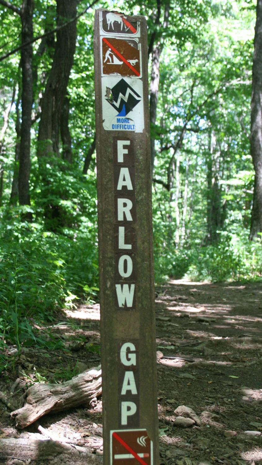
A vertical wooden trail sign for Farlow Gap, featuring icons for prohibited activities and a blue diamond indicating the trail difficulty, standing on a dirt path in a wooded area.
A trail marker for the Farlow Gap trail, indicating trail difficulty and usage restrictions within the forest.

Pisgah National Forest conservation status and protection priorities

Pisgah National Forest represents a major conservation complex in the eastern United States. Approximately 46,600 acres of identified old-growth forest, including a significant stand within the Linville Gorge Wilderness, anchor its ecological value. These forests sustain native biodiversity, protect soil and water, and provide reference ecosystems for studying eastern forest dynamics.

The forest is a cornerstone of regional watershed health, with major streams such as the French Broad, Mills, Davidson, and Bent Creek originating within its boundaries. Protection of these watersheds supports downstream communities and the broader aquatic ecology of the region.

Pisgah also provides landscape-scale connectivity, linking the Great Smoky Mountains National Park, the Cherokee National Forest in Tennessee, and the Blue Ridge Parkway corridor. Its three designated wilderness areas, the Linville Gorge, Middle Prong, and Shining Rock Wildernesses, preserve some of the wildest terrain in the East as part of the National Wilderness Preservation System. Together, these factors give Pisgah enduring significance for conservation, scientific research, and ecosystem resilience in the face of pressures such as invasive species, forest pests, and climate change.

Pisgah National Forest cultural meaning and human context

Pisgah is deeply tied to the cultural and scientific heritage of the southern Appalachians. The forest takes its name from the Hebrew word 'Pisgah,' traditionally used to mean the highest point or summit of a mountain. This name echoes the biblical Mount Pisgah (often associated with Mount Nebo), reflecting the early 20th-century habit of giving Appalachian landmarks meaningful, evocative names.

More concretely, the forest is the birthplace of professional American forestry. The Biltmore Estate, and specifically the Biltmore Forest School founded in 1898, introduced scientific forestry to the United States and helped lay the groundwork for the U.S. Forest Service. Carl Schenk's work at Biltmore, together with Gifford Pinchot's involvement, forms a foundational chapter in American conservation history, and the Cradle of Forestry interpretive area preserves this story within the forest itself. Long-distance trails such as the Appalachian Trail and Mountains-to-Sea Trail also carry forward a strong regional tradition of backcountry travel and outdoor recreation.
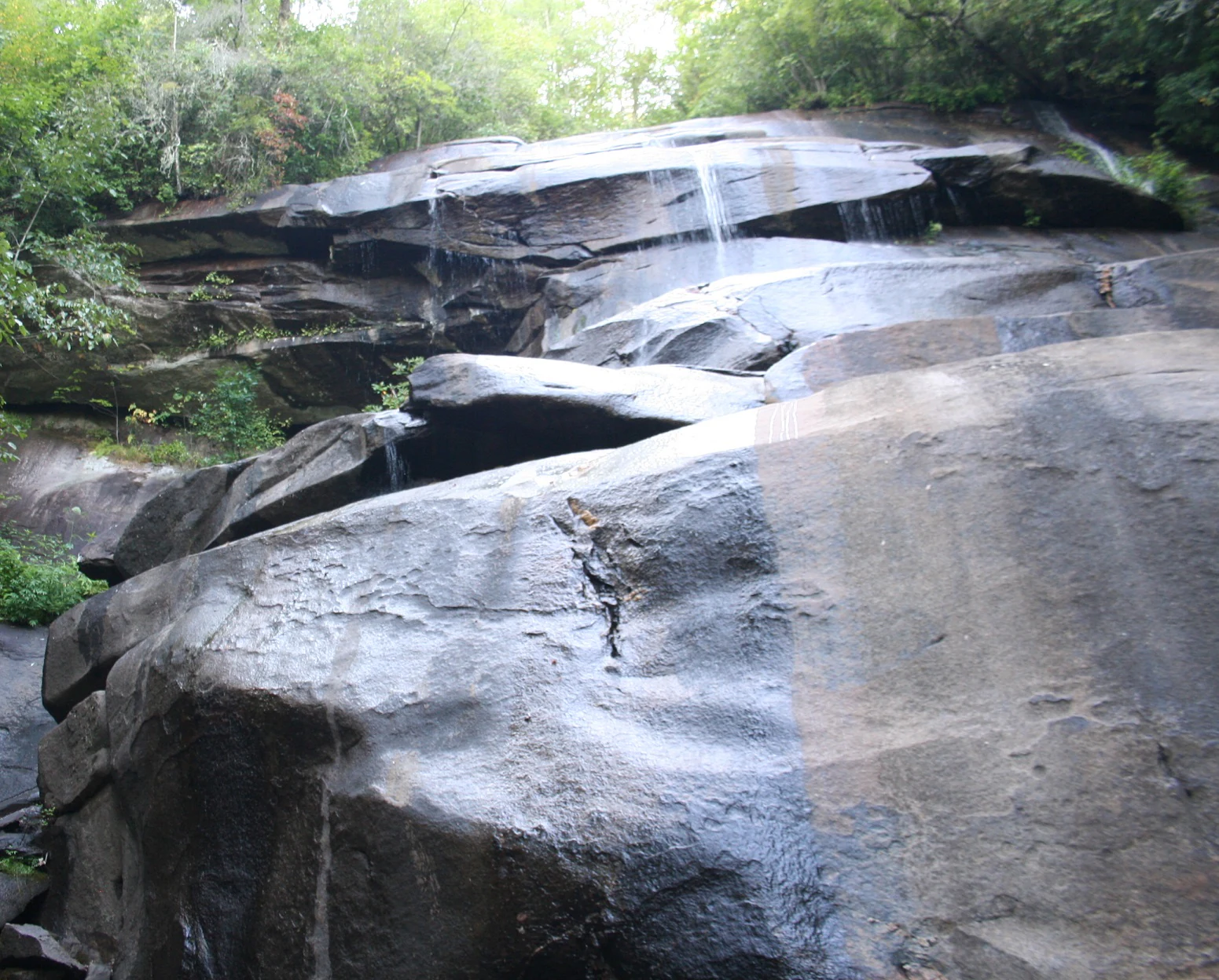
A small stream of water flows over smooth, wet, dark rock shelves surrounded by dense green forest foliage.
A small, tiered waterfall cascading over dark, smooth rock ledges in Pisgah National Forest.

Top sights and standout views in Pisgah National Forest

Pisgah stands out for combining high-elevation Appalachian terrain, an exceptional concentration of waterfalls, and a historic role in American forestry. Its wilderness areas, particularly the Linville Gorge, offer some of the most remote backcountry experiences in the East, while the Pisgah Ranger District anchors world-class mountain biking and waterfall hiking. The Blue Ridge Parkway's passage through the forest adds a scenic, accessible dimension that complements the wilder areas, creating a forest where dramatic landscape, ecological richness, and outdoor heritage meet.
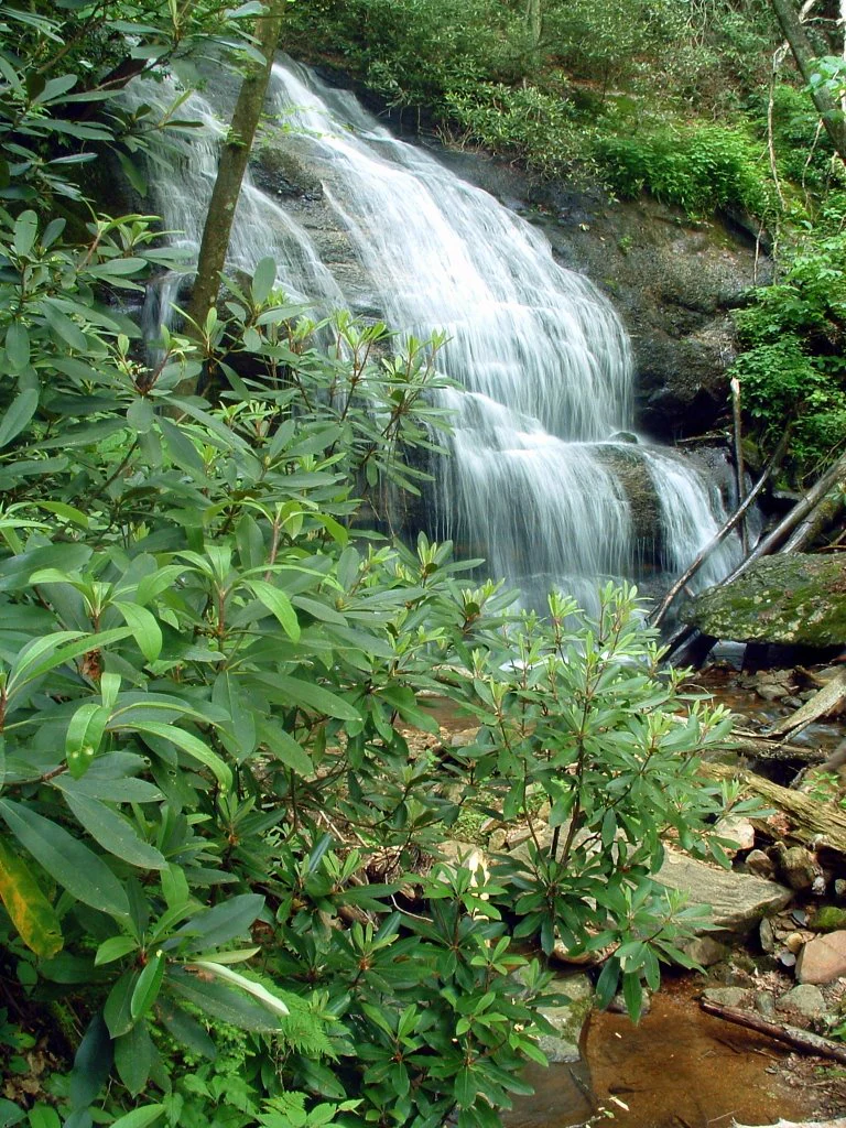
A small waterfall cascades down a rock face, surrounded by dense rhododendron shrubs and forest vegetation.
A small waterfall cascading over rocks at West Prong Hickey Fork in Pisgah National Forest.

Best time to visit Pisgah National Forest

Spring is a strong choice for visitors drawn to waterfalls, as heavy seasonal rains swell the creeks and produce the most powerful cascades. Late spring through early summer brings blooming rhododendron and mountain laurel, with the famous Craggy Gardens and similar high-elevation heath balds near their peak. Summer offers lush greenery, comfortable creek-side hiking, and full access to the network of biking and hiking trails.

Fall is widely regarded as a prime time at Pisgah, when Appalachian foliage turns a vivid palette across the ridges and valleys, especially along the Blue Ridge Parkway corridor. Winter temperatures are generally moderate at lower elevations, and the forest takes on a quieter, colder character with frozen falls and occasional snow at higher elevations. Year-round, visitors can find a balance between active recreation in warmer months and more contemplative scenic travel in the cooler seasons.

Monthly climate preview

Long term representative point measurements for average temperature and monthly precipitation rhythm

Pisgah National Forest Climate Normals and Annual Weather Patterns

Representative coordinate records establish the measured annual rhythm of average temperatures and daily precipitation totals for Pisgah National Forest. Exploring the complete twelve month profile provides detailed long term climate normals across every recorded interval.
Annual mean12 °C
1 °C23 °C
Jan
Feb
Mar
Apr12°
May17°
Jun21°
Jul23°
Aug22°
Sep19°
Oct13°
Nov
Dec
Warmest month
July

23 °C

Coolest month
January

1.3 °C

Wettest month
July

4 mm/day

Driest month
October

2.9 mm/day

Park location guide

Geography guide, regional context, and park location map for Pisgah National Forest

Pisgah National Forest park geography, regions, and map view in United States of America

Understand where Pisgah National Forest sits in United States of America through a broader geographic reading of the surrounding landscape, nearby location context, and its mapped position within the national park landscape.

How Pisgah National Forest fits into United States of America

The United States of America is a federal presidential republic and one of the world's largest countries by area and population. It consists of 50 states across a vast territory spanning multiple time zones, with its capital in Washington, D.C. and largest city in New York City. The nation has a diverse economy, influential political system, and significant cultural and military presence globally.

Wider geography shaping Pisgah National Forest in United States of America

The United States occupies a vast territory in North America, bordered by Canada to the north and Mexico to the south. The 48 contiguous states stretch from the Atlantic to the Pacific Ocean, while Alaska occupies the northwestern region and Hawaii is an archipelago in the Pacific. The country encompasses diverse terrain including the Rocky Mountains, Appalachian Mountains, Great Plains, and extensive river systems.

Map view of Pisgah National Forest

Use this park location map to pinpoint Pisgah National Forest in United States of America, understand its exact geographic position, and read its mapped placement within the surrounding landscape more clearly.

Pigeon | © OpenStreetMap contributors

Location context for Pisgah National Forest

North Carolina
Natural feature types

Discover the Geological and Natural Landmarks of Pisgah National Forest

Trace the diverse physical features, river corridors, and high-mountain landscapes that comprise Pisgah National Forest. This MoriAtlas collection offers a focused way to navigate through regional landforms and water systems to better understand the complex geography of this major Appalachian forest.
Recorded earthquake history

View Recorded Earthquake History Near Pisgah National Forest

Navigate through a comprehensive collection of historical earthquake data linked by location to Pisgah National Forest. MoriAtlas provides a clear view of recorded seismic activity, allowing for a better understanding of the region's geographic history through documented event metrics and proximity analysis.

Pisgah National Forest Earthquake History

Catalogued events

22 events

Strongest magnitude

Magnitude 3.7

Most recent event

Jun 4, 2023

This history includes earthquakes recorded inside the park or within 50 km of its borders

Visual reference collection highlighting mountain ridges, deep gorges, and forest habitats.

Pisgah National Forest Photos: Landscapes, Scenery, and Protected Terrain

Visual documentation captures the rugged topography, temperate rainforest zones, and dramatic waterfalls defining the protected landscape. Photographic records provide clear reference points for understanding eastern mountain terrain, high-elevation ridges, and forest habitats across the region.

A black and white historic photograph of a stone archway spanning a dirt road at the entrance to Pisgah National Forest, with an early 20th-century vehicle visible beneath the arch.

A high-angle scenic view looking across Linville Gorge, featuring craggy rock formations in the foreground and forested mountain ridges stretching into the distance.

A multi-tiered waterfall cascades down dark, wet rock faces surrounded by dense green forest foliage.

A vertical wooden trail sign for Farlow Gap, featuring icons for prohibited activities and a blue diamond indicating the trail difficulty, standing on a dirt path in a wooded area.

Two mountain bikers standing on a rocky trail overlook, with one standing in the foreground and another looking at a view of distant mountain ridges.

A small stream of water flows over smooth, wet, dark rock shelves surrounded by dense green forest foliage.

A small waterfall cascades down a rock face, surrounded by dense rhododendron shrubs and forest vegetation.

A small stream flows through a rocky, forested area, typical of a mountain trail crossing.

A mountain biker stands beside their bicycle on a trail next to a small, tiered waterfall in a forest setting.

A row of icicles hangs from a rocky overhang above a dirt trail, where a mountain bike is parked in the winter woods.

Park atlas

Compare surrounding mountain topography, river gorges, and regional conservation lands.

Parks Near Pisgah National Forest and Related Southern Appalachian Protected Areas

Browse protected areas and federal forests located near Pisgah National Forest to examine broader regional topography. Analyzing adjacent mountain terrain helps place high elevation ridges and river watersheds into a wider geographical context.
National parkTennessee
Park boundaries overlap#1 closest

Northwest

Great Smoky Mountains National Park: Exploring Its Protected Landscape and Regional Geography

Tennessee's premier national park, mapped for landscape discovery.

Delve into the protected area identity of Great Smoky Mountains National Park, a significant natural landmark within Tennessee. This page provides detailed context on its mountainous terrain, mapped ecological zones, and its foundational role in the broader geography of eastern North America. Understanding the park's specific protected landscape features and its geographic setting is essential for appreciating its unique conservation value.

Area
2,114.15 km²
Established
1934
IUCN
II
Visitors
12.2M annual
A soft watercolor painting of a river flowing through a lush green valley with rolling mountains in the hazy background.
Wildlife reserveNorth Carolina
Park boundaries overlap#2 closest

Northeast

Linville Gorge Wilderness: Rugged Canyon Geography and Protected Appalachian Forest

Historic wildlife reserve in North Carolina

Spanning over 10,000 acres, Linville Gorge Wilderness is defined by its steep cliff walls, vertical elevation drops, and an absence of road infrastructure. As one of the original areas designated under the Wilderness Act, this North Carolina landmark offers a unique look at undisturbed old-growth hardwoods and pine communities nestled within the dramatic peaks of the Blue Ridge Mountains.

Area
47.7 km²
Established
1964
IUCN
Ib
Relief
Mountain
A pale, abstract watercolor painting depicting gentle, tree-covered mountain ridges against a white background.
Wildlife reserveNorth Carolina
Park boundaries overlap#3 closest

West

Middle Prong Wilderness: High-Elevation Appalachian Forest and Watershed Geography

Rugged ridges and headwaters in the Pisgah National Forest

Middle Prong Wilderness encompasses nearly 7,900 acres of protected southern Appalachian terrain. This rugged landscape, ranging from deep valley floors to wind-swept high-elevation ridges, serves as a vital protected corridor adjacent to Shining Rock Wilderness, showcasing a complex mosaic of hardwood and spruce-fir forest ecosystems within the Blue Ridge Mountains.

Area
32 km²
Established
1984
IUCN
Ib
Relief
Mountain
A horizontal watercolor painting depicting a soft green landscape with rolling hills, a meandering stream, and foreground grasses against a light white background.
Protected landscapeNorth Carolina
Park boundaries overlap#4 closest

West

Nantahala National Forest: Geographic Overview of Protected Appalachian Mountain Landscapes

Mapping deep river gorges and temperate rainforests in North Carolina

The Nantahala National Forest represents a significant conservation achievement, encompassing diverse southern Appalachian mountain terrain. The landscape features deep river gorges, ancient old-growth forests, and extensive networks of waterfalls. This overview provides mapped context on its vast wilderness areas, including Joyce Kilmer-Slickrock, and the long-distance trail corridors that traverse this temperate rainforest region.

Area
2,150 km²
Established
1920
Relief
Mountain
Climate
Temperate
Protected landscapeSouth Carolina
16 km away#5 closest

Southeast

Sumter National Forest: Mapping Protected Landscapes and Terrain in South Carolina

Bridging Piedmont forests and Appalachian mountain foothills

Sumter National Forest offers a study in geographic contrast, as its three districts span the transition from South Carolina Piedmont ridges to the rugged spurs of the Blue Ridge Mountains. This protected area features the Chattooga Wild and Scenic River corridor, expansive hardwood-conifer mosaics, and complex mountain watersheds. The forest provides a window into regional land restoration, where reclaimed farmland and mountain ridges now form a continuous network of protected natural terrain.

Area
1,500.98 km²
Established
1936
Relief
Mixed relief
Climate
Temperate
A soft watercolor illustration depicting a winding river, a small waterfall over layered rocks, and distant rolling mountains in muted green, blue, and brown tones.
Wildlife reserveUnited States of America
18 km away#6 closest

Southwest

Ellicott Rock Wilderness: Geographic and Historic Protected Landscape Overview

A rare tri-state wilderness in the Southern Appalachian Mountains

Discover the mapped terrain of Ellicott Rock Wilderness, a protected area defined by its steep river gorges, dense cove forests, and unique position at the tripoint of three U.S. states. This wilderness area preserves the Chattooga River corridor and historic survey landmarks within the southern Blue Ridge Mountains, offering deep insight into the regional geography of the American southeast.

Area
33.48 km²
Established
1975
IUCN
Ib
Relief
Mountain
Protected areaVirginia
56 km away#7 closest

Northeast

Lewis Fork Wilderness: Geography and Protected Land Profile in Southwestern Virginia

High-elevation Appalachian backcountry and ridgeline mapping

Spanning the ridgelines near the summit of Mount Rogers, Lewis Fork Wilderness serves as a key ecological anchor for Virginia. This protected backcountry offers a dense mosaic of forest types, ranging from oak-hickory stands to rare spruce-fir habitats. The landscape features steep terrain and pristine mountain streams, providing a concentrated look at the environmental complexity of the southern Appalachian Mountains.

Area
24.59 km²
Established
1984
IUCN
Ib
Relief
Mountain
A soft, horizontal watercolor painting depicting layers of rolling mountain ridges and evergreen forests in shades of green, yellow, and light pink.
Protected landscapeVirginia
About 57 km away#8 closest

Northeast

Mount Rogers National Recreation Area: Virginia Appalachian Highlands Protected Landscape

Mapping high-elevation ridgelines and wilderness corridors.

Located in southwestern Virginia, Mount Rogers National Recreation Area preserves a vast expanse of southern Appalachian mountain terrain. The landscape features spruce-fir forests, alpine-style balds, and deep valley watersheds. This protected area serves as a primary geographic anchor for hikers and conservationists, housing the highest peak in the state and extensive federally designated wilderness segments within its borders.

Area
626.52 km²
Established
1966
Relief
Mountain
Climate
Temperate

Common questions about visiting, size, designation, and location context for Pisgah National Forest

Pisgah National Forest FAQs for park facts, access, geography, and protected area context

Find quick answers about Pisgah National Forest, including protected-area facts, park geography, trail and visitor context, and how the park fits into its surrounding country and regional landscape.
MoriAtlas Explorer

Continue Your Protected Areas Search Across the Global Atlas

Deepen your exploration by continuing the structured search for national parks and protected areas worldwide. Utilize the comprehensive filtering capabilities to compare different conservation landscapes and refine your understanding of global park geography. Discover more about the distribution and characteristics of protected natural areas.

Global natural geography