
Why Sumter National Forest stands out
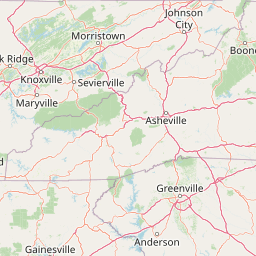
Sumter National Forest is known for its geographic split between low-rolling Piedmont mixed forests and Appalachian-Blue Ridge forests, a contrast that produces very different hiking, scenery, and ecology within a single administrative unit. The Andrew Pickens Ranger District in particular is celebrated for trout fishing and whitewater on the Chattooga River, the backcountry solitude of Ellicott Rock Wilderness, and a string of roughly fifteen named waterfalls. At the same time, the Enoree and Long Cane Districts have built a regional reputation for OHV trails, equestrian use, hunting, and an internationally recognized mountain biking network, making the forest unusually versatile for a southeastern U.S. national forest.
Sumter National Forest history and protected-area timeline
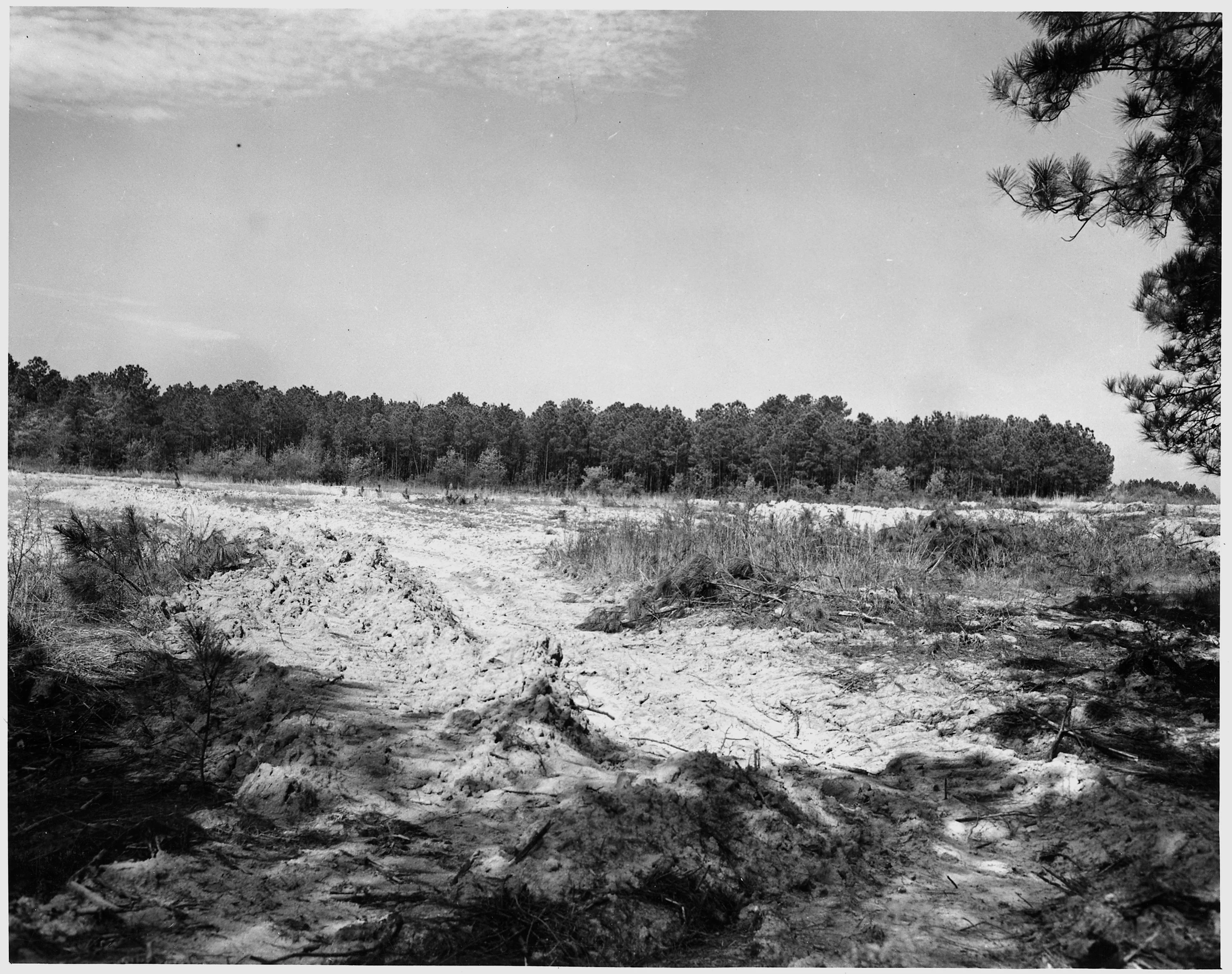
The lands that would become Sumter National Forest entered federal ownership in a heavily degraded condition. Most of the acreage was either extensively logged or covered with eroded old fields and gullied terraces, as visible in mid-twentieth century agricultural surveys of the region.
On July 13, 1936, President Franklin D. Roosevelt proclaimed Sumter a separate national forest, giving the state its second U.S. Forest Service-administered forest alongside Francis Marion. The forest was named for Thomas Sumter, the South Carolina militia leader known as "The Gamecock," who had organized patriot forces in the Piedmont during the American Revolution. The new forest's immediate mission was practical and restorative: to control soil erosion, slow and regulate stream flow, and re-establish productive timber stands on a landscape that decades of cotton-era farming and unregulated logging had largely stripped.
Over the following decades, the Sumter's working landscapes gradually returned to a healthier, mixed forest condition. The forest grew around three operational ranger districts, the Enoree, the Long Cane, and the Andrew Pickens, each with its own geography. In time, the Andrew Pickens District became a gateway to the Ellicott Rock Wilderness and the Chattooga Wild and Scenic River, while the piedmont districts developed a more recreation- and timber-oriented identity.
Sumter National Forest landscape and geographic character
Sumter National Forest is shaped by the meeting of two very different physiographic regions. In the Enoree and Long Cane Districts, the land is typical South Carolina Piedmont: gently rolling ridges, broad shallow valleys, sandy and clay-rich soils, and river corridors marked by the Enoree, Tyger, Broad, and smaller tributary streams. The terrain is easy to traverse on foot, but punctuated by ravines cut into erodible soils in places where old farm fields have only recently come back into forest cover.
In the Andrew Pickens Ranger District, the landscape changes sharply. Tugaloo, Chattooga, Chauga, and the other mountain rivers have carved narrow gorges and rapids into the southernmost spurs of the Blue Ridge. Fork Mountain rises to roughly 3,294 feet, the high point of the forest, and the surrounding ridges are draped in Appalachian-Blue Ridge forest types. Waterfalls drop in succession along many of the tributaries, with documented drops ranging from about twelve to seventy-five feet. The western edge of the district is defined by the Chattooga River corridor, which is designated as a Wild and Scenic River and forms part of the South Carolina-Georgia boundary.
Sumter National Forest ecosystems, habitats, and plant life
Ecologically, the Sumter is best understood as a forest of two regions stitched together. The Enoree and Long Cane Districts fall within the Southeastern mixed forests ecoregion, an oak-hickory-pine mosaic that today includes large amounts of loblolly and shortleaf pine along with bottomland hardwood communities along the rivers. These are working forests, shaped by repeated cycles of timber harvest, prescribed fire in some areas, wildlife management, and the slow return of tree cover to former agricultural land.
The Andrew Pickens Ranger District sits within the Appalachian-Blue Ridge forests ecoregion and looks noticeably different in species composition and structure. Cool, moist slopes carry oak, hickory, tulip poplar, and other eastern hardwoods, with pockets of cove forest along the streams. Elevation and north-facing slopes create microclimates that harbor more northern plant species than are typical elsewhere in South Carolina. The contrast between these two ecoregions, separated by less than 150 miles within a single administrative forest, is one of the defining natural qualities of the Sumter.
Sumter National Forest wildlife and species highlights
The wildlife profile of Sumter National Forest shifts along the same geographic gradient that defines its forests. The piedmont districts support typical southeastern game and non-game species, with white-tailed deer, wild turkey, and small populations of other mammals, alongside songbirds, raptors, and aquatic life associated with the Enoree, Tyger, and Broad rivers.
The Andrew Pickens District, with its cooler streams, denser forest canopy, and more rugged terrain, has long been recognized for its trout fisheries, particularly along the Chattooga, where the river's Wild and Scenic status and its distance from major roads keep fishing pressure relatively light. The Chattooga also anchors an outdoor recreation culture that draws anglers, kayakers, rafters, and hikers. The Ellicott Rock Wilderness, shared with Georgia and North Carolina, offers more remote habitat conditions that benefit wildlife sensitive to human disturbance, while the broader district supports a richer mix of montane bird and mammal species than is found in the lower piedmont.
Sumter National Forest conservation status and protection priorities
From a conservation standpoint, the Sumter's significance lies as much in restoration as in preservation. The forest was assembled explicitly to reverse erosion across damaged farmland and to convert heavily logged lands back into productive, well-managed forest cover. That mission continues today through ongoing soil and watershed work, timber management, and habitat restoration across all three districts.
The forest also contains two nationally recognized conservation anchors. The Chattooga River along the western boundary is formally designated as a Wild and Scenic River, protecting its free-flowing character and outstanding values. Within the Andrew Pickens District, the Sumter protects a portion of the Ellicott Rock Wilderness, the only wilderness area in the country that straddles three states. Together, these designations give the Sumter an outsized role in protecting both aquatic ecosystems and Appalachian backcountry in the Southeast.
Sumter National Forest cultural meaning and human context
The cultural footprint of Sumter National Forest is unusually layered for a southeastern U.S. forest. It is named for Thomas Sumter, whose Revolutionary War activity in the South Carolina Piedmont made him one of the state's most celebrated early figures, and the Andrew Pickens Ranger District carries the name of another South Carolina Revolutionary commander, Andrew Pickens. These names tie the forest directly to the state's founding history.
The Andrew Pickens District also preserves an older layer of place-based heritage. Streams and geographic features such as the Chattooga, Chauga, Tugaloo, Toxaway, Keowee, Oconee, Tamassee, Cheohee, and Jocassee carry names from the Cherokee history of the Blue Ridge foothills and lower Appalachian slopes, even though the Cherokee population itself was displaced from the region long before the forest was established. In the piedmont districts, meanwhile, the forest is interwoven with small historic towns such as Edgefield, Abbeville, McCormick, Greenwood, Whitmire, and Clinton, whose surrounding agricultural landscapes were gradually absorbed into the national forest over the twentieth century.
Top sights and standout views in Sumter National Forest
Sumter National Forest's strongest points of distinction are its geographic breadth and its recreation mix. Three ranger districts give visitors a chance to experience the South Carolina Piedmont and the Blue Ridge foothills within a single forest boundary. Within that boundary, standout features include the Chattooga Wild and Scenic River, the barely disturbed Ellicott Rock Wilderness, a string of fifteen named waterfalls in the Andrew Pickens District, an internationally known mountain biking network in the Long Cane District, and a designated OHV trail in the Enoree District that gives the forest a recreational identity more active than many of its southeastern neighbors.
Best time to visit Sumter National Forest
Seasonal character at Sumter National Forest is shaped by the contrast between its piedmont and Blue Ridge sections. Spring is a particularly appealing time to visit, with cool temperatures, active wildlife, and full waterfalls in the Andrew Pickens District before summer thunderstorms begin. Summer brings hot, humid weather across the piedmont districts, but the higher elevations around Mountain Rest remain noticeably cooler and remain the most comfortable time for hiking and stream fishing.
Fall draws visitors for foliage in the Blue Ridge portion of the forest, where hardwood color change is more pronounced than in the pine-dominated piedmont districts. Winter is generally mild in the piedmont and offers quieter trail and river conditions, while higher elevations in Oconee County can see ice, snow, and limited road access after storms. Wildlife viewing opportunities, particularly wild turkey in spring and deer in autumn, follow these same seasonal patterns across all three districts.