Mori Atlas logo
National parkPuerto Princesa Subterranean River National Park

Discover mapped boundaries and natural terrain of this key protected area in the Philippines.

Puerto Princesa Subterranean River National Park: Protected Landscape and Geographic Context in Palawan

Puerto Princesa Subterranean River National Park stands as a significant protected natural area within the Palawan region of the Philippines. This national park offers a unique perspective on landscape geography, providing users with mapped details of its protected boundaries and surrounding natural terrain. Explore its place within the broader atlas for understanding regional conservation landscapes and their ecological significance.

Karst LandscapeUnderground RiverUNESCO World Heritage SiteCave SystemLimestone CavesWetland Conservation

Puerto Princesa Subterranean River National Park

National park

Park overview

Structured park overview, official facts, and landscape profile for Puerto Princesa Subterranean River National Park

Puerto Princesa Subterranean River National Park park facts, protected area profile, and essential visitor context

Review the core facts for Puerto Princesa Subterranean River National Park, including designation, size, terrain, visitor scale, habitats, and operating context in one park-focused overview.

About Puerto Princesa Subterranean River National Park

Puerto Princesa Subterranean River National Park stands as one of the Philippines' most significant natural treasures, protecting a landscape of extraordinary geological and ecological value on the island of Palawan. The park's centerpiece is an underground river that traverses a cave system of at least 32 kilometers in length, with an 8.2-kilometer underground section that ranks among the longest in the world. This remarkable river flows directly from the cave system into the South China Sea, creating a unique underground estuary where saltwater and freshwater mix for several kilometers inland. The landscape is characterized by dramatic limestone karst formations that rise steeply from the coastline, forming the Saint Paul Mountain Range. These karst hills contain extensive cave networks adorned with massive stalactites and stalagmites, including the enormous Italian's Chamber which represents one of the largest cave rooms on the planet. The park protects a complete ecological gradient from the mountain peaks down through multiple forest types to coastal mangroves and the marine environment, making it a biodiversity hotspot of global importance.

Quick facts and research context for Puerto Princesa Subterranean River National Park

The park covers 22,202 hectares of protected land and marine area on Palawan island. The subterranean river extends at least 32 kilometers through the cave system, making it one of the longest underground rivers in the world. The cave system features massive chambers including the Italian's Chamber, which spans 360 meters in length. The park contains 13 distinct forest types found throughout tropical Asia, from montane forests to mangrove ecosystems. Over 800 plant species from 300 genera and 100 families have been documented within the park boundaries, including 295 tree species dominated by dipterocarp varieties.

Protection and recognition

Documenting international designations including UNESCO World Heritage and Ramsar Wetland status.

Puerto Princesa Subterranean River National Park: Protected Status and Global Recognition

Established in 1999, Puerto Princesa Subterranean River National Park maintains a mixed protection scope to safeguard its coastal and karst geography. Global conservation records confirm its international prominence through documented status as a UNESCO World Heritage site and a designated Ramsar wetland.
Park context

Deeper park guide and search-rich context for Puerto Princesa Subterranean River National Park

Puerto Princesa Subterranean River National Park history, landscape, wildlife, and travel context

Explore Puerto Princesa Subterranean River National Park through its history, landscape character, ecosystems, wildlife, conservation priorities, cultural context, and seasonal travel timing in a structured park guide built for atlas discovery and search intent.

Why Puerto Princesa Subterranean River National Park stands out

The park is most renowned for its spectacular subterranean river, which winds through a vast limestone cave system featuring dramatic stalactite and stalagmite formations. Visitors enter the cave by boat and glide through darkness past ancient rock formations illuminated only by headlamps, experiencing one of the world's most unique underground waterways. The cave contains a second floor with small waterfalls, a 300-meter-high dome, and supports significant bat colonies. Beyond the underground river, the park protects one of Asia's most significant forest ecosystems and represents a complete mountain-to-sea ecological gradient that is increasingly rare in the region.

Puerto Princesa Subterranean River National Park history and protected-area timeline

The Puerto Princesa Subterranean River was placed under the management of the Puerto Princesa city government in 1992, establishing the foundation for its formal protection as a national park. On November 12, 1999, the area was officially established as Puerto Princesa Subterranean River National Park. That same year, on December 4, 1999, the site was inscribed as a UNESCO World Heritage Site in recognition of its outstanding universal value. In 2010, a group of environmentalists and geologists conducted explorations that revealed additional remarkable features of the cave system, including a second floor with waterfalls, a massive cave dome measuring 300 meters in height, and previously unknown river channels and deep chambers. On November 11, 2011, the Puerto Princesa Underground River was provisionally chosen as one of the New 7 Wonders of Nature, and this designation was officially confirmed on January 28, 2012, making it the first Philippine site to be included among the New Seven Wonders of Nature. The site was further recognized as a Ramsar Wetland Site on June 30, 2012, adding international importance for its coastal and marine wetland ecosystems.

Puerto Princesa Subterranean River National Park landscape and geographic character

The park features a dramatic limestone karst landscape characteristic of the Saint Paul Mountain Range along Palawan's western coast. Towering limestone cliffs and peaks rise abruptly from near sea level, containing an extensive network of caves and passages carved over millions of years. The underground river has carved a complex cave system that extends at least 32 kilometers underground, featuring multiple levels, large chambers, and intricate passages. The most notable chamber, known as the Italian's Chamber, stretches 360 meters in length and represents one of the largest cave rooms globally. The cave system contains spectacular formations including massive stalactites hanging from ceilings, stalagmites rising from the cave floor, and drapery formations along the walls. The river itself flows through the caverns for 8.2 kilometers before emerging directly into the South China Sea, creating a natural spectacle where the underground waterway meets the ocean. Coastal areas transition to mangrove forests and beach ecosystems, while the karst hills support lush vegetation despite the rocky substrate.

Puerto Princesa Subterranean River National Park ecosystems, habitats, and plant life

The park protects an exceptional diversity of forest ecosystems, containing all 13 forest types found in tropical Asia within its boundaries. These range from forest over ultramafic soils and limestone soils to montane forest, freshwater swamp forest, lowland evergreen tropical rainforest, riverine forest, beach forest, and mangrove forest. Researchers have documented over 800 plant species from 300 genera and 100 families, including at least 295 tree species dominated by dipterocarp varieties. The lowland forests contain impressive trees including dao, ipil, dita, amugis, and apitong, while beach forests feature species like bitaog. The park represents one of the most important forest areas in Asia, protecting critical habitat within a relatively small geographic area. The mountain-to-sea ecosystem creates a unique ecological gradient that supports remarkable species diversity across multiple habitat types.

Puerto Princesa Subterranean River National Park wildlife and species highlights

The park supports exceptional biodiversity, with particular significance for birdlife. Of the 252 bird species known to occur on Palawan, 165 species have been recorded within the park, representing 67 percent of the island's avifauna and all 15 endemic bird species found on Palawan. Notable bird species include the blue-naped parrot, Tabon scrub fowl, hill myna, Palawan hornbill, and white-breasted sea eagle. The park also hosts approximately 30 mammal species, with the long-tailed macaque being the only primate present. Other mammals include the Palawan bearded pig, bearcat, Palawan stink badger, and Palawan porcupine. Nineteen reptile species have been identified, eight of which are endemic, including the reticulated python, monitor lizard, and green crested lizard. The cave system supports nine bat species, two swiftlet species, and whip spiders. Marine creatures including dugongs and hawksbill turtles feed in the coastal waters adjacent to the park.

Puerto Princesa Subterranean River National Park conservation status and protection priorities

Puerto Princesa Subterranean River National Park holds multiple international designations that underscore its conservation significance. As a UNESCO World Heritage Site, it is recognized for outstanding universal value representing one of the most important examples of natural heritage on Earth. Its Ramsar Wetland designation highlights the importance of its coastal and marine ecosystems. The park protects a complete mountain-to-sea ecosystem that is increasingly rare in Asia, functioning as a critical refuge for both endemic species and migratory wildlife. The cave system's stratification of saltwater and freshwater creates a unique aquatic environment that supports specialized species. The protection of the underground river and its surrounding forest ensures the preservation of geological processes that have shaped the landscape over millions of years while maintaining habitat for species found nowhere else on Earth.

Puerto Princesa Subterranean River National Park cultural meaning and human context

The park is situated within the ancestral lands of indigenous Palawan communities who have historically inhabited the region surrounding the Saint Paul Mountain Range. The local communities have maintained traditional relationships with the landscape, including sustainable use of forest resources and coastal areas. The park is accessed primarily through the seaside village of Sabang, where local boat operators provide transportation to the underground river entrance. These communities have developed livelihoods centered on the park's natural resources while participating in conservation efforts. The park's management involves collaboration between the Department of Environment and Natural Resources and the City of Puerto Princesa, with consideration for the relationship between local communities and the protected area.

Top sights and standout views in Puerto Princesa Subterranean River National Park

The Underground River boat tour stands as the park's signature experience, allowing visitors to journey by paddle boat through the dark cave passages illuminated by headlamps, past ancient rock formations and stalactite curtains. The cave system itself is a geological marvel, with massive chambers like the Italian's Chamber representing one of the largest cave rooms in existence. The discovery of the cave's second floor with waterfalls added another dimension to its already remarkable features. The complete ecosystem gradient from karst peaks through diverse forest types to coastal mangroves provides exceptional biodiversity within a compact area. The international recognition through UNESCO World Heritage status and New 7 Wonders of Nature designation has elevated global awareness of this unique natural treasure.

Best time to visit Puerto Princesa Subterranean River National Park

The park can be visited year-round, though the dry season from November to May generally offers more predictable weather conditions for the boat journey into the cave. During the wet season from June to October, occasional heavy rains can affect visibility and access, though the cave itself remains accessible regardless of weather. The cave's internal environment remains stable throughout the year, maintaining consistent temperatures and conditions. Visitors seeking to avoid peak tourist crowds may find early morning or weekday visits more peaceful, particularly during the high season from December to April. The underground river's water level and navigation conditions may vary slightly between seasons, with the dry season typically providing optimal boat access throughout the 4.3 kilometers of navigable passage.
Monthly climate preview

Annual temperature baselines and monthly precipitation variations in Palawan

Climate and Weather by Month in Puerto Princesa Subterranean River National Park

Long-term climatology data at a representative elevation of 66 meters reveals consistently warm temperatures year-round, alongside clear shifts in daily precipitation. Accessing the full monthly index provides detailed wind, humidity, and daylight statistics to map the complete climate cycle of Puerto Princesa Subterranean River National Park.
Annual mean28 °C
27 °C29 °C
Jan27°
Feb27°
Mar28°
Apr29°
May29°
Jun28°
Jul28°
Aug28°
Sep27°
Oct27°
Nov28°
Dec27°
Warmest month
April

29.1 °C

Coolest month
January

26.7 °C

Wettest month
July

6.8 mm/day

Driest month
February

0.9 mm/day

Park location guide

Geography guide, regional context, and park location map for Puerto Princesa Subterranean River National Park

Puerto Princesa Subterranean River National Park park geography, regions, and map view in Philippines

Understand where Puerto Princesa Subterranean River National Park sits in Philippines through a broader geographic reading of the surrounding landscape, nearby location context, and its mapped position within the national park landscape.

How Puerto Princesa Subterranean River National Park fits into Philippines

The Philippines, officially the Republic of the Philippines, is an archipelagic nation in Southeast Asia comprising approximately 7,641 islands categorized into three main geographical divisions: Luzon, Visayas, and Mindanao. Located in the western Pacific Ocean, it shares maritime borders with Taiwan, Japan, Palau, Indonesia, Malaysia, Vietnam, and China. Manila serves as the capital city, while Quezon City is the most populated city, both within Metro Manila.

Wider geography shaping Puerto Princesa Subterranean River National Park in Philippines

The Philippines is an archipelagic nation in Southeast Asia, positioned in the western Pacific Ocean. Its islands are bounded by the South China Sea to the west, Philippine Sea to the east, and Celebes Sea to the south. The country shares maritime borders with Taiwan to the north, Japan to the northeast, Palau to the east and southeast, Indonesia to the south, Malaysia to the southwest, Vietnam to the west, and China to the northwest.

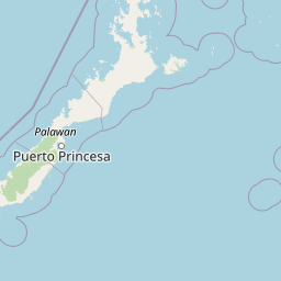
Map view of Puerto Princesa Subterranean River National Park

Use this park location map to pinpoint Puerto Princesa Subterranean River National Park in Philippines, understand its exact geographic position, and read its mapped placement within the surrounding landscape more clearly.

Pigeon | © OpenStreetMap contributors

Location context for Puerto Princesa Subterranean River National Park

Palawan
Park atlas

Compare other protected areas, explore regional geography, and discover connected landscapes across Palawan

Explore Other National Parks and Protected Areas Near Puerto Princesa Subterranean River National Park

Discover additional national parks and protected areas located in the diverse island geography surrounding Puerto Princesa Subterranean River National Park. Trace mapped protected landscapes, compare unique karst features, and understand conservation efforts across the wider Palawan region for deeper geographic context.
Marine protected areaPalawan
About 29 km away#1 closest

Northeast

Port Barton Marine Park: Mapped Protected Landscape and Marine Geography in Palawan

Coastal reef ecosystems and community-managed marine sanctuary.

Port Barton Marine Park encompasses the sheltered waters and small islands of Pagdanan Bay on the western coast of Palawan. This marine protected area is defined by its complex reef systems, such as Manta Ray Reef, and a grassroots governance model that integrates local community stakeholders into the management of its vital underwater nurseries and coastal habitats.

Area
744.83 km²
Established
1998
Scope
Marine
Water
Water-dominated
Protected landscapePalawan
About 75 km away#2 closest

Northeast

Malampaya Sound Protected Landscape/Seascape: Geographic Atlas and Coastal Park Boundaries

A combined marine and terrestrial protected area in Palawan, Philippines

Gain insights into the geographic composition of Malampaya Sound Protected Landscape/Seascape. This expansive site on Palawan island encompasses sheltered bays, island chains, and mangrove-fringed shorelines. Examine the structural balance between brackish-water ecosystems, essential tidal flats, and local fishing barangays within a single managed maritime reserve.

Area
2,015.66 km²
Established
2000
Relief
Lowland
Scope
Mixed
Wildlife reservePalawan
About 107 km away#3 closest

Southwest

Rasa Island Wildlife Sanctuary: Protected Coastal Landscapes and Island Geography

Integrated marine and terrestrial wildlife reserve in Palawan

Positioned in the Sulu Sea off the coast of Palawan, Rasa Island Wildlife Sanctuary protects a rare concentration of mangrove forests, coastal woodland, and reef flats. This compact land and sea reserve serves as an essential sanctuary for bird species and nesting marine turtles, offering a clear window into the biodiversity of the Palawan island province through its preserved island geography.

Area
19.83 km²
Established
2006
Relief
Lowland
Climate
Tropical
Protected landscapePalawan
About 117 km away#4 closest

North

El Nido-Taytay Managed Resource Protected Area: A Coastal Karst and Marine Landscape Atlas

Mapping the terrestrial and marine boundaries of northern Palawan.

An authoritative overview of the El Nido-Taytay Managed Resource Protected Area, detailing its extensive karst limestone islands, hidden lagoons, and diverse coastal ecosystems. This record maps the intersection of terrestrial forests and marine habitats that span the municipalities of El Nido and Taytay, providing a clear geographic context for this significant Philippine protected landscape.

Area
923.34 km²
Established
1998
Protected areaPalawan
About 232 km away#5 closest

Northeast

Coron Island Protected Area: Mapping the Limestone Karst and Inland Lakes of Palawan

Karst terrain and marine protected landscapes in the Calamian Islands

Discover the geographic structure of Coron Island Protected Area, where towering limestone ridges and cliffs surround secluded freshwater lakes. The territory preserves a diverse ecosystem of coastal mangroves and marine waters within the Palawan province, illustrating a unique intersection of geological history and traditional indigenous stewardship.

Area
222.48 km²
Established
1998
Relief
Upland
Scope
Mixed
Wildlife reservePalawan
About 244 km away#6 closest

Southwest

Ursula Island Game Refuge and Bird Sanctuary: Geography and Protected Area Overview

An isolated wildlife reserve in the Sulu Sea, Palawan

The Ursula Island Game Refuge and Bird Sanctuary functions as a vital protected landscape, containing a rare mix of lowland rainforest and dense mangrove forests. Located offshore from the Palawan coastline, this seventeen hectare sanctuary provides essential nesting grounds and ecological refuge, illustrating the complex geography of small island conservation in the tropical Sulu Sea.

Area
0.172 km²
Established
1970
Relief
Lowland
Climate
Tropical
Wildlife reserveMimaropa
About 247 km away#7 closest

Northeast

Calauit Safari Park: Wildlife Reserve Geography and Protected Island Terrain

A conservation sanctuary within the Mimaropa region, Philippines.

Calauit Safari Park stands out as a unique wildlife reserve in the Calamian Islands, featuring a rare combination of African savanna animals and native Philippine wildlife. Its 3,700 hectares encompass a diverse array of tropical forests, grasslands, and mangrove-lined shores, reflecting a complex history of conservation and land management. This protected island ecosystem provides critical habitat for endangered species and serves as an important site for ecological recovery in the western Philippines.

Area
37 km²
Established
1976
Relief
Lowland
Climate
Tropical
Marine protected areaPhilippines
About 316 km away#8 closest

Northeast

Apo Reef Marine Natural Park: Protected Coral Reef Atlas and Marine Geography

Marine protected area in the Mindoro Strait, Philippines

Apo Reef Marine Natural Park serves as a high-priority conservation landscape featuring two massive triangular coral banks and steep underwater drop-offs. This site provides a critical case study in marine geomorphology, characterized by its deep submarine trenches and unique atoll-like structure within the broader Philippine archipelagic geography.

Area
274.69 km²
Established
1996
Scope
Marine
Water
Water-dominated

Common questions about visiting, size, designation, and location context for Puerto Princesa Subterranean River National Park

Puerto Princesa Subterranean River National Park FAQs for park facts, access, geography, and protected area context

Find quick answers about Puerto Princesa Subterranean River National Park, including protected-area facts, park geography, trail and visitor context, and how the park fits into its surrounding country and regional landscape.
MoriAtlas Explorer

Continue Your Protected Areas Search Across the Global Atlas

Deepen your exploration by continuing the structured search for national parks and protected areas worldwide. Utilize the comprehensive filtering capabilities to compare different conservation landscapes and refine your understanding of global park geography. Discover more about the distribution and characteristics of protected natural areas.

Global natural geography