

Mori Atlas logo
Marine protected areaApo Reef Marine Natural Park

Analyzing the submarine trenches and atoll formations within this Philippine marine protected area

Apo Reef Marine Natural Park: Mapped Underwater Topography and Protected Coral Landscapes

Apo Reef Marine Natural Park represents a cornerstone of marine conservation in the Philippines, encompassing an extensive atoll-like system located in the Mindoro Strait. This protected area features dramatic vertical reef walls, shallow central lagoons, and a distinct submarine trench separating its two primary coral banks. By tracing the boundaries of these submerged formations, observers gain insight into the unique geological and ecological complexity of one of the largest coral reef complexes in the archipelagic region.

marine protected areacoral reeftropical reef systematoll-like reefisland and reefscuba diving
A colorful stylized illustration depicting a winding river flowing through a valley, with a waterfall in the background, surrounded by green trees and pinkish cliffs under a sunny sky.

Apo Reef Marine Natural Park

Marine protected area

Park overview

Structured park overview, official facts, and landscape profile for Apo Reef Marine Natural Park

Apo Reef Marine Natural Park park facts, protected area profile, and essential visitor context

Review the core facts for Apo Reef Marine Natural Park, including designation, size, terrain, visitor scale, habitats, and operating context in one park-focused overview.

About Apo Reef Marine Natural Park

Apo Reef Marine Natural Park is a marine protected area of national and international significance, situated in the Mindoro Strait west of Mindoro Island in the Philippines. Despite being relatively close to one of the country's major population centers, the reef system lies in open water and is considered remote. The nearest town on the mainland is Sablayan, the gateway for most visitors and the location of the park's ranger station on Apo Island.

The protected area comprises a core marine zone of around 27,469 hectares, surrounded by a buffer zone of approximately 11,702 hectares. The defining natural feature is a complex of coral reefs arranged over an area roughly 26 by 20 kilometers. Two large triangular coral banks dominate the system, each built like an atoll with a shallow, in places only two-meter-deep, central lagoon. These two structures are separated by a marine trench reaching depths of around 30 meters. A third, smaller reef known as the Apo Reef lies slightly to the west of the main structures and supports Apo Island itself.

Above water, only about 29 hectares of land surface exist within the park. Apo Island, the largest, covers around 22 hectares and carries mangrove and coastal vegetation along with a lighthouse that serves as a visual landmark for vessels. Binangaan is a small rocky limestone formation with limited vegetation, while Cayos del Bajo Tinangkapang is a tiny exposed coral bank, only 200 to 300 square meters in area, without vegetation.

The reef walls of Apo Reef Marine Natural Park are especially notable for their steep drop-offs, descending in places near-vertically from five to as much as 80 meters below the surface. This combination of shallow reef flats, central lagoons, deep trenches and near-vertical walls gives the park an unusually varied underwater topography in a relatively small geographic area and supports a wide diversity of marine habitats. The park's name deliberately references the well-known Apo Reef to draw on its established diving reputation while extending protection across the wider reef complex.

Quick facts and research context for Apo Reef Marine Natural Park

Apo Reef Marine Natural Park is located in the Mindoro Strait in the MIMAROPA region of the Philippines, west of Mindoro, with the nearest mainland town being Sablayan in Occidental Mindoro. Established on September 6, 1996 through Presidential Proclamation No. 868, it is classified as a Marine Natural Park.

The core protected area covers roughly 27,469 hectares, complemented by an approximately 11,702-hectare buffer zone. The reef system itself extends over about 15,800 hectares, with only around 29 hectares rising above sea level as small islands and shallow banks. The park is recognized as the second-largest coral reef complex in the Philippines and is included on the country's UNESCO World Heritage tentative list.

Protection and recognition

Documented marine protection scope and official conservation recognition

Apo Reef Marine Natural Park Protection Status and Management Scope

Apo Reef Marine Natural Park maintains a documented marine protection scope and formalized conservation boundary within its regional waters. Official records compile available management parameters and international recognition data for structured park analysis.

Protection details

Protection scope
Marine
Buffer area
117.02 km²
Park context

Deeper park guide and search-rich context for Apo Reef Marine Natural Park

Apo Reef Marine Natural Park history, landscape, wildlife, and travel context

Explore Apo Reef Marine Natural Park through its history, landscape character, ecosystems, wildlife, conservation priorities, cultural context, and seasonal travel timing in a structured park guide built for atlas discovery and search intent.

Why Apo Reef Marine Natural Park stands out

Apo Reef Marine Natural Park is best known as the second-largest coral reef system in the Philippines, a remote atoll-like reef complex renowned for dramatic vertical drop-offs and rich tropical marine biodiversity. Divers and conservationists value it for its two large triangular coral banks with shallow central lagoons, separated by a roughly 30-meter-deep submarine trench. Beyond the reefs themselves, the park is recognized as an ASEAN Asian Heritage Park and holds a platinum rating from the Marine Conservation Institute's Blue Parks initiative. The combination of unusual reef geomorphology for a continental shelf setting, deep drop-offs, and clear tropical waters has made Apo Reef a signature destination for marine conservation and diving tourism in the Philippines.
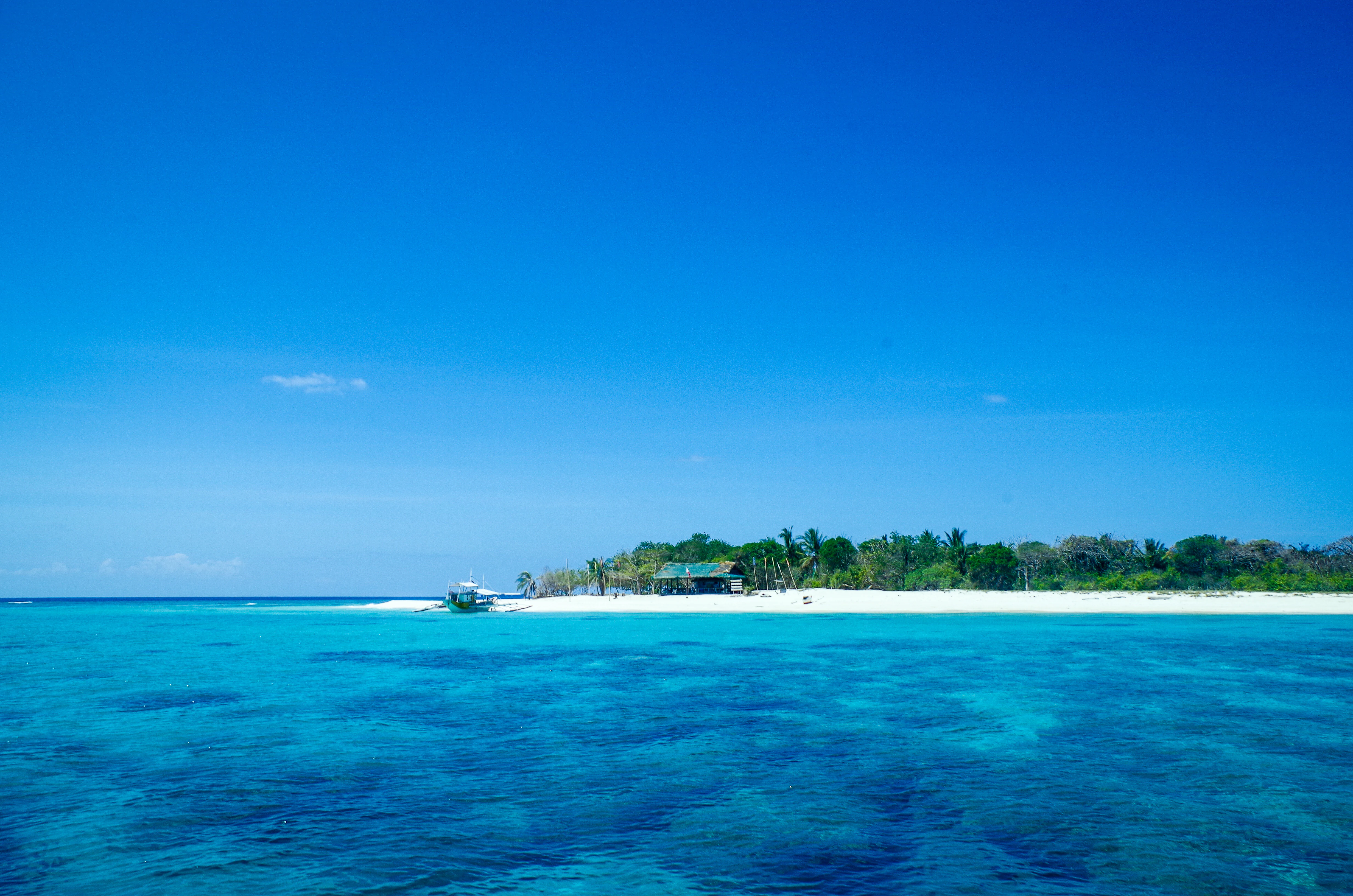
A tropical island with a white sandy beach and green trees surrounded by clear blue and turquoise water under a bright blue sky.
A scenic view of a tropical island with clear turquoise waters and a white sand beach.

Apo Reef Marine Natural Park history and protected-area timeline

Apo Reef Marine Natural Park was formally established on September 6, 1996, by Presidential Proclamation No. 868 of the Philippine government. The proclamation declared the area a Marine Natural Park, recognizing the unique ecological character of the reef system and the need to protect it from growing pressures from fishing, tourism, and resource extraction.

The naming of the park was an intentional choice designed to leverage the prior recognition of the Apo Reef itself, which had already become a well-known destination for diving tourism. By attaching the protected area designation to the familiar reef name, authorities sought to maintain and channel that diving interest into a managed, conservation-oriented framework.

In 2006, the park was placed on the Philippines' tentative list for UNESCO World Heritage status, signaling an effort to elevate the site's global profile and secure additional recognition. The park has subsequently been included among the Asian Heritage Parks designated under the ASEAN framework and has been awarded platinum status under the Marine Conservation Institute's Blue Parks initiative, an international recognition reserved for marine areas of exceptional conservation value.

Apo Reef Marine Natural Park landscape and geographic character

The physical landscape of Apo Reef Marine Natural Park is overwhelmingly a marine seascape, with only a tiny fraction of the protected area ever emerging above the South China Sea. The reef system spans roughly 26 kilometers by 20 kilometers, shaped into two large triangular coral banks that resemble atolls and a smaller, isolated reef to the west. From the surface, the seascape is dominated by open water, with low islands and shallow banks breaking the horizon only occasionally.

Beneath the surface, the marine landscape is defined by dramatic vertical relief. Reef edges plunge in steep, sometimes near-vertical walls to depths of between five and 80 meters, generating an unusually steep underwater topography for a reef complex in this part of the Philippines. Between the two main reef structures lies a submarine trench reaching approximately 30 meters in depth, separating the two atoll-like formations.

The three small land features within the park each present a distinct micro-landscape. Apo Island, the largest at about 22 hectares, supports mangrove and other coastal vegetation typical of small tropical islands, and is marked by a lighthouse. Binangaan consists of low rocky limestone with sparse plants, while Cayos del Bajo Tinangkapang is a tiny bare coral bank only a few hundred square meters in size, without vegetation of its own.

Apo Reef Marine Natural Park ecosystems, habitats, and plant life

The ecological identity of Apo Reef Marine Natural Park centers on its coral reef ecosystems, which together form the second-largest contiguous reef complex in the Philippines after the Danajon Bank off Bohol. Coral coverage spans a total of around 15,800 hectares across the three reef structures, supporting a full range of reef-associated habitats from shallow reef flats and lagoon floors to deep drop-off zones and trench walls.

The atoll-like arrangement of the main reef banks is significant because it echoes the structure of oceanic atolls despite being located in the Mindoro Strait close to Mindoro Island. This gives the park a distinctive ecological profile, with shallow, sunlit lagoon environments lying in close proximity to deep, shaded reef walls, a juxtaposition that supports a wide diversity of reef organisms. The presence of mangrove and coastal vegetation on Apo Island adds an additional small but ecologically meaningful terrestrial component, providing nutrient input and habitat linkages between land and sea.

Because Apo Reef is one of the largest and most topographically varied reef systems in the Philippines, it functions as a regional refuge for reef biodiversity and as a source area for larval dispersal to surrounding waters, an important ecological role for coral and fish populations in the Mindoro Strait.

Apo Reef Marine Natural Park wildlife and species highlights

Apo Reef Marine Natural Park is widely recognized as a key site for marine wildlife in the Philippines, with a reef system whose combination of shallow lagoons, steep drop-offs, and open seascape supports an unusually diverse array of reef-associated species. As the country's second-largest coral reef complex, it provides habitat for a broad range of corals, reef fishes, and larger pelagic visitors typical of Philippine tropical marine environments, including species that depend on drop-off structures and clear, deep water.

Apo Reef Marine Natural Park conservation status and protection priorities

Apo Reef Marine Natural Park holds a distinctive place in Philippine and international marine conservation. Designated as a Marine Natural Park by Presidential Proclamation No. 868 in 1996, the area has been protected for several decades through a combination of core zone management and a substantial buffer zone of around 11,702 hectares surrounding the central 27,469-hectare protected core.

In 2006, the park was placed on the Philippines' tentative list for UNESCO World Heritage status, reflecting its recognized global ecological value. It has also been included among the ASEAN Asian Heritage Parks, a regional recognition of natural and cultural heritage significance.

Internationally, the park has been awarded platinum status under the Marine Conservation Institute's Blue Parks initiative, a designation reserved for marine areas of exceptional conservation importance. Taken together, these layers of recognition show that Apo Reef Marine Natural Park is managed not only as a national reserve but as a site of significant international conservation standing, with the park's remote setting and reef scale both contributing to its long-term ecological value.

Apo Reef Marine Natural Park cultural meaning and human context

Apo Reef Marine Natural Park has a cultural dimension tied primarily to its role as a destination for Philippine dive tourism and to its integration into regional conservation frameworks. The choice of the park's name reflected the desire to preserve and build on the prior recognition of the Apo Reef among the Philippine and international diving community.

The park is also symbolically part of a broader national and regional heritage framework through its inclusion in the ASEAN Asian Heritage Parks network, which highlights sites across Southeast Asia recognized for their natural heritage value. On Apo Island itself, the lighthouse stands as a long-standing navigational feature linked to maritime activity in the Mindoro Strait, though the park itself protects and manages access rather than supporting regular settlement.

Top sights and standout views in Apo Reef Marine Natural Park

Apo Reef Marine Natural Park's highlights are concentrated in its underwater topography and its layered conservation recognition. The two large atoll-like coral banks with shallow central lagoons, separated by a 30-meter trench, define the underwater character of the site.

The park's steep, near-vertical reef drop-offs, descending from five to 80 meters in places, are among the most distinctive features of the Philippine coral reef environment. Combined with its status as the second-largest reef complex in the country, its ASEAN Asian Heritage Park designation, its UNESCO tentative listing since 2006, and its platinum Blue Parks rating, Apo Reef stands out as both a national flagship marine protected area and an internationally recognized conservation site.

Best time to visit Apo Reef Marine Natural Park

Because Apo Reef Marine Natural Park is a dive and marine focused site in the open waters of the Mindoro Strait, conditions for visiting are closely tied to broader Philippine dry and wet season patterns typical of the MIMAROPA region. Months falling within the country's generally calmer, drier season tend to offer more stable sea conditions and clearer underwater visibility, supporting both diving and snorkeling experiences.

Outside the calmest months, rougher seas, reduced visibility, and tropical weather disturbances can affect access to the small islands and reef areas. Visitors planning trips based on diving or snorkeling priorities will generally find conditions most favorable during the calmer and drier part of the year, though exact seasonal conditions can vary year to year.

Monthly climate preview

Long-term representative temperature and monthly precipitation averages

Apo Reef Marine Natural Park Climate Normals and Weather by Month

Representative coordinate measurements reveal measured annual temperature variations and monthly precipitation patterns across the protected marine area. Examining the complete twelve-month climatology dataset clarifies long-term meteorological trends without relying on current forecasts.
Annual mean28 °C
27 °C29 °C
Jan27°
Feb27°
Mar28°
Apr29°
May29°
Jun28°
Jul28°
Aug28°
Sep28°
Oct28°
Nov28°
Dec28°
Warmest month
May

29.2 °C

Coolest month
January

27.1 °C

Wettest month
July

15.7 mm/day

Driest month
March

0.9 mm/day

Park location guide

Geography guide, regional context, and park location map for Apo Reef Marine Natural Park

Apo Reef Marine Natural Park park geography, regions, and map view in Philippines

Understand where Apo Reef Marine Natural Park sits in Philippines through a broader geographic reading of the surrounding landscape, nearby location context, and its mapped position within the national park landscape.

How Apo Reef Marine Natural Park fits into Philippines

The Philippines, officially the Republic of the Philippines, is an archipelagic nation in Southeast Asia comprising approximately 7,641 islands categorized into three main geographical divisions: Luzon, Visayas, and Mindanao. Located in the western Pacific Ocean, it shares maritime borders with Taiwan, Japan, Palau, Indonesia, Malaysia, Vietnam, and China. Manila serves as the capital city, while Quezon City is the most populated city, both within Metro Manila.

Wider geography shaping Apo Reef Marine Natural Park in Philippines

The Philippines is an archipelagic nation in Southeast Asia, positioned in the western Pacific Ocean. Its islands are bounded by the South China Sea to the west, Philippine Sea to the east, and Celebes Sea to the south. The country shares maritime borders with Taiwan to the north, Japan to the northeast, Palau to the east and southeast, Indonesia to the south, Malaysia to the southwest, Vietnam to the west, and China to the northwest.

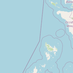
Map view of Apo Reef Marine Natural Park

Use this park location map to pinpoint Apo Reef Marine Natural Park in Philippines, understand its exact geographic position, and read its mapped placement within the surrounding landscape more clearly.

Pigeon | © OpenStreetMap contributors

Explore protected area imagery, vertical reef walls, and atoll topography.

Apo Reef Marine Natural Park Photos and Visual Landscape Scenery

Visual documentation reveals the dramatic vertical reef walls, shallow central lagoons, and expansive marine seascapes defining Apo Reef Marine Natural Park. Examining authentic park photography provides deeper insight into the complex atoll geomorphology and remote island habitats safeguarded within the Mindoro Strait.

A tropical island with a white sandy beach and green trees surrounded by clear blue and turquoise water under a bright blue sky.

Park atlas

Compare nearby marine protected areas and regional conservation landscapes in the Mindoro Strait

Exploring Parks Near Apo Reef Marine Natural Park and Surrounding Marine Reserves

Browsing other parks near Apo Reef Marine Natural Park allows researchers and travelers to compare adjacent marine reserves and coastal ecosystems across the region. Extending exploration beyond this coral reef system reveals the broader geographic distribution of protected landscapes in Philippine waters.
Wildlife reserveMimaropa
About 73 km away#1 closest

Southwest

Calauit Safari Park: Wildlife Reserve Geography and Protected Island Terrain

A conservation sanctuary within the Mimaropa region, Philippines.

Calauit Safari Park stands out as a unique wildlife reserve in the Calamian Islands, featuring a rare combination of African savanna animals and native Philippine wildlife. Its 3,700 hectares encompass a diverse array of tropical forests, grasslands, and mangrove-lined shores, reflecting a complex history of conservation and land management. This protected island ecosystem provides critical habitat for endangered species and serves as an important site for ecological recovery in the western Philippines.

Area
37 km²
Established
1976
Relief
Lowland
Climate
Tropical
Wildlife reserveOccidental Mindoro
About 82 km away#2 closest

North

Mount Calavite Wildlife Sanctuary: Regional Geography and Protected Habitat Mapping

A historic wildlife reserve in Occidental Mindoro

Located in northwestern Occidental Mindoro, Mount Calavite Wildlife Sanctuary preserves a distinct vertical sequence of habitats, from remnant rainforest to high-elevation grasslands. The area is defined by ancient metamorphic geology and serves as a vital stronghold for range-restricted birds and the endangered Tamaraw. This atlas entry provides structured insight into the sanctuary's boundaries, terrain, and its enduring role in Philippine conservation geography.

Area
181.5 km²
Established
1920
Relief
Mountain
Scope
Terrestrial
A horizontal watercolor illustration depicting layers of green, hilly landscapes against a pale pink sky, reflected in calm blue water.
Protected areaPalawan
About 90 km away#3 closest

South

Coron Island Protected Area: Mapping the Limestone Karst and Inland Lakes of Palawan

Karst terrain and marine protected landscapes in the Calamian Islands

Discover the geographic structure of Coron Island Protected Area, where towering limestone ridges and cliffs surround secluded freshwater lakes. The territory preserves a diverse ecosystem of coastal mangroves and marine waters within the Palawan province, illustrating a unique intersection of geological history and traditional indigenous stewardship.

Area
222.48 km²
Established
1998
Relief
Upland
Scope
Mixed
National parkMindoro
About 91 km away#4 closest

East

Mounts Iglit, Baco National Park: Philippines Protected Landscape and Geographic Identity

Explore Mindoro's significant national park and its mapped natural terrain.

Delve into Mounts Iglit, Baco National Park, a protected national park located on the island of Mindoro. This entry offers a detailed geographic perspective, focusing on its mapped boundaries and its role within the archipelago's conservation landscape. Understand the park's specific regional geography and its identity as a distinct protected area.

Relief
Mountain
Scope
Terrestrial
A watercolor painting showing a winding stream flowing through grassy wetlands toward distant low mountain ranges.
National parkPhilippines
About 96 km away#5 closest

Northeast

Lake Naujan National Park: An Atlas of Volcanic Lakes and Wetland Geography

Mapped protected landscapes in the Philippines

Lake Naujan National Park occupies a unique geographic position on Mindoro Island, centering on a vast volcanic freshwater lake. The protected area integrates diverse terrain ranging from aquatic wetland zones and thermal springs to lowland forests and managed agricultural buffers, providing an essential study in human-modified conservation landscapes.

National parkPhilippines
About 112 km away#6 closest

Northeast

Naujan Lake National Park: Philippines National Park Atlas and Protected Landscape

Explore its mapped boundaries and regional geographic context.

Naujan Lake National Park offers a focused exploration of a distinct protected landscape within the Philippines. This page details the park's specific geographic footprint and its characteristics as a national park. Understand its place within the archipelago's broader geography, providing a valuable entry point for atlas-based discovery of protected natural areas and their mapped extents across Southeast Asia.

Scope
Terrestrial
Water
Water-dominated
Protected landscapeCalabarzon
About 153 km away#7 closest

Northeast

Taal Volcano Protected Landscape: Geographic Profile and Protected Area Map

Volcanic caldera and nested lake system in Calabarzon

Explore the layered topography of the Taal Volcano Protected Landscape. This protected area showcases a rare nested volcanic island within a freshwater lake, offering significant insights into the geological and aquatic geography of the Calabarzon region of the Philippines.

Area
622.92 km²
Established
1996
Water
Major water bodies
Watercolor painting of a rolling tropical mountain range with palm trees in the foreground, rendered in soft green, pink, and neutral tones.
Nature reserveCalabarzon
About 176 km away#8 closest

Northeast

Mount Makiling Nature Reserve: Volcanic Geography and Forest Landscapes in Calabarzon

A historic forest reserve and prominent volcanic landmark on Luzon

Mount Makiling represents a layered conservation landscape, functioning as both an active site for forest research and a significant volcanic massif within the Calabarzon region. The area features a complex of subsidiary cones, mud springs, and essential watersheds that define its ecological and cultural identity. Gain a deeper understanding of its geographic boundaries and its importance as a pioneering protected area in Philippine conservation history.

Established
1910
Relief
Mountain
Climate
Tropical
Access
Easy access

Common questions about visiting, size, designation, and location context for Apo Reef Marine Natural Park

Apo Reef Marine Natural Park FAQs for park facts, access, geography, and protected area context

Find quick answers about Apo Reef Marine Natural Park, including protected-area facts, park geography, trail and visitor context, and how the park fits into its surrounding country and regional landscape.
MoriAtlas Explorer

Continue Your Protected Areas Search Across the Global Atlas

Deepen your exploration by continuing the structured search for national parks and protected areas worldwide. Utilize the comprehensive filtering capabilities to compare different conservation landscapes and refine your understanding of global park geography. Discover more about the distribution and characteristics of protected natural areas.

Global natural geography