Mori Atlas logo
National parkNaujan Lake National Park

Discover mapped boundaries and geographic context for this protected area in the Philippines.

Naujan Lake National Park: Philippines National Park Atlas and Protected Landscape Details

Naujan Lake National Park represents a significant protected natural area within the Philippines, a nation composed of thousands of islands. This page provides detailed insights into the park's geographic scope and its role as a protected landscape. Users can explore its mapped boundaries and understand its regional context, contributing to a comprehensive atlas-driven understanding of conservation areas within Southeast Asia.

wetlandslake ecosystembird habitatprotected areaPhilippinesMindoro

Naujan Lake National Park

National park

Park overview

Structured park overview, official facts, and landscape profile for Naujan Lake National Park

Naujan Lake National Park park facts, protected area profile, and essential visitor context

Review the core facts for Naujan Lake National Park, including designation, size, terrain, visitor scale, habitats, and operating context in one park-focused overview.

About Naujan Lake National Park

Naujan Lake National Park is a conservation area protecting Naujan Lake, a major inland lake on Mindoro Island in Oriental Mindoro province. The lake ranks among the largest lakes in the Philippines and forms the core of a significant wetland ecosystem. The park was established to protect the lake's ecological integrity, preserving its biodiversity and the ecosystem services it provides to local communities. The surrounding landscape includes marshlands, forested areas, and agricultural land, creating a complex ecological mosaic. The protected area plays a vital role in water regulation, flood control, and supporting the livelihoods of communities living around the lake.

Quick facts and research context for Naujan Lake National Park

Naujan Lake National Park is situated on Mindoro Island in the Philippines, protecting the country's one of largest inland lakes. The park was designated to safeguard the lake's wetland ecosystems, biodiversity, and watersheds. The area provides habitat for diverse bird species and supports local ecological balance.

Protection and recognition

Documented terrestrial protection frameworks and official international recognition datasets

Naujan Lake National Park Protection Status and Ramsar Designation

Naujan Lake National Park features documented terrestrial protection status alongside an official international designation as a Ramsar site. Accessing verified boundary information helps researchers analyze the formal framework supporting the park's global conservation and geographic classification.

International recognition

Protection details

Protection scope
Terrestrial
Transboundary protection
No
Park context

Deeper park guide and search-rich context for Naujan Lake National Park

Naujan Lake National Park history, landscape, wildlife, and travel context

Explore Naujan Lake National Park through its history, landscape character, ecosystems, wildlife, conservation priorities, cultural context, and seasonal travel timing in a structured park guide built for atlas discovery and search intent.

Why Naujan Lake National Park stands out

Naujan Lake is recognized as one of the most significant wetland areas in the Philippines. The lake and its surrounding marshlands provide crucial habitat for migratory waterfowl and resident bird species. The protected area supports important fish populations and serves as a natural water reservoir for the region.

Naujan Lake National Park history and protected-area timeline

The national park was established to protect the significant ecological and economic value of Naujan Lake. The lake has long been important for local communities as a source of fish and other aquatic resources. Formal protection was granted to prevent degradation of the lake ecosystem and to ensure the sustainable use of its resources.

Naujan Lake National Park landscape and geographic character

Naujan Lake occupies a depression in the interior of Mindoro Island, surrounded by a mix of wetlands, grasslands, and forested slopes. The lake's shallow waters support extensive emergent vegetation and provide open water habitat. The surrounding terrain slopes gently upward from the lake shore, with agricultural areas and secondary forest covering the periphery.

Naujan Lake National Park ecosystems, habitats, and plant life

The park protects a freshwater lake ecosystem with associated wetlands, marshes, and riparian habitats. The shallow, nutrient-rich waters of Naujan Lake support diverse aquatic vegetation and provide ideal conditions for fish and invertebrate populations. The wetland areas around the lake serve as important habitat for waterbirds, including both resident species and migratory ducks and waders that use the lake as a wintering site.

Naujan Lake National Park wildlife and species highlights

Naujan Lake supports significant populations of waterfowl and aquatic birds. The wetlands provide crucial feeding and resting areas for migratory birds traveling along the East Asian Flyway. Resident bird species including herons, egrets, and kingfishers are found throughout the park. The lake's fish populations support fishing communities and also provide food for birds and other predators.

Naujan Lake National Park conservation status and protection priorities

Naujan Lake National Park represents an important conservation priority for the Philippines due to the lake's role as a major wetland habitat. The protected area helps preserve biodiversity, protects water quality, and maintains the lake's function as a natural water storage system. Conservation efforts focus on managing the lake's fish populations, protecting bird habitats, and addressing threats from surrounding land use.

Naujan Lake National Park cultural meaning and human context

Naujan Lake has traditionally supported local fishing communities who depend on the lake's resources for their livelihoods. The lake holds cultural and economic significance for the communities of Oriental Mindoro. Traditional fishing practices have shaped the relationship between local people and the lake ecosystem for generations.

Top sights and standout views in Naujan Lake National Park

Naujan Lake is one of the Philippines' largest lakes and a key wetland conservation area. The lake provides critical habitat for migratory waterfowl along the East Asian Flyway. The protected area supports important fish populations and sustains local fishing communities. The wetland ecosystem offers birdwatching opportunities and ecological research potential.

Best time to visit Naujan Lake National Park

The best time to visit Naujan Lake National Park corresponds to the dry season from November to May, when weather conditions are more favorable for outdoor activities. Migratory birds are most abundant during the northern hemisphere winter months from November to March, making this period particularly rewarding for birdwatching. The wet season from June to October brings higher water levels and different ecological conditions.

Monthly climate preview

Long-term representative temperature and monthly precipitation statistics for Naujan Lake National Park

Naujan Lake National Park Climate Normals and Annual Weather Patterns

Historical coordinate data reveals measurable shifts in average monthly temperatures and precipitation rates across Naujan Lake National Park. Examining the complete twelve-month climate profile provides detailed long-term averages for thorough geographic analysis.
Annual mean25 °C
23 °C27 °C
Jan23°
Feb24°
Mar25°
Apr26°
May27°
Jun26°
Jul25°
Aug25°
Sep25°
Oct25°
Nov25°
Dec24°
Warmest month
May

27 °C

Coolest month
January

23.3 °C

Wettest month
July

10.6 mm/day

Driest month
March

1.8 mm/day

Park location guide

Geography guide, regional context, and park location map for Naujan Lake National Park

Naujan Lake National Park park geography, regions, and map view in Philippines

Understand where Naujan Lake National Park sits in Philippines through a broader geographic reading of the surrounding landscape, nearby location context, and its mapped position within the national park landscape.

How Naujan Lake National Park fits into Philippines

The Philippines, officially the Republic of the Philippines, is an archipelagic nation in Southeast Asia comprising approximately 7,641 islands categorized into three main geographical divisions: Luzon, Visayas, and Mindanao. Located in the western Pacific Ocean, it shares maritime borders with Taiwan, Japan, Palau, Indonesia, Malaysia, Vietnam, and China. Manila serves as the capital city, while Quezon City is the most populated city, both within Metro Manila.

Wider geography shaping Naujan Lake National Park in Philippines

The Philippines is an archipelagic nation in Southeast Asia, positioned in the western Pacific Ocean. Its islands are bounded by the South China Sea to the west, Philippine Sea to the east, and Celebes Sea to the south. The country shares maritime borders with Taiwan to the north, Japan to the northeast, Palau to the east and southeast, Indonesia to the south, Malaysia to the southwest, Vietnam to the west, and China to the northwest.

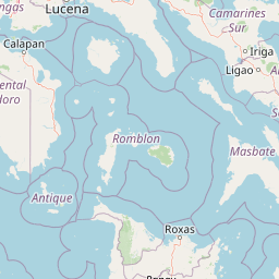
Map view of Naujan Lake National Park

Use this park location map to pinpoint Naujan Lake National Park in Philippines, understand its exact geographic position, and read its mapped placement within the surrounding landscape more clearly.

Pigeon | © OpenStreetMap contributors
Park atlas

Browse regional protected areas and wetland ecosystems across Mindoro Island and the surrounding Philippine geography.

Explore Protected Areas Near Naujan Lake National Park: Discover Other Parks and Wetlands

Continue your exploration from Naujan Lake National Park by tracing other protected areas and significant wetland habitats across Mindoro Island and its nearby regions. Compare diverse park geographies and conservation landscapes to understand the broader ecological network and protected natural heritage in the Philippines.
National parkPhilippines
About 18 km away#1 closest

West

Lake Naujan National Park: An Atlas of Volcanic Lakes and Wetland Geography

Mapped protected landscapes in the Philippines

Lake Naujan National Park occupies a unique geographic position on Mindoro Island, centering on a vast volcanic freshwater lake. The protected area integrates diverse terrain ranging from aquatic wetland zones and thermal springs to lowland forests and managed agricultural buffers, providing an essential study in human-modified conservation landscapes.

National parkMindoro
About 32 km away#2 closest

Southwest

Mounts Iglit, Baco National Park: Philippines Protected Landscape and Geographic Identity

Explore Mindoro's significant national park and its mapped natural terrain.

Delve into Mounts Iglit, Baco National Park, a protected national park located on the island of Mindoro. This entry offers a detailed geographic perspective, focusing on its mapped boundaries and its role within the archipelago's conservation landscape. Understand the park's specific regional geography and its identity as a distinct protected area.

Relief
Mountain
Scope
Terrestrial
Wildlife reserveMarinduque
About 72 km away#3 closest

Northeast

Marinduque Wildlife Sanctuary: Map of the Protected Interior Forest

Exploring the essential wildlife habitats of Marinduque Island

Spanning 8,800 hectares of hilly terrain across five municipalities, the Marinduque Wildlife Sanctuary protects a critical block of forest. This reserve is recognized as a vital sanctuary for endemic Philippine species and forms a significant ecological backbone within the heart of the island landscape.

Area
88.28 km²
Established
2004
Relief
Mountain
Climate
Tropical
Protected landscapeCalabarzon
About 99 km away#4 closest

North

Taal Volcano Protected Landscape: Geographic Profile and Protected Area Map

Volcanic caldera and nested lake system in Calabarzon

Explore the layered topography of the Taal Volcano Protected Landscape. This protected area showcases a rare nested volcanic island within a freshwater lake, offering significant insights into the geological and aquatic geography of the Calabarzon region of the Philippines.

Area
622.92 km²
Established
1996
Water
Major water bodies
Protected landscapeQuezon
About 105 km away#5 closest

Northeast

Quezon Protected Landscape: Mapping the Rainforests and Karst Terrain of Quezon Province

An essential protected landscape in the southern Sierra Madre mountain range.

Quezon Protected Landscape serves as a vital ecological corridor, featuring a rugged mix of karst topography, lowland rainforests, and underground water systems. Explore the geographic layout of this Philippine reserve, which encompasses symbolic summits, cascading waterfalls, and diverse endemic habitats within the southern Sierra Madre foothills.

Area
9.38 km²
Established
2003
IUCN
V
Relief
Mountain
Wildlife reserveOccidental Mindoro
About 107 km away#6 closest

West

Mount Calavite Wildlife Sanctuary: Regional Geography and Protected Habitat Mapping

A historic wildlife reserve in Occidental Mindoro

Located in northwestern Occidental Mindoro, Mount Calavite Wildlife Sanctuary preserves a distinct vertical sequence of habitats, from remnant rainforest to high-elevation grasslands. The area is defined by ancient metamorphic geology and serves as a vital stronghold for range-restricted birds and the endangered Tamaraw. This atlas entry provides structured insight into the sanctuary's boundaries, terrain, and its enduring role in Philippine conservation geography.

Area
181.5 km²
Established
1920
Relief
Mountain
Scope
Terrestrial
Nature reserveCalabarzon
About 108 km away#7 closest

North

Mount Makiling Nature Reserve: Volcanic Geography and Forest Landscapes in Calabarzon

A historic forest reserve and prominent volcanic landmark on Luzon

Mount Makiling represents a layered conservation landscape, functioning as both an active site for forest research and a significant volcanic massif within the Calabarzon region. The area features a complex of subsidiary cones, mud springs, and essential watersheds that define its ecological and cultural identity. Gain a deeper understanding of its geographic boundaries and its importance as a pioneering protected area in Philippine conservation history.

Established
1910
Relief
Mountain
Climate
Tropical
Access
Easy access
Marine protected areaPhilippines
About 112 km away#8 closest

Southwest

Apo Reef Marine Natural Park: Protected Coral Reef Atlas and Marine Geography

Marine protected area in the Mindoro Strait, Philippines

Apo Reef Marine Natural Park serves as a high-priority conservation landscape featuring two massive triangular coral banks and steep underwater drop-offs. This site provides a critical case study in marine geomorphology, characterized by its deep submarine trenches and unique atoll-like structure within the broader Philippine archipelagic geography.

Area
274.69 km²
Established
1996
Scope
Marine
Water
Water-dominated

Common questions about visiting, size, designation, and location context for Naujan Lake National Park

Naujan Lake National Park FAQs for park facts, access, geography, and protected area context

Find quick answers about Naujan Lake National Park, including protected-area facts, park geography, trail and visitor context, and how the park fits into its surrounding country and regional landscape.
MoriAtlas Explorer

Continue Your Protected Areas Search Across the Global Atlas

Deepen your exploration by continuing the structured search for national parks and protected areas worldwide. Utilize the comprehensive filtering capabilities to compare different conservation landscapes and refine your understanding of global park geography. Discover more about the distribution and characteristics of protected natural areas.

Global natural geography