

Mori Atlas logo
National parkLake Naujan National Park

Tracing the volcanic lake basin, wetland boundaries, and forest mosaic of a vital Philippine national park.

Lake Naujan National Park: Mapped Geography and Protected Landscapes in the Philippines

Lake Naujan National Park stands as a significant protected landscape on Mindoro Island, defined by its namesake volcanic freshwater basin and surrounding mosaic of lowland forests and grasslands. This geographic record maps the park as a crucial wetland habitat, highlighting its role within the Philippine National Integrated Protected Areas System. Visitors and researchers can analyze the intersection of inland aquatic ecosystems, thermal springs, and rural agricultural corridors that shape this complex conservation unit.

freshwater lakevolcanic lakewetlandRamsar siteNIPAS sitenational park
A stylized vector illustration of a lake landscape with pine trees in the foreground, rolling green hills, and distant mountains under a sunset-colored sky.

Lake Naujan National Park

National park

Park overview

Structured park overview, official facts, and landscape profile for Lake Naujan National Park

Lake Naujan National Park park facts, protected area profile, and essential visitor context

Review the core facts for Lake Naujan National Park, including designation, size, terrain, visitor scale, habitats, and operating context in one park-focused overview.

About Lake Naujan National Park

Lake Naujan National Park is a national protected area on the island of Mindoro in the Philippines, anchored by one of the country's largest natural freshwater lakes. The park was established on 25 January 1968 and has grown in importance as a model for integrated conservation that links habitat protection with the rural livelihoods of surrounding communities. It encompasses most of Lake Naujan together with hills, forests, grasslands, plantations, and settlement zones at the lake's edges, creating a landscape mosaic rather than a strictly wilderness reserve.

The park's geographic setting defines much of its character. Lake Naujan sits in the northeast of Mindoro, occupying a basin that is separated from the coast by a low chain of hills about eight kilometers inland. The lake itself is roughly 14 by 7 kilometers in extent and reaches depths of about 45 meters, making it one of the deeper inland lakes in the Philippines. The surrounding catchment supports a patchwork of secondary forest, heathland, open grass, and small agricultural plots, including coconut and fruit-tree plantations used by local communities. A reforestation research center at the southern shore of the lake has become an institutional anchor for habitat-recovery efforts in the park.

Conservation-wise, the park stands out because it is one of the founding units of the National Integrated Protected Areas System, the legal framework that organizes protected-area management across the Philippines. It is also one of six Philippine sites formally recognized as a Ramsar Wetland of International Importance, placing it in a small and prestigious group that highlights its significance for waterbirds and wetland biodiversity. The mix of endemic Mindoro birds, waterfowl, freshwater fish, and resilient cultural landscapes gives Lake Naujan National Park a profile that is rare in the Philippine protected-area system, where most flagship parks are either marine or montane.

Quick facts and research context for Lake Naujan National Park

Lake Naujan National Park encircles most of Lake Naujan in Oriental Mindoro, Philippines, covering approximately 13,011 hectares of lake and surrounding land. The protected area was established on 25 January 1968 and is one of the country's earliest designated national parks.

It is recognized as an original component of the National Integrated Protected Areas System and is one of only six Philippine sites formally listed under the Ramsar Convention. The park lies inland on the northeast of Mindoro, about eight kilometers from the coast, separated from the sea by a low hill range, and supports both Endemic Mindoro bird species and globally recognized waterbirds.

Protection and recognition

Documented protection history and official conservation records for Lake Naujan National Park

Lake Naujan National Park Protection Status and Conservation Records

Lake Naujan National Park documentation brings together official protection status records and designation history for this protected area. Conservation details outline the administrative framework and international recognition data without assuming management outcomes.

Protection details

WDPA ID
7217
Park context

Deeper park guide and search-rich context for Lake Naujan National Park

Lake Naujan National Park history, landscape, wildlife, and travel context

Explore Lake Naujan National Park through its history, landscape character, ecosystems, wildlife, conservation priorities, cultural context, and seasonal travel timing in a structured park guide built for atlas discovery and search intent.

Why Lake Naujan National Park stands out

Lake Naujan National Park is best known for protecting Lake Naujan itself, a large freshwater lake of volcanic origin with a maximum depth of around 45 meters. It is notable for combining a productive inland fishery with surrounding forest, heath, grass, and plantation landscapes that sustain high biodiversity. The park's wildlife profile is shaped by Mindoro-endemic species and by its importance as a Ramsar wetland. Several birds found here are restricted to Mindoro or the Philippines, including the Mindoro Bleeding-heart variant pigeons, the Mindoro Hornbill, the Mindoro Coucal, the Ashy Thrush-like Mindoro ground thrush, and the Scarlet-collared Flowerpecker, many of which are among the most range-restricted birds in the country. The lake and marshland also support the Philippine Duck, one of the most important waterbird populations on the archipelago.

A side profile view of a Philippine Duck with a reddish-brown head and a distinctive blue patch on its wing, standing on green grass.
A Philippine Duck (Anas luzonica) standing in the grass.

Lake Naujan National Park history and protected-area timeline

Lake Naujan National Park was established on 25 January 1968, making it one of the relatively early protected-area designations in the Philippines. Its creation recognized both the ecological importance of Lake Naujan as a major freshwater basin and the need to safeguard the surrounding catchment, which supports fishing, forestry, and agriculture for the local population.

The park later took on broader national significance when it was identified as an initial component of the National Integrated Protected Areas System under Republic Act 7586, the framework that defines how the Philippines manages its protected landscapes. This reflected growing recognition that the lake was not only a scenic and hydrological asset but also a biodiversity reserve of national importance.

In addition to its national-protective status, Lake Naujan achieved international recognition as a Ramsar Wetland, becoming part of the small group of Philippine sites officially designated under the Ramsar Convention. The combined weight of its National Integrated Protected Areas System inclusion and Ramsar listing established the park as a flagship for wetland conservation on Mindoro.

Over time, the park has also taken on a management-research role. A reforestation research center on the southern shore of the lake has supported experiments in restoring forest cover around the catchment, building institutional capacity for habitat recovery in and around the protected area.

Lake Naujan National Park landscape and geographic character

Lake Naujan National Park is anchored by Lake Naujan, a large freshwater lake of volcanic origin that occupies the heart of the protected area. The lake extends roughly 14 kilometers in one direction and 7 kilometers in the other, with a maximum depth of around 45 meters. Its waters sit in a basin that was shaped by volcanic activity, and thermal springs are present along the southern shore.

The surrounding topography is gentle but important. A low chain of hills separates the lake from the coastline, with the lake lying about eight kilometers inland. This range acts as a natural barrier between the freshwater system and the sea, and it shapes the catchment dynamics of the basin.

Beyond the lake edge, the park's landscape transitions into a mosaic of forest, open heath, grasslands, and human-used land. Tall second-growth forest and patches of heathland are interspersed with sprawling plains covered in grasses and scrubs. Plantations of coconut palms and fruit trees, together with smaller agricultural holdings, are woven through this natural mosaic, producing a working landscape where wildlife habitat and rural land use coexist.

A small bird with dark plumage and a visible patch of red on its throat perched on a thin branch surrounded by green and yellow leaves.
A Scarlet-collared flowerpecker, an endemic Philippine bird species, perched among foliage in Lake Naujan National Park.

Lake Naujan National Park ecosystems, habitats, and plant life

The natural environment of Lake Naujan National Park is built around a large freshwater lake and its surrounding catchment. The lake's volcanic origin gives it a particular geological character, including the presence of thermal springs at the southern end of the basin. Open water is the central habitat, surrounded by low-lying wetlands, marshlands, and seasonally flooded areas that feed into the lake.

Around the lake, the vegetation changes with elevation and land use. Lowland forest patches and heathland grow on better-drained slopes, while open grasslands dominate flatter plains closer to the shore. Cultivated areas, including coconut and fruit-tree plantations, form part of the broader habitat matrix and influence edge conditions for local wildlife.

While the lake is the ecological core, its surrounding habitats reinforce the wetland value of the area. Mangrove-like wetlands, reed edges, and aquatic vegetation along the shore support waterbirds and fish, while forest patches provide refuge for forest-dwelling birds. The result is a transit zone where freshwater, wetland, lowland forest, and farmland ecosystems overlap, giving the park unusually broad ecological coherence for a single protected area.

Lake Naujan National Park wildlife and species highlights

The wildlife of Lake Naujan National Park reflects the unusual combination of a large freshwater lake, marshland, and lowland forest on Mindoro. The lake supports a productive freshwater fishery that includes cichlids of the genus Oreochromis (most notably tilapia), gobies, cyprinid carp-like fishes, freshwater shrimp, and freshwater snails likely including brackish-tolerant species in certain reaches of the system. These fish stocks underpin local livelihoods and also influence the food web for waterbirds in the area.

The birdlife is especially significant. The park hosts the Philippine Duck, a nationally important waterfowl species, and supports several Mindoro-endemic or Mindoro-centered bird species that rank among the most range-restricted in the Philippines. These include the Mindoro Imperial Pigeon, the Spotted Imperial Pigeon, the Philippine or Red-vented Cockatoo, the Mindoro Coucal, the Mindoro Hornbill, the Ashy Thrush-like Mindoro ground thrush, and the Scarlet-collared Flowerpecker.

The combination of waterbirds around the lake and forest-dwelling endemics in the surrounding habitat gives the park a layered bird profile that is rare within a single protected area. Mammal and reptile presence is less explicitly documented in the available sources, but the diversity of habitats suggests potential for typical lowland Mindoro forest and wetland species associated with similar Philippine lake environments.

Lake Naujan National Park conservation status and protection priorities

Lake Naujan National Park plays an unusually prominent role in Philippine conservation. It is recognized as an initial component of the National Integrated Protected Areas System (NIPAS), the country's central legal framework for managing protected areas under Republic Act 7586. This status places the park among the benchmark sites that shaped how the Philippines approaches integrated conservation, combining habitat protection with sustainable use by surrounding communities.

The park is also one of only six Philippine sites formally inscribed as a Ramsar Wetland of International Importance. That listing reflects the global value of its lake and wetland habitats for migratory waterbirds and for resident wetland-dependent species, including the Philippine Duck. Together, the NIPAS and Ramsar designations give Lake Naujan National Park recognition at both national and international levels.

Conservation activity within the park has also emphasized habitat restoration. A reforestation research center on the southern shore of the lake has supported reforestation and land-recovery efforts, addressing the long-running pressure of forest loss around the catchment. This combination of formal protection, international wetland recognition, and active habitat work gives the park a stronger conservation profile than its relatively modest size would suggest.

Lake Naujan National Park cultural meaning and human context

The cultural context of Lake Naujan National Park is shaped by the rural communities that have long relied on the lake and its surrounding lands. The traditional livelihood base for these communities is agriculture and fishing, both of which continue to define the relationship between people and the protected area.

Lake Naujan's role as a working fishery, combined with extensive coconut and fruit-tree plantations around the lake edge, means the park is not an exclave of pure wilderness but a lived-in landscape. Small-scale farming and fishing coexist with the conservation framework, and the park's management approach has emphasized this human dimension alongside biodiversity protection.

The park also carries cultural weight through its institutional history, including its reforestation research center on the southern shore. This center has become a focal point where scientific work, community engagement, and conservation policy intersect, giving the protected area a distinct identity as both a biodiversity reserve and a working rural landscape.

Top sights and standout views in Lake Naujan National Park

Lake Naujan National Park's profile is shaped by its role as one of the founding sites of the Philippine National Integrated Protected Areas System and as one of only six Ramsar Wetlands in the country. Its centerpiece is Lake Naujan, a 14-by-7-kilometer freshwater lake of volcanic origin reaching depths of around 45 meters, with thermal springs along its southern shore and a low hill chain separating it from the nearby coast.

For birdlife, the park stands out for combining important waterbird populations, including the Philippine Duck, with several of the most range-restricted birds in the Philippines, such as the Mindoro Coucal, Mindoro Hornbill, Mindoro Imperial Pigeon, Spotted Imperial Pigeon, Red-vented Cockatoo, and Scarlet-collared Flowerpecker. This dual strength makes the park a key site for both wetland and Mindoro-endemic bird conservation.

The park's working-landscape character, with agriculture, plantations, fishing, and a reforestation research center along the southern shore, adds another distinctive layer. It is a protected area that blends biodiversity, wetlands, ongoing habitat restoration, and rural community life into a single integrated conservation model.

Best time to visit Lake Naujan National Park

The character of Lake Naujan National Park shifts with the broader wet and dry seasons of the Philippines, and these cycles strongly influence the experience of visiting the lake and surrounding wetlands. During the wetter months, the lake and its associated marshlands expand, increasing the extent of open water and shallow wetland edges that are attractive to waterbirds. These periods can be rewarding for birdwatchers but also bring heavier rainfall and less predictable access around the catchment.

In drier periods, water levels recede and exposed lake edges, grass plains, and forest patches become more accessible on foot, making it easier to explore the mosaic of heathland, lowland forest, and plantations that surround the lake. The drier season also tends to produce calmer conditions on the water and clearer views toward the surrounding hill chain that separates the lake from the coast.

Both seasons highlight different aspects of the park: the wet season emphasizes wetland character and waterbird activity, while the dry season emphasizes the broader landscape mosaic and working rural character of the surrounding area. Visitors interested in waterbirds generally prefer the wetter phase, while those focused on landscape and forest-edge exploration often find drier conditions more comfortable.

Monthly climate preview

Long-term representative measurements of temperature and monthly precipitation rhythm

Lake Naujan National Park Climate Normals and Annual Weather Patterns

Lake Naujan National Park exhibits a measured annual temperature and precipitation cycle spanning from cooler baseline months to warmer periods with heavier daily rainfall. Examining the comprehensive monthly climate normals provides deeper insight into long-term averages recorded at the representative coordinate.
Annual mean25 °C
23 °C27 °C
Jan23°
Feb24°
Mar25°
Apr26°
May27°
Jun26°
Jul25°
Aug25°
Sep25°
Oct25°
Nov25°
Dec24°
Warmest month
May

27 °C

Coolest month
January

23.3 °C

Wettest month
July

10.6 mm/day

Driest month
March

1.8 mm/day

Park location guide

Geography guide, regional context, and park location map for Lake Naujan National Park

Lake Naujan National Park park geography, regions, and map view in Philippines

Understand where Lake Naujan National Park sits in Philippines through a broader geographic reading of the surrounding landscape, nearby location context, and its mapped position within the national park landscape.

How Lake Naujan National Park fits into Philippines

The Philippines, officially the Republic of the Philippines, is an archipelagic nation in Southeast Asia comprising approximately 7,641 islands categorized into three main geographical divisions: Luzon, Visayas, and Mindanao. Located in the western Pacific Ocean, it shares maritime borders with Taiwan, Japan, Palau, Indonesia, Malaysia, Vietnam, and China. Manila serves as the capital city, while Quezon City is the most populated city, both within Metro Manila.

Wider geography shaping Lake Naujan National Park in Philippines

The Philippines is an archipelagic nation in Southeast Asia, positioned in the western Pacific Ocean. Its islands are bounded by the South China Sea to the west, Philippine Sea to the east, and Celebes Sea to the south. The country shares maritime borders with Taiwan to the north, Japan to the northeast, Palau to the east and southeast, Indonesia to the south, Malaysia to the southwest, Vietnam to the west, and China to the northwest.

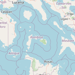
Map view of Lake Naujan National Park

Use this park location map to pinpoint Lake Naujan National Park in Philippines, understand its exact geographic position, and read its mapped placement within the surrounding landscape more clearly.

Pigeon | © OpenStreetMap contributors

Visual reference for volcanic lake waters, surrounding forests, and wetland habitats

Lake Naujan National Park Photos and Protected Landscape Scenery

Visual documentation of Lake Naujan National Park reveals the volcanic basin, freshwater lake surface, and surrounding lowland forest mosaic. Examining these protected area views helps researchers and visitors understand the terrain, wetland habitats, and rural conservation landscape of Mindoro Island.

A side profile view of a Philippine Duck with a reddish-brown head and a distinctive blue patch on its wing, standing on green grass.

Aerial view looking over Lake Naujan in the Philippines with sun glint on the water surface.

A small bird with dark plumage and a visible patch of red on its throat perched on a thin branch surrounded by green and yellow leaves.

Park atlas

Compare adjacent wetland habitats and regional conservation landscapes across the surrounding terrain.

Exploring Other Protected Areas and Parks Near Lake Naujan National Park

Continue geographic discovery by comparing Lake Naujan National Park with other protected areas and regional conservation zones. Examining adjacent wetland habitats and forested terrain provides deeper context for insular ecosystems and regional biodiversity patterns.
National parkPhilippines
About 18 km away#1 closest

East

Naujan Lake National Park: Philippines National Park Atlas and Protected Landscape

Explore its mapped boundaries and regional geographic context.

Naujan Lake National Park offers a focused exploration of a distinct protected landscape within the Philippines. This page details the park's specific geographic footprint and its characteristics as a national park. Understand its place within the archipelago's broader geography, providing a valuable entry point for atlas-based discovery of protected natural areas and their mapped extents across Southeast Asia.

Scope
Terrestrial
Water
Water-dominated
National parkMindoro
About 30 km away#2 closest

South

Mounts Iglit, Baco National Park: Philippines Protected Landscape and Geographic Identity

Explore Mindoro's significant national park and its mapped natural terrain.

Delve into Mounts Iglit, Baco National Park, a protected national park located on the island of Mindoro. This entry offers a detailed geographic perspective, focusing on its mapped boundaries and its role within the archipelago's conservation landscape. Understand the park's specific regional geography and its identity as a distinct protected area.

Relief
Mountain
Scope
Terrestrial
Wildlife reserveMarinduque
About 89 km away#3 closest

East

Marinduque Wildlife Sanctuary: Map of the Protected Interior Forest

Exploring the essential wildlife habitats of Marinduque Island

Spanning 8,800 hectares of hilly terrain across five municipalities, the Marinduque Wildlife Sanctuary protects a critical block of forest. This reserve is recognized as a vital sanctuary for endemic Philippine species and forms a significant ecological backbone within the heart of the island landscape.

Area
88.28 km²
Established
2004
Relief
Mountain
Climate
Tropical
Wildlife reserveOccidental Mindoro
About 90 km away#4 closest

Northwest

Mount Calavite Wildlife Sanctuary: Regional Geography and Protected Habitat Mapping

A historic wildlife reserve in Occidental Mindoro

Located in northwestern Occidental Mindoro, Mount Calavite Wildlife Sanctuary preserves a distinct vertical sequence of habitats, from remnant rainforest to high-elevation grasslands. The area is defined by ancient metamorphic geology and serves as a vital stronghold for range-restricted birds and the endangered Tamaraw. This atlas entry provides structured insight into the sanctuary's boundaries, terrain, and its enduring role in Philippine conservation geography.

Area
181.5 km²
Established
1920
Relief
Mountain
Scope
Terrestrial
Protected landscapeCalabarzon
About 94 km away#5 closest

North

Taal Volcano Protected Landscape: Geographic Profile and Protected Area Map

Volcanic caldera and nested lake system in Calabarzon

Explore the layered topography of the Taal Volcano Protected Landscape. This protected area showcases a rare nested volcanic island within a freshwater lake, offering significant insights into the geological and aquatic geography of the Calabarzon region of the Philippines.

Area
622.92 km²
Established
1996
Water
Major water bodies
A wide panoramic watercolor painting showing a body of water in the foreground, a green tree-lined shore in the midground, and faint mountains under a pink and yellow sky in the background.
Marine protected areaPhilippines
About 96 km away#6 closest

Southwest

Apo Reef Marine Natural Park: Protected Coral Reef Atlas and Marine Geography

Marine protected area in the Mindoro Strait, Philippines

Apo Reef Marine Natural Park serves as a high-priority conservation landscape featuring two massive triangular coral banks and steep underwater drop-offs. This site provides a critical case study in marine geomorphology, characterized by its deep submarine trenches and unique atoll-like structure within the broader Philippine archipelagic geography.

Area
274.69 km²
Established
1996
Scope
Marine
Water
Water-dominated
Watercolor painting of a rolling tropical mountain range with palm trees in the foreground, rendered in soft green, pink, and neutral tones.
Nature reserveCalabarzon
About 107 km away#7 closest

North

Mount Makiling Nature Reserve: Volcanic Geography and Forest Landscapes in Calabarzon

A historic forest reserve and prominent volcanic landmark on Luzon

Mount Makiling represents a layered conservation landscape, functioning as both an active site for forest research and a significant volcanic massif within the Calabarzon region. The area features a complex of subsidiary cones, mud springs, and essential watersheds that define its ecological and cultural identity. Gain a deeper understanding of its geographic boundaries and its importance as a pioneering protected area in Philippine conservation history.

Established
1910
Relief
Mountain
Climate
Tropical
Access
Easy access
Protected landscapeQuezon
About 115 km away#8 closest

Northeast

Quezon Protected Landscape: Mapping the Rainforests and Karst Terrain of Quezon Province

An essential protected landscape in the southern Sierra Madre mountain range.

Quezon Protected Landscape serves as a vital ecological corridor, featuring a rugged mix of karst topography, lowland rainforests, and underground water systems. Explore the geographic layout of this Philippine reserve, which encompasses symbolic summits, cascading waterfalls, and diverse endemic habitats within the southern Sierra Madre foothills.

Area
9.38 km²
Established
2003
IUCN
V
Relief
Mountain

Common questions about visiting, size, designation, and location context for Lake Naujan National Park

Lake Naujan National Park FAQs for park facts, access, geography, and protected area context

Find quick answers about Lake Naujan National Park, including protected-area facts, park geography, trail and visitor context, and how the park fits into its surrounding country and regional landscape.
MoriAtlas Explorer

Continue Your Protected Areas Search Across the Global Atlas

Deepen your exploration by continuing the structured search for national parks and protected areas worldwide. Utilize the comprehensive filtering capabilities to compare different conservation landscapes and refine your understanding of global park geography. Discover more about the distribution and characteristics of protected natural areas.

Global natural geography