
Mori Atlas logo
Wildlife reserveRamseys Draft Wilderness

Analyzing the terrain and mapped watershed boundaries within the George Washington National Forest

Ramseys Draft Wilderness: Appalachian Ridge and Valley Protected Landscape Geography

Ramseys Draft Wilderness encompasses a rugged segment of the central Appalachian Mountains in Virginia, defined by its steep ridges and narrow, dendritic hollows. The area protects significant old-growth Canadian hemlock stands and critical nesting habitats for neotropical migrant songbirds within its mountain drainage. This protected landscape, centered around the stream that gives the wilderness its name, serves as an essential component of the regional watershed flowing toward the James River.

Appalachian wildernessnational forest wildernessold-growth forestCanadian hemlocknative brook troutmountain stream
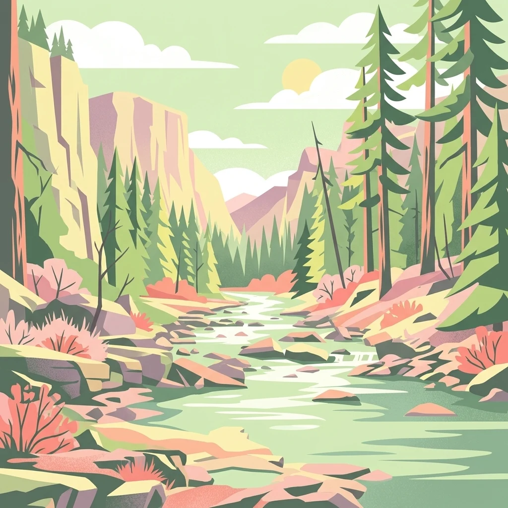
A graphic illustration showing a calm river flowing through a deep valley with steep cliffs on the left, pine trees on the right, and distant mountains under a soft sun.

Ramseys Draft Wilderness

Wildlife reserve

Park overview

Structured park overview, official facts, and landscape profile for Ramsey's Draft Wilderness

Ramsey's Draft Wilderness park facts, protected area profile, and essential visitor context

Review the core facts for Ramsey's Draft Wilderness, including designation, size, terrain, visitor scale, habitats, and operating context in one park-focused overview.

About Ramsey's Draft Wilderness

Ramsey's Draft Wilderness occupies a steep, largely unroaded portion of the George Washington and Jefferson National Forests in the heart of Virginia's Appalachian Mountains. Set between the crest of Shenandoah Mountain and Bald Ridge, the wilderness covers approximately 6,518 acres of rugged ridge-and-hollow topography that has been managed essentially as wilderness land since the 1930s.

The landscape is defined by Ramsey's Draft, the creek that gives the area its name, and by the surrounding ridges and hollows that rise more than 2,500 feet above the drainage. Elevations climb from around 1,600 feet along streams and lower slopes to over 4,200 feet at Hardscrabble Knob. The terrain is remote and physically demanding, with foot trails that often follow the streambed or the remnants of an abandoned road.

Ecologically, the wilderness stands out for stands of old-growth Canadian hemlock that persist in the moist northern hollows, along with extensive populations of tulip poplar, eastern white pine, sugar maple, black birch, shagbark hickory, and northern red oak. Botanists have documented more than 250 species of vascular plants within the area.

Wildlife use is equally varied. The stream itself supports self-sustaining populations of native brook trout, while the surrounding forest provides habitat for black bear, white-tailed deer, wild turkey, grouse, beaver, raccoon, and small mammals. The ridges and high-elevation forest also serve as nesting grounds for neotropical migrant songbirds, earning the site a place on the Virginia Birding and Wildlife Trail.

The wilderness is a destination for primitive, non-motorized recreation. The principal route, the Ramsey's Draft Trail, follows the creek for most of its length and is widely regarded as one of the most popular routes on Virginia's roadless lands. Several side trails branch into the ridges, hollows, and seeps that flank the main drainage, connecting the wilderness to longer routes like the Shenandoah Mountain Trail, a segment of the Great Eastern Trail.

Quick facts and research context for Ramsey's Draft Wilderness

Located in Augusta County, in the North River Ranger District of the George Washington and Jefferson National Forests, Virginia. Approximately 6,518 acres in size, established in 1984 under the Virginia Wilderness Act, and administered by the U.S. Forest Service as a congressionally designated wilderness (IUCN category Ib).

Rises from roughly 1,600 feet along its drainage to about 4,282 feet at Hardscrabble Knob. The area's namesake stream, Ramsey's Draft, flows to the Calfpasture River, the James River, and ultimately the Chesapeake Bay. Recognized as a stop on the Virginia Birding and Wildlife Trail, it is especially valued for old-growth Canadian hemlock stands and a self-sustaining native brook trout stream.

Protection and recognition

Documented terrestrial conservation scope and established 1984 designation timeline

Ramseys Draft Wilderness Protection Status and Designation History

Ramseys Draft Wilderness maintains a documented terrestrial protection status established through its 1984 designation history. Official conservation records outline the established management scope and international recognition data for this protected area.

Protection details

Protection scope
Terrestrial
Designated year
1984
Transboundary protection
No
Park context

Deeper park guide and search-rich context for Ramsey's Draft Wilderness

Ramsey's Draft Wilderness history, landscape, wildlife, and travel context

Explore Ramsey's Draft Wilderness through its history, landscape character, ecosystems, wildlife, conservation priorities, cultural context, and seasonal travel timing in a structured park guide built for atlas discovery and search intent.

Why Ramsey's Draft Wilderness stands out

Old-growth Canadian hemlock stands in its northern drainage, and a native Appalachian brook trout stream that gives the wilderness its name. It is also well known for the rare combination of high-elevation deciduous forest, neotropical migrant nesting habitat, and rugged, roadless terrain only miles from the Shenandoah Valley. The wilderness reflects a classic central Appalachian setting, where steep hollows, ridge-top balds, and unlogged forest converge to support a mix of large mammals, migratory songbirds, and an exceptionally intact native fishery. Few other Virginia wildernesses concentrate this range of ecological interest within a relatively compact footprint.
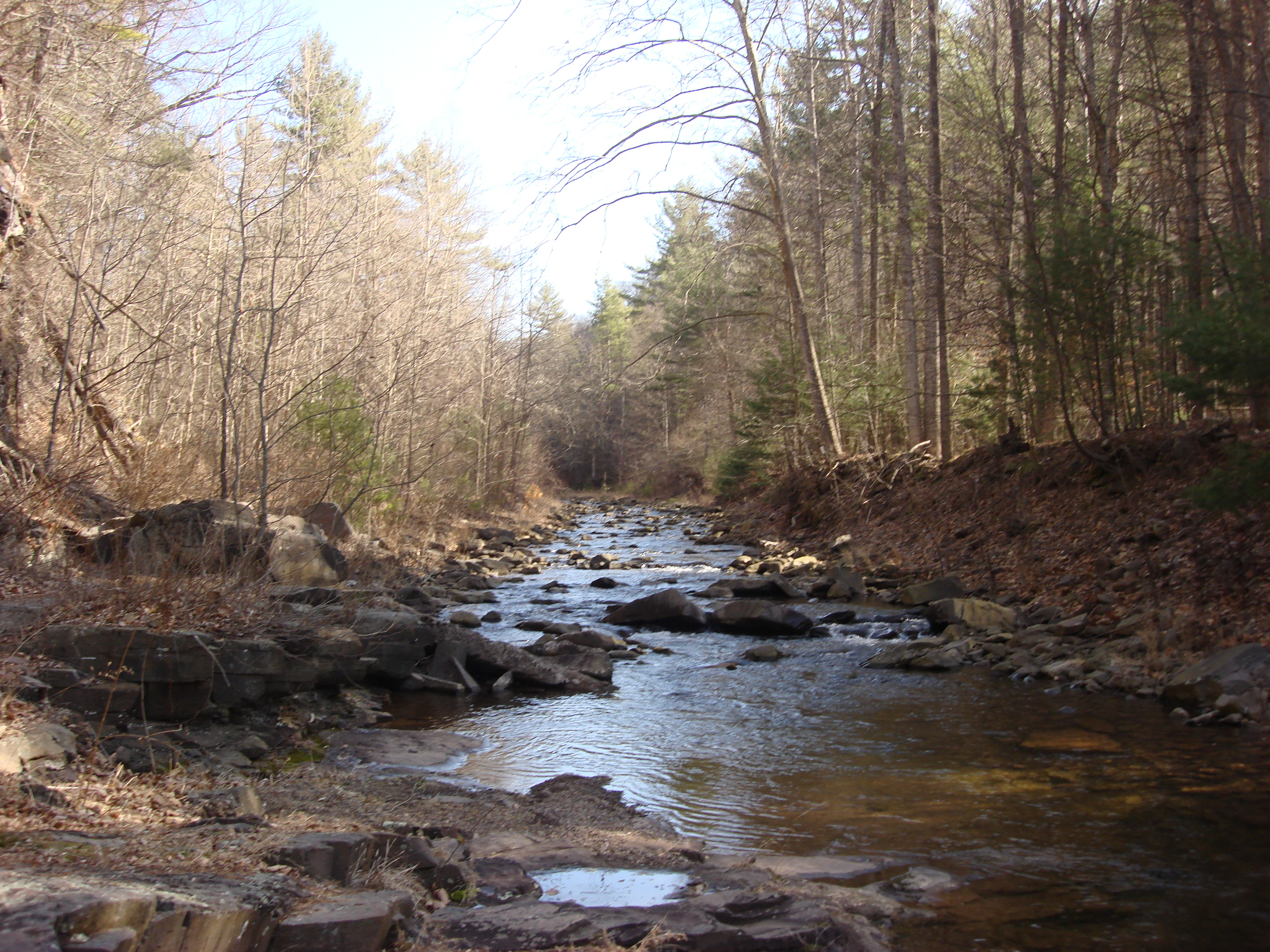
A small, rocky stream flows through a dense forest with bare trees during autumn or winter.
A shallow stream flowing through the forested landscape of Ramseys Draft Wilderness.

Ramsey's Draft Wilderness history and protected-area timeline

The story of Ramsey's Draft begins long before its 1984 designation. The U.S. Forest Service first acquired land in this part of Virginia in 1913 as part of the original Shenandoah National Forest, the administrative ancestor of today's George Washington National Forest. Because much of the drainage had never been logged, the Forest Service managed the area essentially as wilderness from 1935 onward.

In the 1930s, the Civilian Conservation Corps built a road extending more than three miles upstream from U.S. Route 250 to support early management and recreational use. That road survived for roughly three decades until 1969, when rainfall associated with Hurricane Camille destroyed most of it at the stream crossings. A second major flood in November 1985 eliminated the remaining traces of the original road and reshaped the streambed in several places, fortuitously restoring a wild character just months after the area was officially designated.

Recreational use of the area also has a long human story. The Potomac Appalachian Trail Club constructed the Sexton Cabin inside the present wilderness boundaries in 1938; the cabin was destroyed by fire in 1967 and later rebuilt. After the 1984 Virginia Wilderness Act designated the area as wilderness, the Forest Service removed the structure under its interpretation of the Wilderness Act, though only the chimney survives today. Logs from Sexton Cabin were later used to build the PATC's Mutton Top Cabin.

The size and shape of Ramsey's Draft Wilderness have been debated for decades. An early 1970s proposal, backed by the Virginia Wilderness Committee and the Potomac Chapter of the Sierra Club, envisioned a much larger area covering most of Shenandoah Mountain between U.S. Route 250 and FDR 95, the western slope down toward Shaws Fork, and much of Bald Ridge. The Forest Service recommended a smaller core of roughly 6,500 acres, and that is the tract that became law in 1984.

Ramsey's Draft Wilderness landscape and geographic character

Ramsey's Draft Wilderness occupies a classic Appalachian ridge-and-valley setting where high, narrow ridges enclose a long, dendritic drainage. The terrain sits between two structural features: the main crest of Shenandoah Mountain to the west and Bald Ridge to the east, with the wilderness occupying the hollows and slopes that fall between them.

The vertical relief is dramatic for such a compact area. Lowest ground along Ramsey's Draft itself sits near 1,600 feet, while ridges and knobs rise to roughly 4,282 feet at Hardscrabble Knob, creating an elevational span of more than 2,500 feet. The topography is steep and rugged, with narrow hollows, sharp benches, and rocky streambeds that have limited any lasting road construction. The result is a strongly dissected landscape that feels far more remote than its proximity to the Shenandoah Valley would suggest.

Water shapes much of the scenery. Ramsey's Draft itself runs southward toward U.S. Route 250, ultimately joining the Calfpasture River, then the Maury River, the James River, and eventually the Chesapeake Bay. Side hollows such as Jerry's Run, Road Hollow, Bridge Hollow, and Sinclair Hollow branch off the main drainage, each contributing its own small watershed to the broader James River basin. Floods from Hurricane Camille in 1969 and a major storm in 1985 reshaped the channel, removed most of the old road, and helped restore a more natural stream course.

Ramsey's Draft Wilderness ecosystems, habitats, and plant life

The wilderness contains a notably diverse Appalachian forest system concentrated in a small geographic footprint. Mixed mesophytic communities dominate lower and mid-elevation hollows, while northern hardwoods and high-elevation oak forests occupy the upper slopes and ridge tops.

The defining ecological feature is a sizeable stand of old-growth Canadian hemlock along the northern reaches of Ramsey's Draft. These hemlocks, which can reach large size and considerable age, occupy moist, sheltered sites along the creek's upper tributaries. Like hemlocks across much of the Appalachians, they face a serious threat from hemlock woolly adelgid, an invasive insect whose presence has raised concern about the long-term survival of these stands.

Surrounding the hemlock are extensive populations of tulip poplar, eastern white pine, sugar maple, black birch, shagbark hickory, and northern red oak, with a documented flora of more than 250 vascular plant species. Such species richness, combined with the elevation gradient, supports both lowland and high-elevation plant communities within a relatively short distance.

Ramsey's Draft Wilderness wildlife and species highlights

Ramsey's Draft supports a broad assemblage of Appalachian wildlife typical of large, unroaded tracts in the central Appalachians. Common mammals include white-tailed deer, American black bear, wild turkey, eastern gray squirrel, grouse, raccoon, beaver, and eastern cottontail rabbit, all of which rely on the unbroken forest cover and remote hollows for cover, food, and movement corridors.

Rivers and streams likewise contribute strongly to the area's wildlife character. Ramsey's Draft is recognized as a native brook trout stream, meaning it supports self-sustaining populations of this cold-water Appalachian species rather than hatchery-stocked fish, and the creek is considered a particularly important example of intact native trout habitat in the region.

The area is also notable for birdlife. As one of the official stops on the Virginia Birding and Wildlife Trail, the wilderness is recognized for its role as a nesting area for neotropical migrant songbirds that tend to nest at higher elevations. The mix of mature interior forest, ridge-top edge habitats, and a remote, lightly disturbed setting makes the area especially attractive to birders interested in breeding-season species that can be difficult to find elsewhere in Virginia.

Ramsey's Draft Wilderness conservation status and protection priorities

As a congressionally designated wilderness under the 1964 Wilderness Act and the 1984 Virginia Wilderness Act, Ramsey's Draft receives the highest level of federal land protection short of national park status. Motorized equipment, mechanized travel, most commercial activity, and new structures are prohibited, ensuring that the area continues to function under natural ecological processes.

The area's conservation significance lies in its largely unroaded condition, its intact native brook trout fishery, and the presence of old-growth hemlock stands that have been spared extensive historical logging. Many surrounding Appalachian landscapes were heavily cut in the late 19th and 20th centuries, leaving few sizable examples of unlogged forest. The wilderness preserves one such example, where natural forest succession, hydrology, and wildlife populations can continue without significant direct human manipulation.

The hemlock woolly adelgid represents one of the most pressing conservation pressures on the area. The insect has spread across much of the eastern United States and threatens the long-term survival of both young and old Canadian hemlock trees. The outcome of the infestation will significantly shape the future structure of the northern drainage, with cascading effects on shade, stream temperature, and habitat for brook trout and other moisture-dependent species.

Long-running proposals from the Virginia Wilderness Committee, the Potomac Appalachian Trail Club, the Sierra Club, and the Friends of Shenandoah Mountain have suggested expanding the wilderness north and east and adding a separate wilderness on the western slope of Shenandoah Mountain. These ideas have not been enacted, but they reflect how the area is viewed as a core ecological anchor for a much larger conservation landscape in western Virginia.

Top sights and standout views in Ramsey's Draft Wilderness

Stands of old-growth Canadian hemlock in the upper Ramsey's Draft drainage, even as the hemlock woolly adelgid continues to threaten them. The named stream itself, a self-sustaining native brook trout water that flows into the Calfpasture and James rivers.

Recognized high-elevation nesting habitat for neotropical migrant songbirds, with the area's status as a Virginia Birding and Wildlife Trail stop underscoring that ecological value. A trail network centered on the Ramsey's Draft Trail, which follows the streambed and old road remnants through the heart of the wilderness, complemented by ridge-top and side-hollow routes including the Shenandoah Mountain Trail portion of the Great Eastern Trail.

Best time to visit Ramsey's Draft Wilderness

Spring and early summer are especially rewarding for birding, when neotropical migrants arrive to nest in the high-elevation forest; wildflowers also begin to emerge along the lower trail sections during this period. Cooler temperatures and generally stable footing make spring a good time for longer hikes into the upper drainage.

Fall brings strong leaf color across the mixed hardwood canopy, with maple, oak, hickory, and tulip poplar contributing to varied autumn displays, and cooler weather that makes creek-side walking more comfortable in the rougher lower reaches. Winter offers quieter conditions and crisper views along ridge lines, though trail surfaces may include ice, snow, and high water at stream crossings, and remote conditions demand extra preparation.

Monthly climate preview

Long term representative measurements and twelve month baseline weather data for Ramseys Draft Wilderness

Ramseys Draft Wilderness Climate Normals, Annual Temperature and Precipitation Rhythm

Historical climate records for Ramseys Draft Wilderness track monthly temperature swings from sub-zero winter minimums to warm summer peaks alongside steady precipitation rates. Reviewing the complete twelve month data profile provides precise long term averages for analyzing regional environmental conditions at the representative coordinate.
Annual mean10 °C
-3 °C21 °C
Jan-3°
Feb-1°
Mar
Apr
May15°
Jun19°
Jul21°
Aug21°
Sep17°
Oct11°
Nov
Dec-1°
Warmest month
July

21.3 °C

Coolest month
January

-2.7 °C

Wettest month
May

3.6 mm/day

Driest month
October

2.4 mm/day

Park location guide

Geography guide, regional context, and park location map for Ramsey's Draft Wilderness

Ramsey's Draft Wilderness park geography, regions, and map view in United States of America

Understand where Ramsey's Draft Wilderness sits in United States of America through a broader geographic reading of the surrounding landscape, nearby location context, and its mapped position within the national park landscape.

How Ramsey's Draft Wilderness fits into United States of America

The United States of America is a federal presidential republic and one of the world's largest countries by area and population. It consists of 50 states across a vast territory spanning multiple time zones, with its capital in Washington, D.C. and largest city in New York City. The nation has a diverse economy, influential political system, and significant cultural and military presence globally.

Wider geography shaping Ramsey's Draft Wilderness in United States of America

The United States occupies a vast territory in North America, bordered by Canada to the north and Mexico to the south. The 48 contiguous states stretch from the Atlantic to the Pacific Ocean, while Alaska occupies the northwestern region and Hawaii is an archipelago in the Pacific. The country encompasses diverse terrain including the Rocky Mountains, Appalachian Mountains, Great Plains, and extensive river systems.

Map view of Ramsey's Draft Wilderness

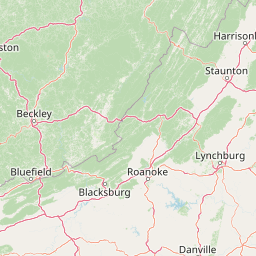
Use this park location map to pinpoint Ramsey's Draft Wilderness in United States of America, understand its exact geographic position, and read its mapped placement within the surrounding landscape more clearly.

Pigeon | © OpenStreetMap contributors

Visual reference of Appalachian ridge and valley terrain, old growth forests, and protected habitats

Ramseys Draft Wilderness Photos and Landscape Scenery

Protected area photography reveals the rugged topography, steep hollows, and pristine mountain streams defining Ramseys Draft Wilderness. Visualizing these remote Appalachian habitats helps observers understand the environmental character and remote terrain of the region.

A small, rocky stream flows through a dense forest with bare trees during autumn or winter.

Park atlas

Compare surrounding Appalachian mountain terrain and connected regional reserves

Other Parks Near Ramseys Draft Wilderness and Protected Landscapes

Browsing parks near Ramseys Draft Wilderness reveals adjacent protected landscapes and rugged mountain terrain across the central Appalachian region. Comparing these nearby areas helps map broader ecological patterns and connected regional topography.
Watercolor painting showing layers of soft green hills and mountain ridges fading into a light hazy background.
Protected landscapeWest Virginia
About 32 km away#1 closest

Northwest

Monongahela National Forest: Protected Appalachian Landscapes and Regional Geography

Mapping West Virginia wilderness and mountain terrain

Monongahela National Forest protects nearly one million acres of the central Appalachian Mountains. This massive federally managed landscape is defined by the Allegheny Front, the highest peak in the Allegheny range at Spruce Knob, and iconic geological formations like Seneca Rocks. The region represents a vital intersection of climate, hydrology, and biodiversity in the eastern United States, housing eight distinct wilderness areas and complex high-altitude ecosystems.

Area
3,727.8 km²
Established
1920
Visitors
3M annual
Relief
Mountain
Watercolor illustration depicting a serene mountain landscape with a winding river, rolling hills, and scattered trees against a light background.
Protected landscapeVirginia
About 35 km away#2 closest

Northeast

George Washington and Jefferson National Forests: Appalachian Protected Landscape Mapping

Explore mountain ridges, river valleys, and wilderness corridors in Virginia.

Covering one of the largest public forest blocks in the eastern United States, George Washington and Jefferson National Forests offer a unique look at the central Appalachian mountain terrain. The area includes extensive wilderness tracts, the Appalachian Trail corridor, and significant geological landmarks like the Breaks gorge. Analyze the protected landscape boundaries and topographic features that define this major regional watershed and forest network.

Area
7,247.65 km²
Established
1995
Relief
Mountain
Climate
Temperate
Watercolor painting of rolling hills, trees, and a river in a scenic landscape
National parkVirginia
About 48 km away#3 closest

East

Shenandoah National Park: National Park Protected Landscape and Geography

Mapped terrain and protected area context in Virginia.

Shenandoah National Park is a designated national park in Virginia, offering a rich exploration of its protected landscape and geographic features. This page provides detailed atlas-oriented information, focusing on the park's mapped boundaries and its role within the regional geography. Discover the natural terrain and spatial identity of this important US protected area, ideal for understanding park landscapes.

Area
811.176 km²
Established
1935
IUCN
II
Visitors
1.7M annual
A wide, panoramic watercolor illustration showing a row of green trees, faint mountains in the background, and grass reeds in the foreground left against a white background.
Wildlife reserveWest Virginia
About 49 km away#4 closest

Northwest

Laurel Fork South Wilderness: Protected Appalachian Highlands and Forested Terrain

High elevation forest and creek drainage geography

Laurel Fork South Wilderness features a dense, unbroken stretch of Appalachian forest within West Virginia. This protected landscape is defined by its deep narrow hollows and high ridgelines, representing a vital example of mid elevation mountain terrain and recovering forest ecosystems within the Monongahela National Forest.

Area
23.41 km²
Established
1983
IUCN
Ib
Relief
Mountain
Wildlife reserveVirginia
About 50 km away#5 closest

Southwest

Rough Mountain Wilderness: Mapping Appalachian Ridges and Protected Terrain

Remote wildlife reserve in western Virginia

Spanning over 9,000 acres, Rough Mountain Wilderness provides a rare example of undisturbed Appalachian forest. The area is characterized by consistently steep slopes, sharp ridgeline topography, and a deep sense of isolation within the George Washington and Jefferson National Forests of western Virginia.

Area
38 km²
Established
1987
IUCN
Ib
Relief
Mountain
Wildlife reserveVirginia
About 51 km away#6 closest

Southwest

Rich Hole Wilderness: Appalachian Wildlife Reserve and Forest Geography

Protected cove hardwood forest in western Virginia

Rich Hole Wilderness represents a protected high quality forest landscape located within the James River Ranger District. This area spans steep, narrow hollows and high ridge crests, providing critical habitat and showcasing old growth timber specimens. Use this resource to understand the park terrain, drainage patterns, and its position within the broader Appalachian forest network of western Virginia.

Area
26.1 km²
Established
1988
IUCN
Ib
Relief
Mountain
Wildlife reserveWest Virginia
About 53 km away#7 closest

Northwest

Laurel Fork North Wilderness: Mapping Appalachian Forest and Mountain Terrain

Protected wilderness landscape in the West Virginia highlands.

Laurel Fork North Wilderness sits as a key conservation unit within the Monongahela National Forest. This protected territory preserves a complex of high-elevation hardwood forests and the stream-cut valley of Laurel Fork. By examining this region, users gain insight into the geography of Allegheny mountain wilderness and the persistent character of recovery-focused Appalachian landscapes.

Area
24.5 km²
Established
1983
IUCN
Ib
Relief
Mountain
Watercolor painting of a mountain landscape with soft green ridges and a pale pink sky above a light tan foreground.
Protected landscapeWest Virginia
About 56 km away#8 closest

North

Spruce Knob-Seneca Rocks National Recreation Area: West Virginia Mountain Landscapes

Mapped terrain of summits, cliffs, and river corridors

Spruce Knob-Seneca Rocks National Recreation Area stands as a unique protected landscape in eastern West Virginia. This area connects the high-elevation spruce forests of Spruce Knob with the vertical quartzite cliffs of Seneca Rocks and the remote depths of Smoke Hole Canyon. It remains a primary example of Appalachian high-country geography, offering a dense concentration of distinct natural features within the Monongahela National Forest.

Area
400 km²
Established
1965
Relief
Mountain
Climate
Temperate

Common questions about visiting, size, designation, and location context for Ramsey's Draft Wilderness

Ramsey's Draft Wilderness FAQs for park facts, access, geography, and protected area context

Find quick answers about Ramsey's Draft Wilderness, including protected-area facts, park geography, trail and visitor context, and how the park fits into its surrounding country and regional landscape.
MoriAtlas Explorer

Continue Your Protected Areas Search Across the Global Atlas

Deepen your exploration by continuing the structured search for national parks and protected areas worldwide. Utilize the comprehensive filtering capabilities to compare different conservation landscapes and refine your understanding of global park geography. Discover more about the distribution and characteristics of protected natural areas.

Global natural geography