
Why Randers Fjord stands out
Randers Fjord is best known for its extensive tidal reed beds, formed mainly of common reed, which line much of its shoreline and significantly shape access and scenery. It is also recognized as the lower reach of the Gudenå, one of Denmark's most important inland waterways, and for its recreational and angling appeal, particularly the herring fishery at Voer. Its conservation profile, with overlapping Ramsar, Habitat and Bird Protection status under Natura 2000, adds a further layer of ecological identity to the fjord.
Randers Fjord history and protected-area timeline
Randers Fjord has long been an important inland waterway, serving historically as a transport corridor for goods traveling from the Kattegat toward the interior of Jutland. Before the Danish road network was developed, the Gudenå and the fjord together acted as a regional artery, with the so-called pramfart, a traditional barge and flatboat trade, moving bulk goods up and down the river and estuary. This connection made Randers a natural inland port.
In the modern era, the fjord remains navigable for coasters all the way to Randers, where coal is among the cargoes handled at the local power station. To preserve this access, a dredged navigation channel, approximately seven meters deep, is maintained up to Randers on a roughly five-year cycle. Above Randers, the Gudenå itself is not usable for commercial ship traffic.
A more recent institutional milestone for the fjord was the 2018 establishment of Naturpark Randers Fjord, which bundles the fjord and surrounding landscape under a single nature, recreation and cultural framework. The northern part of the fjord has also been formally recognized as part of a broader Natura 2000 area, with Ramsar, Habitat and Bird Protection designations reinforcing its ecological standing.
Randers Fjord landscape and geographic character
The landscape of Randers Fjord is defined by a long, narrow, gently winding water corridor framed by low Danish terrain. The depth profile is shallow, with a maintained navigation channel of about seven meters carved into the wider, naturally shallow fjord bottom, and the banks rise only modestly above the waterline. Inland, the channel reads as a river; seaward, it opens into a broader estuary before the Kattegat proper, with the transition zone near Uggelhuse acting as a clear inflection point between river and fjord character.
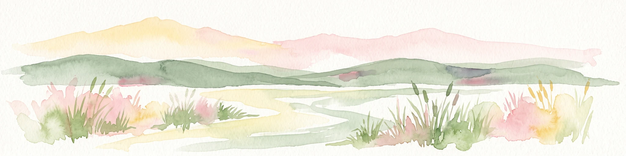
The visual signature of the fjord is provided by its reed-dominated shoreline. Wide, continuous stands of common reed often form tall, dense green walls along the banks for long stretches, interrupted only in a few places where infrastructure, piers or constructed stone embankments provide access to open water. The reed beds are so dominant that they visually mark the fjord from viewpoints and along roads paralleling the coast, and they create an enclosed, marsh-like atmosphere rather than the open shoreline found in many other Danish fjords.
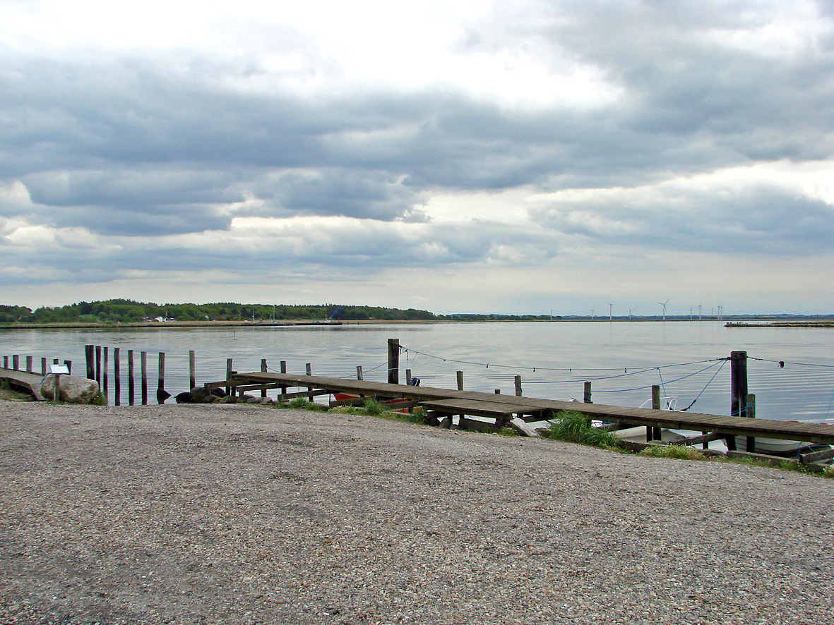
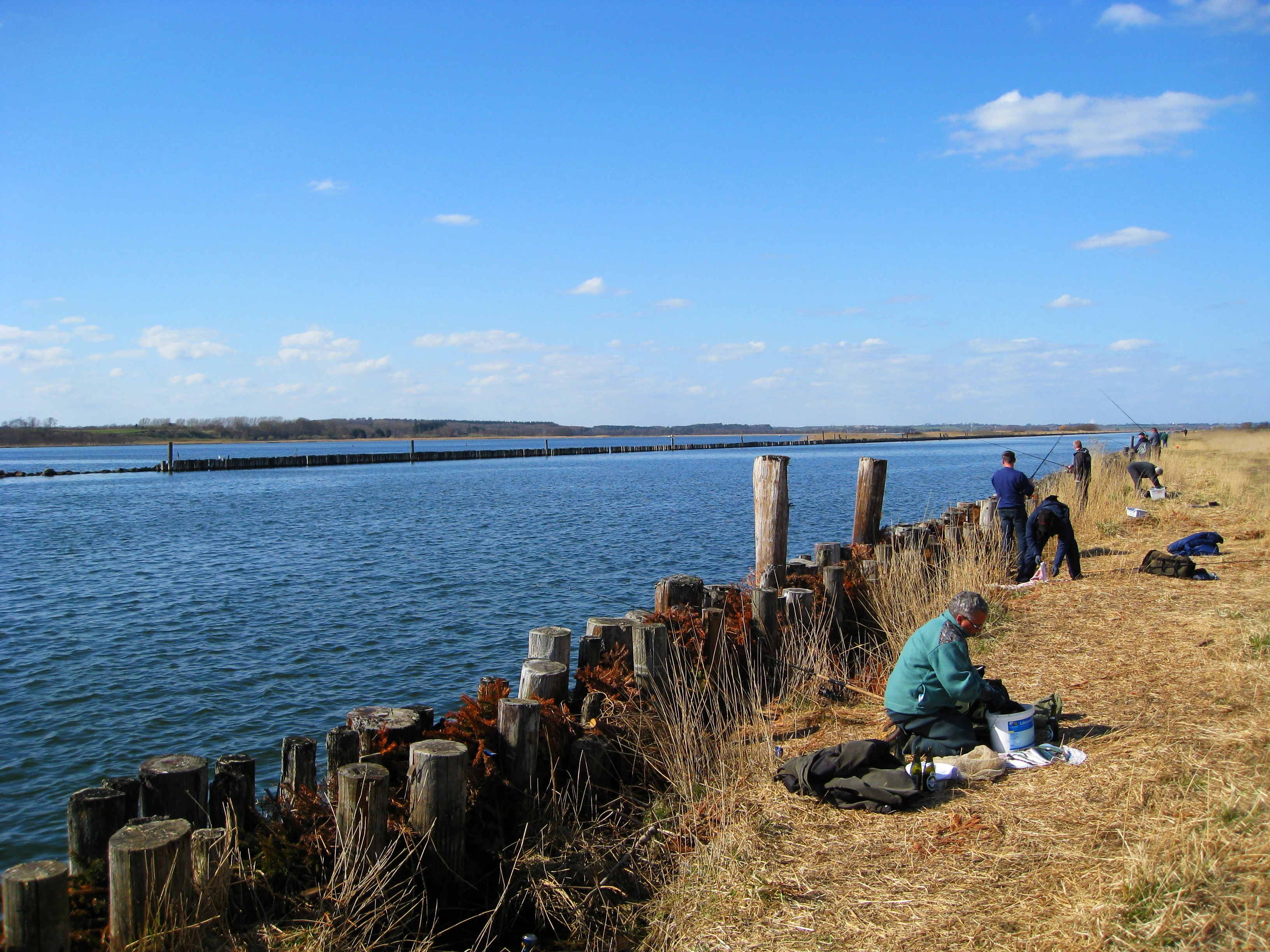
Locally, small features shape the experience of the landscape. The harbor of Voer offers a constructed quay lined along several kilometers by a reed-free embankment built during dredging works, giving both anglers and visitors rare direct access to deep water in an otherwise reed-bordered fjord. Small marinas at Uggelhuse, the inner and outer ferry landings, and the channels of Grund Fjord add further structure to the waterway, while the silhouetted church of Udby serves as a traditional sea mark for vessels approaching the entrance from the Kattegat.
Randers Fjord ecosystems, habitats, and plant life
Randers Fjord is essentially a freshwater-to-brackish tidal ecosystem at the mouth of Denmark's largest river system. The Gudenå discharges substantial volumes of freshwater into the fjord, especially during spring and early summer, while saltwater periodically intrudes from the Kattegat during high tides. This salinity gradient, combined with the low, sheltered shoreline, supports a mosaic of habitats ranging from near-freshwater reed beds to brackish marsh at the seaward end.
The most visible ecological element is the broad, almost continuous belt of common reed that lines the banks and extends into the water itself in many places. These reed-dominated margins form extensive marsh and swamp habitats that transition inland into wet meadows and other low-lying habitats, providing structure for nesting, feeding and shelter across the seasons. The reed is also part of local cultural practice, with portions historically harvested for thatching traditional Danish roofs, showing how closely the ecological and human landscape are tied together.
Because the fjord is a transitional environment, it combines elements of river, estuary and true marine fjord. The inner reaches still behave largely like a slow-flowing river with little salinity, while the outer reaches closer to Udbyhøj become more clearly a North Sea inlet. This combination gives the fjord high ecological value in a national context, and underpins much of its formal recognition in protected-area frameworks.
Randers Fjord wildlife and species highlights
The fauna of Randers Fjord is shaped strongly by the dominance of reed habitats and the brackish character of the water. The continuous reed belts provide cover and nesting sites for waterbirds associated with marsh and shallow estuary environments; the fjord's formal Bird Protection status recognizes the importance of these populations at a European level. Wading and waterfowl species typical of Danish fjords and coastal lagoons are part of the regular wildlife experience here.
Fish are a defining feature of the fjord's wildlife, bridging the ecological and recreational identities of the area. The narrow outer channel near Voer concentrates seasonal herring runs as the waterway compresses schools into a small volume between land and the navigation channel. This edge habitat is the focus for angling tourism in spring and summer, attracting recreational fishermen from Denmark, the Netherlands and Germany.
Further up the fjord, freshwater and estuarine fish make use of the small harbors at Uggelhuse. Species such as perch move into these marinas during periods of saltwater intrusion from the Kattegat on high tides, taking advantage of the brackish opportunity. Combined with diverse waterbird life and a productive macrophyte community, this creates a fjord where wildlife is closely tied to the rhythms of water, tide and reed rather than dramatic predator-prey spectacles.
Randers Fjord conservation status and protection priorities
Randers Fjord carries a particularly strong formal conservation profile for a Danish fjord. The northern part of the fjord, up to Mellerup, is part of the Natura 2000 site covering Aalborg Bay, Randers Fjord and Mariager Fjord, which links ecological management across multiple estuarine systems in northern and central Jutland. Within this larger site, the fjord is recognized simultaneously as a Ramsar wetland of international importance, a designated Habitat area under the EU Habitats Directive, and a Bird Protection area under the EU Birds Directive.
This layered designation reflects the fjord's role in protecting both habitat and species of European interest. The reed beds, brackish marsh, shallow waters and tidal gradient support birdlife and habitat types recognized at the EU level, and the area is therefore managed with conservation objectives explicitly in mind. The Natura 2000 framework gives the fjord the same status in regional conservation planning as other large coastal and estuarine areas of Denmark, even though the surrounding land use still includes working harbors, transport links and angling tourism.
Randers Fjord cultural meaning and human context
Randers Fjord has a deep cultural presence in eastern Jutland through its role as the historical seaway for the Gudenå. The fjord was the inlet of choice for moving goods inland long before railroads and modern roads, and the pramfart tradition of barge and flatboat traffic along the Gudenå was a key part of regional commerce and daily life in earlier centuries. This placed Randers as a natural inland port and shaped the economic geography of the eastern Jutland landscape.
Traditional uses of the natural resources also entangle the fjord with local culture. Reed from the banks has long been cut and used as thatching material for traditional straw roofs, keeping a direct link between landscape, working life and Danish building heritage alive along the fjord. The fjord's small ferries, its quiet marina communities at Uggelhuse, and the role of Voer as a focal point for angling tourism give the area a distinct local character that is separate from Denmark's larger seaside destinations. The establishment of Naturpark Randers Fjord in 2018 further formalized the fjord's place in regional identity and nature-based tourism.
Top sights and standout views in Randers Fjord
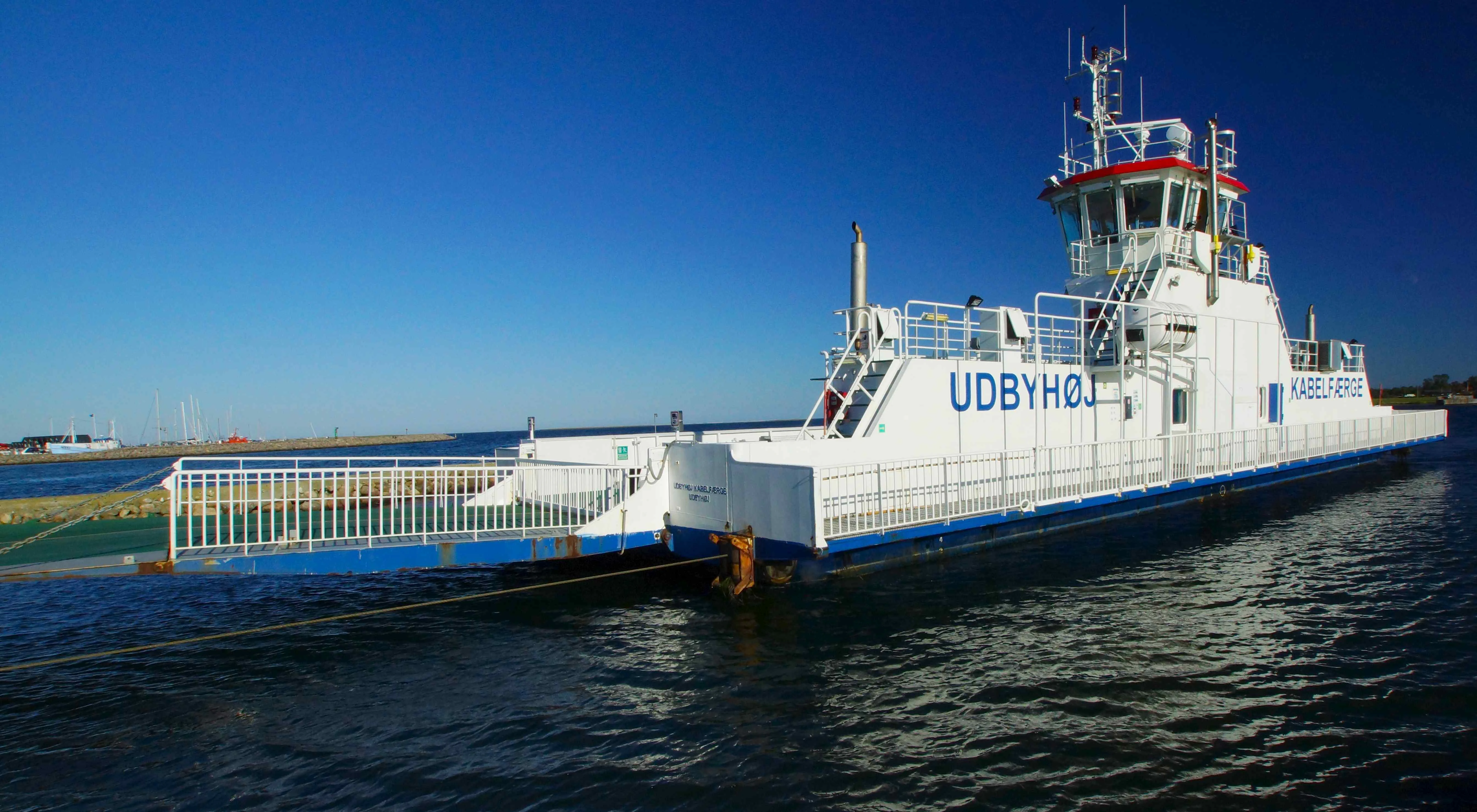
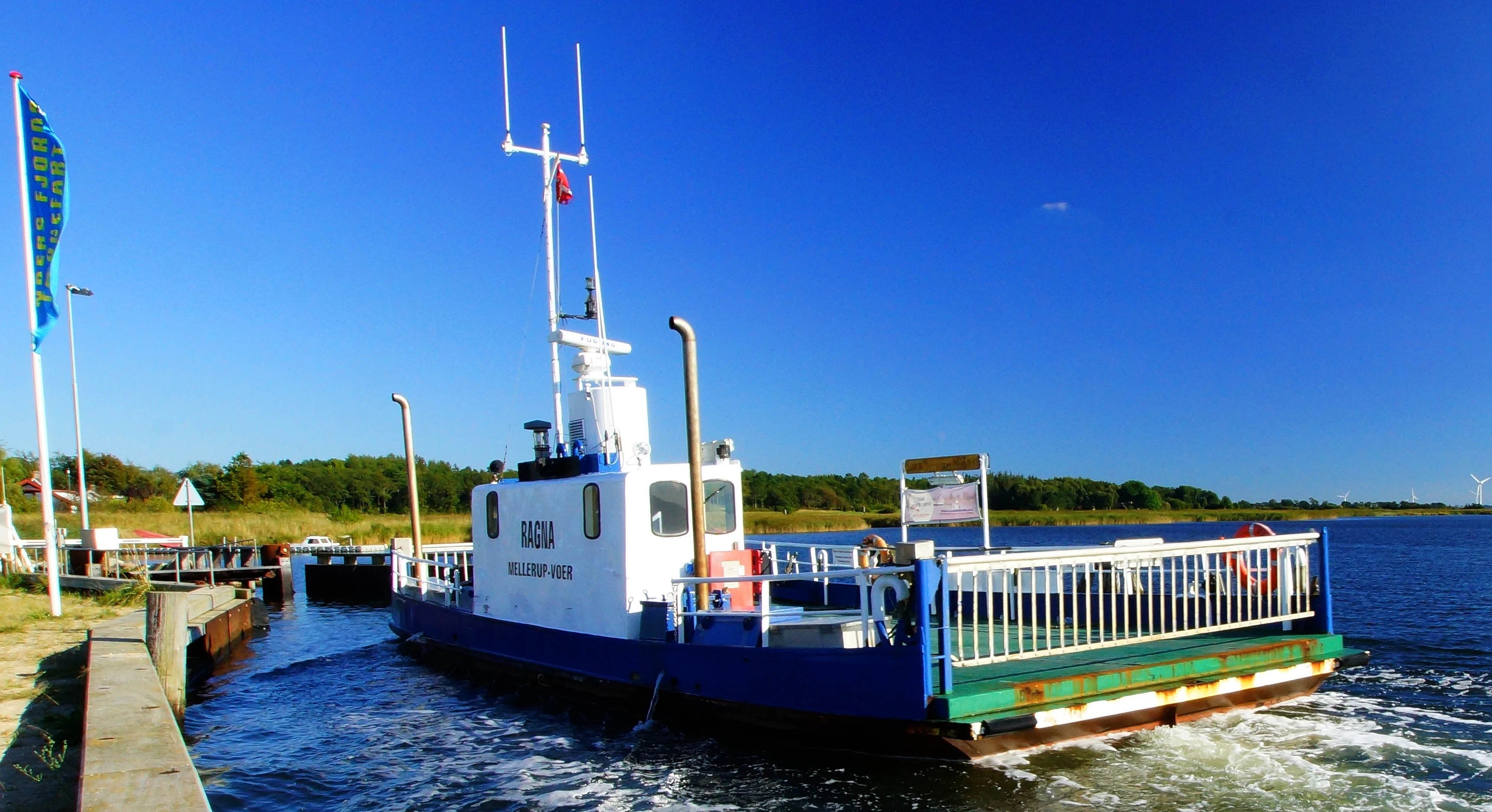
The strongest experience of Randers Fjord is the contrast between wide, wall-like reed belts and the open water lanes beyond them, visible from ferries, elevated roads and viewpoints along the shoreline. A visit is naturally framed by two ferry crossings: the small Ragna ferry between Voer and Mellerup, and the compact cable ferry at Udbyhøj near the Kattegat, both of which give a sense of life across and along the water.
For visitors interested in experiencing the fjord up close, the Fjord and Coastal Center at Voer offers exhibitions, accommodation, meeting facilities, wading-based outdoor programs and boat rental, acting as the main interpretive and recreational hub. The Voer fisheries quay, a long reed-free embankment built during dredging of the navigation channel, is a rare point of direct, easy access to the deeper water and the heart of the local herring angling scene. From there, the small marinas at Uggelhuse, the navigation channel toward Randers and the historic sea-mark church of Udby at the entrance add complementary highlights that together trace the fjord from inland to sea.
Best time to visit Randers Fjord
The character of Randers Fjord changes meaningfully with the seasons. Spring and the warmer half of the year are when the herring runs concentration near Voer draw anglers and outdoor visitors to the angling piers, with recreational fishing running from spring through summer. These months are also the most active for outdoor programs at the Fjord and Coastal Center, including wading activities in the shallow water, which is most pleasant when temperatures are mild.
Late spring and summer are also when the reed beds are at their most vivid and visually dense, shaping much of what the fjord looks and feels like from boats or shore viewpoints. Autumn, with lower water levels and different fish behavior, still supports angling and quieter nature experiences, while winter brings a more muted, structural landscape of brown reed stands and fewer visitors. Across the year, daylight length and weather strongly influence whether the broader reed-belt scenery or the open water moments dominate the visit experience, especially given the fjord's north-south orientation along Jutland's east coast.