
Mori Atlas logo
Nature reserveTved Kær

Examining the calcareous fens, spring seepage zones, and post-glacial coastal terrain of the Mols peninsula.

Tved Kær Nature Reserve: A Detailed Atlas of Protected Coastal Habitats in Region Midtjylland

(Natura 2000-område nr. 50 Tved Kær)

Tved Kær is a concentrated nature reserve situated on the edge of Knebel Vig in eastern Jutland. This protected site features a complex mosaic of spring-influenced fens, raised seabed, and dry calcareous grassland, specifically managed to preserve rare orchid populations. Through its unique post-glacial geomorphology, the area demonstrates how small, specialized coastal habitats function as critical ecological nodes within the broader landscape of Region Midtjylland.

calcareous fencalcareous grasslandspring seepagecoastal habitatNatura 2000municipality
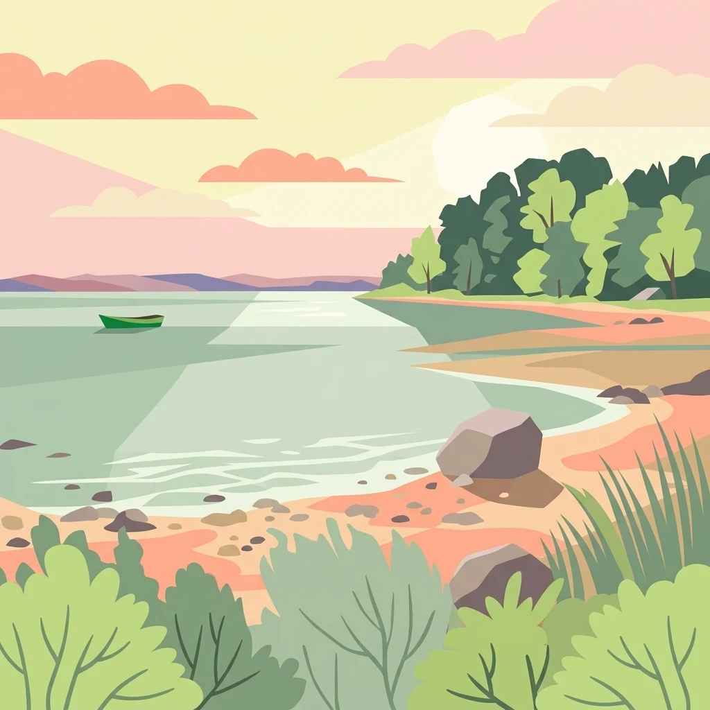
A flat-style digital illustration depicting a calm lake with a small rowboat, a sandy rocky shoreline, and lush green trees under a sunset sky.

Tved Kær

Nature reserve

Park overview

Structured park overview, official facts, and landscape profile for Tved Kær

Tved Kær park facts, protected area profile, and essential visitor context

Review the core facts for Tved Kær, including designation, size, terrain, visitor scale, habitats, and operating context in one park-focused overview.

About Tved Kær

Tved Kær is one of a long list of small, specialized Natura 2000 sites that Denmark uses to protect individual habitat patches of high natural value. Although it covers just a few hectares, the site contributes to the European network of protected areas by conserving a tightly defined set of calcareous and spring-influenced habitats that are increasingly rare in intensively farmed and developed lowlands.

The site is located on the southern flank of Djursland, in the Mols area, immediately inland of the bay known as Knebel Vig. Geologically and ecologically, this part of the Kattegat coast is shaped by the legacy of the last ice age: an old coastal cliff separates higher ground inland from an area of former seabed that has been lifted above sea level over the millennia. Where springs emerge from the base of this cliff, and where the underlying limestone-rich sediments influence the soil chemistry, conditions are unusually favourable to a narrow group of plant communities. These include rich fens (rigkær), calcareous grassland (kalkoverdrev), and spring seepage zones (kildevæld), all of which are listed habitats under the EU Habitats Directive and form the formal basis of the site's Natura 2000 designation.

Beyond its protected status, Tved Kær provides an example of how small Danish sites can carry disproportionate ecological significance. The combination of coastal setting, calcareous soils, and persistent spring activity makes the area one of the few Danish locations where a cluster of rare fen and orchid species can survive in close proximity to the sea. As with other Danish Natura 2000 sites, the area is managed through coordinated plans involving Syddjurs Kommune and Naturstyrelsen, and its natural protection plan is integrated with the wider water plan for Aarhus Bugt to the north.

Quick facts and research context for Tved Kær

Tved Kær is designated as Natura 2000 area number 50 and is registered as the EU habitat area H46. The site covers 6 hectares in total, of which just over 4 hectares are associated with Tved Kirke and protected under section 3 of the Danish Nature Protection Act.

The site lies in Syddjurs Kommune, within Region Midtjylland, on the southern part of the Djursland peninsula, directly above Knebel Vig on the coast of Mols. Its designation focuses on the calcareous-rich habitats of the area, including rigkær (rich fen), calcareous grassland (kalkoverdrev), and spring seepage zones (kildevæld), together with the orchid Mygblomst as a target species.

Protection and recognition

Explore terrestrial protection scope and documented Natura 2000 recognition sources.

Tved Kær Protection Status and Official International Recognition Data

Tved Kær maintains a documented terrestrial protection scope supported by official Natura 2000 recognition data records. Review the verified international designations and administrative status frameworks associated with this protected natural area.

International recognition

Protection details

Protection scope
Terrestrial
Transboundary protection
No
Park context

Deeper park guide and search-rich context for Tved Kær

Tved Kær history, landscape, wildlife, and travel context

Explore Tved Kær through its history, landscape character, ecosystems, wildlife, conservation priorities, cultural context, and seasonal travel timing in a structured park guide built for atlas discovery and search intent.

Why Tved Kær stands out

Tved Kær is best known for being one of the Danish Natura 2000 sites established specifically to protect Mygblomst, a small and nationally rare wild orchid that grows in calcareous-rich seepage and fen habitats. The site is also notable as a compact example of the spring-fed, lime-rich coastal habitats found along the Mols coast, where raised former seabed meets an old coastal cliff to create a distinctive mosaic of calcareous fen, spring seepage vegetation, and dry calcareous grassland within a very small footprint.
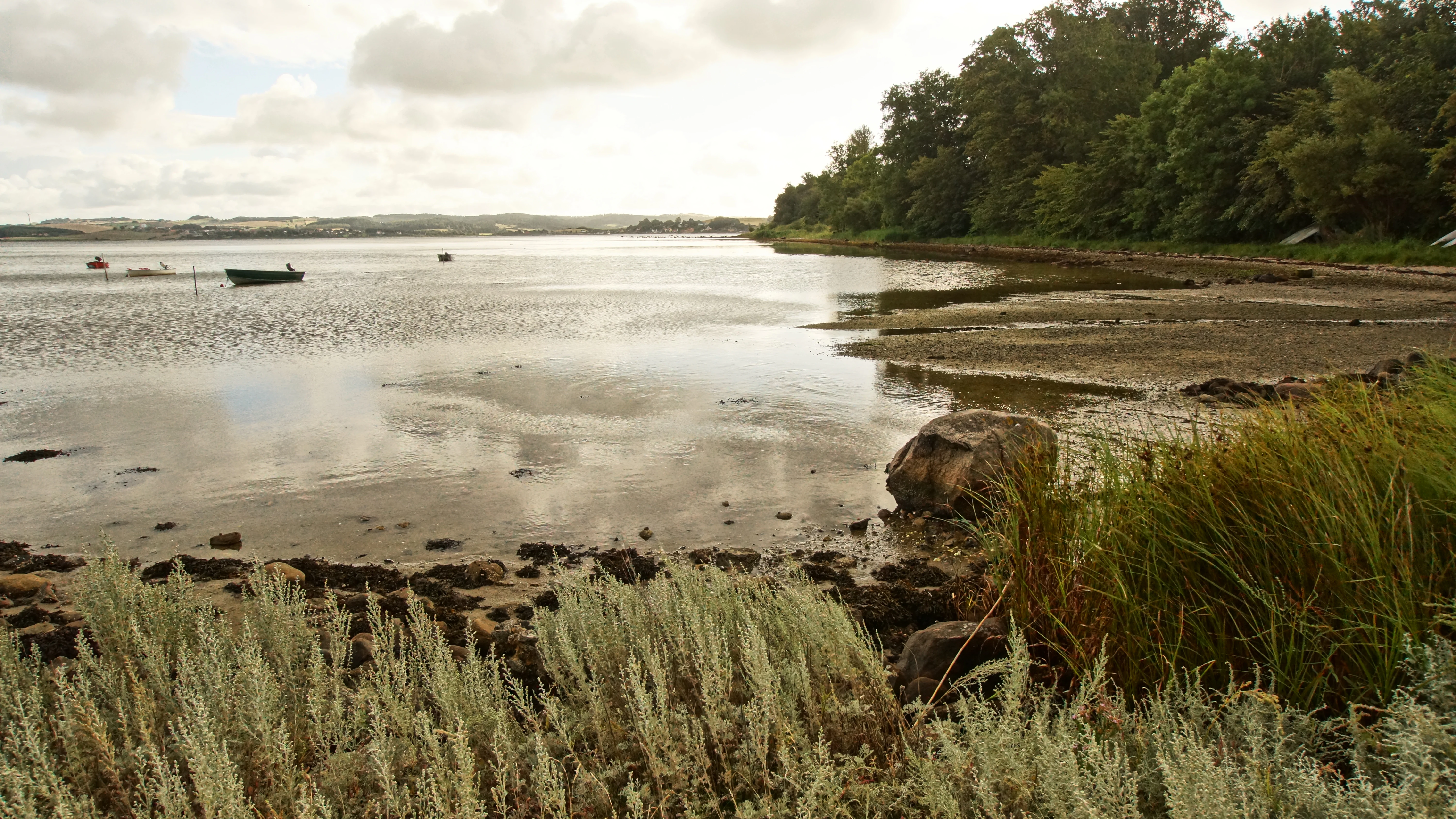
A wide coastal landscape shot showing calm shallow water meeting a marshy shoreline with grasses, rocks, and a small boat in the distance under a cloudy sky.
A view across Knebel Vig from the Tved Kær area, showing the shoreline and calm coastal waters.

Tved Kær history and protected-area timeline

Tved Kær's modern history as a protected site began in 1981 and 1982, when the entire area was placed under formal nature conservation (fredning) status. At that stage, conservation work in Denmark focused on identifying and safeguarding the country's most distinctive natural areas from agricultural expansion, drainage, and building development.

The site later became part of the European Natura 2000 network, gaining its current formal designation as Natura 2000 area number 50 and EU habitat area H46. A Natura 2000 plan for the site was adopted in 2011, after which Syddjurs Kommune and Naturstyrelsen drew up binding action plans to implement that plan on the ground. The site's Natura 2000 framework has since been continued and adjusted in later planning periods, with updated plans covering the 2016 to 2021 period and beyond.

In addition to its Natura 2000 status, roughly four hectares of the site fall under section 3 of the Danish Nature Protection Act, which provides baseline protection for specific natural habitat types in Denmark. The site's natural plan is also coordinated with the water plan for Aarhus Bugt, reflecting the integrated approach to terrestrial and marine catchment management common in modern Danish nature policy.

Tved Kær landscape and geographic character

The landscape of Tved Kær is shaped by its position on the southern Djursland coast, at the inland edge of Knebel Vig. An old coastal cliff cuts across the site, separating more elevated ground inland from an area of raised former seabed that stretches toward the present-day shoreline. This combination of cliff and lifted seabed is characteristic of the post-glacial coastal geomorphology of the Mols peninsula.

At the base of the cliff and across the lower ground closest to the coast, the terrain becomes spring-influenced and waterlogged, giving rise to the fen (kær) and seepage zone (kildevæld) that give the site its name. These low-lying areas transition inland to drier calcareous grassland on the better-drained soils of the cliff itself and the higher ground behind it. The result is a compressed but clearly layered landscape in which cliff, fen, spring seepage, and coastal grassland sit within just a few hectares.

The view from the area over Knebel Vig captures this landscape setting directly. Photographs associated with the site show the open bay and the green coastal slopes near Tved Kirke, where the small stream draining the area reaches the coast.

Tved Kær ecosystems, habitats, and plant life

Ecologically, Tved Kær is defined by the interaction of calcareous soils, persistent spring activity, and a coastal location along the Kattegat. These factors combine to create a small but unusually rich mosaic of habitats. The site is formally listed for three habitat types under the EU Habitats Directive: rich fen (rigkær, habitat code 7230), calcareous grassland (kalkoverdrev, habitat code 6210), and spring seepage zones (kildevæld, habitat code 7220).

The richest fen vegetation develops where lime-rich groundwater emerges at or near the surface, supporting a specialised flora adapted to permanently moist but base-rich conditions. The calcareous grassland, by contrast, supports a different plant community adapted to dry, sun-exposed, nutrient-poor soils. Together, these habitats reflect the lime-influenced substrate that distinguishes parts of eastern Jutland from the more acidic landscapes further west.

The site's protected status is itself a recognition that, despite their small size, these habitats are nationally rare and have declined significantly in Denmark as former coastal wetlands and grazed calcareous grasslands have been drained or ploughed. Tved Kær therefore functions as both a local nature reserve and a node in the broader European effort to maintain representative examples of lime-rich habitats.

Tved Kær wildlife and species highlights

The wildlife value of Tved Kær is overwhelmingly botanical. The site is primarily designated to protect a single nationally rare orchid species, Mygblomst, which is red-listed in Denmark and depends on the particular combination of calcareous, spring-fed conditions that the site provides. Mygblomst is the only formal species element in the Natura 2000 designation basis for the area and is treated as a priority feature of the site.

Alongside the target orchid, the fen and seepage vegetation supports a number of other notable plant species associated with base-rich wetland habitats in Denmark. These include Bredbladet kæruld, a sedge typical of rich fens; Liden Blærerod, a small aquatic and bog species; Almindelig Vibefedt, a characteristic plant of calcareous grassland and spring zones; Hjertegræs, a grass associated with base-rich meadows; Leverurt, a species of dry calcareous grassland; and Vild Hør, a wild relative of flax that grows in lime-rich, open habitats.

Although the published information about the site emphasises its flora, the mosaic of wetland, spring seepage, calcareous grassland, and coastal edge also provides habitat structure for invertebrates and other groups typical of such habitats. The site's ecological importance, however, is most clearly articulated in terms of its rare and specialised plant communities rather than its vertebrate fauna.

Tved Kær conservation status and protection priorities

Tved Kær is protected under several overlapping Danish and European conservation frameworks, and conservation is central to the site's identity. The area was first placed under formal nature conservation (fredning) in 1981 to 1982, an early indication of its recognised natural value.

It later entered the Natura 2000 network as area number 50 and as EU habitat area H46, with the Natura 2000 plan formally adopted in 2011. Under Danish law, roughly four of the site's six hectares are additionally protected under section 3 of the Nature Protection Act, which provides baseline protection for specific natural habitat types across Denmark regardless of their Natura 2000 status.

Conservation management at the site is delivered in a coordinated way. Syddjurs Kommune is responsible for much of the on-the-ground management within its municipal boundaries, while Naturstyrelsen, the Danish Nature Agency, contributes technical and planning support. The site's Natura 2000 plan is integrated with the water plan for Aarhus Bugt, ensuring that land-based conservation decisions consider the wider hydrological catchment. As with other Natura 2000 sites in Denmark, the plan is reviewed and updated in successive planning cycles, based on regular baseline analyses.

Tved Kær cultural meaning and human context

The cultural context of Tved Kær is closely tied to the long-standing parish of Tved on southern Djursland. A significant portion of the protected site, just over four hectares, lies on land associated with Tved Kirke. This link between the nature area and the historic parish church reflects a common pattern in Denmark, where church-owned or church-adjacent land has sometimes retained more traditional, less intensively managed land uses, allowing ecologically valuable habitats to persist.

The wider Mols and southern Djursland region carries a strong sense of regional identity rooted in its coastal landscapes, agricultural traditions, and small parish communities. Tved Kær sits within this setting, immediately inland of Knebel Vig, a bay that has shaped local fishing, sailing, and settlement patterns for centuries. The site itself does not appear to have a separate cultural landmark status beyond its natural protection, but its location near Tved Kirke ties it into the broader historical landscape of southern Djursland.

Top sights and standout views in Tved Kær

Tved Kær's strongest distinguishing features are its very small size combined with a high concentration of rare habitats and species. The site brings together three formally protected habitat types, rich fen, calcareous grassland, and spring seepage, within a single coastal strip just inland from Knebel Vig. The site is, importantly, one of the Danish localities explicitly designated to safeguard the nationally rare orchid Mygblomst under the Natura 2000 framework.

Layered protection is another key feature of the site: it carries both long-standing national nature conservation status from the early 1980s and EU-level Natura 2000 protection, with section 3 protection under the Danish Nature Protection Act reinforcing its ecological security. The site also illustrates how Danish nature policy integrates terrestrial habitats with water planning, since its Natura 2000 plan is coordinated with the Aarhus Bugt water plan.

Best time to visit Tved Kær

Because Tved Kær is a small, low-key habitat site rather than a visitor attraction with developed infrastructure, the best timing for any visit is shaped less by opening hours and more by the flowering cycle of its habitats. Late spring and early summer are typically the most rewarding period in Denmark for calcareous-rich fens and orchid-rich calcareous grasslands, when species like Mygblomst and other characteristic herbs come into bloom.

Mid to late summer allows visitors to see the mature structure of the fen and dry-grassland vegetation, while autumn offers a quieter experience as most flowering has finished but coastal light can be striking over Knebel Vig. Winter visits are possible but emphasize the overall landform and the contrast between the coastal cliff and the lower fen ground rather than any botanical display.


Monthly climate preview

Long-term representative measurements of annual temperature and precipitation rhythm

Tved Kær Climate Normals, Average Temperatures, and Weather by Month

Historical records from a representative coordinate track measured monthly temperature fluctuations alongside daily precipitation averages across the protected landscape. Examining the complete twelve-month normals provides deeper analytical context for long-term regional climate patterns.
Annual mean9 °C
2 °C17 °C
Jan
Feb
Mar
Apr
May11°
Jun15°
Jul17°
Aug17°
Sep14°
Oct10°
Nov
Dec
Warmest month
August

17.5 °C

Coolest month
February

1.5 °C

Wettest month
August

2.5 mm/day

Driest month
April

1.3 mm/day

Park location guide

Geography guide, regional context, and park location map for Tved Kær

Tved Kær park geography, regions, and map view in Denmark

Understand where Tved Kær sits in Denmark through a broader geographic reading of the surrounding landscape, nearby location context, and its mapped position within the national park landscape.

How Tved Kær fits into Denmark

Denmark is a constitutional monarchy and Nordic country in Northern Europe. It is the southernmost of the Scandinavian countries, bordering Germany to the south, Norway to the north, and Sweden to the southwest. The country consists of the Jutland peninsula and an archipelago of islands, with Copenhagen as its capital and largest city. Denmark has a population of over 6 million and is characterized by flat, arable land, sandy coasts, and a temperate climate.

Wider geography shaping Tved Kær in Denmark

Denmark occupies the Jutland peninsula and roughly 406 islands in Northern Europe. It is situated between the North Sea to the west and the Baltic Sea to the east. The country borders Germany to the south and is connected to Sweden via the Øresund Bridge. Denmark is predominantly flat terrain with low elevation, the highest point being Møllehøj at 170.86 meters.

Map view of Tved Kær

Use this park location map to pinpoint Tved Kær in Denmark, understand its exact geographic position, and read its mapped placement within the surrounding landscape more clearly.

Pigeon | © OpenStreetMap contributors

Location context for Tved Kær

Region Midtjylland
Recorded earthquake history

Review the Historical Earthquake Catalogue and Seismic Data for Tved Kær

Explore the documented seismic history of the area surrounding Tved Kær through our structured catalogue. This resource provides a clear, data-driven view of recorded earthquake events, offering historical context for the landscape using information sourced from geophysical databases.

Tved Kær Earthquake History Records

Catalogued events

2 events

Strongest magnitude

Magnitude 3.2

Most recent event

Feb 3, 2005

This history includes earthquakes recorded inside the park or within 50 km of its borders

Explore detailed imagery of spring-fed fens, calcareous grasslands, and coastal terrain.

Tved Kær Photos and Landscapes: Visual Guide to Coastal Habitats

Visual documentation of Tved Kær reveals the intricate geomorphology of raised former sea beds and old coastal cliffs along Knebel Vig. Examining these protected habitats provides direct insight into the rare flora and lime-rich soils characteristic of eastern Jutland.

A wide coastal landscape shot showing calm shallow water meeting a marshy shoreline with grasses, rocks, and a small boat in the distance under a cloudy sky.

Park atlas

Compare nearby coastal habitats, spring fens, and regional nature reserves

Explore Parks Near Tved Kær and Surrounding Protected Landscapes in Denmark

Continue exploring regional protected areas and coastal habitats located across the surrounding Djursland landscape. Comparing nearby reserves provides deeper context on the lime rich soils and post glacial coastal geomorphology of eastern Jutland.
Watercolor illustration showing rolling hills, a lake, pink flowering trees, and distant mountains
National parkDenmark
2.7 km away#1 closest

East

Mols Bjerge National Park: Glacial Geography and Protected Terrain in Central Jutland

Mapping the coastal cliffs and rolling heathland of Denmark

Mols Bjerge National Park protects a sweeping mosaic of glacial hills, woodlands, and coastal zones on the Djursland peninsula. With a landscape shaped by ancient ice sheets, the park offers a detailed view into Denmark's geological history, preserved ancient barrows, and rich botanical diversity along the Kattegat sea.

Area
180 km²
Established
2009
IUCN
II
Relief
Upland
Watercolor painting of a calm coastal bay with soft, layered green hills in the distance and a pale shoreline in the foreground.
Protected areaDenmark
About 5.7 km away#2 closest

South

Begtrup Vig Protected Area: Glacial Terrain and Coastal Geography in Denmark

Coastal landscape and regional protected area mapping

Begtrup Vig is a distinct coastal bay defined by its glacial history, stretching across the southern Djursland peninsula in Denmark. Within the broader Mols Bjerge national park framework, the area features varied topography including stony shores, sandy coves, and pastoral meadows. This record provides a focused look at the environmental boundaries and geographic significance of this protected habitat, bridging natural terrain with the regional landscape context.

Relief
Upland
Scope
Mixed
Water
Water-dominated
Season
Year-round
Watercolor painting of a panoramic landscape featuring green rolling hills, light foliage, and patches of pink wildflowers in the foreground.
National parkCentral Jutland
About 6 km away#3 closest

Northeast

Nationalpark Mols Bjerge: A Geographic Overview of Central Jutland's Glacial Landscape

Mapped terrain, dead-ice hills, and prehistoric monuments

Nationalpark Mols Bjerge offers a deep look into the glacial heritage of Central Jutland. The area features steep, sun-exposed slopes, heathland, and coastal fringes that provide a unique perspective on the Danish landscape. By examining the park's mapped boundaries, one can identify the convergence of geological landforms and ancient cultural history preserved within this protected environment.

Relief
Mountain
Access
Easy access
Water
Major water bodies
A horizontal watercolor illustration showing a calm coastal bay with grassy banks, winding water channels, and rolling hills in the background under a soft yellow sky.
Protected areaRegion Midtjylland
About 6.8 km away#4 closest

Southeast

Natura 2000-område nr. 51 Begtrup Vig og kystområder ved Helgenæs Geography and Maps

Coastal grasslands and marine habitats in Region Midtjylland

Examine the complex terrain of Natura 2000-område nr. 51 Begtrup Vig og kystområder ved Helgenæs, an expansive protected area characterized by its diverse coastal cliff systems and large calcareous grasslands. This site documents the evolution of the Kattegat shoreline through its unique recurved spits and lifted seabed formations, providing a window into the natural landscape history of the Helgenæs peninsula.

Area
17.71 km²
Established
2011
Relief
Lowland
Climate
Temperate
Nature reserveRegion Midtjylland
14 km away#5 closest

East

Stubbe Sø Nature Reserve: A Geographic Exploration of Djursland Protected Landscapes

Mapping the wetlands, forest fringes, and mire systems of eastern Jutland.

Stubbe Sø is a central protected feature within the landscape of eastern Jutland, comprising a large shallow lake surrounded by alder-birch shorelines and coniferous plantations. This nature reserve offers deep insight into the glaciated terrain and wetland mosaic of the Djursland peninsula, providing an essential geographic reference for understanding local conservation habitats and regional waterbird migration corridors.

Area
7.78 km²
Established
1963
Relief
Lowland
Climate
Temperate
A wide watercolor illustration of a lake surrounded by green trees and rolling hills, with a small tree and pink flowers in the foreground.
Nature reserveAarhus Kommune
About 21 km away#6 closest

West

Brabrand Sø Nature Reserve: Mapped Geography of an Aarhus Glacial Tunnel Valley

Protected freshwater wetlands and urban green corridors in Denmark

Brabrand Sø represents a rare, shallow freshwater lake and wetland complex located at the edge of the Aarhus urban fabric. This nature reserve, formed within a post-glacial tunnel valley, remains a cornerstone of the regional landscape through its integration of bird habitats, drinking-water protection, and open meadow terrain. The area offers a profound look at how peri-urban green infrastructure sustains both ecological health and geological character in the Aarhus Kommune region.

Area
1.54 km²
Established
1959
Relief
Lowland
Climate
Temperate
Protected areaRegion Midtjylland
23 km away#7 closest

Southwest

Kysing Fjord Protected Area: Coastal Lagoon and Saltmarsh Geography in Region Midtjylland

Mapped coastal lagoon and wetland protected area

Kysing Fjord serves as a significant coastal lagoon system on the eastern Jutland coast. This protected area in Region Midtjylland integrates shallow lagoon waters, saltmarsh meadows, and riverine terrain, offering a precise look at managed coastal landscapes and their ecological importance for wintering bird populations.

Area
3.7 km²
Established
1942
Relief
Lowland
Climate
Temperate
Watercolor painting depicting a gentle, rolling green landscape leading to a distant blue sea under a pale sky.
Protected areaRegion Midtjylland
23 km away#8 closest

South

Nordby Bakker Protected Area: Glacial Moraine and Grasslands in Region Midtjylland

Coastal cliffs, dunes, and rare calcareous ecosystems

Nordby Bakker preserves one of the largest continuous dry grassland complexes in Denmark, set upon a prominent glacial terminal moraine. Located at the northern tip of Samsø, this protected area features a unique synthesis of coastal dunes, beach ridges, and inland lakes that support a distinct array of rare plant and insect species within the central Kattegat region.

Area
6.28 km²
Relief
Upland
Climate
Temperate
Scope
Mixed

Common questions about visiting, size, designation, and location context for Tved Kær

Tved Kær FAQs for park facts, access, geography, and protected area context

Find quick answers about Tved Kær, including protected-area facts, park geography, trail and visitor context, and how the park fits into its surrounding country and regional landscape.
MoriAtlas Explorer

Continue Your Protected Areas Search Across the Global Atlas

Deepen your exploration by continuing the structured search for national parks and protected areas worldwide. Utilize the comprehensive filtering capabilities to compare different conservation landscapes and refine your understanding of global park geography. Discover more about the distribution and characteristics of protected natural areas.

Global natural geography